Downloaded 100 times
![Angular drainage pattern
Angular drainage patterns form where bedrock joints and faults intersect at more acute angles than
rectangular drainage patterns. Angles are both more and less than 90 degrees.[4]
Discordant drainage patterns
A drainage pattern is described as discordant if it does not correlate to the topography and geology of the
area. Discordant drainage patterns are classified into two main types: antecedent and superimposed,while
anteposition drainage patterns combine the two. In antecedent drainage, a river's vertical incision ability
matches that of land uplift due to tectonic forces. Superimposed drainage develops differently: initially, a
drainage system develops on a surface composed of 'younger' rocks, but due to denudative activities this
surface of younger rocks is removed and the river continues to flow over a seemingly new surface, but one
in fact made up of rocks of old geological formation.
Prepared By Asif Hasan
Geo’47](https://image.slidesharecdn.com/drainagepattern-171214145624/75/Drainage-pattern-5-2048.jpg)

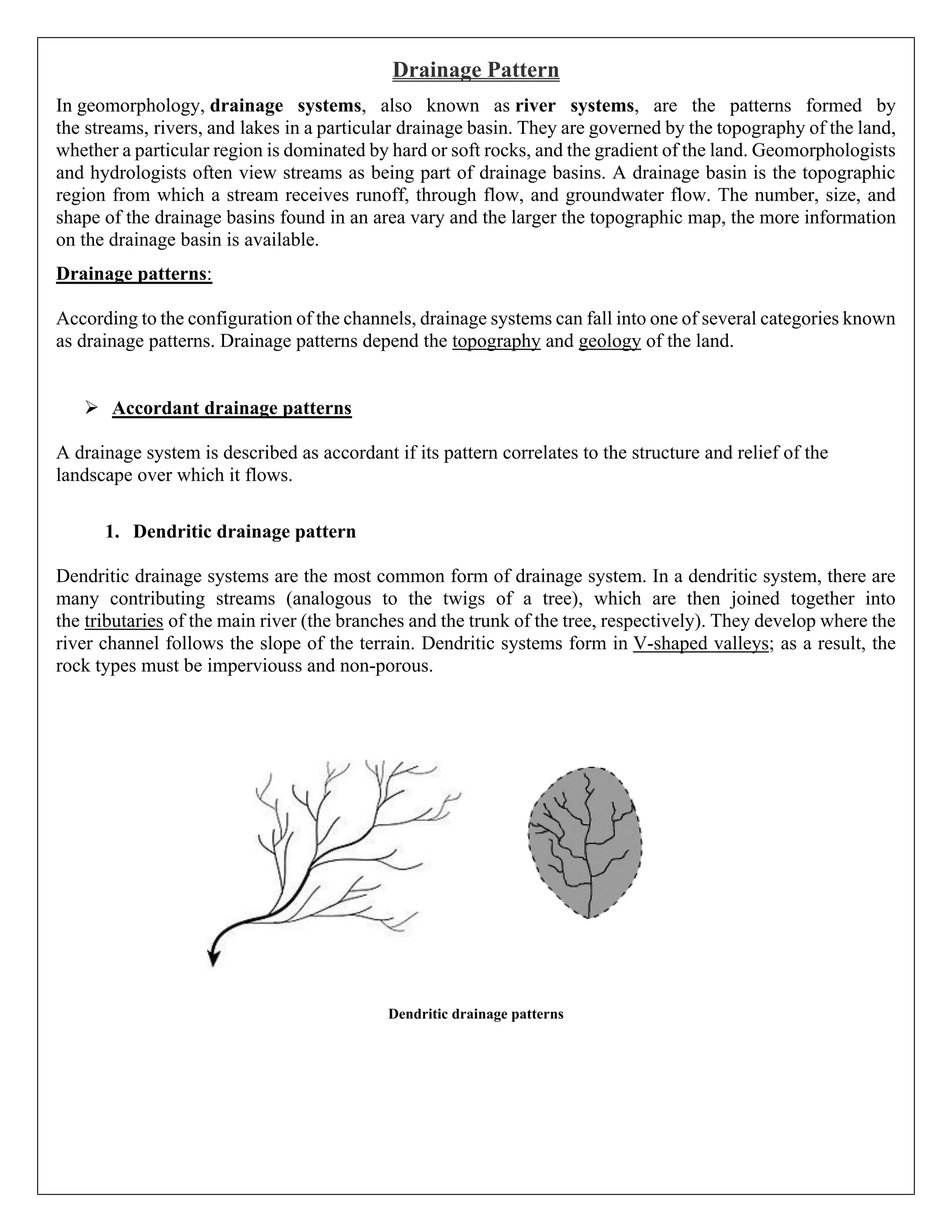
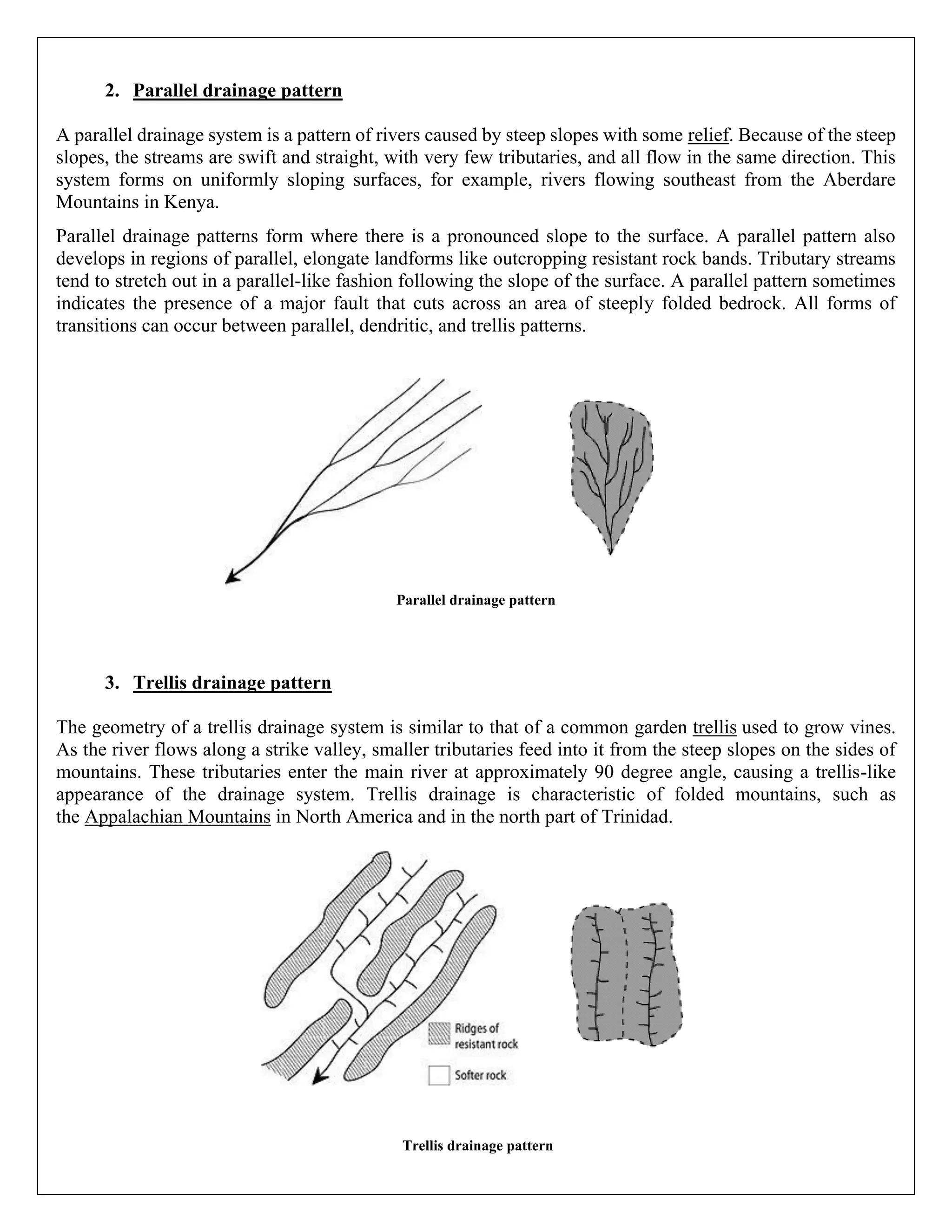
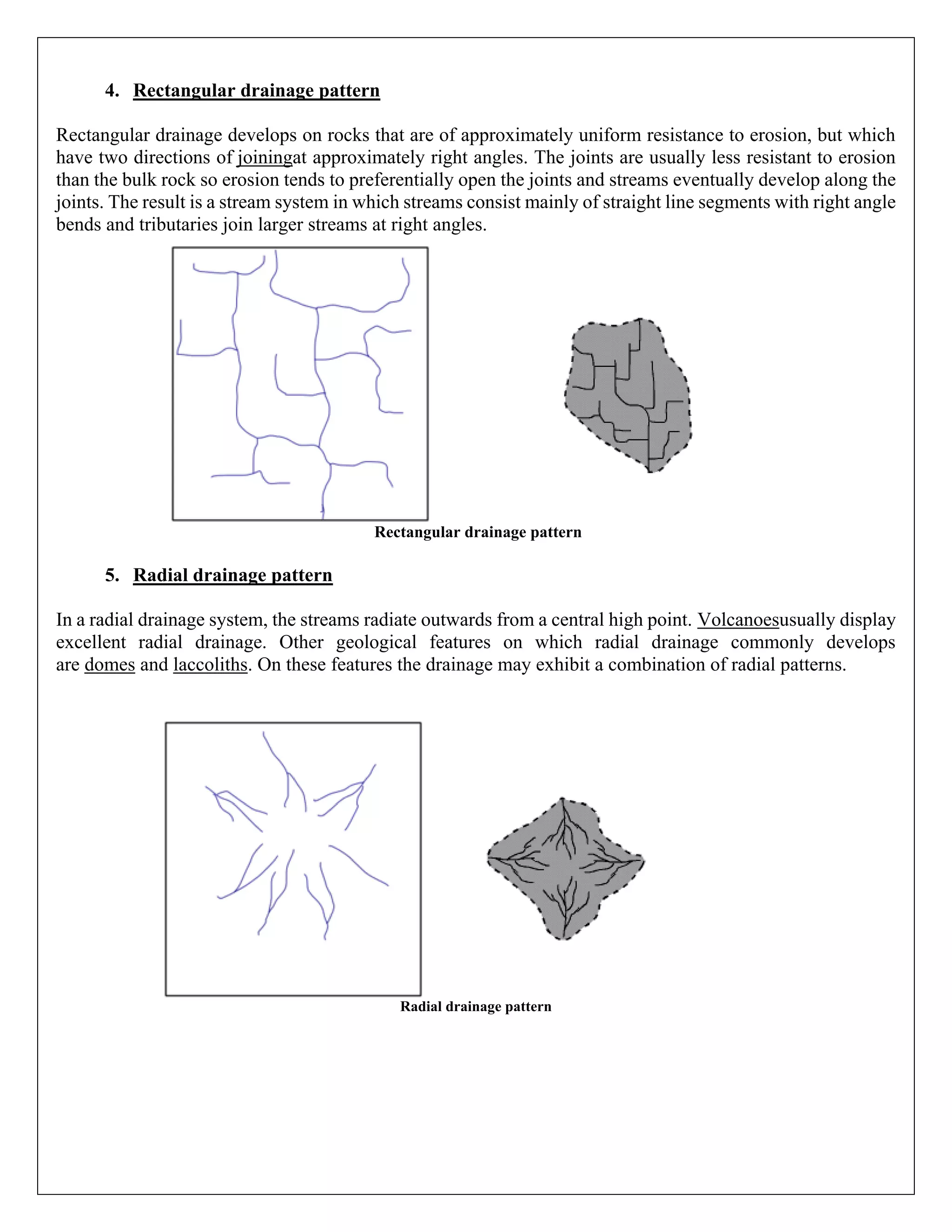
1. Drainage patterns are formed by the networks of streams, rivers, and lakes within a drainage basin and are influenced by the topography and geology of the land. 2. The most common drainage pattern is dendritic, where many small streams feed into larger tributaries and ultimately the trunk river. Dendritic patterns form in V-shaped valleys in impermeable rock. 3. Other drainage patterns include parallel, trellis, rectangular, radial, centripetal, annular, and angular - each forming under different geological conditions and rock structures. Discordant drainage does not correlate to the underlying geology.