SlideShare a Scribd company logo
1 of 43
Download to read offline
Amit K. Mishra
Assistant Professor
Department of Geology
Banasthali University
Himalayas
An introduction
• Digital Elevation Model showing the Himalaya, Karakoram, and Tibetan Plateau with locations of the major peaks.
• The Himalaya, located on the southern fringe of the Tibetan Plateau,
form a mountain arc (convex toward the south) about 2400 km long
and 250-300 km wide; they are bounded by two structural bends on
the northwest (Nanga Parbat, the Indus gorge) and northeast
(Namcha Barwa, the Tsangpo gorge). The Himalayas are the loftiest
and still rising mountains in the world.
• Indeed, the Tibetan Plateau and its surrounding mountains form the
largest topographic high on earth. All of the mountain summits taller
than 7000 m are located in this part of our planet, and several large
rivers, which rise in these highlands, provide fresh water for nearly
three billion people in Asia (almost half of world population).
• Sediments shed from the Himalaya have also formed extensive
agricultural plains in northern India, Pakistan, Nepal, and
Bangladesh which have supported civilizations for millennia.
• The Himalaya act as a topographic barrier to the summer-time
warm monsoon winds coming from the Indian Ocean and the
winter-time cold winds coming from Siberia, and have thus
caused cold dry climate in Tibet but torrential rainfall on the
valleys and plains to the south.
• Rich diversity of flora and faunas extending from the almost
sea-level plains upward the Higher Himalaya is also
significant for ecology. The Himalaya offer splendid peaks and
valleys for mountaineers, tourists and artists. Major
earthquakes that occasionally visit the Himalayan region can
indeed be devastating for people.
• Last but not least, these mountains are a natural laboratory
for geologists to study how mountains of similar type on Earth
form and influence the environment. For all these reasons,
scientific studies of the Himalaya are significant and
necessary.
The Anatomy of the Himalaya
• It is interesting that geologists sometimes
employ biological terms to describe
mountains; for example, ‘anatomy’ for
tectonic framework and structure of
mountains, or ‘evolution’ for the geologic
history and formation of mountains. To
understand how the Himalaya formed we
need to consider its structure the types and
ages of the rocks and the nature of faults that
have fashioned these mountains.
• Geological mapping in various parts of the
Himalaya over the past century has led the
geologists to divide these mountains into six
major longitudinal zones or northwest-
northeast trending belts. Although local
differences exist to some degree, the overall
consistency of these zones along the entire
length of the Himalaya is significant, and
points to a single tectonic explanation for the
mountain formation. The six zones of the
Himalayans are described below from north
to south.
• The term ‘Trans-Himalaya’ for a mountain range to the north
of the Indus and Yarlung-Tsangpo rivers was first used by
Alexander Cunningham in his book Ladak (1854), but it was
Sven Hedin who popularized the name in his book Trans-
Himalaya (1909-1912) which documents Hedin’s exploration
of this region.
• Geologically speaking, the Trans-Himalaya is made up of
granitic and volcanic rocks formed from 110-40 million year
ago (Ma). These igneous rocks intruded the metamorphic and
sedimentary rocks of the southern Tibetan block.
• The Trans-Himalaya is geographically divided into several
areas: Kohistan (to the west of Nanga Parbat), Ladakh
(between Nanga Parbat and the Karakoram strike-slip fault),
Kailash, Gangdese, Lhasa (all in southern Tibet), and Mishimi
(to the east of Namche Barwa).
• A ‘suture zone’ is a tectonic line along which two
continental plates collide and join each other.
• Prior to the collision, an ocean separates the two continents
but it gradually shrinks as the ocean floor subducts beneath
one of the continents. The collision thus occurs after the
intervening sea completely subducts and disappears, and the
moving continental plates crash into each other.
• The Indus-Tsangpo Suture Zone marks the boundary
between the Indian and Asian plates. It was so named by
the Swiss geologist Augusto Gansser in his Geology of the
Himalayas(1964) because the upper river valleys of the Indus
and Tsangpo lie along this suture zone. Here, we find ocean-
floor volcanic rocks, subduction-related high-pressure
metamorphic rocks (greenschist rocks), and deep-sea
sediments of the Tethys Ocean.
• This zone consists of Cambrian through Eocene sediments (sandstone, shale and
limestone) which were deposited on the continental shelf of the Tethys Ocean. These
sedimentary rocks contain many kinds of fossils including the Cretaceous-age ammonite
fossils which are called ‘shaligram shila’ in Nepal and are used as amulets (dark stones
devoted to Lord Shiva) by the Himalayan Hindus.
• Since most of this zone lies within southern Tibet, it is also sometimes called the Tibetan
Himalaya.
• In northwest India, the Tethyan sediments are exposed in Kashmir, Zanskar, Chamba, and
Spiti. With a width of about 100 km, the Tethys Himalaya is the widest zone of the
Himalaya.
• The stratigraphic thickness of sediments in this zone reaches up to 12 km. Within the
Tethyan Himalaya, there is also a series of dome-shaped structures made up of Cambrian-
age (about 500-450 Ma) granite gneiss or Miocene-age (18-9 Ma) white granites
(leucogranites), collectively referred to as the North Himalayan Granite Gneiss Domes.
These rocks and structural domes have been uplifted by a thrust fault called the North
Himalayan Thrust, situated at their base.
• Further south, the Tethys Himalaya is separated from the Higher Himalaya by a major
normal fault called the South Tibetan Detachment, first mapped in the 1980s in southern
Tibet and Zanskar.
• The Higher Himalaya, the backbone of the Himalayan mountains, is
made up of 10-20 km-thick metamorphic rocks (schist and gneiss)
and granites situated at altitudes of 3000 m to over 8000 m.
• These rocks are Proterozoic-Cambrian age (2,000-500 Ma) and
belong to the continental crust of the Indian plate. In addition we
also find white granites (leucogranites) of Miocene-age (24-17
Ma) in the upper parts of the Higher Himalaya.
• The South Tibetan Detachment constitutes the northern boundary of
the Higher Himalaya where the highest summits of the Himalaya
(over 7000 m) lie.
• Along its southern boundary, the Higher Himalaya is thrust over the
Lesser Himalaya along the Main Central Thrust, so named by
Augusto Gansser who first mapped this structure in Kumaon
(reported in Central Himalaya: Geological Observations of the Swiss
Expedition, 1939).
• French geologists working in Nepal have
also called this zone the Tibetan Slab
because it forms the basement for the
thick pile of the Tethyan (Tibetan)
sedimentary rocks. Still other geologists
also called it the Central Crystalline
zone. ‘Crystalline’ refers to an igneous
or metamorphic rock, in which minerals
were crystallized in the rock itself; unlike a
sedimentary rock which contains minerals
derived from other rocks.
• To the south of the Higher Himalaya (the Main Central Thrust) lies
the Lesser Himalaya which consists of metamorphosed sedimentary
rocks (quartzite, marble, slate, phyllite, schist and gneiss) and
minor volcanic and granitic rocks of Proterozoic-Cambrian age
(2000-500 Ma).
• The stratigraphic thickness of the rock sequence in this zone is 10-
20 km. In a plate-tectonic setting, the Lesser Himalaya, like the
Tethyan Himalaya and the Higher Himalaya, belongs to the northern
margin of the Indian plate.
• Unlike the rich fossiliferous sediments of the Tethyan Himalaya, the
sedimentary rocks in the Lesser Himalaya barely yield fossils partly
because they are much older (dating back to a period when life
forms were not abundant or diverse) and partly because they have
been metamorphosed. Nevertheless, metamorphism in the Lesser
Himalaya was less severe (under lower temperatures) compared to
the Higher Himalayan metamorphic rocks.
• Within the Lesser Himalaya, geologists have
also mapped transported, isolated parts of
the Higher Himalayan (Central) crystalline
rocks; these are called the ‘outer crystalline
zone’ or the Higher Himalayan ‘klippe’. (
‘Klippe’ is a German word which literally
means ’cliff’). These rocks were transported
on the back of the Main Central Thrust onto
the Lesser Himalaya, but were later isolated
from their root zone in the Higher Himalaya.
The Almora klippe in Kumaun is a classic
example.
• With elevations of 2000-3000 m, the Lesser
Himalaya is home to many hilly resorts and
forests. In Nepal, the Lesser Himalayan zone
geographically corresponds to the
Mahabharat Range.
• The southern boundary of the Lesser
Himalaya is the Main Boundary Thrust
which has uplifted this zone atop the Sub-
Himalayan (Siwalik) rocks. The Main
Boundary Thrust was first mapped (and
named) in 1864 by Henry B. Medlicott, a
British geologist working for the Geological
Survey of India.
• The Sub-Himalaya (or the Outer Himalaya) geographically
corresponds to the Siwalik range (or the Churia range in
Nepal) ďż˝ foothills ranging in elevation from 250-800 m.
• This zone is made up of 10-km thick succession of sandstone
and mudstone shed from the Himalayan mountains, and
carried and deposited by rivers, especially since the Miocene
(over the past 24 million years).
• These sediments have yielded abundant fossils of mammals
(elephants, horses, etc.), who then lived in the Himalayan
forests. (The Shivalik Fossil Park in Saketi, Himachal Pradesh
houses examples of these fossils and recreates the ancient
environment in which the animals lived.
• The Siwalik foothills were surveyed by
Captain Proby Cautley of the East India
Company in the 1840s-1850s, when he
was constructing the Ganga Canal in the
Doab region of north India. Cautley’s
geologist colleague Hugh Falconer
examined the rocks and fossils excavated
from the hills, which he called ‘Siwalik’,
after the pilgrimage site at Haridwar,
dedicated to Lord Shiva.
• The Siwalik foothills were uplifted approximately
one million years ago along high-angle reverse
faults (still active), called the Himalayan Frontal
Fault (or Thrust) and first mapped in India and
Nepal by the Japanese geologist T. Nakata in
1972. The Himalayan Frontal Fault marks the
boundary between the Siwalik Range and the
north Indian plains. Similar faults have also been
mapped in Pakistan by Robert Yeats in the 1980s.
The Himalayan Frontal Fault is a series of
‘blind’ faults (the fault plane is not visible at the
surface), and can be mapped from the topographic
features they have created. These faults are often
concealed under an apron of debris, called
Bhabhar, washed down from the hillsides.
• As the Himalayan Frontal Fault began
uplifting the Siwalik range, a series of river
valley were formed within the Sub-
Himalayan zone; these tectonic basins are
called dun (doon), and some well-known
examples include Dehra Dun in India and
Chitwan in Nepal.
India, Gondwana and Tethys
• About 500 million years ago, a supercontinent comprised by
Australia, Antarctica, India, Africa, and South Africa, was
assembled in the southern hemisphere. Geologists have called it
Gondwana, after the Gond tribes in central India, where the
sediments of this supercontinent were first studied in the late
nineteenth century.
• Within Gondwana, India was adjacent to Madagascar-Africa on
the west and to Antarctica on the east.
• The Paleo-Tethys Ocean bordered the northern margin of
Gondwana.
• During the Permian (275-260 Ma) a series of continental fragments
consisting of Turkey, Iran and Tibet drifted away from Gondwana,
thus opening the Neo-Tethys Ocean on their trails.
• When a continent splits apart, a large volcanic eruption affects some
part of it. The Permian-age Panjal Traps (basalts) exposed in the
Pir Panjal Range of Kashmir are believed to be the volcanic
outpouring of continental rifting between India and the Tibetan block.
• Gondwana largely remained intact until the late Jurassic when this
supercontinent started to fragment, part of a long global process
which eventually created the present-day continents and oceans.
• India together with Madagascar was drifted away from Africa in the
late Jurassic (about 165 Ma); afterwards, India was separated from
East Antarctica at about 135 Ma and began its northward journey
across the Neo-Tethys Ocean, at the same time as the Indian Ocean
was opening behind India.
• Around 85 Ma, a further split occurred between India and
Madagascar.
• The Cretaceous-Cenozoic boundary at 65 Ma marks an important
event in Earth’s history. The dinosaurs, ammonites and many other
species were wiped out probably because a huge meteorite struck
our planet and played havoc with the environment.
• At this time, India was passing over the Reunion hotspot which
caused a large volume of volcanic rocks ďż˝ the Deccan traps ďż˝ to
flood the central western India; this also caused the Seychelles-
Mauritius fragment to separate from India.
• As India drifted northward, the Neo-Tethys
ocean floor began to subduct beneath the
southern margin of Asia (along the
Karakoram and Tibet). This usually happens
because the oceanic crust (mainly basalt) is
heavier than the continental crust (mainly
granite), and if pushed the oceanic crust
subducts into an oceanic trench. The
subducting slab then partially melts
(dehydrates), and produces a large volume of
granitic and volcanic rocks in the form of an
island arc (Aleutian type) or a continental
margin igneous belt (Andes type).
• In the northwestern part of the Himalaya, we have evidence of
Cretaceous-age Kohistan-Ladakh island arc made up of
volcanic rocks similar to those found today on the Aleutian
Islands in the northern Pacific Ocean.
• At about 85 Ma or so, the Kohistan-Ladakh island collided
with the Karakoram margin as the oceanic floor between the
two subducted and closed. Therefore, in the northwestern
Himalaya there is a Northern Suture Zone between the
Karakoram and the Kohistan-Ladakh blocks; this suture zone
has also been called the Chalt Suture in Kohistan and the
Shyok Suture in Ladakh, after the two valleys where the Chalt
and Shyok volcanic rocks were mapped.
• After the Northern Suture formed, the subduction-related
igneous activity continued along an Andes-type continental
margin from Kohistan and Ladakh all along the southern
Tibetan block. The age of granites found in this Trans-
Himalayan belt have been determined by the radiometric
methods to range from 110 Ma through 40 Ma.
The India-Asia Collision
• When did India collide with Asia? Several types of data appear to point to
the early-middle Eocene period.
• First, reconstruction of the speed of the Indian plate in the geologic past
indicates that the plate motion drastically decreased in the Eocene. During
Cretaceous and Paleocene times (85-55 Ma), India moved northward at
rates of 15-20 cm per year but slowed down to only about 5 cm per year by
45 Ma. (These data come from examination of magnetic anomalies of rocks
on the Indian Ocean floor and from paleomagnetic analyses of rock
samples from the Trans-Himalaya by various scientists.)
• Second, the youngest granites in the Trans-Himalaya, produced by the
subduction of the Neo-Tethys Ocean floor beneath Asia, have been dated
by radiometric methods to be about 40 Ma. This indicates the ending of
subduction of Neo-Tethys sometime before 40 Ma.
• Third, the sedimentary record in the Himalaya show that after the lower-
middle Eocene (55- 45 Ma) the depositional environment changed from
purely marine to continental.
• In short, data of different kinds have led
many geologists to believe that at first the
northwest corner of the Indian plate
collided with Asia, probably at 55 Ma or
even 60-65 Ma (as some studies suggest);
then the Neo-Tethys ocean floor closed in
an oblique manner and India moved in
counterclockwise rotation until its
northeastern corner docked with Asia at
about 45 Ma. The Indus-Tsangpo Suture
Zone marks the line of this plate collision.
• Block diagram illustrating the structure of the Himalaya. STD is the South Tibetan Detachment—the
low angle normal fault that bounds the northern margin of the Greater Himalayan metamorphic
rocks and granites (magenta color); MCT is the Main Central thrust that places the metamorphic
rocks south over un-metamorphosed rocks of the Lesser Himalaya. MBT is the Main Boundary
thrust, the active southern margin of the Himalaya and the fault zone along which earthquakes are
triggered.
The Evolution of the Himalaya
• The Himalaya are products of 55 million years of tectonic
compression and structural deformation.
• Examination of geochronologic, structural, petrologic and
sedimentary data from various parts of the Himalaya indicates
that at least five major episodes or phases were milestones in
the geologic history of these mountains.
• Here a question may arise: While the motion of the Indian
plate has been steady and constant (about 5 cm per year)
over the past 45 million years, how is it possible that the uplift
of the Himalaya has not been at a uniform rate but in distinct
episodes? To answer this, consider an earthquake prone area
undergoing tectonic stress; the stress builds up gradually over
time, and then the area ruptures along a fault which releases
the stress as it surpasses the strength of the rock. On a larger
scale too, it takes time for major tectonic events to occur.
• Even before the India-Asia continental
collision, tectonic deformation was taking
place in the leading margin of the Indian
plate, near the Neo-Tethys subduction
zone and the continental margin of
southern Tibet. However, the Himalayan
drama began after the collision.
• It is conceivable that the first mountain range to emerge was
the Trans-Himalayan igneous arc, and that the Indus and
Tsangpo were the first rivers to arise and transport sediments
in the Eocene period. Geochronologic analyses of granites
from the Trans-Himalaya indicate that these rocks rapidly
cooled and eroded at about 40 Ma. And, there are basins in
the southern front of the Trans-Himalaya filled with continental
sediments (for example, in Kargil, Kailash and Lhasa).
• Mapping in southern Tibet by An Yin reveals the existence of
a south-directed thrust fault which he has called the
Gangdese Thrust, probably part of a deep-seated structure
responsible for the uplift of the Trans-Himalaya. (Along most
of the Indus-Tsangpo Suture, geologists, as early as Ausgsot
Gansser in 1930s, have mapped northdirected backthrusts,
which are probably later and shallower structures compared
to the Gangdese Thrust.)
• Partly concurrent with and partly after the uplift of the
Trans- Himalayan range, tectonic deformation also
affected the Tethyan Himalaya. Interestingly, the
Tethyan sediments in most of the Himalaya have
escaped metamorphism (they are still sedimentary
rocks) but they are highly folded and faulted. The
emergence from the sea and folding of these
sediments probably occurred shortly after the India-
Asia collision and continued for millions of years. The
North Himalayan Thrust and the uplift of the granite
gneiss domes within the Tethyan Himalaya began
during this phase (40-35 Ma). The Eocene-age
tectonic deformation in the Himalayan region may be
called the ‘Eo- (early) Himalayan’ episode.
• Since the India-Asia collision occurred in a
diachronous (variable time), oblique manner, both
the Trans-Himalayan and Eo-Himalayan events
first began in the northwestern Himalaya (in
Pakistan and Ladakh) around 55-45 Ma, and then
affected the eastern parts of the Himalaya at 35
Ma.
• The fact that the Trans-Himalaya and the Tethyan
Himalaya were uplifted prior to the Higher
Himalaya is evident from the ‘antecedent’ (flowing
before) pattern of many of the Himalaya river (the
Indus, Satluj, Ganga, Kali Gandaki, Arun and
Brahmaputra); these river courses rise behind the
Higher Himalaya (predating its uplift) and cut deep
gorges through it to flow southward.
• There is ample evidence that during the early Miocene (24-17 Ma), the Higher Himalayan
rocks, which were then buried 20-25 km deep and metamorphosed and partially melted
under temperatures of 600-800 degrees Celsius and pressures of 6-10 kilobars, began a
rapid uplift along the Main Central Thrust.
• Concurrent with the activity of this fault, the Tethyan Himalayan zone was detached from
the Higher Himalaya along a normal fault, named the South Tibetan Detachment. This
fault, which runs parallel to the Main Central Thrust and forms the northern boundary of the
Higher Himalaya, caused tectonic extension (spreading), gravitational gliding and back-
folding of sediments in the Tethyan Himalaya (the down-thrown block), while uplifting and
exhuming the Higher Himalayan rocks (the upthrown block).
• Moreover, a series of white granites (leucogranites) formed during 24-17 Ma were
emplaced and rapidly uplifted along the South Tibetan Detachment. These granites
constitute the core or the summit of the highest peaks in the Himalaya including Manaslu
and Annapurna in Nepal and Badrinath and Shivling in Kumaun. It is interesting that
these granites are located along the upthrown edge of the South Tibetan Detachment,
indicating that their formation (possibly by decompressional melting of deeply buried rocks)
and exhumation to the surface were related to the activity of this fault.
• Along the Main Central Thrust we do not find any
Miocene-age granites. Nevertheless, the Main Central
Thrust emerged as a major structure across which the
topography of the Himalaya markedly increases from
south to north. The slip on the Main Central Thrust is
more than 150 km as this thrust has transported the
Higher Himalayan metamorphic rocks onto the Lesser
Himalaya (where we find them as klippe outliers),
some 150 km distance their root zone.
• With the uplift of the Higher Himalaya beginning in the
early Miocene, increasing amounts of sands were
deposited not only in the Siwalik and Indus-Ganga
basins but were also transported by rivers to the
Arabian Sea (forming the submarine Indus Fan) and
the Bay of Bengal (the Bengal Fan).
• During the late Miocene (11-7 Ma), sedimentation rates in the
Siwalik basin drastically increased, and the mineral kyanite
which, in the Himalayan region is found only in the Higher
Himalayan metamorphic rocks (to the north of the Main
Central Thrust), first appeared in the Siwalik sediments.
These data indicate rapid erosion of the Himalaya at that time.
There is also limited geochronologic evidence from Pakistan
that the Main Boundary Thrust began its activity in the late
Miocene.
• Geochemical analyses of samples from the Indian Ocean
drilled cores and from the Siwalik ancient-soils indicate that
the Monsoon seasonality related to the Himalayan
topographic barrier also began in the late Miocene, indicating
that by 7 Ma, the Himalaya had attained sufficient heights.
• Some geologists including Augusto Gansser and K. S. Valdiya have
highlighted the significance of the Himalayan uplift over the past 2.5
million years or so, while certain geologists who confine their
research to the Miocene geochronology of the Himalaya have
ignored or downplayed the Quaternary events as if the maximum
topography of the Himalaya was reached in the Miocene and since
then only erosion has shaped these mountains.
• Considering various lines of evidence I consider the Quaternary
period as an important renewed phase of tectonic uplift in these
mountains. The uplift of the Siwalik range along the Himalayan
Frontal Fault over the past one million years, geochronologic
evidence (fission-track ages of 1-3 Ma) of rapid erosion from various
parts of the Higher Himalaya (Nanga Parbat, Zanskar, Gangotri,
Khumbu Himal, Namche Barwa, etc.), presence of active faults and
large earthquakes, deep and narrow gorges in the Higher Himalaya,
uplifted terraces of young sediments, and enormous amounts of
coarse-grained fluvial sediments in the Quaternary record of the
Himalayan foreland basins all testify to the intense neotectonics in
this region.
The Himalaya’s Adventure
Continues
• Geophysical surveys by the seismic (sound wave) reflection and gravity methods indicate that the
crustal thickness beneath the Himalaya is about 70 km, which is twice that of a normal continental
crust (for example, the Indian Peninsula). In other words, the Himalaya are higher because these
mountains are sitting on an over-thickened continental crust, produced by compression, thrusting,
and folding.
• Geologists believe that all major faults in the Himalaya, including the Normal Himalayan Thrust,
the South Tibetan Detachment, the Main Central Thrust, the Main Boundary Thrust, and the
Himalayan Frontal Fault, are all joined at depth to a major shallow-dipping structure, called the
Main Himalayan Thrust or Decollement (a French word meaning Detachment).
• This structural model together with the available geologic data discussed in this article implies that
as the Indian plate has pushed northward, thrust faults have developed sequentially from north to
south and that as a new thrust fault has ruptured, the tectonic push has added some elevation to
the entire Himalaya. In other words, the present elevation of the Himalaya is a cumulative effect of
55 million years of continental collision, a magnificent drama of episodes which geologists have
painstakingly pieced together and are beginning to make sense of it.
• A period of 55 million years or so since the India-Asia collision
may seem a long time from human perspective, but by Earth’s
standards, the Himalaya are still young, rising mountains.
Anatomy of the Himalaya: Structure and Formation

More Related Content

What's hot

Vindhyan supergroup
Vindhyan supergroupVindhyan supergroup
Vindhyan supergroupPramoda Raj
 
Glacial processes and their land forms.
Glacial processes and their land forms.Glacial processes and their land forms.
Glacial processes and their land forms.Pramoda Raj
 
Glaciers and its types
Glaciers and its types Glaciers and its types
Glaciers and its types GCUF
 
Eastern dharwar craton
Eastern dharwar cratonEastern dharwar craton
Eastern dharwar cratonPramoda Raj
 
Cratons of india
Cratons of indiaCratons of india
Cratons of indiaPramoda Raj
 
Glacial landforms (geomorphology)
Glacial landforms (geomorphology) Glacial landforms (geomorphology)
Glacial landforms (geomorphology) Shivam Jain
 
Introduction to Geomorphology
Introduction to Geomorphology Introduction to Geomorphology
Introduction to Geomorphology P.K. Mani
 
Western dharwar craton
Western dharwar cratonWestern dharwar craton
Western dharwar cratonPramoda Raj
 
Origin of himalayas
Origin of himalayasOrigin of himalayas
Origin of himalayasLavanya
 
Isostasy
IsostasyIsostasy
IsostasySaad Raja
 
Singhbhum Craton
Singhbhum CratonSinghbhum Craton
Singhbhum CratonAkash Naik
 
Geomorophology presentation
Geomorophology presentationGeomorophology presentation
Geomorophology presentationNigatu G-medhin
 
Cuddapah supergroup
Cuddapah supergroupCuddapah supergroup
Cuddapah supergroupPramoda Raj
 
Dharwar super group
Dharwar super groupDharwar super group
Dharwar super groupPramoda Raj
 
Davis cycle of erosion
Davis cycle of erosionDavis cycle of erosion
Davis cycle of erosionPramoda Raj
 
Tectonc framework of india
Tectonc framework of india Tectonc framework of india
Tectonc framework of india parag sonwane
 
Fluvial process
Fluvial processFluvial process
Fluvial processPramoda Raj
 
Boundary problems
Boundary problemsBoundary problems
Boundary problemsUjjavalPatel16
 
Bundelkhand craton
Bundelkhand cratonBundelkhand craton
Bundelkhand cratonPramoda Raj
 

What's hot (20)

Vindhyan supergroup
Vindhyan supergroupVindhyan supergroup
Vindhyan supergroup
 
Glacial processes and their land forms.
Glacial processes and their land forms.Glacial processes and their land forms.
Glacial processes and their land forms.
 
Glaciers and its types
Glaciers and its types Glaciers and its types
Glaciers and its types
 
Eastern dharwar craton
Eastern dharwar cratonEastern dharwar craton
Eastern dharwar craton
 
Cratons of india
Cratons of indiaCratons of india
Cratons of india
 
Glacial landforms (geomorphology)
Glacial landforms (geomorphology) Glacial landforms (geomorphology)
Glacial landforms (geomorphology)
 
Introduction to Geomorphology
Introduction to Geomorphology Introduction to Geomorphology
Introduction to Geomorphology
 
Western dharwar craton
Western dharwar cratonWestern dharwar craton
Western dharwar craton
 
Origin of himalayas
Origin of himalayasOrigin of himalayas
Origin of himalayas
 
Isostasy
IsostasyIsostasy
Isostasy
 
Singhbhum Craton
Singhbhum CratonSinghbhum Craton
Singhbhum Craton
 
Geomorophology presentation
Geomorophology presentationGeomorophology presentation
Geomorophology presentation
 
Cuddapah supergroup
Cuddapah supergroupCuddapah supergroup
Cuddapah supergroup
 
Physiographic divisions of India
Physiographic divisions of IndiaPhysiographic divisions of India
Physiographic divisions of India
 
Dharwar super group
Dharwar super groupDharwar super group
Dharwar super group
 
Davis cycle of erosion
Davis cycle of erosionDavis cycle of erosion
Davis cycle of erosion
 
Tectonc framework of india
Tectonc framework of india Tectonc framework of india
Tectonc framework of india
 
Fluvial process
Fluvial processFluvial process
Fluvial process
 
Boundary problems
Boundary problemsBoundary problems
Boundary problems
 
Bundelkhand craton
Bundelkhand cratonBundelkhand craton
Bundelkhand craton
 

Viewers also liked

Himalayas Quick Review - A brief but comprehensive presentation
Himalayas Quick Review - A brief but comprehensive presentationHimalayas Quick Review - A brief but comprehensive presentation
Himalayas Quick Review - A brief but comprehensive presentationSir Parashurambhau College, Pune
 
Ananda in himalayas
Ananda in himalayasAnanda in himalayas
Ananda in himalayasEeshna Dewan
 
Himalaya
HimalayaHimalaya
HimalayaOtzzi
 
High Passes & Soft Curves (A quick trip to the Indian Himalaya)
High Passes & Soft Curves (A quick trip to the Indian Himalaya)High Passes & Soft Curves (A quick trip to the Indian Himalaya)
High Passes & Soft Curves (A quick trip to the Indian Himalaya)indigoprime
 
Ward.3.the himalayas
Ward.3.the himalayasWard.3.the himalayas
Ward.3.the himalayaspunxsyscience
 
Arise robert placement presents secrets of himalayas
Arise robert placement presents secrets of himalayasArise robert placement presents secrets of himalayas
Arise robert placement presents secrets of himalayasArise Roby
 
Himalayas
HimalayasHimalayas
Himalayasaloksir
 
The Himalayas, Mountains And Rivers Project - Carver
The Himalayas,  Mountains And Rivers Project - CarverThe Himalayas,  Mountains And Rivers Project - Carver
The Himalayas, Mountains And Rivers Project - Carveryear 6 DBIS
 
Himalaya
HimalayaHimalaya
HimalayaDiego
 

Viewers also liked (11)

Himalayas Quick Review - A brief but comprehensive presentation
Himalayas Quick Review - A brief but comprehensive presentationHimalayas Quick Review - A brief but comprehensive presentation
Himalayas Quick Review - A brief but comprehensive presentation
 
Himalayas
HimalayasHimalayas
Himalayas
 
Ananda in himalayas
Ananda in himalayasAnanda in himalayas
Ananda in himalayas
 
Himalayas
HimalayasHimalayas
Himalayas
 
Himalaya
HimalayaHimalaya
Himalaya
 
High Passes & Soft Curves (A quick trip to the Indian Himalaya)
High Passes & Soft Curves (A quick trip to the Indian Himalaya)High Passes & Soft Curves (A quick trip to the Indian Himalaya)
High Passes & Soft Curves (A quick trip to the Indian Himalaya)
 
Ward.3.the himalayas
Ward.3.the himalayasWard.3.the himalayas
Ward.3.the himalayas
 
Arise robert placement presents secrets of himalayas
Arise robert placement presents secrets of himalayasArise robert placement presents secrets of himalayas
Arise robert placement presents secrets of himalayas
 
Himalayas
HimalayasHimalayas
Himalayas
 
The Himalayas, Mountains And Rivers Project - Carver
The Himalayas,  Mountains And Rivers Project - CarverThe Himalayas,  Mountains And Rivers Project - Carver
The Himalayas, Mountains And Rivers Project - Carver
 
Himalaya
HimalayaHimalaya
Himalaya
 

Similar to Anatomy of the Himalaya: Structure and Formation

evolution of siwalik.pptx
evolution of siwalik.pptxevolution of siwalik.pptx
evolution of siwalik.pptxDEVANANDANPS
 
Physical features of India.pptx
Physical features of India.pptxPhysical features of India.pptx
Physical features of India.pptxparvaizmalik
 
Geodynamic Evolution of Himalayas.pptx
Geodynamic Evolution of Himalayas.pptxGeodynamic Evolution of Himalayas.pptx
Geodynamic Evolution of Himalayas.pptxRitik
 
HIMALAYAN LANDSCAPE
HIMALAYAN LANDSCAPEHIMALAYAN LANDSCAPE
HIMALAYAN LANDSCAPEshakeelakther2
 
Chapter - 2, Physical Features of India, Geography, Social Science, Class 9
Chapter - 2, Physical Features of India, Geography, Social Science, Class 9Chapter - 2, Physical Features of India, Geography, Social Science, Class 9
Chapter - 2, Physical Features of India, Geography, Social Science, Class 9Shivam Parmar
 
physical features of india
physical features of indiaphysical features of india
physical features of indiaBhakti Gaunkar
 
Himalaya Formation By Junaidurrehman
Himalaya Formation By JunaidurrehmanHimalaya Formation By Junaidurrehman
Himalaya Formation By JunaidurrehmanJunaidurrehman26
 
Physical features of india
Physical features of indiaPhysical features of india
Physical features of indiaUday Pal
 
Origin of himalayas
Origin of himalayasOrigin of himalayas
Origin of himalayasLavanya
 
SST PPT PRESENTATION
SST PPT PRESENTATIONSST PPT PRESENTATION
SST PPT PRESENTATIONAmal Krishna
 
physiography_of_india_upsc_notes_10.pdf
physiography_of_india_upsc_notes_10.pdfphysiography_of_india_upsc_notes_10.pdf
physiography_of_india_upsc_notes_10.pdfprabanjanprabanjan
 
Physical feature of india.ppt
Physical feature of india.pptPhysical feature of india.ppt
Physical feature of india.pptAyushDewangan20
 
Physical features of india
Physical features of indiaPhysical features of india
Physical features of indiaUday Pal
 
Geo chp 1&2 combine
Geo chp 1&2 combineGeo chp 1&2 combine
Geo chp 1&2 combineAlefiya78652
 
the northern mountains-himalayas
the northern mountains-himalayasthe northern mountains-himalayas
the northern mountains-himalayasMohammed Rahat Kaleem
 
Ppt on Features of india
Ppt on Features of indiaPpt on Features of india
Ppt on Features of indiaVisheshPunia1
 

Similar to Anatomy of the Himalaya: Structure and Formation (20)

evolution of siwalik.pptx
evolution of siwalik.pptxevolution of siwalik.pptx
evolution of siwalik.pptx
 
Physical features of India.pptx
Physical features of India.pptxPhysical features of India.pptx
Physical features of India.pptx
 
Geodynamic Evolution of Himalayas.pptx
Geodynamic Evolution of Himalayas.pptxGeodynamic Evolution of Himalayas.pptx
Geodynamic Evolution of Himalayas.pptx
 
HIMALAYAN LANDSCAPE
HIMALAYAN LANDSCAPEHIMALAYAN LANDSCAPE
HIMALAYAN LANDSCAPE
 
Chapter - 2, Physical Features of India, Geography, Social Science, Class 9
Chapter - 2, Physical Features of India, Geography, Social Science, Class 9Chapter - 2, Physical Features of India, Geography, Social Science, Class 9
Chapter - 2, Physical Features of India, Geography, Social Science, Class 9
 
9 std geo
9 std geo9 std geo
9 std geo
 
physical features of india
physical features of indiaphysical features of india
physical features of india
 
Himalaya Formation By Junaidurrehman
Himalaya Formation By JunaidurrehmanHimalaya Formation By Junaidurrehman
Himalaya Formation By Junaidurrehman
 
Physical features of india
Physical features of indiaPhysical features of india
Physical features of india
 
Origin of himalayas
Origin of himalayasOrigin of himalayas
Origin of himalayas
 
SST PPT PRESENTATION
SST PPT PRESENTATIONSST PPT PRESENTATION
SST PPT PRESENTATION
 
physiography_of_india_upsc_notes_10.pdf
physiography_of_india_upsc_notes_10.pdfphysiography_of_india_upsc_notes_10.pdf
physiography_of_india_upsc_notes_10.pdf
 
West himalaya
West himalayaWest himalaya
West himalaya
 
The himalayas
The himalayasThe himalayas
The himalayas
 
Physical feature of india.ppt
Physical feature of india.pptPhysical feature of india.ppt
Physical feature of india.ppt
 
Physical features of india
Physical features of indiaPhysical features of india
Physical features of india
 
Mountain Ranges
Mountain RangesMountain Ranges
Mountain Ranges
 
Geo chp 1&2 combine
Geo chp 1&2 combineGeo chp 1&2 combine
Geo chp 1&2 combine
 
the northern mountains-himalayas
the northern mountains-himalayasthe northern mountains-himalayas
the northern mountains-himalayas
 
Ppt on Features of india
Ppt on Features of indiaPpt on Features of india
Ppt on Features of india
 

More from Amit K. Mishra

Toposheet indexing .
Toposheet indexing .Toposheet indexing .
Toposheet indexing .Amit K. Mishra
 
Gravity anomaly across reagional structures
Gravity anomaly across reagional structuresGravity anomaly across reagional structures
Gravity anomaly across reagional structuresAmit K. Mishra
 
Shape, size and motions of the earth 1
Shape, size and motions of the earth 1Shape, size and motions of the earth 1
Shape, size and motions of the earth 1Amit K. Mishra
 
Kutch geological field report
Kutch geological field reportKutch geological field report
Kutch geological field reportAmit K. Mishra
 
Resistivity Survey
Resistivity SurveyResistivity Survey
Resistivity SurveyAmit K. Mishra
 
Electrical survey 2018
Electrical survey 2018Electrical survey 2018
Electrical survey 2018Amit K. Mishra
 
Topography and its representation
Topography and its representationTopography and its representation
Topography and its representationAmit K. Mishra
 
Fractures and fault 2017
Fractures and fault 2017Fractures and fault 2017
Fractures and fault 2017Amit K. Mishra
 

More from Amit K. Mishra (14)

Toposheet indexing .
Toposheet indexing .Toposheet indexing .
Toposheet indexing .
 
Lineation
Lineation Lineation
Lineation
 
Gravity anomaly across reagional structures
Gravity anomaly across reagional structuresGravity anomaly across reagional structures
Gravity anomaly across reagional structures
 
Shape, size and motions of the earth 1
Shape, size and motions of the earth 1Shape, size and motions of the earth 1
Shape, size and motions of the earth 1
 
Kutch geological field report
Kutch geological field reportKutch geological field report
Kutch geological field report
 
Resistivity Survey
Resistivity SurveyResistivity Survey
Resistivity Survey
 
Electrical survey 2018
Electrical survey 2018Electrical survey 2018
Electrical survey 2018
 
Topography and its representation
Topography and its representationTopography and its representation
Topography and its representation
 
Folds
FoldsFolds
Folds
 
Fractures and fault 2017
Fractures and fault 2017Fractures and fault 2017
Fractures and fault 2017
 
Wilson cycle
Wilson cycleWilson cycle
Wilson cycle
 
Fabric elements
Fabric elementsFabric elements
Fabric elements
 
Mantle plumes
Mantle plumesMantle plumes
Mantle plumes
 
Plate tectonics
Plate tectonicsPlate tectonics
Plate tectonics
 

Recently uploaded

STOPPED FLOW METHOD & APPLICATION MURUGAVENI B.pptx
STOPPED FLOW METHOD & APPLICATION MURUGAVENI B.pptxSTOPPED FLOW METHOD & APPLICATION MURUGAVENI B.pptx
STOPPED FLOW METHOD & APPLICATION MURUGAVENI B.pptxMurugaveni B
 
Scheme-of-Work-Science-Stage-4 cambridge science.docx
Scheme-of-Work-Science-Stage-4 cambridge science.docxScheme-of-Work-Science-Stage-4 cambridge science.docx
Scheme-of-Work-Science-Stage-4 cambridge science.docxyaramohamed343013
 
Call Girls in Mayapuri Delhi 💯Call Us 🔝9953322196🔝 💯Escort.
Call Girls in Mayapuri Delhi 💯Call Us 🔝9953322196🔝 💯Escort.Call Girls in Mayapuri Delhi 💯Call Us 🔝9953322196🔝 💯Escort.
Call Girls in Mayapuri Delhi 💯Call Us 🔝9953322196🔝 💯Escort.aasikanpl
 
SOLUBLE PATTERN RECOGNITION RECEPTORS.pptx
SOLUBLE PATTERN RECOGNITION RECEPTORS.pptxSOLUBLE PATTERN RECOGNITION RECEPTORS.pptx
SOLUBLE PATTERN RECOGNITION RECEPTORS.pptxkessiyaTpeter
 
Call Girls in Munirka Delhi 💯Call Us 🔝9953322196🔝 💯Escort.
Call Girls in Munirka Delhi 💯Call Us 🔝9953322196🔝 💯Escort.Call Girls in Munirka Delhi 💯Call Us 🔝9953322196🔝 💯Escort.
Call Girls in Munirka Delhi 💯Call Us 🔝9953322196🔝 💯Escort.aasikanpl
 
Vision and reflection on Mining Software Repositories research in 2024
Vision and reflection on Mining Software Repositories research in 2024Vision and reflection on Mining Software Repositories research in 2024
Vision and reflection on Mining Software Repositories research in 2024AyushiRastogi48
 
Evidences of Evolution General Biology 2
Evidences of Evolution General Biology 2Evidences of Evolution General Biology 2
Evidences of Evolution General Biology 2John Carlo Rollon
 
Forest laws, Indian forest laws, why they are important
Forest laws, Indian forest laws, why they are importantForest laws, Indian forest laws, why they are important
Forest laws, Indian forest laws, why they are importantadityabhardwaj282
 
zoogeography of pakistan.pptx fauna of Pakistan
zoogeography of pakistan.pptx fauna of Pakistanzoogeography of pakistan.pptx fauna of Pakistan
zoogeography of pakistan.pptx fauna of Pakistanzohaibmir069
 
Recombinant DNA technology( Transgenic plant and animal)
Recombinant DNA technology( Transgenic plant and animal)Recombinant DNA technology( Transgenic plant and animal)
Recombinant DNA technology( Transgenic plant and animal)DHURKADEVIBASKAR
 
BIOETHICS IN RECOMBINANT DNA TECHNOLOGY.
BIOETHICS IN RECOMBINANT DNA TECHNOLOGY.BIOETHICS IN RECOMBINANT DNA TECHNOLOGY.
BIOETHICS IN RECOMBINANT DNA TECHNOLOGY.PraveenaKalaiselvan1
 
Call Us ≽ 9953322196 ≼ Call Girls In Lajpat Nagar (Delhi) |
Call Us ≽ 9953322196 ≼ Call Girls In Lajpat Nagar (Delhi) |Call Us ≽ 9953322196 ≼ Call Girls In Lajpat Nagar (Delhi) |
Call Us ≽ 9953322196 ≼ Call Girls In Lajpat Nagar (Delhi) |aasikanpl
 
Call Girls in Munirka Delhi 💯Call Us 🔝8264348440🔝
Call Girls in Munirka Delhi 💯Call Us 🔝8264348440🔝Call Girls in Munirka Delhi 💯Call Us 🔝8264348440🔝
Call Girls in Munirka Delhi 💯Call Us 🔝8264348440🔝soniya singh
 
Pests of jatropha_Bionomics_identification_Dr.UPR.pdf
Pests of jatropha_Bionomics_identification_Dr.UPR.pdfPests of jatropha_Bionomics_identification_Dr.UPR.pdf
Pests of jatropha_Bionomics_identification_Dr.UPR.pdfPirithiRaju
 
THE ROLE OF PHARMACOGNOSY IN TRADITIONAL AND MODERN SYSTEM OF MEDICINE.pptx
THE ROLE OF PHARMACOGNOSY IN TRADITIONAL AND MODERN SYSTEM OF MEDICINE.pptxTHE ROLE OF PHARMACOGNOSY IN TRADITIONAL AND MODERN SYSTEM OF MEDICINE.pptx
THE ROLE OF PHARMACOGNOSY IN TRADITIONAL AND MODERN SYSTEM OF MEDICINE.pptxNandakishor Bhaurao Deshmukh
 
Solution chemistry, Moral and Normal solutions
Solution chemistry, Moral and Normal solutionsSolution chemistry, Moral and Normal solutions
Solution chemistry, Moral and Normal solutionsHajira Mahmood
 
Behavioral Disorder: Schizophrenia & it's Case Study.pdf
Behavioral Disorder: Schizophrenia & it's Case Study.pdfBehavioral Disorder: Schizophrenia & it's Case Study.pdf
Behavioral Disorder: Schizophrenia & it's Case Study.pdfSELF-EXPLANATORY
 
Pests of safflower_Binomics_Identification_Dr.UPR.pdf
Pests of safflower_Binomics_Identification_Dr.UPR.pdfPests of safflower_Binomics_Identification_Dr.UPR.pdf
Pests of safflower_Binomics_Identification_Dr.UPR.pdfPirithiRaju
 
BUMI DAN ANTARIKSA PROJEK IPAS SMK KELAS X.pdf
BUMI DAN ANTARIKSA PROJEK IPAS SMK KELAS X.pdfBUMI DAN ANTARIKSA PROJEK IPAS SMK KELAS X.pdf
BUMI DAN ANTARIKSA PROJEK IPAS SMK KELAS X.pdfWildaNurAmalia2
 

Recently uploaded (20)

STOPPED FLOW METHOD & APPLICATION MURUGAVENI B.pptx
STOPPED FLOW METHOD & APPLICATION MURUGAVENI B.pptxSTOPPED FLOW METHOD & APPLICATION MURUGAVENI B.pptx
STOPPED FLOW METHOD & APPLICATION MURUGAVENI B.pptx
 
Scheme-of-Work-Science-Stage-4 cambridge science.docx
Scheme-of-Work-Science-Stage-4 cambridge science.docxScheme-of-Work-Science-Stage-4 cambridge science.docx
Scheme-of-Work-Science-Stage-4 cambridge science.docx
 
Call Girls in Mayapuri Delhi 💯Call Us 🔝9953322196🔝 💯Escort.
Call Girls in Mayapuri Delhi 💯Call Us 🔝9953322196🔝 💯Escort.Call Girls in Mayapuri Delhi 💯Call Us 🔝9953322196🔝 💯Escort.
Call Girls in Mayapuri Delhi 💯Call Us 🔝9953322196🔝 💯Escort.
 
SOLUBLE PATTERN RECOGNITION RECEPTORS.pptx
SOLUBLE PATTERN RECOGNITION RECEPTORS.pptxSOLUBLE PATTERN RECOGNITION RECEPTORS.pptx
SOLUBLE PATTERN RECOGNITION RECEPTORS.pptx
 
Call Girls in Munirka Delhi 💯Call Us 🔝9953322196🔝 💯Escort.
Call Girls in Munirka Delhi 💯Call Us 🔝9953322196🔝 💯Escort.Call Girls in Munirka Delhi 💯Call Us 🔝9953322196🔝 💯Escort.
Call Girls in Munirka Delhi 💯Call Us 🔝9953322196🔝 💯Escort.
 
Vision and reflection on Mining Software Repositories research in 2024
Vision and reflection on Mining Software Repositories research in 2024Vision and reflection on Mining Software Repositories research in 2024
Vision and reflection on Mining Software Repositories research in 2024
 
Evidences of Evolution General Biology 2
Evidences of Evolution General Biology 2Evidences of Evolution General Biology 2
Evidences of Evolution General Biology 2
 
Forest laws, Indian forest laws, why they are important
Forest laws, Indian forest laws, why they are importantForest laws, Indian forest laws, why they are important
Forest laws, Indian forest laws, why they are important
 
Engler and Prantl system of classification in plant taxonomy
Engler and Prantl system of classification in plant taxonomyEngler and Prantl system of classification in plant taxonomy
Engler and Prantl system of classification in plant taxonomy
 
zoogeography of pakistan.pptx fauna of Pakistan
zoogeography of pakistan.pptx fauna of Pakistanzoogeography of pakistan.pptx fauna of Pakistan
zoogeography of pakistan.pptx fauna of Pakistan
 
Recombinant DNA technology( Transgenic plant and animal)
Recombinant DNA technology( Transgenic plant and animal)Recombinant DNA technology( Transgenic plant and animal)
Recombinant DNA technology( Transgenic plant and animal)
 
BIOETHICS IN RECOMBINANT DNA TECHNOLOGY.
BIOETHICS IN RECOMBINANT DNA TECHNOLOGY.BIOETHICS IN RECOMBINANT DNA TECHNOLOGY.
BIOETHICS IN RECOMBINANT DNA TECHNOLOGY.
 
Call Us ≽ 9953322196 ≼ Call Girls In Lajpat Nagar (Delhi) |
Call Us ≽ 9953322196 ≼ Call Girls In Lajpat Nagar (Delhi) |Call Us ≽ 9953322196 ≼ Call Girls In Lajpat Nagar (Delhi) |
Call Us ≽ 9953322196 ≼ Call Girls In Lajpat Nagar (Delhi) |
 
Call Girls in Munirka Delhi 💯Call Us 🔝8264348440🔝
Call Girls in Munirka Delhi 💯Call Us 🔝8264348440🔝Call Girls in Munirka Delhi 💯Call Us 🔝8264348440🔝
Call Girls in Munirka Delhi 💯Call Us 🔝8264348440🔝
 
Pests of jatropha_Bionomics_identification_Dr.UPR.pdf
Pests of jatropha_Bionomics_identification_Dr.UPR.pdfPests of jatropha_Bionomics_identification_Dr.UPR.pdf
Pests of jatropha_Bionomics_identification_Dr.UPR.pdf
 
THE ROLE OF PHARMACOGNOSY IN TRADITIONAL AND MODERN SYSTEM OF MEDICINE.pptx
THE ROLE OF PHARMACOGNOSY IN TRADITIONAL AND MODERN SYSTEM OF MEDICINE.pptxTHE ROLE OF PHARMACOGNOSY IN TRADITIONAL AND MODERN SYSTEM OF MEDICINE.pptx
THE ROLE OF PHARMACOGNOSY IN TRADITIONAL AND MODERN SYSTEM OF MEDICINE.pptx
 
Solution chemistry, Moral and Normal solutions
Solution chemistry, Moral and Normal solutionsSolution chemistry, Moral and Normal solutions
Solution chemistry, Moral and Normal solutions
 
Behavioral Disorder: Schizophrenia & it's Case Study.pdf
Behavioral Disorder: Schizophrenia & it's Case Study.pdfBehavioral Disorder: Schizophrenia & it's Case Study.pdf
Behavioral Disorder: Schizophrenia & it's Case Study.pdf
 
Pests of safflower_Binomics_Identification_Dr.UPR.pdf
Pests of safflower_Binomics_Identification_Dr.UPR.pdfPests of safflower_Binomics_Identification_Dr.UPR.pdf
Pests of safflower_Binomics_Identification_Dr.UPR.pdf
 
BUMI DAN ANTARIKSA PROJEK IPAS SMK KELAS X.pdf
BUMI DAN ANTARIKSA PROJEK IPAS SMK KELAS X.pdfBUMI DAN ANTARIKSA PROJEK IPAS SMK KELAS X.pdf
BUMI DAN ANTARIKSA PROJEK IPAS SMK KELAS X.pdf
 

Anatomy of the Himalaya: Structure and Formation

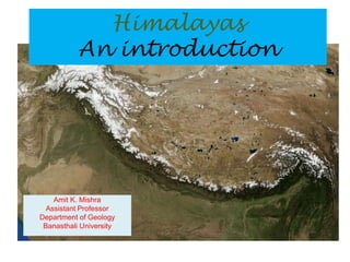
  • 1. Amit K. Mishra Assistant Professor Department of Geology Banasthali University Himalayas An introduction
  • 2. • Digital Elevation Model showing the Himalaya, Karakoram, and Tibetan Plateau with locations of the major peaks.
  • 3. • The Himalaya, located on the southern fringe of the Tibetan Plateau, form a mountain arc (convex toward the south) about 2400 km long and 250-300 km wide; they are bounded by two structural bends on the northwest (Nanga Parbat, the Indus gorge) and northeast (Namcha Barwa, the Tsangpo gorge). The Himalayas are the loftiest and still rising mountains in the world. • Indeed, the Tibetan Plateau and its surrounding mountains form the largest topographic high on earth. All of the mountain summits taller than 7000 m are located in this part of our planet, and several large rivers, which rise in these highlands, provide fresh water for nearly three billion people in Asia (almost half of world population). • Sediments shed from the Himalaya have also formed extensive agricultural plains in northern India, Pakistan, Nepal, and Bangladesh which have supported civilizations for millennia.
  • 4. • The Himalaya act as a topographic barrier to the summer-time warm monsoon winds coming from the Indian Ocean and the winter-time cold winds coming from Siberia, and have thus caused cold dry climate in Tibet but torrential rainfall on the valleys and plains to the south. • Rich diversity of flora and faunas extending from the almost sea-level plains upward the Higher Himalaya is also significant for ecology. The Himalaya offer splendid peaks and valleys for mountaineers, tourists and artists. Major earthquakes that occasionally visit the Himalayan region can indeed be devastating for people. • Last but not least, these mountains are a natural laboratory for geologists to study how mountains of similar type on Earth form and influence the environment. For all these reasons, scientific studies of the Himalaya are significant and necessary.
  • 5. The Anatomy of the Himalaya • It is interesting that geologists sometimes employ biological terms to describe mountains; for example, ‘anatomy’ for tectonic framework and structure of mountains, or ‘evolution’ for the geologic history and formation of mountains. To understand how the Himalaya formed we need to consider its structure the types and ages of the rocks and the nature of faults that have fashioned these mountains.
  • 6. • Geological mapping in various parts of the Himalaya over the past century has led the geologists to divide these mountains into six major longitudinal zones or northwest- northeast trending belts. Although local differences exist to some degree, the overall consistency of these zones along the entire length of the Himalaya is significant, and points to a single tectonic explanation for the mountain formation. The six zones of the Himalayans are described below from north to south.
  • 7.
  • 8. • The term ‘Trans-Himalaya’ for a mountain range to the north of the Indus and Yarlung-Tsangpo rivers was first used by Alexander Cunningham in his book Ladak (1854), but it was Sven Hedin who popularized the name in his book Trans- Himalaya (1909-1912) which documents Hedin’s exploration of this region. • Geologically speaking, the Trans-Himalaya is made up of granitic and volcanic rocks formed from 110-40 million year ago (Ma). These igneous rocks intruded the metamorphic and sedimentary rocks of the southern Tibetan block. • The Trans-Himalaya is geographically divided into several areas: Kohistan (to the west of Nanga Parbat), Ladakh (between Nanga Parbat and the Karakoram strike-slip fault), Kailash, Gangdese, Lhasa (all in southern Tibet), and Mishimi (to the east of Namche Barwa).
  • 9.
  • 10. • A ‘suture zone’ is a tectonic line along which two continental plates collide and join each other. • Prior to the collision, an ocean separates the two continents but it gradually shrinks as the ocean floor subducts beneath one of the continents. The collision thus occurs after the intervening sea completely subducts and disappears, and the moving continental plates crash into each other. • The Indus-Tsangpo Suture Zone marks the boundary between the Indian and Asian plates. It was so named by the Swiss geologist Augusto Gansser in his Geology of the Himalayas(1964) because the upper river valleys of the Indus and Tsangpo lie along this suture zone. Here, we find ocean- floor volcanic rocks, subduction-related high-pressure metamorphic rocks (greenschist rocks), and deep-sea sediments of the Tethys Ocean.
  • 11. • This zone consists of Cambrian through Eocene sediments (sandstone, shale and limestone) which were deposited on the continental shelf of the Tethys Ocean. These sedimentary rocks contain many kinds of fossils including the Cretaceous-age ammonite fossils which are called ‘shaligram shila’ in Nepal and are used as amulets (dark stones devoted to Lord Shiva) by the Himalayan Hindus. • Since most of this zone lies within southern Tibet, it is also sometimes called the Tibetan Himalaya. • In northwest India, the Tethyan sediments are exposed in Kashmir, Zanskar, Chamba, and Spiti. With a width of about 100 km, the Tethys Himalaya is the widest zone of the Himalaya. • The stratigraphic thickness of sediments in this zone reaches up to 12 km. Within the Tethyan Himalaya, there is also a series of dome-shaped structures made up of Cambrian- age (about 500-450 Ma) granite gneiss or Miocene-age (18-9 Ma) white granites (leucogranites), collectively referred to as the North Himalayan Granite Gneiss Domes. These rocks and structural domes have been uplifted by a thrust fault called the North Himalayan Thrust, situated at their base. • Further south, the Tethys Himalaya is separated from the Higher Himalaya by a major normal fault called the South Tibetan Detachment, first mapped in the 1980s in southern Tibet and Zanskar.
  • 12. • The Higher Himalaya, the backbone of the Himalayan mountains, is made up of 10-20 km-thick metamorphic rocks (schist and gneiss) and granites situated at altitudes of 3000 m to over 8000 m. • These rocks are Proterozoic-Cambrian age (2,000-500 Ma) and belong to the continental crust of the Indian plate. In addition we also find white granites (leucogranites) of Miocene-age (24-17 Ma) in the upper parts of the Higher Himalaya. • The South Tibetan Detachment constitutes the northern boundary of the Higher Himalaya where the highest summits of the Himalaya (over 7000 m) lie. • Along its southern boundary, the Higher Himalaya is thrust over the Lesser Himalaya along the Main Central Thrust, so named by Augusto Gansser who first mapped this structure in Kumaon (reported in Central Himalaya: Geological Observations of the Swiss Expedition, 1939).
  • 13. • French geologists working in Nepal have also called this zone the Tibetan Slab because it forms the basement for the thick pile of the Tethyan (Tibetan) sedimentary rocks. Still other geologists also called it the Central Crystalline zone. ‘Crystalline’ refers to an igneous or metamorphic rock, in which minerals were crystallized in the rock itself; unlike a sedimentary rock which contains minerals derived from other rocks.
  • 14. • To the south of the Higher Himalaya (the Main Central Thrust) lies the Lesser Himalaya which consists of metamorphosed sedimentary rocks (quartzite, marble, slate, phyllite, schist and gneiss) and minor volcanic and granitic rocks of Proterozoic-Cambrian age (2000-500 Ma). • The stratigraphic thickness of the rock sequence in this zone is 10- 20 km. In a plate-tectonic setting, the Lesser Himalaya, like the Tethyan Himalaya and the Higher Himalaya, belongs to the northern margin of the Indian plate. • Unlike the rich fossiliferous sediments of the Tethyan Himalaya, the sedimentary rocks in the Lesser Himalaya barely yield fossils partly because they are much older (dating back to a period when life forms were not abundant or diverse) and partly because they have been metamorphosed. Nevertheless, metamorphism in the Lesser Himalaya was less severe (under lower temperatures) compared to the Higher Himalayan metamorphic rocks.
  • 15. • Within the Lesser Himalaya, geologists have also mapped transported, isolated parts of the Higher Himalayan (Central) crystalline rocks; these are called the ‘outer crystalline zone’ or the Higher Himalayan ‘klippe’. ( ‘Klippe’ is a German word which literally means ’cliff’). These rocks were transported on the back of the Main Central Thrust onto the Lesser Himalaya, but were later isolated from their root zone in the Higher Himalaya. The Almora klippe in Kumaun is a classic example.
  • 16. • With elevations of 2000-3000 m, the Lesser Himalaya is home to many hilly resorts and forests. In Nepal, the Lesser Himalayan zone geographically corresponds to the Mahabharat Range. • The southern boundary of the Lesser Himalaya is the Main Boundary Thrust which has uplifted this zone atop the Sub- Himalayan (Siwalik) rocks. The Main Boundary Thrust was first mapped (and named) in 1864 by Henry B. Medlicott, a British geologist working for the Geological Survey of India.
  • 17.
  • 18. • The Sub-Himalaya (or the Outer Himalaya) geographically corresponds to the Siwalik range (or the Churia range in Nepal) ďż˝ foothills ranging in elevation from 250-800 m. • This zone is made up of 10-km thick succession of sandstone and mudstone shed from the Himalayan mountains, and carried and deposited by rivers, especially since the Miocene (over the past 24 million years). • These sediments have yielded abundant fossils of mammals (elephants, horses, etc.), who then lived in the Himalayan forests. (The Shivalik Fossil Park in Saketi, Himachal Pradesh houses examples of these fossils and recreates the ancient environment in which the animals lived.
  • 19. • The Siwalik foothills were surveyed by Captain Proby Cautley of the East India Company in the 1840s-1850s, when he was constructing the Ganga Canal in the Doab region of north India. Cautley’s geologist colleague Hugh Falconer examined the rocks and fossils excavated from the hills, which he called ‘Siwalik’, after the pilgrimage site at Haridwar, dedicated to Lord Shiva.
  • 20. • The Siwalik foothills were uplifted approximately one million years ago along high-angle reverse faults (still active), called the Himalayan Frontal Fault (or Thrust) and first mapped in India and Nepal by the Japanese geologist T. Nakata in 1972. The Himalayan Frontal Fault marks the boundary between the Siwalik Range and the north Indian plains. Similar faults have also been mapped in Pakistan by Robert Yeats in the 1980s. The Himalayan Frontal Fault is a series of ‘blind’ faults (the fault plane is not visible at the surface), and can be mapped from the topographic features they have created. These faults are often concealed under an apron of debris, called Bhabhar, washed down from the hillsides.
  • 21. • As the Himalayan Frontal Fault began uplifting the Siwalik range, a series of river valley were formed within the Sub- Himalayan zone; these tectonic basins are called dun (doon), and some well-known examples include Dehra Dun in India and Chitwan in Nepal.
  • 22. India, Gondwana and Tethys • About 500 million years ago, a supercontinent comprised by Australia, Antarctica, India, Africa, and South Africa, was assembled in the southern hemisphere. Geologists have called it Gondwana, after the Gond tribes in central India, where the sediments of this supercontinent were first studied in the late nineteenth century. • Within Gondwana, India was adjacent to Madagascar-Africa on the west and to Antarctica on the east. • The Paleo-Tethys Ocean bordered the northern margin of Gondwana. • During the Permian (275-260 Ma) a series of continental fragments consisting of Turkey, Iran and Tibet drifted away from Gondwana, thus opening the Neo-Tethys Ocean on their trails. • When a continent splits apart, a large volcanic eruption affects some part of it. The Permian-age Panjal Traps (basalts) exposed in the Pir Panjal Range of Kashmir are believed to be the volcanic outpouring of continental rifting between India and the Tibetan block.
  • 23. • Gondwana largely remained intact until the late Jurassic when this supercontinent started to fragment, part of a long global process which eventually created the present-day continents and oceans. • India together with Madagascar was drifted away from Africa in the late Jurassic (about 165 Ma); afterwards, India was separated from East Antarctica at about 135 Ma and began its northward journey across the Neo-Tethys Ocean, at the same time as the Indian Ocean was opening behind India. • Around 85 Ma, a further split occurred between India and Madagascar. • The Cretaceous-Cenozoic boundary at 65 Ma marks an important event in Earth’s history. The dinosaurs, ammonites and many other species were wiped out probably because a huge meteorite struck our planet and played havoc with the environment. • At this time, India was passing over the Reunion hotspot which caused a large volume of volcanic rocks ďż˝ the Deccan traps ďż˝ to flood the central western India; this also caused the Seychelles- Mauritius fragment to separate from India.
  • 24.
  • 25. • As India drifted northward, the Neo-Tethys ocean floor began to subduct beneath the southern margin of Asia (along the Karakoram and Tibet). This usually happens because the oceanic crust (mainly basalt) is heavier than the continental crust (mainly granite), and if pushed the oceanic crust subducts into an oceanic trench. The subducting slab then partially melts (dehydrates), and produces a large volume of granitic and volcanic rocks in the form of an island arc (Aleutian type) or a continental margin igneous belt (Andes type).
  • 26. • In the northwestern part of the Himalaya, we have evidence of Cretaceous-age Kohistan-Ladakh island arc made up of volcanic rocks similar to those found today on the Aleutian Islands in the northern Pacific Ocean. • At about 85 Ma or so, the Kohistan-Ladakh island collided with the Karakoram margin as the oceanic floor between the two subducted and closed. Therefore, in the northwestern Himalaya there is a Northern Suture Zone between the Karakoram and the Kohistan-Ladakh blocks; this suture zone has also been called the Chalt Suture in Kohistan and the Shyok Suture in Ladakh, after the two valleys where the Chalt and Shyok volcanic rocks were mapped. • After the Northern Suture formed, the subduction-related igneous activity continued along an Andes-type continental margin from Kohistan and Ladakh all along the southern Tibetan block. The age of granites found in this Trans- Himalayan belt have been determined by the radiometric methods to range from 110 Ma through 40 Ma.
  • 27. The India-Asia Collision • When did India collide with Asia? Several types of data appear to point to the early-middle Eocene period. • First, reconstruction of the speed of the Indian plate in the geologic past indicates that the plate motion drastically decreased in the Eocene. During Cretaceous and Paleocene times (85-55 Ma), India moved northward at rates of 15-20 cm per year but slowed down to only about 5 cm per year by 45 Ma. (These data come from examination of magnetic anomalies of rocks on the Indian Ocean floor and from paleomagnetic analyses of rock samples from the Trans-Himalaya by various scientists.) • Second, the youngest granites in the Trans-Himalaya, produced by the subduction of the Neo-Tethys Ocean floor beneath Asia, have been dated by radiometric methods to be about 40 Ma. This indicates the ending of subduction of Neo-Tethys sometime before 40 Ma. • Third, the sedimentary record in the Himalaya show that after the lower- middle Eocene (55- 45 Ma) the depositional environment changed from purely marine to continental.
  • 28. • In short, data of different kinds have led many geologists to believe that at first the northwest corner of the Indian plate collided with Asia, probably at 55 Ma or even 60-65 Ma (as some studies suggest); then the Neo-Tethys ocean floor closed in an oblique manner and India moved in counterclockwise rotation until its northeastern corner docked with Asia at about 45 Ma. The Indus-Tsangpo Suture Zone marks the line of this plate collision.
  • 29. • Block diagram illustrating the structure of the Himalaya. STD is the South Tibetan Detachment—the low angle normal fault that bounds the northern margin of the Greater Himalayan metamorphic rocks and granites (magenta color); MCT is the Main Central thrust that places the metamorphic rocks south over un-metamorphosed rocks of the Lesser Himalaya. MBT is the Main Boundary thrust, the active southern margin of the Himalaya and the fault zone along which earthquakes are triggered.
  • 30. The Evolution of the Himalaya • The Himalaya are products of 55 million years of tectonic compression and structural deformation. • Examination of geochronologic, structural, petrologic and sedimentary data from various parts of the Himalaya indicates that at least five major episodes or phases were milestones in the geologic history of these mountains. • Here a question may arise: While the motion of the Indian plate has been steady and constant (about 5 cm per year) over the past 45 million years, how is it possible that the uplift of the Himalaya has not been at a uniform rate but in distinct episodes? To answer this, consider an earthquake prone area undergoing tectonic stress; the stress builds up gradually over time, and then the area ruptures along a fault which releases the stress as it surpasses the strength of the rock. On a larger scale too, it takes time for major tectonic events to occur.
  • 31.
  • 32.
  • 33.
  • 34. • Even before the India-Asia continental collision, tectonic deformation was taking place in the leading margin of the Indian plate, near the Neo-Tethys subduction zone and the continental margin of southern Tibet. However, the Himalayan drama began after the collision.
  • 35. • It is conceivable that the first mountain range to emerge was the Trans-Himalayan igneous arc, and that the Indus and Tsangpo were the first rivers to arise and transport sediments in the Eocene period. Geochronologic analyses of granites from the Trans-Himalaya indicate that these rocks rapidly cooled and eroded at about 40 Ma. And, there are basins in the southern front of the Trans-Himalaya filled with continental sediments (for example, in Kargil, Kailash and Lhasa). • Mapping in southern Tibet by An Yin reveals the existence of a south-directed thrust fault which he has called the Gangdese Thrust, probably part of a deep-seated structure responsible for the uplift of the Trans-Himalaya. (Along most of the Indus-Tsangpo Suture, geologists, as early as Ausgsot Gansser in 1930s, have mapped northdirected backthrusts, which are probably later and shallower structures compared to the Gangdese Thrust.)
  • 36. • Partly concurrent with and partly after the uplift of the Trans- Himalayan range, tectonic deformation also affected the Tethyan Himalaya. Interestingly, the Tethyan sediments in most of the Himalaya have escaped metamorphism (they are still sedimentary rocks) but they are highly folded and faulted. The emergence from the sea and folding of these sediments probably occurred shortly after the India- Asia collision and continued for millions of years. The North Himalayan Thrust and the uplift of the granite gneiss domes within the Tethyan Himalaya began during this phase (40-35 Ma). The Eocene-age tectonic deformation in the Himalayan region may be called the ‘Eo- (early) Himalayan’ episode.
  • 37. • Since the India-Asia collision occurred in a diachronous (variable time), oblique manner, both the Trans-Himalayan and Eo-Himalayan events first began in the northwestern Himalaya (in Pakistan and Ladakh) around 55-45 Ma, and then affected the eastern parts of the Himalaya at 35 Ma. • The fact that the Trans-Himalaya and the Tethyan Himalaya were uplifted prior to the Higher Himalaya is evident from the ‘antecedent’ (flowing before) pattern of many of the Himalaya river (the Indus, Satluj, Ganga, Kali Gandaki, Arun and Brahmaputra); these river courses rise behind the Higher Himalaya (predating its uplift) and cut deep gorges through it to flow southward.
  • 38. • There is ample evidence that during the early Miocene (24-17 Ma), the Higher Himalayan rocks, which were then buried 20-25 km deep and metamorphosed and partially melted under temperatures of 600-800 degrees Celsius and pressures of 6-10 kilobars, began a rapid uplift along the Main Central Thrust. • Concurrent with the activity of this fault, the Tethyan Himalayan zone was detached from the Higher Himalaya along a normal fault, named the South Tibetan Detachment. This fault, which runs parallel to the Main Central Thrust and forms the northern boundary of the Higher Himalaya, caused tectonic extension (spreading), gravitational gliding and back- folding of sediments in the Tethyan Himalaya (the down-thrown block), while uplifting and exhuming the Higher Himalayan rocks (the upthrown block). • Moreover, a series of white granites (leucogranites) formed during 24-17 Ma were emplaced and rapidly uplifted along the South Tibetan Detachment. These granites constitute the core or the summit of the highest peaks in the Himalaya including Manaslu and Annapurna in Nepal and Badrinath and Shivling in Kumaun. It is interesting that these granites are located along the upthrown edge of the South Tibetan Detachment, indicating that their formation (possibly by decompressional melting of deeply buried rocks) and exhumation to the surface were related to the activity of this fault.
  • 39. • Along the Main Central Thrust we do not find any Miocene-age granites. Nevertheless, the Main Central Thrust emerged as a major structure across which the topography of the Himalaya markedly increases from south to north. The slip on the Main Central Thrust is more than 150 km as this thrust has transported the Higher Himalayan metamorphic rocks onto the Lesser Himalaya (where we find them as klippe outliers), some 150 km distance their root zone. • With the uplift of the Higher Himalaya beginning in the early Miocene, increasing amounts of sands were deposited not only in the Siwalik and Indus-Ganga basins but were also transported by rivers to the Arabian Sea (forming the submarine Indus Fan) and the Bay of Bengal (the Bengal Fan).
  • 40. • During the late Miocene (11-7 Ma), sedimentation rates in the Siwalik basin drastically increased, and the mineral kyanite which, in the Himalayan region is found only in the Higher Himalayan metamorphic rocks (to the north of the Main Central Thrust), first appeared in the Siwalik sediments. These data indicate rapid erosion of the Himalaya at that time. There is also limited geochronologic evidence from Pakistan that the Main Boundary Thrust began its activity in the late Miocene. • Geochemical analyses of samples from the Indian Ocean drilled cores and from the Siwalik ancient-soils indicate that the Monsoon seasonality related to the Himalayan topographic barrier also began in the late Miocene, indicating that by 7 Ma, the Himalaya had attained sufficient heights.
  • 41. • Some geologists including Augusto Gansser and K. S. Valdiya have highlighted the significance of the Himalayan uplift over the past 2.5 million years or so, while certain geologists who confine their research to the Miocene geochronology of the Himalaya have ignored or downplayed the Quaternary events as if the maximum topography of the Himalaya was reached in the Miocene and since then only erosion has shaped these mountains. • Considering various lines of evidence I consider the Quaternary period as an important renewed phase of tectonic uplift in these mountains. The uplift of the Siwalik range along the Himalayan Frontal Fault over the past one million years, geochronologic evidence (fission-track ages of 1-3 Ma) of rapid erosion from various parts of the Higher Himalaya (Nanga Parbat, Zanskar, Gangotri, Khumbu Himal, Namche Barwa, etc.), presence of active faults and large earthquakes, deep and narrow gorges in the Higher Himalaya, uplifted terraces of young sediments, and enormous amounts of coarse-grained fluvial sediments in the Quaternary record of the Himalayan foreland basins all testify to the intense neotectonics in this region.
  • 42. The Himalaya’s Adventure Continues • Geophysical surveys by the seismic (sound wave) reflection and gravity methods indicate that the crustal thickness beneath the Himalaya is about 70 km, which is twice that of a normal continental crust (for example, the Indian Peninsula). In other words, the Himalaya are higher because these mountains are sitting on an over-thickened continental crust, produced by compression, thrusting, and folding. • Geologists believe that all major faults in the Himalaya, including the Normal Himalayan Thrust, the South Tibetan Detachment, the Main Central Thrust, the Main Boundary Thrust, and the Himalayan Frontal Fault, are all joined at depth to a major shallow-dipping structure, called the Main Himalayan Thrust or Decollement (a French word meaning Detachment). • This structural model together with the available geologic data discussed in this article implies that as the Indian plate has pushed northward, thrust faults have developed sequentially from north to south and that as a new thrust fault has ruptured, the tectonic push has added some elevation to the entire Himalaya. In other words, the present elevation of the Himalaya is a cumulative effect of 55 million years of continental collision, a magnificent drama of episodes which geologists have painstakingly pieced together and are beginning to make sense of it. • A period of 55 million years or so since the India-Asia collision may seem a long time from human perspective, but by Earth’s standards, the Himalaya are still young, rising mountains.