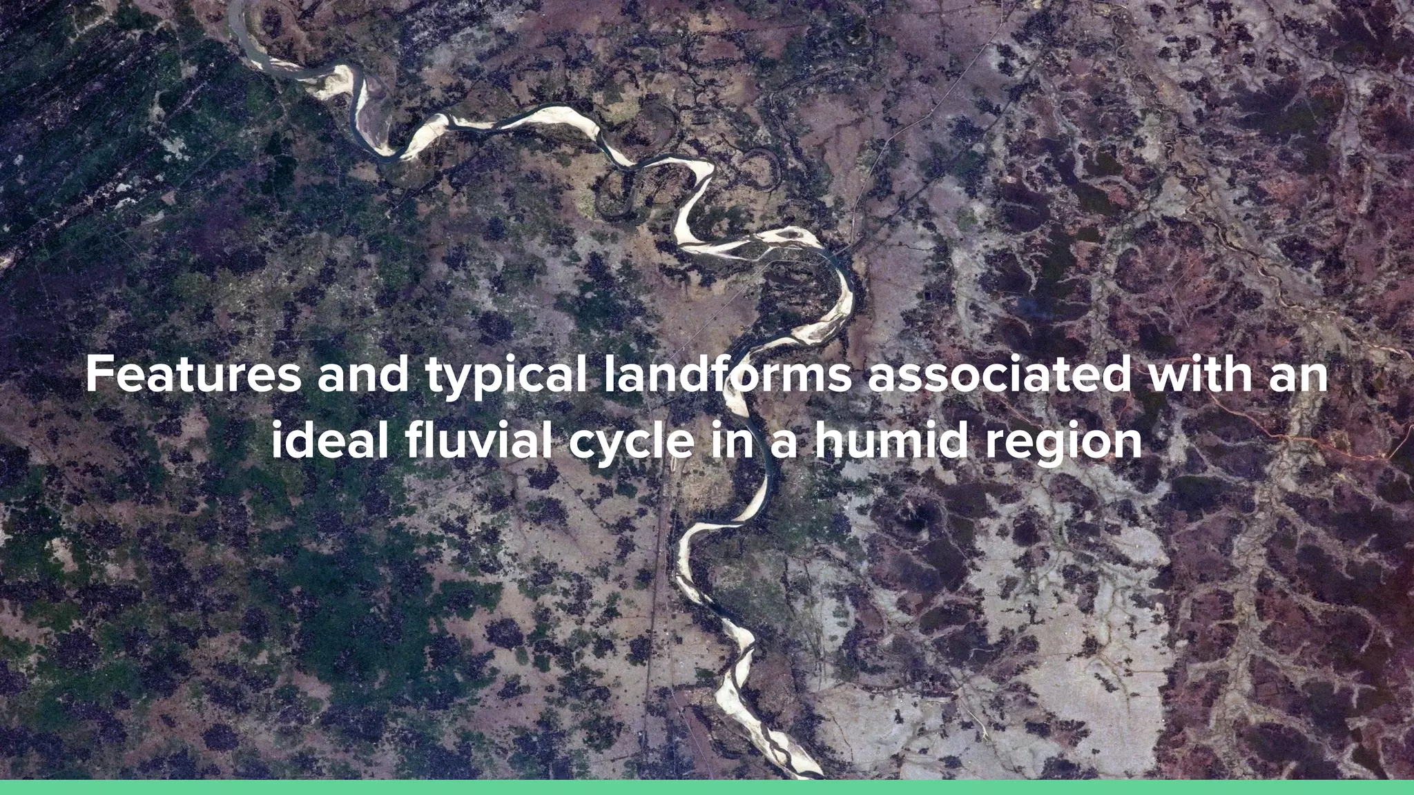
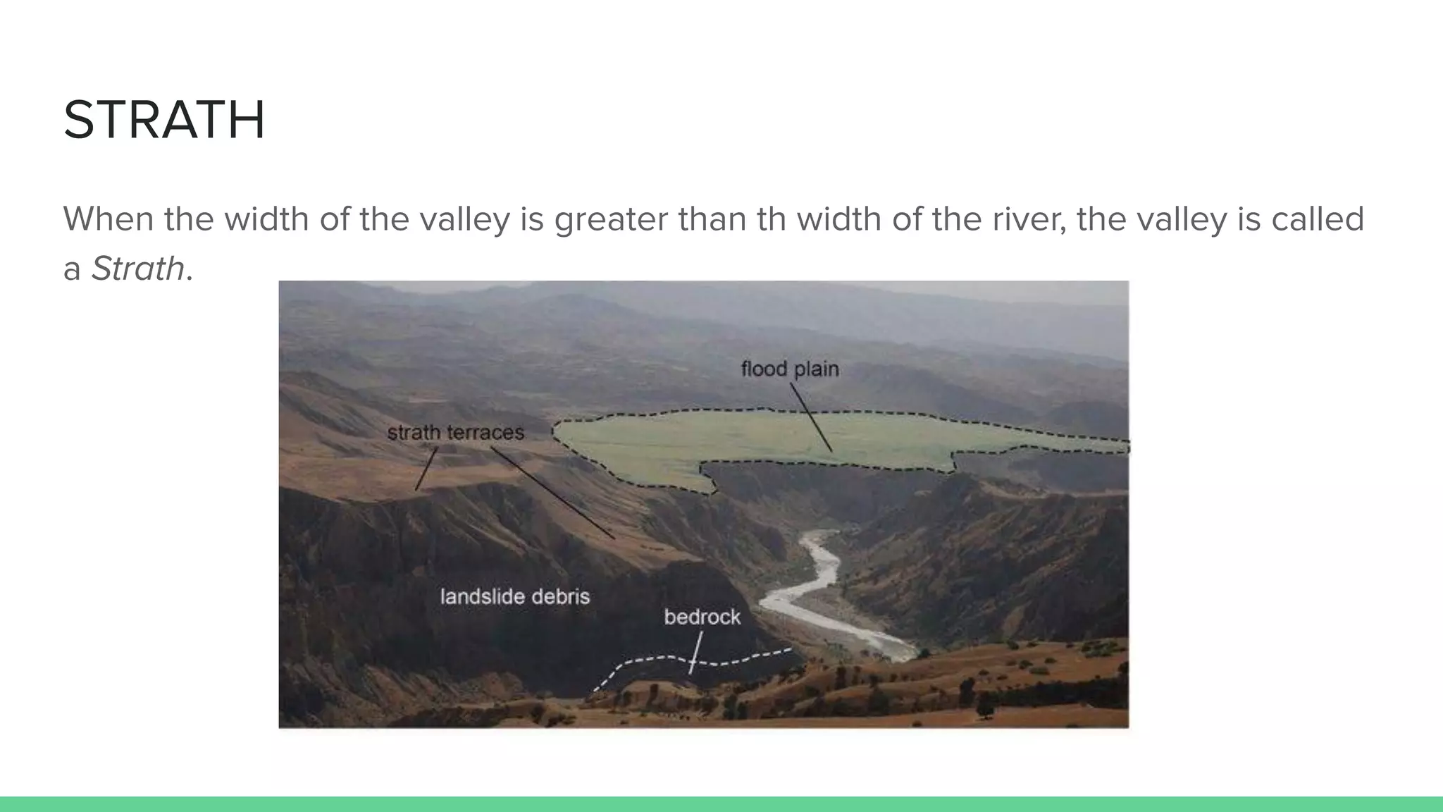
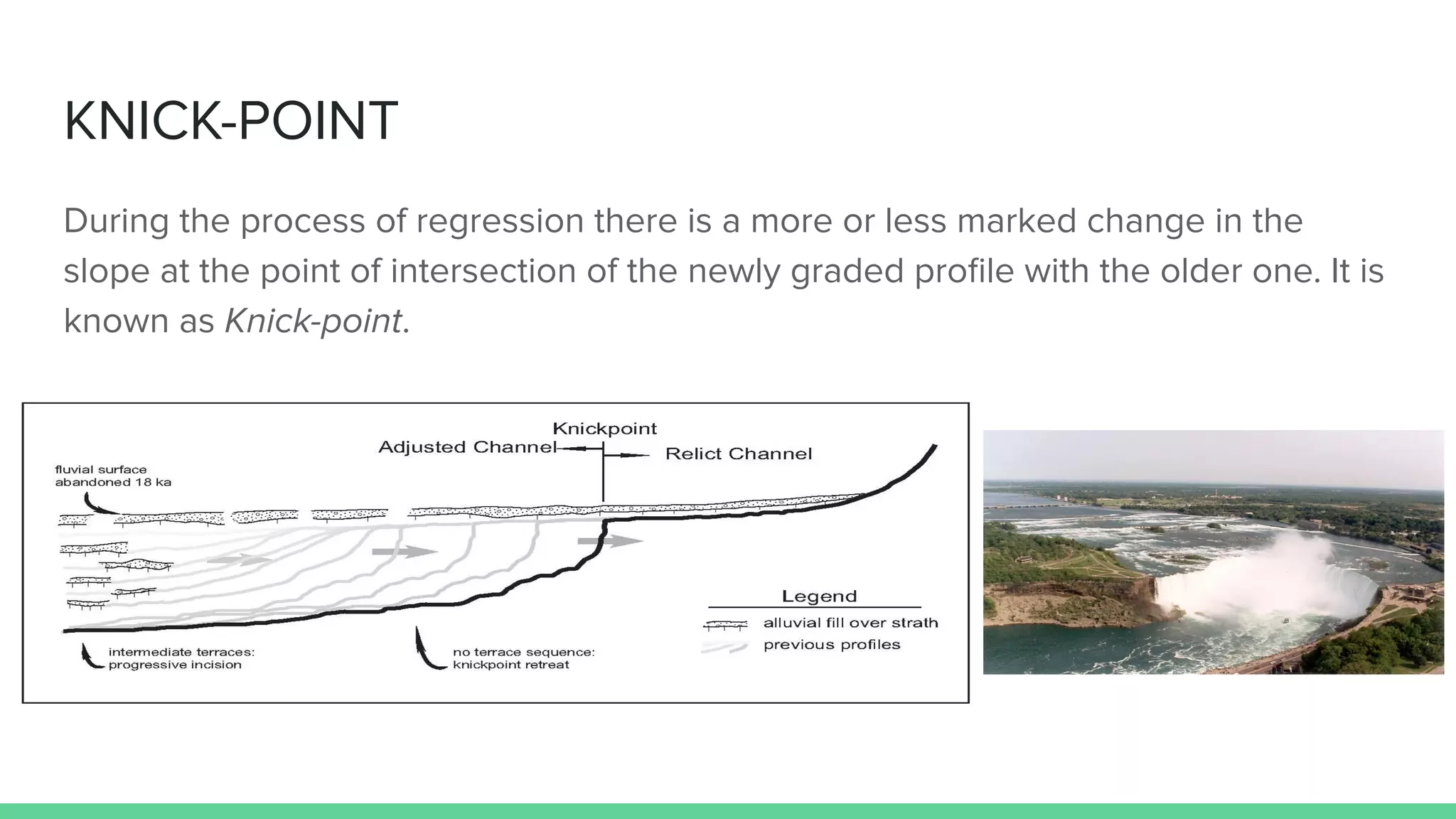
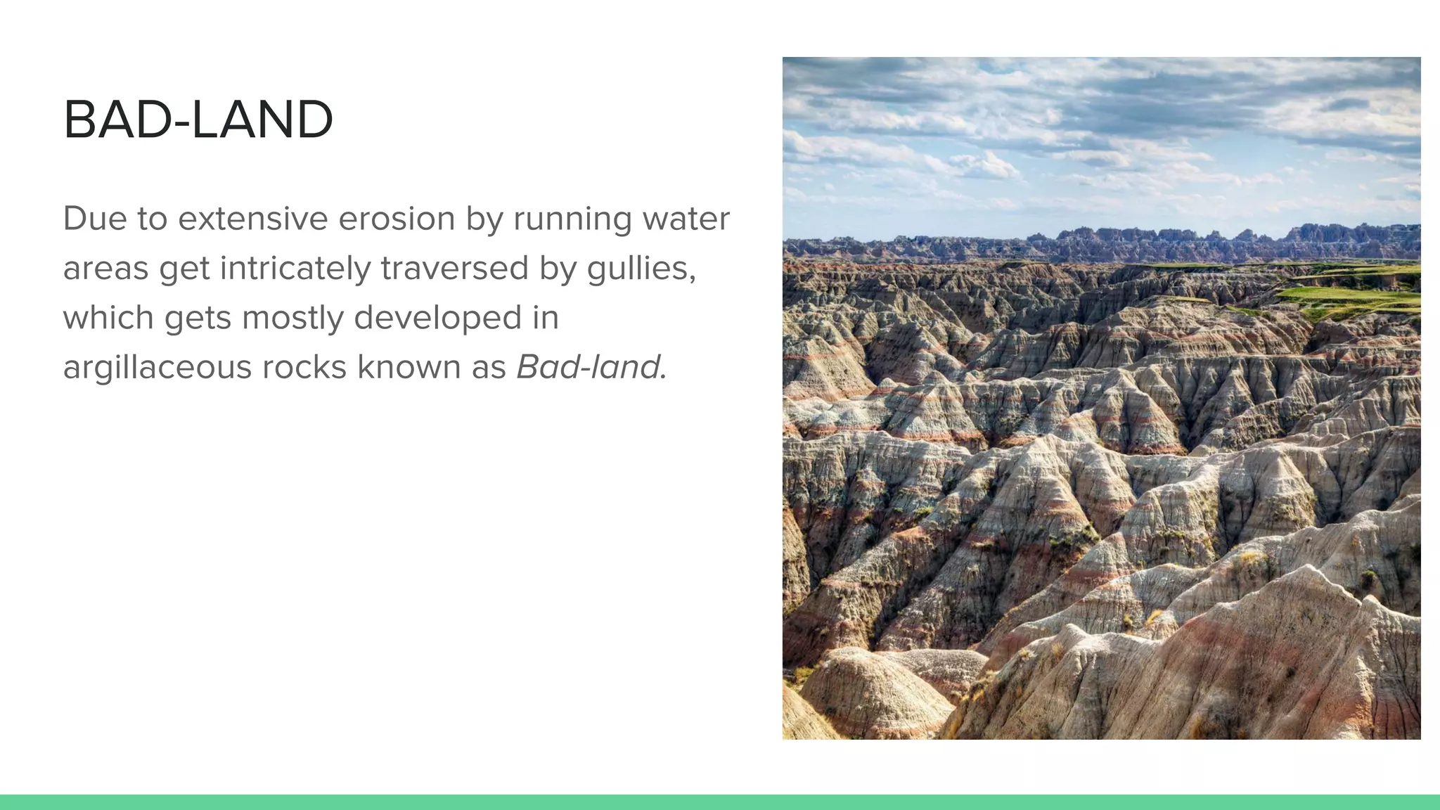
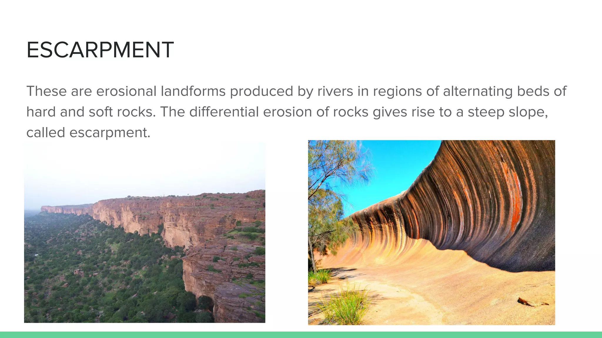
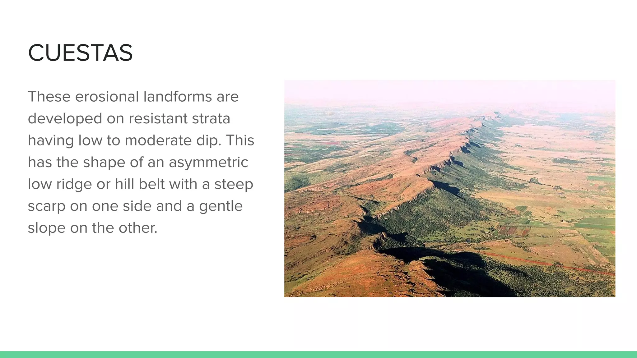
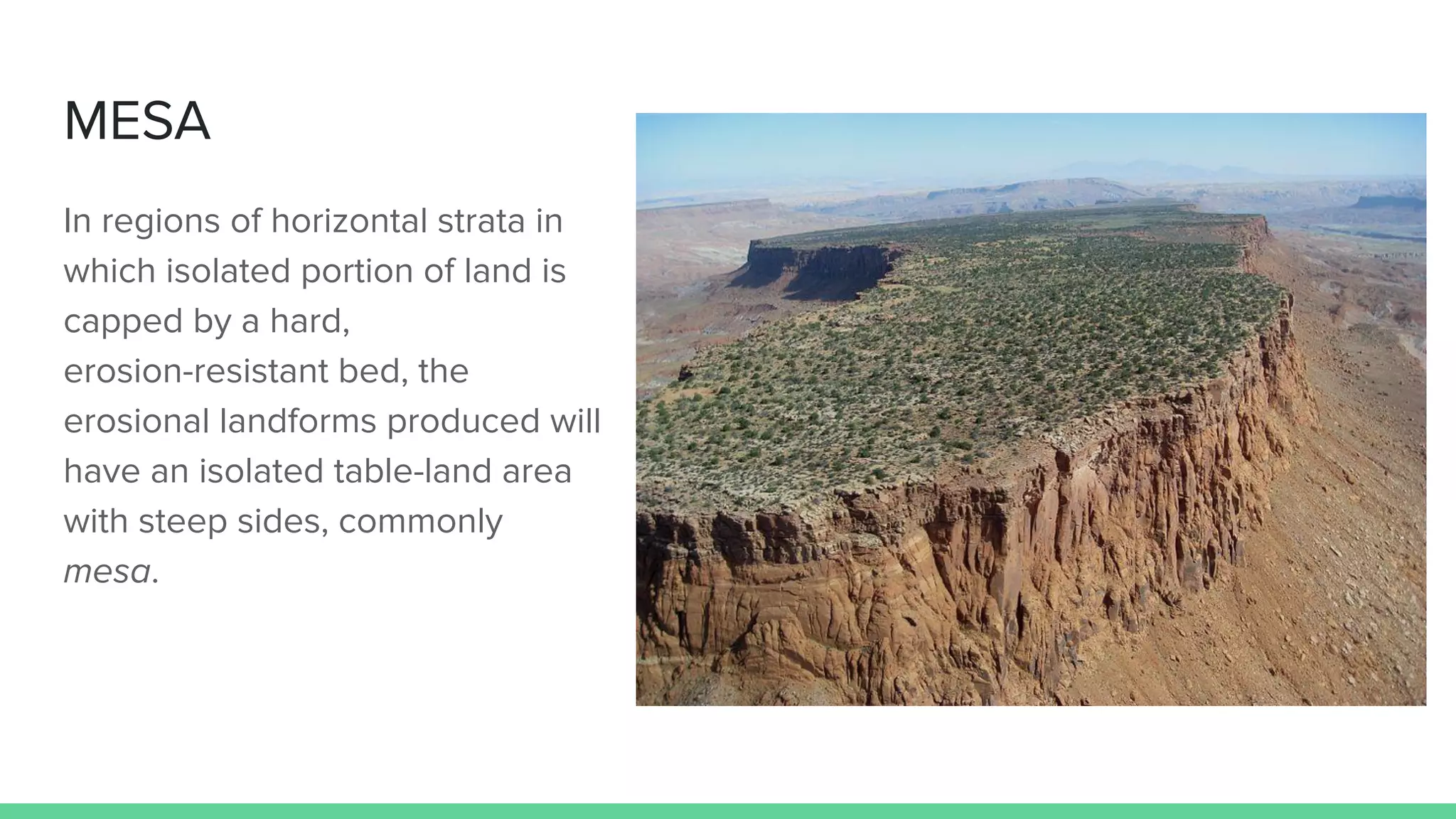
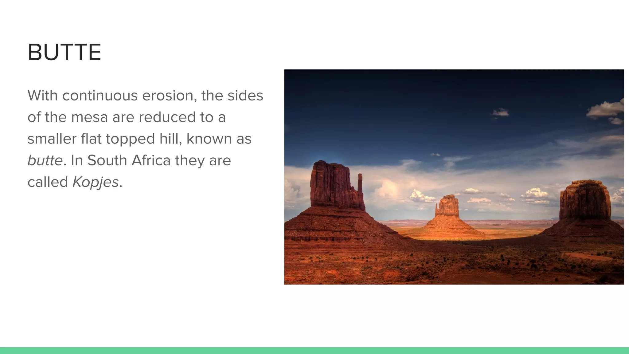
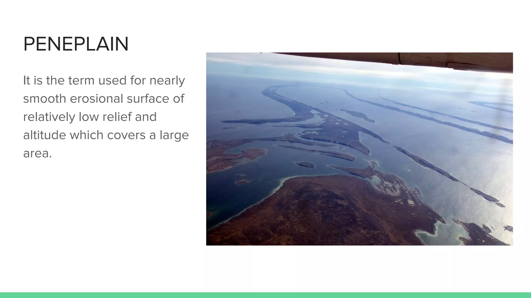
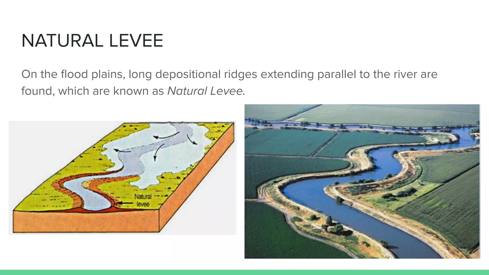
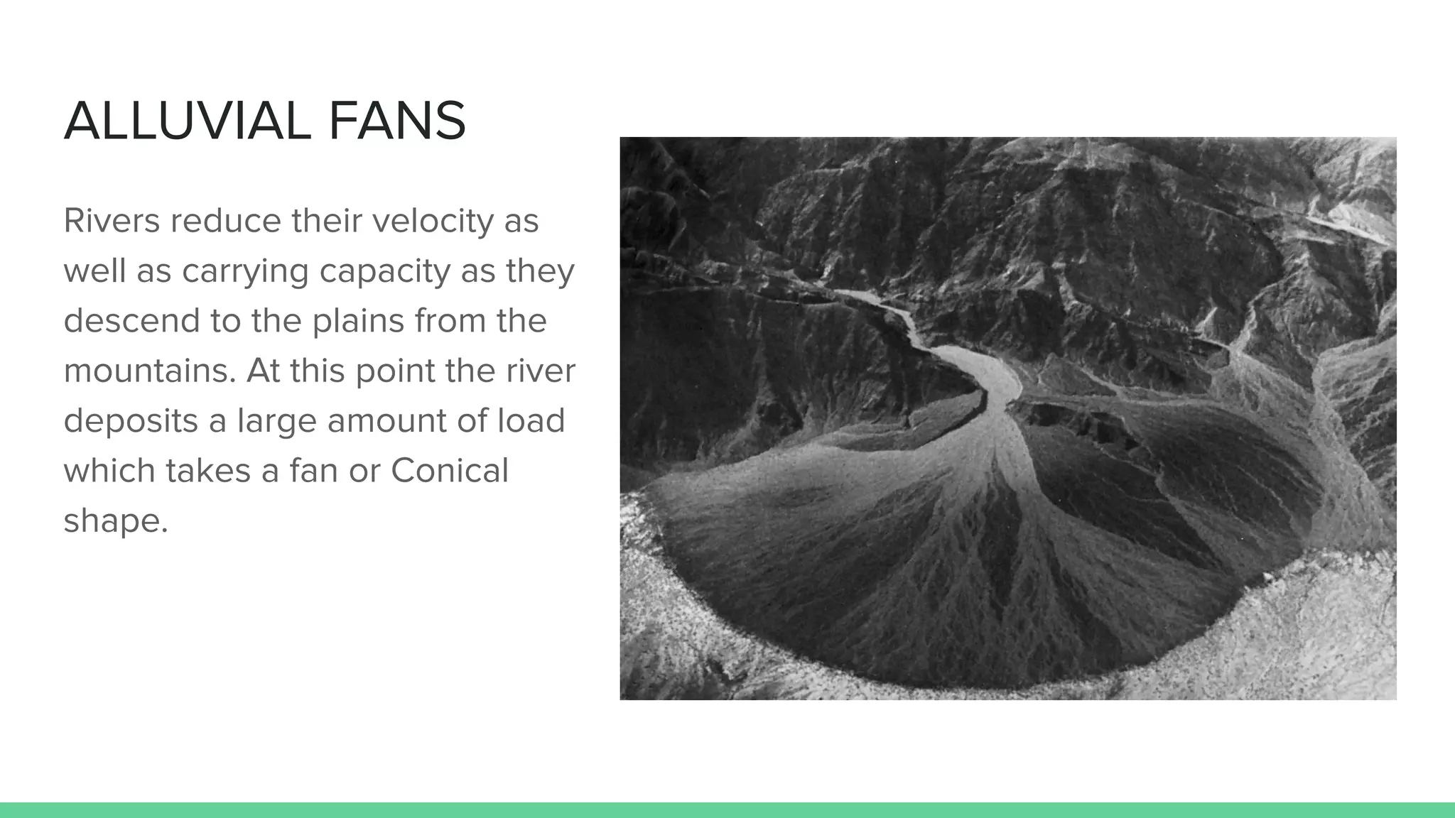
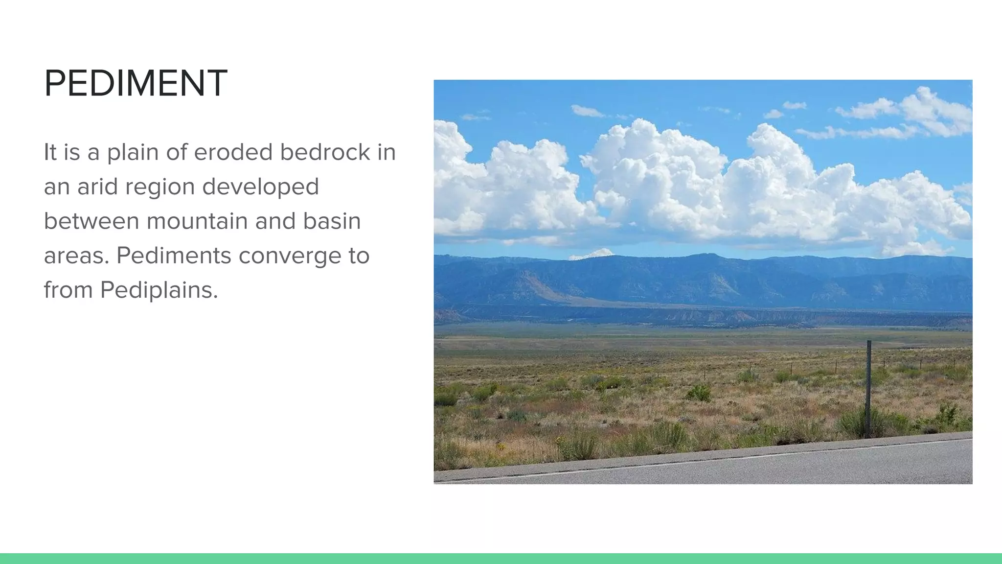
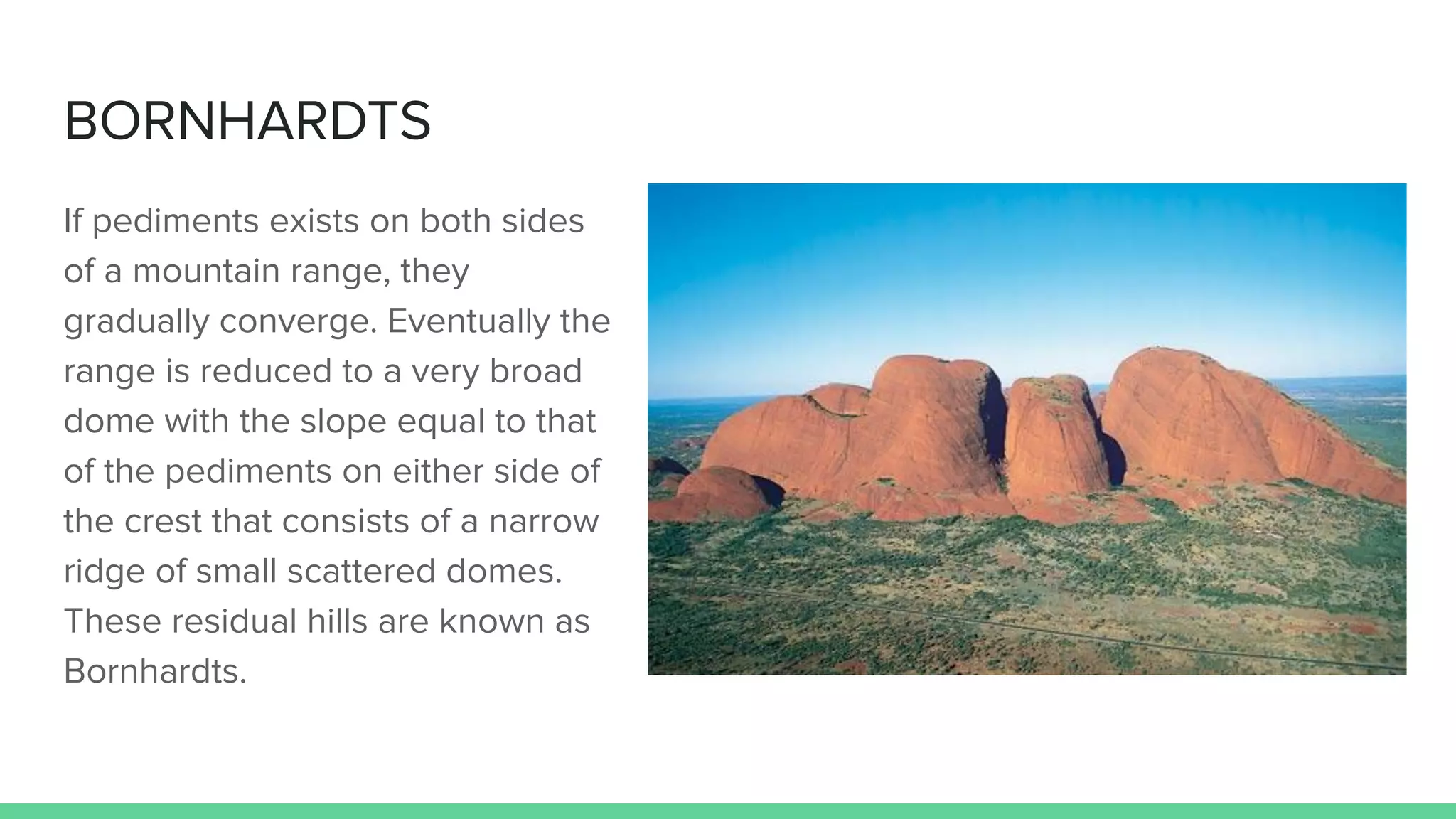
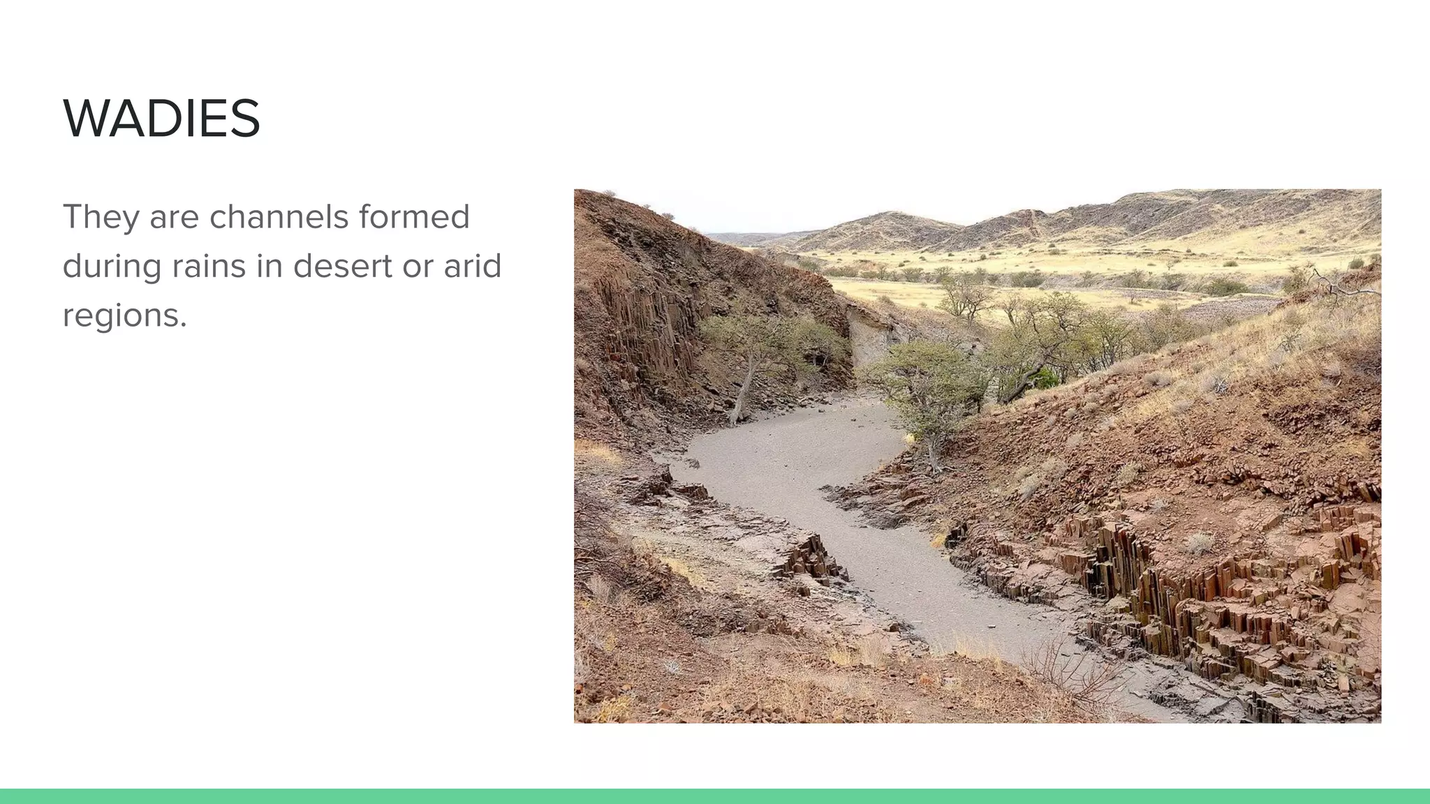
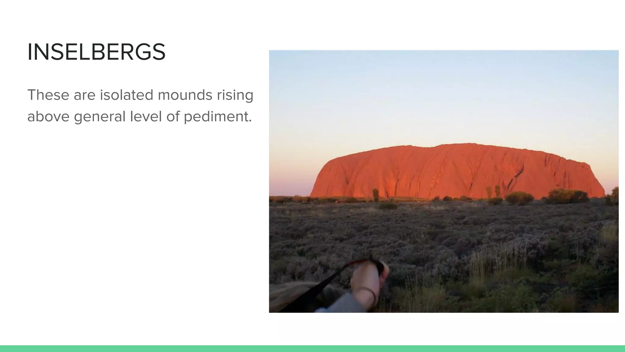
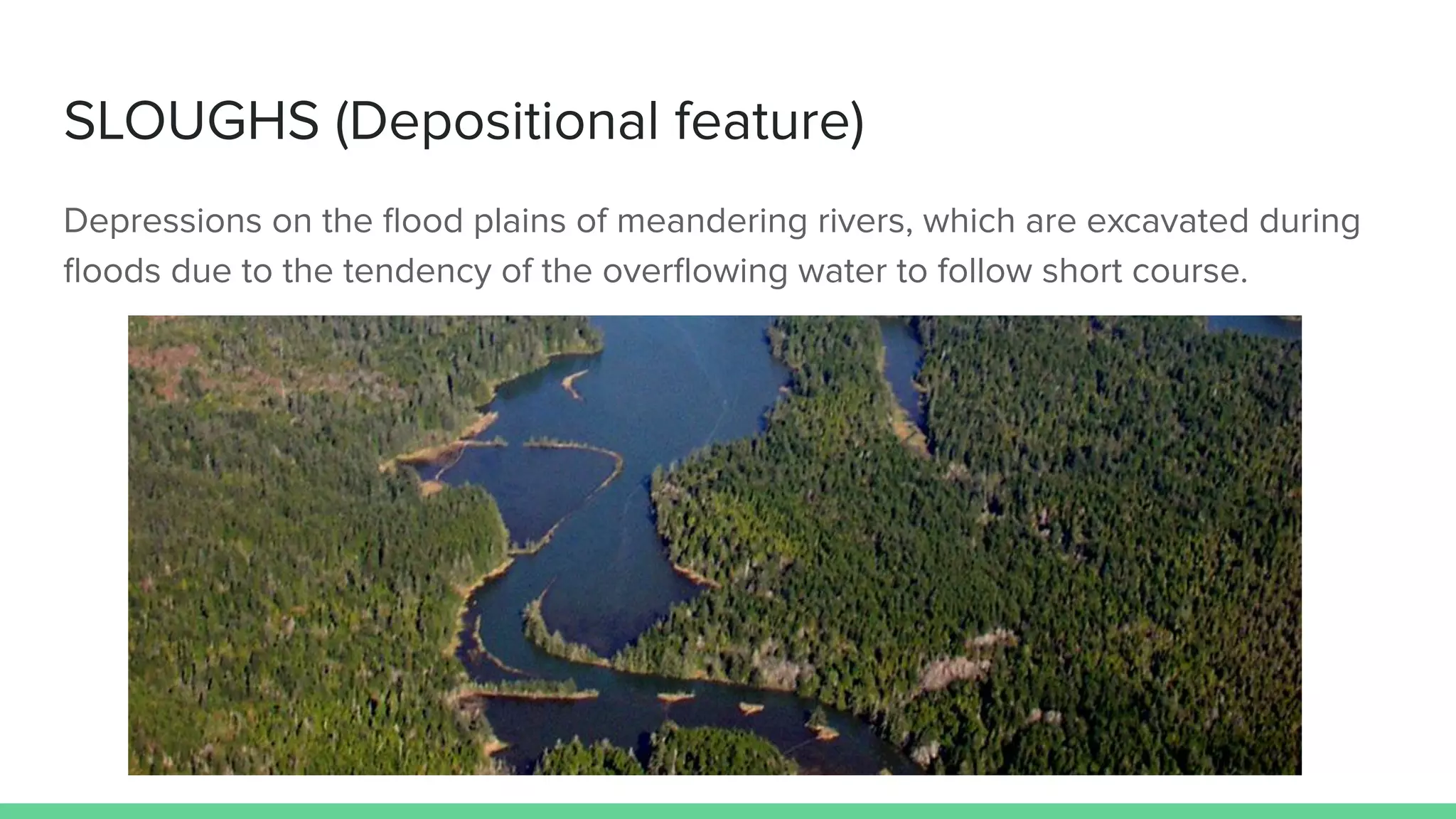
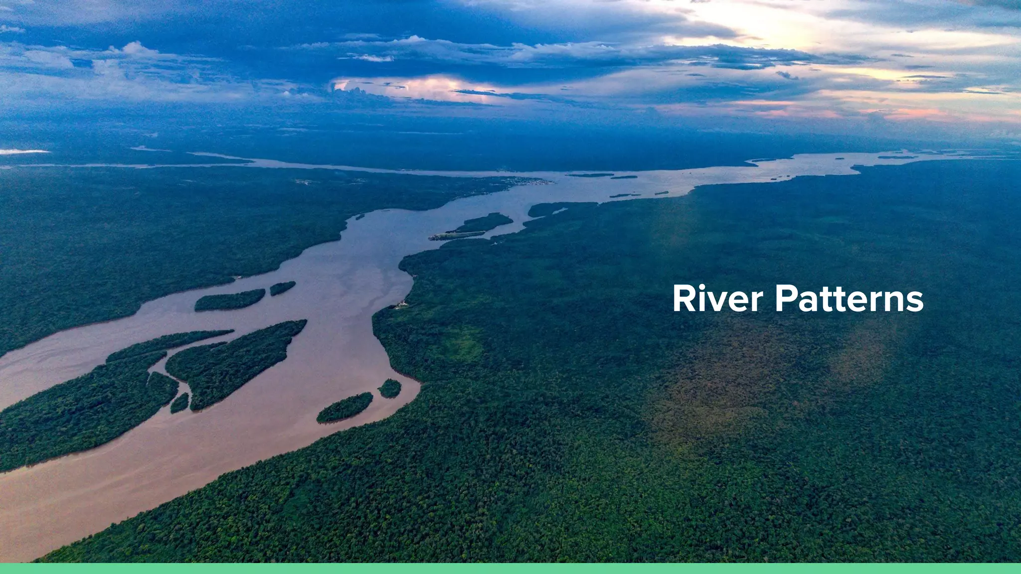
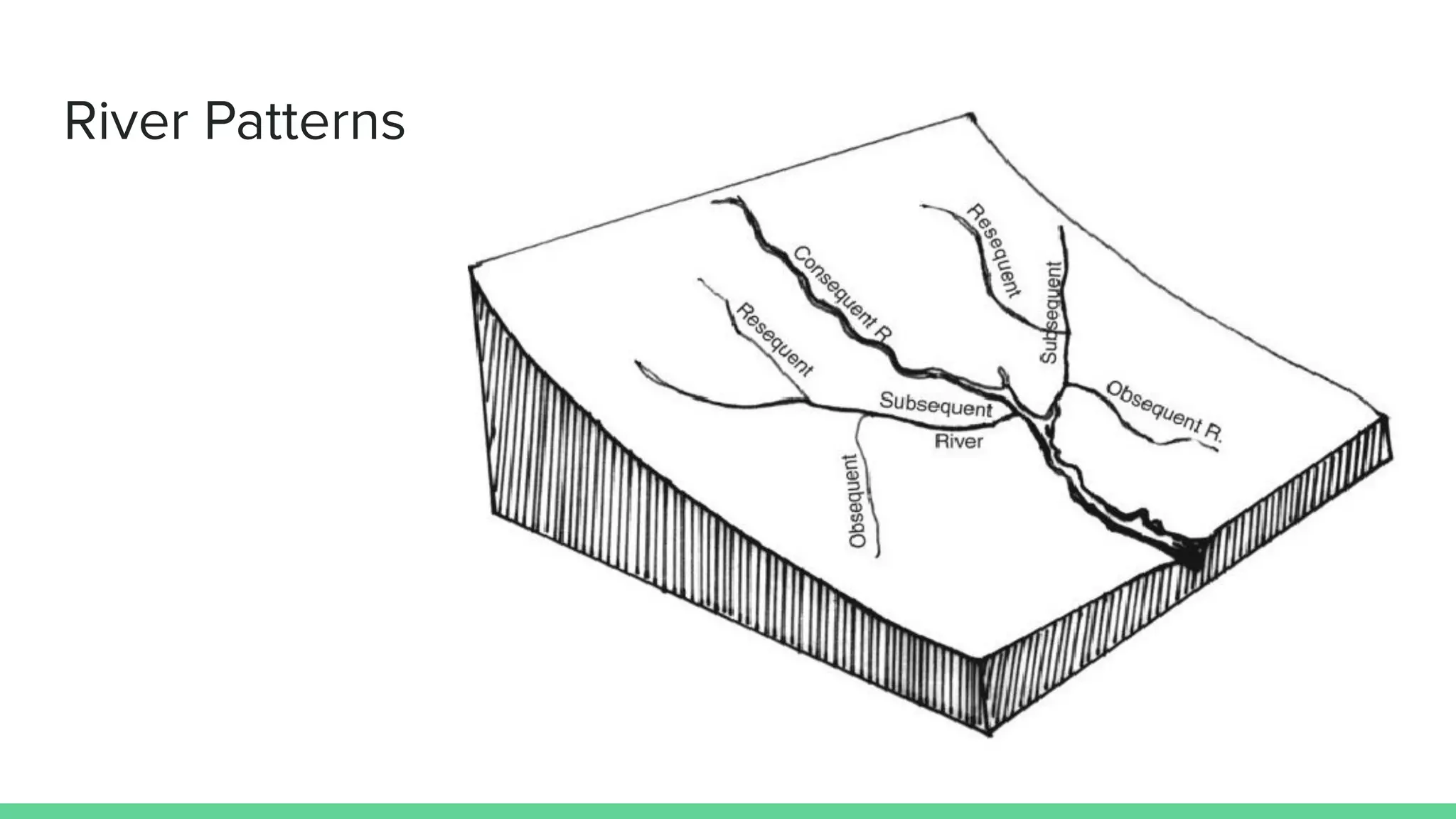
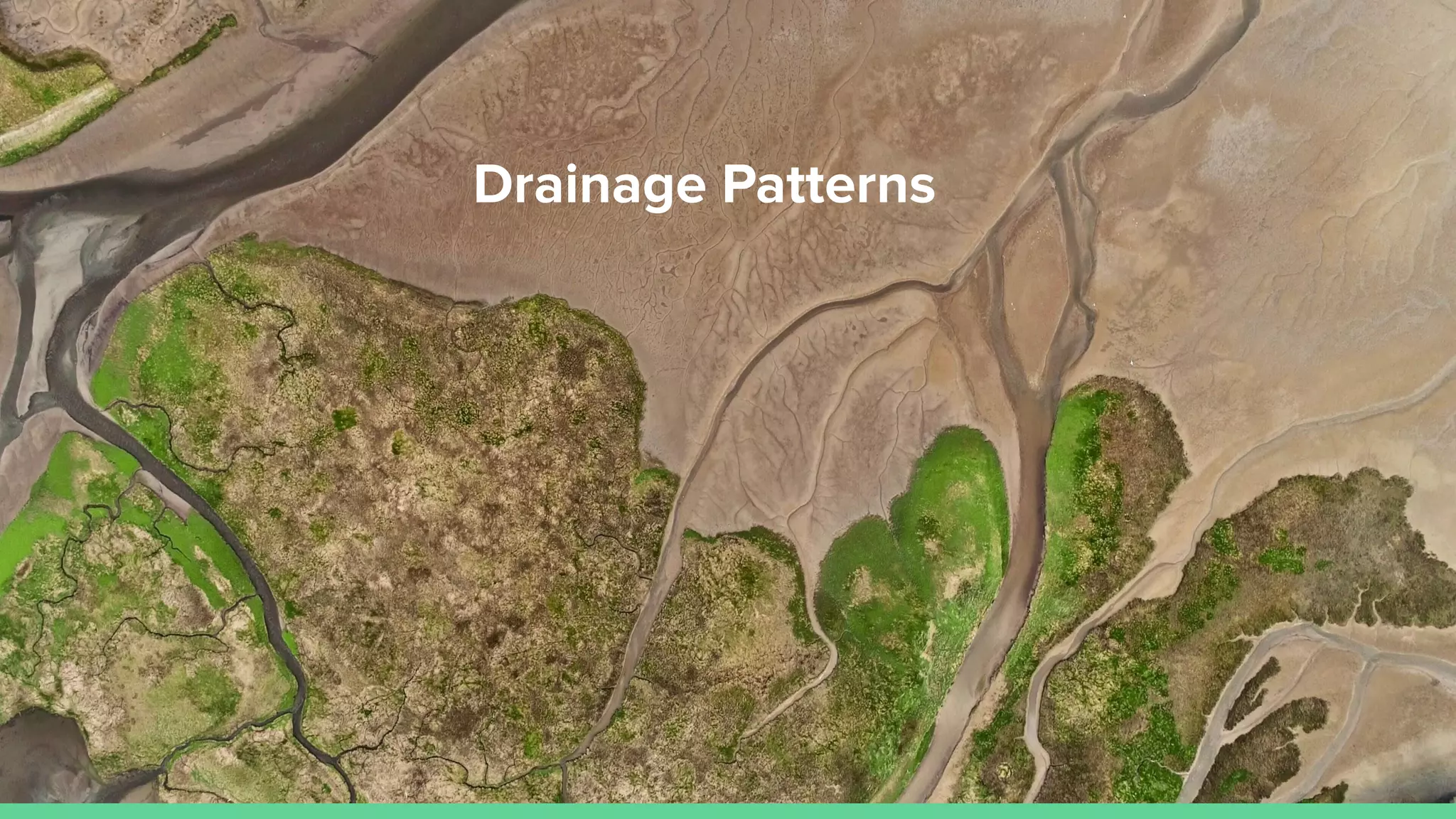
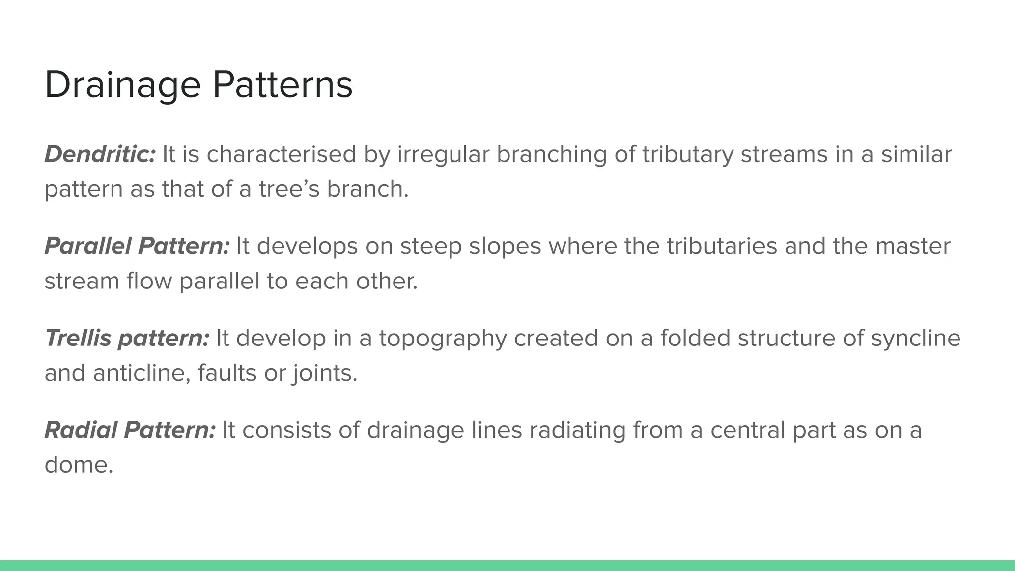
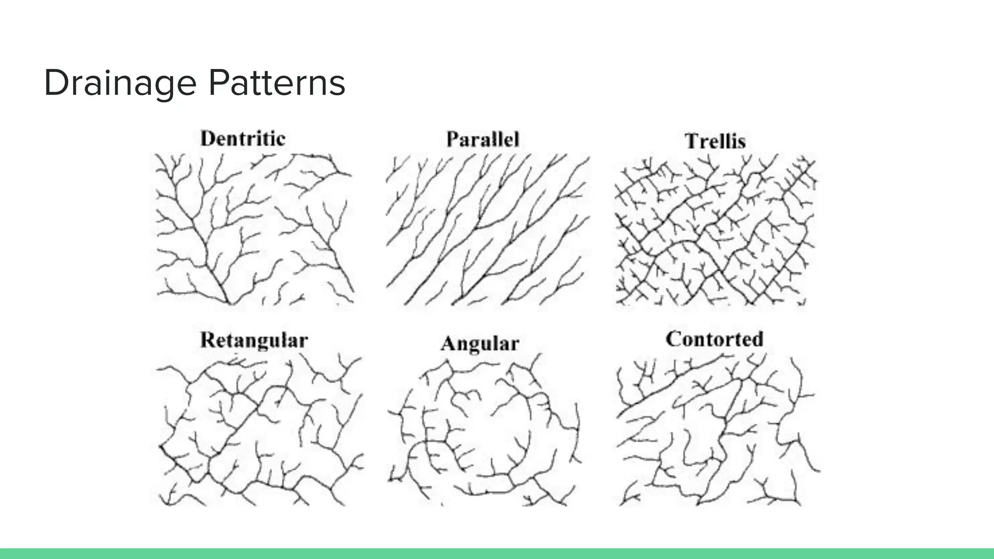
Geomorphological
Landforms
(Part - I)
By Uddipta Mohanta
Features and typical landforms associated with an
ideal fluvial cycle in a humid region
STRATH
When the width of the valley is greater than th width of the river, the valley is called
a Strath.
KNICK-POINT
During the process of regression there is a more or less marked change in the
slope at the point of intersection of the newly graded profile with the older one. It is
known as Knick-point.
BAD-LAND
Due to extensive erosion by running water
areas get intricately traversed by gullies,
which gets mostly developed in
argillaceous rocks known as Bad-land.
ESCARPMENT
These are erosional landforms produced by rivers in regions of alternating beds of
hard and soft rocks. The differential erosion of rocks gives rise to a steep slope,
called escarpment.
CUESTAS
These erosional landforms are
developed on resistant strata
having low to moderate dip. This
has the shape of an asymmetric
low ridge or hill belt with a steep
scarp on one side and a gentle
slope on the other.
MESA
In regions of horizontal strata in
which isolated portion of land is
capped by a hard,
erosion-resistant bed, the
erosional landforms produced will
have an isolated table-land area
with steep sides, commonly
mesa.
BUTTE
With continuous erosion, the sides
of the mesa are reduced to a
smaller flat topped hill, known as
butte. In South Africa they are
called Kopjes.
PENEPLAIN
It is the term used for nearly
smooth erosional surface of
relatively low relief and
altitude which covers a large
area.
NATURAL LEVEE
On the flood plains, long depositional ridges extending parallel to the river are
found, which are known as Natural Levee.
Features found in Arid regions
ALLUVIAL FANS
Rivers reduce their velocity as
well as carrying capacity as they
descend to the plains from the
mountains. At this point the river
deposits a large amount of load
which takes a fan or Conical
shape.
PEDIMENT
It is a plain of eroded bedrock in
an arid region developed
between mountain and basin
areas. Pediments converge to
from Pediplains.
BORNHARDTS
If pediments exists on both sides
of a mountain range, they
gradually converge. Eventually the
range is reduced to a very broad
dome with the slope equal to that
of the pediments on either side of
the crest that consists of a narrow
ridge of small scattered domes.
These residual hills are known as
Bornhardts.
PLAYAS
In deserts consisting of basins
enclosed by mountain ranges
the drainage is towards the
centre of the basin from all
margins. When there is
sufficient water, this plain is
covered by a broad shallow
lake called Playa.
WADIES
They are channels formed
during rains in desert or arid
regions.
INSELBERGS
These are isolated mounds rising
above general level of pediment.
SLOUGHS (Depositional feature)
Depressions on the flood plains of meandering rivers, which are excavated during
floods due to the tendency of the overflowing water to follow short course.
River Patterns
River Patterns
Antecedant: Rivers exiting before the surface relief was imposed upon the area.
Consequent: The flow of the river occurs as a result of the existing surface relief.
Subsequent: The river which joins the consequent river arising later as erosion proceeds.
Insequent: It displays no reason for its particular course.
Obsequent: The river drains in opposite direction to the original consequent river.
Resequent: The river drains in the same direction as the original consequent river, but at a lower topographic level.
Superimposed: At some places older rocks may be covered by sheet of new deposits. Any river developed on such
area will follow the surface relief of the overlying cover and will not have any relation to the older rocks below.
Gradual erosion removes the overlying cover and the river is said to be superimposed on the older rocks below.
River Patterns
Drainage Patterns
Drainage Patterns
Dendritic: It is characterised by irregular branching of tributary streams in a similar
pattern as that of a tree’s branch.
Parallel Pattern: It develops on steep slopes where the tributaries and the master
stream flow parallel to each other.
Trellis pattern: It develop in a topography created on a folded structure of syncline
and anticline, faults or joints.
Radial Pattern: It consists of drainage lines radiating from a central part as on a
dome.
Drainage Patterns

Geological landforms

  • 1.
  • 2.
    Features and typicallandforms associated with an ideal fluvial cycle in a humid region
  • 3.
    STRATH When the widthof the valley is greater than th width of the river, the valley is called a Strath.
  • 4.
    KNICK-POINT During the processof regression there is a more or less marked change in the slope at the point of intersection of the newly graded profile with the older one. It is known as Knick-point.
  • 5.
    BAD-LAND Due to extensiveerosion by running water areas get intricately traversed by gullies, which gets mostly developed in argillaceous rocks known as Bad-land.
  • 6.
    ESCARPMENT These are erosionallandforms produced by rivers in regions of alternating beds of hard and soft rocks. The differential erosion of rocks gives rise to a steep slope, called escarpment.
  • 7.
    CUESTAS These erosional landformsare developed on resistant strata having low to moderate dip. This has the shape of an asymmetric low ridge or hill belt with a steep scarp on one side and a gentle slope on the other.
  • 8.
    MESA In regions ofhorizontal strata in which isolated portion of land is capped by a hard, erosion-resistant bed, the erosional landforms produced will have an isolated table-land area with steep sides, commonly mesa.
  • 9.
    BUTTE With continuous erosion,the sides of the mesa are reduced to a smaller flat topped hill, known as butte. In South Africa they are called Kopjes.
  • 10.
    PENEPLAIN It is theterm used for nearly smooth erosional surface of relatively low relief and altitude which covers a large area.
  • 11.
    NATURAL LEVEE On theflood plains, long depositional ridges extending parallel to the river are found, which are known as Natural Levee.
  • 12.
    Features found inArid regions
  • 13.
    ALLUVIAL FANS Rivers reducetheir velocity as well as carrying capacity as they descend to the plains from the mountains. At this point the river deposits a large amount of load which takes a fan or Conical shape.
  • 14.
    PEDIMENT It is aplain of eroded bedrock in an arid region developed between mountain and basin areas. Pediments converge to from Pediplains.
  • 15.
    BORNHARDTS If pediments existson both sides of a mountain range, they gradually converge. Eventually the range is reduced to a very broad dome with the slope equal to that of the pediments on either side of the crest that consists of a narrow ridge of small scattered domes. These residual hills are known as Bornhardts.
  • 16.
    PLAYAS In deserts consistingof basins enclosed by mountain ranges the drainage is towards the centre of the basin from all margins. When there is sufficient water, this plain is covered by a broad shallow lake called Playa.
  • 17.
    WADIES They are channelsformed during rains in desert or arid regions.
  • 18.
    INSELBERGS These are isolatedmounds rising above general level of pediment.
  • 19.
    SLOUGHS (Depositional feature) Depressionson the flood plains of meandering rivers, which are excavated during floods due to the tendency of the overflowing water to follow short course.
  • 20.
  • 21.
    River Patterns Antecedant: Riversexiting before the surface relief was imposed upon the area. Consequent: The flow of the river occurs as a result of the existing surface relief. Subsequent: The river which joins the consequent river arising later as erosion proceeds. Insequent: It displays no reason for its particular course. Obsequent: The river drains in opposite direction to the original consequent river. Resequent: The river drains in the same direction as the original consequent river, but at a lower topographic level. Superimposed: At some places older rocks may be covered by sheet of new deposits. Any river developed on such area will follow the surface relief of the overlying cover and will not have any relation to the older rocks below. Gradual erosion removes the overlying cover and the river is said to be superimposed on the older rocks below.
  • 22.
  • 23.
  • 24.
    Drainage Patterns Dendritic: Itis characterised by irregular branching of tributary streams in a similar pattern as that of a tree’s branch. Parallel Pattern: It develops on steep slopes where the tributaries and the master stream flow parallel to each other. Trellis pattern: It develop in a topography created on a folded structure of syncline and anticline, faults or joints. Radial Pattern: It consists of drainage lines radiating from a central part as on a dome.
  • 25.