Downloaded 371 times
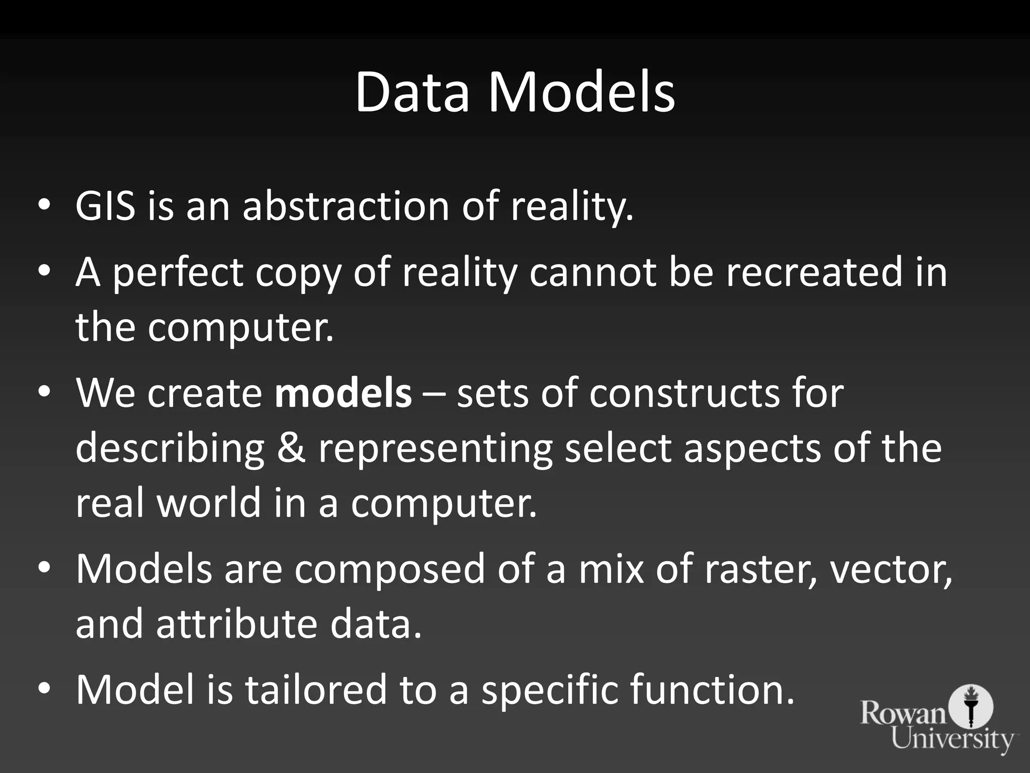
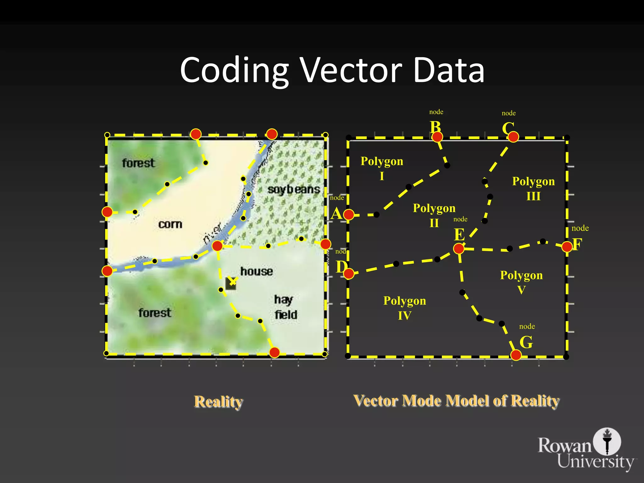
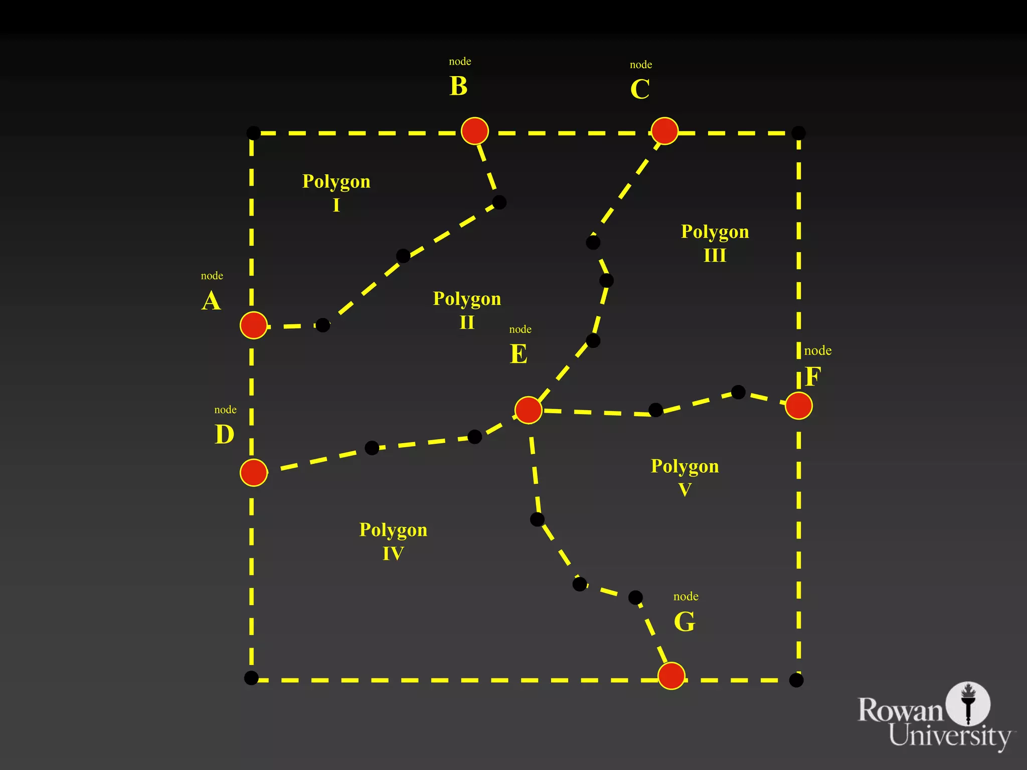
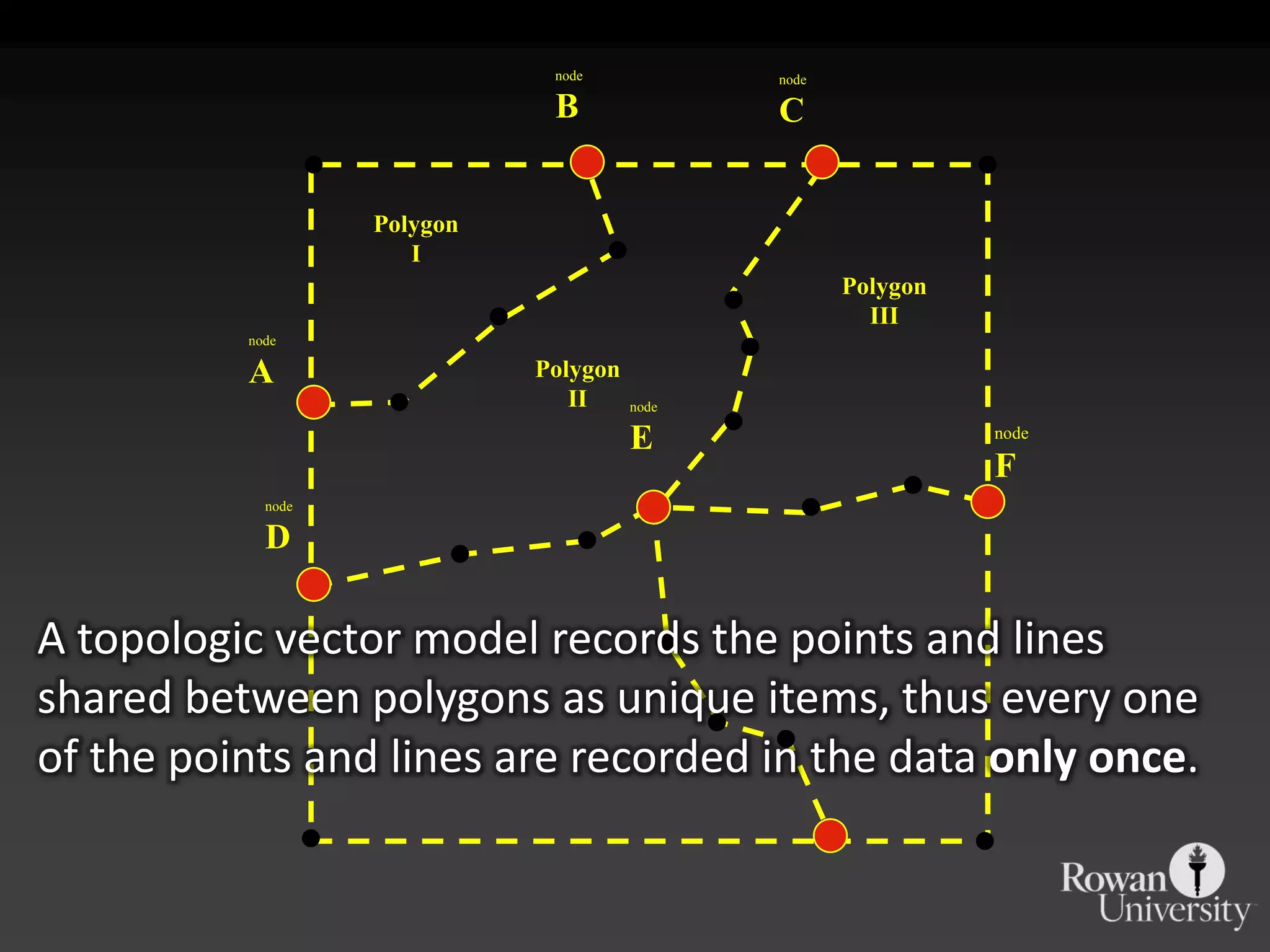
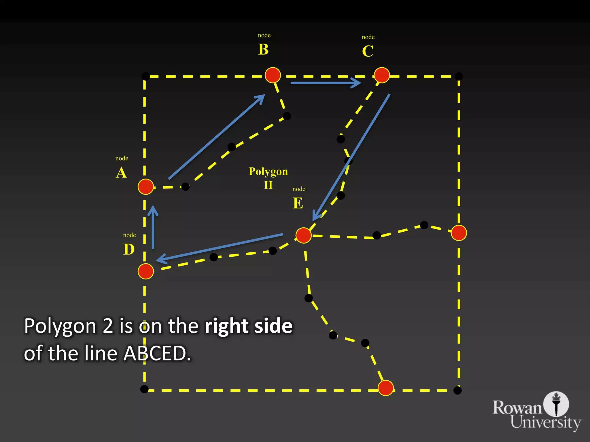
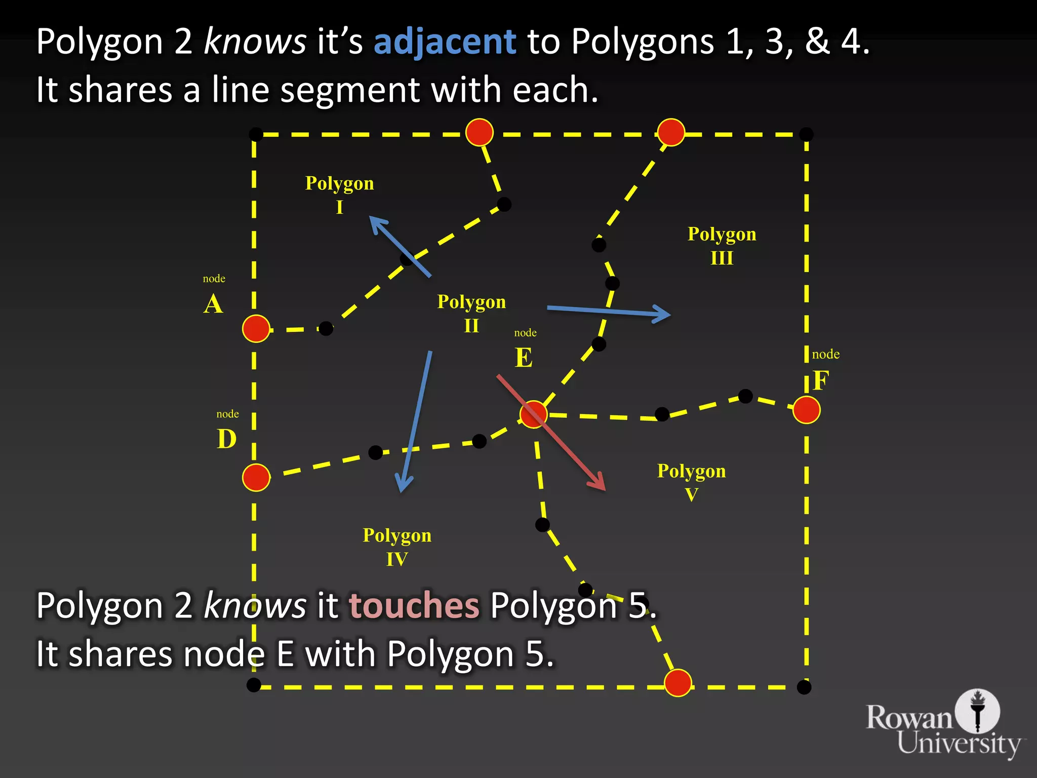
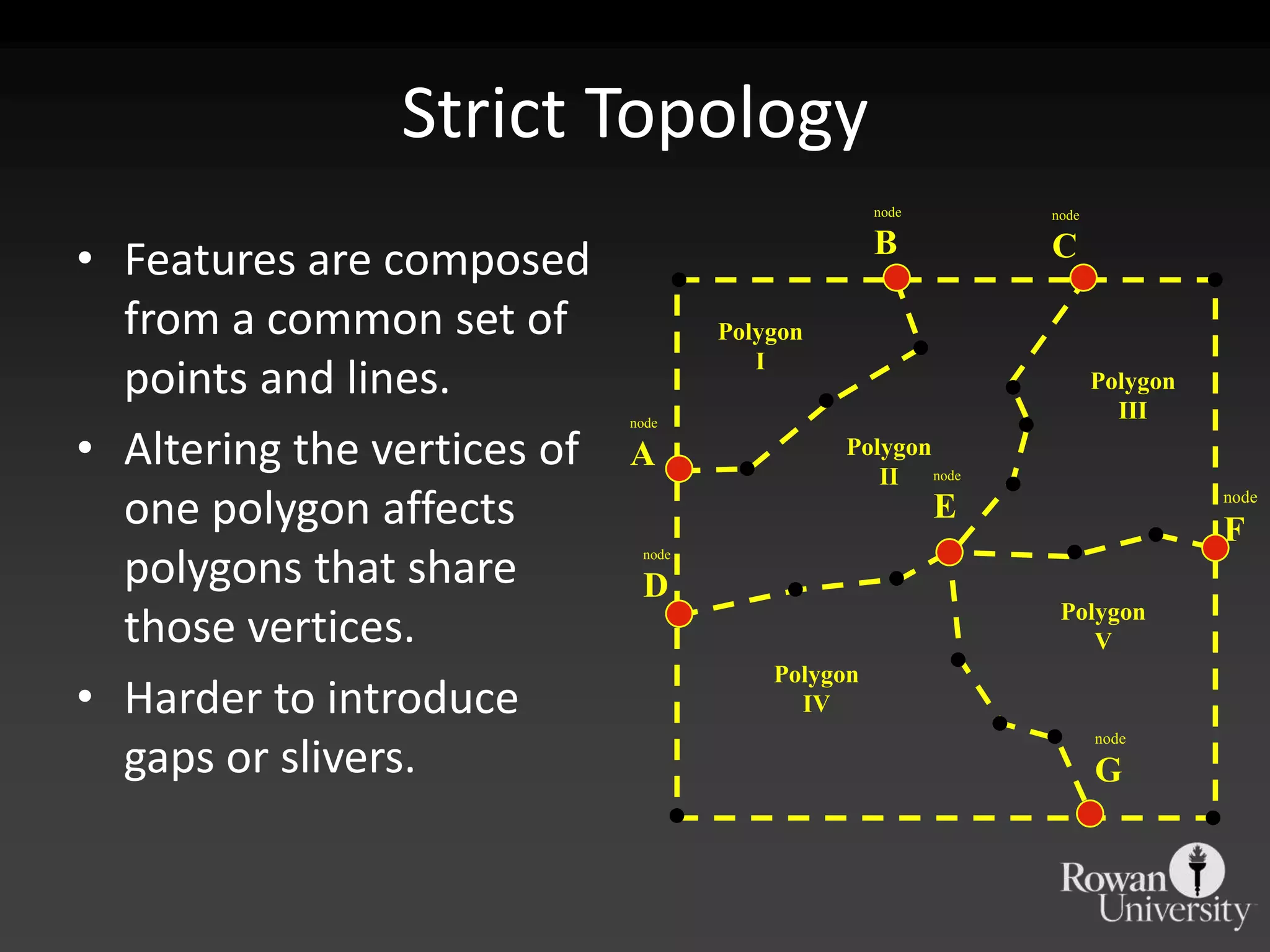
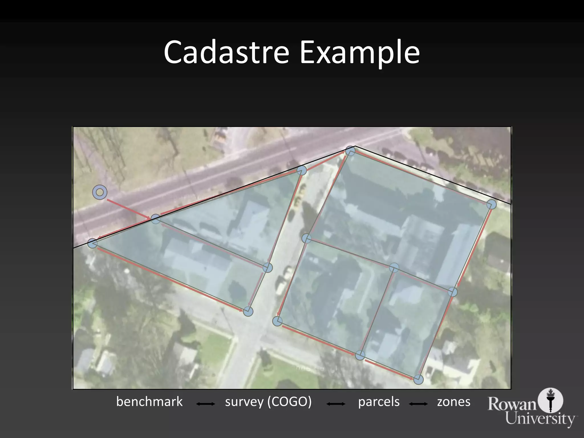


GIS models reality through abstraction using a mix of raster, vector, and attribute data tailored to specific functions. Topological vector models record shared geometries like points and lines only once, allowing features to be connected and ensuring integrity as changes propagate between related features. Object-oriented models represent real-world phenomena as interconnected objects with their own rules and relationships.