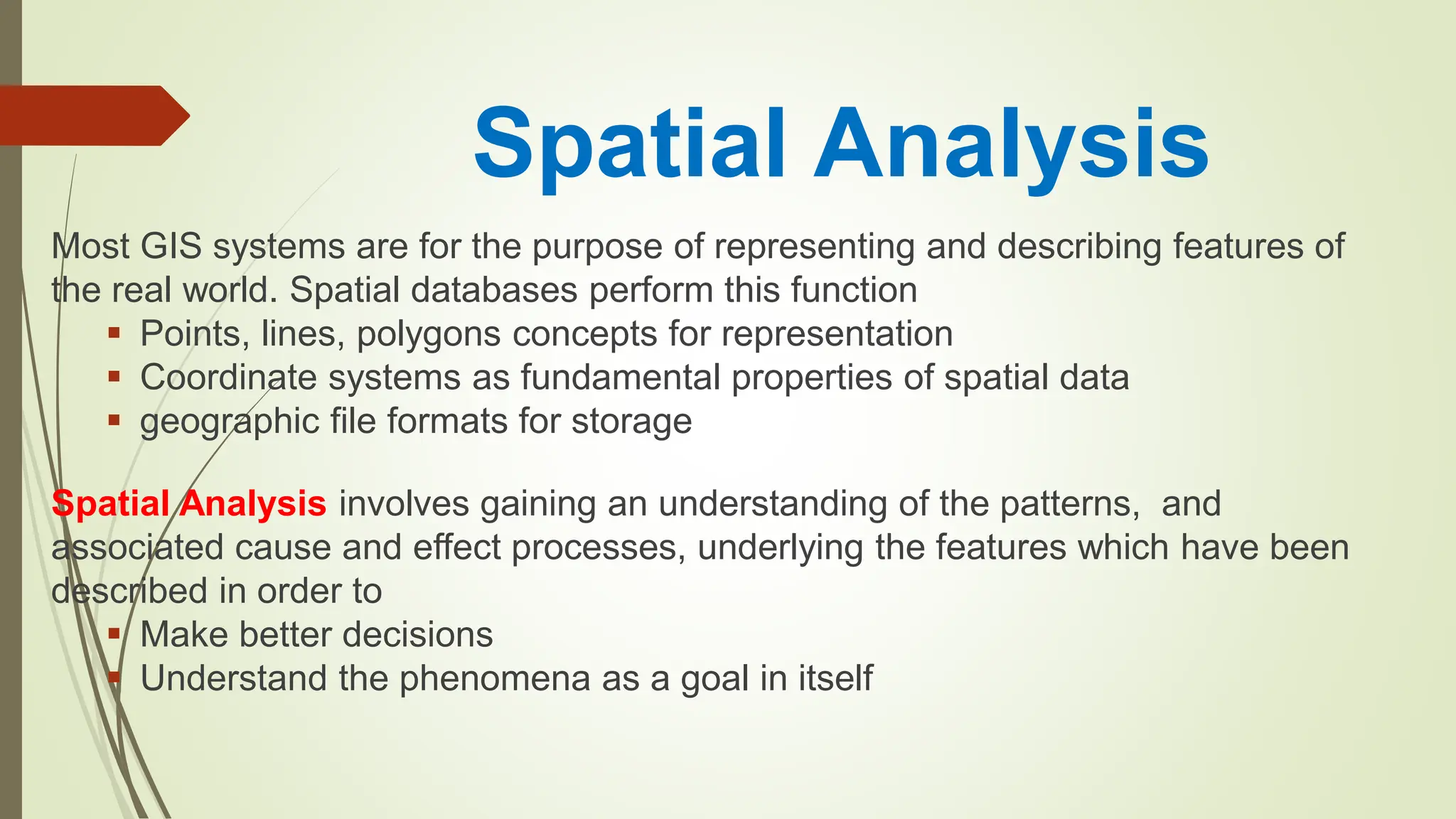
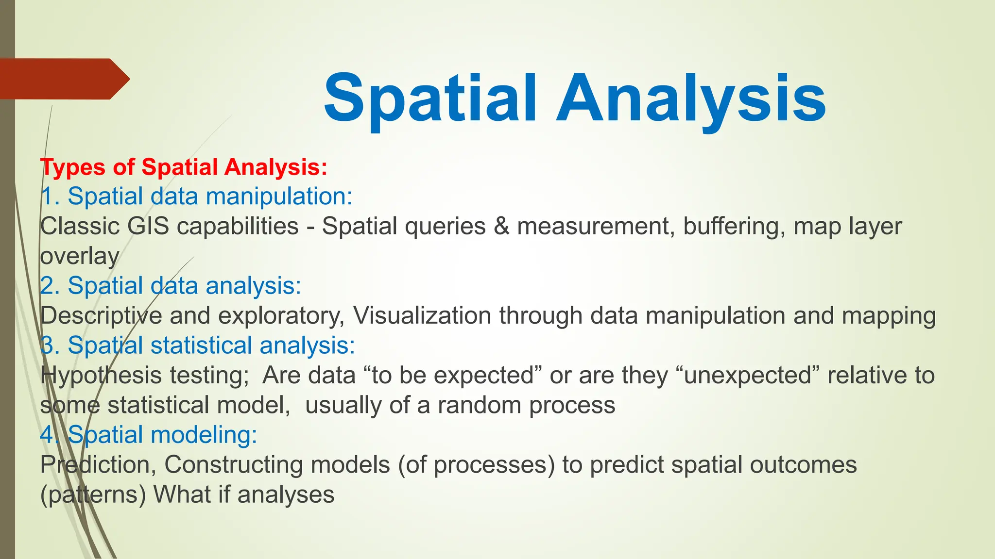
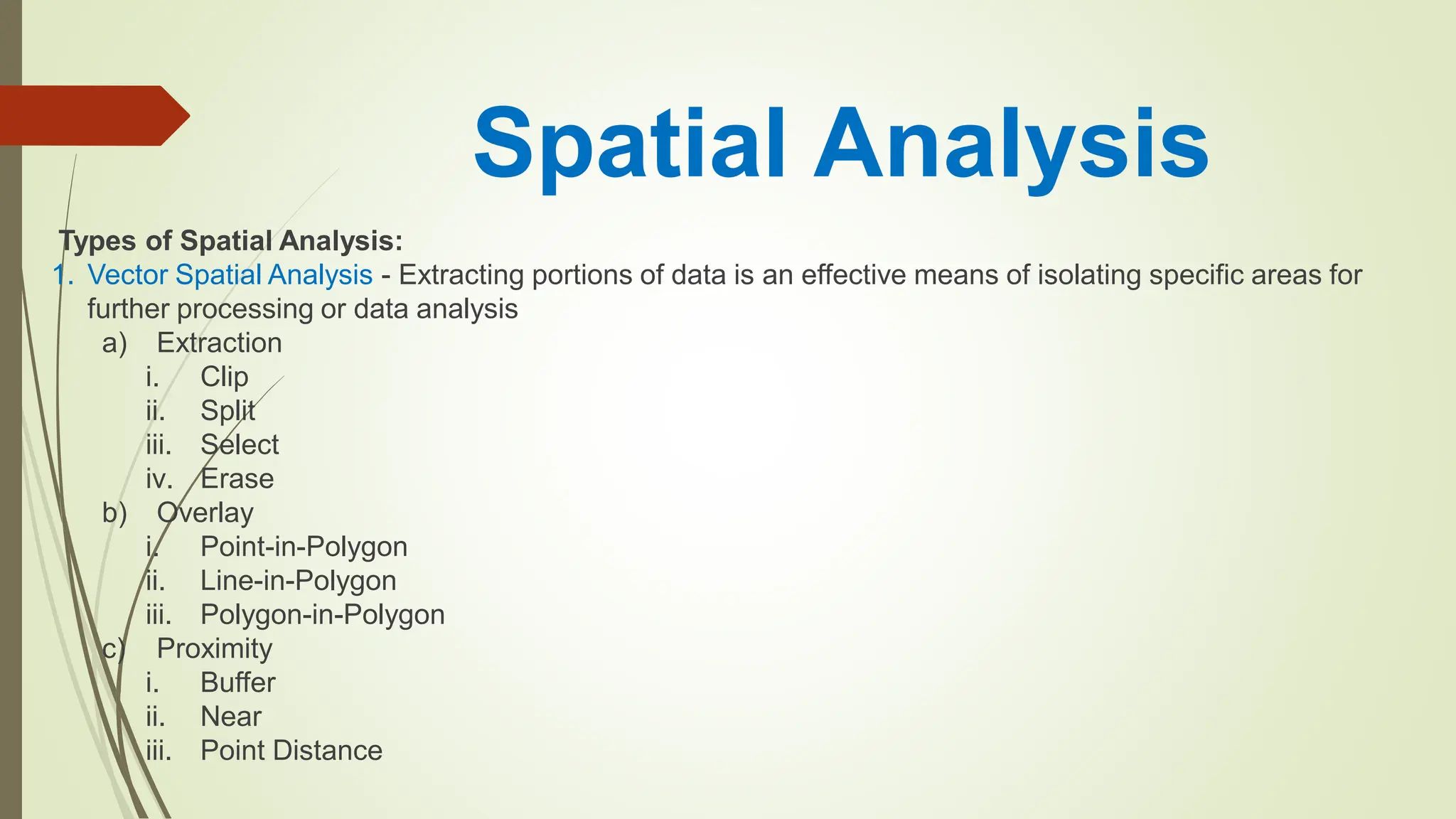
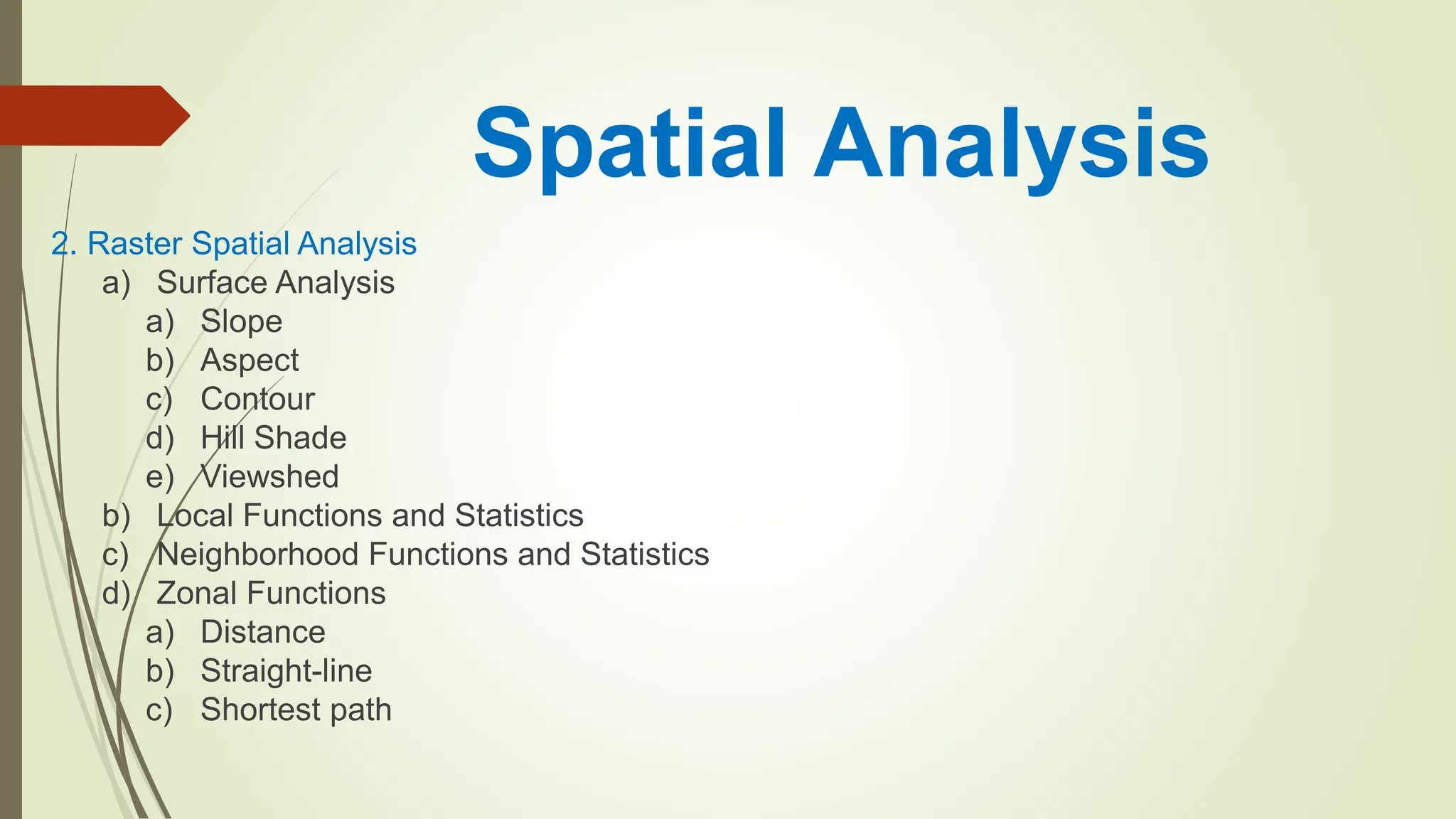
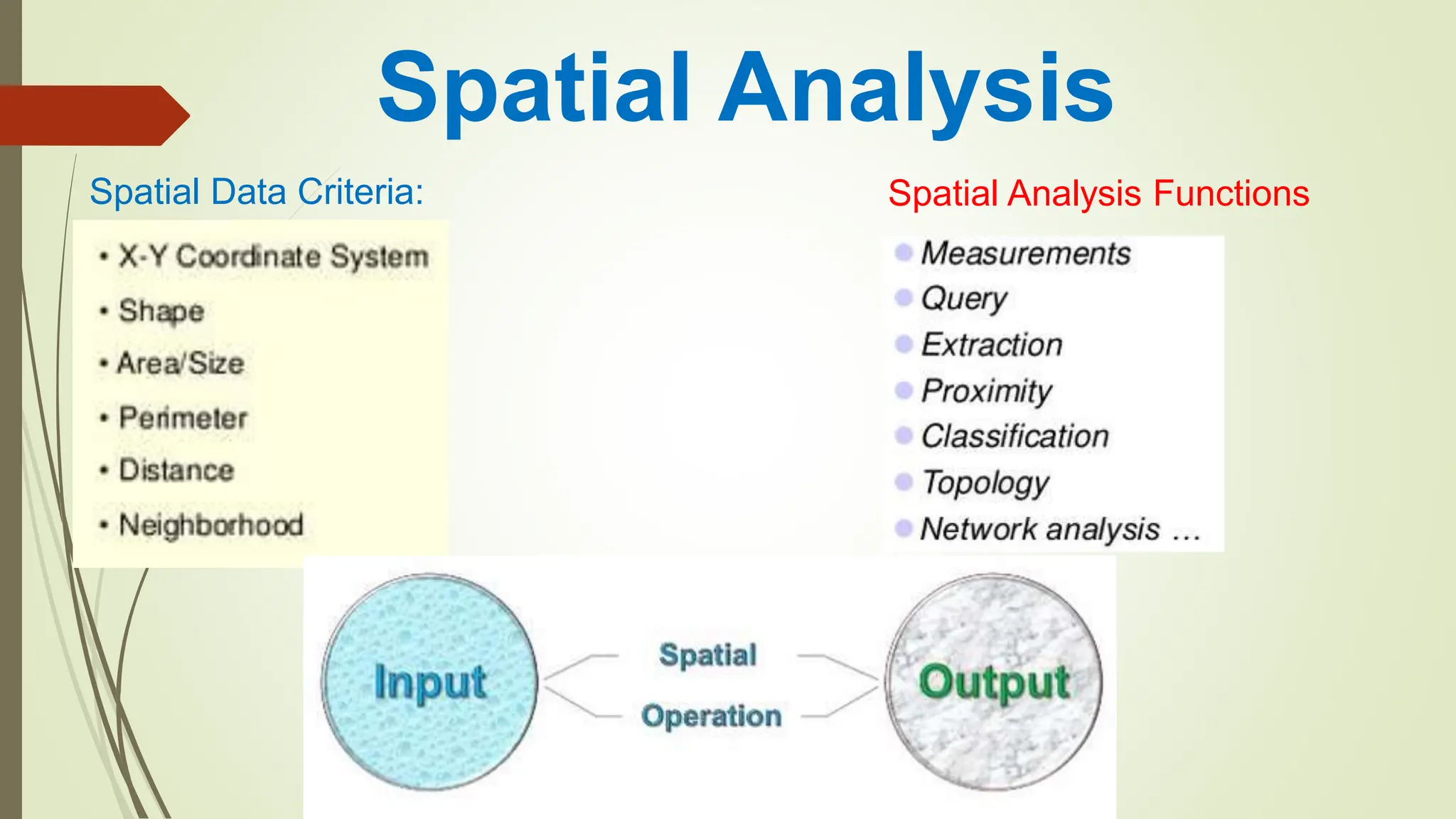
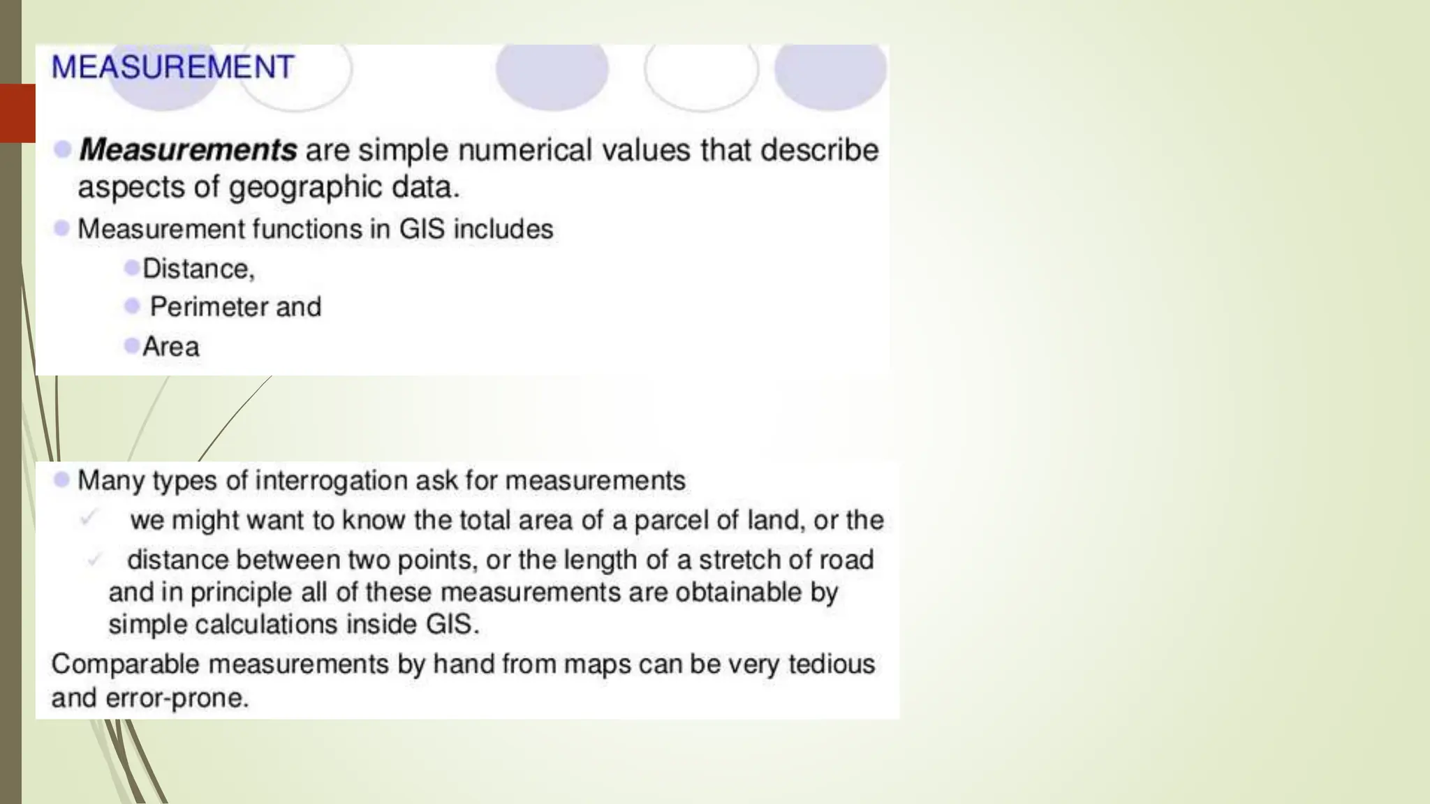
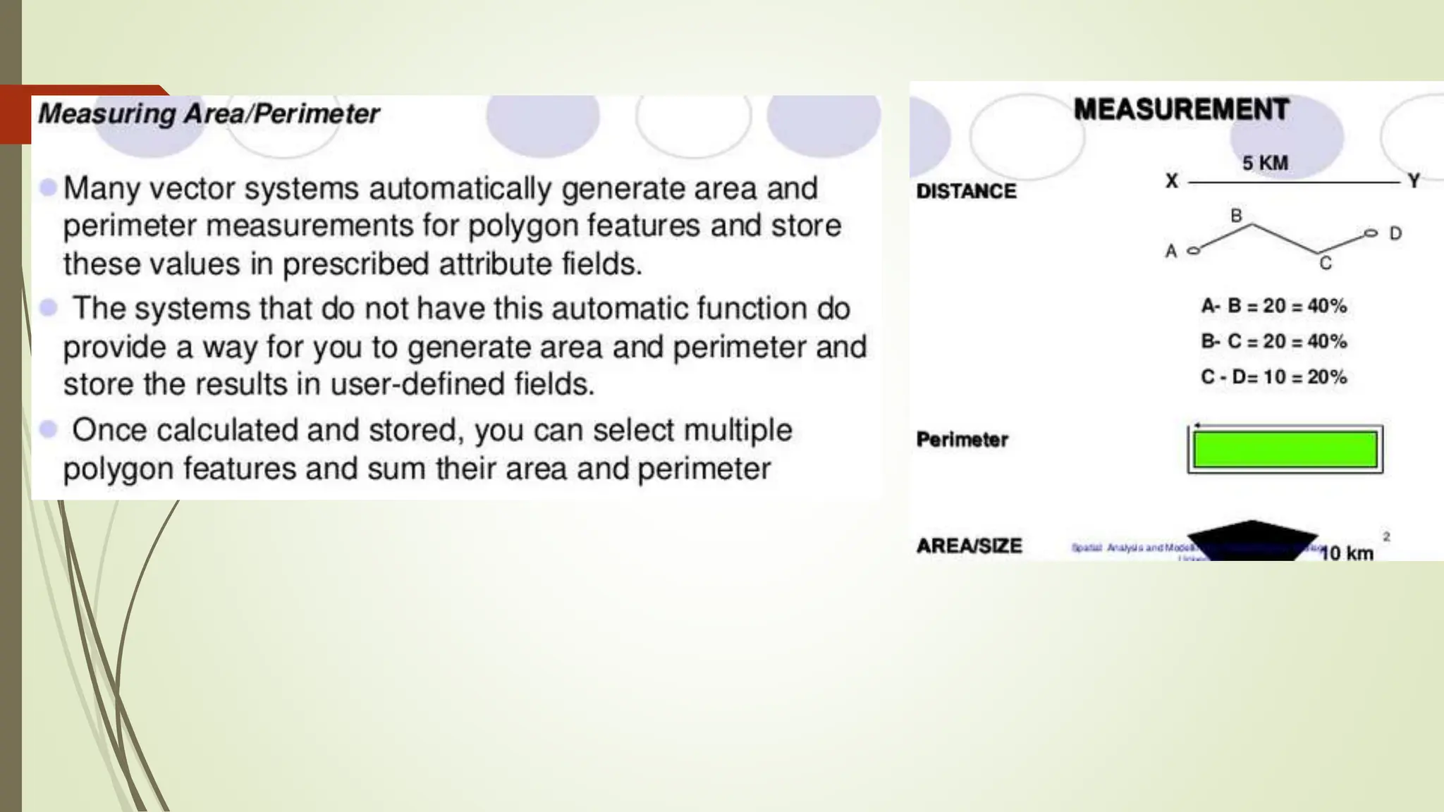
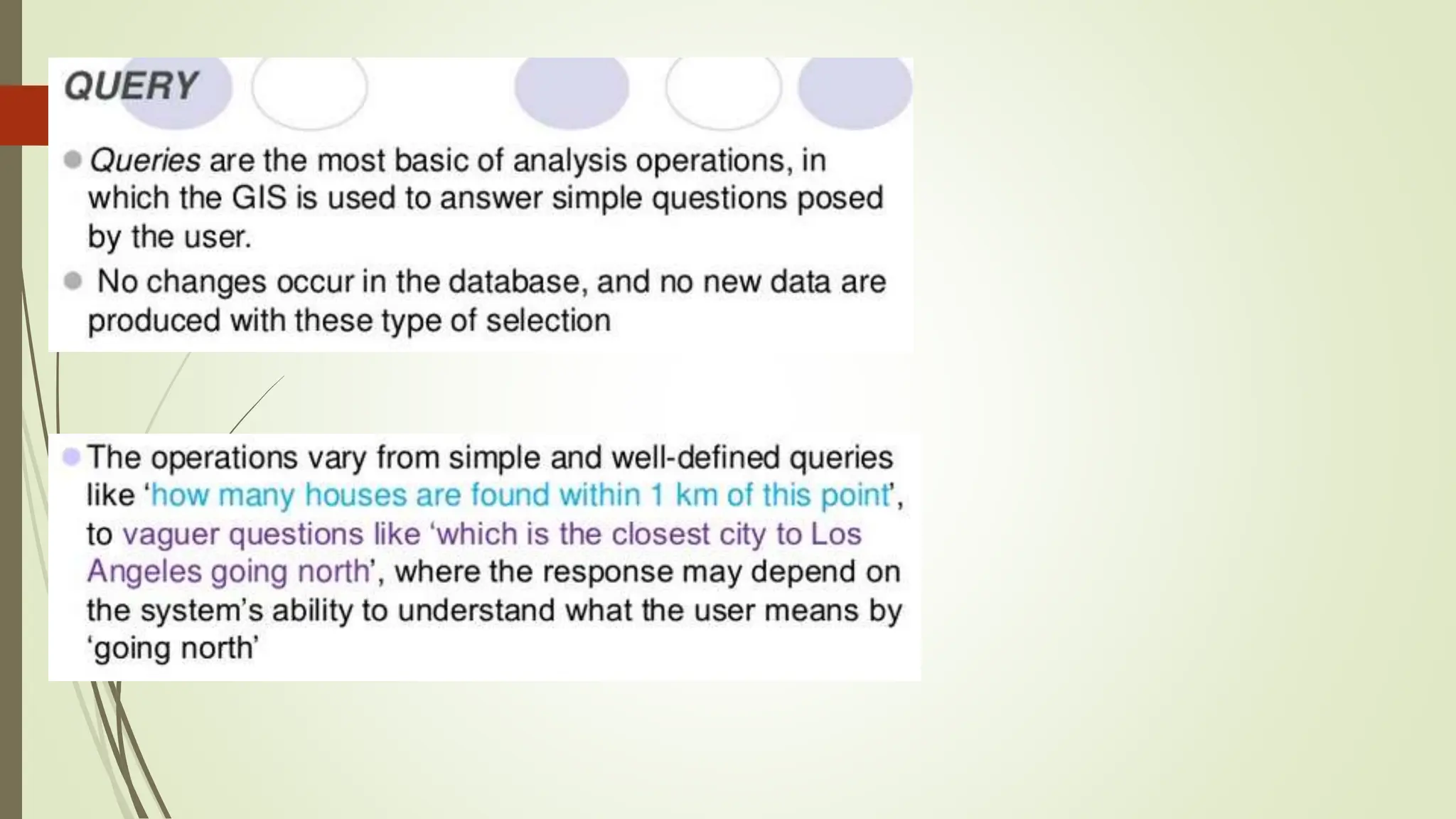
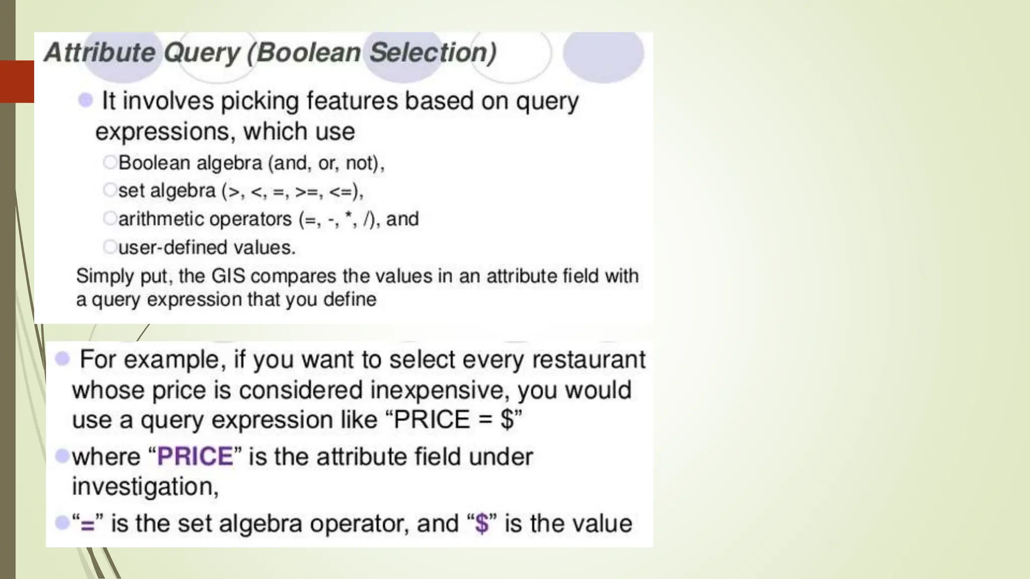
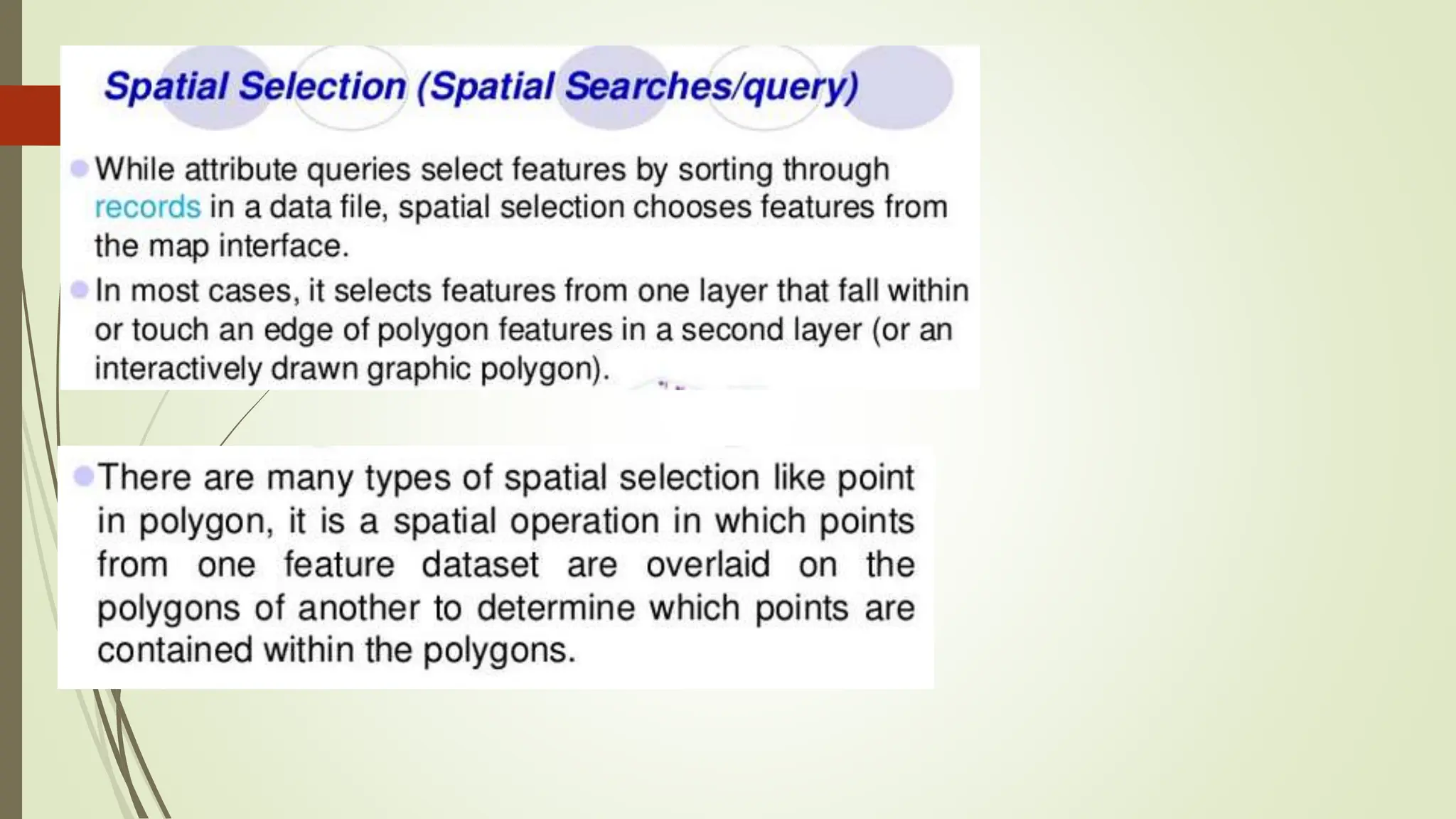
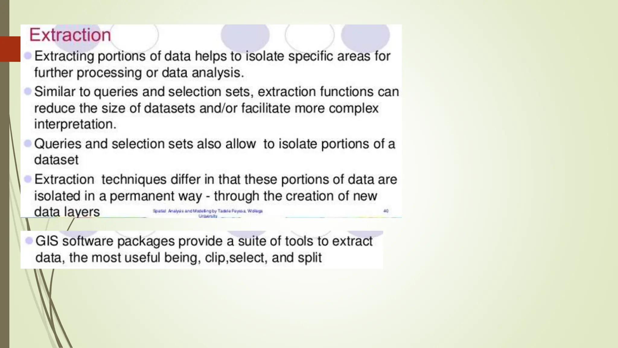
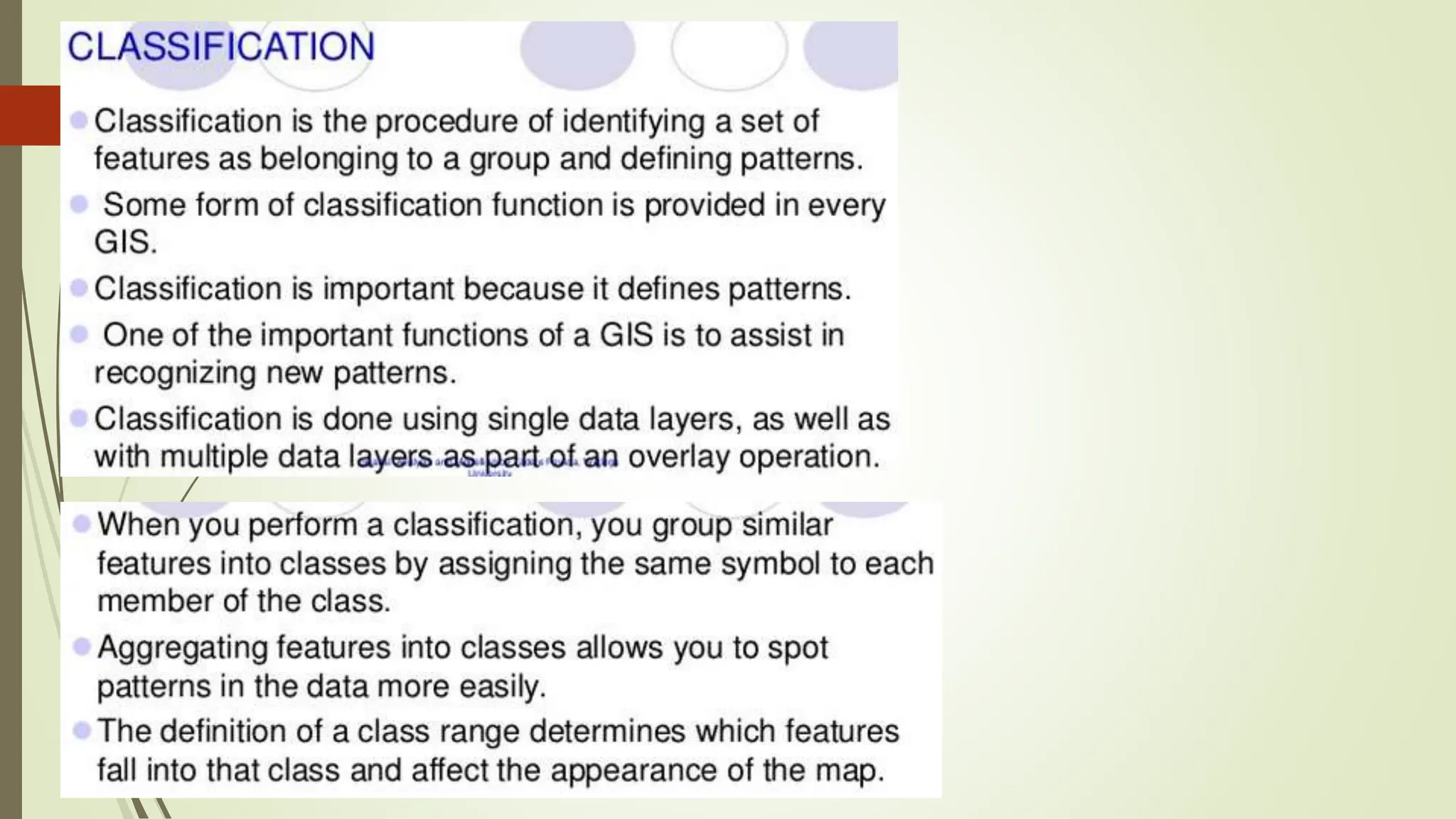
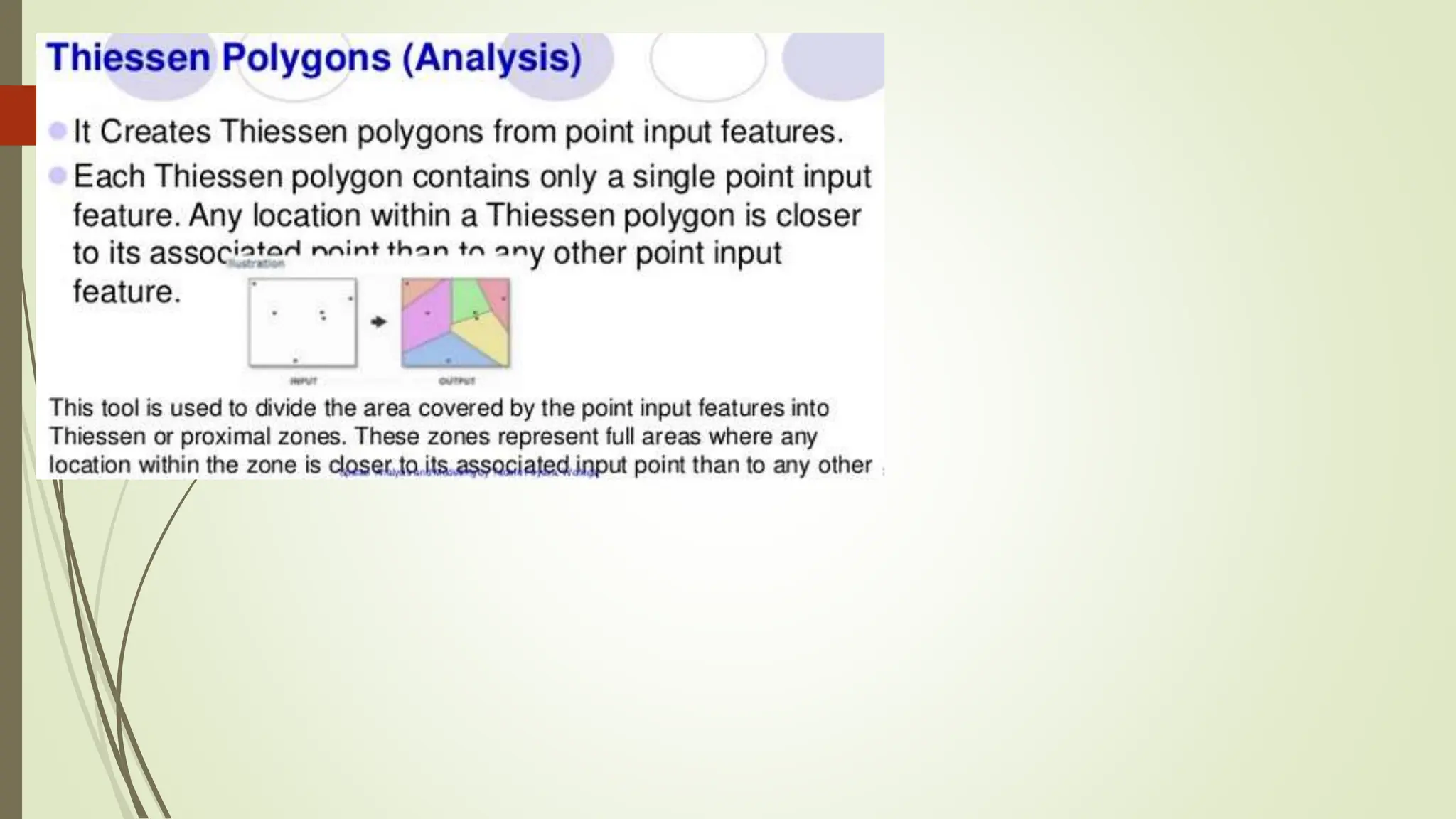
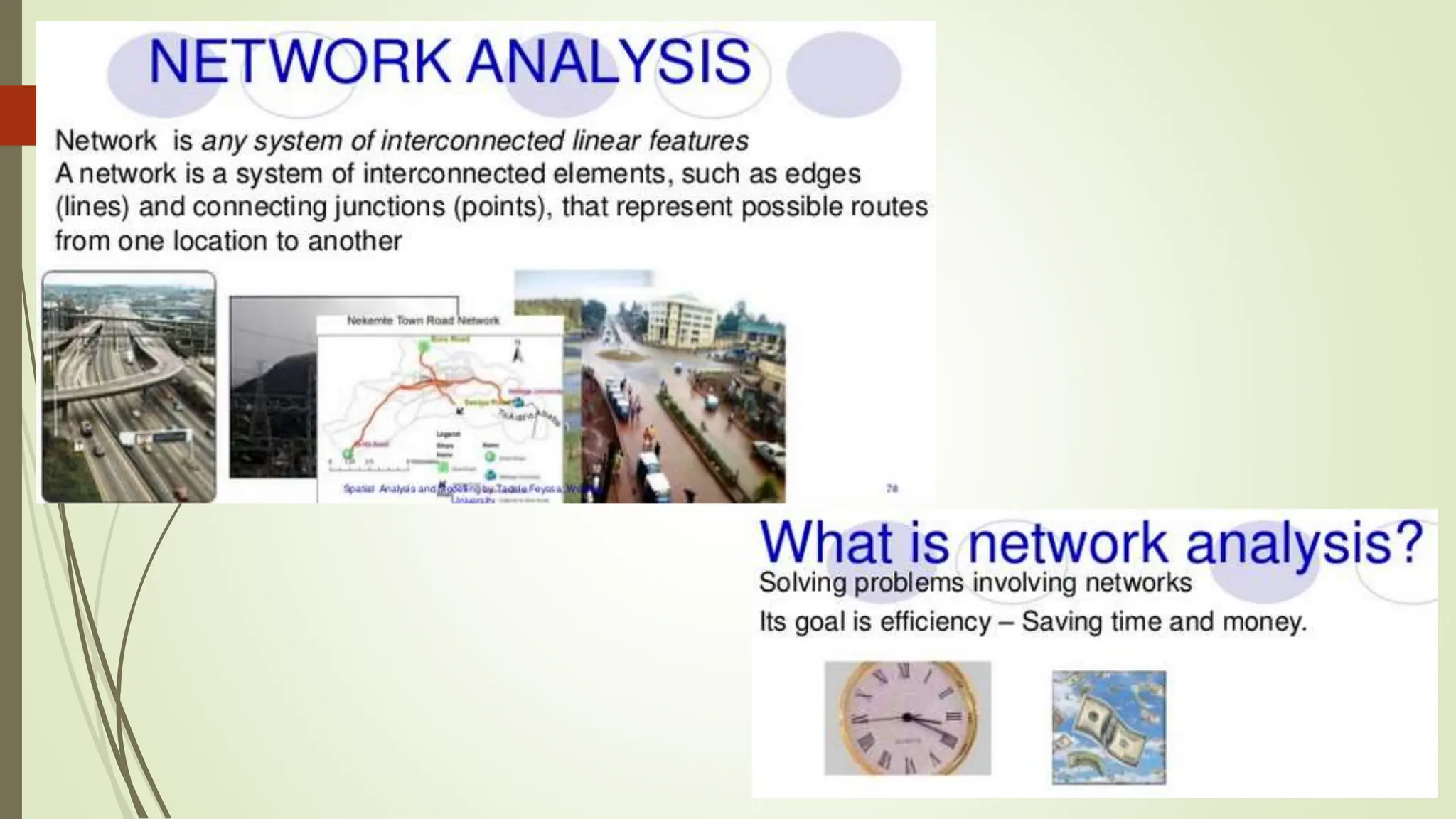
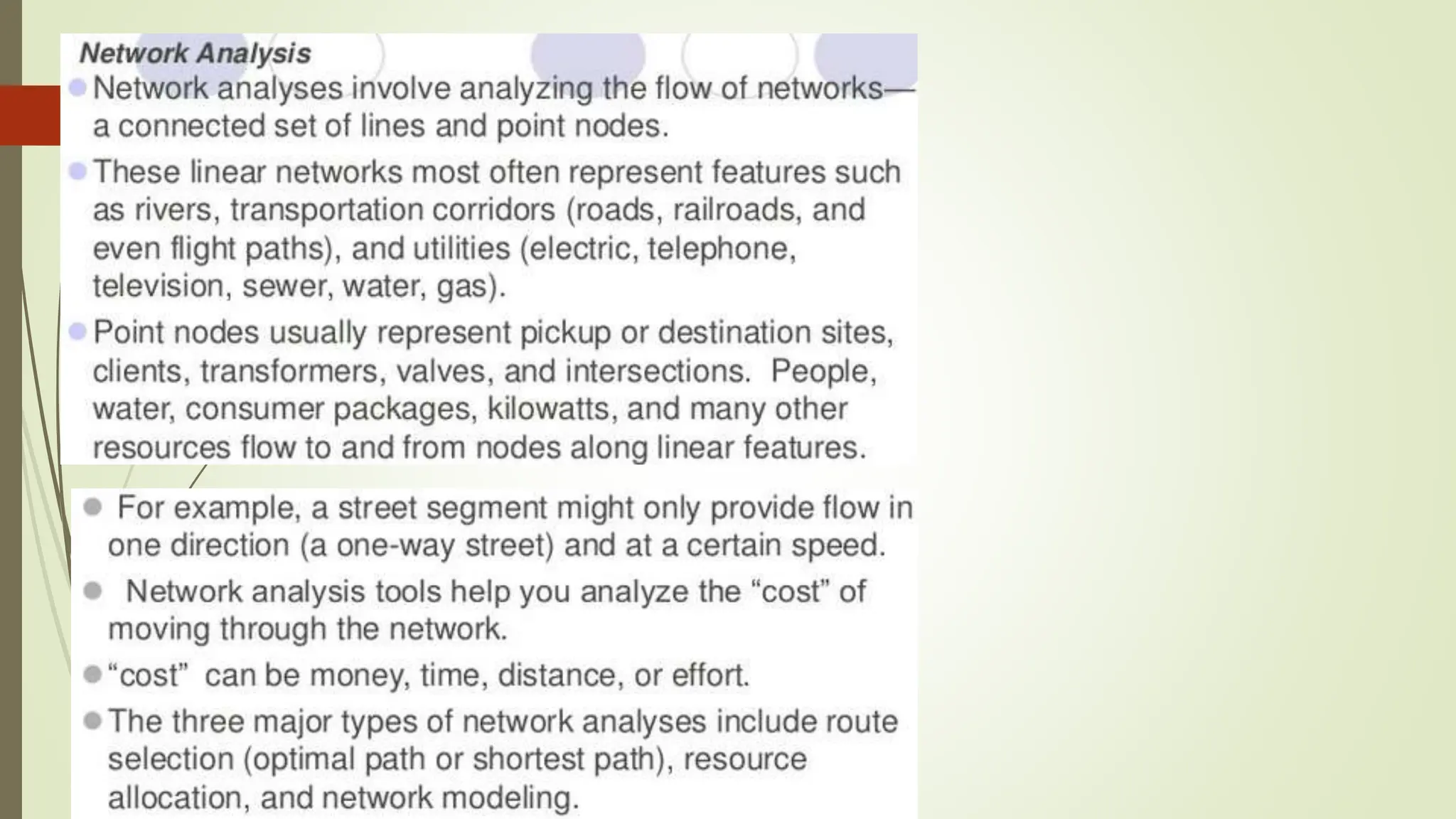
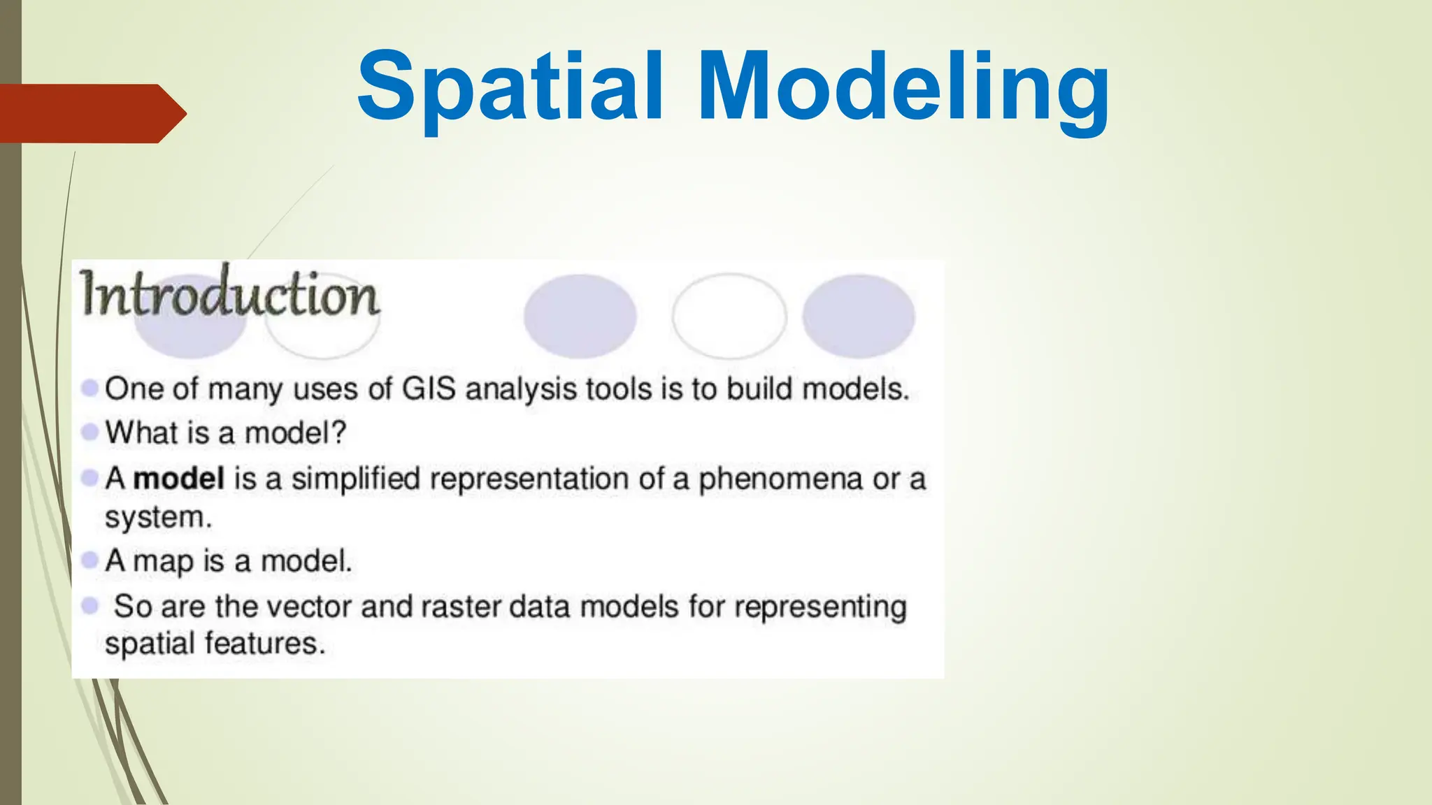
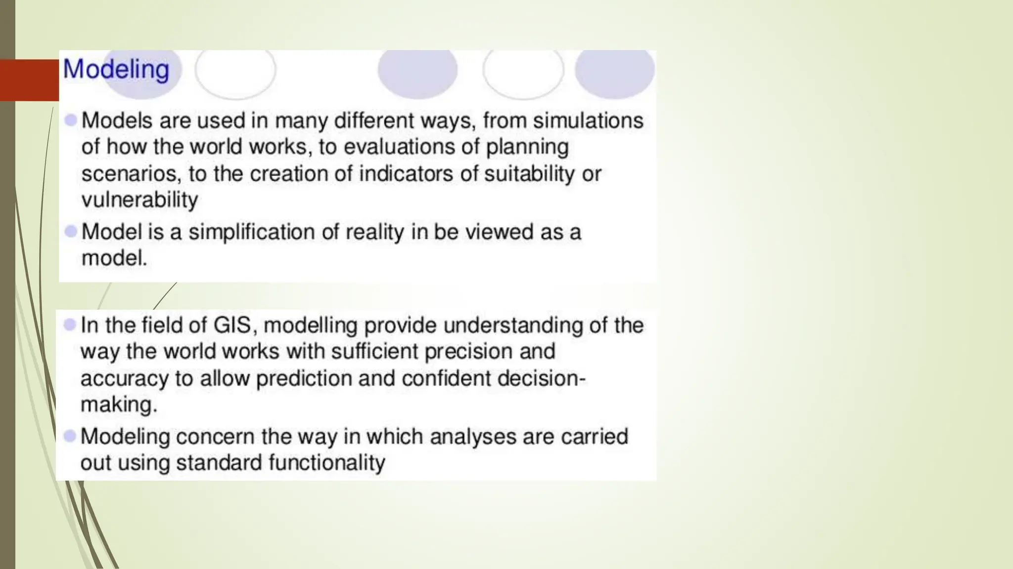
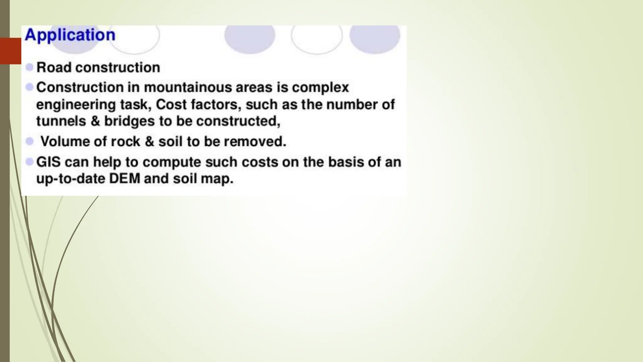
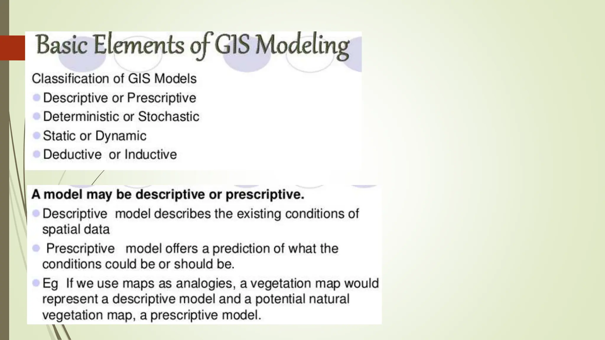
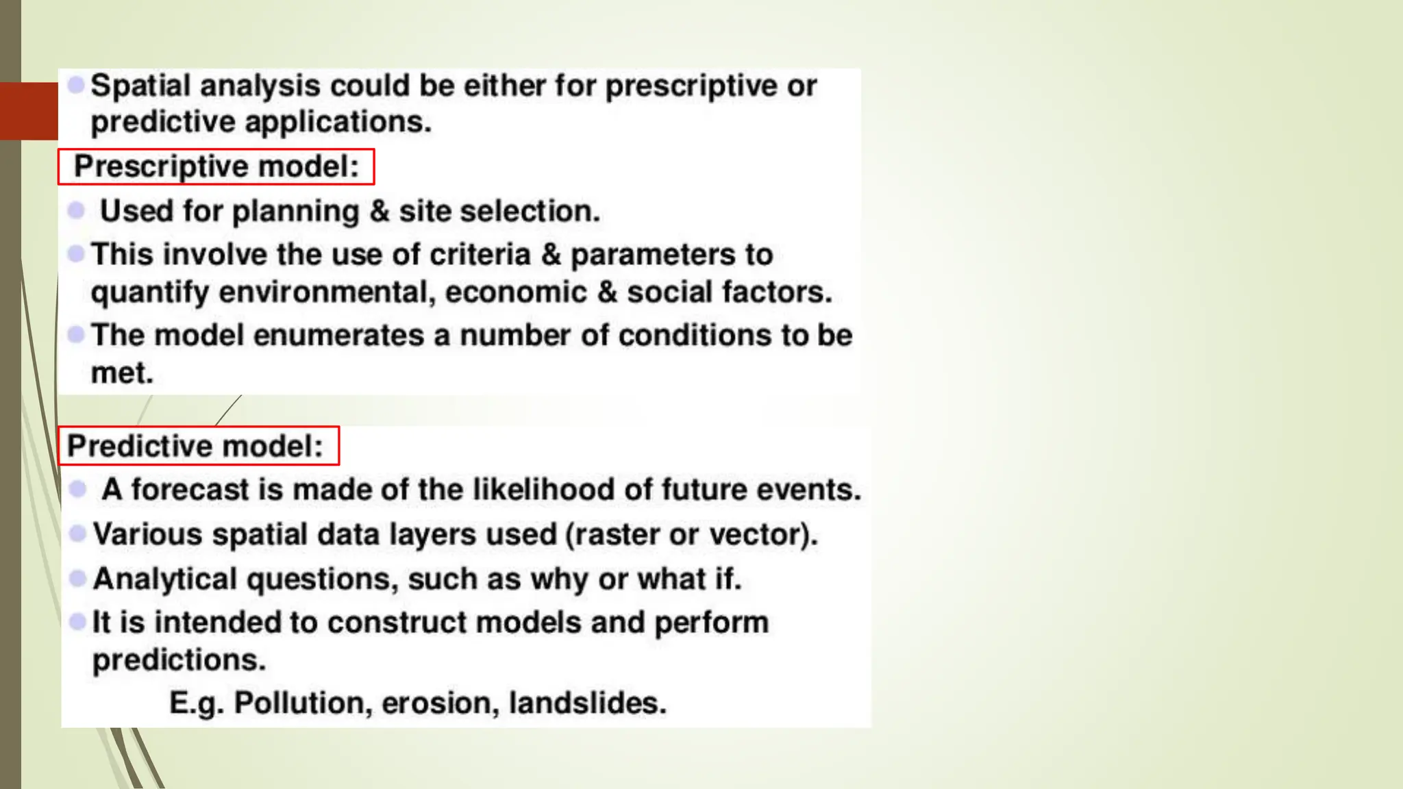
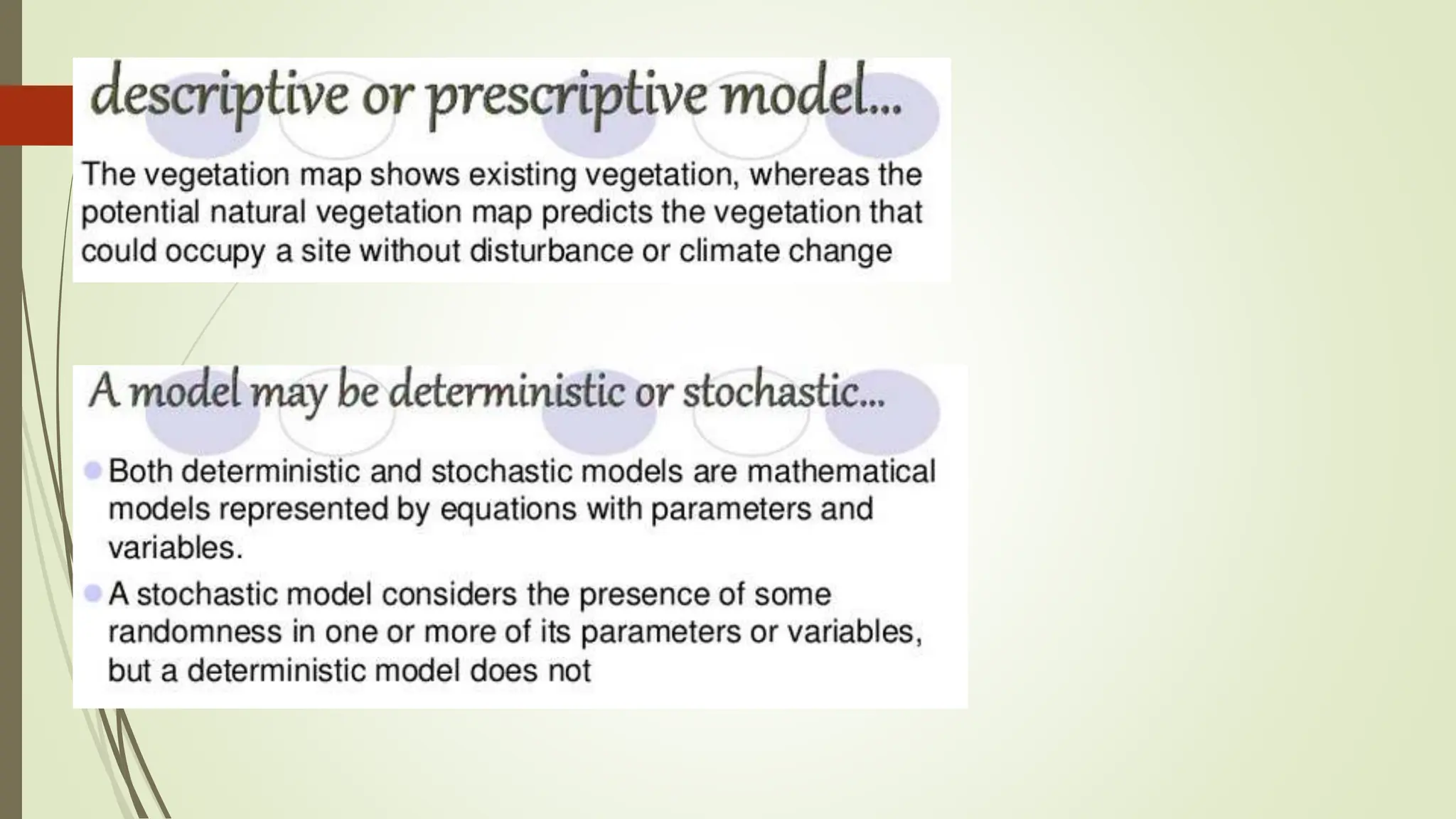
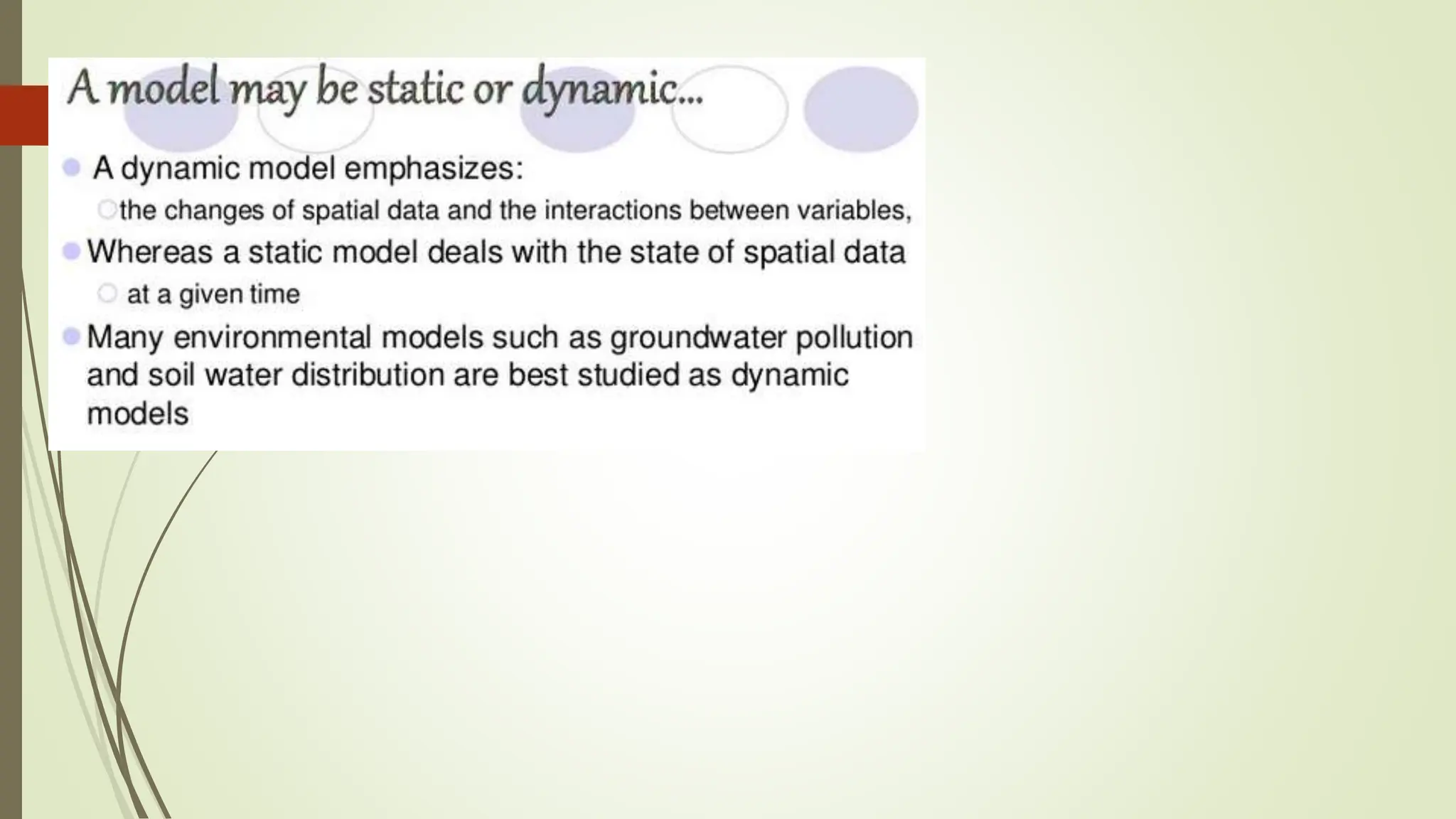
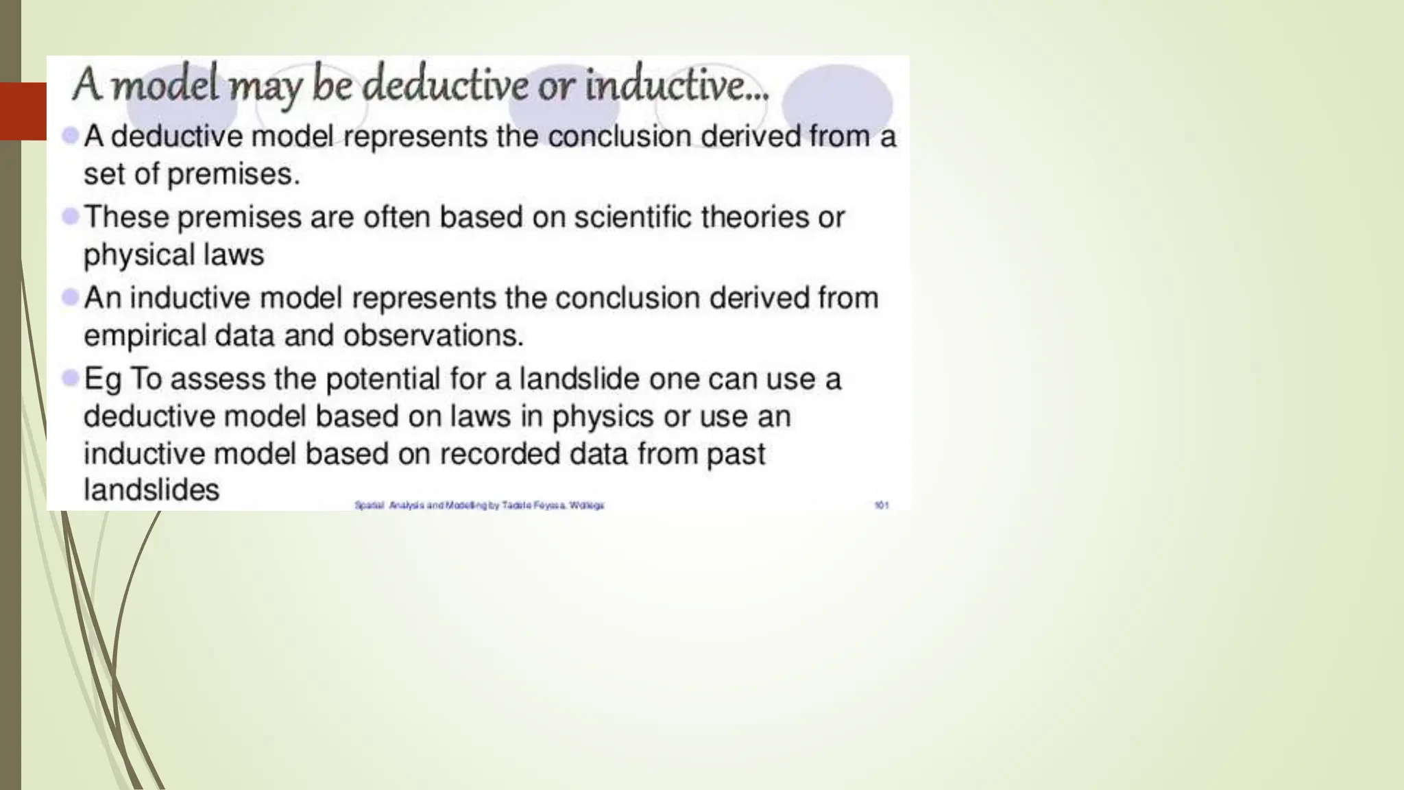
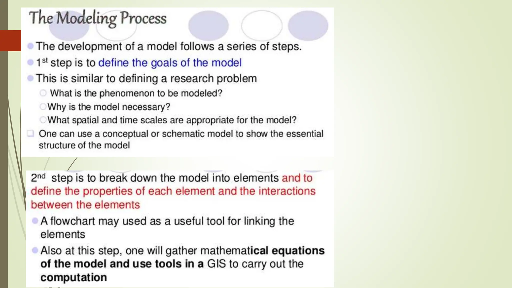
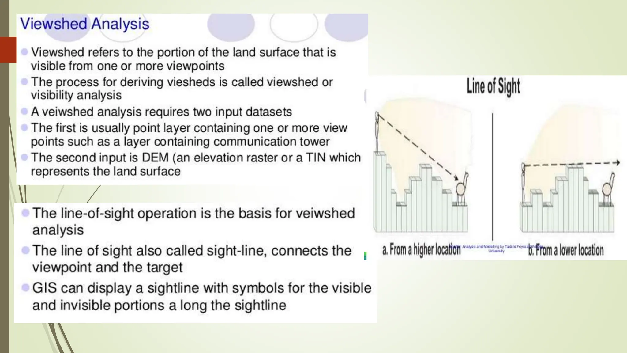
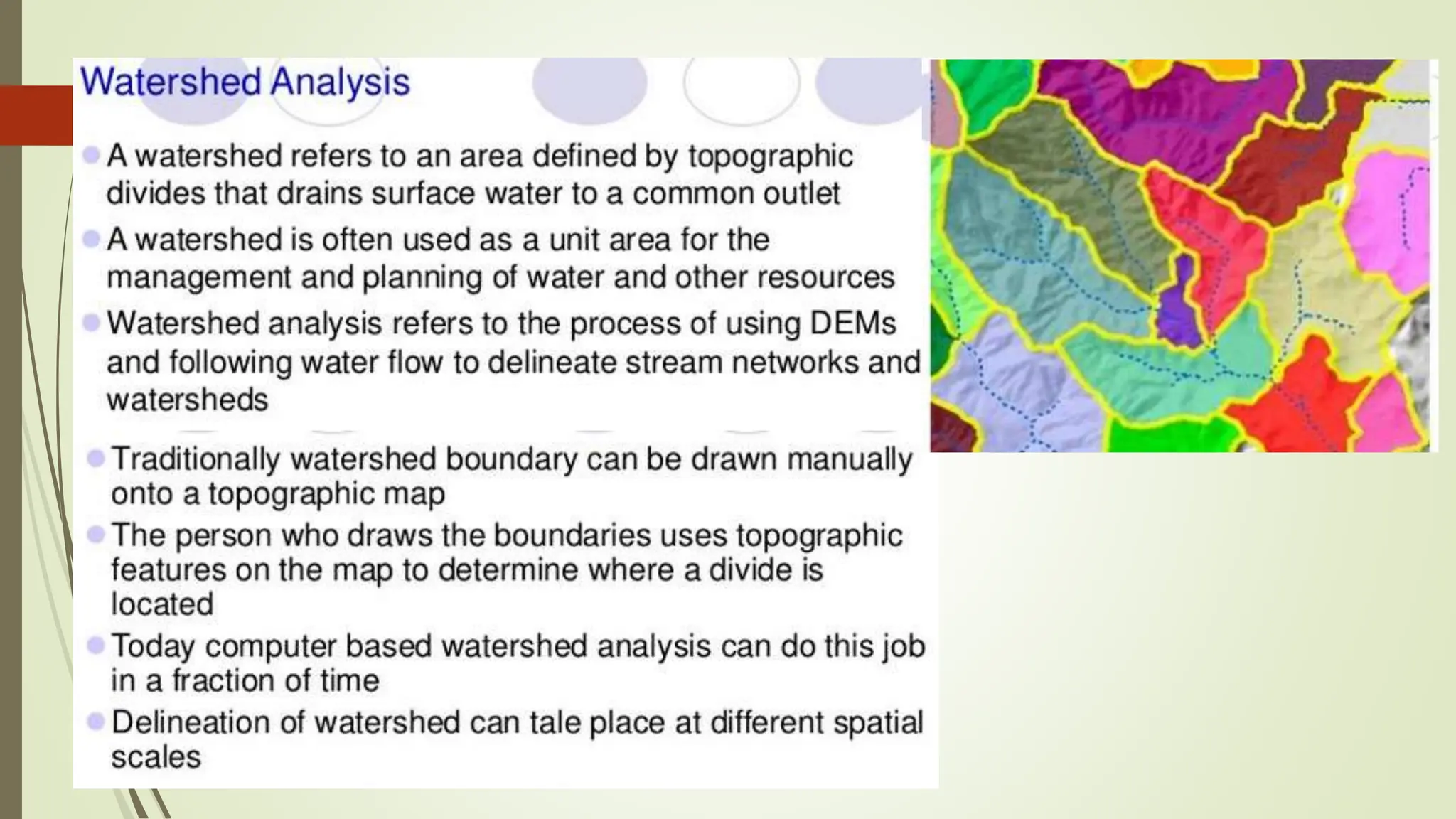
SlideShare a Scribd company logo
SPATIALANALYSIS AND MODELING
(geographical information system)
Dr. Venkateswarlu Gogana
Spatial Analysis
Most GIS systems are for the purpose of representing and describing features of
the real world. Spatial databases perform this function
 Points, lines, polygons concepts for representation
 Coordinate systems as fundamental properties of spatial data
 geographic file formats for storage
Spatial Analysis involves gaining an understanding of the patterns, and
associated cause and effect processes, underlying the features which have been
described in order to
 Make better decisions
 Understand the phenomena as a goal in itself
Spatial Analysis
Types of Spatial Analysis:
1. Spatial data manipulation:
Classic GIS capabilities - Spatial queries & measurement, buffering, map layer
overlay
2. Spatial data analysis:
Descriptive and exploratory, Visualization through data manipulation and mapping
3. Spatial statistical analysis:
Hypothesis testing; Are data “to be expected” or are they “unexpected” relative to
some statistical model, usually of a random process
4. Spatial modeling:
Prediction, Constructing models (of processes) to predict spatial outcomes
(patterns) What if analyses
Spatial Analysis
Types of Spatial Analysis:
1. Vector Spatial Analysis - Extracting portions of data is an effective means of isolating specific areas for
further processing or data analysis
a) Extraction
i. Clip
ii. Split
iii. Select
iv. Erase
b) Overlay
i. Point-in-Polygon
ii. Line-in-Polygon
iii. Polygon-in-Polygon
c) Proximity
i. Buffer
ii. Near
iii. Point Distance
Spatial Analysis
2. Raster Spatial Analysis
a) Surface Analysis
a) Slope
b) Aspect
c) Contour
d) Hill Shade
e) Viewshed
b) Local Functions and Statistics
c) Neighborhood Functions and Statistics
d) Zonal Functions
a) Distance
b) Straight-line
c) Shortest path
Spatial Data Criteria: Spatial Analysis Functions
Spatial Analysis
Spatial Modeling
- Spatial Analysis and Modeling.pptx

More Related Content

Similar to - Spatial Analysis and Modeling.pptx

Texture based feature extraction and object tracking
Texture based feature extraction and object trackingTexture based feature extraction and object tracking
Texture based feature extraction and object tracking
Priyanka Goswami
 
Introduction to GIS
Introduction to GISIntroduction to GIS
Introduction to GIS
KU Leuven
 
2-200305220204.pdf
2-200305220204.pdf2-200305220204.pdf
2-200305220204.pdf
IIT Bombay
 
Introduction to arc gis
Introduction to arc gisIntroduction to arc gis
Introduction to arc gis
Mohamed Hamed
 
Unit 4 Spatial Analysis.pptx
Unit 4 Spatial Analysis.pptxUnit 4 Spatial Analysis.pptx
Unit 4 Spatial Analysis.pptx
e20ag004
 
17 manjula aakunuri final_paper--185-190
17 manjula aakunuri final_paper--185-19017 manjula aakunuri final_paper--185-190
17 manjula aakunuri final_paper--185-190
Alexander Decker
 
Exploratory Spatial Analytics (ESA)
Exploratory Spatial Analytics (ESA)Exploratory Spatial Analytics (ESA)
Exploratory Spatial Analytics (ESA)
Stig-Arne Kristoffersen
 
Intro to GIS and Remote Sensing
Intro to GIS and Remote SensingIntro to GIS and Remote Sensing
Intro to GIS and Remote Sensing
John Reiser
 
TerraWorld
TerraWorldTerraWorld
International Journal of Engineering Research and Development
International Journal of Engineering Research and DevelopmentInternational Journal of Engineering Research and Development
International Journal of Engineering Research and Development
IJERD Editor
 
Final ies
Final iesFinal ies
Final ies
AJAL A J
 
Geographical information system
Geographical information systemGeographical information system
Geographical information system
North Orissa University
 
Exploratory data analysis
Exploratory data analysisExploratory data analysis
Exploratory data analysis
Vishwas N
 
Spatial Databases
Spatial DatabasesSpatial Databases
Spatial Databases
Pratibha Chaudhary
 
GIS_Intro_March_2014
GIS_Intro_March_2014GIS_Intro_March_2014
GIS_Intro_March_2014
Lyndy Worsham, GISP
 
Geographical Information System By Zewde Alemayehu Tilahun.pptx
Geographical Information System By Zewde Alemayehu Tilahun.pptxGeographical Information System By Zewde Alemayehu Tilahun.pptx
Geographical Information System By Zewde Alemayehu Tilahun.pptx
zewde alemayehu
 
Geographical information system by zewde alemayehu tilahun
Geographical information system by zewde alemayehu tilahunGeographical information system by zewde alemayehu tilahun
Geographical information system by zewde alemayehu tilahun
zewde alemayehu
 
Spatial data analysis
Spatial data analysisSpatial data analysis
Spatial data analysis
Johan Blomme
 
UNIt 6.pptxkkkkkkkkkkkkkkkkkkkkkkkkkkkkkkkkkkkkk
UNIt 6.pptxkkkkkkkkkkkkkkkkkkkkkkkkkkkkkkkkkkkkkUNIt 6.pptxkkkkkkkkkkkkkkkkkkkkkkkkkkkkkkkkkkkkk
UNIt 6.pptxkkkkkkkkkkkkkkkkkkkkkkkkkkkkkkkkkkkkk
Mrunmayee Manjari
 
TYBSC IT PGIS Unit I Chapter I- Introduction to Geographic Information Systems
TYBSC IT PGIS Unit I  Chapter I- Introduction to Geographic Information SystemsTYBSC IT PGIS Unit I  Chapter I- Introduction to Geographic Information Systems
TYBSC IT PGIS Unit I Chapter I- Introduction to Geographic Information Systems
Arti Parab Academics
 

Similar to - Spatial Analysis and Modeling.pptx (20)

Texture based feature extraction and object tracking
Texture based feature extraction and object trackingTexture based feature extraction and object tracking
Texture based feature extraction and object tracking
 
Introduction to GIS
Introduction to GISIntroduction to GIS
Introduction to GIS
 
2-200305220204.pdf
2-200305220204.pdf2-200305220204.pdf
2-200305220204.pdf
 
Introduction to arc gis
Introduction to arc gisIntroduction to arc gis
Introduction to arc gis
 
Unit 4 Spatial Analysis.pptx
Unit 4 Spatial Analysis.pptxUnit 4 Spatial Analysis.pptx
Unit 4 Spatial Analysis.pptx
 
17 manjula aakunuri final_paper--185-190
17 manjula aakunuri final_paper--185-19017 manjula aakunuri final_paper--185-190
17 manjula aakunuri final_paper--185-190
 
Exploratory Spatial Analytics (ESA)
Exploratory Spatial Analytics (ESA)Exploratory Spatial Analytics (ESA)
Exploratory Spatial Analytics (ESA)
 
Intro to GIS and Remote Sensing
Intro to GIS and Remote SensingIntro to GIS and Remote Sensing
Intro to GIS and Remote Sensing
 
TerraWorld
TerraWorldTerraWorld
TerraWorld
 
International Journal of Engineering Research and Development
International Journal of Engineering Research and DevelopmentInternational Journal of Engineering Research and Development
International Journal of Engineering Research and Development
 
Final ies
Final iesFinal ies
Final ies
 
Geographical information system
Geographical information systemGeographical information system
Geographical information system
 
Exploratory data analysis
Exploratory data analysisExploratory data analysis
Exploratory data analysis
 
Spatial Databases
Spatial DatabasesSpatial Databases
Spatial Databases
 
GIS_Intro_March_2014
GIS_Intro_March_2014GIS_Intro_March_2014
GIS_Intro_March_2014
 
Geographical Information System By Zewde Alemayehu Tilahun.pptx
Geographical Information System By Zewde Alemayehu Tilahun.pptxGeographical Information System By Zewde Alemayehu Tilahun.pptx
Geographical Information System By Zewde Alemayehu Tilahun.pptx
 
Geographical information system by zewde alemayehu tilahun
Geographical information system by zewde alemayehu tilahunGeographical information system by zewde alemayehu tilahun
Geographical information system by zewde alemayehu tilahun
 
Spatial data analysis
Spatial data analysisSpatial data analysis
Spatial data analysis
 
UNIt 6.pptxkkkkkkkkkkkkkkkkkkkkkkkkkkkkkkkkkkkkk
UNIt 6.pptxkkkkkkkkkkkkkkkkkkkkkkkkkkkkkkkkkkkkkUNIt 6.pptxkkkkkkkkkkkkkkkkkkkkkkkkkkkkkkkkkkkkk
UNIt 6.pptxkkkkkkkkkkkkkkkkkkkkkkkkkkkkkkkkkkkkk
 
TYBSC IT PGIS Unit I Chapter I- Introduction to Geographic Information Systems
TYBSC IT PGIS Unit I  Chapter I- Introduction to Geographic Information SystemsTYBSC IT PGIS Unit I  Chapter I- Introduction to Geographic Information Systems
TYBSC IT PGIS Unit I Chapter I- Introduction to Geographic Information Systems
 

More from DrVenkateswarluGogan1

EG NOTES.docx
EG NOTES.docxEG NOTES.docx
EG NOTES.docx
DrVenkateswarluGogan1
 
EG QUESTION BANK.docx
EG QUESTION BANK.docxEG QUESTION BANK.docx
EG QUESTION BANK.docx
DrVenkateswarluGogan1
 
PHOTOGRAMMETRY.pptx
PHOTOGRAMMETRY.pptxPHOTOGRAMMETRY.pptx
PHOTOGRAMMETRY.pptx
DrVenkateswarluGogan1
 
MODERN SURVEYING TECHNIQUES.pptx
 MODERN SURVEYING TECHNIQUES.pptx MODERN SURVEYING TECHNIQUES.pptx
MODERN SURVEYING TECHNIQUES.pptx
DrVenkateswarluGogan1
 
GPS.ppt
GPS.pptGPS.ppt
Modern surveying instruments.pdf
Modern surveying instruments.pdfModern surveying instruments.pdf
Modern surveying instruments.pdf
DrVenkateswarluGogan1
 
Project Evaluation Techniques by Dr.Venkateswarlu Gogana.pdf
Project Evaluation Techniques by Dr.Venkateswarlu Gogana.pdfProject Evaluation Techniques by Dr.Venkateswarlu Gogana.pdf
Project Evaluation Techniques by Dr.Venkateswarlu Gogana.pdf
DrVenkateswarluGogan1
 
HOUSING AND COMMUNITY PLANNING.pdf
HOUSING AND COMMUNITY PLANNING.pdfHOUSING AND COMMUNITY PLANNING.pdf
HOUSING AND COMMUNITY PLANNING.pdf
DrVenkateswarluGogan1
 
Slum improvement act.pdf
Slum improvement act.pdfSlum improvement act.pdf
Slum improvement act.pdf
DrVenkateswarluGogan1
 
Regional Plan for National Capital Region Dr venkateswarlu gogana.pdf
Regional Plan for National Capital Region Dr venkateswarlu gogana.pdfRegional Plan for National Capital Region Dr venkateswarlu gogana.pdf
Regional Plan for National Capital Region Dr venkateswarlu gogana.pdf
DrVenkateswarluGogan1
 
National Housing Board Dr Venkateswarlu Gogana.pdf
National Housing Board Dr Venkateswarlu Gogana.pdfNational Housing Board Dr Venkateswarlu Gogana.pdf
National Housing Board Dr Venkateswarlu Gogana.pdf
DrVenkateswarluGogan1
 
municipal act by Dr venkateswarlu gogana.pdf
municipal act by Dr venkateswarlu gogana.pdfmunicipal act by Dr venkateswarlu gogana.pdf
municipal act by Dr venkateswarlu gogana.pdf
DrVenkateswarluGogan1
 
Land Acquisitoin Act 1894 Dr Venkateswarlu gogana.pdf
Land Acquisitoin Act 1894 Dr Venkateswarlu gogana.pdfLand Acquisitoin Act 1894 Dr Venkateswarlu gogana.pdf
Land Acquisitoin Act 1894 Dr Venkateswarlu gogana.pdf
DrVenkateswarluGogan1
 
Land acquisition Dr gogana venkateswarlu.pdf
Land acquisition Dr gogana venkateswarlu.pdfLand acquisition Dr gogana venkateswarlu.pdf
Land acquisition Dr gogana venkateswarlu.pdf
DrVenkateswarluGogan1
 
Land acquisition 1894 and larr 2013.pptx
Land acquisition 1894 and larr 2013.pptxLand acquisition 1894 and larr 2013.pptx
Land acquisition 1894 and larr 2013.pptx
DrVenkateswarluGogan1
 
Environmental Legislations.pptx
Environmental Legislations.pptxEnvironmental Legislations.pptx
Environmental Legislations.pptx
DrVenkateswarluGogan1
 
EXOGENOUS HAZARDS docx
EXOGENOUS HAZARDS docxEXOGENOUS HAZARDS docx
EXOGENOUS HAZARDS docx
DrVenkateswarluGogan1
 
ENDOGENOUS HAZARDS EARTHQUAKES .docx
ENDOGENOUS HAZARDS EARTHQUAKES .docxENDOGENOUS HAZARDS EARTHQUAKES .docx
ENDOGENOUS HAZARDS EARTHQUAKES .docx
DrVenkateswarluGogan1
 
Environmental Hazards and Environmental Disaster and Its Types.docx
Environmental Hazards and Environmental Disaster and Its Types.docxEnvironmental Hazards and Environmental Disaster and Its Types.docx
Environmental Hazards and Environmental Disaster and Its Types.docx
DrVenkateswarluGogan1
 
HOW GIS USED IN TENDERING
HOW GIS USED IN TENDERINGHOW GIS USED IN TENDERING
HOW GIS USED IN TENDERING
DrVenkateswarluGogan1
 

More from DrVenkateswarluGogan1 (20)

EG NOTES.docx
EG NOTES.docxEG NOTES.docx
EG NOTES.docx
 
EG QUESTION BANK.docx
EG QUESTION BANK.docxEG QUESTION BANK.docx
EG QUESTION BANK.docx
 
PHOTOGRAMMETRY.pptx
PHOTOGRAMMETRY.pptxPHOTOGRAMMETRY.pptx
PHOTOGRAMMETRY.pptx
 
MODERN SURVEYING TECHNIQUES.pptx
 MODERN SURVEYING TECHNIQUES.pptx MODERN SURVEYING TECHNIQUES.pptx
MODERN SURVEYING TECHNIQUES.pptx
 
GPS.ppt
GPS.pptGPS.ppt
GPS.ppt
 
Modern surveying instruments.pdf
Modern surveying instruments.pdfModern surveying instruments.pdf
Modern surveying instruments.pdf
 
Project Evaluation Techniques by Dr.Venkateswarlu Gogana.pdf
Project Evaluation Techniques by Dr.Venkateswarlu Gogana.pdfProject Evaluation Techniques by Dr.Venkateswarlu Gogana.pdf
Project Evaluation Techniques by Dr.Venkateswarlu Gogana.pdf
 
HOUSING AND COMMUNITY PLANNING.pdf
HOUSING AND COMMUNITY PLANNING.pdfHOUSING AND COMMUNITY PLANNING.pdf
HOUSING AND COMMUNITY PLANNING.pdf
 
Slum improvement act.pdf
Slum improvement act.pdfSlum improvement act.pdf
Slum improvement act.pdf
 
Regional Plan for National Capital Region Dr venkateswarlu gogana.pdf
Regional Plan for National Capital Region Dr venkateswarlu gogana.pdfRegional Plan for National Capital Region Dr venkateswarlu gogana.pdf
Regional Plan for National Capital Region Dr venkateswarlu gogana.pdf
 
National Housing Board Dr Venkateswarlu Gogana.pdf
National Housing Board Dr Venkateswarlu Gogana.pdfNational Housing Board Dr Venkateswarlu Gogana.pdf
National Housing Board Dr Venkateswarlu Gogana.pdf
 
municipal act by Dr venkateswarlu gogana.pdf
municipal act by Dr venkateswarlu gogana.pdfmunicipal act by Dr venkateswarlu gogana.pdf
municipal act by Dr venkateswarlu gogana.pdf
 
Land Acquisitoin Act 1894 Dr Venkateswarlu gogana.pdf
Land Acquisitoin Act 1894 Dr Venkateswarlu gogana.pdfLand Acquisitoin Act 1894 Dr Venkateswarlu gogana.pdf
Land Acquisitoin Act 1894 Dr Venkateswarlu gogana.pdf
 
Land acquisition Dr gogana venkateswarlu.pdf
Land acquisition Dr gogana venkateswarlu.pdfLand acquisition Dr gogana venkateswarlu.pdf
Land acquisition Dr gogana venkateswarlu.pdf
 
Land acquisition 1894 and larr 2013.pptx
Land acquisition 1894 and larr 2013.pptxLand acquisition 1894 and larr 2013.pptx
Land acquisition 1894 and larr 2013.pptx
 
Environmental Legislations.pptx
Environmental Legislations.pptxEnvironmental Legislations.pptx
Environmental Legislations.pptx
 
EXOGENOUS HAZARDS docx
EXOGENOUS HAZARDS docxEXOGENOUS HAZARDS docx
EXOGENOUS HAZARDS docx
 
ENDOGENOUS HAZARDS EARTHQUAKES .docx
ENDOGENOUS HAZARDS EARTHQUAKES .docxENDOGENOUS HAZARDS EARTHQUAKES .docx
ENDOGENOUS HAZARDS EARTHQUAKES .docx
 
Environmental Hazards and Environmental Disaster and Its Types.docx
Environmental Hazards and Environmental Disaster and Its Types.docxEnvironmental Hazards and Environmental Disaster and Its Types.docx
Environmental Hazards and Environmental Disaster and Its Types.docx
 
HOW GIS USED IN TENDERING
HOW GIS USED IN TENDERINGHOW GIS USED IN TENDERING
HOW GIS USED IN TENDERING
 

Recently uploaded

Heat Resistant Concrete Presentation ppt
Heat Resistant Concrete Presentation pptHeat Resistant Concrete Presentation ppt
Heat Resistant Concrete Presentation ppt
mamunhossenbd75
 
Generative AI leverages algorithms to create various forms of content
Generative AI leverages algorithms to create various forms of contentGenerative AI leverages algorithms to create various forms of content
Generative AI leverages algorithms to create various forms of content
Hitesh Mohapatra
 
ACEP Magazine edition 4th launched on 05.06.2024
ACEP Magazine edition 4th launched on 05.06.2024ACEP Magazine edition 4th launched on 05.06.2024
ACEP Magazine edition 4th launched on 05.06.2024
Rahul
 
Presentation of IEEE Slovenia CIS (Computational Intelligence Society) Chapte...
Presentation of IEEE Slovenia CIS (Computational Intelligence Society) Chapte...Presentation of IEEE Slovenia CIS (Computational Intelligence Society) Chapte...
Presentation of IEEE Slovenia CIS (Computational Intelligence Society) Chapte...
University of Maribor
 
22CYT12-Unit-V-E Waste and its Management.ppt
22CYT12-Unit-V-E Waste and its Management.ppt22CYT12-Unit-V-E Waste and its Management.ppt
22CYT12-Unit-V-E Waste and its Management.ppt
KrishnaveniKrishnara1
 
CHINA’S GEO-ECONOMIC OUTREACH IN CENTRAL ASIAN COUNTRIES AND FUTURE PROSPECT
CHINA’S GEO-ECONOMIC OUTREACH IN CENTRAL ASIAN COUNTRIES AND FUTURE PROSPECTCHINA’S GEO-ECONOMIC OUTREACH IN CENTRAL ASIAN COUNTRIES AND FUTURE PROSPECT
CHINA’S GEO-ECONOMIC OUTREACH IN CENTRAL ASIAN COUNTRIES AND FUTURE PROSPECT
jpsjournal1
 
Electric vehicle and photovoltaic advanced roles in enhancing the financial p...
Electric vehicle and photovoltaic advanced roles in enhancing the financial p...Electric vehicle and photovoltaic advanced roles in enhancing the financial p...
Electric vehicle and photovoltaic advanced roles in enhancing the financial p...
IJECEIAES
 
IEEE Aerospace and Electronic Systems Society as a Graduate Student Member
IEEE Aerospace and Electronic Systems Society as a Graduate Student MemberIEEE Aerospace and Electronic Systems Society as a Graduate Student Member
IEEE Aerospace and Electronic Systems Society as a Graduate Student Member
VICTOR MAESTRE RAMIREZ
 
BPV-GUI-01-Guide-for-ASME-Review-Teams-(General)-10-10-2023.pdf
BPV-GUI-01-Guide-for-ASME-Review-Teams-(General)-10-10-2023.pdfBPV-GUI-01-Guide-for-ASME-Review-Teams-(General)-10-10-2023.pdf
BPV-GUI-01-Guide-for-ASME-Review-Teams-(General)-10-10-2023.pdf
MIGUELANGEL966976
 
basic-wireline-operations-course-mahmoud-f-radwan.pdf
basic-wireline-operations-course-mahmoud-f-radwan.pdfbasic-wireline-operations-course-mahmoud-f-radwan.pdf
basic-wireline-operations-course-mahmoud-f-radwan.pdf
NidhalKahouli2
 
[JPP-1] - (JEE 3.0) - Kinematics 1D - 14th May..pdf
[JPP-1] - (JEE 3.0) - Kinematics 1D - 14th May..pdf[JPP-1] - (JEE 3.0) - Kinematics 1D - 14th May..pdf
[JPP-1] - (JEE 3.0) - Kinematics 1D - 14th May..pdf
awadeshbabu
 
Technical Drawings introduction to drawing of prisms
Technical Drawings introduction to drawing of prismsTechnical Drawings introduction to drawing of prisms
Technical Drawings introduction to drawing of prisms
heavyhaig
 
DfMAy 2024 - key insights and contributions
DfMAy 2024 - key insights and contributionsDfMAy 2024 - key insights and contributions
DfMAy 2024 - key insights and contributions
gestioneergodomus
 
ACRP 4-09 Risk Assessment Method to Support Modification of Airfield Separat...
ACRP 4-09 Risk Assessment Method to Support Modification of Airfield Separat...ACRP 4-09 Risk Assessment Method to Support Modification of Airfield Separat...
ACRP 4-09 Risk Assessment Method to Support Modification of Airfield Separat...
Mukeshwaran Balu
 
RAT: Retrieval Augmented Thoughts Elicit Context-Aware Reasoning in Long-Hori...
RAT: Retrieval Augmented Thoughts Elicit Context-Aware Reasoning in Long-Hori...RAT: Retrieval Augmented Thoughts Elicit Context-Aware Reasoning in Long-Hori...
RAT: Retrieval Augmented Thoughts Elicit Context-Aware Reasoning in Long-Hori...
thanhdowork
 
Embedded machine learning-based road conditions and driving behavior monitoring
Embedded machine learning-based road conditions and driving behavior monitoringEmbedded machine learning-based road conditions and driving behavior monitoring
Embedded machine learning-based road conditions and driving behavior monitoring
IJECEIAES
 
digital fundamental by Thomas L.floydl.pdf
digital fundamental by Thomas L.floydl.pdfdigital fundamental by Thomas L.floydl.pdf
digital fundamental by Thomas L.floydl.pdf
drwaing
 
A SYSTEMATIC RISK ASSESSMENT APPROACH FOR SECURING THE SMART IRRIGATION SYSTEMS
A SYSTEMATIC RISK ASSESSMENT APPROACH FOR SECURING THE SMART IRRIGATION SYSTEMSA SYSTEMATIC RISK ASSESSMENT APPROACH FOR SECURING THE SMART IRRIGATION SYSTEMS
A SYSTEMATIC RISK ASSESSMENT APPROACH FOR SECURING THE SMART IRRIGATION SYSTEMS
IJNSA Journal
 
132/33KV substation case study Presentation
132/33KV substation case study Presentation132/33KV substation case study Presentation
132/33KV substation case study Presentation
kandramariana6
 
Modelagem de um CSTR com reação endotermica.pdf
Modelagem de um CSTR com reação endotermica.pdfModelagem de um CSTR com reação endotermica.pdf
Modelagem de um CSTR com reação endotermica.pdf
camseq
 

Recently uploaded (20)

Heat Resistant Concrete Presentation ppt
Heat Resistant Concrete Presentation pptHeat Resistant Concrete Presentation ppt
Heat Resistant Concrete Presentation ppt
 
Generative AI leverages algorithms to create various forms of content
Generative AI leverages algorithms to create various forms of contentGenerative AI leverages algorithms to create various forms of content
Generative AI leverages algorithms to create various forms of content
 
ACEP Magazine edition 4th launched on 05.06.2024
ACEP Magazine edition 4th launched on 05.06.2024ACEP Magazine edition 4th launched on 05.06.2024
ACEP Magazine edition 4th launched on 05.06.2024
 
Presentation of IEEE Slovenia CIS (Computational Intelligence Society) Chapte...
Presentation of IEEE Slovenia CIS (Computational Intelligence Society) Chapte...Presentation of IEEE Slovenia CIS (Computational Intelligence Society) Chapte...
Presentation of IEEE Slovenia CIS (Computational Intelligence Society) Chapte...
 
22CYT12-Unit-V-E Waste and its Management.ppt
22CYT12-Unit-V-E Waste and its Management.ppt22CYT12-Unit-V-E Waste and its Management.ppt
22CYT12-Unit-V-E Waste and its Management.ppt
 
CHINA’S GEO-ECONOMIC OUTREACH IN CENTRAL ASIAN COUNTRIES AND FUTURE PROSPECT
CHINA’S GEO-ECONOMIC OUTREACH IN CENTRAL ASIAN COUNTRIES AND FUTURE PROSPECTCHINA’S GEO-ECONOMIC OUTREACH IN CENTRAL ASIAN COUNTRIES AND FUTURE PROSPECT
CHINA’S GEO-ECONOMIC OUTREACH IN CENTRAL ASIAN COUNTRIES AND FUTURE PROSPECT
 
Electric vehicle and photovoltaic advanced roles in enhancing the financial p...
Electric vehicle and photovoltaic advanced roles in enhancing the financial p...Electric vehicle and photovoltaic advanced roles in enhancing the financial p...
Electric vehicle and photovoltaic advanced roles in enhancing the financial p...
 
IEEE Aerospace and Electronic Systems Society as a Graduate Student Member
IEEE Aerospace and Electronic Systems Society as a Graduate Student MemberIEEE Aerospace and Electronic Systems Society as a Graduate Student Member
IEEE Aerospace and Electronic Systems Society as a Graduate Student Member
 
BPV-GUI-01-Guide-for-ASME-Review-Teams-(General)-10-10-2023.pdf
BPV-GUI-01-Guide-for-ASME-Review-Teams-(General)-10-10-2023.pdfBPV-GUI-01-Guide-for-ASME-Review-Teams-(General)-10-10-2023.pdf
BPV-GUI-01-Guide-for-ASME-Review-Teams-(General)-10-10-2023.pdf
 
basic-wireline-operations-course-mahmoud-f-radwan.pdf
basic-wireline-operations-course-mahmoud-f-radwan.pdfbasic-wireline-operations-course-mahmoud-f-radwan.pdf
basic-wireline-operations-course-mahmoud-f-radwan.pdf
 
[JPP-1] - (JEE 3.0) - Kinematics 1D - 14th May..pdf
[JPP-1] - (JEE 3.0) - Kinematics 1D - 14th May..pdf[JPP-1] - (JEE 3.0) - Kinematics 1D - 14th May..pdf
[JPP-1] - (JEE 3.0) - Kinematics 1D - 14th May..pdf
 
Technical Drawings introduction to drawing of prisms
Technical Drawings introduction to drawing of prismsTechnical Drawings introduction to drawing of prisms
Technical Drawings introduction to drawing of prisms
 
DfMAy 2024 - key insights and contributions
DfMAy 2024 - key insights and contributionsDfMAy 2024 - key insights and contributions
DfMAy 2024 - key insights and contributions
 
ACRP 4-09 Risk Assessment Method to Support Modification of Airfield Separat...
ACRP 4-09 Risk Assessment Method to Support Modification of Airfield Separat...ACRP 4-09 Risk Assessment Method to Support Modification of Airfield Separat...
ACRP 4-09 Risk Assessment Method to Support Modification of Airfield Separat...
 
RAT: Retrieval Augmented Thoughts Elicit Context-Aware Reasoning in Long-Hori...
RAT: Retrieval Augmented Thoughts Elicit Context-Aware Reasoning in Long-Hori...RAT: Retrieval Augmented Thoughts Elicit Context-Aware Reasoning in Long-Hori...
RAT: Retrieval Augmented Thoughts Elicit Context-Aware Reasoning in Long-Hori...
 
Embedded machine learning-based road conditions and driving behavior monitoring
Embedded machine learning-based road conditions and driving behavior monitoringEmbedded machine learning-based road conditions and driving behavior monitoring
Embedded machine learning-based road conditions and driving behavior monitoring
 
digital fundamental by Thomas L.floydl.pdf
digital fundamental by Thomas L.floydl.pdfdigital fundamental by Thomas L.floydl.pdf
digital fundamental by Thomas L.floydl.pdf
 
A SYSTEMATIC RISK ASSESSMENT APPROACH FOR SECURING THE SMART IRRIGATION SYSTEMS
A SYSTEMATIC RISK ASSESSMENT APPROACH FOR SECURING THE SMART IRRIGATION SYSTEMSA SYSTEMATIC RISK ASSESSMENT APPROACH FOR SECURING THE SMART IRRIGATION SYSTEMS
A SYSTEMATIC RISK ASSESSMENT APPROACH FOR SECURING THE SMART IRRIGATION SYSTEMS
 
132/33KV substation case study Presentation
132/33KV substation case study Presentation132/33KV substation case study Presentation
132/33KV substation case study Presentation
 
Modelagem de um CSTR com reação endotermica.pdf
Modelagem de um CSTR com reação endotermica.pdfModelagem de um CSTR com reação endotermica.pdf
Modelagem de um CSTR com reação endotermica.pdf
 

- Spatial Analysis and Modeling.pptx

  • 1. SPATIALANALYSIS AND MODELING (geographical information system) Dr. Venkateswarlu Gogana
  • 2. Spatial Analysis Most GIS systems are for the purpose of representing and describing features of the real world. Spatial databases perform this function  Points, lines, polygons concepts for representation  Coordinate systems as fundamental properties of spatial data  geographic file formats for storage Spatial Analysis involves gaining an understanding of the patterns, and associated cause and effect processes, underlying the features which have been described in order to  Make better decisions  Understand the phenomena as a goal in itself
  • 3. Spatial Analysis Types of Spatial Analysis: 1. Spatial data manipulation: Classic GIS capabilities - Spatial queries & measurement, buffering, map layer overlay 2. Spatial data analysis: Descriptive and exploratory, Visualization through data manipulation and mapping 3. Spatial statistical analysis: Hypothesis testing; Are data “to be expected” or are they “unexpected” relative to some statistical model, usually of a random process 4. Spatial modeling: Prediction, Constructing models (of processes) to predict spatial outcomes (patterns) What if analyses
  • 4. Spatial Analysis Types of Spatial Analysis: 1. Vector Spatial Analysis - Extracting portions of data is an effective means of isolating specific areas for further processing or data analysis a) Extraction i. Clip ii. Split iii. Select iv. Erase b) Overlay i. Point-in-Polygon ii. Line-in-Polygon iii. Polygon-in-Polygon c) Proximity i. Buffer ii. Near iii. Point Distance
  • 5. Spatial Analysis 2. Raster Spatial Analysis a) Surface Analysis a) Slope b) Aspect c) Contour d) Hill Shade e) Viewshed b) Local Functions and Statistics c) Neighborhood Functions and Statistics d) Zonal Functions a) Distance b) Straight-line c) Shortest path
  • 6. Spatial Data Criteria: Spatial Analysis Functions Spatial Analysis
  • 7.
  • 8.
  • 9.
  • 10.
  • 11.
  • 12.
  • 13.
  • 14.
  • 15.
  • 16.
  • 17.
  • 18.
  • 19.
  • 20.
  • 21.
  • 22.
  • 23.
  • 24.
  • 25.
  • 26.
  • 27.