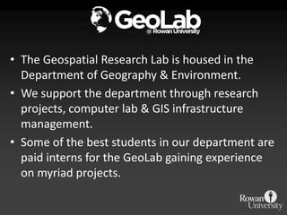
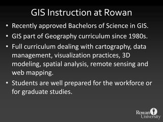
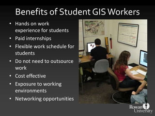
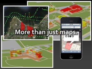
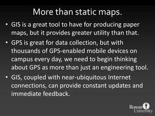
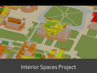
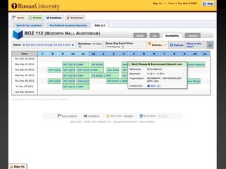
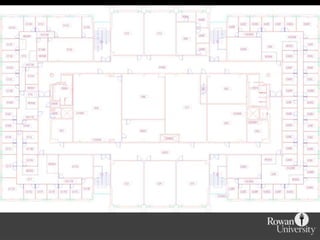
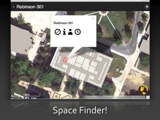
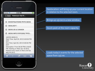
Managing our human environment.
• The Geospatial Research Lab is housed in the
  Department of Geography & Environment.
• We support the department through research
  projects, computer lab & GIS infrastructure
  management.
• Some of the best students in our department are
  paid interns for the GeoLab gaining experience
  on myriad projects.
GIS Instruction at Rowan
• Recently approved Bachelors of Science in GIS.
• GIS part of Geography curriculum since 1980s.
• Full curriculum dealing with cartography, data
  management, visualization practices, 3D
  modeling, spatial analysis, remote sensing and
  web mapping.
• Students are well prepared for the workforce or
  for graduate studies.
Student Involvement
• Without reliable data, GIS is not very powerful.
• Our GIS database began with a CAD document
  produced by a consultant.
• Student efforts have made our DB grow to
  include new features and updates to existing
  data.
• Students participate in all facets of our
  work, from data collection to project
  management.
Benefits of Student GIS Workers
• Hands on work
  experience for students
• Paid internships
• Flexible work schedule for
  students
• Do not need to outsource
  work
• Cost effective
• Exposure to working
  environments
• Networking opportunities
So what exactly is GIS?
Maps.
More than just maps.
More than static maps.
• GIS is a great tool to have for producing paper
  maps, but it provides greater utility than that.
• GPS is great for data collection, but with
  thousands of GPS-enabled mobile devices on
  campus every day, we need to begin thinking
  about GPS as more than just an engineering tool.
• GIS, coupled with near-ubiquitous Internet
  connections, can provide constant updates and
  immediate feedback.
Interior Spaces Project
Space Finder!
http://gis.rowan.edu/projects/finder
          It’s interactive!
Geolocation: will bring up your current location
in relation to the selected room.


Brings up 25Live in a new window.


Quick peek at the room capacity.


Loads today’s events for the selected
space from 25Live.
Technology Used
• User interface is HTML5 and Javascript, using
  JQuery and the Google Maps API. Work is
  underway to switch to the Leaflet mapping API.
• Server side, the data is stored in a PostGIS
  database.
• Node.js is used to power the instant search.
• Floor plans are a map tile cache.
Improving the Space Finder
• Interior photos of every space.
• Using OpenStreetMap/MapQuest, incorporate
  walking directions to spaces on campus.
• Students can have their course schedule
  visualized on a campus map, with walking
  directions.
• Public Safety can have a portal that will support
  emergency response; estimated amount of
  students in a given building, based on schedule
  data
Disseminating Campus Information
• Using GIS through a web interface allows for
  many potential projects that would benefit and
  interest the greater community:
  General campus wayfinding: getting there from here!
  – Campus virtual tours for potential students
  – Public tours of available art and sculpture
  – Walking tour of an arboretum
  – Graffiti and vandalism reporting
  – Public safety emergency response
GIS helps make large, cumbersome
     data easy to understand.
-dvidshub on flickr
-spleeness on flickr
MapMill photo assessment
http://sandy.hotosm.org/
“Check Your Home” app
PhotoMatcher
gis.rowan.edu/projects/sandy
Live Map Service
GIS enables you to make informed
decisions and ask the right questions.
Thank you!

Rowan University          John Reiser
Geospatial Research Lab   Campus GIS Specialist
http://gis.rowan.edu/     reiser@rowan.edu
856-256-4861              856-256-4817
@rowangeolab              @johnjreiser

Mapping the Human Environment

  • 1.
    Managing our humanenvironment.
  • 2.
    • The GeospatialResearch Lab is housed in the Department of Geography & Environment. • We support the department through research projects, computer lab & GIS infrastructure management. • Some of the best students in our department are paid interns for the GeoLab gaining experience on myriad projects.
  • 3.
    GIS Instruction atRowan • Recently approved Bachelors of Science in GIS. • GIS part of Geography curriculum since 1980s. • Full curriculum dealing with cartography, data management, visualization practices, 3D modeling, spatial analysis, remote sensing and web mapping. • Students are well prepared for the workforce or for graduate studies.
  • 4.
    Student Involvement • Withoutreliable data, GIS is not very powerful. • Our GIS database began with a CAD document produced by a consultant. • Student efforts have made our DB grow to include new features and updates to existing data. • Students participate in all facets of our work, from data collection to project management.
  • 5.
    Benefits of StudentGIS Workers • Hands on work experience for students • Paid internships • Flexible work schedule for students • Do not need to outsource work • Cost effective • Exposure to working environments • Networking opportunities
  • 6.
  • 7.
  • 8.
  • 9.
    More than staticmaps. • GIS is a great tool to have for producing paper maps, but it provides greater utility than that. • GPS is great for data collection, but with thousands of GPS-enabled mobile devices on campus every day, we need to begin thinking about GPS as more than just an engineering tool. • GIS, coupled with near-ubiquitous Internet connections, can provide constant updates and immediate feedback.
  • 10.
  • 13.
  • 14.
  • 15.
    Geolocation: will bringup your current location in relation to the selected room. Brings up 25Live in a new window. Quick peek at the room capacity. Loads today’s events for the selected space from 25Live.
  • 16.
    Technology Used • Userinterface is HTML5 and Javascript, using JQuery and the Google Maps API. Work is underway to switch to the Leaflet mapping API. • Server side, the data is stored in a PostGIS database. • Node.js is used to power the instant search. • Floor plans are a map tile cache.
  • 17.
    Improving the SpaceFinder • Interior photos of every space. • Using OpenStreetMap/MapQuest, incorporate walking directions to spaces on campus. • Students can have their course schedule visualized on a campus map, with walking directions. • Public Safety can have a portal that will support emergency response; estimated amount of students in a given building, based on schedule data
  • 18.
    Disseminating Campus Information •Using GIS through a web interface allows for many potential projects that would benefit and interest the greater community: General campus wayfinding: getting there from here! – Campus virtual tours for potential students – Public tours of available art and sculpture – Walking tour of an arboretum – Graffiti and vandalism reporting – Public safety emergency response
  • 19.
    GIS helps makelarge, cumbersome data easy to understand.
  • 20.
  • 21.
  • 23.
  • 24.
  • 25.
  • 26.
  • 27.
  • 28.
  • 29.
    GIS enables youto make informed decisions and ask the right questions.
  • 30.
    Thank you! Rowan University John Reiser Geospatial Research Lab Campus GIS Specialist http://gis.rowan.edu/ reiser@rowan.edu 856-256-4861 856-256-4817 @rowangeolab @johnjreiser

Editor's Notes

  • #3 Our students are currently working on such topics as open data, national-scale base map production, web mapping, tax assessor and planning analysis and 3D modeling.
  • #8 [Sampling of maps including: arboretum, hydrants, bond issue, etc…]So, naturally we produce a set of maps for Rowan’s administration. Being the GIS people, we can produce high-quality maps that are based on our internally-collected data able the campus and any additional data provided to us. We maintain a list of different codes and identifiers so that when data comes from any source, FAMIS, SchoolDude, Banner, 25Live, we can quickly link that data to GIS and depict it graphically.
  • #9 [Sampling of GIS applications, such as web maps, Google Earth, ArcGIS, ArcLogistics…]