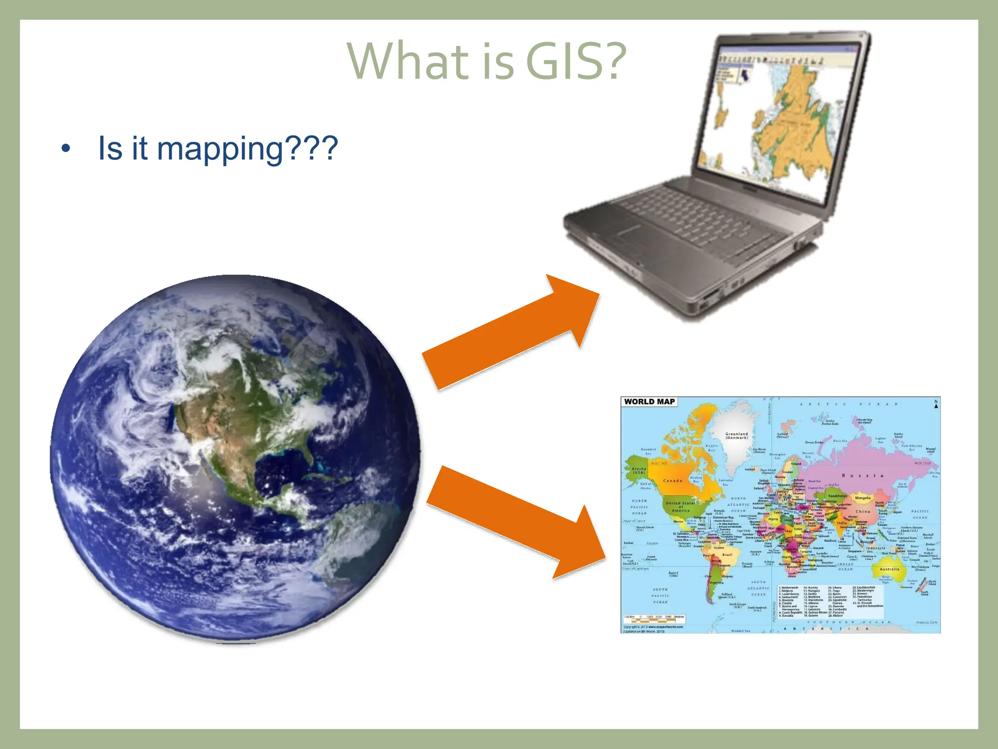
BASICS OF GIS
IRS -502
Session 2024-25 (4th batch)
Institute of Remote Sensing and GIS
Jahangirnagar University
What isGIS?
• Is it mapping???
What isGIS?
•What’s the GI?
Geographic/Geospatial
Information
– information about places on the
earth’s surface
– knowledge about “what is
located where”
What isGIS?
• …four main perspectives of the trailing “S”
Introduction to geographic information systems
What is GIS?
An organized integration
of
➢ Hardware
➢ Software and
➢ Geographic system
What is GIS?
Geographic Information Systems (GIS) is a set of tools that
integrate and link various components: hardware, software,
human capital, data and processes; that capture, store,
manage, analyse and model large amounts of
geographically referenced information in order to meet the
needs related to planning and management
UNGGIM: Americas
Majority of data and information are
associated with some location in space or
referenced to the locations on the earth
GEOGRAPHIC-
Location
Attributes, or the characteristics (data), can be used to symbolize and provide
further insight into a given location
INFORMAT
ION-
Attributes
A seamless operation linking the information to the geography –
which requires hardware, networks, software, data, and
operational procedures
SYSTEM-
Manipulation
FunctionsofGIS
➢Digitization
➢Editing
➢Topology
➢Projection
➢Format conversion
1) Data Acquisition and Preprocessing 2) Database Management, Update and
Retrieval
➢Data retrieval
➢Updation
➢Maintenance
➢Security and, Integration
Storing Data
Personal GDB
File GDB
Desktop GDB
GEODATABASE (GDB)
Enterprise GDB
Workgroup
GDB
SINGLE-
USER
GDB
MULTI-
USER
GDB
Query
• Identifying specific features
• Identifying features based
on conditions
Trinidad Constituencies with an
electorate greater than 28,000
Analysis
Which parcels are
within 50 feet of the road?
Well type Drilled
Building owner Smith
Soil type Sandy
Proximity
Overlay
Network
Display
Maps
Graphs
Reports
Output
Trinidad.mxd
Document
Internet
Paper map
GIS
Data
Trinidad.jpg
Image
Fundamental Data types
1) Spatial Data
Objects or elements that are present in a geographical space or horizon
➢ Map
➢ Image
2) Non-Spatial Data
Not involving Space - Describes the quantitative or qualitative
characteristic of spatial features
For example, area, length & population
Spatial data can be mapped and usually stored as coordinate
and topology
Non-Spatial
Information
Fundamental Data types
Source:2023 World Air Quality Report | IQAir
Spatial Information
Spatial Data
Spatial Data Models
(1) Raster
➢ Defines space as an array of equally sized cells
arranged
contains
in rows and columns. Each cell
an attribute value and location
coordinates
➢ The spatial resolution is determined by the size of
the cell
➢ Data values for a given parameter are stored in
each cell – these values may represent an
elevation in meters above sea level, a land use
class, a plant biomass in grams per square
meter, and so forth
Structure of raster data model showing the matrix structure into row and column
of the cells
The spatial resolution is determined by the size of the cell
Spatial Data
SENTINEL, 10 M
GOOGLE EARTH
Two forms of raster data
1) Continuous Raster
➢Numeric values ranges smoothly from
one location to another
2) Discrete Raster
➢Relative few possible values to
repeat themselves in adjacent cells
Spatial Data
Pm 2.5 Pm 2.5
Spatial Data Models
(2) Vector
➢ Objects are represented as Points, Lines or Polygon
➢ The position of each object is defined by a (series of)
coordinate pairs
➢ A point is described by a single X-Y coordinate pair and by
its name or label e.g. buildings, trees etc.
➢ A line is described by a set of coordinate pairs and by its
name and label e.g. streams, streets, sewers
An area, also called a Polygon, is described by a set of a
coordinate pairs and by its name and label, with the difference
that the coordinate pairs at the beginning and the end are
same .e.g. Land parcels, cities, countries, forest, rock type
etc.
Topological property of vector data model
Set of rules that model the relationships between neighboring points, lines, and polygons and determines
how they share geometry
Connectivity: Information about linkages among spatial objects.
Arc node topology supported through an arc-node list. For
each arc in
the list there is a from node and a to node.
Connected arcs are determined by common node
numbers
Contiguity: Polygons share a common arc. Contiguity allows
the vector data model to determine adjacency
Containment: Geographic features cover distinguishable
area on the surface of the earth. An area is represented by
one or more boundaries defining a polygon
Conversion of vector to rater Conversion of raster to vector
Input
raster
Simplified
Non-Simplified
Spatial Data
Raster Vector
Data structure
Advantage
Simple Complex
Disadvantage
Overlaying Easy and efficient Difficult to perform
Compatible with RS imagery Yes No
Efficient
representation
In-efficient
representation
High spatial variability
Yes Complex
Programming by user
Compact data structure
Disadvantage
No Yes
Advantage
Efficient encoding of topology No Yes
Easy editing No Yes
Network analysis In-efficient Efficient
Map output Less accurate Accurate
Projection transformation In-efficient Efficient
Spatial Data
Raster Vector
Digital remote sensing
images
Primary
GPS measurements
Digital aerial
photographs
Survey
measurements
Scanned Maps
Secondary
Topographic survey
Digital Elevation
Model (DEM)
images
Toponymy data
Non-Spatial Data
Attribute Data
➢ Commonly arranged in tables where a
row is equivalent to one entity and a
column is equivalent to one attribute, or
descriptor, of that entity
➢ Typically, each row relates to a single
object and a geospatial data model
➢ Usually, each object will have multiple
attributes that describe the object
Related
to names
Sequence
or ranking
Non-Spatial Data
Attribute Data Type
Both values are equally important Both values are not equally important
•Date: This data type stores dates and times in the format as
hh:mm:ss’
‘mm/dd/yyyy
Questions Answers
FALSE
➢ The no. of population at each district of Bangladesh
represents nominal data-
TRUE
➢ The data collected via GPS on field is of which type of data
source?
PRIMARY
➢ Excel sheet representing Rows and Columns for different
agriculture data represents?
NON-SPATIAL
➢ Vector data are well-suited for representing continuous
phenomena like elevation or temperature FALSE
➢Thenames of different crop typesof
Bangladesh representnominal data-

GIS Fundamentals, and Basic Introduction

  • 1.
    BASICS OF GIS IRS-502 Session 2024-25 (4th batch) Institute of Remote Sensing and GIS Jahangirnagar University
  • 2.
    What isGIS? • Isit mapping???
  • 3.
    What isGIS? •What’s theGI? Geographic/Geospatial Information – information about places on the earth’s surface – knowledge about “what is located where”
  • 4.
    What isGIS? • …fourmain perspectives of the trailing “S”
  • 5.
    Introduction to geographicinformation systems What is GIS? An organized integration of ➢ Hardware ➢ Software and ➢ Geographic system
  • 6.
    What is GIS? GeographicInformation Systems (GIS) is a set of tools that integrate and link various components: hardware, software, human capital, data and processes; that capture, store, manage, analyse and model large amounts of geographically referenced information in order to meet the needs related to planning and management UNGGIM: Americas
  • 7.
    Majority of dataand information are associated with some location in space or referenced to the locations on the earth GEOGRAPHIC- Location
  • 8.
    Attributes, or thecharacteristics (data), can be used to symbolize and provide further insight into a given location INFORMAT ION- Attributes
  • 9.
    A seamless operationlinking the information to the geography – which requires hardware, networks, software, data, and operational procedures SYSTEM- Manipulation
  • 10.
    FunctionsofGIS ➢Digitization ➢Editing ➢Topology ➢Projection ➢Format conversion 1) DataAcquisition and Preprocessing 2) Database Management, Update and Retrieval ➢Data retrieval ➢Updation ➢Maintenance ➢Security and, Integration
  • 11.
    Storing Data Personal GDB FileGDB Desktop GDB GEODATABASE (GDB) Enterprise GDB Workgroup GDB SINGLE- USER GDB MULTI- USER GDB
  • 12.
    Query • Identifying specificfeatures • Identifying features based on conditions Trinidad Constituencies with an electorate greater than 28,000
  • 13.
    Analysis Which parcels are within50 feet of the road? Well type Drilled Building owner Smith Soil type Sandy Proximity Overlay Network
  • 14.
  • 15.
  • 16.
    Fundamental Data types 1)Spatial Data Objects or elements that are present in a geographical space or horizon ➢ Map ➢ Image 2) Non-Spatial Data Not involving Space - Describes the quantitative or qualitative characteristic of spatial features For example, area, length & population Spatial data can be mapped and usually stored as coordinate and topology
  • 17.
    Non-Spatial Information Fundamental Data types Source:2023World Air Quality Report | IQAir Spatial Information
  • 18.
    Spatial Data Spatial DataModels (1) Raster ➢ Defines space as an array of equally sized cells arranged contains in rows and columns. Each cell an attribute value and location coordinates ➢ The spatial resolution is determined by the size of the cell ➢ Data values for a given parameter are stored in each cell – these values may represent an elevation in meters above sea level, a land use class, a plant biomass in grams per square meter, and so forth Structure of raster data model showing the matrix structure into row and column of the cells
  • 19.
    The spatial resolutionis determined by the size of the cell Spatial Data SENTINEL, 10 M GOOGLE EARTH
  • 20.
    Two forms ofraster data 1) Continuous Raster ➢Numeric values ranges smoothly from one location to another 2) Discrete Raster ➢Relative few possible values to repeat themselves in adjacent cells Spatial Data Pm 2.5 Pm 2.5
  • 21.
    Spatial Data Models (2)Vector ➢ Objects are represented as Points, Lines or Polygon ➢ The position of each object is defined by a (series of) coordinate pairs ➢ A point is described by a single X-Y coordinate pair and by its name or label e.g. buildings, trees etc. ➢ A line is described by a set of coordinate pairs and by its name and label e.g. streams, streets, sewers An area, also called a Polygon, is described by a set of a coordinate pairs and by its name and label, with the difference that the coordinate pairs at the beginning and the end are same .e.g. Land parcels, cities, countries, forest, rock type etc.
  • 22.
    Topological property ofvector data model Set of rules that model the relationships between neighboring points, lines, and polygons and determines how they share geometry Connectivity: Information about linkages among spatial objects. Arc node topology supported through an arc-node list. For each arc in the list there is a from node and a to node. Connected arcs are determined by common node numbers Contiguity: Polygons share a common arc. Contiguity allows the vector data model to determine adjacency Containment: Geographic features cover distinguishable area on the surface of the earth. An area is represented by one or more boundaries defining a polygon
  • 23.
    Conversion of vectorto rater Conversion of raster to vector Input raster Simplified Non-Simplified
  • 24.
    Spatial Data Raster Vector Datastructure Advantage Simple Complex Disadvantage Overlaying Easy and efficient Difficult to perform Compatible with RS imagery Yes No Efficient representation In-efficient representation High spatial variability Yes Complex Programming by user Compact data structure Disadvantage No Yes Advantage Efficient encoding of topology No Yes Easy editing No Yes Network analysis In-efficient Efficient Map output Less accurate Accurate Projection transformation In-efficient Efficient
  • 25.
    Spatial Data Raster Vector Digitalremote sensing images Primary GPS measurements Digital aerial photographs Survey measurements Scanned Maps Secondary Topographic survey Digital Elevation Model (DEM) images Toponymy data
  • 26.
    Non-Spatial Data Attribute Data ➢Commonly arranged in tables where a row is equivalent to one entity and a column is equivalent to one attribute, or descriptor, of that entity ➢ Typically, each row relates to a single object and a geospatial data model ➢ Usually, each object will have multiple attributes that describe the object
  • 27.
    Related to names Sequence or ranking Non-SpatialData Attribute Data Type Both values are equally important Both values are not equally important •Date: This data type stores dates and times in the format as hh:mm:ss’ ‘mm/dd/yyyy
  • 28.
    Questions Answers FALSE ➢ Theno. of population at each district of Bangladesh represents nominal data- TRUE ➢ The data collected via GPS on field is of which type of data source? PRIMARY ➢ Excel sheet representing Rows and Columns for different agriculture data represents? NON-SPATIAL ➢ Vector data are well-suited for representing continuous phenomena like elevation or temperature FALSE ➢Thenames of different crop typesof Bangladesh representnominal data-