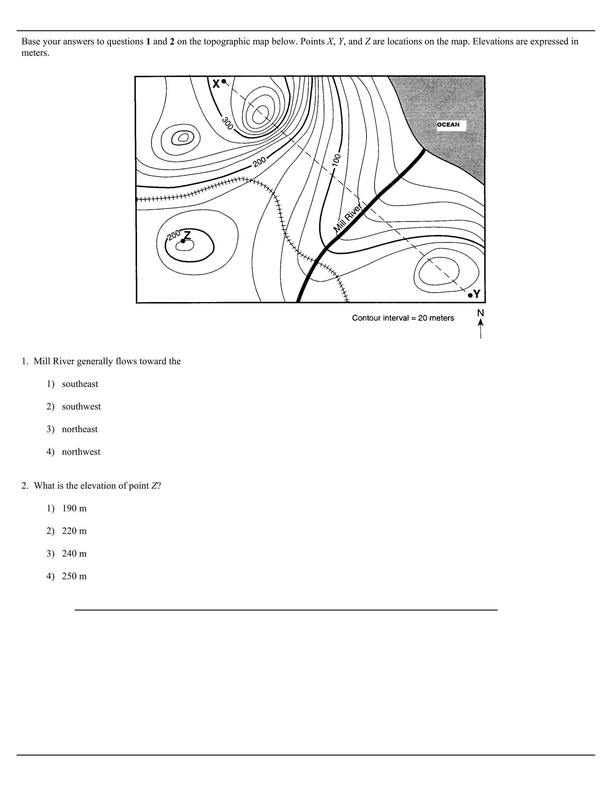
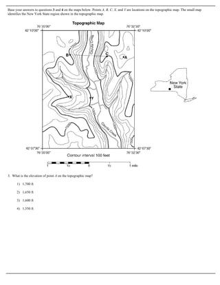
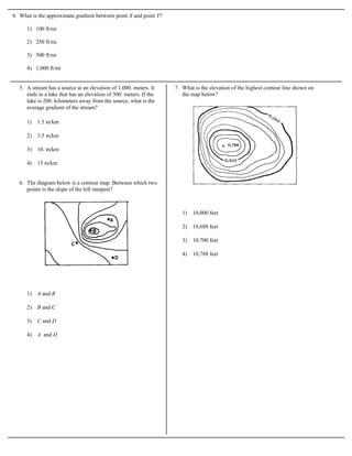
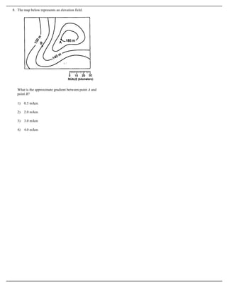
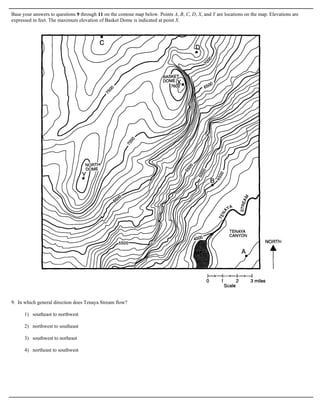
This document contains 15 multiple choice questions about interpreting information from various topographic maps. The questions assess identifying map features like elevation, gradient, contour interval, and stream flow direction at different labeled points on each map. An answer key is provided at the end.

![Answer Key
HW 106 Earth Science Mapping Questions [Oct 06, 2009]
1. 3
2. 2
3. 1
4. 4
5. 2
6. 2
7. 3
8. 2
9. 4
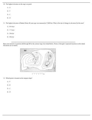
10. 3
11. 1
12. 3
13. 4
14. 3
15. 3](https://image.slidesharecdn.com/contourmaphwproblems-110110131954-phpapp02/85/Contour-map-hw-problems-8-320.jpg)