Downloaded 124 times
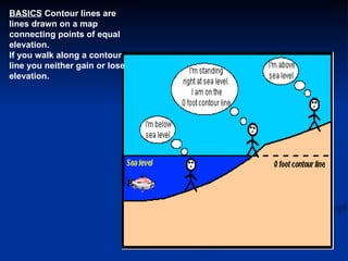
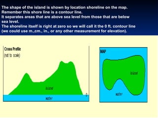
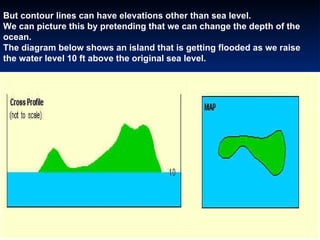
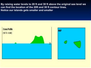
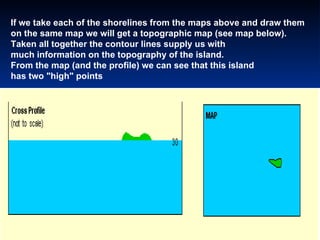
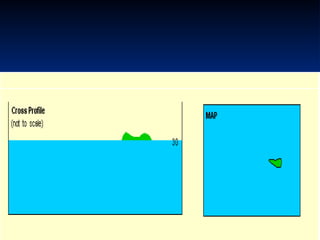
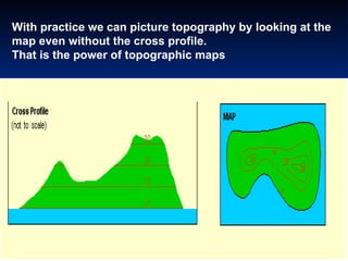
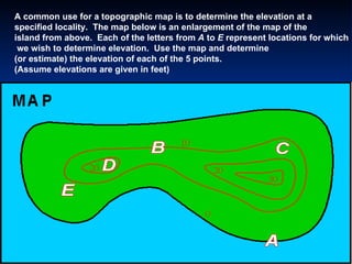
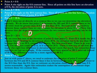
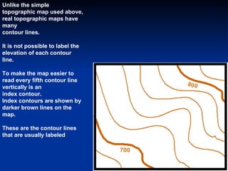
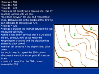


Contour lines on a topographic map connect points of equal elevation, so that walking along a contour line would not result in gaining or losing altitude. Multiple contour lines at increasing elevations can be used to depict changes in landscape and indicate elevations at specific points. While points directly on contour lines allow determining the precise elevation, points between lines require estimating elevation based on the contour interval and relative position between lines. Topographic maps convey detailed terrain information through the use of contour lines.