Download to read offline
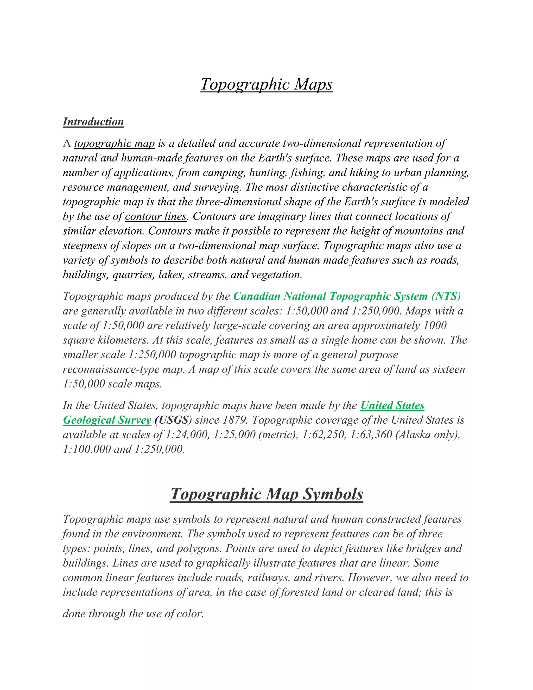
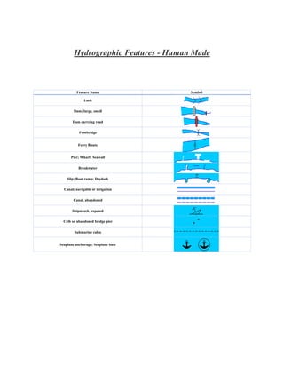
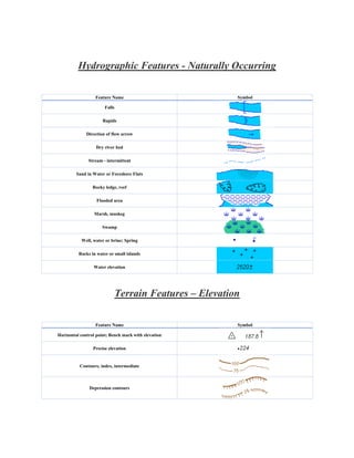
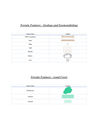
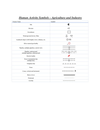


Topographic maps provide detailed representations of natural and human features on Earth's surface using contour lines and symbols. Contour lines connect points of equal elevation and allow three-dimensional shapes to be represented on a two-dimensional map. Topographic maps produced by the Canadian National Topographic System are available at scales of 1:50,000 or 1:250,000. They use standardized symbols to depict features like roads, bridges, and elevation.


![Polymer [ बहुलक ] Chemistry Notes PDF - Irfanullah Mehar - JJ Sir Chemistry.pdf](https://cdn.slidesharecdn.com/ss_thumbnails/polymerchemistrynotespdf-irfanullahmehar-jjsirchemistry-260210172118-3f9b37f7-thumbnail.jpg?width=640&height=640&fit=bounds)


