Downloaded 11 times
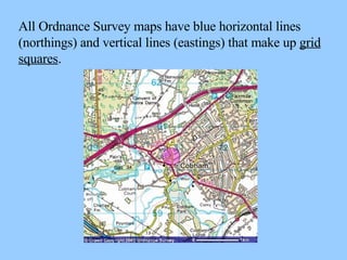
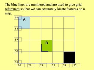
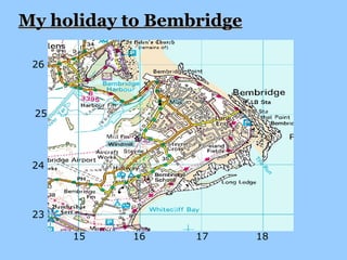
Four-figure grid references are used to accurately locate features on Ordnance Survey maps. All OS maps have a grid of blue horizontal and vertical lines that make up grid squares. Grid references provide the coordinates by giving the northing first, which is the horizontal line number, followed by the easting, which is the vertical line number. Examples are shown of using grid references to locate places on maps.