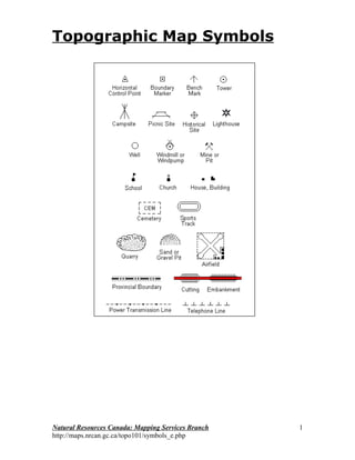
This document provides a summary of topographic map symbols used for various features including:
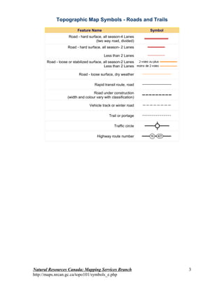
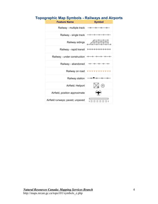
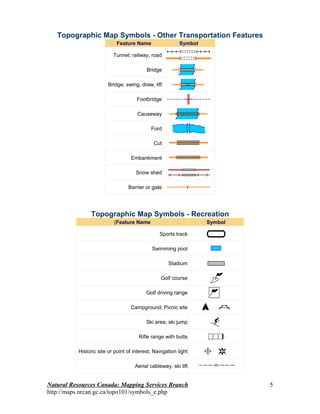
- Roads, trails, railways and other transportation features and their symbols
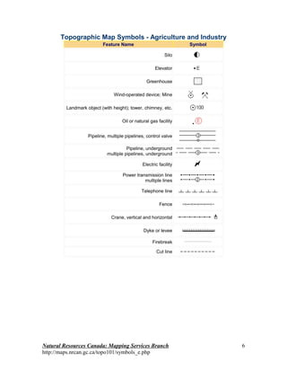
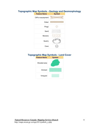
- Recreation, agriculture, industry, buildings, elevation and other man-made or natural landmarks and their symbols
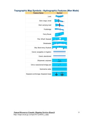
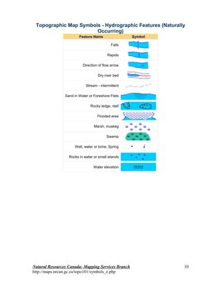
- Hydrographic features both man-made and natural occurring and their symbols
It includes tables that list specific features commonly mapped and the symbols used to represent each one.