Traffic engineering aims to achieve efficient operation, safety, economic design and minimize environmental impact. Highway design considers factors like traffic volume, design speed, vehicle type, terrain, and level of service. Design hourly volume is used for calculations and is typically the 30th highest hourly volume. The design vehicle is the largest vehicle expected to frequently use the road and determines design standards. A highway cross section includes travel lanes, shoulders, medians, barriers, curbs, gutters, sidewalks and slopes. Right of way width must accommodate all highway elements and potential future expansion.
The clear distance ahead of vehicle which is visible to the driver is known as sight distance
The minimum distance within which a driver can safely stop his vehicle without any collision with some vehicle, animal or any other object is known as stopping sight distance.
The clear distance ahead of vehicle which is visible to the driver is known as sight distance
The minimum distance within which a driver can safely stop his vehicle without any collision with some vehicle, animal or any other object is known as stopping sight distance.
this is a brief introduction to various traffic engineering basic characteristics which are useful in designing any corridor or passage with safety & reliability.
traffic volume studies pdf
traffic studies pdf
types of traffic engineering studies
traffic volume study report
traffic volume study
traffic impact studies
types of traffic studies
traffic safety studies
average daily traffic calculation
traffic volume formula
how to calculate adt traffic
calculating adt from peak hour
traffic volume growth factor formula
traffic growth rate calculator
aadt to peak hour volume
calculate dhv from adt
The content of presentation slides describe the concept of road safety auditing and its application starting from the planning of the road project until opening the road.
Highway planning and alignment: Different modes of transportation – historical Development of road construction- Highway Development in India –Classification of roads- Road pattern
– Highway planning in India- Highway alignment - Engineering Surveys for alignment – Highway Project- Important Transport/Highway related agencies in India. PMGSY project.
Introduction about IRC, NRRDA
Alignment: The position or the layout of the central line of the highway on the ground is called the alignment.
Highway Alignment includes both
a) Horizontal alignment includes straight and curved paths, the deviations and horizontal curves.
b) Vertical alignment includes changes in level, gradients and vertical curves.
The overtaking sight distance or passing sight distance is measured along the center line of the road over which a driver with his eye level 1.2 m above the road surface can see the top of an object 1.2 m above the road surface.
passing sight distance formula
aashto intersection sight triangles
highway sight distance
stopping sight distance formula
stopping sight distance calculator
headlight sight distance equation
headlight sight distance
aashto sight triangle standards
stopping site distance
safe stopping sight distance
aashto stopping sight distance
sight distance in geometric design
stopping sight distance example
ssd stopping sight distance
stopping site distance calculation
headlight sight distance
Sight distance is the length of road visible ahead of the driver at any instance.
Sight distance available at any location of the carriageway is the actual distance a driver with his eye level at a specified height above the pavements surface has visibility of any stationary or moving object of specified height which is on the carriageway ahead.
The sight distance between the driver and the object is measured along the road surface.
accident report for cars
form for accident report
blue report for accident
accident reports for nc
the best study method
effective study methods
causes of accidents
factors affecting accidents
how accident data are collected
The attached powerpoint presentation contains details about Traffic aids - Street Furniture. Useful for CE6006 - Traffic Engineering and Management - Elective - for Civil Engineering Students, (7th Semester - Anna University Affliated Institutions)
International journal of Transportation Engineering and Traffic System
provides a platform that delivers high impact article and research reviews in the field of transportation engineering, focusing on railroad, harbors, airport and highway engineering. Journal also covers intelligent transportation system, traffic operations and control and other related technological advancements.
Hybrid optimization of pumped hydro system and solar- Engr. Abdul-Azeez.pdffxintegritypublishin
Advancements in technology unveil a myriad of electrical and electronic breakthroughs geared towards efficiently harnessing limited resources to meet human energy demands. The optimization of hybrid solar PV panels and pumped hydro energy supply systems plays a pivotal role in utilizing natural resources effectively. This initiative not only benefits humanity but also fosters environmental sustainability. The study investigated the design optimization of these hybrid systems, focusing on understanding solar radiation patterns, identifying geographical influences on solar radiation, formulating a mathematical model for system optimization, and determining the optimal configuration of PV panels and pumped hydro storage. Through a comparative analysis approach and eight weeks of data collection, the study addressed key research questions related to solar radiation patterns and optimal system design. The findings highlighted regions with heightened solar radiation levels, showcasing substantial potential for power generation and emphasizing the system's efficiency. Optimizing system design significantly boosted power generation, promoted renewable energy utilization, and enhanced energy storage capacity. The study underscored the benefits of optimizing hybrid solar PV panels and pumped hydro energy supply systems for sustainable energy usage. Optimizing the design of solar PV panels and pumped hydro energy supply systems as examined across diverse climatic conditions in a developing country, not only enhances power generation but also improves the integration of renewable energy sources and boosts energy storage capacities, particularly beneficial for less economically prosperous regions. Additionally, the study provides valuable insights for advancing energy research in economically viable areas. Recommendations included conducting site-specific assessments, utilizing advanced modeling tools, implementing regular maintenance protocols, and enhancing communication among system components.
Student information management system project report ii.pdfKamal Acharya
Our project explains about the student management. This project mainly explains the various actions related to student details. This project shows some ease in adding, editing and deleting the student details. It also provides a less time consuming process for viewing, adding, editing and deleting the marks of the students.
About
Indigenized remote control interface card suitable for MAFI system CCR equipment. Compatible for IDM8000 CCR. Backplane mounted serial and TCP/Ethernet communication module for CCR remote access. IDM 8000 CCR remote control on serial and TCP protocol.
• Remote control: Parallel or serial interface.
• Compatible with MAFI CCR system.
• Compatible with IDM8000 CCR.
• Compatible with Backplane mount serial communication.
• Compatible with commercial and Defence aviation CCR system.
• Remote control system for accessing CCR and allied system over serial or TCP.
• Indigenized local Support/presence in India.
• Easy in configuration using DIP switches.
Technical Specifications
Indigenized remote control interface card suitable for MAFI system CCR equipment. Compatible for IDM8000 CCR. Backplane mounted serial and TCP/Ethernet communication module for CCR remote access. IDM 8000 CCR remote control on serial and TCP protocol.
Key Features
Indigenized remote control interface card suitable for MAFI system CCR equipment. Compatible for IDM8000 CCR. Backplane mounted serial and TCP/Ethernet communication module for CCR remote access. IDM 8000 CCR remote control on serial and TCP protocol.
• Remote control: Parallel or serial interface
• Compatible with MAFI CCR system
• Copatiable with IDM8000 CCR
• Compatible with Backplane mount serial communication.
• Compatible with commercial and Defence aviation CCR system.
• Remote control system for accessing CCR and allied system over serial or TCP.
• Indigenized local Support/presence in India.
Application
• Remote control: Parallel or serial interface.
• Compatible with MAFI CCR system.
• Compatible with IDM8000 CCR.
• Compatible with Backplane mount serial communication.
• Compatible with commercial and Defence aviation CCR system.
• Remote control system for accessing CCR and allied system over serial or TCP.
• Indigenized local Support/presence in India.
• Easy in configuration using DIP switches.
CW RADAR, FMCW RADAR, FMCW ALTIMETER, AND THEIR PARAMETERSveerababupersonal22
It consists of cw radar and fmcw radar ,range measurement,if amplifier and fmcw altimeterThe CW radar operates using continuous wave transmission, while the FMCW radar employs frequency-modulated continuous wave technology. Range measurement is a crucial aspect of radar systems, providing information about the distance to a target. The IF amplifier plays a key role in signal processing, amplifying intermediate frequency signals for further analysis. The FMCW altimeter utilizes frequency-modulated continuous wave technology to accurately measure altitude above a reference point.
Sachpazis:Terzaghi Bearing Capacity Estimation in simple terms with Calculati...Dr.Costas Sachpazis
Terzaghi's soil bearing capacity theory, developed by Karl Terzaghi, is a fundamental principle in geotechnical engineering used to determine the bearing capacity of shallow foundations. This theory provides a method to calculate the ultimate bearing capacity of soil, which is the maximum load per unit area that the soil can support without undergoing shear failure. The Calculation HTML Code included.
We have compiled the most important slides from each speaker's presentation. This year’s compilation, available for free, captures the key insights and contributions shared during the DfMAy 2024 conference.
Using recycled concrete aggregates (RCA) for pavements is crucial to achieving sustainability. Implementing RCA for new pavement can minimize carbon footprint, conserve natural resources, reduce harmful emissions, and lower life cycle costs. Compared to natural aggregate (NA), RCA pavement has fewer comprehensive studies and sustainability assessments.
Final project report on grocery store management system..pdfKamal Acharya
In today’s fast-changing business environment, it’s extremely important to be able to respond to client needs in the most effective and timely manner. If your customers wish to see your business online and have instant access to your products or services.
Online Grocery Store is an e-commerce website, which retails various grocery products. This project allows viewing various products available enables registered users to purchase desired products instantly using Paytm, UPI payment processor (Instant Pay) and also can place order by using Cash on Delivery (Pay Later) option. This project provides an easy access to Administrators and Managers to view orders placed using Pay Later and Instant Pay options.
In order to develop an e-commerce website, a number of Technologies must be studied and understood. These include multi-tiered architecture, server and client-side scripting techniques, implementation technologies, programming language (such as PHP, HTML, CSS, JavaScript) and MySQL relational databases. This is a project with the objective to develop a basic website where a consumer is provided with a shopping cart website and also to know about the technologies used to develop such a website.
This document will discuss each of the underlying technologies to create and implement an e- commerce website.
Forklift Classes Overview by Intella PartsIntella Parts
Discover the different forklift classes and their specific applications. Learn how to choose the right forklift for your needs to ensure safety, efficiency, and compliance in your operations.
For more technical information, visit our website https://intellaparts.com
1-Introduction & Concepts-Traffic ( Transportation and Traffic Engineering Dr. Sheriff El-Badawy )
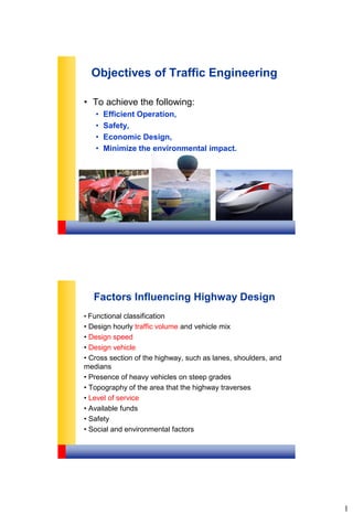
1. 1
Objectives of Traffic Engineering
• To achieve the following:
• Efficient Operation,
• Safety,
• Economic Design,
• Minimize the environmental impact.
Factors Influencing Highway Design
• Functional classification
• Design hourly traffic volume and vehicle mix
• Design speed
• Design vehicle
• Cross section of the highway, such as lanes, shoulders, and
medians
• Presence of heavy vehicles on steep grades
• Topography of the area that the highway traverses
• Level of service
• Available funds
• Safety
• Social and environmental factors
2. 2
Design Traffic Volumes
• Average Daily Traffic (ADT):
• Daily basis
• Both directions
• Annual Average Daily Traffic (AADT):
• Annual traffic averaged on daily basis
• Both directions
• Design Hourly Volume (DHV):
• Traffic volume used for design calculations
• Typically between the 10th and 50th highest
volume hour of the year (30th highest is most
common)
Minimum Design Speeds for Local Rural Roads
Minimum Design Speeds for Rural Collectors
SOURCE: A Policy on Geometric
Design of Highways and Streets,
AASHTO, 2001.
3. 3
Design Vehicle
• A design vehicle is selected to represent all vehicles on
the highway.
• Its weight, dimensions, and operating characteristics are
used to establish the design standards of the highway
such as the turning radii at intersections, max. grades,
etc.
• The vehicle type selected as the design vehicle is the
largest that is likely to use the highway with
considerable frequency.
Design Vehicle Dimensions
SOURCE: A Policy on Geometric
Design of Highways and Streets,
AASHTO, 2001.
4. 4
Design Vehicle
Passenger Car (P) Single Unit Truck (SU)
Intercity Bus (BUS-40) Intercity Bus (BUS-45)
SOURCE: A Policy on Geometric
Design of Highways and Streets,
AASHTO, 2001.
Design Vehicle
School Bus (S-BUS-36) Semi-Trailer (WB-40)
Semi-Trailer (WB-65) SOURCE: A Policy on Geometric
Design of Highways and Streets,
AASHTO, 2001.
5. 5
Design Vehicle
• Passenger car (P) the main traffic generator in a parking lot
or series of parking lots.
• Single-Unit Truck (SU) intersection design of residential
streets and park roads.
• City transit bus state highway intersections with city streets
that are designated bus routes and relatively few large trucks.
• Large School Bus (84 passengers) or Conventional School
Bus (65 passengers) may be used for the design of
intersections of highways with low-volume county highways and
township/local roads under 400 ADT.
• WB-65 or 67 is the minimum size of the design vehicle at
intersections of freeway ramp terminals and arterial crossroads,
and at intersections of state highways and industrialized streets
that carry high volumes of traffic.
Cross Section Elements
.
6. 6
Highway Cross Section Elements
• Travel Lanes (Carriageways)
• Shoulders
• Medians
• Roadside Barriers and
Guard Rails
• Curbs and Gutters
• Sidewalks
• Cross slopes
• Side slopes
Principal Elements Marginal Elements
Typical Cross Section of Rural Road
Highway Engineering, Tonias, D.
10. 10
Typical Cross Section in Urban Road
without Median
Typical Cross Section in Urban Road
without Median
11. 11
Typical Cross Section of Urban Road
with Median
Typical Cross Section in Urban Road
with Median
12. 12
Travel Lanes
• In general, the number of travel lanes should be based on
the design traffic volume and level of service.
• No. of travels lanes in both directions are usually equal.
• Travel lanes generally range in width from 10 to 13 ft.
(3 to 3.95 m).
• Typically is 12 ft (3.65 m)
• Under extreme circumstances, a width of 9 ft (2.70 m) may
be used.
• Lane width affects the LOS.
Minimum Lane Width for Rural Roads
LocalCollector
Arterial
Functional Class
minorMajor
3.03.33.63.6
Min. Lane Width
(m)
LocalCollector
Arterial
Functional Class
minorMajor
3.03.33.63.6
Min. Lane Width
(m)
Minimum Lane Width for Urban Roads
LocalCollector
Arterial
Functional Class
minorMajor
3.03.33.63.6
Min. Lane Width
(m)
LocalCollector
Arterial
Functional Class
minorMajor
2.703.33.63.6
Min. Lane Width
(m)
13. 13
Shoulder
• Shoulders usually range in width from 2 ft (0.6 m) for minor
local roads. (6 to 8 ft – 1.8 to 2.45 m- is preferred) to 12 ft
(3.65 m) for major highways.
• Typical cross slope is 3% for paved shoulders and 5% for
unpaved shoulders .
Graded and Usable Shoulder
Rounding = 1.2 to 1.8 m
14. 14
Shoulders (Cont’d)
• Shoulders may be surfaced either full or partial width.
• Materials used to surface shoulders include:
• Gravel,
• Crushed rock,
• Chemical additives,
• Bituminous surface treatments,
• Various forms of asphaltic or concrete pavements.
• Bituminous and concrete-surfaced shoulders should
be sloped from 2 to 6%,
• Gravel or crushed-rock shoulders from 4 to 6 %,
Medians
A median is a wide strip of a highway used to:
• Separate traffic traveling in opposite directions.
• Offer a recovery area for out-of-control vehicles.
• Provide an area for emergency stopping.
• Provide storage area for left-turning and U-turning
vehicles.
• Decrease the amount of headlight glare.
• Providing temporary lanes during maintenance operations.
• Allow for expansion to future lanes.
• Medians can be Flushed – Depressed- Raised.
15. 15
Minimum Median Width for Rural Roads
LocalCollector
Arterial
Functional Class
minorMajor
3.03.33.63.6Min. Width (m)
Minimum Median Width for Urban Roads
LocalCollector
Arterial
Functional Class
minorMajor
3.03.33.63.6Min. Width (m)
*Minimum width = 15 m for desert roads
Sharja, UAE
Moscow, Idaho UI Campus
16. 16
Medians
Cross Slope
• The slope selected generally depends on the type of
pavement used.
• Typical cross slope of 1.5 to 3% High surface type
• Cross slopes greater than 2% should be avoided (for
safety).
• Typical cross slope of 2 to 6% Low surface type
17. 17
Basic Cross Slope Arrangements for Divided Highways
(a) Each Pavement Slopes Two Ways
(b) Each Pavement Slopes One Way
A curb is a raised element that is used, among other things,
to denote the edge of a roadway.
Functions of curbs
• Drainage control
• Roadway edge delineation
• Enhanced appearance
• Right-of-way reduction
• Delineation of pedestrian walkways
Curbs
سم 25
سم 12
سم 20
لت ف س ال ل ي نهائ ال سوب ن م ال
م قائ ال ساس اال قه ب ط
سم 10 سمك ب شطه مم ه سان خر
سم 15
سم 10
سم 15
سم 15
18. 18
Curbs
• Barrier Curbs
• The purpose of a barrier curb is to prevent or limit the possibility of
a vehicle’s leaving the roadway.
• Barrier curbs should not be used when the design speed is greater
than 40 mph (60km/hr).
• Mountable Curbs
• A mountable curb offers the advantage that a vehicle can cross it
when necessary.
19. 19
Gutters
• Gutters or drainage ditches are usually located on the
pavement side of a curb to provide the principal
drainage facility for the highway.
• They are sloped to prevent any hazard to traffic.
• Cross slopes of 5 to 8%.
• Width 0.3 m to 1.8 m wide.
• Gutters can be designed as V-type sections or as
broad, flat, rounded sections.
20. 20
Sidewalks
• Sidewalks are an integral part of city roads,
sometimes provided in rural areas.
• Min. 0.6 m for maintenance of bridges.
• In residential areas the sidewalk width varies between
1.2 to 2.4 m.
ÊÝÕ í áåÑÕ í Ý ÇáãÔÇå
ه يوس ت ل ل مس 3 سمك يه ت ن سم ا ه مون قه ب ط
يه ت ي مو ادلل ار الاجح من ساس ا قه ب ط مس 25
مس 3 ك مس مس 30 * 30 عي راب ت الط ب
كادلم عد ب مس 15 سمك فه ي ظ ن رمل قه ب ط
يه ناسرخ ه ردور ب 100 15 30 15 12,5
يه ت ن امس ه ناسرخ مس 10
سم 4 سمك يه سطح لت ف س ا قه ب ط
سم 6 سمك طه راب لت ف س ا قه ب ط
ير س ك ت احجار من ساس ا قه ب ط
دمك ال عد ب سم 25 سمك سارات ك
?1,5
Sidewalk Detail
21. 21
Min. Width of Sidewalks
• 1.5 m in residential areas.
• 2.5 m in industrial and commercial areas.
• 3.0 m in pedestrian bridges.
• 3.0 m in pedestrian crossings
Source: Egyptian Code (2008)
Minimum Grade
• Minimum grades depend on the drainage conditions of
the highway.
• Zero percent grades may be used on uncurbed
pavements with adequate cross slopes.
• For curbed pavements, a minimum of 0.5 percent which
may be reduced to 0.3 percent on high-type pavement
constructed on suitably crowned, firm ground can be
used.
23. 23
20cm
8cm
20cm
8cm
1.0m
15
175165
60
17
85
20
Base Conc. Class 210/50
Const. Joint (Level)
Equally Spaced Preset in Base Concrete
3 NO. Each Side Per 2.5m Length of Unit
Staggered Dowel Bars ? 32 0.60m Long
Barrier Conc.
2cm Chamfer
1025
15 15
R=3
50
R=25
Reflector
Reflector
Colour: Red
Every 6.0m
Spacing:
Pre-Cast New Jersey Barrier Double Face
7
Paved shoulder
30
100
(Cast in situ)
30
24. 24
Right of Way
• Total land area acquired for the construction of a highway.
• The width should be sufficient to accommodate:
• All the elements of the highway cross section,
• Any planned widening of the highway,
• Public-utility facilities that will be installed along the highway.
The desirable minimum right of way
Two-lane urban collectors 12 m and 18 m.
Two-lane urban arterials 25 m.
Undivided four-lane arterials 19 m to 32 m.
Divided arterials 36 to 90 m.