Ppt on remote sensing system
•Download as PPT, PDF•
12 likes•6,391 views
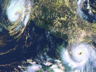
Remote sensing involves gathering information about an object without direct contact. It has been used since the 1850s for aerial photography from balloons and developed further for military purposes. Satellites now allow remote sensing on a global scale. Common applications include geology, environmental monitoring, forestry, agriculture, and mapping land use. Remote sensing uses sensors that detect reflected electromagnetic radiation to form images. Key concepts include spectral signatures, spatial and spectral resolution, and multispectral imaging. Active sensors like radar and lidar also measure distance using electromagnetic pulses.
Report
Share
Report
Share

Recommended
Stereoscopic Parallax
In this I have discussed how to estimate height of an object from aerial photo and steps to make a stereo pair
Aerial photography abraham thomas
Aerial photography involves taking photographs from aircraft or other flying objects. It provides a synoptic view of large areas that allows for identifying small-scale features and spatial relationships. Interpreting aerial photographs involves detecting, recognizing, analyzing, deducing, classifying, and determining the accuracy of identified objects based on their tone, texture, pattern, shape, shadow, size, place, and associations with other objects. Key elements that aid interpretation include tone, texture, pattern, shape, shadow, and size.
Aerial photography- Concept and Terminologies
Aerial photography involves taking photographs of the ground from an elevated perspective using cameras mounted on aircraft or drones. The key aspects of aerial photography include:
- Photos have geometric distortions that can be corrected through photogrammetry to allow for accurate measurements, mapping, and 3D modeling.
- Factors like camera tilt, flight height, and relief displacement of objects must be accounted for.
- Aerial photos have specific scales depending on the flight altitude, and these scales are larger than typical maps, showing greater detail of a smaller area.
- Aerial photos find diverse uses in fields like geology, agriculture, land use planning, and environmental monitoring by providing overhead perspectives not available from ground level.
Thermal remote sensing
The document provides an overview of thermal remote sensing. It discusses key concepts like the thermal infrared spectrum, atmospheric windows and absorption bands, fundamental radiation laws, thermal data acquisition using sensors, and applications in mapping forest fires, urban heat islands, volcanoes, and military purposes. Thermal remote sensing allows measuring the true temperature of objects and detecting features not visible in optical remote sensing. It has advantages like temperature measurement but maintaining sensors at low temperatures can be challenging.
Remote Sensing And GIS Application In Mineral , Oil , Ground Water MappingMin...
Remote sensing and GIS techniques can be used to map minerals, oil, and groundwater. For minerals, accommodation zones between faults can localize magmatic material and mineralized fluids, and be identified in satellite images showing brecciation and fault patterns. Oil and gas exploration uses airborne magnetic and gravity surveys integrated with high resolution satellite imagery and DEMs for 3D visualization. Groundwater mapping involves literature review, image interpretation to create spatial databases, field reconnaissance, spatial analysis of data, and identifying recommended recharge structures by analyzing IRS satellite images, groundwater table maps, DEM elevation data, and resistivity curve modeling from electrical soundings.
Remote sensing
Remote sensing involves collecting data about objects from a distance without direct contact. It works by measuring reflected electromagnetic energy from targets using sensors on platforms like satellites. There are several key components, including the energy source (sun), its interaction with the atmosphere and earth surfaces, sensors to record the energy, and processing of the data. Remote sensing provides digital imagery that can be analyzed for applications like land use mapping. Global positioning systems (GPS) provide location data by triangulating signals from satellite constellations. India is developing its own regional GPS network called IRNSS and has also launched satellites for other countries to gain experience in space technologies.
Introduction to Landsat
Landsat is a series of Earth observation satellite missions jointly managed by NASA and the U.S. Geological Survey. The first Landsat satellite was launched in 1972 and subsequent satellites were launched through 2013 to acquire global land data. Landsat satellites carry imaging sensors to collect medium-resolution multi-spectral images of the Earth's surface on a 16-day repeat cycle. The images are used to observe changes in land use, monitor deforestation, and detect water pollution among other applications. Six Landsat satellites have been launched to date, each carrying improved sensors from the Multi-Spectral Scanner to the Enhanced Thematic Mapper Plus. Landsat provides the longest continuous space-based record of Earth's surface.
.remote sensing.Ece 402 unit-2
physics of remote sensing,ideal remote sensing,swath,platform,sensor,orbit and its characteristics,electromagnetic radiations,EMR solar radiations and its application,shortwave and long waves,spectrul reflectance curve, resolution AND multi concept,FCC,
Applications of remote sensing in geological aspects
Remote sensing uses sensors on airborne or spaceborne platforms to detect and record electromagnetic radiation from the Earth's surface. It has two main phases - data acquisition through sensors and data analysis. In geology, remote sensing is used to map lithology, structural features, and monitor hazards. It helps identify rock types and structures that can indicate mineral or oil and gas deposits. Remote sensing provides synoptic data to study geomorphology, hydrology, and other Earth processes over large areas.
Optical remote sensing
This document discusses different types of remote sensing systems used in civil engineering, including optical, photogrammetric, thermal, multispectral, hyperspectral, and panchromatic systems. It provides examples and specifications of various sensors, such as MODIS, AVIRIS, IKONOS, and WorldView. The document also covers digital image formats, photogrammetry, image distortions and displacements, reference ellipsoids, relief displacement, and methods of measuring heights from aerial photographs.
LISS
The document describes the specifications of several sensors used in Indian remote sensing satellites. LISS-I operated in four spectral bands with a resolution of 72m and swath width of 148km. LISS-II had higher resolution of 36.25m and smaller swath of 74km across four bands. LISS-III covered a 142km swath at 23.5m resolution in green, red, NIR and SWIR bands. LISS-IV could operate panchromatically at 5.8m or multispectrally like LISS-III with a swath of 23.9-70km for Resourcesat-1 or 70km for Resourcesat-2.
Introduction to Remote Sensing
The document discusses remote sensing, including its definition, history, applications, and the underlying physics and principles. Remote sensing is defined as obtaining information about an object without physical contact using electromagnetic energy. Its applications include flood and drought monitoring, weather mapping, and land use planning. The history of remote sensing began with cameras on balloons and airplanes in the 1840s and expanded to satellite platforms starting in the 1960s. The document also covers the electromagnetic spectrum, atmospheric interactions, surface reflections, and sensor selection considerations.
Remote Sensing - Fundamentals
This document discusses remote sensing fundamentals, including the types of sensors, physics, and platforms used. It describes two main types of sensors - passive sensors that record radiation from the sun and active sensors that provide their own illumination. The key aspects of electromagnetic radiation used in remote sensing are wavelength and frequency. Platforms can be ground, air, or space-based, with satellites and aircraft being most common. Remote sensing relies on measuring electromagnetic energy reflected or emitted from the target area.
Digital image processing
this presentation briefly describes the digital image processing and its various procedures and techniques which include image correction or rectification with remote sensing data/ images. it also contains various image classification techniques.
Landsat
Landsat was a joint NASA/USGS satellite program designed to systematically acquire global land surface images. Landsat 1 was launched in 1972 as the first satellite dedicated to observing Earth's land areas. Subsequent Landsat satellites carried improved sensors with higher spatial, spectral, and radiometric resolutions. Landsat provides repetitive coverage of the entire global land mass with images useful for mapping and monitoring land use change over time.
Microwave remote sensing
Microwave remote sensing uses both passive and active sensors operating within the wavelength range of 1mm to 1m. Passive sensors such as microwave radiometers record naturally emitted energy, while active sensors like synthetic aperture radar (SAR) generate their own electromagnetic signals. SAR is an example of side-looking radar that uses signal processing to synthesize a very long antenna and improve azimuth resolution. Radar imagery exhibits characteristics like penetration of vegetation and clouds, day/night imaging, and sensitivity to surface properties. However, it also shows distortions from terrain relief and speckle noise from signal interference.
Basics of remote sensing, pk mani
This document provides an outline and overview of the topics covered in a course on remote sensing and its applications in soil resource mapping. The outline includes definitions of remote sensing, the history and development of the technology, principles of electromagnetic radiation and its interactions with targets, spectral signatures, resolutions, satellite orbits, and applications of remote sensing. Examples are given of different remote sensing systems like the human eye. A definition of remote sensing is provided. The history section describes early developments dating back to the 1600s and important events in the 1900s. The document gives an overview of active and passive remote sensing as well as elements involved like the energy source, radiation, recording, transmission and more. Remote sensing principles, websites and literature are also listed.
SPOT
The SPOT satellite system includes several satellites (SPOT 1-5) operated by France and Belgium to observe and monitor Earth. Key specifications of the SPOT satellites include their launch dates between 1986-2002 using Ariane rockets, orbital parameters, onboard instruments including high-resolution visible and infrared cameras, recording and transmission capabilities, and inclusion of vegetation monitoring instruments on some satellites. The SPOT satellites provide high-resolution optical imagery of Earth to study resources, climate, human activities and natural phenomena.
SAR Interferometry Technique
This content presents concept and methodology of SAR Interferometry technique (software, and processing steps based on GMTSAR)
Remote sensing - Sensors, Platforms and Satellite orbits
Remote sensing uses sensors on various platforms to detect electromagnetic radiation from the Earth. Sensors can be passive, detecting natural radiation, or active, emitting their own radiation. Platforms include ground-based, airborne, and space-based options at increasing heights. Space-based platforms include low Earth orbit satellites in polar or sun synchronous orbits for frequent coverage, and geostationary satellites for continuous coverage of fixed regions. Different sensors have varying spatial, spectral, radiometric, and temporal resolutions to detect features on Earth.
Thermal remote sensing and its applications
Thermal Remote Sensing and its applications. You have also know the applications of thermal remote sensing with clarity.
Introduction to aerial photography and photogrammetry.ppt
Aerial photography and photogrammetry are techniques used in remote sensing. Aerial photography involves taking photographs from aircraft and has been used since the 1850s. Photogrammetry uses photographs to measure and obtain spatial information about the objects and terrain photographed. It allows for the creation of topographic maps, cadastral maps, and large-scale construction plans more quickly and economically than traditional ground-based surveying. While aerial photography and photogrammetry provide advantages over field surveys, some on-site control and verification is still needed.
Historical Development of Photogrammetry
This document summarizes the historical development of photogrammetry. It describes how photogrammetry evolved from early plane table photogrammetry between 1850-1900, to analog photogrammetry between 1900-1960, to analytical photogrammetry between 1960-present. It also discusses how digital photogrammetry is just beginning. The document provides background on important historical figures and developments in the field, including the first uses of aerial photography in the late 19th century and how photogrammetry has been used to create topographic maps since the 1840s.
Introduction to remote sensing and gis
This document provides an overview of a course on applying remote sensing and geographical information systems in civil engineering. The course consists of lectures and seminars covering topics in remote sensing and GIS. For remote sensing, lectures will discuss principles, sensors, data processing, platforms, image processing software, and microwave sensing. For GIS, lectures will cover concepts, data structures, software tools like ArcGIS, spatial queries, and applications in hydrological modeling. The goal of the course is to provide students with an understanding of remote sensing and GIS and their integration, and to learn basic skills in working with related data and software.
Spectral signatures
Spectral signatures are the specific combination of emitted, reflected or absorbed electromagnetic radiation (EM) at varying wavelengths which can uniquely identify an object. Here, i have focused on the spectral signature of water and the various micro-process that are responsible for it.
Indian remote sensing satellites
Indian remote sensing satellites past and future launches with payloads. operational RS satellites detail.
Height measurement of aerial photography
This document discusses various methods for measuring height from aerial photographs:
1. Relief displacement - The shift in location of an object in a photo due to its height. Height can be calculated using the object's displacement, flying height, and distance from the photo center.
2. Shadow length - An object's height is calculated using the length of its shadow, the sun's angle, and trigonometric functions.
3. Stereoscopic parallax - Taking photos of the same object from different positions and measuring the difference in the object's position between photos. Differential and absolute parallax values are used to calculate height.
Remote Sensing PPT
This document provides an overview of remote sensing through a seminar presented by Ashwathy Babu Paul. It defines remote sensing as obtaining information about an object without physical contact through electromagnetic radiation. It describes the basic components and process of remote sensing systems including energy sources, sensor recording, transmission and processing. Various sensors and platforms are discussed along with advantages and applications in fields like agriculture, natural resource management, national security, geology, meteorology, and more. Challenges are addressed but advantages of remote sensing are said to far outweigh these.
remote sensing
Remote sensing is the science of acquiring information about objects or areas from a distance, typically from aircraft or satellites. Key points of remote sensing include:
1) It allows observation and analysis of an area without direct contact, using sensors to measure electromagnetic radiation reflected or emitted from the target.
2) Remote sensing has evolved from early aerial photography to include various imaging technologies using different parts of the electromagnetic spectrum.
3) Common types of remote sensing include optical, thermal, and microwave sensors, each suited to different applications depending on wavelength.
More Related Content
What's hot
Applications of remote sensing in geological aspects
Remote sensing uses sensors on airborne or spaceborne platforms to detect and record electromagnetic radiation from the Earth's surface. It has two main phases - data acquisition through sensors and data analysis. In geology, remote sensing is used to map lithology, structural features, and monitor hazards. It helps identify rock types and structures that can indicate mineral or oil and gas deposits. Remote sensing provides synoptic data to study geomorphology, hydrology, and other Earth processes over large areas.
Optical remote sensing
This document discusses different types of remote sensing systems used in civil engineering, including optical, photogrammetric, thermal, multispectral, hyperspectral, and panchromatic systems. It provides examples and specifications of various sensors, such as MODIS, AVIRIS, IKONOS, and WorldView. The document also covers digital image formats, photogrammetry, image distortions and displacements, reference ellipsoids, relief displacement, and methods of measuring heights from aerial photographs.
LISS
The document describes the specifications of several sensors used in Indian remote sensing satellites. LISS-I operated in four spectral bands with a resolution of 72m and swath width of 148km. LISS-II had higher resolution of 36.25m and smaller swath of 74km across four bands. LISS-III covered a 142km swath at 23.5m resolution in green, red, NIR and SWIR bands. LISS-IV could operate panchromatically at 5.8m or multispectrally like LISS-III with a swath of 23.9-70km for Resourcesat-1 or 70km for Resourcesat-2.
Introduction to Remote Sensing
The document discusses remote sensing, including its definition, history, applications, and the underlying physics and principles. Remote sensing is defined as obtaining information about an object without physical contact using electromagnetic energy. Its applications include flood and drought monitoring, weather mapping, and land use planning. The history of remote sensing began with cameras on balloons and airplanes in the 1840s and expanded to satellite platforms starting in the 1960s. The document also covers the electromagnetic spectrum, atmospheric interactions, surface reflections, and sensor selection considerations.
Remote Sensing - Fundamentals
This document discusses remote sensing fundamentals, including the types of sensors, physics, and platforms used. It describes two main types of sensors - passive sensors that record radiation from the sun and active sensors that provide their own illumination. The key aspects of electromagnetic radiation used in remote sensing are wavelength and frequency. Platforms can be ground, air, or space-based, with satellites and aircraft being most common. Remote sensing relies on measuring electromagnetic energy reflected or emitted from the target area.
Digital image processing
this presentation briefly describes the digital image processing and its various procedures and techniques which include image correction or rectification with remote sensing data/ images. it also contains various image classification techniques.
Landsat
Landsat was a joint NASA/USGS satellite program designed to systematically acquire global land surface images. Landsat 1 was launched in 1972 as the first satellite dedicated to observing Earth's land areas. Subsequent Landsat satellites carried improved sensors with higher spatial, spectral, and radiometric resolutions. Landsat provides repetitive coverage of the entire global land mass with images useful for mapping and monitoring land use change over time.
Microwave remote sensing
Microwave remote sensing uses both passive and active sensors operating within the wavelength range of 1mm to 1m. Passive sensors such as microwave radiometers record naturally emitted energy, while active sensors like synthetic aperture radar (SAR) generate their own electromagnetic signals. SAR is an example of side-looking radar that uses signal processing to synthesize a very long antenna and improve azimuth resolution. Radar imagery exhibits characteristics like penetration of vegetation and clouds, day/night imaging, and sensitivity to surface properties. However, it also shows distortions from terrain relief and speckle noise from signal interference.
Basics of remote sensing, pk mani
This document provides an outline and overview of the topics covered in a course on remote sensing and its applications in soil resource mapping. The outline includes definitions of remote sensing, the history and development of the technology, principles of electromagnetic radiation and its interactions with targets, spectral signatures, resolutions, satellite orbits, and applications of remote sensing. Examples are given of different remote sensing systems like the human eye. A definition of remote sensing is provided. The history section describes early developments dating back to the 1600s and important events in the 1900s. The document gives an overview of active and passive remote sensing as well as elements involved like the energy source, radiation, recording, transmission and more. Remote sensing principles, websites and literature are also listed.
SPOT
The SPOT satellite system includes several satellites (SPOT 1-5) operated by France and Belgium to observe and monitor Earth. Key specifications of the SPOT satellites include their launch dates between 1986-2002 using Ariane rockets, orbital parameters, onboard instruments including high-resolution visible and infrared cameras, recording and transmission capabilities, and inclusion of vegetation monitoring instruments on some satellites. The SPOT satellites provide high-resolution optical imagery of Earth to study resources, climate, human activities and natural phenomena.
SAR Interferometry Technique
This content presents concept and methodology of SAR Interferometry technique (software, and processing steps based on GMTSAR)
Remote sensing - Sensors, Platforms and Satellite orbits
Remote sensing uses sensors on various platforms to detect electromagnetic radiation from the Earth. Sensors can be passive, detecting natural radiation, or active, emitting their own radiation. Platforms include ground-based, airborne, and space-based options at increasing heights. Space-based platforms include low Earth orbit satellites in polar or sun synchronous orbits for frequent coverage, and geostationary satellites for continuous coverage of fixed regions. Different sensors have varying spatial, spectral, radiometric, and temporal resolutions to detect features on Earth.
Thermal remote sensing and its applications
Thermal Remote Sensing and its applications. You have also know the applications of thermal remote sensing with clarity.
Introduction to aerial photography and photogrammetry.ppt
Aerial photography and photogrammetry are techniques used in remote sensing. Aerial photography involves taking photographs from aircraft and has been used since the 1850s. Photogrammetry uses photographs to measure and obtain spatial information about the objects and terrain photographed. It allows for the creation of topographic maps, cadastral maps, and large-scale construction plans more quickly and economically than traditional ground-based surveying. While aerial photography and photogrammetry provide advantages over field surveys, some on-site control and verification is still needed.
Historical Development of Photogrammetry
This document summarizes the historical development of photogrammetry. It describes how photogrammetry evolved from early plane table photogrammetry between 1850-1900, to analog photogrammetry between 1900-1960, to analytical photogrammetry between 1960-present. It also discusses how digital photogrammetry is just beginning. The document provides background on important historical figures and developments in the field, including the first uses of aerial photography in the late 19th century and how photogrammetry has been used to create topographic maps since the 1840s.
Introduction to remote sensing and gis
This document provides an overview of a course on applying remote sensing and geographical information systems in civil engineering. The course consists of lectures and seminars covering topics in remote sensing and GIS. For remote sensing, lectures will discuss principles, sensors, data processing, platforms, image processing software, and microwave sensing. For GIS, lectures will cover concepts, data structures, software tools like ArcGIS, spatial queries, and applications in hydrological modeling. The goal of the course is to provide students with an understanding of remote sensing and GIS and their integration, and to learn basic skills in working with related data and software.
Spectral signatures
Spectral signatures are the specific combination of emitted, reflected or absorbed electromagnetic radiation (EM) at varying wavelengths which can uniquely identify an object. Here, i have focused on the spectral signature of water and the various micro-process that are responsible for it.
Indian remote sensing satellites
Indian remote sensing satellites past and future launches with payloads. operational RS satellites detail.
Height measurement of aerial photography
This document discusses various methods for measuring height from aerial photographs:
1. Relief displacement - The shift in location of an object in a photo due to its height. Height can be calculated using the object's displacement, flying height, and distance from the photo center.
2. Shadow length - An object's height is calculated using the length of its shadow, the sun's angle, and trigonometric functions.
3. Stereoscopic parallax - Taking photos of the same object from different positions and measuring the difference in the object's position between photos. Differential and absolute parallax values are used to calculate height.
What's hot (20)
Applications of remote sensing in geological aspects
Applications of remote sensing in geological aspects
Remote sensing - Sensors, Platforms and Satellite orbits
Remote sensing - Sensors, Platforms and Satellite orbits
Introduction to aerial photography and photogrammetry.ppt
Introduction to aerial photography and photogrammetry.ppt
Viewers also liked
Remote Sensing PPT
This document provides an overview of remote sensing through a seminar presented by Ashwathy Babu Paul. It defines remote sensing as obtaining information about an object without physical contact through electromagnetic radiation. It describes the basic components and process of remote sensing systems including energy sources, sensor recording, transmission and processing. Various sensors and platforms are discussed along with advantages and applications in fields like agriculture, natural resource management, national security, geology, meteorology, and more. Challenges are addressed but advantages of remote sensing are said to far outweigh these.
remote sensing
Remote sensing is the science of acquiring information about objects or areas from a distance, typically from aircraft or satellites. Key points of remote sensing include:
1) It allows observation and analysis of an area without direct contact, using sensors to measure electromagnetic radiation reflected or emitted from the target.
2) Remote sensing has evolved from early aerial photography to include various imaging technologies using different parts of the electromagnetic spectrum.
3) Common types of remote sensing include optical, thermal, and microwave sensors, each suited to different applications depending on wavelength.
Ppt on remote sensing system
This document discusses remote sensing systems. It begins with an introduction to remote sensing as gathering information from objects without direct contact. It then covers the history of remote sensing from early aerial photography to modern satellite systems. The document outlines different types of remote sensing including passive methods like photography and radiometers and active methods like RADAR and LiDAR. It provides examples of remote sensing applications and techniques. Finally, it describes different optical, RADAR, and LiDAR remote sensing systems and how they work.
Themating maping
A thematic map is a type of map that focuses on displaying information about a single theme or topic within a geographic area. Thematic maps emphasize specific distributions of phenomena, such as climate, population density, or other social, economic, or agricultural aspects. They show variations and relationships of geographic elements by using symbols instead of focusing on base map details. The purpose is to tell a story about places by mapping spatial patterns rather than just showing where locations are.
Up2Maps (create thematic maps on GoogleMaps)
Up2Maps is a website that allows users to create and share thematic maps on Google Maps of over 50 countries. Users can paint territories on maps, directly type in data, or upload an Excel file. The site features a library of maps created by other users and tools to edit labels, legends, colors, and backgrounds.
Precision Viticulture Ampelos 2013
This slideshow was presented at the Ampelos 2013 International Symposium in Santorini.
It's goal is to inform about recent developments in the field of Remote Sensing, that can be used as a supplement to vine grower's/wine maker's experience and knowledge, to aid him/her in achieving better results.
The complete title of the study is: Advanced remote sensing techniques & high spatial and spectral resolution data for Precision Viticulture.
Geography Skills - Thematic Maps & Climate
Maps represent areas of the Earth's surface and provide information like place names, land features, and boundaries. Maps usually have North at the top and use symbols in legends to label features clearly. There are physical maps of natural areas and political maps of borders. Thematic maps focus on specific themes like climate, vegetation, or population. Modern maps use satellite data to be highly accurate.
Components of Remote Sensing
Remote sensing involves collecting data about objects without physical contact. It uses sensors on platforms like satellites and aircraft to detect electromagnetic radiation reflected or emitted from targets. The key components of remote sensing are: (1) an energy source like the sun, (2) interaction of the energy with the target, (3) sensors that record the energy, (4) transmission of the data to processing stations, and (5) analysis and interpretation of the data to extract information. Common sensors detect radiation in the visible, infrared, and microwave portions of the electromagnetic spectrum.
Remote sensing
Remote sensing is the collection of information about Earth's surface without direct contact. It uses sensors on satellites and aircraft to detect and measure electromagnetic radiation reflected or emitted from objects. There are two types of remote sensing - active uses sensors that emit energy like radar, while passive detects natural energy like sunlight. Applications include monitoring agriculture, forestry, geology, oceans, and the environment. NASA operates many satellites that use different parts of the electromagnetic spectrum to analyze features and changes on Earth.
Advantages and disadvantages of Remote Sensing
This document discusses the advantages and disadvantages of remote sensing. Some key advantages include large area coverage allowing regional surveys, repetitive coverage enabling monitoring of dynamic themes, and data being acquired at different scales and resolutions. Disadvantages include remote sensing being expensive for small areas, requiring specialized training, and human errors potentially being introduced. The document provides 15 advantages and 9 disadvantages of remote sensing in detail.
Cross domain sentiment classification via spectral feature alignment
This document presents a method for cross-domain sentiment classification using spectral feature alignment (SFA). SFA constructs a bipartite graph between domain-independent and domain-specific features to relate them. It then applies spectral clustering to align domain-specific features from different domains into meaningful clusters. Experiments on Amazon reviews show SFA outperforms other cross-domain sentiment classification methods.
The 5 Themes of Geography
The document outlines the five key themes of geography: (1) Location, (2) Place, (3) Human-Environment Interaction, (4) Movement, and (5) Regions. Location refers to where places are located and their absolute and relative positions. Place examines the physical and human characteristics of locations. Human-Environment Interaction considers how humans impact and are impacted by their environments. Movement discusses how people, goods, and ideas flow between places. Regions looks at how the world can be divided into defined areas based on various characteristics.
REMOTE SENSING
This document discusses the concept and history of remote sensing. It provides examples of different types of remote sensing technologies including cameras on satellites, multispectral imaging, radar, and medical imaging tools. It also outlines some applications of remote sensing such as military surveillance, medical diagnostics, and mineral exploration.
Basic of Remote Sensing
This document provides an overview of the basics of remote sensing. It defines remote sensing as acquiring information about an object without direct contact. It discusses key components of the remote sensing process including data acquisition, the electromagnetic spectrum, atmospheric interactions, spectral signatures, and satellite platforms and orbits. Remote sensing draws from many areas and plays an important role in monitoring the Earth through satellite imagery.
Viewers also liked (14)
Cross domain sentiment classification via spectral feature alignment
Cross domain sentiment classification via spectral feature alignment
Similar to Ppt on remote sensing system
remote senseppt
This document provides an overview of remote sensing systems. It discusses the history of remote sensing from early aerial photography to modern satellite-based systems. It describes the main types of remote sensing as passive (photography, radiometers, infrared) and active (RADAR, LiDAR). Applications include forestry, agriculture, hydrology, and land use analysis. Key techniques are spectral signatures, image acquisition, spatial and spectral resolution, and multispectral and hyperspectral imaging. Common systems are optical, panchromatic, multispectral, hyperspectral, RADAR, and LiDAR.
INTRODUCTION TO REMOTE SENSING
ITS ALL ABOUT REMOTE SENSING . IT'S APPLICATIONS, FUNCTIONS AND TECHNICS
it is just uploaded for the help of students of city and regional planning and the civil engineering students of all the universities .
Remote sensing
This document discusses remote sensing technology and its history. It describes how remote sensing works by gathering information from objects without direct contact through various components like energy source, sensors, transmission and processing. It outlines different types of remote sensing like passive and active, and systems used like optical, radar and lidar. It provides details on optical remote sensing systems including panchromatic, multispectral, super spectral and hyperspectral imaging. Finally, it lists some application areas of remote sensing like forestry, agriculture, hydrology and land use.
REMOTE SENSING A VERY USEFUL TECHNOLOGY TO MANKIND
Hi! I am Kaushika i have given a clear explanation about remotesensing and its types.I have aso explained about the advantages of remote sensing technology.I hope it will be very useful for u.
Sensors
Sensors are devices that measure physical quantities and convert them into signals that can be read by instruments. There are two main types of sensors: active sensors that emit energy and measure reflected radiation, and passive sensors that measure incoming radiation from external sources like the sun. Examples of active sensors include radar and LIDAR, while examples of passive sensors include cameras, spectrometers, and radiometers. Sensors can operate across different parts of the electromagnetic spectrum and be used for applications like imaging, scanning, and measuring wind speed and direction.
Remote sensing and its applications in environment
This document provides an overview of remote sensing including its history, sensors, platforms, applications, software, and use in Pakistan. Remote sensing allows obtaining information about objects through analysis of data collected by instruments without physical contact. It uses electromagnetic radiation as an information carrier. Common sensors are active like LIDAR and RADAR, or passive. Platforms include ground, airborne, and spaceborne. Applications span meteorology, oceanography, geology, agriculture, and more. Popular software for analysis includes ERDAS, ENVI, and ESRI. Pakistan is developing its own remote sensing satellite called PRSS and using the technology to improve flood management.
A Brief Introduction to Remote Sensing Satellites
The document discusses remote sensing satellites. It begins by defining remote sensing as obtaining information about an object through analysis of data acquired from a distance without physical contact. There are two broad categories of remote sensing based on platforms: aerial and satellite. Satellite remote sensing has advantages like continuous data acquisition and broad area coverage. Remote sensing systems are classified based on the radiation source as passive or active, and based on spectral regions as optical, thermal infrared, or microwave. Key resolutions for remote sensing include spatial, spectral, temporal, and radiometric. Common applications are land cover mapping, change detection, flood monitoring, and more. Major satellite missions discussed are Landsat, SPOT, and IKONOS.
Remote sensing by Priyanshu kumar, 9608684800
1. The document discusses remote sensing, including its history, types, principles, stages, and applications.
2. Remote sensing involves acquiring information about an object without physical contact using propagated signals like electromagnetic radiation from aerial sensors.
3. It has military, commercial, and scientific uses such as mapping terrain and monitoring the environment.
Types of Remote Sensing.pdf
1. There are several types of remote sensing systems including visual, optical, infrared, microwave, radar, satellite, airborne, and acoustic systems.
2. Visual systems use the human eyes as sensors while optical systems use sensors to detect solar radiation reflected from the Earth to form images. Infrared systems detect infrared radiation emitted from the Earth's surface.
3. Microwave and radar systems can image the Earth day and night through clouds using radio signals, with radar providing highly accurate topographic maps. Satellite systems acquire images using sensors on orbiting platforms.
Remote Sensing.ppt
Remote sensing involves acquiring information about objects through analysis of sensor data without physical contact. The document discusses various aspects of remote sensing including:
- Platforms that carry sensors like satellites, aircraft, and space shuttles at different altitudes.
- Sensors detect electromagnetic radiation in different wavelength bands from ultraviolet to radio. Common sensors include cameras, scanners, and radar.
- Factors like the atmosphere, wavelength, and sensor design impact remote sensing. Atmospheric windows allow transmission of certain wavelengths.
- Imaging systems include push-broom scanners that use linear detector arrays and opto-mechanical scanners that use oscillating mirrors to build up images.
Remote sensing: Its Application & Types
What is remote sensing? what are its application and various types of remote sensing in detail with graphic visuals.
Remote sensing
Remote sensing involves collecting information about objects without physical contact. It was first defined in the 1960s and the first earth observation satellite, Landsat-1, was launched in 1972. Remote sensing uses sensors on airborne and spaceborne platforms to detect electromagnetic radiation reflected or emitted from the object of interest. Common platforms include aircraft, balloons, and satellites. Satellites provide global coverage and frequent revisits. Remote sensing data has various applications such as agriculture, forestry, and soil mapping.
Remote Sensing: Meaning, Concept and Components | Geography
This document provides an overview of remote sensing, including its definition, key concepts, components, and applications. In 3 sentences:
Remote sensing is defined as obtaining information about an object through analysis of data from a device not in contact with the object. It has major components including an energy source, sensors, platforms, and processing systems. Satellite remote sensing provides multispectral images that are utilized across various applications including land management, global change research, mapping, and more.
Basic Understanding of Remote Sensing.pdf
This PPT gives brief knowledge of Remote Sensing technology. It contains the definition, history and types of remote sensing.
APPLICATION OF REMOTE SENSING AND GIS IN AGRICULTURE
India is a country that depends on agriculture. Today in this era of technological supremacy, agriculture is also using different new technologies like some robotic machinery to remote sensing and Geographical Information System (GIS) for the betterment of agriculture. It is easy to get the information about that area where human cannot check the condition everyday and help in gathering the data with the help of remote sensing. Whereas GIS helps in preparation of map that shows an accurate representation of data we get through remote sensing. From disease estimation to stress factor due to water, from ground water quality index to acreage estimation in various way agriculture is being profited by the application of remote sensing and GIS in agriculture. The applications of those software or techniques are very new to the agriculture domain still much more exploration is needed in this part. New software’s are developing in different parts of the world and remote sensing. Today farmers understand the beneficiaries of these kinds of techniques to the farm field which help in increasing productivity that will help future generation as technology is hype in traditional system of farming.
rsgis-unitii-160731062950.pdf
Lidar uses laser light to measure distances by illuminating targets. It is an active remote sensing method. The document discusses remote sensing concepts like platforms, sensors, data collection using electromagnetic radiation, and data interpretation techniques. It provides examples of Indian remote sensing satellites like Resourcesat and Cartosat, and describes their sensors and applications in areas like agriculture, mapping, and disaster management. Visual interpretation of remote sensing images involves analyzing tone, shape, size, pattern, texture, shadows, and associations of targets.
Introduction to Remote Sensing
Lidar uses laser light to measure distances by illuminating targets. It is an active remote sensing method. The document discusses remote sensing concepts like platforms, sensors, data collection using electromagnetic radiation, and data interpretation techniques. It provides examples of Indian remote sensing satellites like Resourcesat and Cartosat, and describes their sensors and applications in areas like agriculture, mapping, and disaster management. Visual interpretation of remote sensing images involves analyzing tone, shape, size, pattern, texture, shadows, and associations of targets.
Kannan RS.ppt
This document discusses various remote sensing platforms and sensors. It provides information on:
1. Airborne platforms like balloons and aircraft that are used to acquire aerial imagery and photographs. Aircraft provide regional coverage and flexibility but are affected by weather.
2. Spaceborne platforms like geo-stationary and sun-synchronous satellites. Geo-stationary satellites like GOES and INSAT are used for weather and communication due to low spatial resolution. Sun-synchronous satellites like LANDSAT, SPOT, and IRS provide global coverage with high resolution for resource surveys.
3. Different types of sensors including passive sensors like photographic and multispectral systems, and active sensors like radar. Advanced sensors include push
Remote sensing
Remote sensing involves obtaining information about objects through analysis of sensor data without physical contact. It uses electromagnetic radiation as an information carrier. The key elements of remote sensing are an energy source, interaction with the atmosphere and target, sensor recording, data transmission and processing, interpretation and analysis, and applications. Sensors can be passive, using natural radiation sources like the sun, or active, providing their own electromagnetic radiation. Remote sensing provides regional views of large areas and repetitive monitoring with benefits like multi-spectral data collection and day/night usage.
Similar to Ppt on remote sensing system (20)
REMOTE SENSING A VERY USEFUL TECHNOLOGY TO MANKIND
REMOTE SENSING A VERY USEFUL TECHNOLOGY TO MANKIND
Remote sensing and its applications in environment
Remote sensing and its applications in environment
Remote Sensing: Meaning, Concept and Components | Geography
Remote Sensing: Meaning, Concept and Components | Geography
APPLICATION OF REMOTE SENSING AND GIS IN AGRICULTURE
APPLICATION OF REMOTE SENSING AND GIS IN AGRICULTURE
More from Alisha Korpal
Cyber crime and secuity
Cyber crime involves using computers and the internet to steal identities or data. The document discusses the history and types of cyber crimes such as hacking, denial of service attacks, and software piracy. It provides statistics on common cyber attacks and safety tips for preventing cyber crimes like using antivirus software and firewalls. The conclusion reflects on how technology can be destructive if not used responsibly.
Air crew
The document discusses crew pairings for an airline with daily flights between Chennai and Mumbai. It provides the schedule of four daily flights in each direction and calculates the total layover time for different crew pairings. The optimal pairing is identified as flights 1, 103, 2, 104 with the minimum total layover time of 40.5 hours.
Research presentaion on 2g,3g
2G technology commercially launched in 1990s using GSM standards, allowing digital cellular networks. 2.5G and 2.75G brought enhancements like MMS and faster data. 3G launched in 2001 in Japan, bringing high-speed data including video calling, mobile TV, and streaming media. Key differences between 2G and 3G are 3G supports higher bandwidth for full motion video, music, and gaming while 2G mainly provided voice and basic data services.
Alisha
The document outlines the contents and features of an inventory management system project, including system requirements, data flow diagrams, database specifications, and feasibility studies. It describes the existing manual inventory system, then presents the proposed automated system's 0-level, 1-level, and 2-level data flow diagrams and entity relationship diagram. The database specification defines entity sets for customer, supplier, items, login, and order tables.
Computer graphics report
Flat panel displays such as LCDs and plasma panels are thinner and lighter than traditional CRT displays. LCDs are the most common type of flat panel display and work by modulating liquid crystals to control the amount of light that passes through. Plasma displays use small cells containing electrically charged gases to create images. While flat panels have advantages over CRTs like size and weight, CRTs provide better picture quality with higher dynamic range and response times.
Ppt on flat panel display
The document discusses different types of video display devices including cathode ray tube (CRT) displays and flat panel displays. CRT displays use an electron gun to create images on a phosphorus screen but have disadvantages like large size, weight, and high power consumption. Flat panel displays like liquid crystal displays (LCDs) and plasma display panels are thinner, lighter, and use less power than CRTs. LCDs have advantages such as portability, reduced eyestrain, and thin panels but have limitations like dependence on viewing angle and slower response times. Plasma displays can be large, have good color rendering, and brightness but also have high costs and power consumption.
Java swings
Swing is the primary Java GUI widget toolkit. It is highly customizable and extensible, allowing users to override default implementations and extend the framework. Swing components are lightweight because they do not require allocating native operating system resources. Common Swing components include buttons, lists, menus, frames, and panels.
Search engine
1) Google provides many advanced search features beyond basic keyword searches, including tools for unit conversions, weather lookups, package tracking, stock prices, and more.
2) Some techniques include using special search operators like filetype, site, and - to exclude results, and using quotes for exact phrase matching.
3) Google's search algorithms aim to provide the most relevant results first based on factors like keywords in the page title, incoming links, and text on the page.
Report swings
Swing is the primary Java GUI widget toolkit. It provides more sophisticated and flexible components than AWT, including buttons, labels, text fields, lists, tables, and tabs. Unlike AWT, Swing components are platform-independent and rendered using Java 2D rather than native OS widgets. Swing introduces pluggable look and feels to customize the appearance of components without changing code.
Search engine
A search engine crawls websites to build an index of web pages, then uses algorithms to rank pages for relevant search results. Meta search engines submit queries to multiple other search engines and aggregate the results into a single summary. Registration involves providing basic site details to be included in a search engine's index. Key factors in rankings include meta titles, keywords, and incoming links. Search engines regularly update their algorithms and indexes.
Artificial intelligence
The document discusses the history and future of artificial intelligence. It outlines key areas of AI research including games playing, expert systems, neural networks, natural language processing, and robotics. Important early developments include Aristotle's formal logic in the 15th century and Babbage's mechanical computer in the 18th century. John McCarthy first coined the term "artificial intelligence" in 1956. The document argues that AI has the potential to accurately solve complex problems, learn from experience, and make unbiased decisions.
AiArtificial Itelligence
This document provides an overview of artificial intelligence including:
1) It discusses what AI is, its history, and some of the key subfields like games playing, expert systems, natural language processing, and neural networks.
2) It outlines several applications of AI including in computer science, finance, medicine, heavy industry, transportation, telecommunications, toys/games, music, aviation, and news/publishing.
3) It provides a brief history of AI from the 15th century to modern day, highlighting milestones like the first mechanical calculator and Deep Blue's victory over Kasparov in chess.
Science and tecnology
The document discusses the definitions and relationships between science, technology, and various fields of science. It defines science as building and organizing knowledge through testable explanations, and technology as the usage and knowledge of tools and techniques to solve problems. It notes that science and technology is a term used to describe the relationship between the two. It then lists and provides brief definitions for several natural sciences, formal sciences, social/behavioral sciences, and applied sciences.
Visual basic
The document provides details about 12 sample Visual Basic applications to demonstrate the use of various controls and programming concepts in Visual Basic. It includes applications to display labels and textboxes, perform arithmetic operations, use option buttons, create a student form, use timers and shapes, move items between lists, format text, use menus for calculations, print a series, and create a puzzle game. Code snippets are provided for each application example.
Internet
The document discusses how the Internet works. It explains that the Internet is a global network of interconnected computers and networks that communicate using common protocols like TCP/IP. It describes key concepts like IP addresses, domain names, URLs, protocols, and how clients and servers interact over the Internet using these standards.
Report on data link layer
The document discusses error control and flow control in the data link layer. It describes three main services provided by the data link layer to the network layer: unacknowledged connectionless service, acknowledged connectionless service, and connection-oriented service. It also discusses framing, error detection techniques like parity checks and cyclic redundancy checks, and error correction. Flow control is mentioned as another important service to regulate data transmission speeds between devices.
Presentation on dll
The document discusses various error control techniques used at the data link layer, including parity checks, checksums, and automatic repeat request (ARQ) protocols. It describes stop-and-wait ARQ, go-back-n ARQ, and selective reject ARQ. For example, stop-and-wait ARQ involves the sender transmitting a single frame and waiting for an acknowledgment before sending the next frame. Go-back-n ARQ allows the sender to transmit multiple frames before waiting for an acknowledgment.
Report on touch screen
This document discusses touch screen technology. It provides a brief history, describing the development of early touch sensors in the 1970s and the growing popularity and use of touch screens. It then describes the main touch screen technologies - resistive, capacitive, and interruptive - and explains the basic components of a touch screen system, including the touch sensor, controller, and software driver. Finally, it outlines some key advantages of touch screen technology, such as its usefulness for public displays, retail/restaurant systems, customer self-service, control systems, computer-based training, and assistive technology applications.
Ppt on touch screen
Touch screen technology has evolved significantly since its inception in the 1970s. A touch screen consists of three main components: a touch sensor, controller, and software driver. Various touch sensing technologies have been developed, including resistive, surface acoustic wave, capacitive, infrared, and optical imaging. While touch screens provide an intuitive user interface, they can also cause finger stress and have difficulty working in direct sunlight. Today, touch screens are widely used in applications such as museums, retail stores, airports, and ATMs due to their simplicity and innovation.
Data mining
Data mining involves extracting useful patterns from large amounts of data. It involves defining a problem, preparing data, exploring data, building models, and deploying models. Some common applications of data mining include analyzing customer purchasing patterns, detecting fraud, predicting disease outbreaks, and analyzing financial/business data. While data warehousing provides insights into past trends, data mining can discover hidden patterns to predict future trends and behaviors from data.
More from Alisha Korpal (20)
Recently uploaded
GraphRAG for Life Science to increase LLM accuracy
GraphRAG for life science domain, where you retriever information from biomedical knowledge graphs using LLMs to increase the accuracy and performance of generated answers
Skybuffer SAM4U tool for SAP license adoption
Manage and optimize your license adoption and consumption with SAM4U, an SAP free customer software asset management tool.
SAM4U, an SAP complimentary software asset management tool for customers, delivers a detailed and well-structured overview of license inventory and usage with a user-friendly interface. We offer a hosted, cost-effective, and performance-optimized SAM4U setup in the Skybuffer Cloud environment. You retain ownership of the system and data, while we manage the ABAP 7.58 infrastructure, ensuring fixed Total Cost of Ownership (TCO) and exceptional services through the SAP Fiori interface.
Let's Integrate MuleSoft RPA, COMPOSER, APM with AWS IDP along with Slack
Discover the seamless integration of RPA (Robotic Process Automation), COMPOSER, and APM with AWS IDP enhanced with Slack notifications. Explore how these technologies converge to streamline workflows, optimize performance, and ensure secure access, all while leveraging the power of AWS IDP and real-time communication via Slack notifications.
Your One-Stop Shop for Python Success: Top 10 US Python Development Providers
Simplify your search for a reliable Python development partner! This list presents the top 10 trusted US providers offering comprehensive Python development services, ensuring your project's success from conception to completion.
Building Production Ready Search Pipelines with Spark and Milvus
Spark is the widely used ETL tool for processing, indexing and ingesting data to serving stack for search. Milvus is the production-ready open-source vector database. In this talk we will show how to use Spark to process unstructured data to extract vector representations, and push the vectors to Milvus vector database for search serving.
Salesforce Integration for Bonterra Impact Management (fka Social Solutions A...
Sidekick Solutions uses Bonterra Impact Management (fka Social Solutions Apricot) and automation solutions to integrate data for business workflows.
We believe integration and automation are essential to user experience and the promise of efficient work through technology. Automation is the critical ingredient to realizing that full vision. We develop integration products and services for Bonterra Case Management software to support the deployment of automations for a variety of use cases.
This video focuses on integration of Salesforce with Bonterra Impact Management.
Interested in deploying an integration with Salesforce for Bonterra Impact Management? Contact us at sales@sidekicksolutionsllc.com to discuss next steps.
Monitoring and Managing Anomaly Detection on OpenShift.pdf
Monitoring and Managing Anomaly Detection on OpenShift
Overview
Dive into the world of anomaly detection on edge devices with our comprehensive hands-on tutorial. This SlideShare presentation will guide you through the entire process, from data collection and model training to edge deployment and real-time monitoring. Perfect for those looking to implement robust anomaly detection systems on resource-constrained IoT/edge devices.
Key Topics Covered
1. Introduction to Anomaly Detection
- Understand the fundamentals of anomaly detection and its importance in identifying unusual behavior or failures in systems.
2. Understanding Edge (IoT)
- Learn about edge computing and IoT, and how they enable real-time data processing and decision-making at the source.
3. What is ArgoCD?
- Discover ArgoCD, a declarative, GitOps continuous delivery tool for Kubernetes, and its role in deploying applications on edge devices.
4. Deployment Using ArgoCD for Edge Devices
- Step-by-step guide on deploying anomaly detection models on edge devices using ArgoCD.
5. Introduction to Apache Kafka and S3
- Explore Apache Kafka for real-time data streaming and Amazon S3 for scalable storage solutions.
6. Viewing Kafka Messages in the Data Lake
- Learn how to view and analyze Kafka messages stored in a data lake for better insights.
7. What is Prometheus?
- Get to know Prometheus, an open-source monitoring and alerting toolkit, and its application in monitoring edge devices.
8. Monitoring Application Metrics with Prometheus
- Detailed instructions on setting up Prometheus to monitor the performance and health of your anomaly detection system.
9. What is Camel K?
- Introduction to Camel K, a lightweight integration framework built on Apache Camel, designed for Kubernetes.
10. Configuring Camel K Integrations for Data Pipelines
- Learn how to configure Camel K for seamless data pipeline integrations in your anomaly detection workflow.
11. What is a Jupyter Notebook?
- Overview of Jupyter Notebooks, an open-source web application for creating and sharing documents with live code, equations, visualizations, and narrative text.
12. Jupyter Notebooks with Code Examples
- Hands-on examples and code snippets in Jupyter Notebooks to help you implement and test anomaly detection models.
Fueling AI with Great Data with Airbyte Webinar
This talk will focus on how to collect data from a variety of sources, leveraging this data for RAG and other GenAI use cases, and finally charting your course to productionalization.
Main news related to the CCS TSI 2023 (2023/1695)
An English 🇬🇧 translation of a presentation to the speech I gave about the main changes brought by CCS TSI 2023 at the biggest Czech conference on Communications and signalling systems on Railways, which was held in Clarion Hotel Olomouc from 7th to 9th November 2023 (konferenceszt.cz). Attended by around 500 participants and 200 on-line followers.
The original Czech 🇨🇿 version of the presentation can be found here: https://www.slideshare.net/slideshow/hlavni-novinky-souvisejici-s-ccs-tsi-2023-2023-1695/269688092 .
The videorecording (in Czech) from the presentation is available here: https://youtu.be/WzjJWm4IyPk?si=SImb06tuXGb30BEH .
Programming Foundation Models with DSPy - Meetup Slides
Prompting language models is hard, while programming language models is easy. In this talk, I will discuss the state-of-the-art framework DSPy for programming foundation models with its powerful optimizers and runtime constraint system.
HCL Notes and Domino License Cost Reduction in the World of DLAU
Webinar Recording: https://www.panagenda.com/webinars/hcl-notes-and-domino-license-cost-reduction-in-the-world-of-dlau/
The introduction of DLAU and the CCB & CCX licensing model caused quite a stir in the HCL community. As a Notes and Domino customer, you may have faced challenges with unexpected user counts and license costs. You probably have questions on how this new licensing approach works and how to benefit from it. Most importantly, you likely have budget constraints and want to save money where possible. Don’t worry, we can help with all of this!
We’ll show you how to fix common misconfigurations that cause higher-than-expected user counts, and how to identify accounts which you can deactivate to save money. There are also frequent patterns that can cause unnecessary cost, like using a person document instead of a mail-in for shared mailboxes. We’ll provide examples and solutions for those as well. And naturally we’ll explain the new licensing model.
Join HCL Ambassador Marc Thomas in this webinar with a special guest appearance from Franz Walder. It will give you the tools and know-how to stay on top of what is going on with Domino licensing. You will be able lower your cost through an optimized configuration and keep it low going forward.
These topics will be covered
- Reducing license cost by finding and fixing misconfigurations and superfluous accounts
- How do CCB and CCX licenses really work?
- Understanding the DLAU tool and how to best utilize it
- Tips for common problem areas, like team mailboxes, functional/test users, etc
- Practical examples and best practices to implement right away
5th LF Energy Power Grid Model Meet-up Slides
5th Power Grid Model Meet-up
It is with great pleasure that we extend to you an invitation to the 5th Power Grid Model Meet-up, scheduled for 6th June 2024. This event will adopt a hybrid format, allowing participants to join us either through an online Mircosoft Teams session or in person at TU/e located at Den Dolech 2, Eindhoven, Netherlands. The meet-up will be hosted by Eindhoven University of Technology (TU/e), a research university specializing in engineering science & technology.
Power Grid Model
The global energy transition is placing new and unprecedented demands on Distribution System Operators (DSOs). Alongside upgrades to grid capacity, processes such as digitization, capacity optimization, and congestion management are becoming vital for delivering reliable services.
Power Grid Model is an open source project from Linux Foundation Energy and provides a calculation engine that is increasingly essential for DSOs. It offers a standards-based foundation enabling real-time power systems analysis, simulations of electrical power grids, and sophisticated what-if analysis. In addition, it enables in-depth studies and analysis of the electrical power grid’s behavior and performance. This comprehensive model incorporates essential factors such as power generation capacity, electrical losses, voltage levels, power flows, and system stability.
Power Grid Model is currently being applied in a wide variety of use cases, including grid planning, expansion, reliability, and congestion studies. It can also help in analyzing the impact of renewable energy integration, assessing the effects of disturbances or faults, and developing strategies for grid control and optimization.
What to expect
For the upcoming meetup we are organizing, we have an exciting lineup of activities planned:
-Insightful presentations covering two practical applications of the Power Grid Model.
-An update on the latest advancements in Power Grid -Model technology during the first and second quarters of 2024.
-An interactive brainstorming session to discuss and propose new feature requests.
-An opportunity to connect with fellow Power Grid Model enthusiasts and users.
Choosing The Best AWS Service For Your Website + API.pptx
Have you ever been confused by the myriad of choices offered by AWS for hosting a website or an API?
Lambda, Elastic Beanstalk, Lightsail, Amplify, S3 (and more!) can each host websites + APIs. But which one should we choose?
Which one is cheapest? Which one is fastest? Which one will scale to meet our needs?
Join me in this session as we dive into each AWS hosting service to determine which one is best for your scenario and explain why!
Columbus Data & Analytics Wednesdays - June 2024
Columbus Data & Analytics Wednesdays, June 2024 with Maria Copot 20
Artificial Intelligence for XMLDevelopment
In the rapidly evolving landscape of technologies, XML continues to play a vital role in structuring, storing, and transporting data across diverse systems. The recent advancements in artificial intelligence (AI) present new methodologies for enhancing XML development workflows, introducing efficiency, automation, and intelligent capabilities. This presentation will outline the scope and perspective of utilizing AI in XML development. The potential benefits and the possible pitfalls will be highlighted, providing a balanced view of the subject.
We will explore the capabilities of AI in understanding XML markup languages and autonomously creating structured XML content. Additionally, we will examine the capacity of AI to enrich plain text with appropriate XML markup. Practical examples and methodological guidelines will be provided to elucidate how AI can be effectively prompted to interpret and generate accurate XML markup.
Further emphasis will be placed on the role of AI in developing XSLT, or schemas such as XSD and Schematron. We will address the techniques and strategies adopted to create prompts for generating code, explaining code, or refactoring the code, and the results achieved.
The discussion will extend to how AI can be used to transform XML content. In particular, the focus will be on the use of AI XPath extension functions in XSLT, Schematron, Schematron Quick Fixes, or for XML content refactoring.
The presentation aims to deliver a comprehensive overview of AI usage in XML development, providing attendees with the necessary knowledge to make informed decisions. Whether you’re at the early stages of adopting AI or considering integrating it in advanced XML development, this presentation will cover all levels of expertise.
By highlighting the potential advantages and challenges of integrating AI with XML development tools and languages, the presentation seeks to inspire thoughtful conversation around the future of XML development. We’ll not only delve into the technical aspects of AI-powered XML development but also discuss practical implications and possible future directions.
Recently uploaded (20)
GraphRAG for Life Science to increase LLM accuracy
GraphRAG for Life Science to increase LLM accuracy
Let's Integrate MuleSoft RPA, COMPOSER, APM with AWS IDP along with Slack
Let's Integrate MuleSoft RPA, COMPOSER, APM with AWS IDP along with Slack
Nordic Marketo Engage User Group_June 13_ 2024.pptx
Nordic Marketo Engage User Group_June 13_ 2024.pptx
Your One-Stop Shop for Python Success: Top 10 US Python Development Providers
Your One-Stop Shop for Python Success: Top 10 US Python Development Providers
Building Production Ready Search Pipelines with Spark and Milvus
Building Production Ready Search Pipelines with Spark and Milvus
Salesforce Integration for Bonterra Impact Management (fka Social Solutions A...
Salesforce Integration for Bonterra Impact Management (fka Social Solutions A...
Monitoring and Managing Anomaly Detection on OpenShift.pdf
Monitoring and Managing Anomaly Detection on OpenShift.pdf
WeTestAthens: Postman's AI & Automation Techniques
WeTestAthens: Postman's AI & Automation Techniques
Programming Foundation Models with DSPy - Meetup Slides
Programming Foundation Models with DSPy - Meetup Slides
Deep Dive: AI-Powered Marketing to Get More Leads and Customers with HyperGro...
Deep Dive: AI-Powered Marketing to Get More Leads and Customers with HyperGro...
HCL Notes and Domino License Cost Reduction in the World of DLAU
HCL Notes and Domino License Cost Reduction in the World of DLAU
Choosing The Best AWS Service For Your Website + API.pptx
Choosing The Best AWS Service For Your Website + API.pptx
Deep Dive: Getting Funded with Jason Jason Lemkin Founder & CEO @ SaaStr
Deep Dive: Getting Funded with Jason Jason Lemkin Founder & CEO @ SaaStr
Ppt on remote sensing system
- 3. Presented by BCA-3A (Kreatipedia )