This document provides information about the Earth's geography. It begins by describing the Earth's shape as a sphere and its rotation on an axis. It then defines key geographic terms like poles, hemispheres, and latitude and longitude. Subsequent sections explain concepts such as time zones, ocean currents, climate zones, and the composition of the Earth. Activities are included throughout to reinforce the material. The document serves as a comprehensive overview of basic Earth science concepts.
Features on the ocean floor textbook pages 384-386aalleyne
S6E3. Students will recognize the significant role of water in earth processes.
c. Describe the composition, location, and subsurface topography of the world’s oceans.
Features on the ocean floor textbook pages 384-386aalleyne
S6E3. Students will recognize the significant role of water in earth processes.
c. Describe the composition, location, and subsurface topography of the world’s oceans.
1 10 ocean composition-location Water in Earth’s Processesaalleyne
Water in Earth’s Processes
S6E3. Students will recognize the significant role of water in earth processes.
c. Describe the composition, location, and subsurface topography of the world’s oceans.
Seas and Oceans are blue beauties of the planet earth.
Oceans are vast body of saline water occupying the great depressions on the earth. The surface beneath the oceanic waters is characterized by a lot of relief features.
The structure, configuration and relief features of the oceans also vary from each other.On the basis of Bathymetry and other studies, the morphology of Ocean basins contains a lot of relief features. This module highlights many of those features.
The Atlantic is relatively a narrow body of water. It exists between two parallel continental masses.
The Atlantic Ocean touches both the Europe and the Africa on its eastern side. It is bounded by North America and South America along its western region. The Atlantic has no definite northern or southern boundaries. It runs into the Arctic Ocean on the north, and the Antarctic Ocean on the south. Some geographers consider the Arctic Circle as its northern boundary, and the Antarctic Circle as its southern boundary. The ancient Romans named the Atlantic after the Atlas mountains. These mountains rose at the western end of the Mediterranean sea.
Explore the dynamic world of ocean water and currents with this engaging PPT lesson by IAS Next. Dive deep into the intricate mechanisms governing ocean currents, their impact on climate, marine life, and more. Gain insights into the significance of understanding oceanic processes for various competitive exams, including IAS. This comprehensive presentation combines visuals and informative content to make learning about oceanography both educational and enjoyable.
Students, digital devices and success - Andreas Schleicher - 27 May 2024..pptxEduSkills OECD
Andreas Schleicher presents at the OECD webinar ‘Digital devices in schools: detrimental distraction or secret to success?’ on 27 May 2024. The presentation was based on findings from PISA 2022 results and the webinar helped launch the PISA in Focus ‘Managing screen time: How to protect and equip students against distraction’ https://www.oecd-ilibrary.org/education/managing-screen-time_7c225af4-en and the OECD Education Policy Perspective ‘Students, digital devices and success’ can be found here - https://oe.cd/il/5yV
Synthetic Fiber Construction in lab .pptxPavel ( NSTU)
Synthetic fiber production is a fascinating and complex field that blends chemistry, engineering, and environmental science. By understanding these aspects, students can gain a comprehensive view of synthetic fiber production, its impact on society and the environment, and the potential for future innovations. Synthetic fibers play a crucial role in modern society, impacting various aspects of daily life, industry, and the environment. ynthetic fibers are integral to modern life, offering a range of benefits from cost-effectiveness and versatility to innovative applications and performance characteristics. While they pose environmental challenges, ongoing research and development aim to create more sustainable and eco-friendly alternatives. Understanding the importance of synthetic fibers helps in appreciating their role in the economy, industry, and daily life, while also emphasizing the need for sustainable practices and innovation.
Unit 8 - Information and Communication Technology (Paper I).pdfThiyagu K
This slides describes the basic concepts of ICT, basics of Email, Emerging Technology and Digital Initiatives in Education. This presentations aligns with the UGC Paper I syllabus.
How to Create Map Views in the Odoo 17 ERPCeline George
The map views are useful for providing a geographical representation of data. They allow users to visualize and analyze the data in a more intuitive manner.
The Art Pastor's Guide to Sabbath | Steve ThomasonSteve Thomason
What is the purpose of the Sabbath Law in the Torah. It is interesting to compare how the context of the law shifts from Exodus to Deuteronomy. Who gets to rest, and why?
Read| The latest issue of The Challenger is here! We are thrilled to announce that our school paper has qualified for the NATIONAL SCHOOLS PRESS CONFERENCE (NSPC) 2024. Thank you for your unwavering support and trust. Dive into the stories that made us stand out!
Model Attribute Check Company Auto PropertyCeline George
In Odoo, the multi-company feature allows you to manage multiple companies within a single Odoo database instance. Each company can have its own configurations while still sharing common resources such as products, customers, and suppliers.
Thesis Statement for students diagnonsed withADHD.ppt
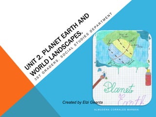
Unit 2 planet earth
1. A L M U D E N A C O R R A L E S M A R B Á N
Created by Elzi Geanta
2. 1. THE EARTH
The Earth is a sphere slightly fattened at the
poles. It rotates on its axis.
An axis is an imaginary line through the centre of
the Earth.
• POLES: the places where the axis meets the
surface of the Earth are called the North Pole
and the South Pole.
• ARCTIC: the area around the North Pole. The
Arctic Circle marks the edge of the Arctic.
• ANTARCTIC: the area around the South Pole.
The Antarctic Circle marks the edge of the
Antarctic.
• EQUATOR: an imaginary line around the Earth.
It is the same distance from the North Pole and
the South Pole.
• HEMISPHERES: the Earth has two
4. 2. LATITUDE
Latitude is how far north or south of the
equator a place is. Lines that connect
places with the same latitude are called
parallels because these lines are parallel to
the Equator.
• We measure latitude in degrees.
• The Equator has a latitude of 0 degrees
(0º)
Northern Hemisphere
Places to the north of the equator have a
latitude between 0º and 90º north
Southern Hemisphere
Places that are south the equator have a
latitude of between 0º and 90º south.
5. 3. LONGITUDE
Longitude is how far east or west a place
is. Lines that connect places with the
same longitude are called lines of
longitude or meridians.They go between
the North Pole and the South Pole..
• We measure latitude in degrees.
• The Greenwich Meridian or Prime
Meridian has a longitude of 0 degrees
(0º). The Greenwich Meridian goes
through Greenwich in London.
• Places that are east of Greenwich have
a longitude of between 0º and 180º east
(180ºE)
• Places to the west of Greenwich have
a longitde of between 0º and 180º
degrees west (180ºW)
6. ACTIVITIES
1. What is the latitude of Madrid? 40ºN or 40S?
2. What is the latitude of the Tropic of Capricorn?
It is between………………………..and …………………N or S
3. Is the longitude of New York 74º E or 74ºW?
7. 4. MOVEMENT OF THE EARTH
The Earth rotates on its axis once a day, so its does one complete rotation
every 24 hours.
As the Earth rotates, places on the surface sometimes face the sun-this is the
day.
When it faces away from the sun, it is night.
The Earth takes 365 days and 6 hours to orbit around the sun. Each year has
four seasons. There are seasons because the Earth’s axis is not vertical. It is
tilted.
9. 5. GLOBES VS MAPS
A globe is the most
accurate way to
represent the Earth. It
is a small version of
the Earth.
A map shows the Earth on a flat
surface. Maps are more useful
than globe.
WHY?
• they are cheaper to make.
• they are easier to store.
• it is easy to make a map for a
small or large area.
There is also a disadvantage. When we
make a flat map of the curved Earth,
shapes and distances get distored. Even
more with large areas.
10. 6. WHAT IS THE EARTH MADE OF?
The Earth is made of three layers:
1, The crust is the surface of the Earth. It is
a thin layer made of solid rock.
2. The mantle is much thicker layer made of
magma. Magma is molten (liquid) rock.
• The upper mantle is the part nearest the
crust.
• The lower mantle is below the upper
mantle.
3. The core is the bit in the centre of the
Earth. It is part solid and part liquid
13. 8. THE EARTH’S SURFACE
On the surface
The Earth’s surface is not flat; some
parts are higher than others.
• The lower areas are covered by
water-these are the seas and
oceans.
• The higher areas form the land.
This is divided into continents.
• There is more water than land.
The coast or coastline is where the
land meets the sea or ocean.
14. 8.1. CONTINENTAL RELIEF (EMERGED LAND)
RELIEVE TERRESTRE
-Mountain ranges (cadenas montañosas): series
of mountains joined together. Old mountains are
low and rounded (e.g. Irish mountains), while
young mountains are higher and their peaks are
prominent (e.g. Himalayas or Picos de Europa)
-Shields and platforms (Llanuras y plataformas):
ancient mountain ranges eroded (plains and small
rounded hills).
-Sedimentary basins (cuencas sedimentarias):
sunken area filled with eroded material and
usually flat.
COASTAL RELIEF
(RELIEVE COSTERO)
capes (cabos), gulfs
(golfos), peninsula
(península), estuaries
(estuarios), fiords (fiordos)
15. 8. 2. OCEANIC RELIEF (SUBMERGED
LAND) RELIEVE OCEÁNICO
-Continental platform /shelf (plataforma
continental): gentle slope at the edge of the
continent with a depth of 200 m.
-Continental slope (talud continental): Sharp
slope between the continent platform and the
bottom of the sea.
-Abyssal plain (llanura abisal): extensive flat,
sea bottom at depth of 4000-5000 metres
-Marine trench (fosa marina): long, narrow,
underwater depression.
16. ACTIVITY
Search for a landscape: land or water and describe the picture. (5-10
lines)
What is it?
Where is it located? Continent an country
What do you see
Opinion
EMAIL ME WITH THE
ANSWER AND ATTACH
THE PHOTO YOU
HAVE CHOSEN.
I WOULD LIKE TO
SHARE THE PICS IN
CLASS
almusociales@gmail.com
17. 8. WATER
8.1. RIVERS
The drainage basin of a river is the area where water from rain and snow
drains into the river.
A tributary is another river that flows into the main river.
The place where two rivers meet is called the confluence.
The course of a river is the route it follows from the source to the mouth.
The course is divided into the upper course, middle course and lower
course.
18. ACTIVITY
Fill in the gaps:
The Missouri river is longer than the Mississippi river, but it is a
…………………………of the Mississippi.
The……………………….of the Mississippi and Missouri rivers is
near St. Louis.
The……………………….of the Mississippi river is at New Orleans.
19. 7.2. SEAS AND OCEANS
The seas and oceans contain almost
all of the Earth’s water. Water in a sea
or ocean is called seawater or salt
water, because it contains a lot of salt.
The amount of salt depends on the
temperature.
If it is hotter, more water evaporates,
so a higher concentration of salt is
left. The Dead Sea is much hotter than
the Baltic Sea and it has much more salt.
The high salt level makes it very easy
to float in the Dead Sea-you can even
read a book.
20. 8.2. OCEAN CURRENTS
Ocean currents are huge movements of water in
the oceans.
• Warm currents are warmer thatn the
surrounding water because they start in
warmer places.
• Cold currents are colder than the
surrounding water because they start in colder
places.
Ocean currents can make the climate warmer or
colder. The Gulf Stream flows from the
Caribbean to Europe. When it reaches the north
21. ACTIVITIES
1. Look in an atlas or the Internet to find the Caribean Sea and the Barents Sea.
Which of them do you think has more salt? Why?
2. Do you think the Gulf Stream is a warm current or a cold current? (Think
about where it starts from)
3. What effect do you think it has on the climate of Europe?
22. 9. CLIMATE AND WEATHER
Weather and climate are related to:
• Temperature (amount of heat in the atmosphere)
• Precipitation (amount of water in the atmosphere)
• Atmospheric Pressure (weight of the air above the
Earth’s surface)
• Wind. (movement of the air)
Weather looks at the short-term changes. It means the atmospheric
conditions in a place at a particular time.
E.g. The weather in Madrid today is warm and sunny.
Climate looks at long-term averages; to understand the climate of a
place you need to study the weather over a period of at least 30 years.
It means the avergae atmospheric conditions in a place over a long
period of time.
E.g. The north of Spain has a marine climate with mild winters and
cool summers.
These are called
the elements of
climate
23. The weather and climate are affected by:
• atmospheric preassure
• latitude
• altitude
• distance from the coast/sea.
These are the
factors that affect
climate
24. ATMOSPHERIC PRESSURE
The atmosphere (a layer of gases surrouded the Earth)
regulates the temperature:
It stops it getting too cold at night.
When the air moves it spreads the heat from hot zones to
colder parts of the Earth.
25. LATITUDE
Temperature vary with latitude:
• They are highest near the equator and lowest near the poles.
• The Earth is divided into five climatic zones.
26. ALTITUDE
• Temperatures are usually warmest at low latitudes and get
colder as we go higher.
• Temperature drops 0,6 ºC every 100 metres.
27. DISTANCE FROM THE SEA
The sea moderates temperatures.
In summer, the sea takes longer to heat up than the land. This means that
coastal areas are less hot in summer than places further from the sea.
In winter the sea takes longer to cool down than the land. This means that
coastal areas are less cold in winter than places further from the sea.
We say that coastal areas are milder than inland areas. Inland means away
from the coast. (interior)