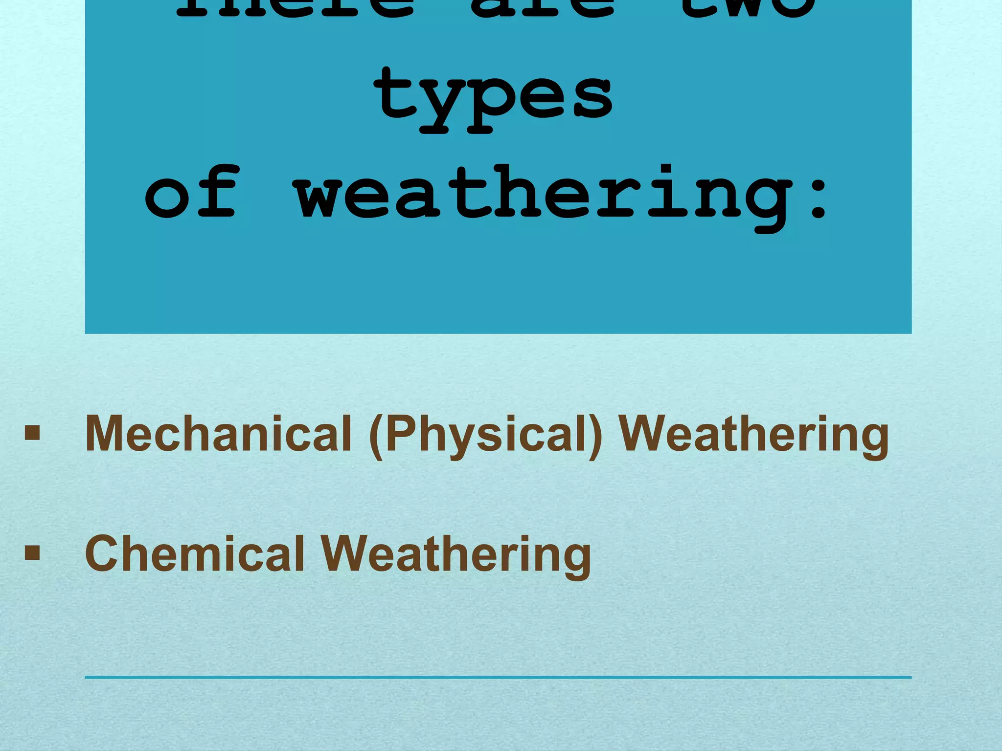
Earth’s Lithosphere
 Crust
 Mantle
 Core
Three Layers
• The Crust
• The
Mantle
• The Core
The Crust
• The surface of Earth.
• The thinnest layer.
• Made of solid rock.
• Contains all the
mountains, rocks,
water, soil and land
features.
• Contains the
lithosphere, oceanic
crust and continental
crust. 5 – 25 miles
thick
Lithosphere
• Made from the Crust and Upper Mantle.
• “Litho” means “stone” in Greek.
• This is the layer in which we live because it contains the
oceanic and continental crust.
Two types of Crust:
Oceanic and Continental
Oceanic versus
Continental Crust
• Oceanic Crust:
• Below the ocean
• Consists of basalt
• Very dense
• Continental Crust:
• Forms and contains the
large landmasses
• Consists of granite
• Less dense
5 – 25 miles thick
3 - 5 miles thick
The Mantle
• Most of the mantle is
solid rock.
• The lower mantle rock
is softer.
• It makes up 85% of
the Earth’s mass.
• Temperatures can
reach up to 870 C.
1,800 miles thick
• Divided into two parts:
 The upper mantle extends from the crust to a depth of about 410
kilometers (255 miles). The upper mantle is mostly solid, but its
more malleable regions contribute to tectonic activity.
 The lower mantle extends from about 660 kilometers (410 miles) to
about 2,700 kilometers (1,678 miles) beneath Earth’s surface. The lower
mantle is hotter and denser than the upper mantle and transition zone.
Asthenosphere
• Zone in the Upper
Mantle.
• Lithosphere floats
on top of it.
• Consists of hot,
plastic rock.
• “Asthens” means
“weak” in Greek.
Asthenosphere
The asthenosphere (“weak sphere”) is a soft layer of the
mantle on which pieces of the lithosphere move. It is made
of solid rock that, like putty, flows slowly- at about the same
rate your fingernails grow.
The motion of plates can be described
in four general patterns:
• Collision: when two continental plates are shoved
together
• Subduction: when one plate plunges beneath another
• Spreading: when two plates are pushed apart
• Transform faulting: when two plates slide past each
other
Convection Currents
The middle mantle "flows" because of convection
currents. Convection currents are caused by the very hot
material at the deepest part of the mantle rising being less
dense, then cooling becoming more dense and sinking
again --repeating this cycle over and over.
Convection Currents
• Density = Mass
Volume
• What are Convection Currents???
The process of liquid heating and cooling in between the mantle
and outer core of the Earth.
• When a liquid is heated, the particles spread apart. This is due
to the fact that their energy is being converted into kinetic
energy (the energy of movement). Once these molecules
spread out, their volume increases causing their density to
decrease. Therefore, the hot liquid floats to the top and the
cooler water, which has decreased in volume and increased in
density, sinks to the bottom.
• This process occurs, repeatedly, in the mantle due to the heat
from the core and mantle.
Convection Currents
Takes place
between the
Mantle and the
Outer Core.
Since the density of the
liquid decreased, it
floated up, towards the
surface.
Subduction of Plates
The Core
• The Core is Divided into
two parts:
• Outer Core
• Inner Core
Inner Core
Outer Core
Outer vs. Inner Core
• Outer Core – only liquid layer.
• Made up of liquid iron and nickel.
• This layer creates the Earth’s
magnetic field.
• Temperatures can reach up to
2,200 C.
• Inner Core
• The center of Earth.
• Made up of scorching-hot iron and
nickel. This layer stays solid though
due to intense pressure.
• This layer may also contain oxygen,
sulfur and silicon.
• Temperatures range between
9,000 C and 13,000 C.
What do these two images tell us
about the layers of the Earth?
Temperature
increases as depth increases
Look at the information in the graph
and table below. What’s the
relationship between depth and
density/pressure?
Density and Pressure
increase as depth increases
Which layer of the Earth has the greatest
temperature, pressure, and density?
Core
Evidence
How do Scientists know about the interior of the
Earth?
Two forms of evidence:
• Direct evidence from rock samples
• Indirect evidence from seismic waves
Review…
1. Inner Core
2. Outer Core
3. Lower Mantle
4. Upper Mantle
5. Crust
4
5
3
2
1
LANDFORMS
OF OUR WORLD
Earth is divided into three layers.
The outer layer is called the crust.
Beneath the crust lies the mantle.
The core is the innermost layer
Earth’s Layers
• The solid features formed on Earth’s crust.
• Other features include bodies of water.
• Crustal movement and other tectonic activity inside Earth create
landforms; mountains, faults, sinks, and volcanos.
• Many landforms are shaped by water and wind that carve and erode
land surfaces, carrying and depositing soil, sand and other debris.
Landforms
Topographic maps and models are used to represent landforms
and help scientists better understand objects and processes.
Landforms
Archipelago Bay Strait &
Canal
Cape Channel
Delta Desert Gulf Island Isthmus
Mountain Peninsula Plateau Plain Sound
Swamp Sea Mesa Oasis Valley
Source River Tundra Lake Butte
Canyon Fjord Geyser Lagoon Glacier
Pond Prairie Tributary Volcano Waterfall
Estuary Dune Savanna Reef Marsh
archipelago
• ahr-kuh-pel-uh-goh
A group or chain of
islands in a large body
of water
Back to
Landform Chart
bay
• A bay is a body of
water that is partly
enclosed by land (and
is usually smaller than
a gulf).
Back to
Landform Chart
butte
• A butte is a flat-topped
rock or hill formation
with steep sides.
Back to
Landform Chart
canyon
• A canyon is a deep
valley with very steep
sides - often carved
from the Earth by a
river.
• “Canyon” comes from
the Spanish
word cañon, which
means “tube” or “pipe.”
Back to
Landform Chart
cape
• A cape is a pointed
piece of land that
sticks out into a sea,
ocean, lake, or river.
Back to
Landform Chart
peninsula
• A peninsula is a piece
of land that is almost
entirely surrounded by
water but is connected
to the mainland on one
side.
Back to
Landform Chart
channel
• A channel is a body of
water that connects two
larger bodies of water
(like the English
Channel). A channel is
also a part of a river or
harbor that is deep
enough to let ships sail
through.
Back to
Landform Chart
strait and canal
Strait- A
passageway of
water connecting
two large bodies
of water.
Canal- A constructed
channel filled with
water used for
navigation, irrigation,
or drainage.
Back to
Landform Chart
delta
• A delta is a low, watery land
formed at the mouth of a
river. It is formed from the silt,
sand and small rocks that
flow downstream in the river
and are deposited in the
delta. A delta is often (but not
always) shaped like a triangle
(hence its name, delta, a
Greek letter that is shaped
like a triangle).
Back to
Landform Chart
desert
• A desert is an area
that receives less
than 10 inches of rain
per year and where
there is little to no
vegetation.
Back to
Landform Chart
oasis
- an area made fertile by
a source of freshwater in
an otherwise dry
and arid region.
Back to
Landform Chart
dune
• A dune is a hill or a
ridge made of sand.
Dunes are shaped by
the wind, and change
all the time.
Back to
Landform Chart
estuary
• An estuary is
where a river
meets the sea
or ocean.
Back to
Landform Chart
fjord
• A fjord is an inlet that
is long and narrow in
shape, with
steep cliffs or other
steep rock formations
on each side.
Back to
Landform Chart
geyser
• A geyser is a natural
hot spring that
occasionally sprays
water and steam
above the ground.
Back to
Landform Chart
glacier
• A glacier is an accumulation of
snow and ice that has grown
sufficiently so that it can move
downhill by the force of gravity.
Pressure generated at the bottom
of a glacier is high enough to
cause ice to melt, even in very
cold freezing temperatures. This
permits a glacier to move very
slowly downhill.
Back to
Landform Chart
gulf
• A gulf is a part of the
ocean (or sea) that is
partly surrounded by
land (it is usually
larger than a bay).
Back to
Landform Chart
hill
• A hill landform is a
piece of land that is
above the
surrounding land. It
also has sloping sides
unlike the steepness
of a mountain
landform.
Back to
Landform Chart
island
• An island landform is land that
is completely surrounded by
water. It can be any type of
land. The island can also be
surrounded different types of
water such as a
sea, ocean, river and lake.
Back to
Landform Chart
isthmus
• An isthmus is a
narrow strip of
land connecting
two larger
landmasses. An
isthmus has
water on two
sides.
Back to
Landform Chart
lagoon
• A lagoon is a shallow
body of water protected
from a larger body of
water (usually the ocean)
by sandbars, barrier
islands, or coral
reefs. Lagoons are often
called estuaries, sounds,
bays, or even lakes.
Back to
Landform Chart
lake
• A lake is a large body
of water surrounded
by land on all sides.
This type of water is
usually fresh water
while there are some
that are salt water
lake.
Back to
Landform Chart
marsh
• A marsh is a type of
freshwater, brackish
water or saltwater
wetland that is found
along rivers, pond,
lakes and coasts.
Marsh plants grow up
out of the water.
Back to
Landform Chart
mesa
• A mesa is a land
formation with a flat
area on top and steep
walls - usually
occurring in dry
areas.
Back to
Landform Chart
mountain
• A mountain is a very
tall high, natural
place on Earth -
higher than a hill.
The tallest mountain
on Earth is Mt.
Everest.
Back to
Landform Chart
ocean
• An ocean is a large
body of salt water
that surrounds a
continent. Oceans
cover more the two-
thirds of the Earth's
surface
Back to
Landform Chart
plain
• A plain landform is land that is relatively flat and
does not change much in elevation within a
common area.
Back to
Landform Chart
plateau
• A plateau is a portion of land that is more or less
flat and level, elevated above the surrounding
area. It may have steep slopes or
vertical cliffs on one or more sides.
Back to
Landform Chart
pond
• A pond is a small
body of water
surrounded by land. A
pond is smaller than a
lake.
Back to
Landform Chart
prairie
• A prairie is a wide,
relatively flat area of
land that has
grasses and only a
few trees.
Back to
Landform Chart
river
• A river is a large, flowing
body of water that usually
empties into a sea or
ocean.
Back to
Landform Chart
sea
• A sea is a large body of
salty water that is often
connected to an ocean.
A sea may be partly or
completely surrounded
by land.
Back to
Landform Chart
sound
• A sound is a wide
inlet of the sea or
ocean that is parallel
to the coastline; it
often separates a
coastline from a
nearby island
Back to
Landform Chart
source
• A source is the beginning of a river.
Back to
Landform Chart
swamp
• A swamp is a type of
freshwater wetland
that has spongy,
muddy land and a lot
of water. Many trees
and shrubs grow in
swamps.
Back to
Landform Chart
tributary
• A tributary is a freshwater
stream that feeds into a
larger stream or river.
• The larger, or
parent, river is called
the mainstem. The point
where a tributary meets
the mainstem is called
the confluence.
Back to
Landform Chart
tundra
• A tundra is a cold, treeless area; it is the coldest
biome.
Back to
Landform Chart
valley
• A valley is a low
place between
mountains.
Back to
Landform Chart
volcano
• A volcano is a
mountainous vent in
the Earth's crust.
When a volcano
erupts, it spews out
lava, ashes, and hot
gases from deep
inside the Earth.
Back to
Landform Chart
waterfall
• When a river falls off steeply, there is a waterfall.
Back to
Landform Chart
reef
• Ridge of sand, rock, or coral that lies at or near
the surface of a sea or ocean.
Back to
Landform Chart
savanna
• An area of
grassland and
scattered trees.
Back to
Landform Chart
Earth: Surface
Activities
True or False: The Earth’s surface
has stayed the same for thousands of
years.
True or False: The Earth’s surface
has stayed the same for thousands of
years
The Earth’s surface is always
changing!
Weathering
• The process that breaks down rock and other
substances at the Earth’s surface
• Caused by: heat, cold, water, ice, oxygen, and
carbon dioxide on the Earth’s surface.
There are two
types
of weathering:
 Mechanical (Physical) Weathering
 Chemical Weathering
Mechanical Weathering
 Rocks are broken apart by physical processes (heat,
water, ice, pressure, temperature, etc.)
 The overall chemical makeup of the rock stays the same
 Each piece has characteristics similar to the original rock
• Different Types of Physical Weathering:
– Frost action/ice wedging
– Abrasion
– Exfoliation
– Wind
– Plant Growth
Frost action/ice wedging
• breakup of rock caused by the
freezing and thawing (contracting
and expansion) of water.
• Water seeps into cracks of a rock
and as the climate cools the water
freezes and expands breaking the
rock apart.
Shattered rocks are
common in cold and
alpine environments,
where repeated
process of freezing
effect breaks the rocks
gradually in smaller
fragments and
disintegration process
occurs.
Alternate freezing and thawing
form potholes and frost heave.
Breaking of Rocks by Thermal Process
Thermal expansion due
to the extreme range of
temperatures can
shatter rocks in desert
environments.
Repeated swelling and
shrinking of minerals
with different
expansion rates will
also shatter rocks.
Temperature Changes-alternating hot
and cold temperatures weaken the
rock as it expands and contracts.
Abrasion
• The physical wearing
down of rocks as they
rub or bounce against
each other.
• This process is most
common in windy
areas, under glaciers,
or in stream channels.
Plants and Animals-plant roots force their
way into cracks, animals uncover rock
and expose it to the elements.
PLANT ROOTS
Plants CAN PREVENT erosion
Exfoliation
• the peeling away of large sheets of loosened materials
at the surface of a rock.
• Common in shale, slate, and mica.
Enchanted State Rock Park, Texas
SHEET JOINTS
EXFOLIATION
Sheeting joints in
granite:
a. Mt. Bukhansan,
near Seoul,
Korea;
b. Tuen Mun
Highway, Hong
Kong
EXFOLIATED DOMES
Stone Mountain, Georgia, showing the
product of exfoliation due to unloading
 the process by which chemicals breakdown
rock through a change in the mineral’s
composition, happens fastest in a hot,
moist climate.
a. Oxidation-occurs when oxygen
from the air combines with
iron-rich minerals of the rock,
oxidation = RUST.
Chemical Weathering
Oxidation taking place on shale in Highland
County (Photograph by Stan Johnson)
b. Carbonation-occurs when water
combines with carbon dioxide
in the air to form carbonic acid.
Carbonic acid easily dissolves
rocks like limestone and marble.
When the water is underground,
weathering and erosion forms caves.
www.dkimages.com
www.dkimages.com
As the water evaporates, the
minerals that were dissolved get
left behind to form the beautiful
cave structures.
c. Hydrolysis - water combines with
minerals such as mica and
feldspar found in granite, to
form clay, the rock weakens and
crumbles apart.
Granite gneiss is converting to clay
by hydrolysis in Buckingham County
d. Dissolution – rocks, when in water,
react with acids in the water and dissolve.
A clue that this has happened to a rock is
the presence of small holes.
Natural Bridge
in Rockbridge
County
Factors Affecting the Rate of Weathering
1. Exposure - rate and type of weathering
are dependent on exposure to air,
water and living things.
The greater the amount of rock
exposed, the greater the
weathering.
This is a direct relationship.
2. Particle Size - an increase in surface area
increases the rate of weathering.
Example: Granulated sugar dissolves faster
than a cube of sugar. More surfaces
are exposed when cut.
Fast
Slow
Rate
of
Weathering
Surface Area
3. Mineral Composition - rocks made of harder
minerals weather slower than rocks
made of softer minerals.
Fast
Slow
Rate
of
Weathering
Mineral Hardness
4. Climate - physical and chemical weathering
are affected by climate.
a. In cold and moist climates, physical
weathering is dominant.
b. In hot and moist
climates, chemical
weathering is
dominant.
Cleopatra’s Needle
c. In both cases, water is the major
ingredient that promotes weathering.
5. Time - as time goes on, more weathering
occurs.
6. Humans - excavation of land, mining,
building, etc.
Soil Formation - end product of weathering
and biologic activity.
Time increases
Factor’s Affecting Soil Formation
a. Parent Material(bedrock)
• Residual soil—soil is formed from the
parent material and is of
the same composition.
• Transported soil—parent material has
been carried from
elsewhere and
deposited
b. Climate
• Arid climates have thin soils, high in
mineral content, low in organic
matter.
•Humid climates have thick soils, high
in organic matter, low in mineral
content.
c. Organisms
• Dead and decayed plants and animals
add nutrients, forming topsoil.
d. Time - the longer the weathering,
the deeper the soil.
Erosion
Erosion transports
weathered rock
material.
A similar process, weathering,
breaks down or dissolves rock,
weakening it or turning it into
tiny fragments.
» Gravity
»Water
»Wind
»Ice
The agents of erosion that wear
away at the surface of the Earth:
What are some ways that
weathered material can be
transported?
Erosion by
Gravity
Rocks and other materials,
especially on steep slopes, are
pulled toward the center of
Earth by gravity.
Here, the
weathering
occurs by
frost wedging
The erosion occurs by gravity
Erosion by Gravity
Slump
Rock Slide Mud Slide
Landslide
Erosion
by Wind
When air moves, it picks
up loose material and
transports it to other places.
Erosion
by Wind
Strong Winds
Dust Storm
Sandstorm
Erosion by
Water
When water moves, it picks
up loose material and
transports it to other places.
Four primary types of erosion that occur as a
direct result of rainfall:
Erosion by Water
Rivers or Streams Rain
Flooding
Runoff
Erosion by Water
Waves eroding
the shoreline
Erosion
by Ice
When a glacier moves, it
picks up loose material and
transports it to other places.
The rocks carried by a glacier rub against
the ground below, eroding both the ground
and the rocks. Glaciers grind up rocks and
scrape away the soil. Moving glaciers gouge
out basins and form steep-sided mountain
valleys. Eroded sediment is often visible on
and around glaciers. This material is called
moraine.
Erosion by Ice
Glacial moraines above Lake
Louise, in Alberta, Canada
Mount Everest
Tustamena Glacier, Alaska
Alaska Glacier
Tustamena Glacier, Alaska
Alaska
Weathering and Erosion are
two very different processes
that tend to act sequentially.
Weathering is the result of
the physical and chemical
changes of rock and mineral
material; the resulting
products might or might not
be transported.
Deposition
Deposition occurs where the
agents (forces) of erosion lay
sediment down.
Weathering and Erosion wear
down, and deposition fills in
the Earth’s surface.
Deposition by Water
As water moves through a river,
it loses some of its energy and it
can no longer carry some of its
sediment. As a result, it drops, or
is deposited, to the bottom
of the stream.
Deposition by Water
Rivers and streams erode and
deposit water along their path.
Deposition by Water
Water also loses energy and
deposits sediment when it empties
into an ocean or lake.
Sediment that is deposited as
water empties into an ocean or
lake forms a triangular shaped
deposit (delta).
The Mississippi River flowing into
the Gulf of Mexico forms the
Mississippi River delta.
In this example, river waters
are being deposited from
a mountain.
Deposition by Water
Currents, wind, and storms carry
and deposit sand along beaches.
Sandbar Barrier Island
Deposition by Wind
Sediments blown away by wind
eventually are deposited. Over time,
these deposits develop into landforms.
Sand Dune
Deposition by Ice
When glaciers begin to melt, they
deposit sediment on the land.
Copyright © Tim McCabe, NRCS
This is a picture of slump. What caused this erosion?
Notice that the deposition is very close to where the
erosion occurred! It just slid a little down the hill.
Gravity!
This is a picture of creep. What type of erosion is this?
Evidence is easiest to see when it affects the growth of trees.
Wind Erosion
Rivers also empty into the sea.
The water slows down and the sediment drops out.
This forms a delta.
Notice the
Mississippi
River runs
through the
dry land that
has built up
from the
sediment it
dropped once
it reached the
Gulf of Mexico.
www.swisseduc.ch
http://nsidc.org
www.traditionalmountaineering.org
As glaciers melt, they leave
behind all the rocks and
sediment they broken off the
area through which they
flowed.
Notice all the rock
material that is being
left behind as these
glacier melts back.
This is called till.
/www.wayfaring.info
Our Appalachian
Mountains looked like
this millions of years
ago.
Due to
weathering,
erosion, and
deposition,
they now
look like this!
• https://studyjams.scholastic.com/studyjams/jams/science/r
ocks-minerals-landforms/weathering-and-erosion.htm
• https://studyjams.scholastic.com/studyjams/jams/science/r
ocks-minerals-landforms/landforms.htm
Earth Science Report.pptx

Earth Science Report.pptx

  • 1.
  • 2.
    Three Layers • TheCrust • The Mantle • The Core
  • 3.
    The Crust • Thesurface of Earth. • The thinnest layer. • Made of solid rock. • Contains all the mountains, rocks, water, soil and land features. • Contains the lithosphere, oceanic crust and continental crust. 5 – 25 miles thick
  • 5.
    Lithosphere • Made fromthe Crust and Upper Mantle. • “Litho” means “stone” in Greek. • This is the layer in which we live because it contains the oceanic and continental crust.
  • 6.
    Two types ofCrust: Oceanic and Continental
  • 7.
    Oceanic versus Continental Crust •Oceanic Crust: • Below the ocean • Consists of basalt • Very dense • Continental Crust: • Forms and contains the large landmasses • Consists of granite • Less dense 5 – 25 miles thick 3 - 5 miles thick
  • 8.
    The Mantle • Mostof the mantle is solid rock. • The lower mantle rock is softer. • It makes up 85% of the Earth’s mass. • Temperatures can reach up to 870 C. 1,800 miles thick
  • 9.
    • Divided intotwo parts:  The upper mantle extends from the crust to a depth of about 410 kilometers (255 miles). The upper mantle is mostly solid, but its more malleable regions contribute to tectonic activity.  The lower mantle extends from about 660 kilometers (410 miles) to about 2,700 kilometers (1,678 miles) beneath Earth’s surface. The lower mantle is hotter and denser than the upper mantle and transition zone.
  • 10.
    Asthenosphere • Zone inthe Upper Mantle. • Lithosphere floats on top of it. • Consists of hot, plastic rock. • “Asthens” means “weak” in Greek.
  • 11.
    Asthenosphere The asthenosphere (“weaksphere”) is a soft layer of the mantle on which pieces of the lithosphere move. It is made of solid rock that, like putty, flows slowly- at about the same rate your fingernails grow.
  • 12.
    The motion ofplates can be described in four general patterns: • Collision: when two continental plates are shoved together • Subduction: when one plate plunges beneath another • Spreading: when two plates are pushed apart • Transform faulting: when two plates slide past each other
  • 13.
    Convection Currents The middlemantle "flows" because of convection currents. Convection currents are caused by the very hot material at the deepest part of the mantle rising being less dense, then cooling becoming more dense and sinking again --repeating this cycle over and over.
  • 14.
    Convection Currents • Density= Mass Volume • What are Convection Currents??? The process of liquid heating and cooling in between the mantle and outer core of the Earth. • When a liquid is heated, the particles spread apart. This is due to the fact that their energy is being converted into kinetic energy (the energy of movement). Once these molecules spread out, their volume increases causing their density to decrease. Therefore, the hot liquid floats to the top and the cooler water, which has decreased in volume and increased in density, sinks to the bottom. • This process occurs, repeatedly, in the mantle due to the heat from the core and mantle.
  • 15.
    Convection Currents Takes place betweenthe Mantle and the Outer Core. Since the density of the liquid decreased, it floated up, towards the surface.
  • 16.
  • 17.
    The Core • TheCore is Divided into two parts: • Outer Core • Inner Core Inner Core Outer Core
  • 18.
    Outer vs. InnerCore • Outer Core – only liquid layer. • Made up of liquid iron and nickel. • This layer creates the Earth’s magnetic field. • Temperatures can reach up to 2,200 C. • Inner Core • The center of Earth. • Made up of scorching-hot iron and nickel. This layer stays solid though due to intense pressure. • This layer may also contain oxygen, sulfur and silicon. • Temperatures range between 9,000 C and 13,000 C.
  • 20.
    What do thesetwo images tell us about the layers of the Earth?
  • 21.
  • 22.
    Look at theinformation in the graph and table below. What’s the relationship between depth and density/pressure?
  • 23.
  • 24.
    Which layer ofthe Earth has the greatest temperature, pressure, and density? Core
  • 25.
    Evidence How do Scientistsknow about the interior of the Earth? Two forms of evidence: • Direct evidence from rock samples • Indirect evidence from seismic waves
  • 26.
    Review… 1. Inner Core 2.Outer Core 3. Lower Mantle 4. Upper Mantle 5. Crust 4 5 3 2 1
  • 27.
  • 28.
    Earth is dividedinto three layers. The outer layer is called the crust. Beneath the crust lies the mantle. The core is the innermost layer Earth’s Layers
  • 29.
    • The solidfeatures formed on Earth’s crust. • Other features include bodies of water. • Crustal movement and other tectonic activity inside Earth create landforms; mountains, faults, sinks, and volcanos. • Many landforms are shaped by water and wind that carve and erode land surfaces, carrying and depositing soil, sand and other debris. Landforms
  • 30.
    Topographic maps andmodels are used to represent landforms and help scientists better understand objects and processes.
  • 31.
    Landforms Archipelago Bay Strait& Canal Cape Channel Delta Desert Gulf Island Isthmus Mountain Peninsula Plateau Plain Sound Swamp Sea Mesa Oasis Valley Source River Tundra Lake Butte Canyon Fjord Geyser Lagoon Glacier Pond Prairie Tributary Volcano Waterfall Estuary Dune Savanna Reef Marsh
  • 32.
    archipelago • ahr-kuh-pel-uh-goh A groupor chain of islands in a large body of water Back to Landform Chart
  • 33.
    bay • A bayis a body of water that is partly enclosed by land (and is usually smaller than a gulf). Back to Landform Chart
  • 34.
    butte • A butteis a flat-topped rock or hill formation with steep sides. Back to Landform Chart
  • 35.
    canyon • A canyonis a deep valley with very steep sides - often carved from the Earth by a river. • “Canyon” comes from the Spanish word cañon, which means “tube” or “pipe.” Back to Landform Chart
  • 36.
    cape • A capeis a pointed piece of land that sticks out into a sea, ocean, lake, or river. Back to Landform Chart
  • 37.
    peninsula • A peninsulais a piece of land that is almost entirely surrounded by water but is connected to the mainland on one side. Back to Landform Chart
  • 38.
    channel • A channelis a body of water that connects two larger bodies of water (like the English Channel). A channel is also a part of a river or harbor that is deep enough to let ships sail through. Back to Landform Chart
  • 39.
    strait and canal Strait-A passageway of water connecting two large bodies of water. Canal- A constructed channel filled with water used for navigation, irrigation, or drainage. Back to Landform Chart
  • 40.
    delta • A deltais a low, watery land formed at the mouth of a river. It is formed from the silt, sand and small rocks that flow downstream in the river and are deposited in the delta. A delta is often (but not always) shaped like a triangle (hence its name, delta, a Greek letter that is shaped like a triangle). Back to Landform Chart
  • 41.
    desert • A desertis an area that receives less than 10 inches of rain per year and where there is little to no vegetation. Back to Landform Chart
  • 42.
    oasis - an areamade fertile by a source of freshwater in an otherwise dry and arid region. Back to Landform Chart
  • 43.
    dune • A duneis a hill or a ridge made of sand. Dunes are shaped by the wind, and change all the time. Back to Landform Chart
  • 44.
    estuary • An estuaryis where a river meets the sea or ocean. Back to Landform Chart
  • 45.
    fjord • A fjordis an inlet that is long and narrow in shape, with steep cliffs or other steep rock formations on each side. Back to Landform Chart
  • 46.
    geyser • A geyseris a natural hot spring that occasionally sprays water and steam above the ground. Back to Landform Chart
  • 47.
    glacier • A glacieris an accumulation of snow and ice that has grown sufficiently so that it can move downhill by the force of gravity. Pressure generated at the bottom of a glacier is high enough to cause ice to melt, even in very cold freezing temperatures. This permits a glacier to move very slowly downhill. Back to Landform Chart
  • 48.
    gulf • A gulfis a part of the ocean (or sea) that is partly surrounded by land (it is usually larger than a bay). Back to Landform Chart
  • 49.
    hill • A hilllandform is a piece of land that is above the surrounding land. It also has sloping sides unlike the steepness of a mountain landform. Back to Landform Chart
  • 50.
    island • An islandlandform is land that is completely surrounded by water. It can be any type of land. The island can also be surrounded different types of water such as a sea, ocean, river and lake. Back to Landform Chart
  • 51.
    isthmus • An isthmusis a narrow strip of land connecting two larger landmasses. An isthmus has water on two sides. Back to Landform Chart
  • 52.
    lagoon • A lagoonis a shallow body of water protected from a larger body of water (usually the ocean) by sandbars, barrier islands, or coral reefs. Lagoons are often called estuaries, sounds, bays, or even lakes. Back to Landform Chart
  • 53.
    lake • A lakeis a large body of water surrounded by land on all sides. This type of water is usually fresh water while there are some that are salt water lake. Back to Landform Chart
  • 54.
    marsh • A marshis a type of freshwater, brackish water or saltwater wetland that is found along rivers, pond, lakes and coasts. Marsh plants grow up out of the water. Back to Landform Chart
  • 55.
    mesa • A mesais a land formation with a flat area on top and steep walls - usually occurring in dry areas. Back to Landform Chart
  • 56.
    mountain • A mountainis a very tall high, natural place on Earth - higher than a hill. The tallest mountain on Earth is Mt. Everest. Back to Landform Chart
  • 57.
    ocean • An oceanis a large body of salt water that surrounds a continent. Oceans cover more the two- thirds of the Earth's surface Back to Landform Chart
  • 58.
    plain • A plainlandform is land that is relatively flat and does not change much in elevation within a common area. Back to Landform Chart
  • 59.
    plateau • A plateauis a portion of land that is more or less flat and level, elevated above the surrounding area. It may have steep slopes or vertical cliffs on one or more sides. Back to Landform Chart
  • 60.
    pond • A pondis a small body of water surrounded by land. A pond is smaller than a lake. Back to Landform Chart
  • 61.
    prairie • A prairieis a wide, relatively flat area of land that has grasses and only a few trees. Back to Landform Chart
  • 62.
    river • A riveris a large, flowing body of water that usually empties into a sea or ocean. Back to Landform Chart
  • 63.
    sea • A seais a large body of salty water that is often connected to an ocean. A sea may be partly or completely surrounded by land. Back to Landform Chart
  • 64.
    sound • A soundis a wide inlet of the sea or ocean that is parallel to the coastline; it often separates a coastline from a nearby island Back to Landform Chart
  • 65.
    source • A sourceis the beginning of a river. Back to Landform Chart
  • 66.
    swamp • A swampis a type of freshwater wetland that has spongy, muddy land and a lot of water. Many trees and shrubs grow in swamps. Back to Landform Chart
  • 67.
    tributary • A tributaryis a freshwater stream that feeds into a larger stream or river. • The larger, or parent, river is called the mainstem. The point where a tributary meets the mainstem is called the confluence. Back to Landform Chart
  • 68.
    tundra • A tundrais a cold, treeless area; it is the coldest biome. Back to Landform Chart
  • 69.
    valley • A valleyis a low place between mountains. Back to Landform Chart
  • 70.
    volcano • A volcanois a mountainous vent in the Earth's crust. When a volcano erupts, it spews out lava, ashes, and hot gases from deep inside the Earth. Back to Landform Chart
  • 71.
    waterfall • When ariver falls off steeply, there is a waterfall. Back to Landform Chart
  • 72.
    reef • Ridge ofsand, rock, or coral that lies at or near the surface of a sea or ocean. Back to Landform Chart
  • 73.
    savanna • An areaof grassland and scattered trees. Back to Landform Chart
  • 74.
  • 75.
    True or False:The Earth’s surface has stayed the same for thousands of years.
  • 76.
    True or False:The Earth’s surface has stayed the same for thousands of years The Earth’s surface is always changing!
  • 79.
    Weathering • The processthat breaks down rock and other substances at the Earth’s surface • Caused by: heat, cold, water, ice, oxygen, and carbon dioxide on the Earth’s surface.
  • 80.
    There are two types ofweathering:  Mechanical (Physical) Weathering  Chemical Weathering
  • 81.
    Mechanical Weathering  Rocksare broken apart by physical processes (heat, water, ice, pressure, temperature, etc.)  The overall chemical makeup of the rock stays the same  Each piece has characteristics similar to the original rock • Different Types of Physical Weathering: – Frost action/ice wedging – Abrasion – Exfoliation – Wind – Plant Growth
  • 82.
    Frost action/ice wedging •breakup of rock caused by the freezing and thawing (contracting and expansion) of water. • Water seeps into cracks of a rock and as the climate cools the water freezes and expands breaking the rock apart.
  • 83.
    Shattered rocks are commonin cold and alpine environments, where repeated process of freezing effect breaks the rocks gradually in smaller fragments and disintegration process occurs.
  • 84.
    Alternate freezing andthawing form potholes and frost heave.
  • 85.
    Breaking of Rocksby Thermal Process Thermal expansion due to the extreme range of temperatures can shatter rocks in desert environments. Repeated swelling and shrinking of minerals with different expansion rates will also shatter rocks.
  • 86.
    Temperature Changes-alternating hot andcold temperatures weaken the rock as it expands and contracts.
  • 87.
    Abrasion • The physicalwearing down of rocks as they rub or bounce against each other. • This process is most common in windy areas, under glaciers, or in stream channels.
  • 89.
    Plants and Animals-plantroots force their way into cracks, animals uncover rock and expose it to the elements.
  • 90.
  • 91.
  • 92.
    Exfoliation • the peelingaway of large sheets of loosened materials at the surface of a rock. • Common in shale, slate, and mica. Enchanted State Rock Park, Texas
  • 93.
  • 94.
    Sheeting joints in granite: a.Mt. Bukhansan, near Seoul, Korea; b. Tuen Mun Highway, Hong Kong
  • 95.
  • 96.
    Stone Mountain, Georgia,showing the product of exfoliation due to unloading
  • 97.
     the processby which chemicals breakdown rock through a change in the mineral’s composition, happens fastest in a hot, moist climate. a. Oxidation-occurs when oxygen from the air combines with iron-rich minerals of the rock, oxidation = RUST. Chemical Weathering
  • 98.
    Oxidation taking placeon shale in Highland County (Photograph by Stan Johnson)
  • 99.
    b. Carbonation-occurs whenwater combines with carbon dioxide in the air to form carbonic acid. Carbonic acid easily dissolves rocks like limestone and marble.
  • 100.
    When the wateris underground, weathering and erosion forms caves. www.dkimages.com www.dkimages.com As the water evaporates, the minerals that were dissolved get left behind to form the beautiful cave structures.
  • 102.
    c. Hydrolysis -water combines with minerals such as mica and feldspar found in granite, to form clay, the rock weakens and crumbles apart.
  • 103.
    Granite gneiss isconverting to clay by hydrolysis in Buckingham County
  • 104.
    d. Dissolution –rocks, when in water, react with acids in the water and dissolve. A clue that this has happened to a rock is the presence of small holes.
  • 105.
  • 106.
    Factors Affecting theRate of Weathering 1. Exposure - rate and type of weathering are dependent on exposure to air, water and living things. The greater the amount of rock exposed, the greater the weathering. This is a direct relationship.
  • 107.
    2. Particle Size- an increase in surface area increases the rate of weathering.
  • 108.
    Example: Granulated sugardissolves faster than a cube of sugar. More surfaces are exposed when cut. Fast Slow Rate of Weathering Surface Area
  • 109.
    3. Mineral Composition- rocks made of harder minerals weather slower than rocks made of softer minerals. Fast Slow Rate of Weathering Mineral Hardness
  • 110.
    4. Climate -physical and chemical weathering are affected by climate. a. In cold and moist climates, physical weathering is dominant. b. In hot and moist climates, chemical weathering is dominant. Cleopatra’s Needle
  • 111.
    c. In bothcases, water is the major ingredient that promotes weathering.
  • 112.
    5. Time -as time goes on, more weathering occurs. 6. Humans - excavation of land, mining, building, etc.
  • 113.
    Soil Formation -end product of weathering and biologic activity. Time increases
  • 114.
    Factor’s Affecting SoilFormation a. Parent Material(bedrock) • Residual soil—soil is formed from the parent material and is of the same composition. • Transported soil—parent material has been carried from elsewhere and deposited
  • 115.
    b. Climate • Aridclimates have thin soils, high in mineral content, low in organic matter. •Humid climates have thick soils, high in organic matter, low in mineral content. c. Organisms • Dead and decayed plants and animals add nutrients, forming topsoil.
  • 116.
    d. Time -the longer the weathering, the deeper the soil.
  • 117.
  • 118.
  • 119.
    A similar process,weathering, breaks down or dissolves rock, weakening it or turning it into tiny fragments.
  • 120.
    » Gravity »Water »Wind »Ice The agentsof erosion that wear away at the surface of the Earth: What are some ways that weathered material can be transported?
  • 121.
    Erosion by Gravity Rocks andother materials, especially on steep slopes, are pulled toward the center of Earth by gravity.
  • 122.
    Here, the weathering occurs by frostwedging The erosion occurs by gravity
  • 123.
    Erosion by Gravity Slump RockSlide Mud Slide Landslide
  • 124.
    Erosion by Wind When airmoves, it picks up loose material and transports it to other places.
  • 125.
  • 127.
    Erosion by Water When watermoves, it picks up loose material and transports it to other places.
  • 128.
    Four primary typesof erosion that occur as a direct result of rainfall:
  • 130.
    Erosion by Water Riversor Streams Rain Flooding Runoff
  • 131.
    Erosion by Water Waveseroding the shoreline
  • 132.
    Erosion by Ice When aglacier moves, it picks up loose material and transports it to other places.
  • 133.
    The rocks carriedby a glacier rub against the ground below, eroding both the ground and the rocks. Glaciers grind up rocks and scrape away the soil. Moving glaciers gouge out basins and form steep-sided mountain valleys. Eroded sediment is often visible on and around glaciers. This material is called moraine. Erosion by Ice
  • 134.
    Glacial moraines aboveLake Louise, in Alberta, Canada Mount Everest
  • 135.
  • 136.
  • 137.
  • 138.
    Weathering and Erosionare two very different processes that tend to act sequentially.
  • 139.
    Weathering is theresult of the physical and chemical changes of rock and mineral material; the resulting products might or might not be transported.
  • 140.
  • 141.
    Deposition occurs wherethe agents (forces) of erosion lay sediment down.
  • 142.
    Weathering and Erosionwear down, and deposition fills in the Earth’s surface.
  • 144.
    Deposition by Water Aswater moves through a river, it loses some of its energy and it can no longer carry some of its sediment. As a result, it drops, or is deposited, to the bottom of the stream.
  • 145.
    Deposition by Water Riversand streams erode and deposit water along their path.
  • 146.
    Deposition by Water Wateralso loses energy and deposits sediment when it empties into an ocean or lake. Sediment that is deposited as water empties into an ocean or lake forms a triangular shaped deposit (delta).
  • 147.
    The Mississippi Riverflowing into the Gulf of Mexico forms the Mississippi River delta.
  • 148.
    In this example,river waters are being deposited from a mountain.
  • 149.
    Deposition by Water Currents,wind, and storms carry and deposit sand along beaches. Sandbar Barrier Island
  • 150.
    Deposition by Wind Sedimentsblown away by wind eventually are deposited. Over time, these deposits develop into landforms. Sand Dune
  • 152.
    Deposition by Ice Whenglaciers begin to melt, they deposit sediment on the land.
  • 154.
    Copyright © TimMcCabe, NRCS This is a picture of slump. What caused this erosion? Notice that the deposition is very close to where the erosion occurred! It just slid a little down the hill. Gravity!
  • 155.
    This is apicture of creep. What type of erosion is this? Evidence is easiest to see when it affects the growth of trees. Wind Erosion
  • 156.
    Rivers also emptyinto the sea. The water slows down and the sediment drops out. This forms a delta. Notice the Mississippi River runs through the dry land that has built up from the sediment it dropped once it reached the Gulf of Mexico.
  • 157.
  • 158.
    http://nsidc.org www.traditionalmountaineering.org As glaciers melt,they leave behind all the rocks and sediment they broken off the area through which they flowed. Notice all the rock material that is being left behind as these glacier melts back. This is called till.
  • 159.
    /www.wayfaring.info Our Appalachian Mountains lookedlike this millions of years ago. Due to weathering, erosion, and deposition, they now look like this!
  • 162.

Editor's Notes

  • #162 To sum up the Earth’s activity.