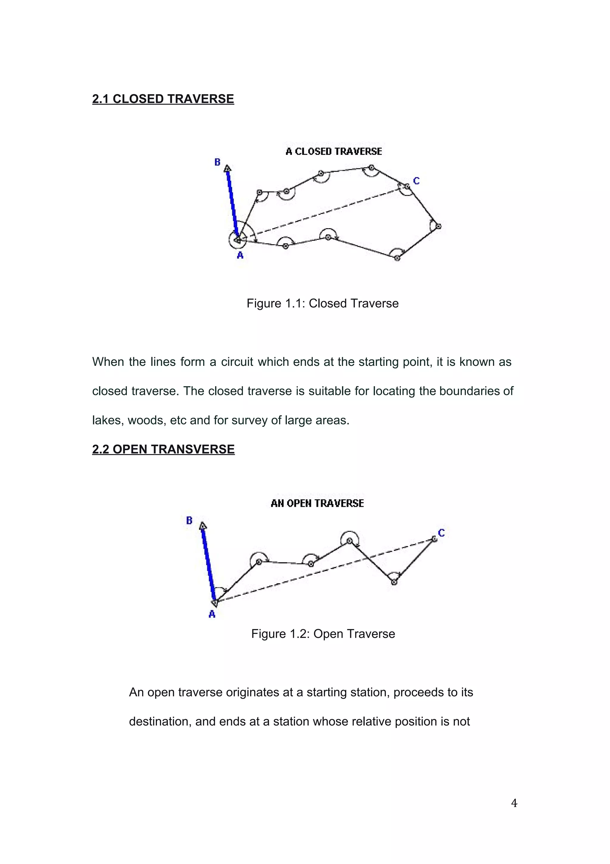
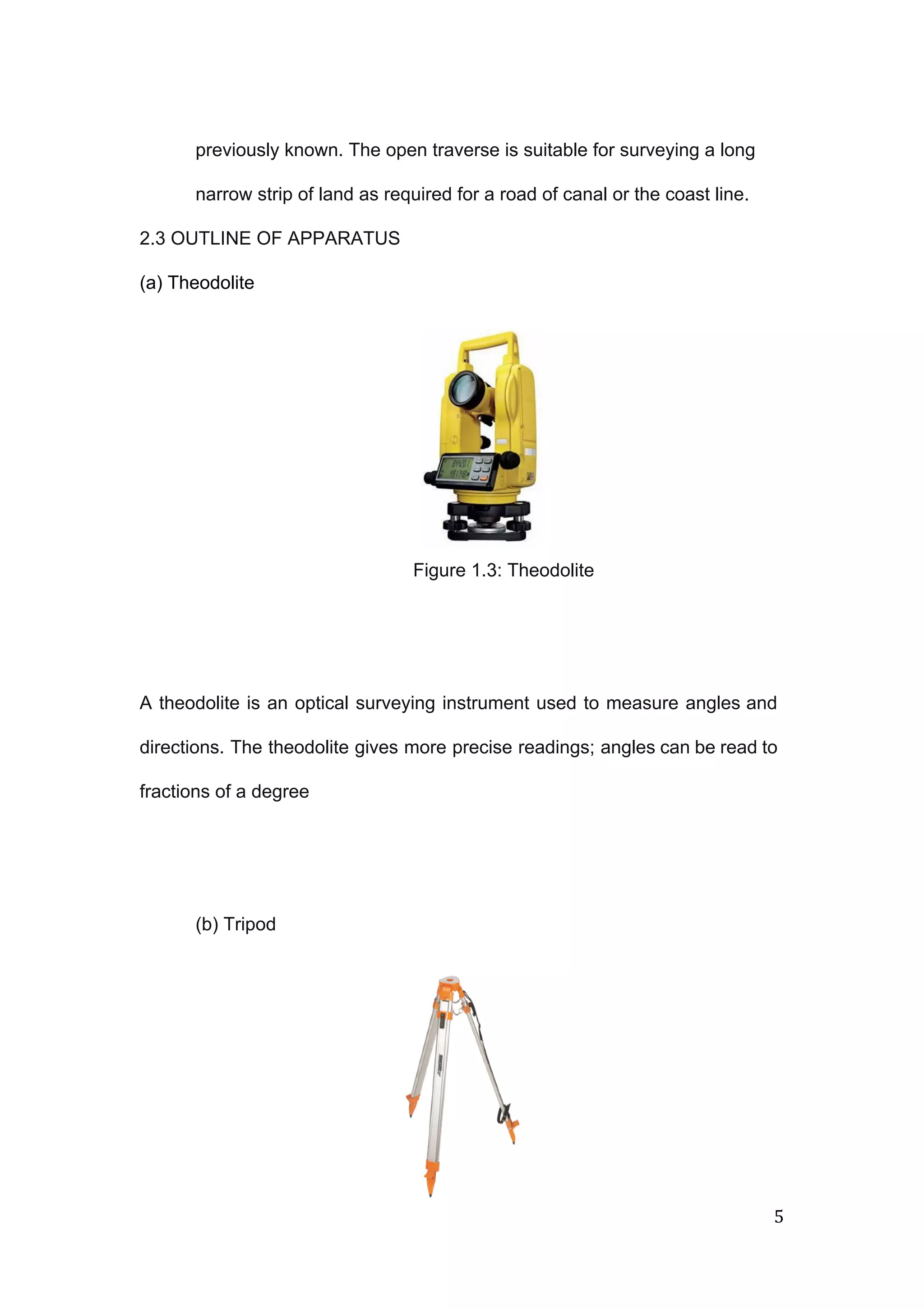
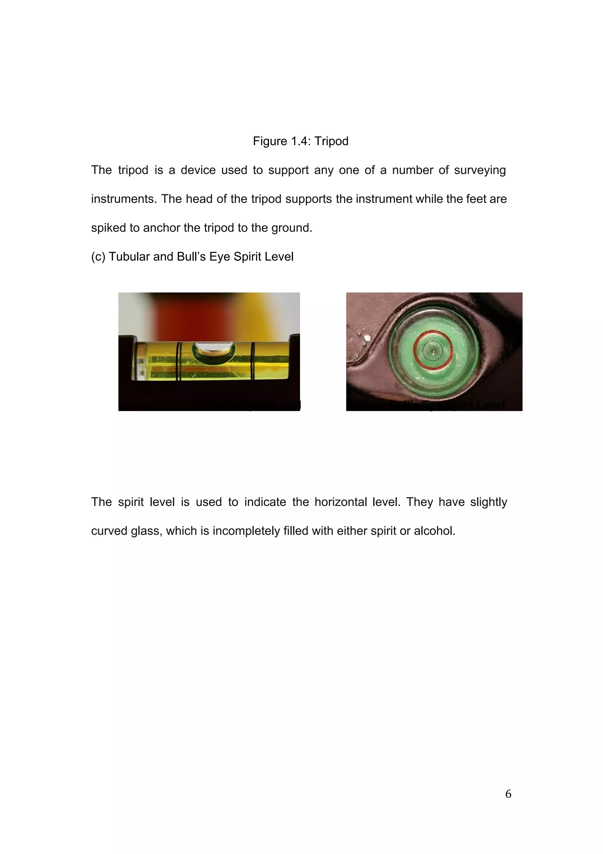
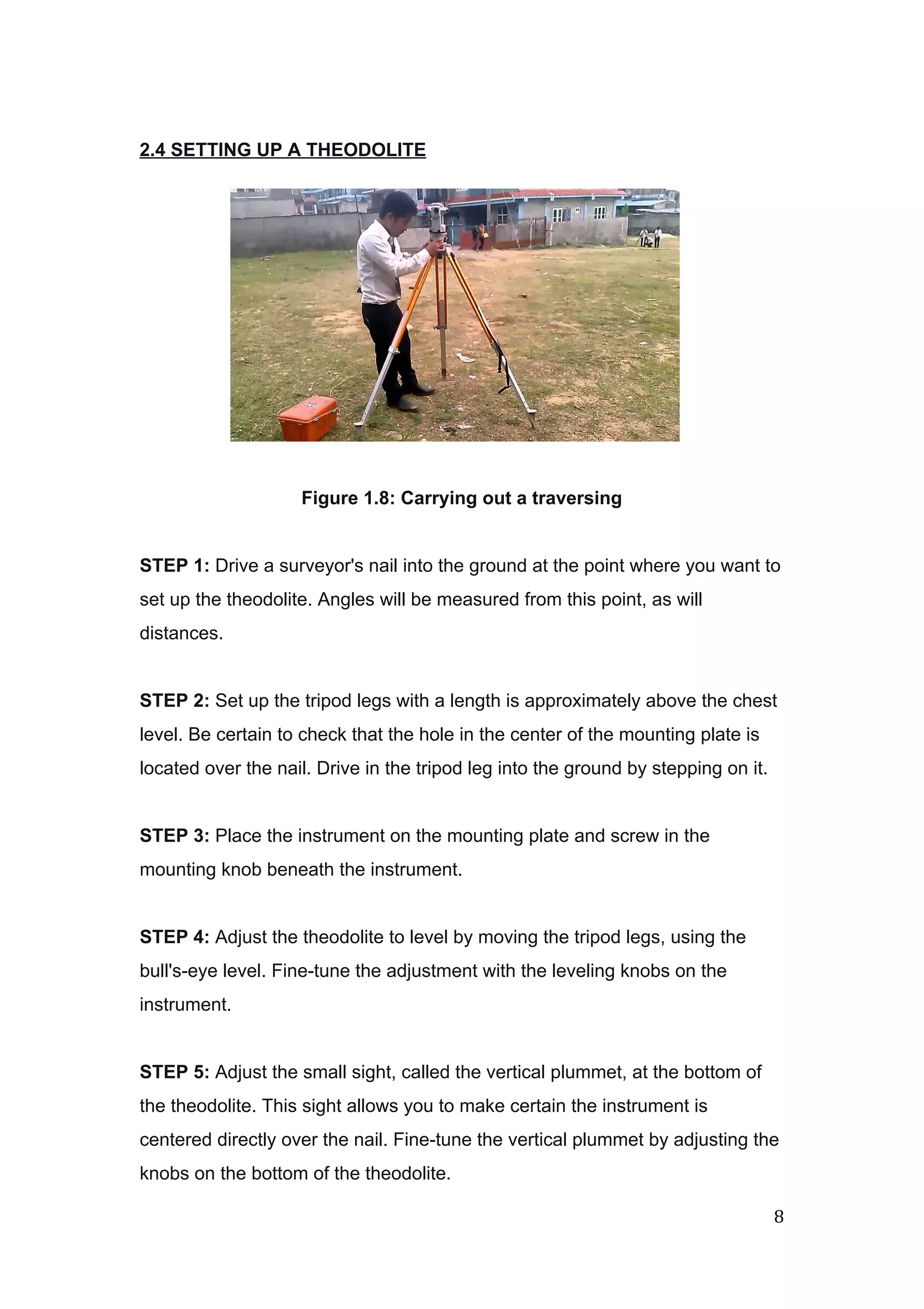
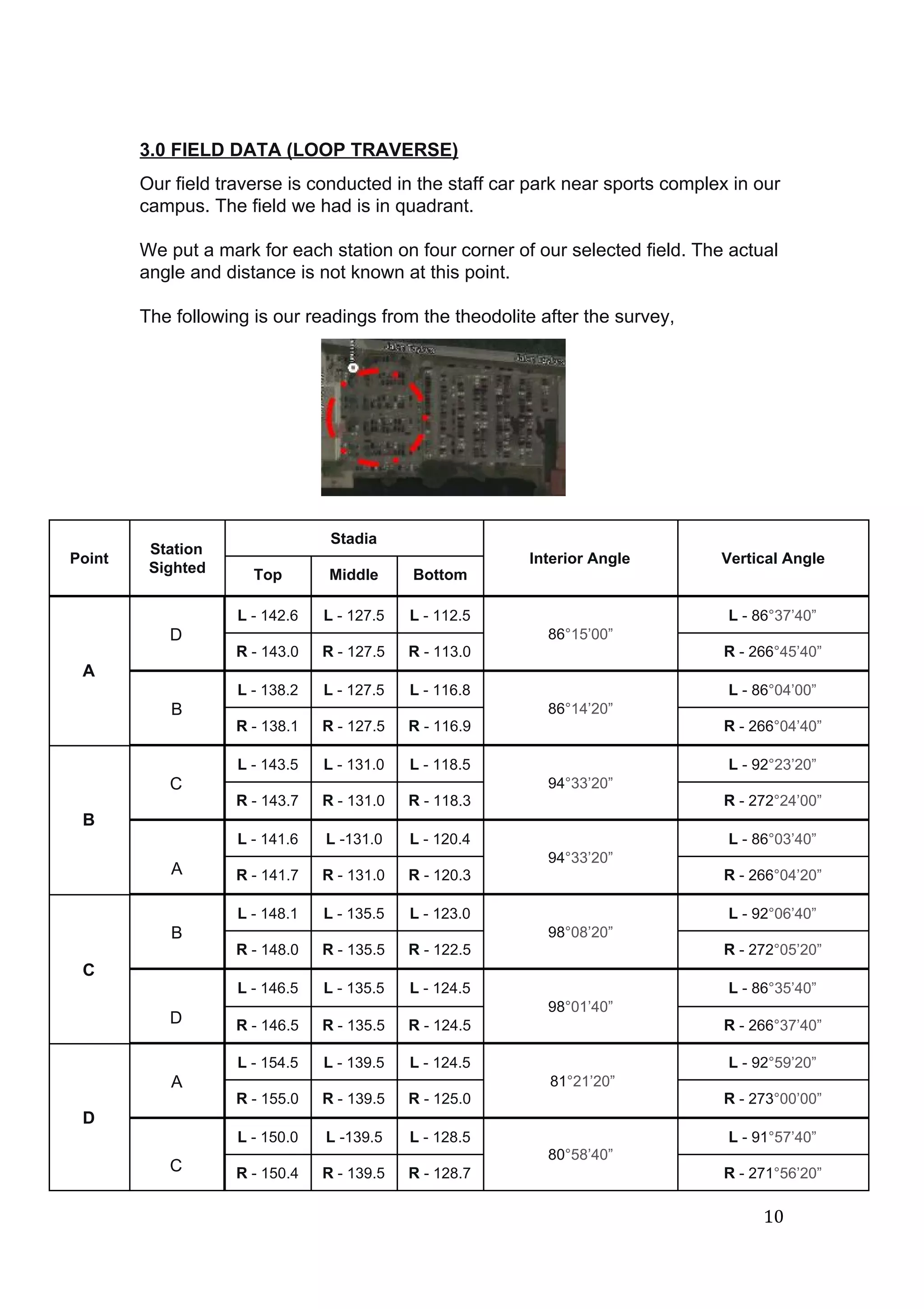
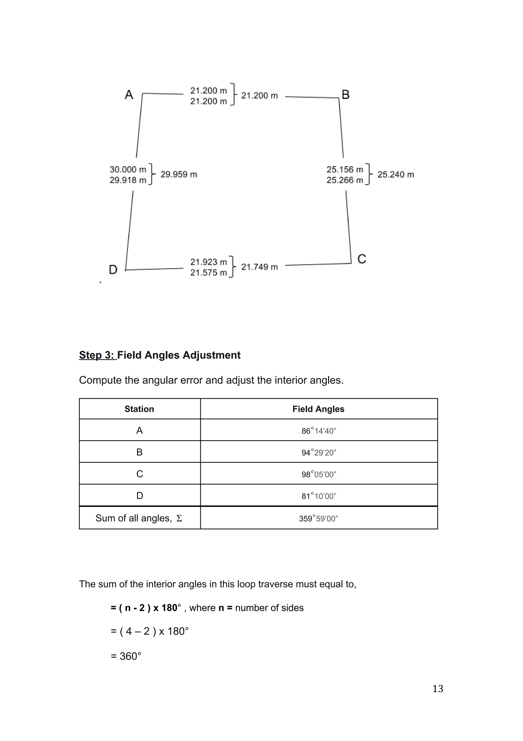
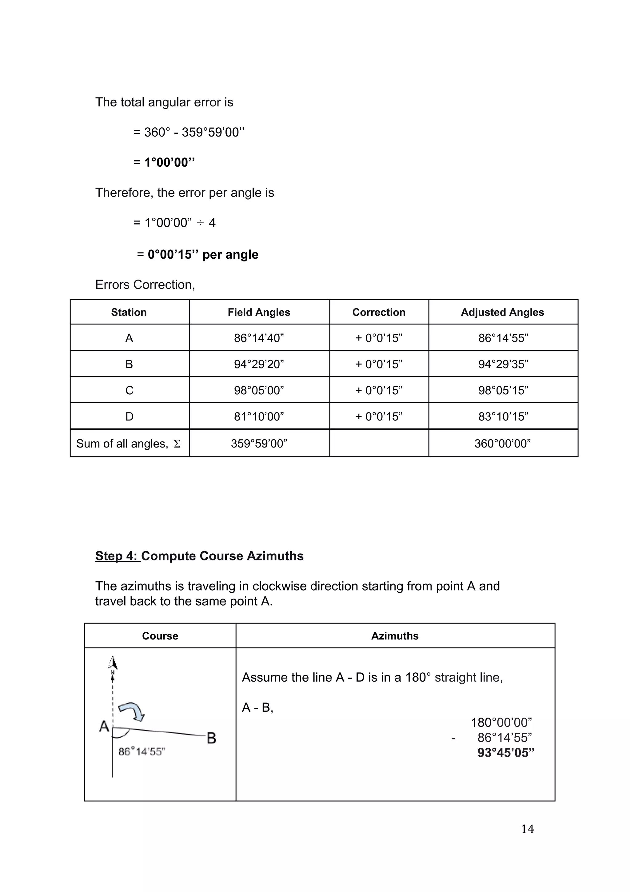
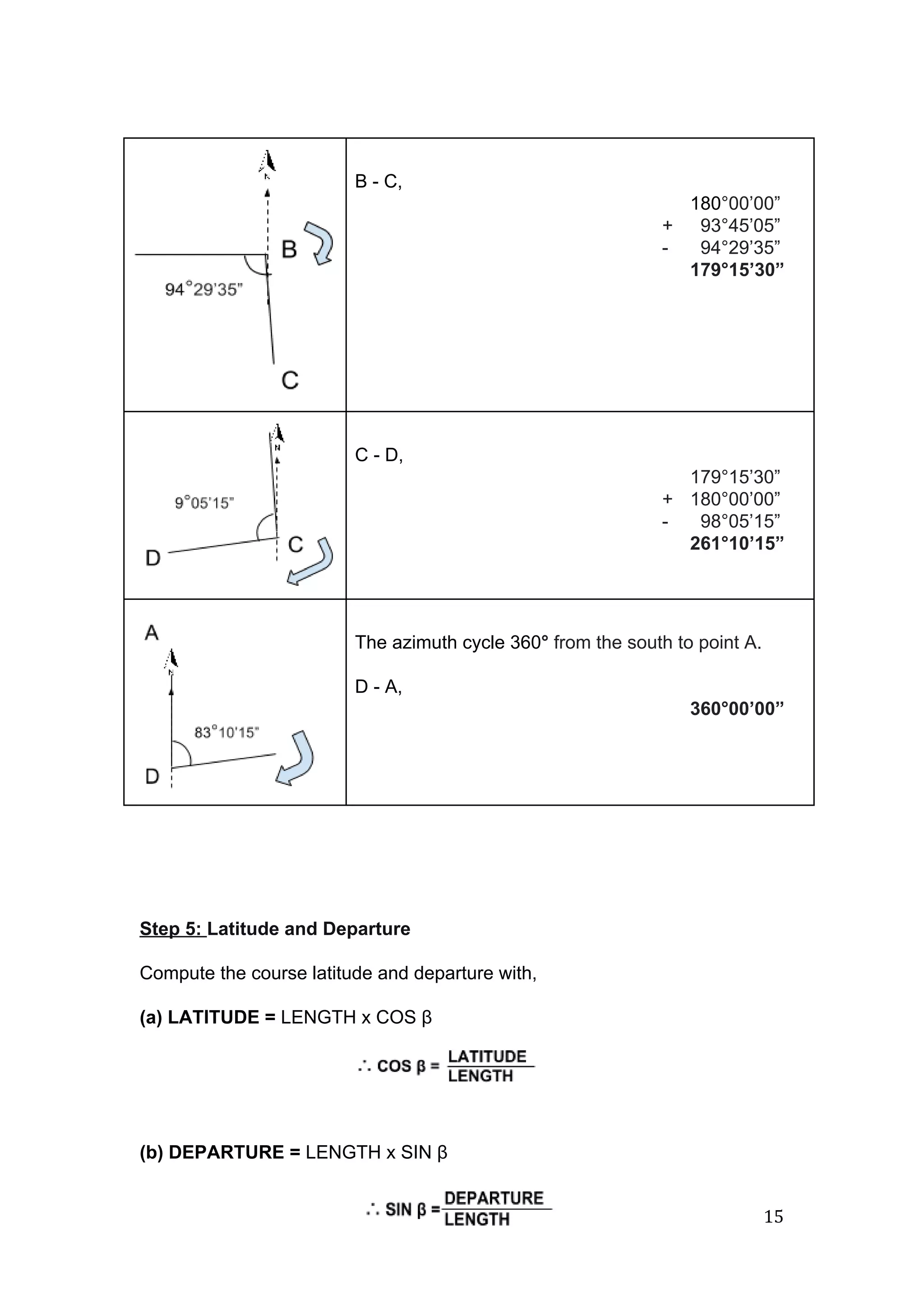
This document reports on a site surveying project using traversing techniques. The objectives of traversing are outlined, including determining boundary positions and areas. Closed and open traverses are described and surveying equipment like theodolites, tripods, levels, and ranging rods are explained. Field data from a loop traverse conducted in a campus parking lot is presented, including station sightings, interior angles, vertical angles, and stadia readings. The data is averaged and used to calculate vertical distances between points to develop a layout diagram of the traverse.
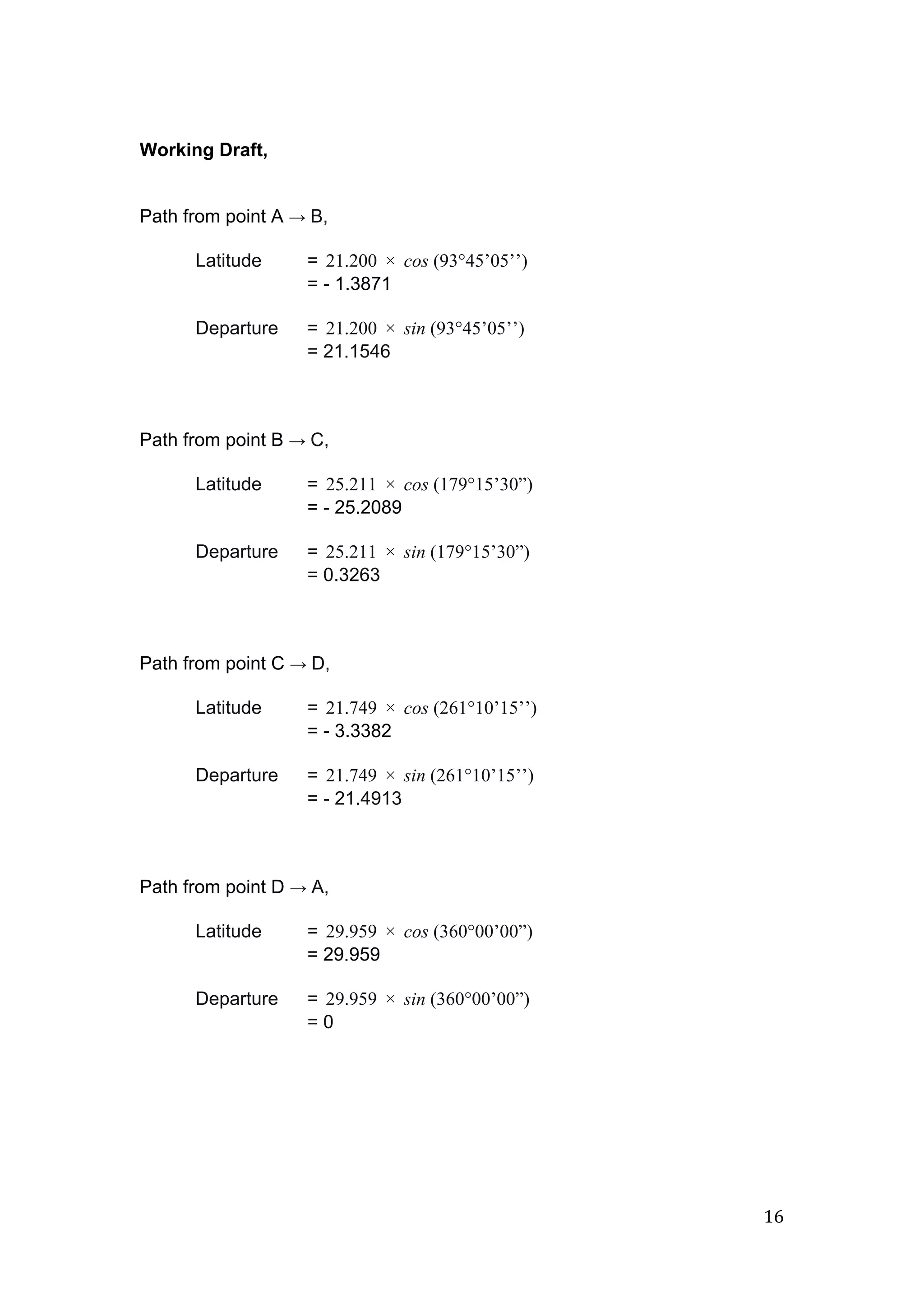
![The latitude and departure for each station is as followings,
Station Azimuth, β Length, L (m) Cosine β Sine β Latitude Departure
A
93°45’05’’ 21.200 0.0654 0.9981 1.3871 21.1546
B
179°15’30” 25.211 0.9999 0.0129 25.2089 0.3263
C
261°10’15’’ 21.749 0.1535 0.9882 3.3382 21.4913
D
360°00’00” 29.959 1.000 0 29.959 0
A
Σ
(Perimeter)
98.119
(∑Δy)
0.0248
(∑Δx)
0.0104
Step 5: Error of closure and accuracy
Determine the error of closure and accuracy;
= ∑Δy²
∑Δx²
= √ (0.0248)² + (0.0104)²
= 0.0269
Hence, the accuracy is
= 1: (P/ Ec)
= 1: (98.119/0.0269)
= 1: 3647.5465 [> 1: 3000]
∴ ERROR ACCEPTABLE, proceed to adjustment
17](https://image.slidesharecdn.com/ssreport2-traversing-160713171416/75/Site-Surveying-report2-traversing-17-2048.jpg)
![Step 6: Adjust Course Latitudes and Departures
The correction can be done with “The Compass Rule”:
= OR , where,ΣΔy] P L − [ ÷ × ΣΔx] P L − [ ÷ ×
and = the error in latitude or in departureΔy Σ Δx Σ
= the total length or perimeter of traverseP
= the length of particular courseL
Station Unadjusted Corrections Adjusted
Latitude Departure Latitude Departure Latitude Departure
A
1.3871 21.1546 0.0053 0.0022 1.3924 21.1568
B
25.2089 0.3263 0.0064 0.0027 25.2153 0.3290
C
3.3382 21.4913 0.0055 0.0023 3.3437 21.4890
D
29.959 0 0.0076 0.0032 29.9514 0.0032
A
(∑Δy)
0.0248
(∑Δx)
0.0104
Check
0.0248
0.0104
Check
0.0000
0.0000
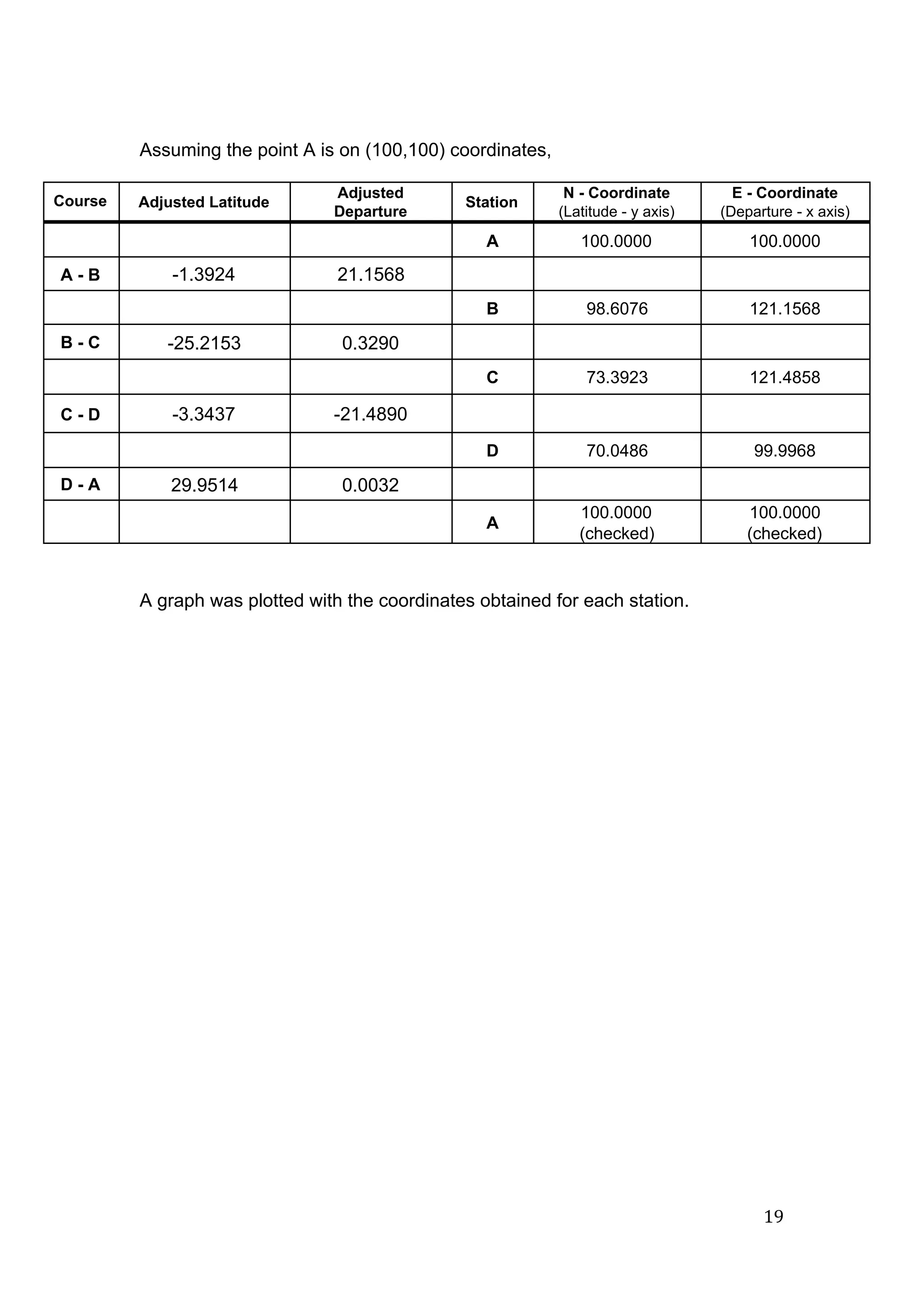
Step 7: Station Coordinates
Compute the station coordinates with,
N₂ = N₁ + Latitude₁₋₂
E₂ = E₁ + Departure₁₋₂, where,
N₂ and E₂ = the Y and X coordinates of station 2
N₁ and E₁ = the Y and X coordinates of station 1
Latitude₁₋₂ = Latitude of course 12
Departure₁₋₂ = Departure of course 12
18](https://image.slidesharecdn.com/ssreport2-traversing-160713171416/75/Site-Surveying-report2-traversing-18-2048.jpg)
![closing up the point A and A’ by adjusting the latitude and departure of our
readings by using these two formulae, the compass rule:
● [∑Δy]/ ∑ l Latitude l x Cumulative Length ( Latitude )
● [∑Δx]/ ∑ l Departure l x Cumulative Length ( Departure )
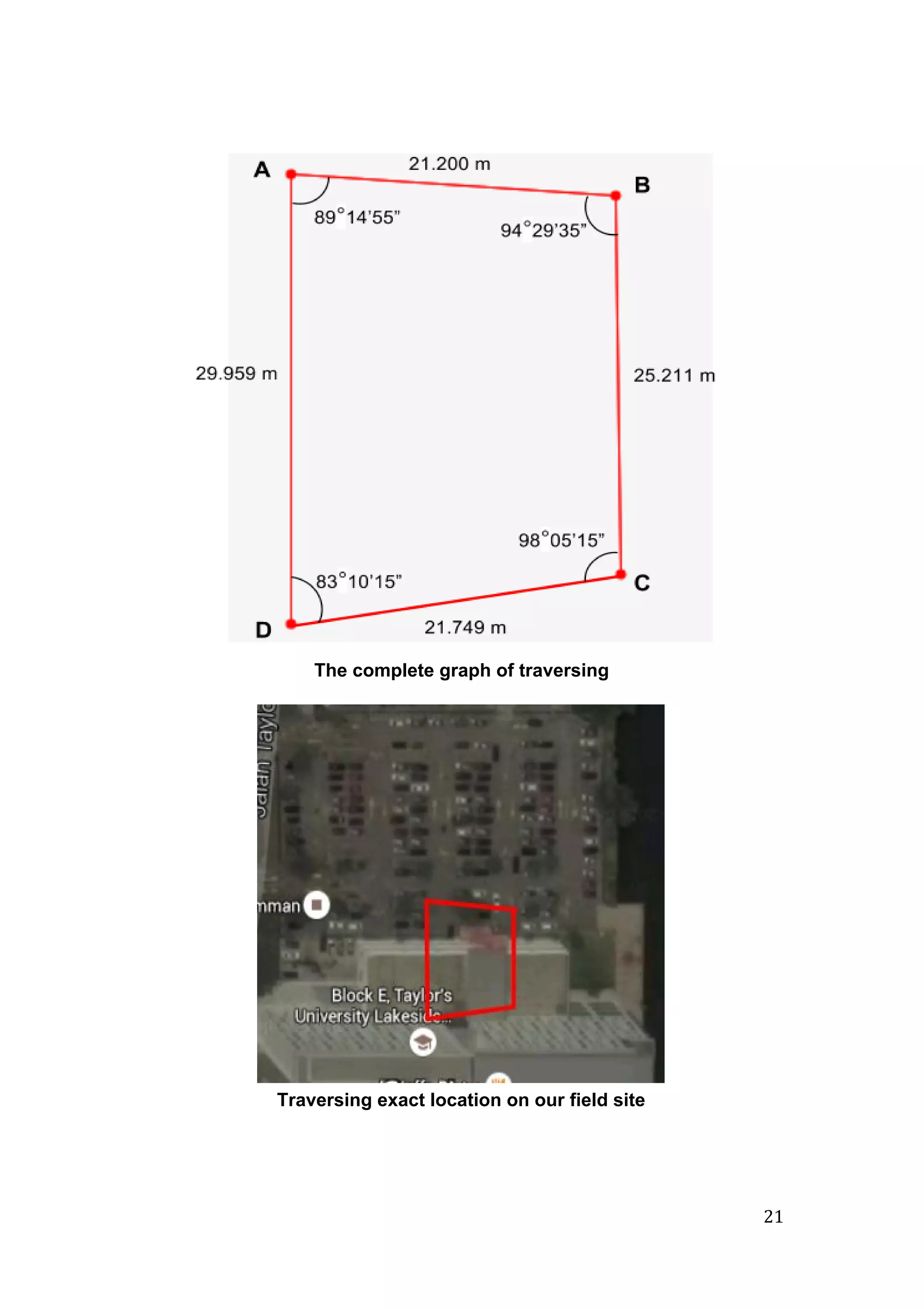
After the adjustment, thus giving a complete quadrant on the site survey.
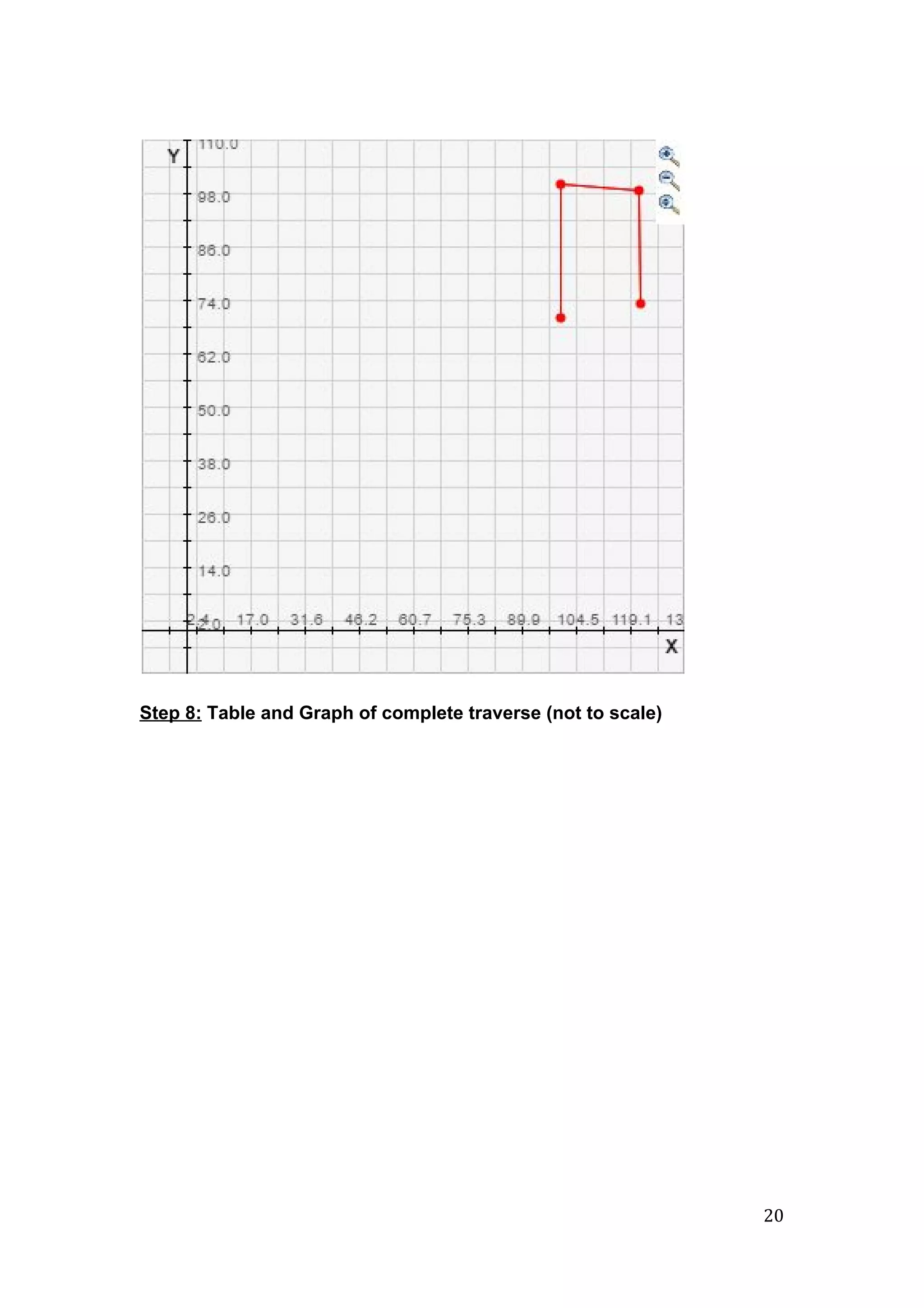
We are then continue to find the coordinates and plotting them on a graph,
this help us to get a better understanding on our site survey, with all the
detailed dimensions and measurements.
In conclusion, we have learnt how to use a theodolite in proper way and also
able to get a correct measurement. Our groupmates have also been very
helpful as this task cannot be carried out by one less person especially under
the scorching hot sun. Also special thanks to our Site Surveying lecturer, Mr.
Chai to be always there in the field to guide us and make sure that we carry
out the measurement correctly.
23](https://image.slidesharecdn.com/ssreport2-traversing-160713171416/75/Site-Surveying-report2-traversing-23-2048.jpg)


