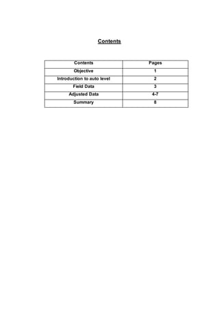
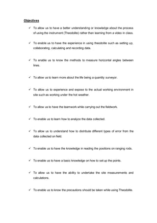
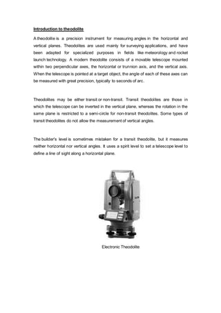
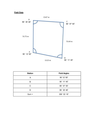
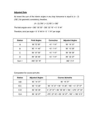
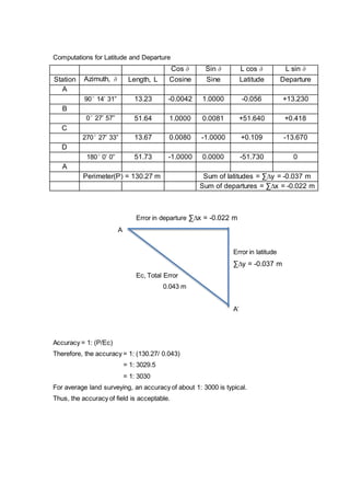
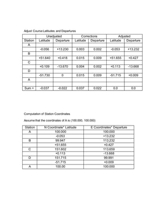
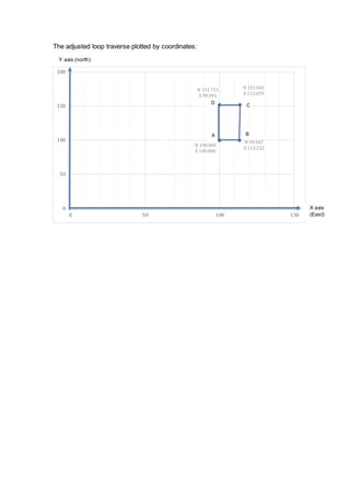
The document describes a student fieldwork assignment using a theodolite to measure horizontal angles between stations (A, B, C, D) set up to form a loop traverse. The students measured the field angles, adjusted for angular errors, computed latitudes, departures and station coordinates, and plotted the adjusted loop traverse. Key steps included setting up the theodolite, measuring angles, distributing errors, calculating accuracy, and determining station positions had an acceptable accuracy of 1:3030 for average land surveying.
![SCHOOL OF ARCHITECTURAL,
BUILDING &
DESIGN
BACHELOR OF QUANTITY SURVEYING (HONOURS)
AUGUST 2014
[QSB 60203] SITE SURVEYING
Fieldwork 2
Group Member: Eley Chong Shu Hui 0319458
Melvin Lim 0315772
Moy Chin Hoong 0314014
Muhammad Hakim 0310371
Lecturer : CHAI VOON CHIET](https://image.slidesharecdn.com/fieldwork2ss-2-141203080515-conversion-gate01/85/Fieldwork-2-1-320.jpg)
![SCHOOL OF ARCHITECTURAL,
BUILDING &
DESIGN
BACHELOR OF QUANTITY SURVEYING (HONOURS)
AUGUST 2014
[QSB 60203] SITE SURVEYING
Fieldwork 2
Group Member: Eley Chong Shu Hui 0319458
Melvin Lim 0315772
Moy Chin Hoong 0314014
Muhammad Hakim 0310371
Lecturer : CHAI VOON CHIET](https://image.slidesharecdn.com/fieldwork2ss-2-141203080515-conversion-gate01/75/Fieldwork-2-1-2048.jpg)


![Module-V SURVEYING-I [BTCVC304]](https://cdn.slidesharecdn.com/ss_thumbnails/module-v-191020180056-thumbnail.jpg?width=640&height=640&fit=bounds)


