Downloaded 865 times
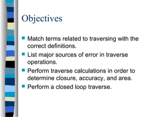
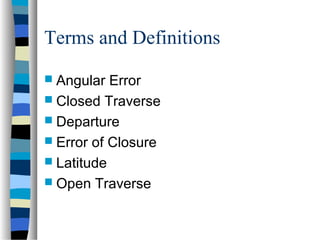
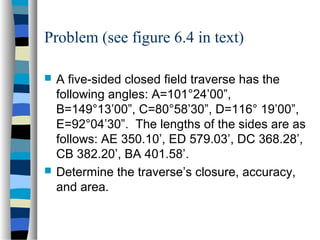
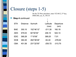
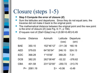
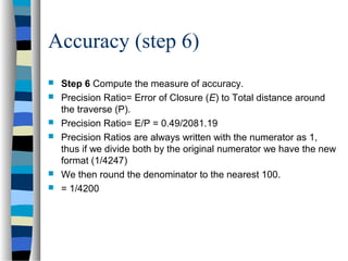
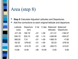
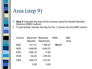
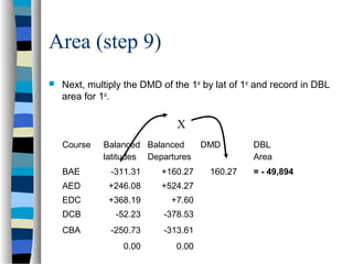
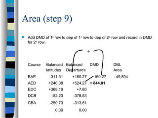
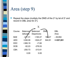
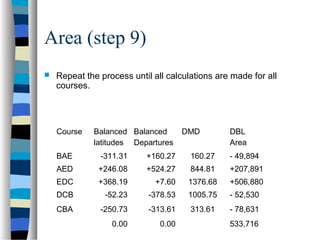
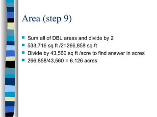

This document outlines the steps to compute the closure, accuracy, and area of a traverse survey. It discusses key terms, sources of error, and a 9-step process to calculate closure, precision ratio, and area using the double meridian distance method. As an example, it works through the calculations for a 5-sided closed traverse, determining the closure is 0.49 feet, precision ratio is 1:4200, and total area is 6.126 acres.