
Recommended
More Related Content
What's hot
What's hot (20)
Similar to Setting out of bridges unit 6
Similar to Setting out of bridges unit 6 (20)
Recently uploaded
Recently uploaded (20)
Setting out of bridges unit 6
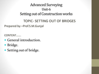
- 1. AdvancedSurveying Unit-6 SettingoutofConstructionworks TOPIC- SETTING OUT OF BRIDGES Prepared by –Prof.S.M.Gunjal CONTENT……. General introduction. Bridge. Setting outof bridge.
- 2. Setting Out:- 1. It is a process of transferring the distance from the plan already prepared, to the ground before starting the construction. The plan as designed and prepared is set out on the ground in the correct position. 2. Setting out in a sense, is a reverse of the conventional surveying plans are prepared by the designer using the data from the site. While, in setting out the plans and designs prepared by the designer are transferred accurately onto the site.
- 3. Bridge 1. A bridge is a structure built to span physical obstacles without closing the way underneath such as a body of water, valley, or road, for the purpose of providing passage over the obstacle. 2. There are many different designs that each serve a particular purpose and apply to different situations. Designs of bridges vary depending on the function of the bridge, the nature of the terrain where the bridge is constructed and anchored, the material used to make it, and the funds available to build it.
- 4. Surveys 1. Bridge surveying is necessary to locate a site, obtain information for design, and furnish lines and grades for construction. A reconnaissance survey is made at all possible sites. 2. A preliminary survey is made at the best site to establish horizontal and vertical control and to obtain information for the bridge design and construction planning. A location survey is made to lay out the bridge according to the bridge plans. 3. During Actual construction, the surveyor establishes any additional lines and grades required by the construction foreman. 4. The accuracy of measurements and the number and type of survey markers vary with the degree of precision demanded and the type of construction.Variations may range from hand-level and sketch board work for a tactical bridge to precise measurements for a prefabricated steel bridge.
- 5. Setting out of bridges • Setting out of structures like culverts is quite simple, because there is only one span and also the f low of water is less. Even if the f low of water is much, it maybe easily diverted. But in case of bridges , the f low of water can not be diverted. Also the bridge maybe very long having more than one spans. Therefore, the setting out of bridge involves:- 1. Determination of length of the centre line. 2. Determination of location of piers.
- 6. Determinationof length of centerline The length of the center line of a short bridge maybe measured directly with the standard steel tape. But in case of a long bridge the length is usually determined by triangulation. Let A and B be theend pointson Centre line on ether bank of the riverand if it is required todetermine the length AB.
- 7. Method– 1 : The stepsinvolvedare:- • Set out a line perpendicular to AB and measure AD accurately. • With the theodolite at point D and using the method of repetition, measure of angle ADB = Ѳ • Then, tan Ѳ = AB/AD. • AB = AD tan Ѳ • To check the length AB, set out a line BC perpendicular to • AB at point B. • Measure the length BC and angle BCA = α • Then, tan α = AB/BC. • AB = BC tan α. • If two distances are almost equal the mean of the two is taken as the length of the centre line, otherwise the procedure is repeated.
- 8. Setting out of a bridge. base line B α C centre lineof bridge River A Ѳ D
- 9. Method2. The stepsinvolvedare • Set out lines AD and BC, perpendicular to AB. Join CD, Ac and Bd. Measure these lines AD and BC and eight angles accurately. • Calculate the length of AD from the measured length from the measured length of BC and the angles, and compare it with the measured value. The difference between the two should be less than 1 in 5000. • Then calculate the length of AB from the known angles and the base lines.
- 10. . B base line C River Base line D
- 11. Determinationof locationof piers • Method 1 • After accurately measuring the length of the centre line AB,base lines are laid out on each bank, perpendicular to Ab.Let it be required to fix the positions of piers p1 and p2. • Compute the angles ADP1, ADP2, BCP1, BCP2 from the known length of the base lines and angles BAD & CBA. • Direct the transit at A to B, and set the angle ADP1 with the transit at D. The intersection of these two lines of sight gives the position of the central point P1, sly. Locate the second point P2. • The location of p1 and p2 maybe checked by setting two transits at B and C.
- 13. Method2 • Calculate the length of the centre line AB and mark the positions of P1 and P2 on the plan. • Set up the base line at A and B, and perpendicular to AB • Measure the distance AP1 and AP2, BP1 & BP2 from the plan and mark them n base line at A and B respectively. • Set up the theodolite at P1 on the base line B. • Locate the centre point at P1 of the pier by simultaneously sighting from both the points of P1 • Similarly, locate the central point P2 of the second pier.
- 14. • Shift the instrument to the corresponding point of the opposite side of the centre line AB and locate P1 and P2 in the same way. • If the points P1 and P2 are located in the same position as before, the work is correct, otherwise repeat the process.
- 15. . • P1 P2 B P2 P1 • 45 • 45 • p2 • River • p1 • P2 P1 A P2 P2
- 16. THANK YOU