Download as PDF, PPTX
![Ranging [Direct and Indirect]](https://image.slidesharecdn.com/module-i-191020180028/85/Module-I-SURVEYING-I-BTCVC304-11-320.jpg)
![SCALE
• Scale is a fixed ratio that every distance on the plan bears with corresponding distance on the ground.
• One centimetre on the plan represents some whole number of the metres on the ground.
1cm = 10m [This type of scale is called engineering scale].
• 1 unit of length on the plan represents some number of same units of length on the ground.
i.e. 1/1000 etc.
• This ratio of map distance to the corresponding ground distance independent of units of measurement is
called Representative Factor (RF).
• For example,
1cm = 50m
RF = 1/(50×100) = 1/5000
• Above two types of scales are also known as numerical scales.](https://image.slidesharecdn.com/module-i-191020180028/85/Module-I-SURVEYING-I-BTCVC304-16-320.jpg)

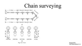
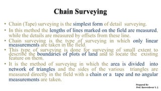
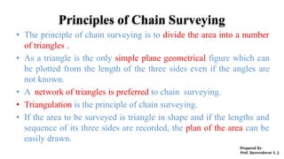
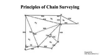
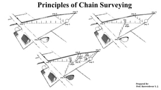
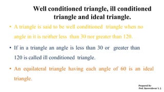
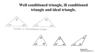
Chain surveying, or tape surveying, is a method of detail surveying where linear measurements are taken to mark boundaries and locate features in small areas, utilizing a network of triangles for accurate plotting. Key principles include dividing the area into triangles and ensuring well-conditioned triangles are formed, as they provide straightforward geometric relationships. It is suitable for level ground and small areas but not recommended for crowded or undulating terrain.


![Module-II SURVEYING-I [BTCVC304]](https://cdn.slidesharecdn.com/ss_thumbnails/module-ii-191020180034-thumbnail.jpg?width=640&height=640&fit=bounds)


