Here is another creative presentation by your slide maker on the topic "OCEAN CURRENTS OF THE WORLD". Hope you like it. If you like it then please, *like*, *Download* and *Share*.
By- Slide_maker4u (Abhishek Sharma)
*******For presentation Orders, contact me on the Email addresses Written below********
Email- Sharmaabhishek576@gmail.com
or
Sharmacomputers87@gmail.com
*******THANK YOU***************
Oceans are a vast body of salt water that covers almost three to fourths of the earth's surface.
Seas are smaller, found on the margins of the ocean and are partially enclosed by land.
Seawater:
High density, high heat capacity, colder, salty and slightly compressible (its volume decreases under pressure), thus its density increases with pressure.
Why is Ocean Circulation Important?
•Similar to winds in the atmosphere, they transfer significant amounts of heat from equatorial areas to the poles and thus play important roles in determining the climates of coastal regions.
•The ocean circulation pattern exchanges water of varying characteristics, such as temperature and salinity
•ocean currents and atmospheric circulation influence one another.
•in addition, they transport nutrients and organisms
Oceanography is the science that studies the oceans along with marine organisms and ecosystem dynamics, ocean currents and waves, plate tectonics and the geology of the sea floor, and the chemical substances and physical properties of the world oceans.
Seas and Oceans are dynamic ecosystems. Oceans are very vast bodies of water. Wind blowing on the surface of the ocean has the greatest effect on the movement of surface water. Vertical or horizontal movement of both surface and deep water masses happen in the world’s oceans. They are called as Ocean currents. Currents normally move in certain specific directions. Hence, they aid in the circulation of the moisture on Earth. Because ocean currents circulate water worldwide, they have a significant impact on the movement of energy and moisture between the oceans and the atmosphere. As a result, they are important to the world’s weather.
The reason for the occurrence of such a huge mass of water on the globe, is still a myth and reality. The reason goes back to the Origin of Earth itself. The exact mode of origin is not precisely known. Scientists assume, both Primary and secondary sources would have given rise to all both air and water on the earth. Two possible sources as internal source (or) external source have been proposed so far. Some of them are attributed towards the theories of origin of the earth.
Every continent or island is bordered by a long or short coastline. Coastline is the line separating the land and sea. Coastal zones are the transition zones between terrestrial and marine habitat. They form an interface between land and oceanic natural processes. Coastal areas also are varied in their topography, climate and vegetation. Some are sandy beaches, rocky shores, with or without tidal inlets. The climate of a coast are controlled by the land and sea breezes and the humidity controlled by marine water. Waves are powerful tools for constructive and destructive activities. Hence. the geomorphology of beach, materials and processes are always not constant due to the impact of everlasting action of tides, waves and currents.
The Earth’s climate is dynamic and characterised by trends, aberrations and quasi-periodic oscillations varying over a broad range of time-scales [1], which are governed by external (extraterrestrial systems) and/or internal(ocean, atmosphere and land system). Trends are largely controlled by plate tectonics, and thus to change gradually on million year time scale. Aberrations occur when the certain thresholds are passed and are manifested in the geological record as the unusual rapid (less than a few thousands of years) or extreme change in climate. The quasi-periodic oscillations are mostly astronomically paced; they are driven by astronomical perturbations that affect the earth’s orbit around the sun and the orientation of earth’s rotation axis with respect to its orbital plane. These perturbations are described by the three main astronomical cycles: eccentricity, precession and obliquity, which together determine the spatial and seasonal pattern of insolation received by the earth [2], eventually resulting in climatic oscillations of ten to hundreds of thousands of year [3].Sun being the main source of energy for the earth system controls the climate of it. Variation in solar activity and cosmic ray intensity has direct influence over climatic features such as cloudiness, temperature and rainfall [4]. Volcanic eruptions also force all elements of the climatic systems up to a varying degree but producing long term climatic signals in the ocean. The cumulative volcanic cooling effect at present offsets about one third of anthropogenic warming [5].Other than these causes paleoclimatologists also relates the past climate changes with movement of solar system[6], interplanetary dusts and influence of asteroids[7].However the recent variability in climate what earth is experiencing is unlikely due to any of the individual above factors rather it is due to the compound effect of complex interactions of all the natural as well as anthropogenic forcings.
References:
1. J. C. Zachos, M. Pagani, L. Sloan, E. Thomas, K. Billups, Science 292 (2001) 686-693.
2. G. Kukla, Nature (London) 253, 600 (1975).
3. J. D. Hays, J. Imbrie, N. J. Shackleton, Science 194 (1876) 1121-1132.
4. N. Marsh, H. Swensmark, Space Sci. Rev. 94 (2000) 215-230.
5. T. L. Delworth, V. Ramaswamy, G. L. Stenchikov, Geophys. Res. Lett. 32 (2005) L24709.
6. K. Fuhrer, E. W. Wolf, S. J. Johnsen, J. Geophys. Res. 104(D24) (1999) 31043-31052
7. P. Hut, W. Alvarez, W. P. Elder, T. Hansen, E. G. Kauffman, G. Keller, E. M. Shoemaker & P. R. Weissman, Nature Vol. 329, 10 September, 1987
This PowerPoint is one small part of the Weather and Climate unit from www.sciencepowerpoint.com. This unit consists of a five part 2500+ slide PowerPoint roadmap, 14 page bundled homework package, modified homework, detailed answer keys, 19 pages of unit notes for students who may require assistance, follow along worksheets, and many review games. The homework and lesson notes chronologically follow the PowerPoint slideshow. The answer keys and unit notes are great for support professionals. The activities and discussion questions in the slideshow are meaningful. The PowerPoint includes built-in instructions, visuals, and review questions. Also included are critical class notes (color coded red), project ideas, video links, and review games. This unit also includes four PowerPoint review games (110+ slides each with Answers), 38+ video links, lab handouts, activity sheets, rubrics, materials list, templates, guides, and much more. Also included is a 190 slide first day of school PowerPoint presentation.
Areas of Focus within The Weather and Climate Unit: -What is weather?, Climate, Importance of the Atmosphere, Components of the Atmosphere, Layers of the Atmosphere, Air Quality and Pollution, Carbon Monoxide, Ozone Layer, Ways to Avoid Skin Cancer, Air Pressure, Barometer, Air Pressure and Wind, Fronts, Wind, Global Wind, Coriolis Force, Jet Stream, Sea Breeze / Land Breeze, Mountain Winds, Mountain Rain Shadow, Wind Chill, Flight, Dangerous Weather Systems, Light, Albedo, Temperature, Thermometers, Seasons, Humidity / Condensation / Evaporation, Dew Points, Clouds, Types of Clouds, Meteorology, Weather Tools, Isotherms, Ocean Currents, Enhanced Global Warming, Greenhouse Effect, The Effects of Global Warming, Biomes, Types of Biomes. Difficulty rating 8/10.
This unit aligns with the Next Generation Science Standards and with Common Core Standards for ELA and Literacy for Science and Technical Subjects. See preview for more information
If you have any questions please feel free to contact me. Thanks again and best wishes. Sincerely, Ryan Murphy M.Ed www.sciencepowerpoint@gmail.com
There are two types of currents in the ocean1) surface curre.docxssusera34210
There are two types of currents in the ocean:
1) surface currents move the water above the pycnocline
a) ≈ 10% of the ocean
b) horizontal motion
c) wind powered = solar powered
2) thermohaline = deep currents move the water below the pycnoline (zone of rapid change of water density)
a) ≈ 90% of the ocean
b) horizontal and vertical motion
c) density driven
density depends temperature and salinity
these are also solar powered
3) these two sets of current are interconnected
Chapter 7 – Ocean Circulation
Surface currents are moved by friction between the surface winds and the water surface = wind driven.
max speed is 3% of wind speed
Since winds are solar powered,
surface currents are solar powered.
The overall pattern of surface currents is controlled by the Coriolis effect, gravity, and the shape of the ocean basin.
Like Fig 7.7, p. 205
Ekman Transport – the net (or average) motion of wind driven water, is 90° to the direction of the wind. In a perfect world, this movement is:
90° to the right in the Northern Hemisphere,
90° to the left in the Southern Hemisphere, WHY?...........the Coriolis Effect
Fig. 9-, p. 236
In the northern hemisphere, the Westerlies tends to move water southeast, while the Trade winds move water northwest!
wind direction
wind-driven water movement (Ekman Transport)
The Westerlies (30° - 60°) and the Trade Winds (0° – 30°) are the strongest winds,* and are the
main winds causing ocean currents!
Largest change in temperature causes the strongest wind!
Remember, according to Ekman Transport, wind - driven water moves 90° to the wind direction.
In the northern hemisphere, the Westerlies tends to move water southeast, while the Trade winds move water northwest!
The movement of wind-driven water can be described with a vector = an arrow pointing in the direction of travel and scaled to the speed.
This vector can be broken up into a component moving toward the edge of the ocean and a component moving toward the center of the ocean.
wind direction water movement
vectors of water movement
The water moving east or west (toward the edge of the basin) bounces
off of the land.
In the northern hemisphere,
the water
current
turns right!
Current bounces off land
Current bounces off land
Subtropical Convergence = a short (≈ 6.5 feet tall) hill of water formed when part of the wind blow water moves to the center of the ocean basin.
Can water stand in a hill?
No!
Gravity works to move the water back downhill.
BUT the wind is still working to push water uphill again
So – The winds build the hill taller, and
The taller the hill the more gravity pulls the water back downhill
The hill continues to grow until wind driven Coriolis deflected motion in = gravity driven motion out.
Then – only the circular movement around the edge of the hill is left.
THIS IS THE SURFACE CURRENT!
Garrison, 2009, Essentials of Oceanography
Under the hill of wa ...
A guide to prepare for unit 2.6: The Oceans - Environmental Management syllabus 5014. The pictorial content will help understand the Ocean floor topography, Ocean Currents, and El-Nino phenomenon
The Roman Empire A Historical Colossus.pdfkaushalkr1407
The Roman Empire, a vast and enduring power, stands as one of history's most remarkable civilizations, leaving an indelible imprint on the world. It emerged from the Roman Republic, transitioning into an imperial powerhouse under the leadership of Augustus Caesar in 27 BCE. This transformation marked the beginning of an era defined by unprecedented territorial expansion, architectural marvels, and profound cultural influence.
The empire's roots lie in the city of Rome, founded, according to legend, by Romulus in 753 BCE. Over centuries, Rome evolved from a small settlement to a formidable republic, characterized by a complex political system with elected officials and checks on power. However, internal strife, class conflicts, and military ambitions paved the way for the end of the Republic. Julius Caesar’s dictatorship and subsequent assassination in 44 BCE created a power vacuum, leading to a civil war. Octavian, later Augustus, emerged victorious, heralding the Roman Empire’s birth.
Under Augustus, the empire experienced the Pax Romana, a 200-year period of relative peace and stability. Augustus reformed the military, established efficient administrative systems, and initiated grand construction projects. The empire's borders expanded, encompassing territories from Britain to Egypt and from Spain to the Euphrates. Roman legions, renowned for their discipline and engineering prowess, secured and maintained these vast territories, building roads, fortifications, and cities that facilitated control and integration.
The Roman Empire’s society was hierarchical, with a rigid class system. At the top were the patricians, wealthy elites who held significant political power. Below them were the plebeians, free citizens with limited political influence, and the vast numbers of slaves who formed the backbone of the economy. The family unit was central, governed by the paterfamilias, the male head who held absolute authority.
Culturally, the Romans were eclectic, absorbing and adapting elements from the civilizations they encountered, particularly the Greeks. Roman art, literature, and philosophy reflected this synthesis, creating a rich cultural tapestry. Latin, the Roman language, became the lingua franca of the Western world, influencing numerous modern languages.
Roman architecture and engineering achievements were monumental. They perfected the arch, vault, and dome, constructing enduring structures like the Colosseum, Pantheon, and aqueducts. These engineering marvels not only showcased Roman ingenuity but also served practical purposes, from public entertainment to water supply.
Embracing GenAI - A Strategic ImperativePeter Windle
Artificial Intelligence (AI) technologies such as Generative AI, Image Generators and Large Language Models have had a dramatic impact on teaching, learning and assessment over the past 18 months. The most immediate threat AI posed was to Academic Integrity with Higher Education Institutes (HEIs) focusing their efforts on combating the use of GenAI in assessment. Guidelines were developed for staff and students, policies put in place too. Innovative educators have forged paths in the use of Generative AI for teaching, learning and assessments leading to pockets of transformation springing up across HEIs, often with little or no top-down guidance, support or direction.
This Gasta posits a strategic approach to integrating AI into HEIs to prepare staff, students and the curriculum for an evolving world and workplace. We will highlight the advantages of working with these technologies beyond the realm of teaching, learning and assessment by considering prompt engineering skills, industry impact, curriculum changes, and the need for staff upskilling. In contrast, not engaging strategically with Generative AI poses risks, including falling behind peers, missed opportunities and failing to ensure our graduates remain employable. The rapid evolution of AI technologies necessitates a proactive and strategic approach if we are to remain relevant.
2024.06.01 Introducing a competency framework for languag learning materials ...Sandy Millin
http://sandymillin.wordpress.com/iateflwebinar2024
Published classroom materials form the basis of syllabuses, drive teacher professional development, and have a potentially huge influence on learners, teachers and education systems. All teachers also create their own materials, whether a few sentences on a blackboard, a highly-structured fully-realised online course, or anything in between. Despite this, the knowledge and skills needed to create effective language learning materials are rarely part of teacher training, and are mostly learnt by trial and error.
Knowledge and skills frameworks, generally called competency frameworks, for ELT teachers, trainers and managers have existed for a few years now. However, until I created one for my MA dissertation, there wasn’t one drawing together what we need to know and do to be able to effectively produce language learning materials.
This webinar will introduce you to my framework, highlighting the key competencies I identified from my research. It will also show how anybody involved in language teaching (any language, not just English!), teacher training, managing schools or developing language learning materials can benefit from using the framework.
A Strategic Approach: GenAI in EducationPeter Windle
Artificial Intelligence (AI) technologies such as Generative AI, Image Generators and Large Language Models have had a dramatic impact on teaching, learning and assessment over the past 18 months. The most immediate threat AI posed was to Academic Integrity with Higher Education Institutes (HEIs) focusing their efforts on combating the use of GenAI in assessment. Guidelines were developed for staff and students, policies put in place too. Innovative educators have forged paths in the use of Generative AI for teaching, learning and assessments leading to pockets of transformation springing up across HEIs, often with little or no top-down guidance, support or direction.
This Gasta posits a strategic approach to integrating AI into HEIs to prepare staff, students and the curriculum for an evolving world and workplace. We will highlight the advantages of working with these technologies beyond the realm of teaching, learning and assessment by considering prompt engineering skills, industry impact, curriculum changes, and the need for staff upskilling. In contrast, not engaging strategically with Generative AI poses risks, including falling behind peers, missed opportunities and failing to ensure our graduates remain employable. The rapid evolution of AI technologies necessitates a proactive and strategic approach if we are to remain relevant.
Read| The latest issue of The Challenger is here! We are thrilled to announce that our school paper has qualified for the NATIONAL SCHOOLS PRESS CONFERENCE (NSPC) 2024. Thank you for your unwavering support and trust. Dive into the stories that made us stand out!
Macroeconomics- Movie Location
This will be used as part of your Personal Professional Portfolio once graded.
Objective:
Prepare a presentation or a paper using research, basic comparative analysis, data organization and application of economic information. You will make an informed assessment of an economic climate outside of the United States to accomplish an entertainment industry objective.
Palestine last event orientationfvgnh .pptxRaedMohamed3
An EFL lesson about the current events in Palestine. It is intended to be for intermediate students who wish to increase their listening skills through a short lesson in power point.
3. Currents
A current is a large stream of
moving water that flows
through the oceans.
Currents carry water great
distances and some currents
move water at the surface of
the ocean, while others move
the deep water.
Currents move the Sun’s energy
from the equator to the poles.
They also move cold water
from the poles towards the
equator.
This moderates the climate of
our planet.
4. One Way to Explore
Currents
Norwegian explorer
Thor Heyerdahl
proved his theory that
ocean currents
influenced human
migration by using a
raft that was powered
only by wind and
ocean currents.
He showed that
Polynesia could have
been settled from
people migrating from
South America.
5. Surface Currents
The wind mainly drives
surface currents, which
affects water to the
depth of several
hundred meters.
If Earth were not
rotating, winds and
currents would only flow
in straight lines to the
north and south poles.
The Coriolis effect
causes the winds to
curve.
6. Coriolis Effect
The Earth’s
rotation causes the
winds and currents
to curve in relation
to Earth’s surface.
In the northern
hemisphere the
Coriolis effect
causes the currents
to curve to the
right (clockwise).
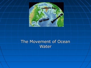
8. The Gulf Stream
The largest and most
powerful surface current
is the Gulf Stream in the
North Atlantic Ocean.
It is caused by strong
winds from the west.
The Gulf Stream carries
warm water from the Gulf
of Mexico to the
Caribbean Sea, then
northward along the coast
of the United States.
This current keeps
Northern Europe much
warmer in the winter than
it would otherwise be.
10. How Surface Currents Affect
Climate
Climate is a pattern of
temperature and
precipitation, typical
for an area over a
long period of time.
Currents affect the
climate by moving
cold and warm water
around the globe.
A surface current
warms or cools the air
above it, affecting the
climate of the land
near the coast.
11. Deep Currents
Streamlike movements
of ocean water located
far below the surface
are called deep
currents. Deep
currents are not
controlled by wind.
Deep currents form in
parts of the ocean
where water density
increases. The density
of the ocean is affected
by temperature and
salinity.
Deep currents are
caused by changes in
density.
15. Surface Currents and Climate
•
Warm-Water Currents and Climate
Warm-water currents create warmer climates
in coastal areas that would otherwise be much
cooler.
16. Surface Currents and Climate,
continued
•
Cold-Water Currents and Climate
Cold-water currents keep climates along a
coast cooler than the inland climate yearround.
17. Surface Currents and Climate,
continued
Upwelling is the
movement of deep, cold,
and nutrient-rich water
to the surface of the
ocean.
The nutrients that are
brought to the surface
support the growth of
plankton. Plankton
support larger
organisms, such as fish
and seabirds.
Upwelling is shown on
the next slide.
18.
19. El Nino
El Nino is an abnormal
climate event that
occurs every two to
seven years in the
Pacific Ocean.
It begins when an
unusual pattern of
winds form over the
western Pacific.
This causes fast
sheets of warm water
to move eastward to
the south American
coast.
It can last one to two
years.
20. Surface Currents and Climate,
continued
El Niño is a change in the
water temperature in the
Pacific Ocean that produces
a warm current.
Effects of El Niño El
Niño alters weather patterns
enough to cause disasters,
including flash floods,
mudslides, and droughts. El
Niño also prevents upwelling
off the coast of South
America.
21. El Nino Impact (Western Coast of
South America)
El Nino can have
disastrous
consequences.
Warm surface water
prevents upwelling off
of the western coast
of South America.
Without nutrients
brought up by
upwelling, fish die or
go somewhere else to
find food.
Sea birds have no fish
to eat, and also must
leave the area or die.
22. El Nino (On Land)
El Nino causes shifts in weather patterns around the world,
bringing severe conditions to different areas.
El Nino caused an unusually warm winter in northeastern U.S.
It also brought heavy rains, flooding, and mud slides in
California.
It also brought a string of deadly tornadoes in Florida.
23. Surface Currents and Climate,
continued
Studying and Predicting
El Niño Learning as much as
possible about El Niño is
important because of its
effects on organisms and land.
To study El Niño, scientist use
a network of buoys located
along the equator. The buoys
collect data about surface
temperature, air temperature,
currents, and wind.
24. Forecasting El Nino
Scientist don’t fully
understand the
conditions that create
El Nino
They can predict its
occurrence by using
computer models of
the world climate
Knowing when El Nino
will strike, officials will
give notice and can
plan for unusual
weather patterns.
25. El Nino (2006 hurricane season)
Why weren’t there many
hurricanes in the 2006
hurricane season?
The seasonal activity was lower
than expected because of the
rapid development of El Nino.
This year there were only 9
named storms, 5 became
hurricanes, and 2 became
major hurricanes in Category 3
or higher.
2005 was the most active
season on record, with 28
named storms, of which 15
became hurricanes.
Five of the seven major storms
hit the US, including Katrina.