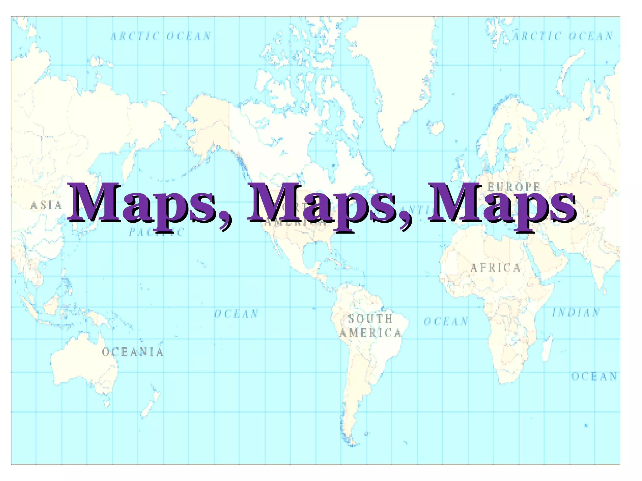
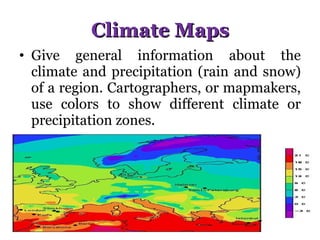
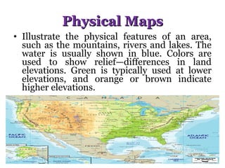
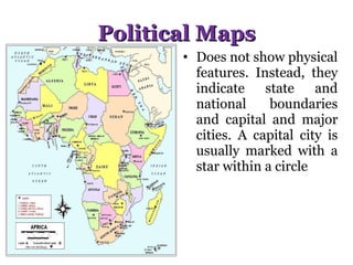
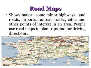
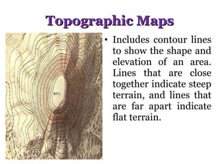
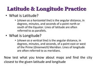
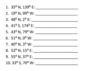
Maps, Maps, Maps
Climate Maps Give general information about the climate and precipitation (rain and snow) of a region. Cartographers, or mapmakers, use colors to show different climate or precipitation zones.
Economic/ Resource Maps Feature the type of natural resources or economic activity that dominates an area. Cartographers use symbols to show the locations of natural resources or economic activities. For example, oranges on a map of Florida tell you that oranges are grown there
Physical Maps Illustrate the physical features of an area, such as the mountains, rivers and lakes. The water is usually shown in blue. Colors are used to show relief—differences in land elevations. Green is typically used at lower elevations, and orange or brown indicate higher elevations.
Political Maps Does not show physical features. Instead, they indicate state and national boundaries and capital and major cities. A capital city is usually marked with a star within a circle
Road Maps Shows major—some minor highways—and roads, airports, railroad tracks, cities and other points of interest in an area. People use road maps to plan trips and for driving directions.
Topographic Maps Includes contour lines to show the shape and elevation of an area. Lines that are close together indicate steep terrain, and lines that are far apart indicate flat terrain.
Latitude & Longitude Practice What is Latitude?  ( shown as a horizontal line ) is the angular distance, in degrees, minutes, and seconds of a point north or south of the Equator. Lines of latitude are often referred to as parallels. What is Longitude? ( shown as a vertical line ) is the angular distance, in degrees, minutes, and seconds, of a point east or west of the Prime ( Greenwich ) Meridian. Lines of longitude are often referred to as meridians.  Now test what you know about maps and find the city closest to the given latitude and longitude
35⁰ N, 139⁰ E: ____________________ 19⁰ N, 99⁰ W: ____________________ 48⁰ N, 2⁰ E: ______________________ 41⁰ S, 174⁰ E: ____________________ 43⁰ N, 79⁰ W: ____________________ 51⁰ N, 0⁰ W: _____________________ 40⁰ N, 3⁰ W: _____________________ 52⁰ N, 15⁰ E: _____________________ 55⁰ N, 37⁰ E: _____________________ 33⁰ S, 70⁰ W: ____________________

Maps, Maps, Maps

  • 1.
  • 2.
    Climate Maps Givegeneral information about the climate and precipitation (rain and snow) of a region. Cartographers, or mapmakers, use colors to show different climate or precipitation zones.
  • 3.
    Economic/ Resource MapsFeature the type of natural resources or economic activity that dominates an area. Cartographers use symbols to show the locations of natural resources or economic activities. For example, oranges on a map of Florida tell you that oranges are grown there
  • 4.
    Physical Maps Illustratethe physical features of an area, such as the mountains, rivers and lakes. The water is usually shown in blue. Colors are used to show relief—differences in land elevations. Green is typically used at lower elevations, and orange or brown indicate higher elevations.
  • 5.
    Political Maps Doesnot show physical features. Instead, they indicate state and national boundaries and capital and major cities. A capital city is usually marked with a star within a circle
  • 6.
    Road Maps Showsmajor—some minor highways—and roads, airports, railroad tracks, cities and other points of interest in an area. People use road maps to plan trips and for driving directions.
  • 7.
    Topographic Maps Includescontour lines to show the shape and elevation of an area. Lines that are close together indicate steep terrain, and lines that are far apart indicate flat terrain.
  • 8.
    Latitude & LongitudePractice What is Latitude? ( shown as a horizontal line ) is the angular distance, in degrees, minutes, and seconds of a point north or south of the Equator. Lines of latitude are often referred to as parallels. What is Longitude? ( shown as a vertical line ) is the angular distance, in degrees, minutes, and seconds, of a point east or west of the Prime ( Greenwich ) Meridian. Lines of longitude are often referred to as meridians. Now test what you know about maps and find the city closest to the given latitude and longitude
  • 9.
    35⁰ N, 139⁰E: ____________________ 19⁰ N, 99⁰ W: ____________________ 48⁰ N, 2⁰ E: ______________________ 41⁰ S, 174⁰ E: ____________________ 43⁰ N, 79⁰ W: ____________________ 51⁰ N, 0⁰ W: _____________________ 40⁰ N, 3⁰ W: _____________________ 52⁰ N, 15⁰ E: _____________________ 55⁰ N, 37⁰ E: _____________________ 33⁰ S, 70⁰ W: ____________________