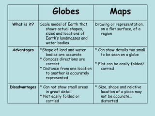
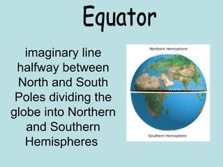
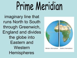
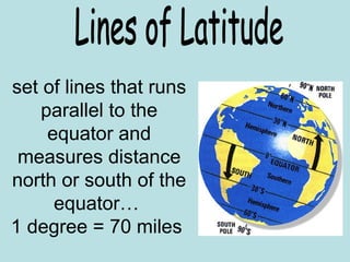
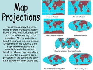
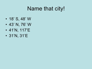
This document provides information about maps and globes, including their advantages and disadvantages. It explains that globes accurately show the shapes and sizes of landmasses and oceans, while maps represent these on a flat surface, which can distort sizes and distances. The document also defines geographic lines like the equator and prime meridian that divide the globe. It notes different map projections can distort shapes depending on their purpose. Finally, it poses questions about locations of cities and superlatives like largest bodies of water and countries.