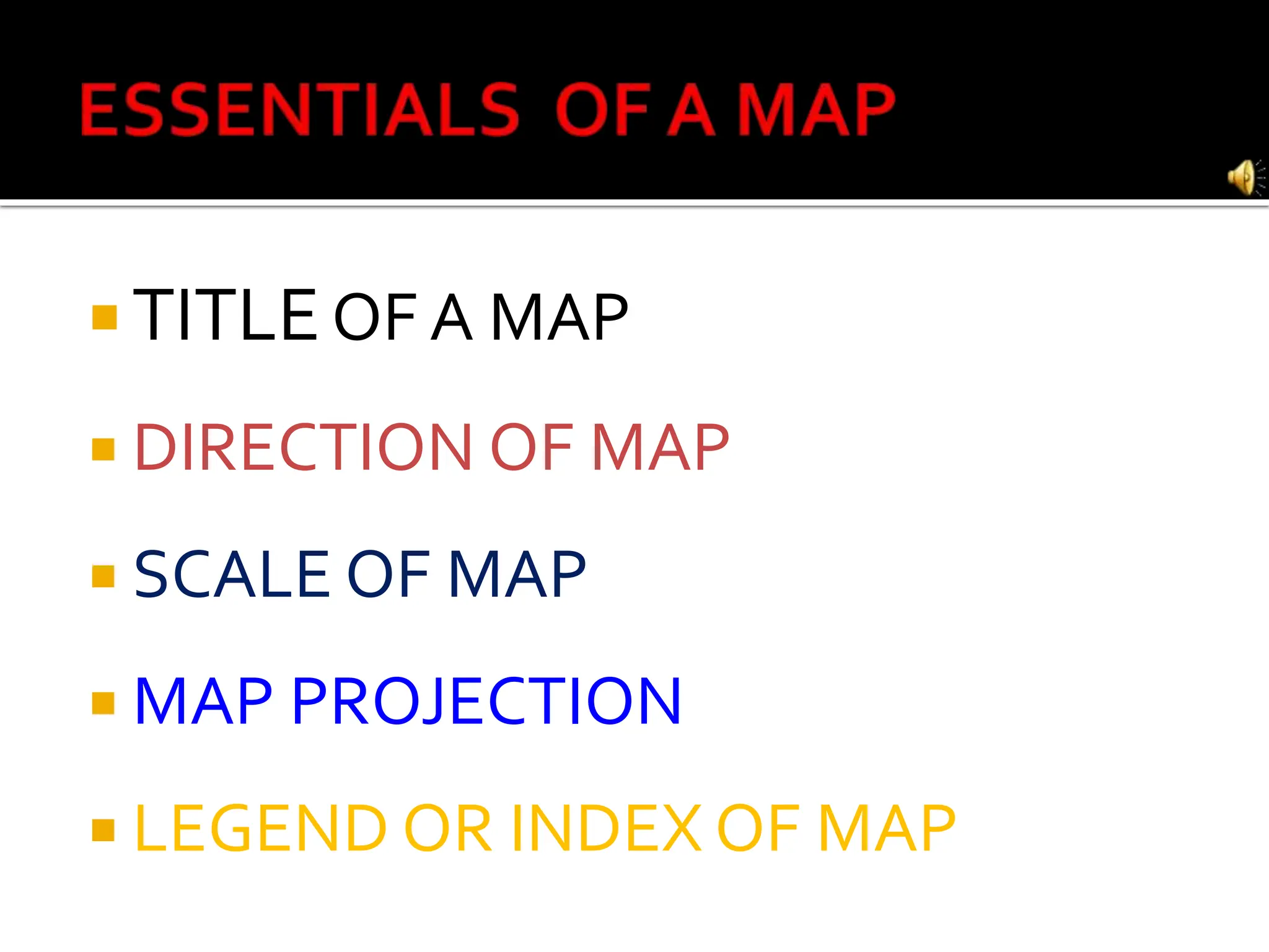
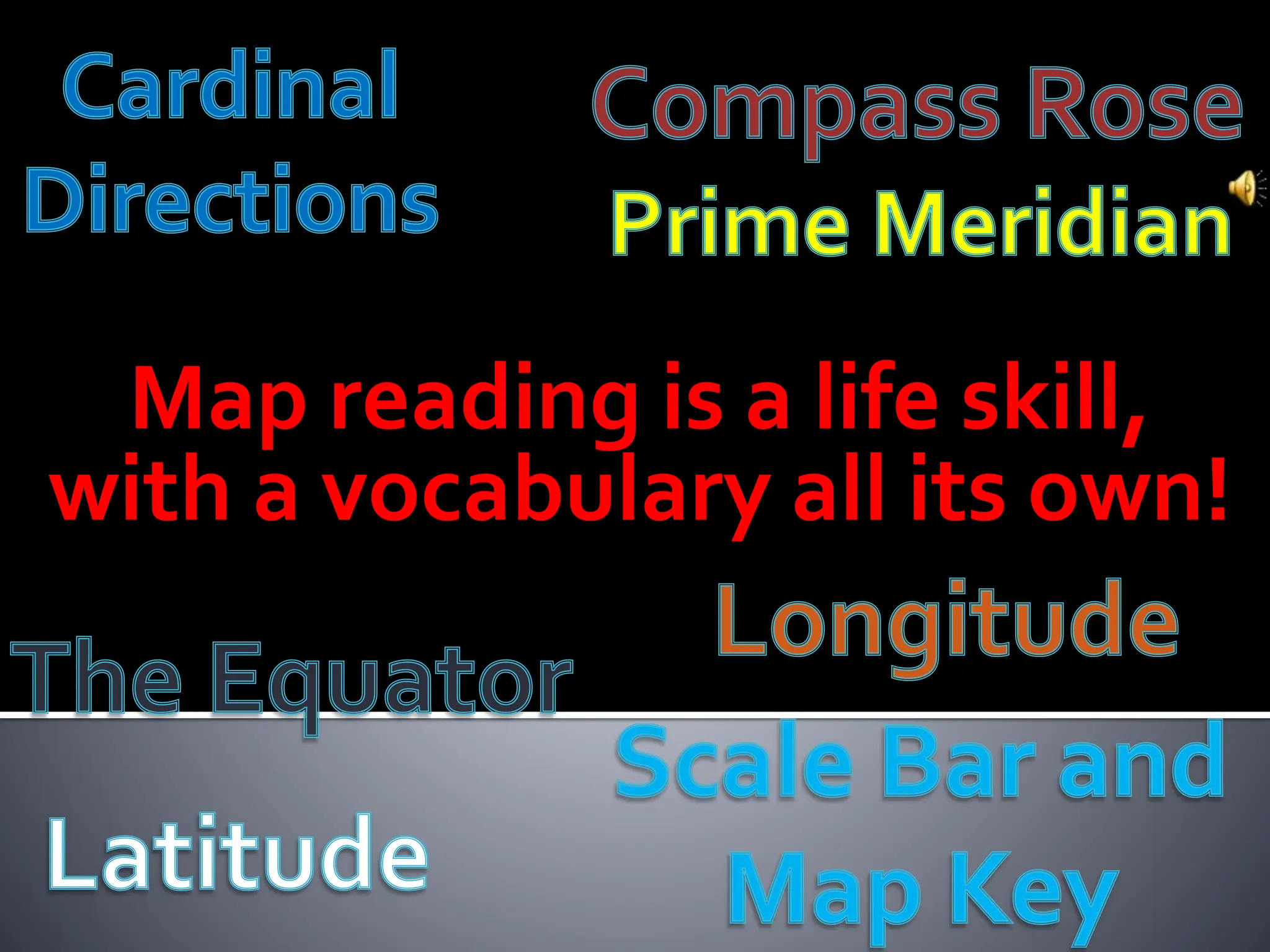
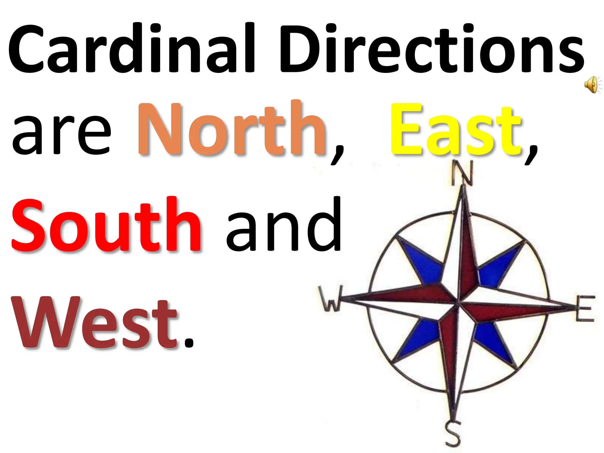
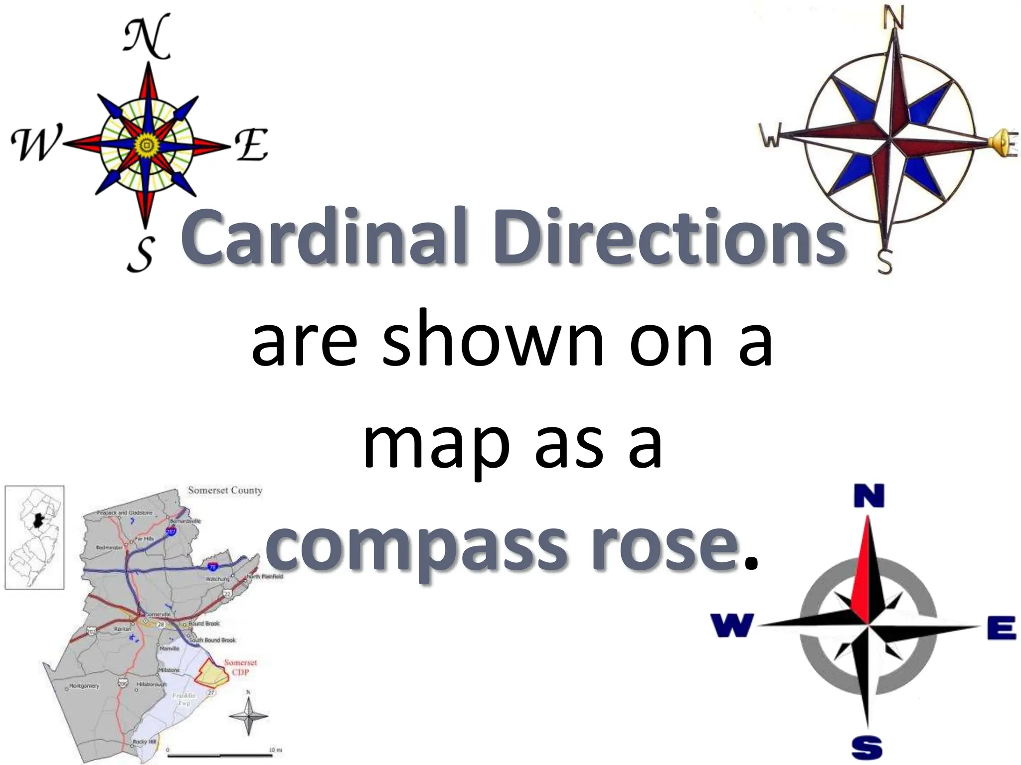
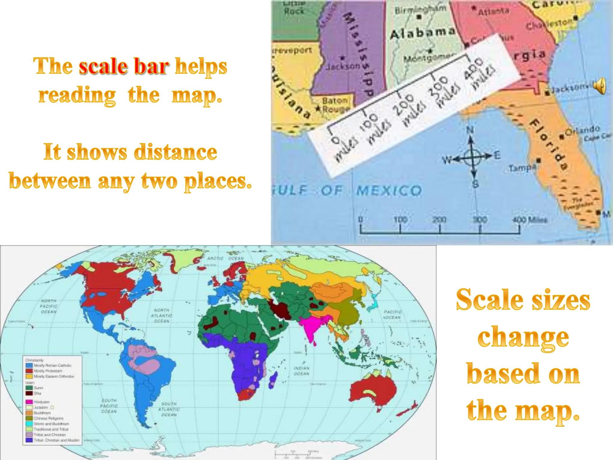
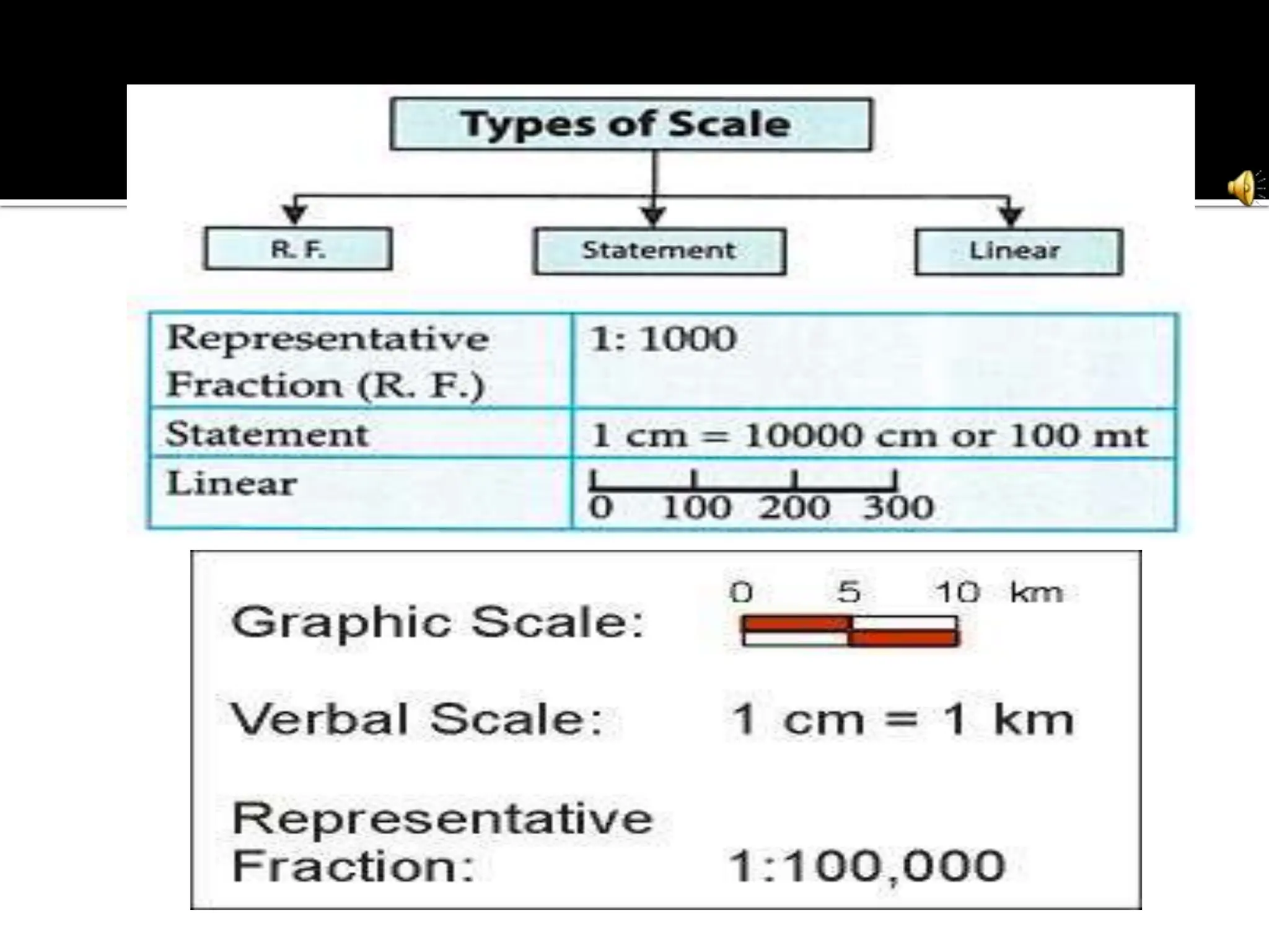
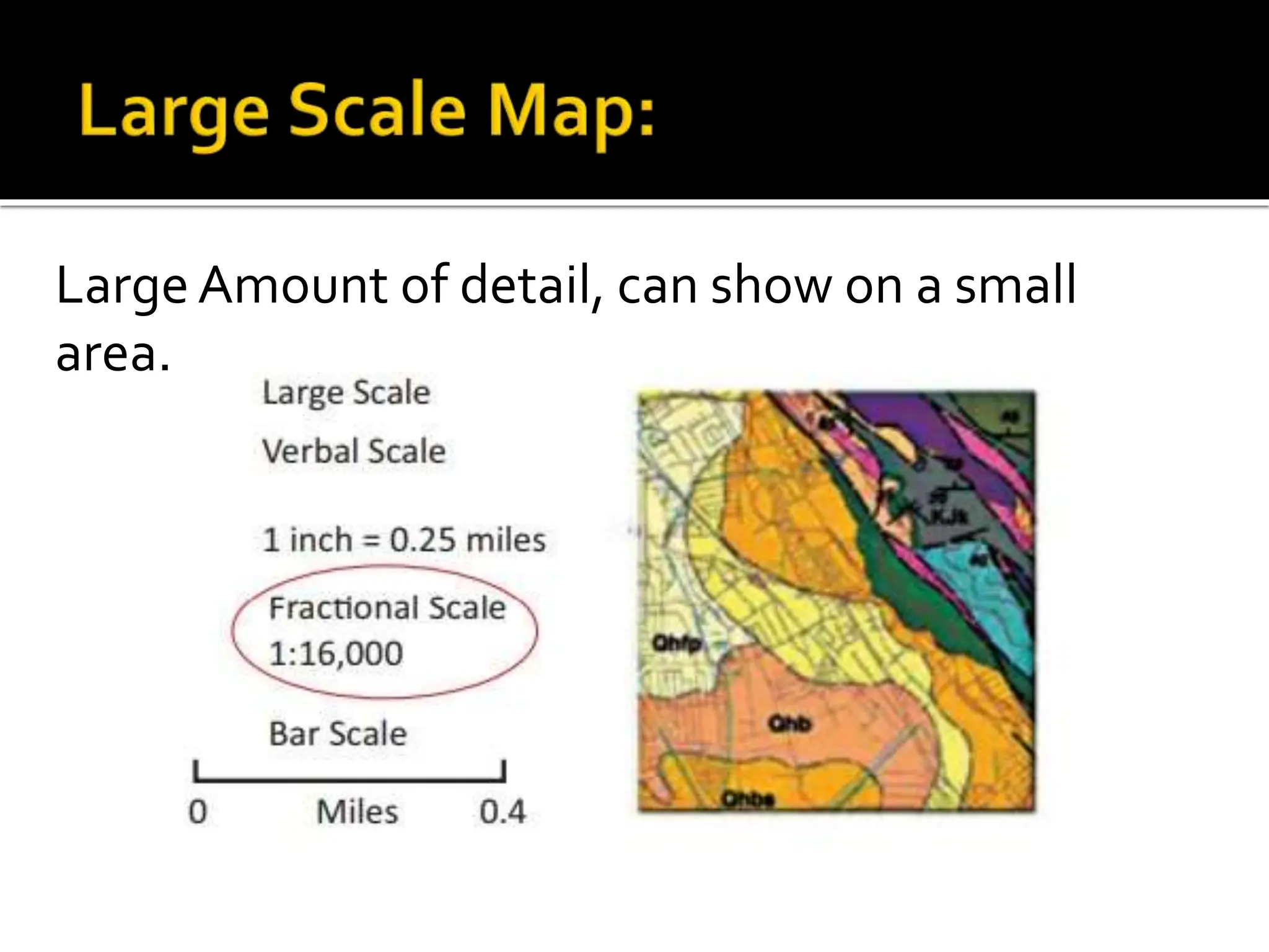
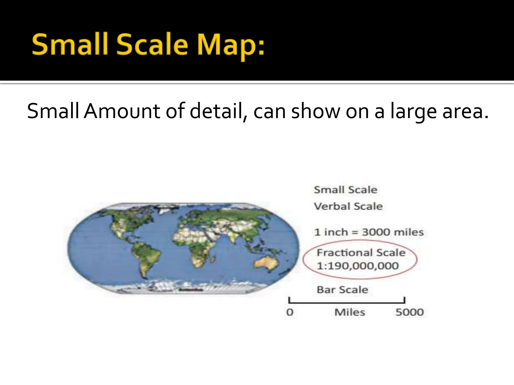
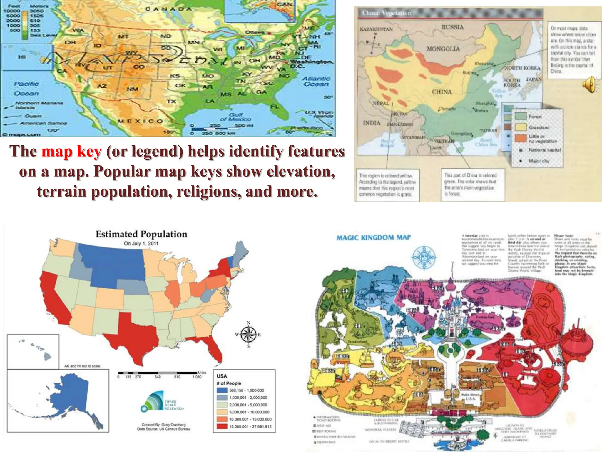
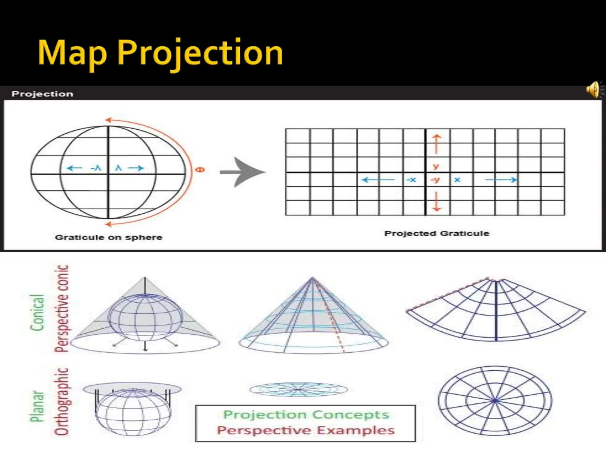
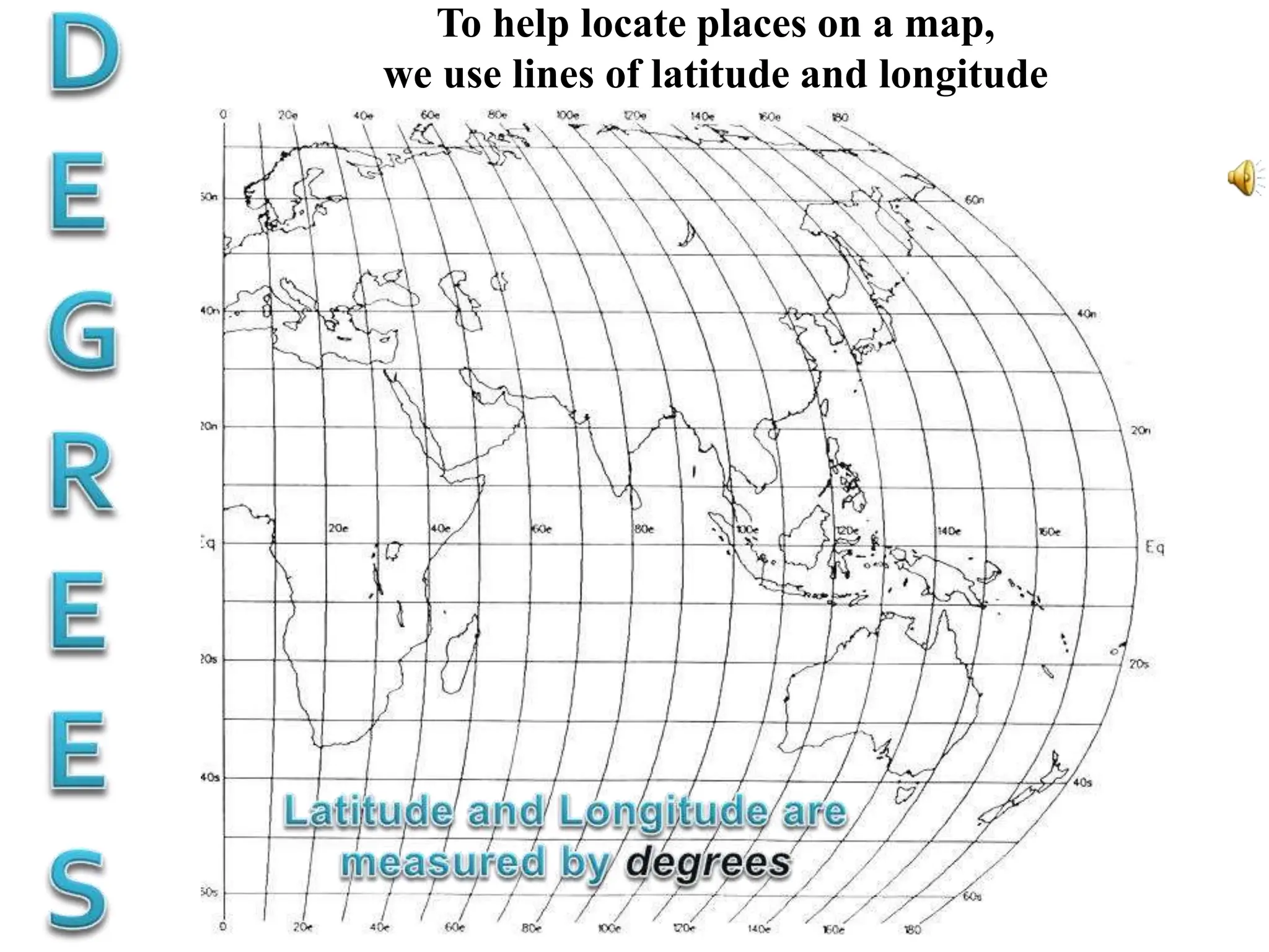
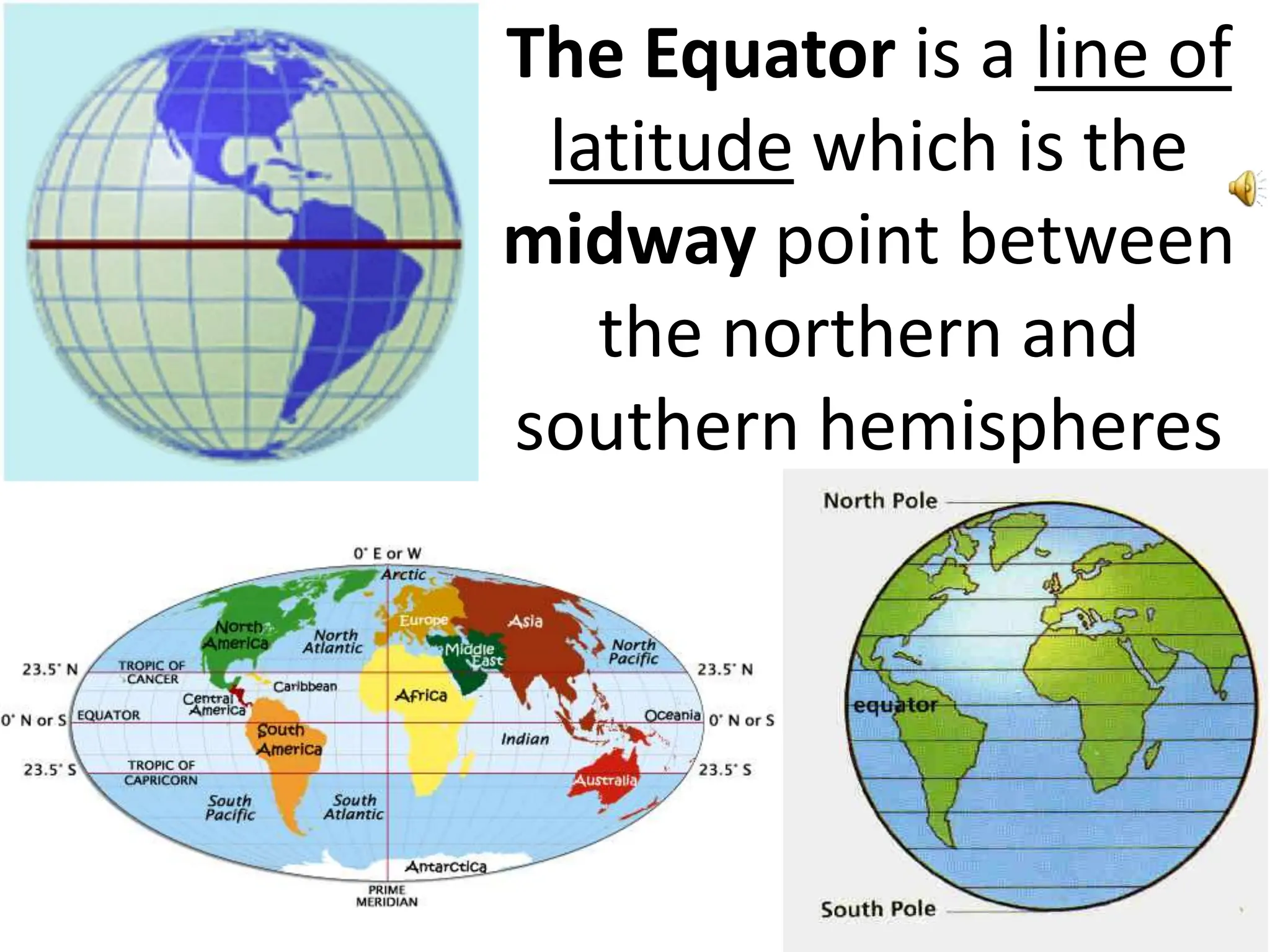
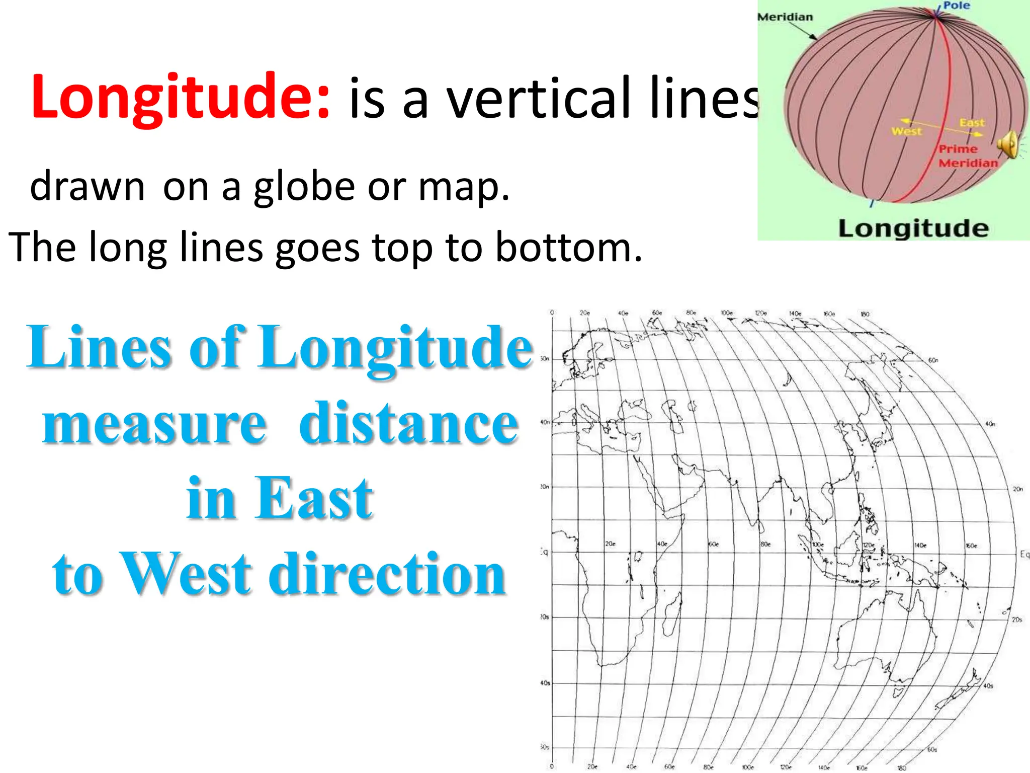
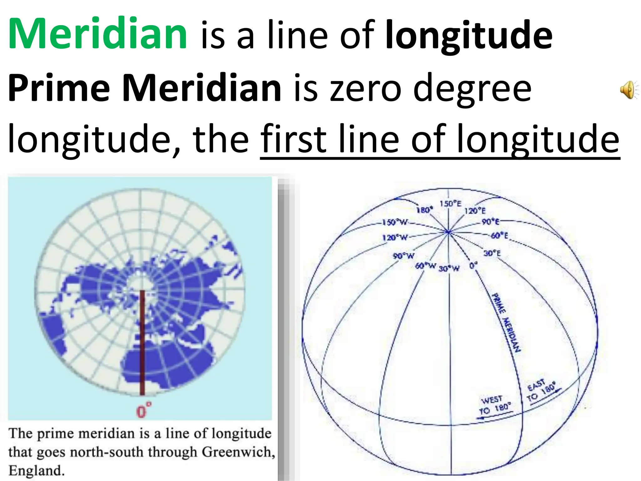
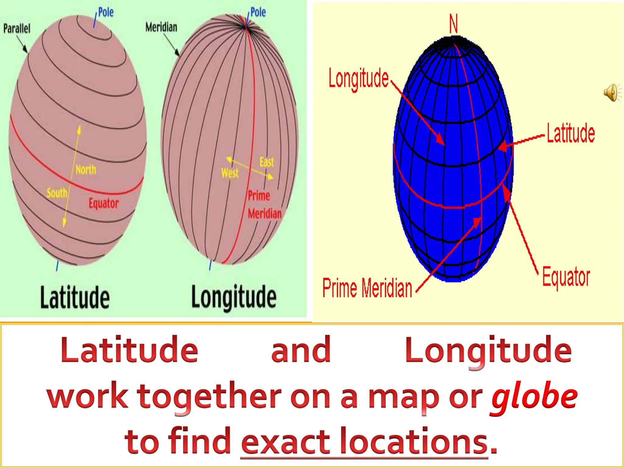
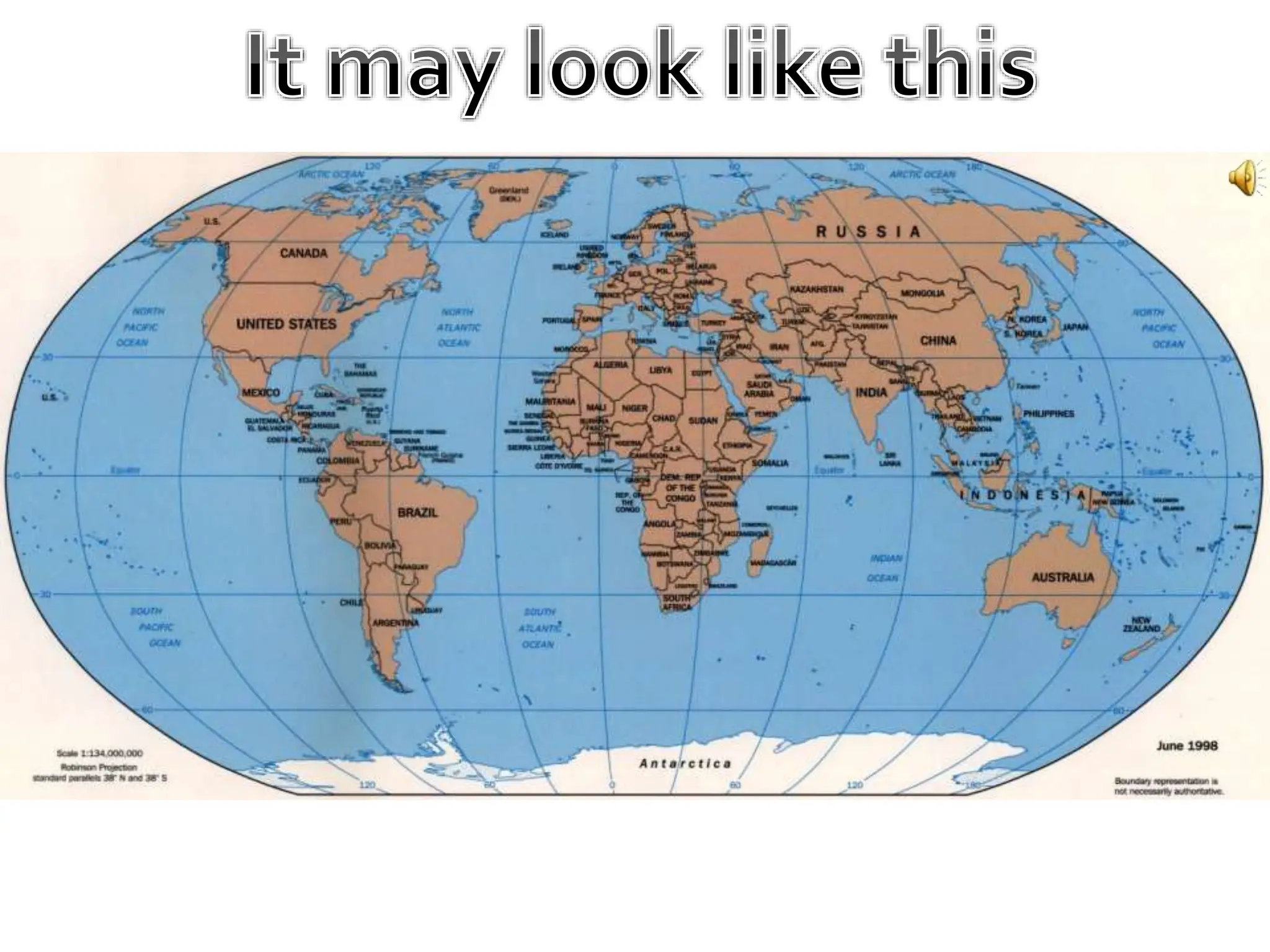
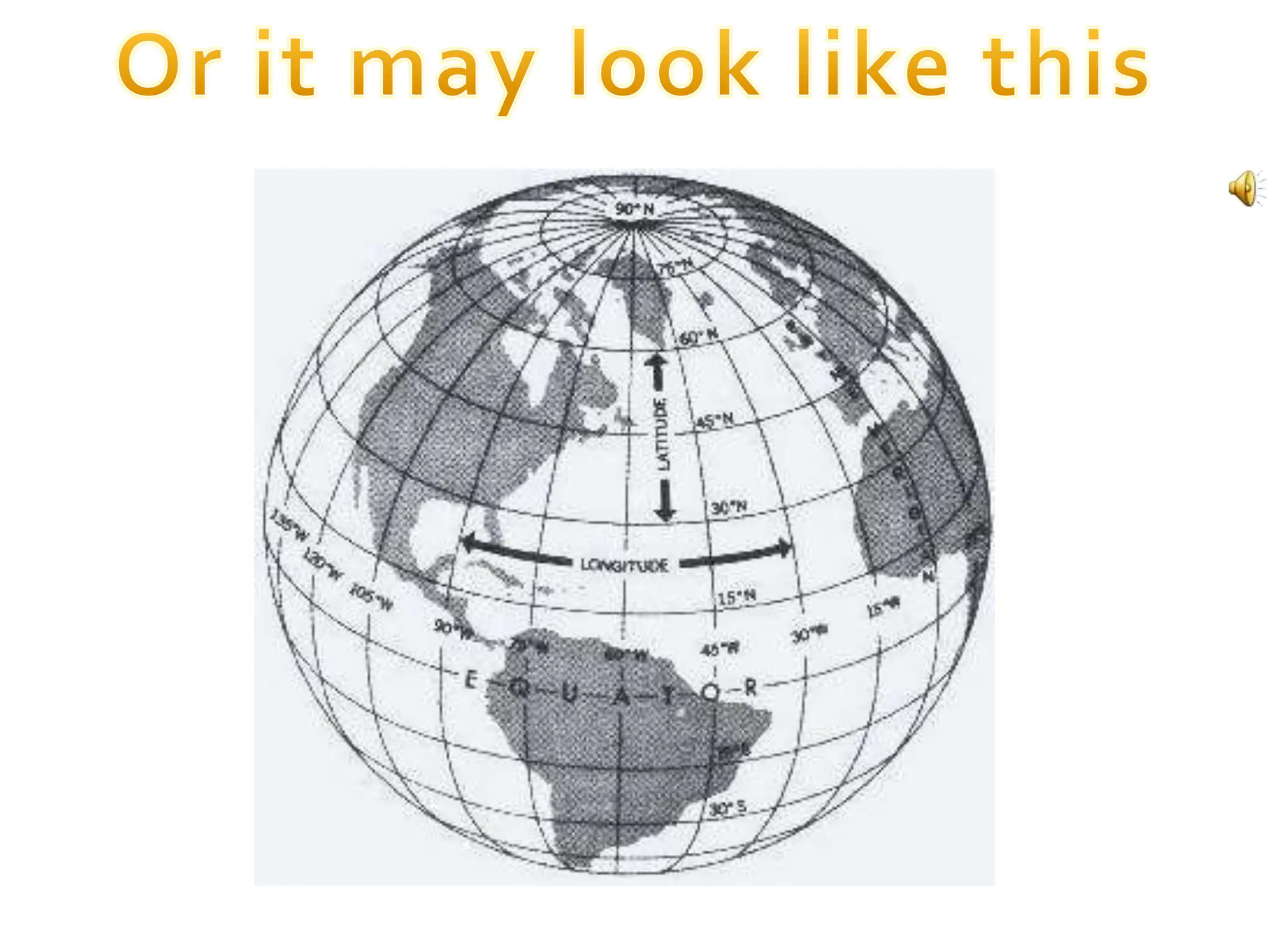
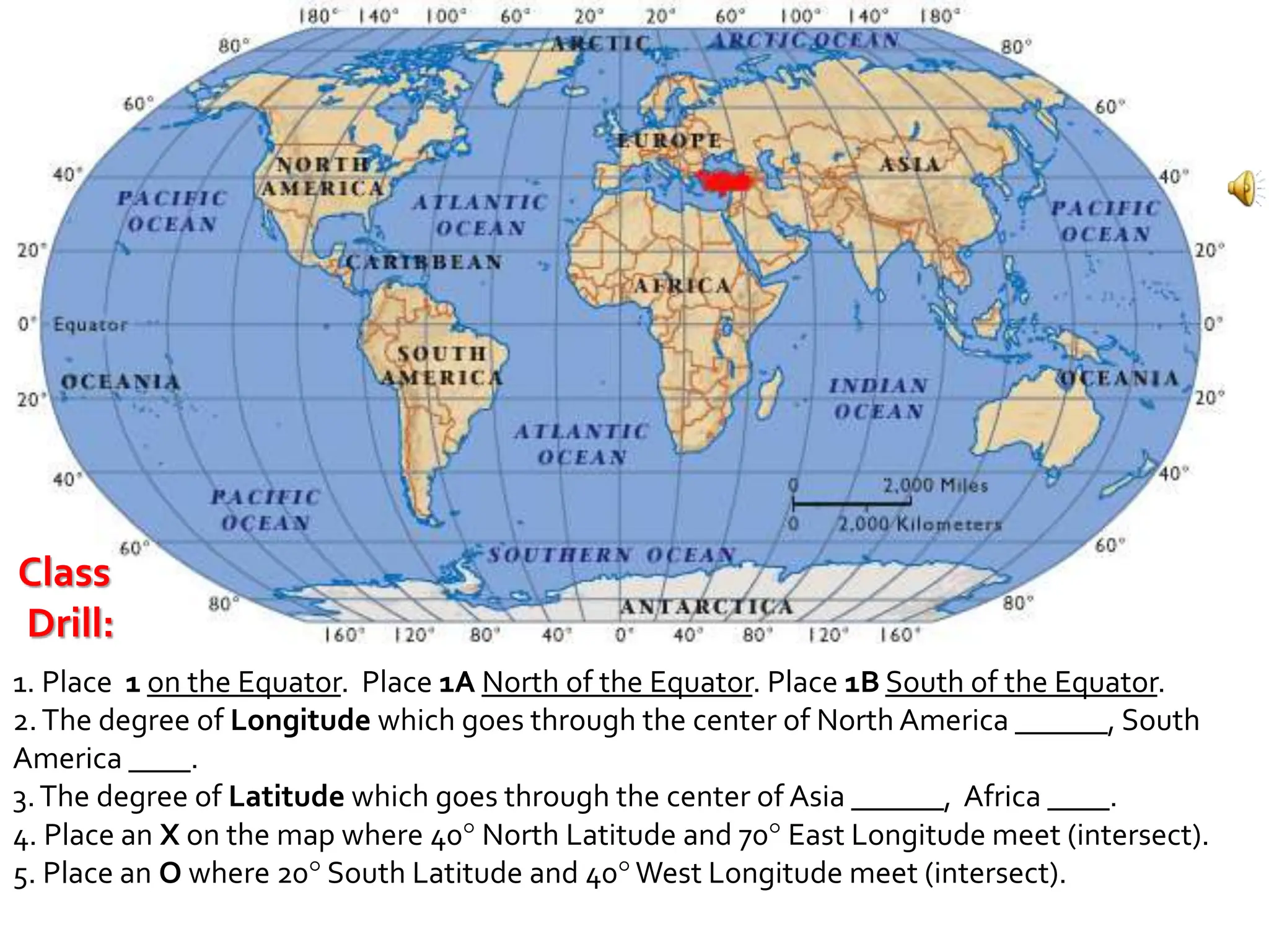
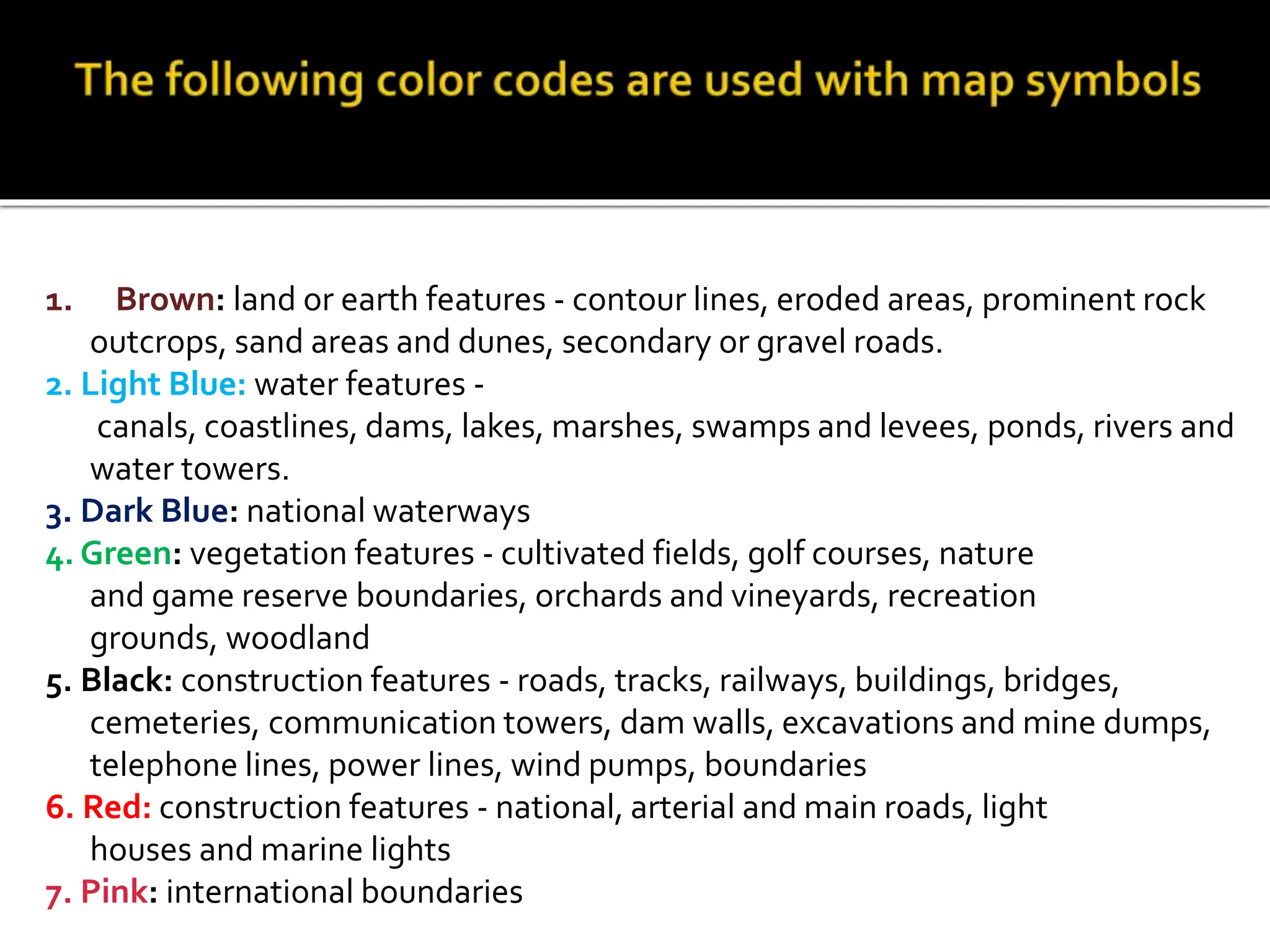
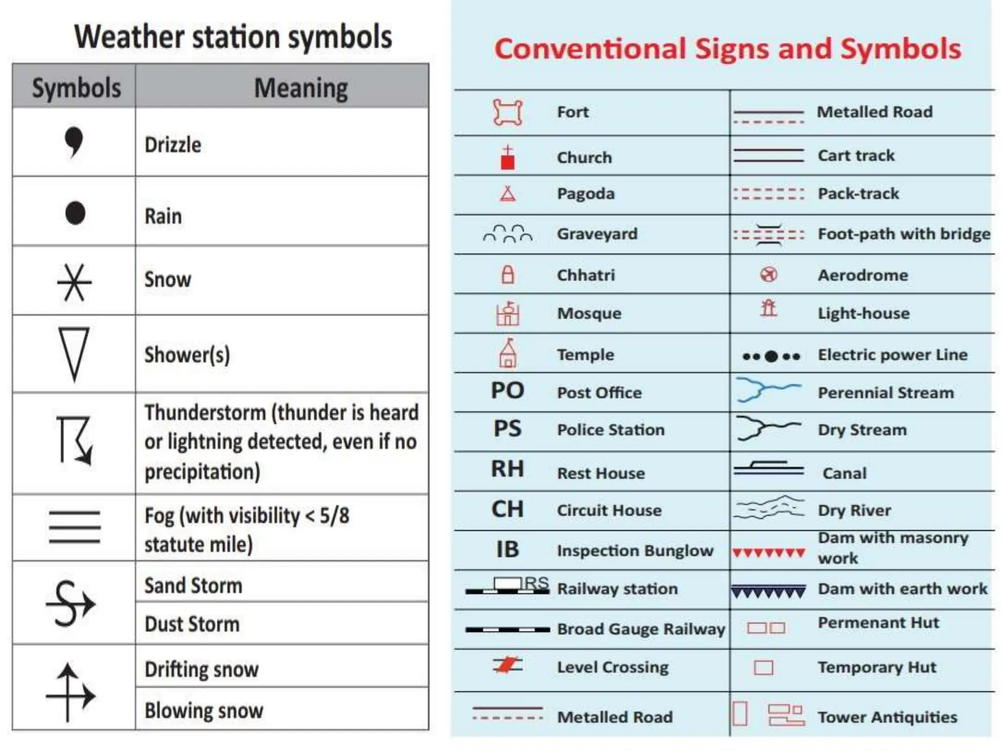
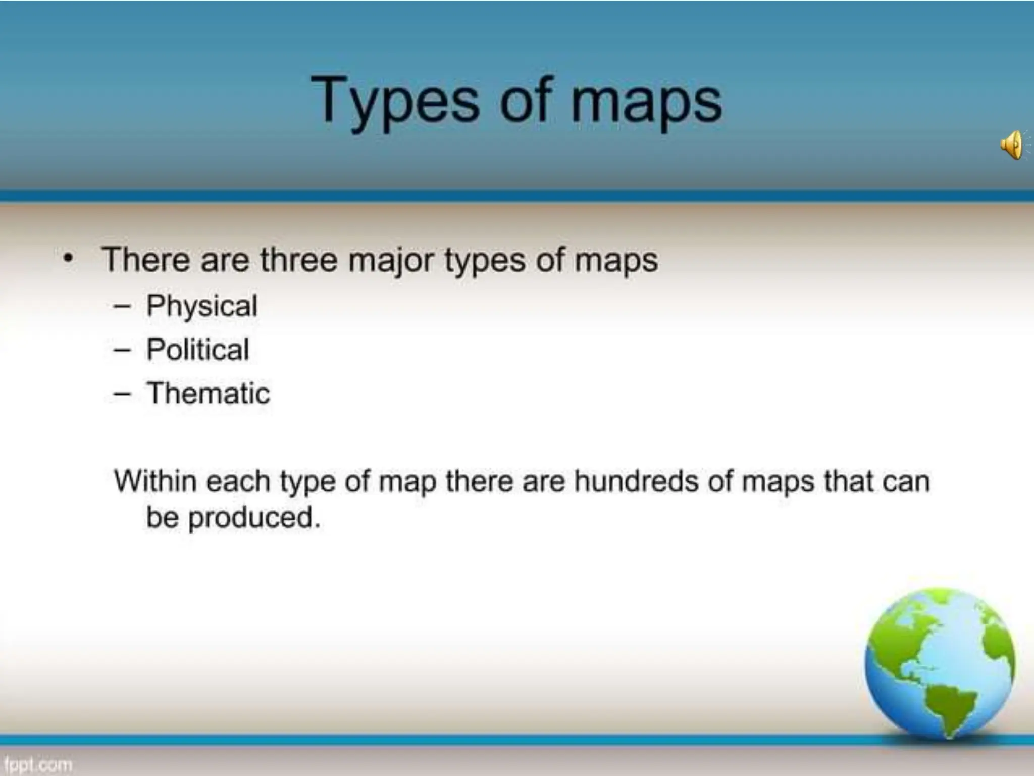
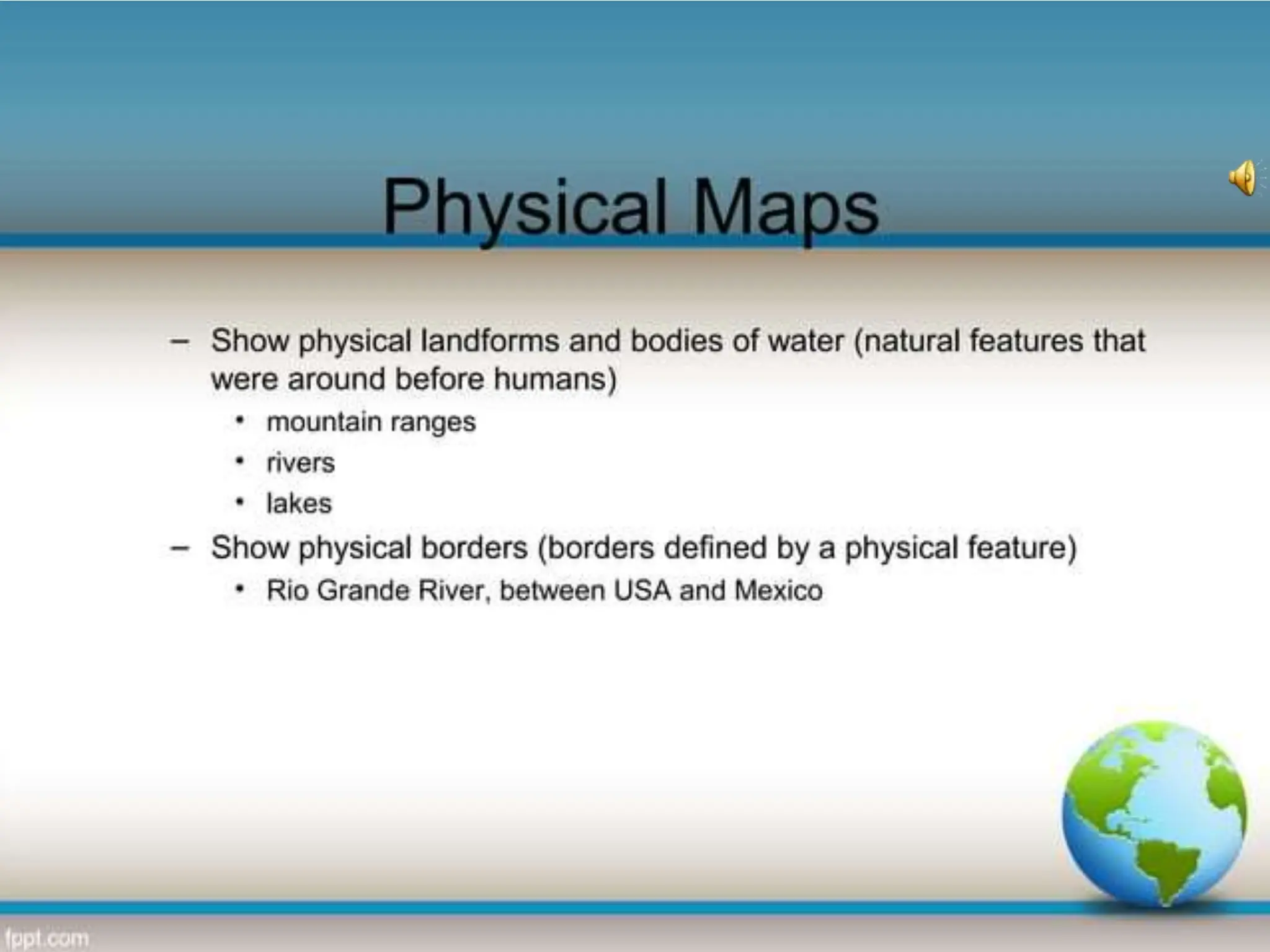
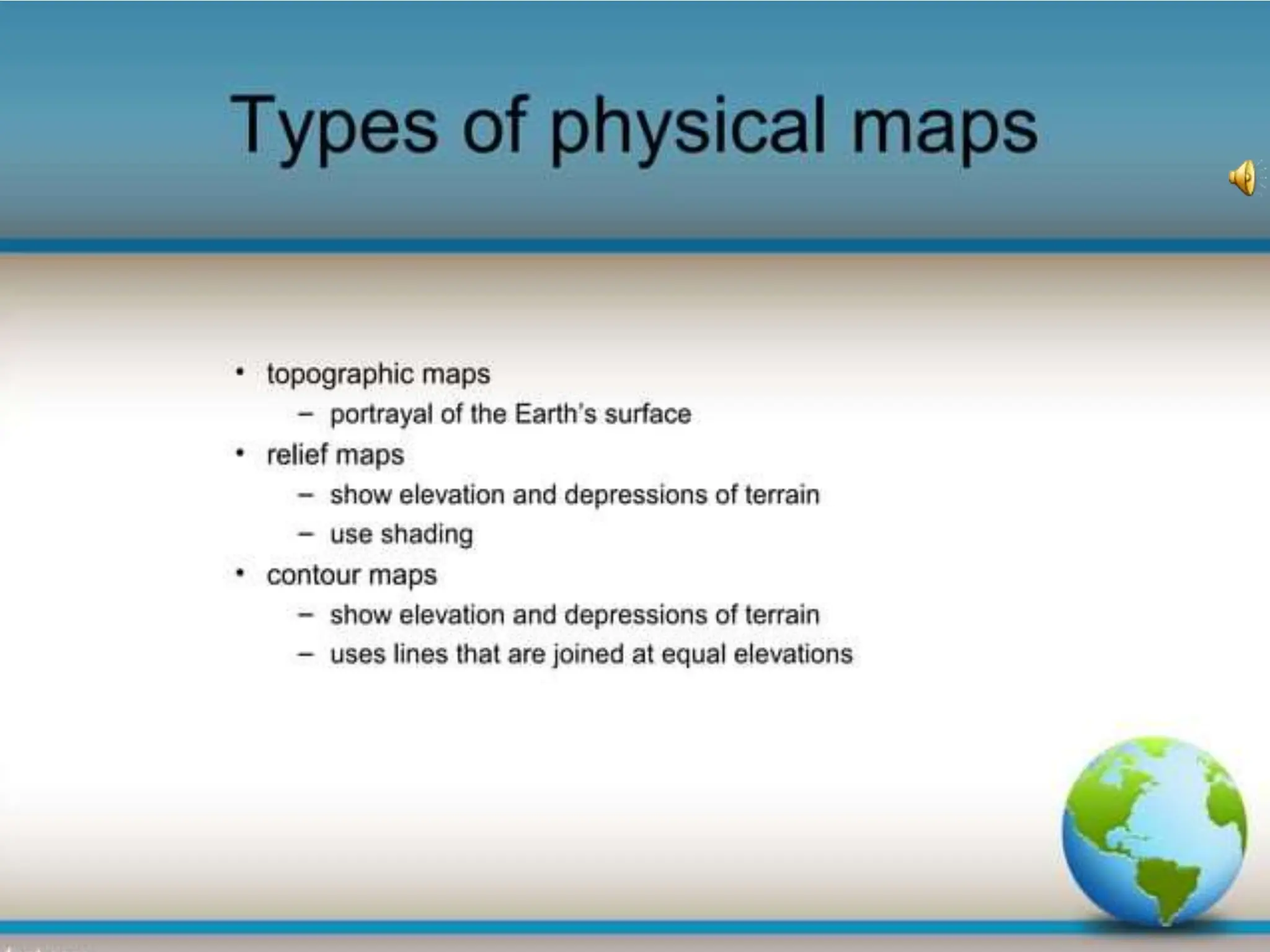
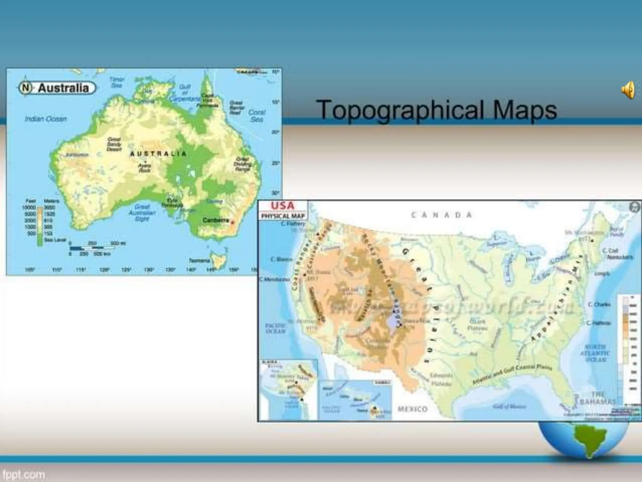
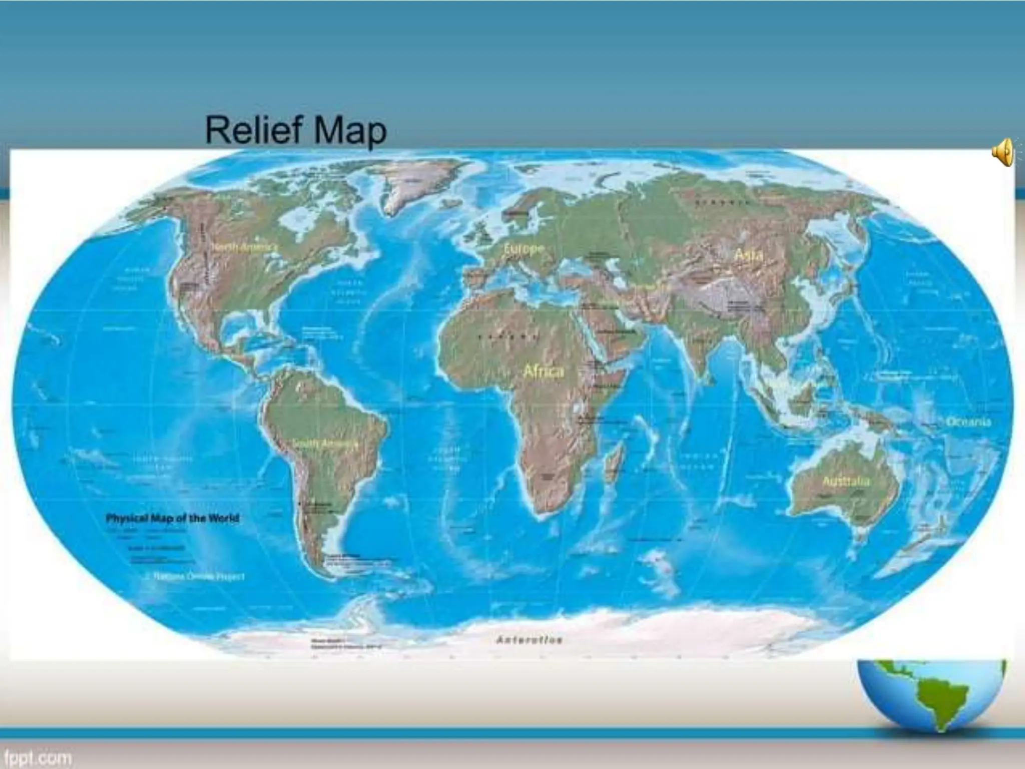
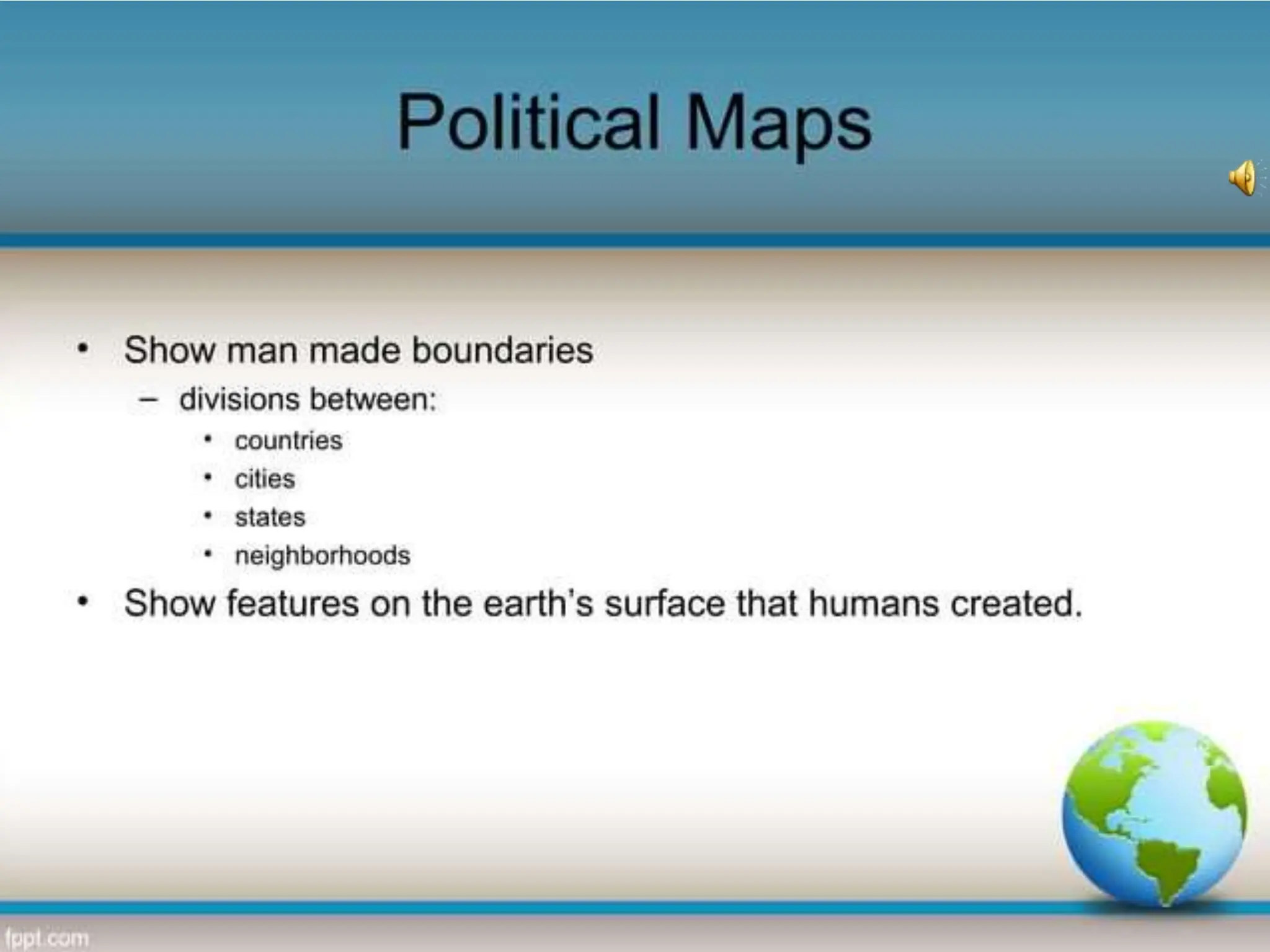
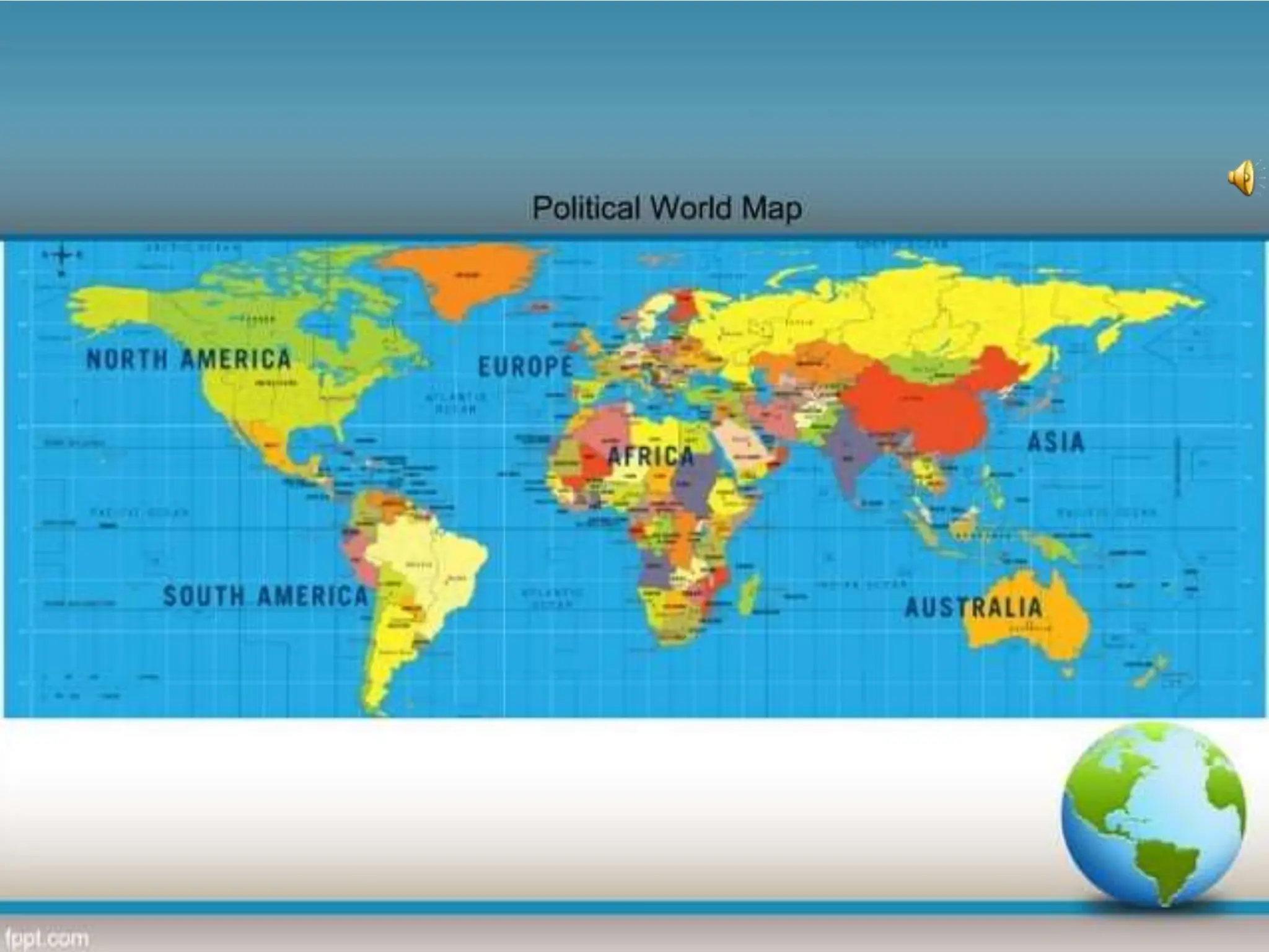
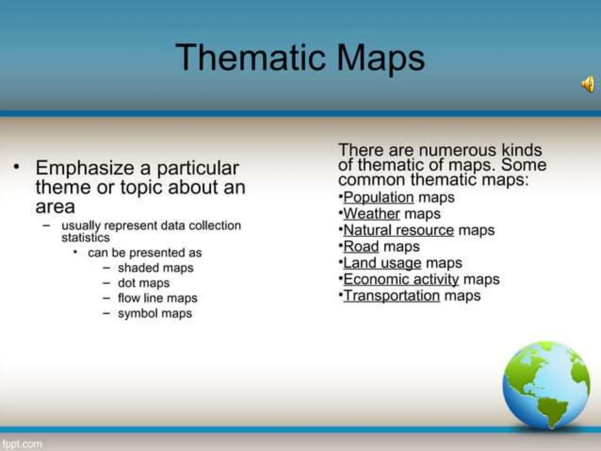
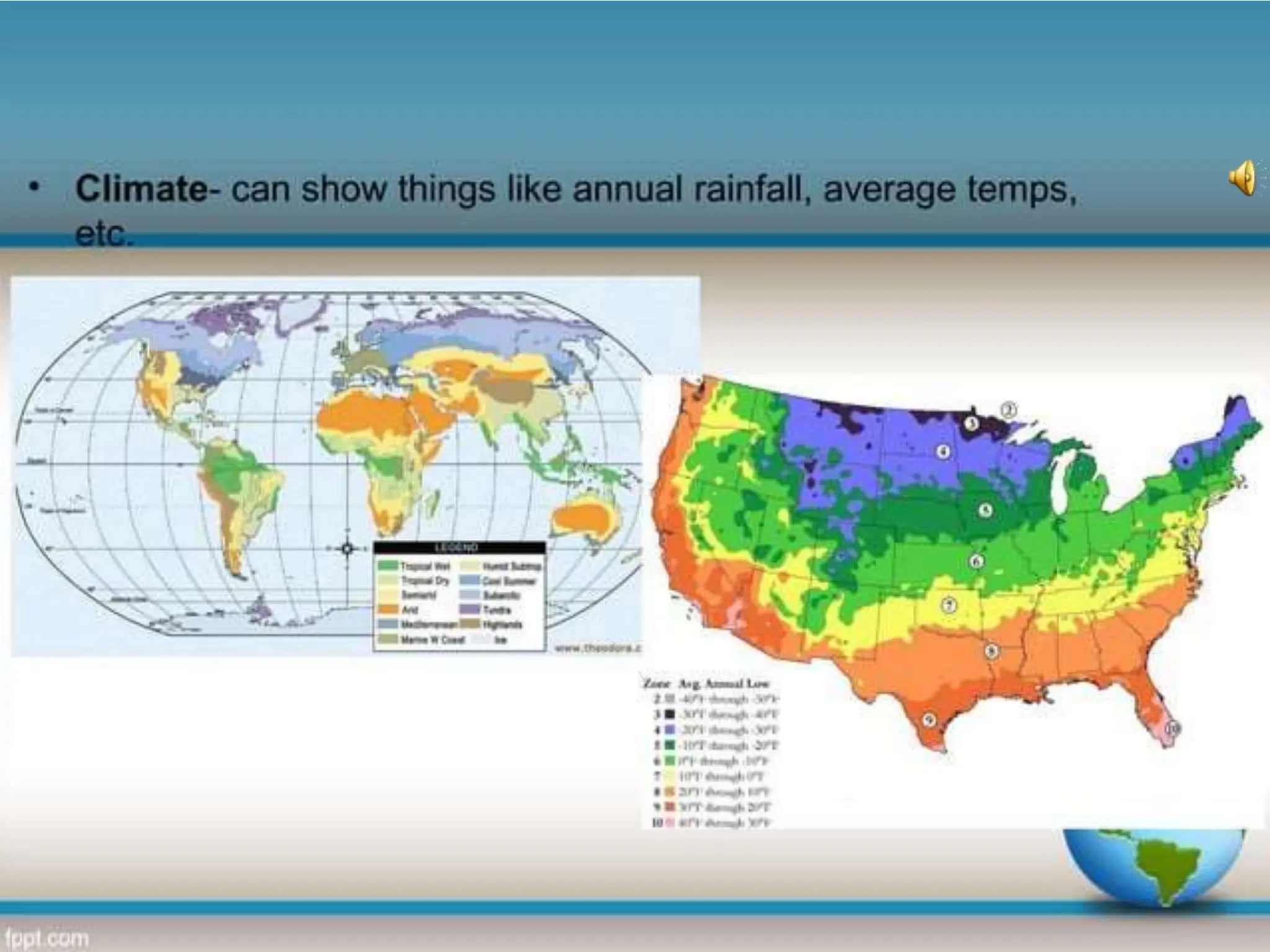
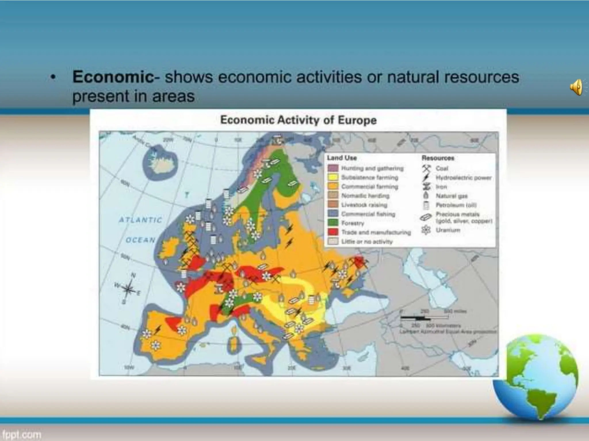
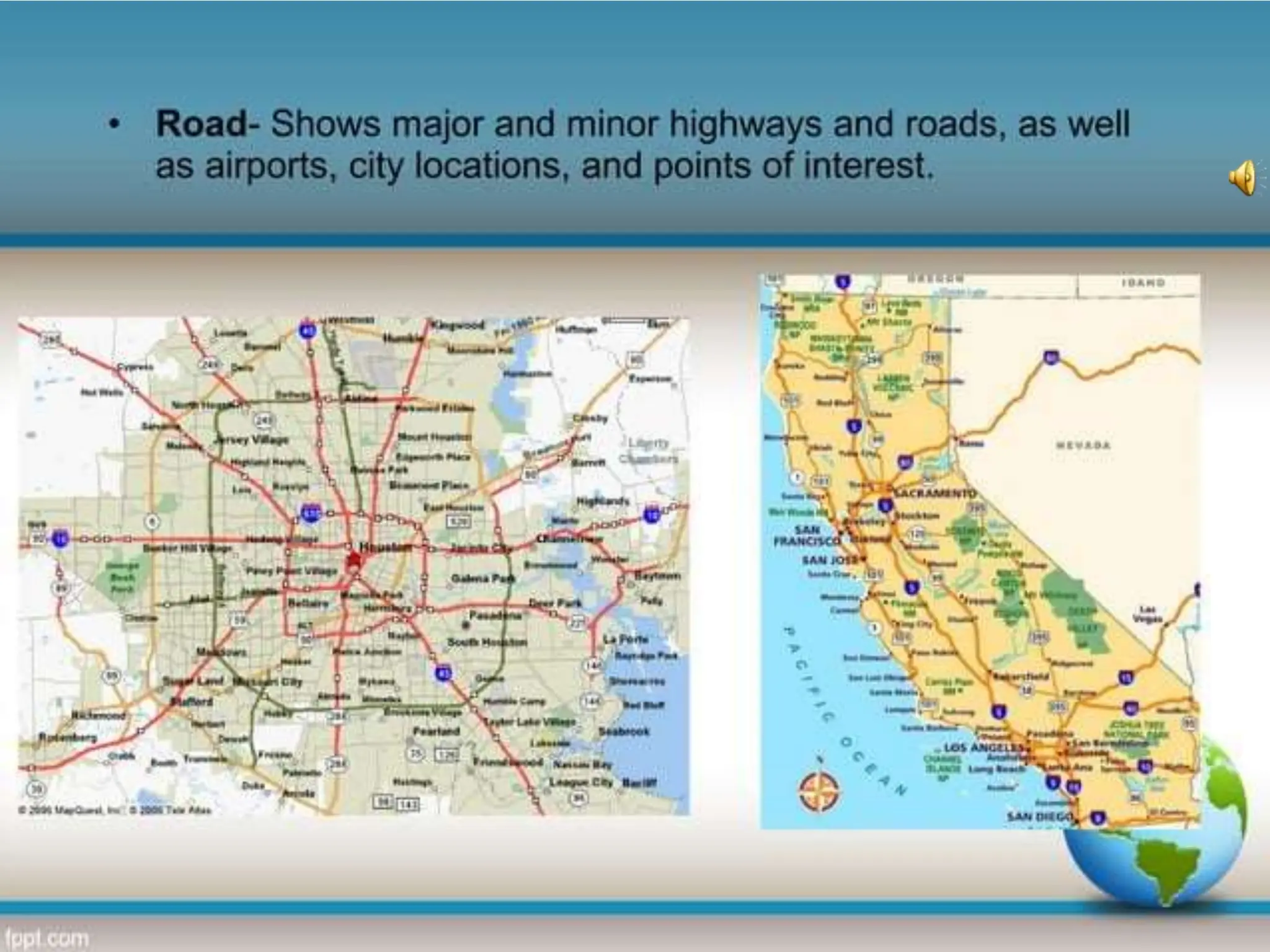
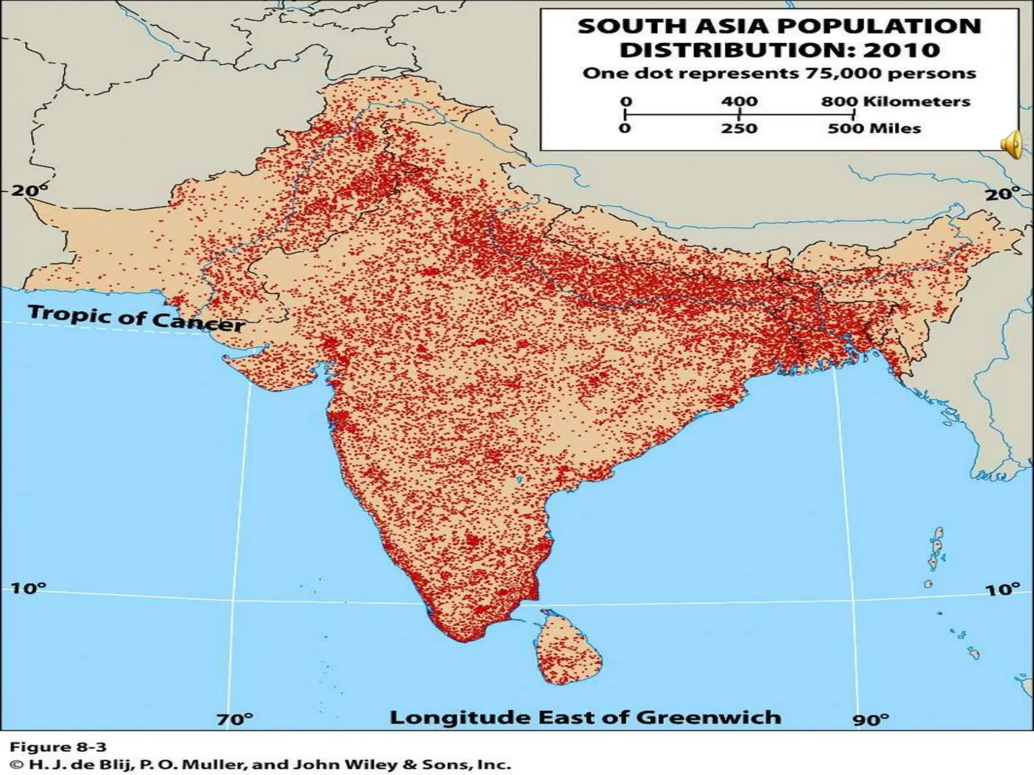
This document provides an overview of important concepts for map reading skills. It discusses key components of maps, including the title, scale, direction, grid system, projection, and legend. It also covers cardinal directions, latitude and longitude lines, and how to locate places using their coordinates. The purpose is to teach life skills for interpreting and navigating using maps.
Map is a drawn or printed representation of the physical features of the Earth.
It is the best tool to show, understand and analyse the features of an area. Cartography is the art and science of making maps. This module highlights many information on maps, types and their uses.
Gives details about maps, projections,their uses and also about data presentation. Made for students for 11th and 12th standard. Also helpful for competitive examinations. This file is made from NCERT books of class 11th and 12th books titled "Practical work in Geography"
Detail on ,
Physiography region of Pakistan, Like Mountains, Plateaus, Deserts, River system of Pakistan,
it is very important for the students of Geography & Pakistan Studies.
A Strategic Approach: GenAI in EducationPeter Windle
Artificial Intelligence (AI) technologies such as Generative AI, Image Generators and Large Language Models have had a dramatic impact on teaching, learning and assessment over the past 18 months. The most immediate threat AI posed was to Academic Integrity with Higher Education Institutes (HEIs) focusing their efforts on combating the use of GenAI in assessment. Guidelines were developed for staff and students, policies put in place too. Innovative educators have forged paths in the use of Generative AI for teaching, learning and assessments leading to pockets of transformation springing up across HEIs, often with little or no top-down guidance, support or direction.
This Gasta posits a strategic approach to integrating AI into HEIs to prepare staff, students and the curriculum for an evolving world and workplace. We will highlight the advantages of working with these technologies beyond the realm of teaching, learning and assessment by considering prompt engineering skills, industry impact, curriculum changes, and the need for staff upskilling. In contrast, not engaging strategically with Generative AI poses risks, including falling behind peers, missed opportunities and failing to ensure our graduates remain employable. The rapid evolution of AI technologies necessitates a proactive and strategic approach if we are to remain relevant.
Read| The latest issue of The Challenger is here! We are thrilled to announce that our school paper has qualified for the NATIONAL SCHOOLS PRESS CONFERENCE (NSPC) 2024. Thank you for your unwavering support and trust. Dive into the stories that made us stand out!
The French Revolution, which began in 1789, was a period of radical social and political upheaval in France. It marked the decline of absolute monarchies, the rise of secular and democratic republics, and the eventual rise of Napoleon Bonaparte. This revolutionary period is crucial in understanding the transition from feudalism to modernity in Europe.
For more information, visit-www.vavaclasses.com
Model Attribute Check Company Auto PropertyCeline George
In Odoo, the multi-company feature allows you to manage multiple companies within a single Odoo database instance. Each company can have its own configurations while still sharing common resources such as products, customers, and suppliers.
The Roman Empire A Historical Colossus.pdfkaushalkr1407
The Roman Empire, a vast and enduring power, stands as one of history's most remarkable civilizations, leaving an indelible imprint on the world. It emerged from the Roman Republic, transitioning into an imperial powerhouse under the leadership of Augustus Caesar in 27 BCE. This transformation marked the beginning of an era defined by unprecedented territorial expansion, architectural marvels, and profound cultural influence.
The empire's roots lie in the city of Rome, founded, according to legend, by Romulus in 753 BCE. Over centuries, Rome evolved from a small settlement to a formidable republic, characterized by a complex political system with elected officials and checks on power. However, internal strife, class conflicts, and military ambitions paved the way for the end of the Republic. Julius Caesar’s dictatorship and subsequent assassination in 44 BCE created a power vacuum, leading to a civil war. Octavian, later Augustus, emerged victorious, heralding the Roman Empire’s birth.
Under Augustus, the empire experienced the Pax Romana, a 200-year period of relative peace and stability. Augustus reformed the military, established efficient administrative systems, and initiated grand construction projects. The empire's borders expanded, encompassing territories from Britain to Egypt and from Spain to the Euphrates. Roman legions, renowned for their discipline and engineering prowess, secured and maintained these vast territories, building roads, fortifications, and cities that facilitated control and integration.
The Roman Empire’s society was hierarchical, with a rigid class system. At the top were the patricians, wealthy elites who held significant political power. Below them were the plebeians, free citizens with limited political influence, and the vast numbers of slaves who formed the backbone of the economy. The family unit was central, governed by the paterfamilias, the male head who held absolute authority.
Culturally, the Romans were eclectic, absorbing and adapting elements from the civilizations they encountered, particularly the Greeks. Roman art, literature, and philosophy reflected this synthesis, creating a rich cultural tapestry. Latin, the Roman language, became the lingua franca of the Western world, influencing numerous modern languages.
Roman architecture and engineering achievements were monumental. They perfected the arch, vault, and dome, constructing enduring structures like the Colosseum, Pantheon, and aqueducts. These engineering marvels not only showcased Roman ingenuity but also served practical purposes, from public entertainment to water supply.
Unit 8 - Information and Communication Technology (Paper I).pdfThiyagu K
This slides describes the basic concepts of ICT, basics of Email, Emerging Technology and Digital Initiatives in Education. This presentations aligns with the UGC Paper I syllabus.
Operation “Blue Star” is the only event in the history of Independent India where the state went into war with its own people. Even after about 40 years it is not clear if it was culmination of states anger over people of the region, a political game of power or start of dictatorial chapter in the democratic setup.
The people of Punjab felt alienated from main stream due to denial of their just demands during a long democratic struggle since independence. As it happen all over the word, it led to militant struggle with great loss of lives of military, police and civilian personnel. Killing of Indira Gandhi and massacre of innocent Sikhs in Delhi and other India cities was also associated with this movement.
Instructions for Submissions thorugh G- Classroom.pptxJheel Barad
This presentation provides a briefing on how to upload submissions and documents in Google Classroom. It was prepared as part of an orientation for new Sainik School in-service teacher trainees. As a training officer, my goal is to ensure that you are comfortable and proficient with this essential tool for managing assignments and fostering student engagement.
4. The art of map - making is called Cartography.
A map is defined as a representation of the whole or
a part of an area. Maps are usually prepared on a flat
surface, but globes are also maps in that they
represent the entire earth.
We commonly use them to communicate graphic
information about places to others. Maps are used
for many purposes in daily life -- to help people
navigate from place to place.
5. TITLEOF A MAP
DIRECTION OF MAP
SCALE OF MAP
MAP PROJECTION
LEGEND OR INDEX OF MAP
6. Map reading is a life skill,
with a vocabulary all its own!
13. The map key (or legend) helps identify features
on a map. Popular map keys show elevation,
terrain population, religions, and more.
14.
15. To help locate places on a map,
we use lines of latitude and longitude
16. Latitude:
is shown on a map as a horizontal line.
Lines of Latitude are parallel lines.
They go around,
but never intersect each other.
17. The Equator is a line of
latitude which is the
midway point between
the northern and
southern hemispheres
18. Longitude: is a vertical lines
drawn on a globe or map.
The long lines goes top to bottom.
Lines of Longitude
measure distance
in East
to West direction
19. Meridian is a line of longitude
Prime Meridian is zero degree
longitude, the first line of longitude
23. 1. Place 1 on the Equator. Place 1A North of the Equator. Place 1B South of the Equator.
2.The degree of Longitude which goes through the center of North America ______, South
America ____.
3.The degree of Latitude which goes through the center of Asia ______, Africa ____.
4. Place an X on the map where 40 North Latitude and 70 East Longitude meet (intersect).
5. Place an O where 20 South Latitude and 40 West Longitude meet (intersect).
Class
Drill:
24. A map should include the following components namely,
the title, scale, direction, grid system, projection, legend,
conventional signs and symbols.
TITLE OF MAP
It indicates the purpose or theme of the map. Example: Pakistan
– Physical,World – Political, Islamabad –Transport.
Scale
Scale makes it possible to reduce the size of the whole earth
to show it on a piece of paper.
A scale is a ratio between the actual distance on the map to
the actual distance on the ground.
25. Direction
Maps are drawn normally with north
orientation. North direction in a map is always towards the North Pole of the earth
Grid System
The location of a place can be simply defined by its latitude and longitude. In normal
practice, latitude is stated first and then comes the longitude.The latitude and
longitude of a place can be expressed in units of degree, minutes and seconds.
Map Projection
A map projection is a way of showing the spherical shaped earth on a flat piece of paper.
Legend
The legend of a map helps to understand
the map details which are placed at the left or right corner at the bottom of the map
26. 1. Brown: land or earth features - contour lines, eroded areas, prominent rock
outcrops, sand areas and dunes, secondary or gravel roads.
2. Light Blue: water features -
canals, coastlines, dams, lakes, marshes, swamps and levees, ponds, rivers and
water towers.
3. Dark Blue: national waterways
4. Green: vegetation features - cultivated fields, golf courses, nature
and game reserve boundaries, orchards and vineyards, recreation
grounds, woodland
5. Black: construction features - roads, tracks, railways, buildings, bridges,
cemeteries, communication towers, dam walls, excavations and mine dumps,
telephone lines, power lines, wind pumps, boundaries
6. Red: construction features - national, arterial and main roads, light
houses and marine lights
7. Pink: international boundaries