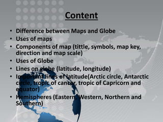
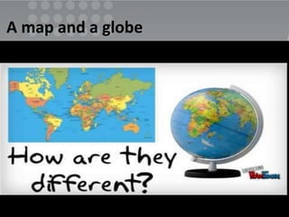
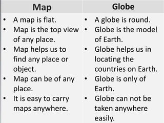
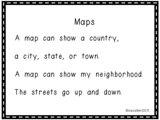
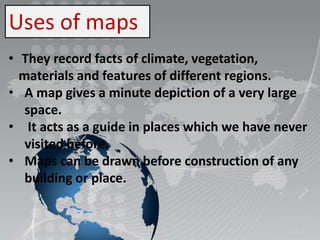
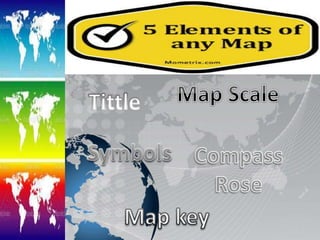
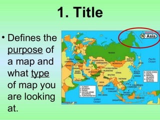
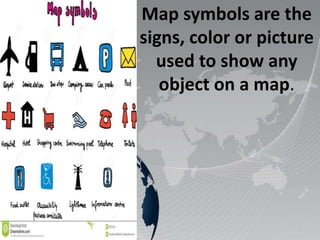
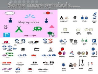
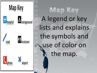
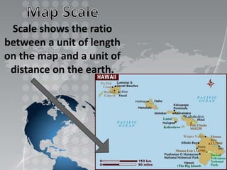
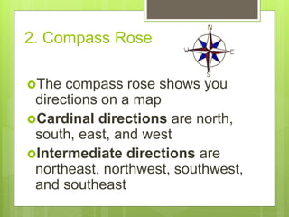
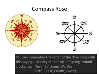
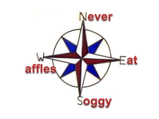
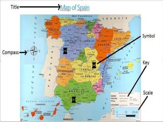
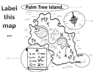
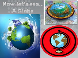
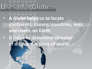
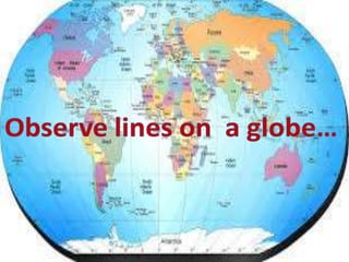
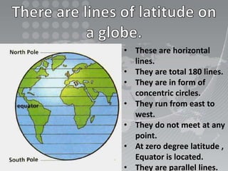
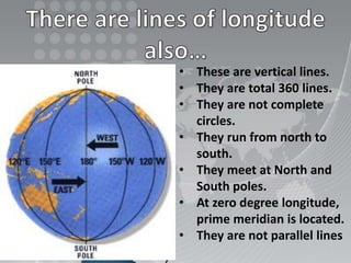
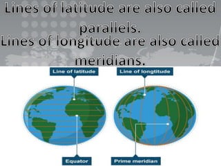
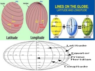
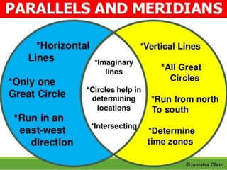
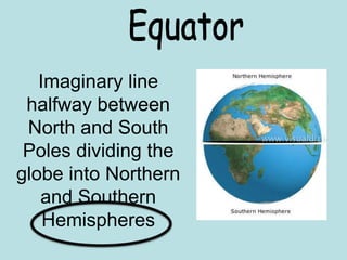
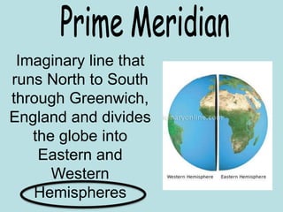
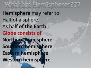
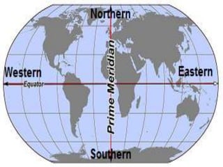
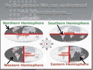
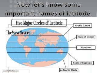
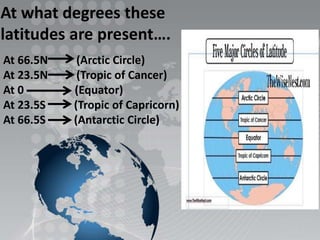
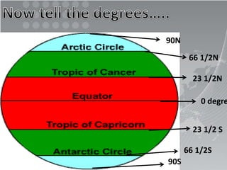
Content
• Difference between Maps and Globe
• Uses of maps
• Components of map (tittle, symbols, map key,
direction and map scale)
• Uses of Globe
• Lines on globe (latitude, longitude)
• Important lines of latitude(Arctic circle, Antarctic
circle, tropic of cancer, tropic of Capricorn and
equator)
• Hemispheres (Eastern, Western, Northern and
Southern)
A map and a globe
Map Globe
• A map is flat.
• Map is the top view
of any place.
• Map helps us to
find any place or
object.
• Map can be of any
place.
• It is easy to carry
maps anywhere.
• A globe is round.
• Globe is the model
of Earth.
• Globe helps us in
locating the
countries on Earth.
• Globe is only of
Earth.
• Globe can not be
taken anywhere
easily.
Uses of maps
• They record facts of climate, vegetation,
materials and features of different regions.
• A map gives a minute depiction of a very large
space.
• It acts as a guide in places which we have never
visited before.
• Maps can be drawn before construction of any
building or place.
Map symbols are the
signs, color or picture
used to show any
object on a map.
A legend or key
lists and explains
the symbols and
use of color on
the map.
Scale shows the ratio
between a unit of length
on the map and a unit of
distance on the earth.
2. Compass Rose
The compass rose shows you
directions on a map
Cardinal directions are north,
south, east, and west
Intermediate directions are
northeast, northwest, southwest,
and southeast
Compass Rose
You can remember the order of the directions with
this saying… starting at the top and going around
clockwise: Never Eat Soggy Waffles
(north) (east) (south) (west)
Palm Tree Island.
scale
• A Globe helps us to locate
continents, oceans, countries, seas
and rivers on Earth.
• It helps to determine climates
of different regions of world.
• These are horizontal
lines.
• They are total 180 lines.
• They are in form of
concentric circles.
• They run from east to
west.
• They do not meet at any
point.
• At zero degree latitude ,
Equator is located.
• They are parallel lines.
• These are vertical lines.
• They are total 360 lines.
• They are not complete
circles.
• They run from north to
south.
• They meet at North and
South poles.
• At zero degree longitude,
prime meridian is located.
• They are not parallel lines
Imaginary line
halfway between
North and South
Poles dividing the
globe into Northern
and Southern
Hemispheres
Imaginary line that
runs North to South
through Greenwich,
England and divides
the globe into
Eastern and
Western
Hemispheres
Hemisphere may refer to:
Half of a sphere…
As half of the Earth:
Globe consists of
Northern hemisphere
Southern hemisphere
Eastern hemisphere
Western hemisphere
At what degrees these
latitudes are present….
At 66.5N (Arctic Circle)
At 23.5N (Tropic of Cancer)
At 0 (Equator)
At 23.5S (Tropic of Capricorn)
At 66.5S (Antarctic Circle)
90N
66 1/2N
23 1/2N
0 degre
23 1/2 S
66 1/2S
90S
Presentation of maps & globe

Presentation of maps & globe

  • 2.
    Content • Difference betweenMaps and Globe • Uses of maps • Components of map (tittle, symbols, map key, direction and map scale) • Uses of Globe • Lines on globe (latitude, longitude) • Important lines of latitude(Arctic circle, Antarctic circle, tropic of cancer, tropic of Capricorn and equator) • Hemispheres (Eastern, Western, Northern and Southern)
  • 3.
    A map anda globe
  • 4.
    Map Globe • Amap is flat. • Map is the top view of any place. • Map helps us to find any place or object. • Map can be of any place. • It is easy to carry maps anywhere. • A globe is round. • Globe is the model of Earth. • Globe helps us in locating the countries on Earth. • Globe is only of Earth. • Globe can not be taken anywhere easily.
  • 6.
    Uses of maps •They record facts of climate, vegetation, materials and features of different regions. • A map gives a minute depiction of a very large space. • It acts as a guide in places which we have never visited before. • Maps can be drawn before construction of any building or place.
  • 9.
    Map symbols arethe signs, color or picture used to show any object on a map.
  • 11.
    A legend orkey lists and explains the symbols and use of color on the map.
  • 12.
    Scale shows theratio between a unit of length on the map and a unit of distance on the earth.
  • 13.
    2. Compass Rose Thecompass rose shows you directions on a map Cardinal directions are north, south, east, and west Intermediate directions are northeast, northwest, southwest, and southeast
  • 14.
    Compass Rose You canremember the order of the directions with this saying… starting at the top and going around clockwise: Never Eat Soggy Waffles (north) (east) (south) (west)
  • 17.
  • 19.
    • A Globehelps us to locate continents, oceans, countries, seas and rivers on Earth. • It helps to determine climates of different regions of world.
  • 21.
    • These arehorizontal lines. • They are total 180 lines. • They are in form of concentric circles. • They run from east to west. • They do not meet at any point. • At zero degree latitude , Equator is located. • They are parallel lines.
  • 22.
    • These arevertical lines. • They are total 360 lines. • They are not complete circles. • They run from north to south. • They meet at North and South poles. • At zero degree longitude, prime meridian is located. • They are not parallel lines
  • 26.
    Imaginary line halfway between Northand South Poles dividing the globe into Northern and Southern Hemispheres
  • 27.
    Imaginary line that runsNorth to South through Greenwich, England and divides the globe into Eastern and Western Hemispheres
  • 28.
    Hemisphere may referto: Half of a sphere… As half of the Earth: Globe consists of Northern hemisphere Southern hemisphere Eastern hemisphere Western hemisphere
  • 32.
    At what degreesthese latitudes are present…. At 66.5N (Arctic Circle) At 23.5N (Tropic of Cancer) At 0 (Equator) At 23.5S (Tropic of Capricorn) At 66.5S (Antarctic Circle)
  • 33.
    90N 66 1/2N 23 1/2N 0degre 23 1/2 S 66 1/2S 90S