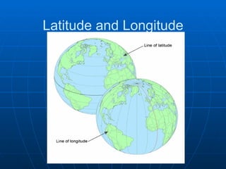
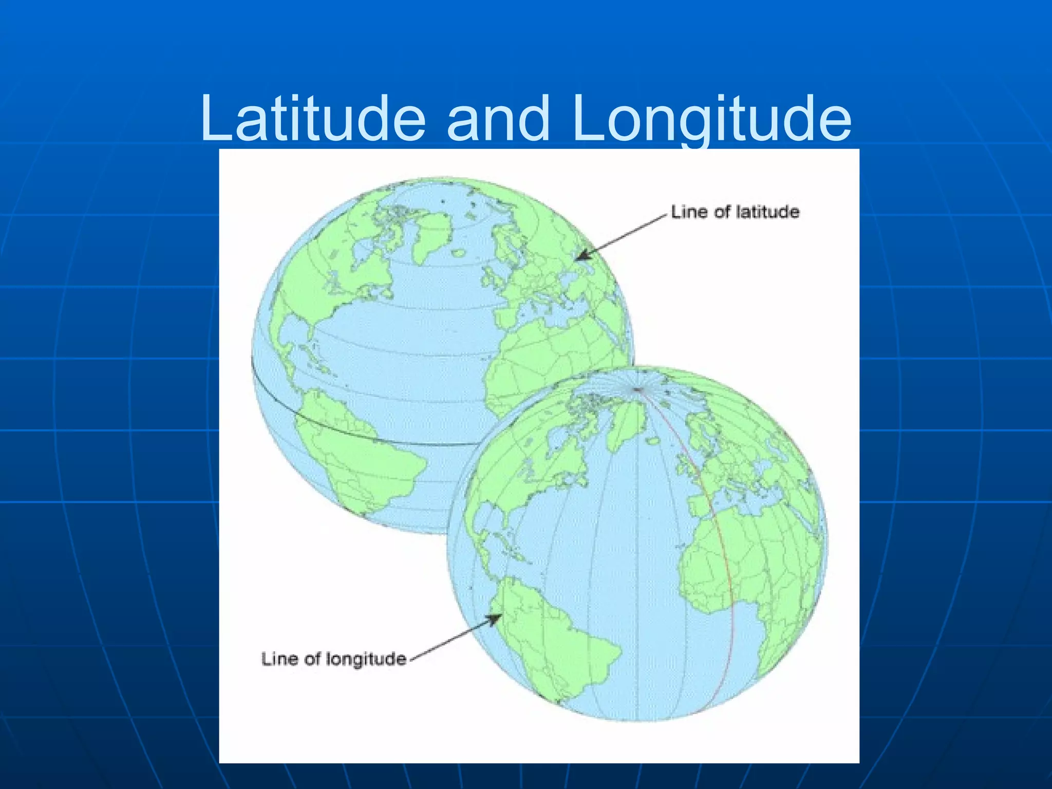
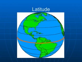
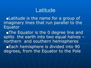
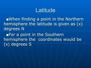
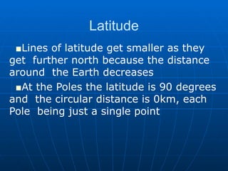
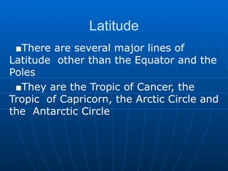
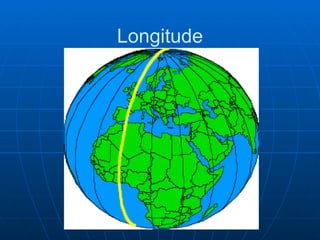
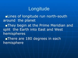
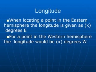
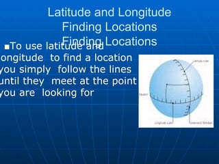
Latitude and Longitude
Latitude and Longitude Lines of Latitude and  Longitude are imaginary lines  that encircle the Earth in either  an East- West direction or in a  North-South direction Together they form a grid  which can be used to identify  locations on the Earth’s  surface
Latitude and Longitude When using these lines to find a location  the coordinates are always given latitude  first and then longitude
Latitude
Latitude Latitude is the name for a group of  imaginary lines that run parallel to the  Equator The Equator is the 0 degree line and splits  the earth into two equal halves –northern  and southern hemispheres Each hemisphere is divided into 90  degrees, from the Equator to the Pole
Latitude When finding a point in the Northern  hemisphere the latitude is given as (x)  degrees N For a point in the Southern hemisphere the  coordinates would be (x) degrees S
Latitude Lines of latitude get smaller as they get  further north because the distance around  the Earth decreases At the Poles the latitude is 90 degrees and  the circular distance is 0km, each Pole  being just a single point
Latitude There are several major lines of Latitude  other than the Equator and the Poles They are the Tropic of Cancer, the Tropic  of Capricorn, the Arctic Circle and the  Antarctic Circle
Longitude
Longitude Lines of longitude run north-south around  the planet They begin at the Prime Meridian and split  the Earth into East and West hemispheres There are 180 degrees in each hemisphere
Longitude When locating a point in the Eastern  hemisphere the longitude is given as (x)  degrees E For a point in the Western hemisphere the  longitude would be (x) degrees W
Longitude All lines of longitude are the same length There is only one important line of  Longitude other than the Prime Meridian –  the International Date Line This is the 180 degree line in both  directions
Latitude and Longitude Finding Locations Finding Locations To use latitude and longitude  to find a location you simply  follow the lines until they  meet at the point you are  looking for
Latitude and Longitude Finding Locations Finding Locations The latitude is always the first coordinate given It will be a number between 0 and 90 degrees  and will be followed by either an N or an S,  depending on which hemisphere the location is in Longitude is always the second number and will  be between 0 and 180 degrees, followed by  either an E or a W
Latitude and Longitude Finding Locations Finding Locations Not all points are located neatly at the  points where the lines intersect To find locations between the points each  degree is split into 60 smaller sections  called minutes For example, the coordinates for Orono are  43 59N 78 36W
Latitude and Longitude Finding Locations Finding Locations The coordinates for Orono mean that the village  is located 43 degrees and 59 minutes north of the  Equator and 78 degrees and 36 minutes west of  the Prime Meridian If you are using a GPS device there will be an  additional set of numbers for each coordinate,  called seconds Seconds subdivide the minutes into even smaller  sections and provide additional accuracy

Latitude And Longitude

  • 1.
  • 2.
    Latitude and LongitudeLines of Latitude and Longitude are imaginary lines that encircle the Earth in either an East- West direction or in a North-South direction Together they form a grid which can be used to identify locations on the Earth’s surface
  • 3.
    Latitude and LongitudeWhen using these lines to find a location the coordinates are always given latitude first and then longitude
  • 4.
  • 5.
    Latitude Latitude isthe name for a group of imaginary lines that run parallel to the Equator The Equator is the 0 degree line and splits the earth into two equal halves –northern and southern hemispheres Each hemisphere is divided into 90 degrees, from the Equator to the Pole
  • 6.
    Latitude When findinga point in the Northern hemisphere the latitude is given as (x) degrees N For a point in the Southern hemisphere the coordinates would be (x) degrees S
  • 7.
    Latitude Lines oflatitude get smaller as they get further north because the distance around the Earth decreases At the Poles the latitude is 90 degrees and the circular distance is 0km, each Pole being just a single point
  • 8.
    Latitude There areseveral major lines of Latitude other than the Equator and the Poles They are the Tropic of Cancer, the Tropic of Capricorn, the Arctic Circle and the Antarctic Circle
  • 9.
  • 10.
    Longitude Lines oflongitude run north-south around the planet They begin at the Prime Meridian and split the Earth into East and West hemispheres There are 180 degrees in each hemisphere
  • 11.
    Longitude When locatinga point in the Eastern hemisphere the longitude is given as (x) degrees E For a point in the Western hemisphere the longitude would be (x) degrees W
  • 12.
    Longitude All linesof longitude are the same length There is only one important line of Longitude other than the Prime Meridian – the International Date Line This is the 180 degree line in both directions
  • 13.
    Latitude and LongitudeFinding Locations Finding Locations To use latitude and longitude to find a location you simply follow the lines until they meet at the point you are looking for
  • 14.
    Latitude and LongitudeFinding Locations Finding Locations The latitude is always the first coordinate given It will be a number between 0 and 90 degrees and will be followed by either an N or an S, depending on which hemisphere the location is in Longitude is always the second number and will be between 0 and 180 degrees, followed by either an E or a W
  • 15.
    Latitude and LongitudeFinding Locations Finding Locations Not all points are located neatly at the points where the lines intersect To find locations between the points each degree is split into 60 smaller sections called minutes For example, the coordinates for Orono are 43 59N 78 36W
  • 16.
    Latitude and LongitudeFinding Locations Finding Locations The coordinates for Orono mean that the village is located 43 degrees and 59 minutes north of the Equator and 78 degrees and 36 minutes west of the Prime Meridian If you are using a GPS device there will be an additional set of numbers for each coordinate, called seconds Seconds subdivide the minutes into even smaller sections and provide additional accuracy