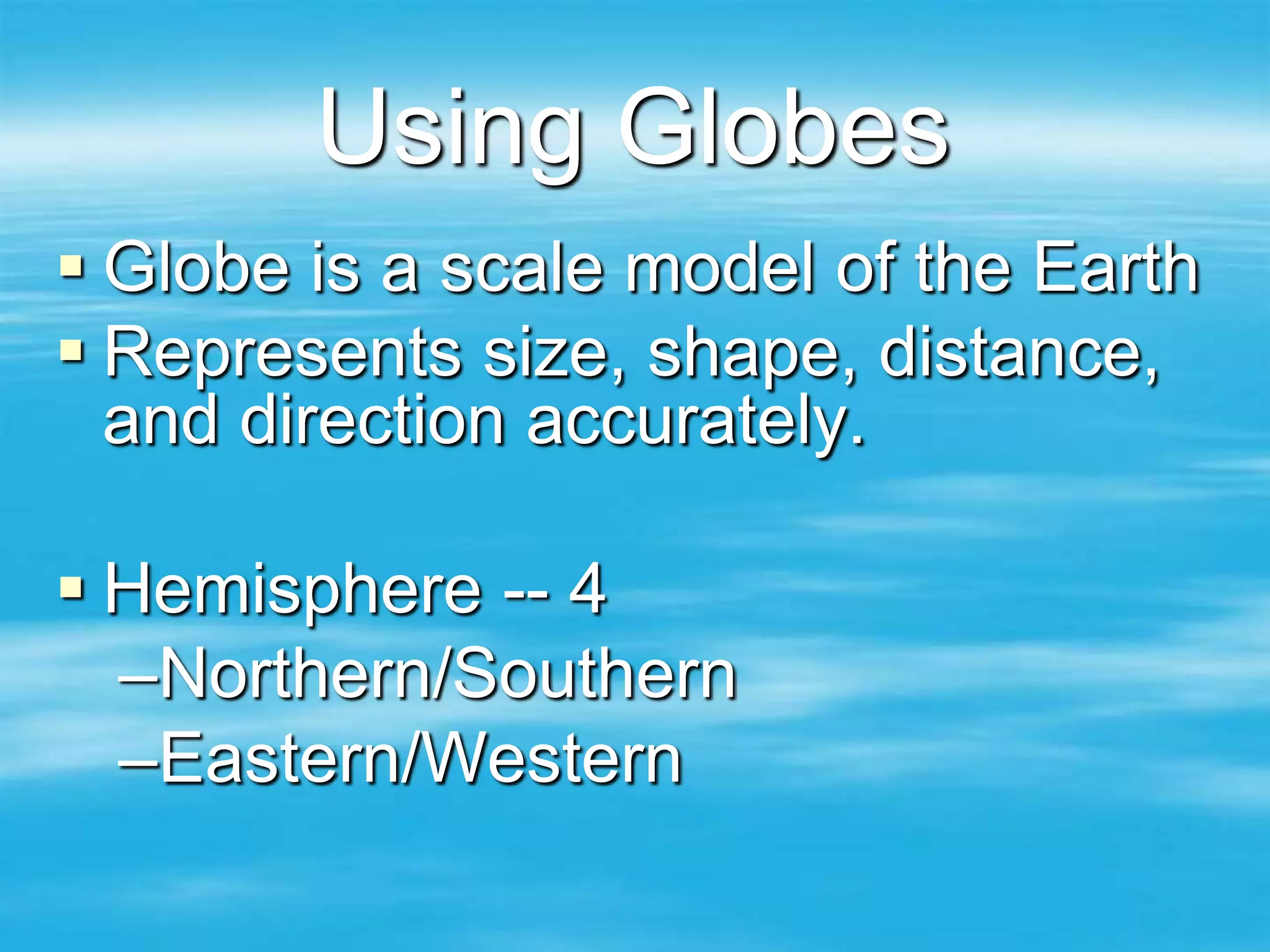
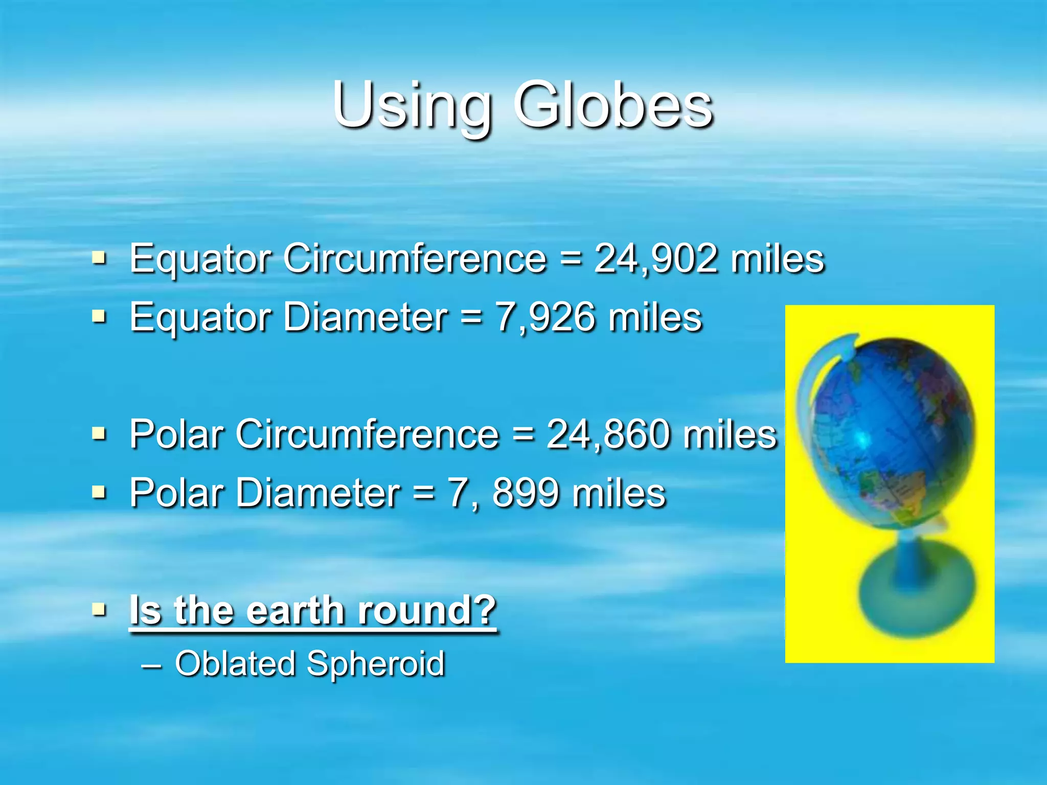
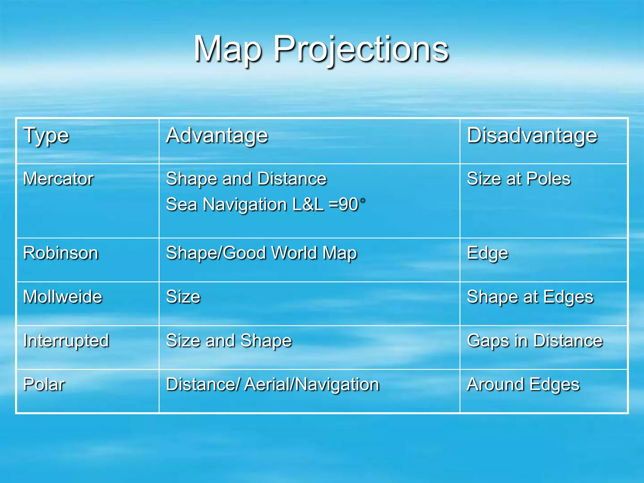
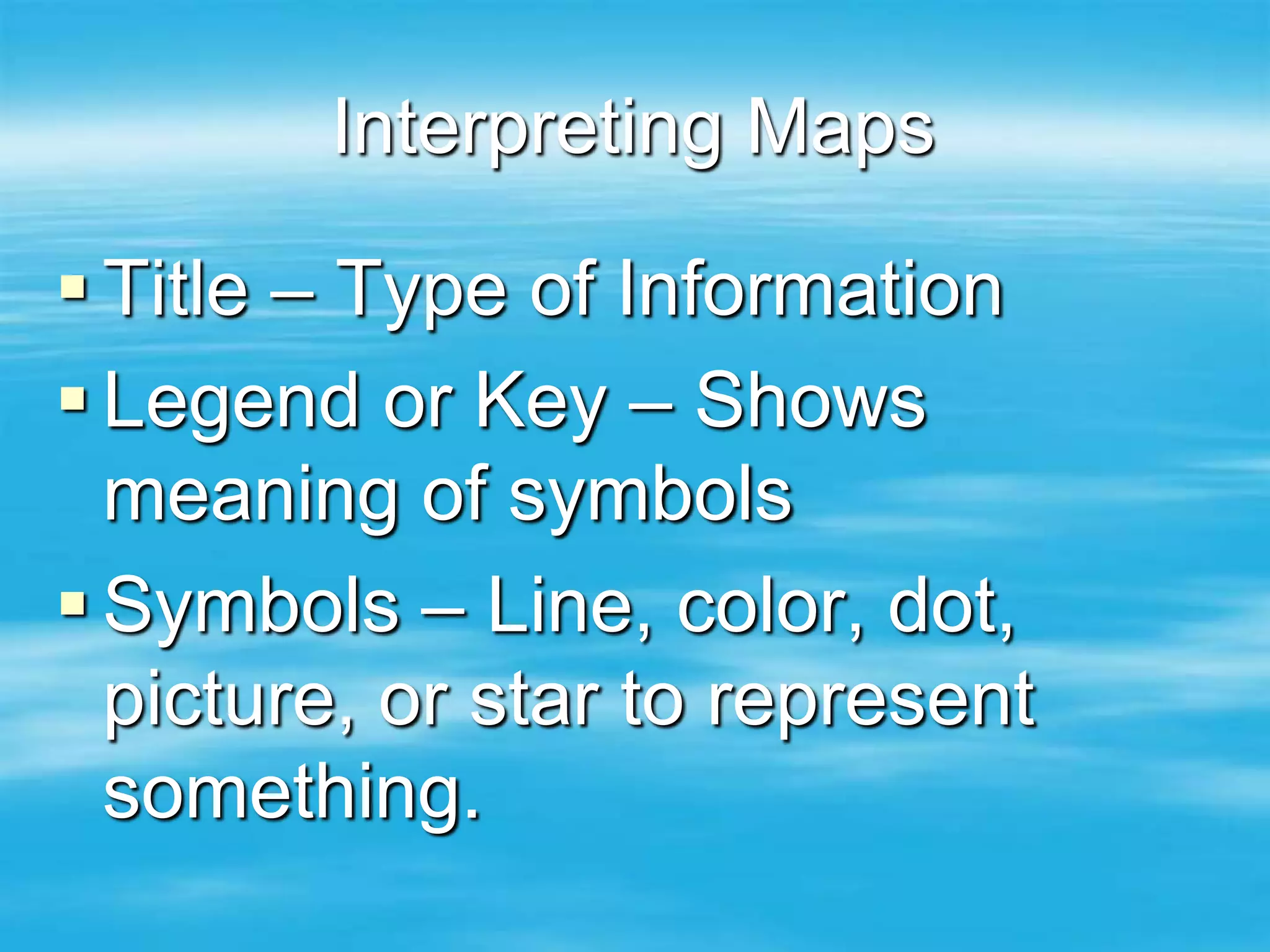
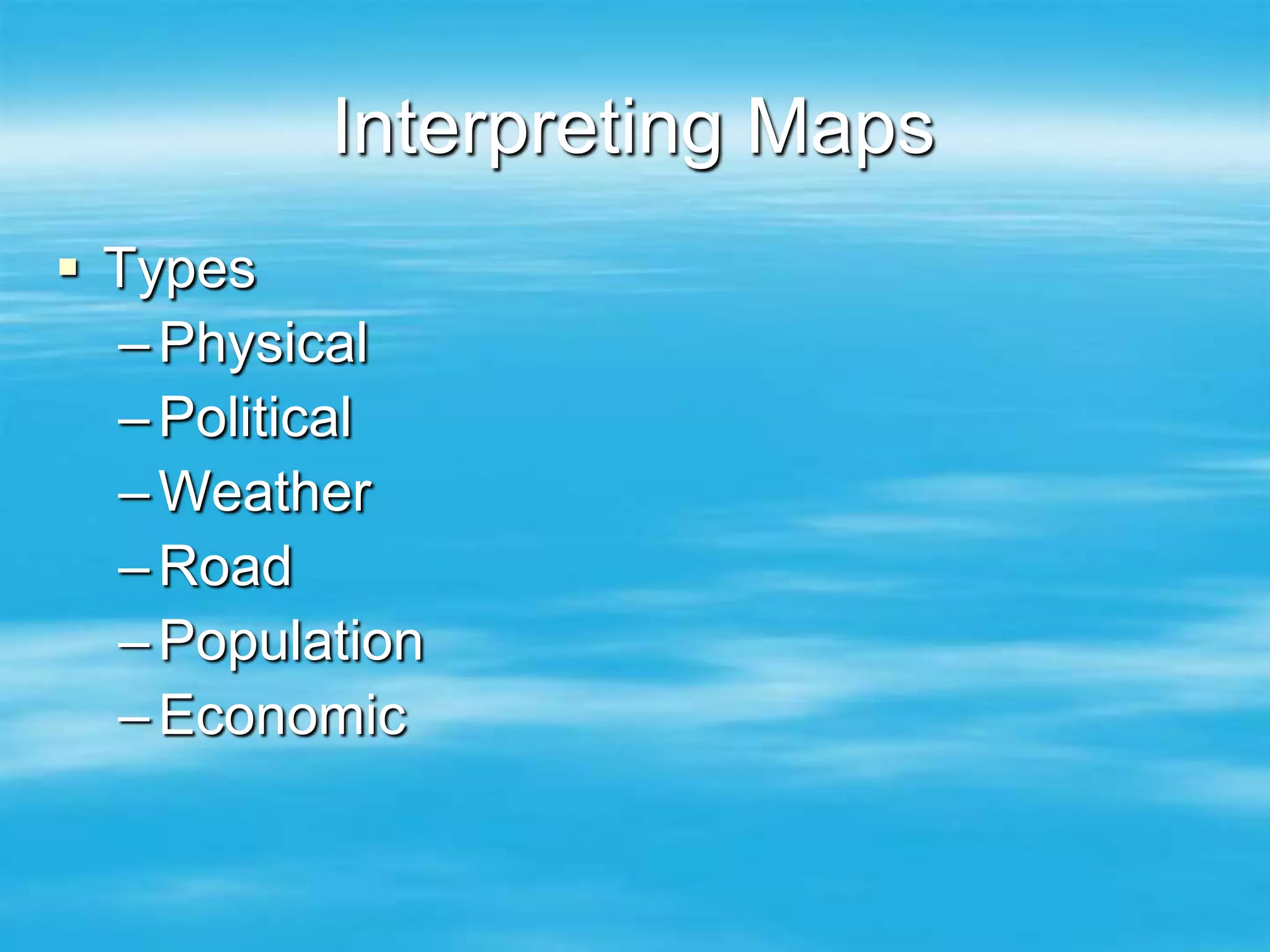
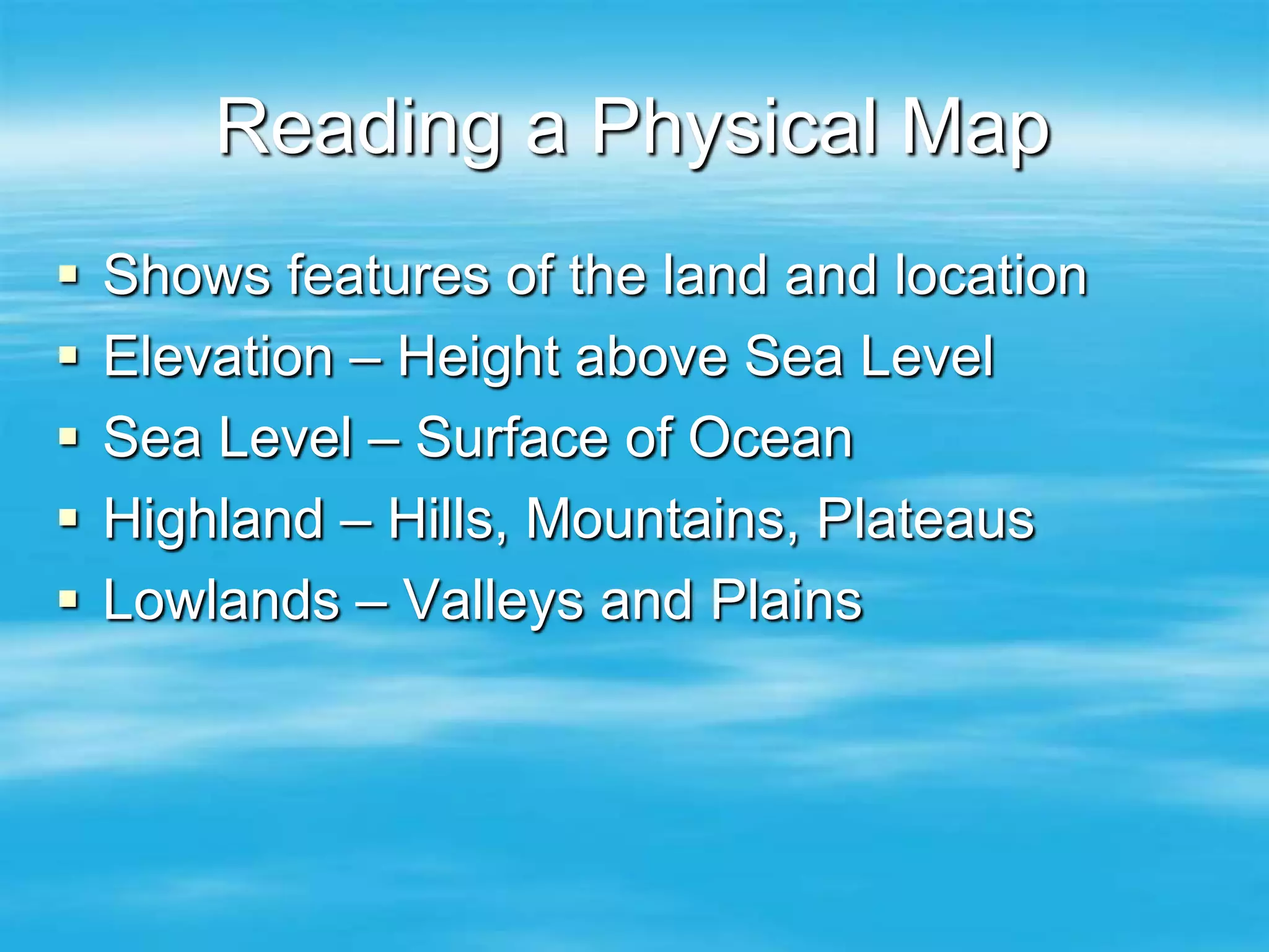
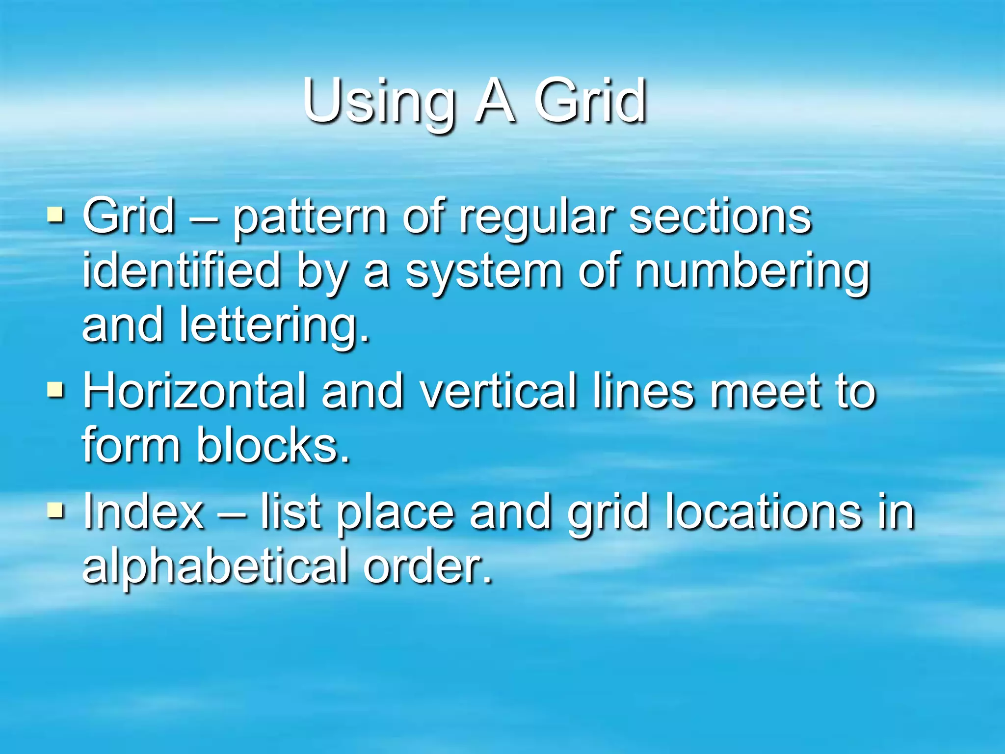
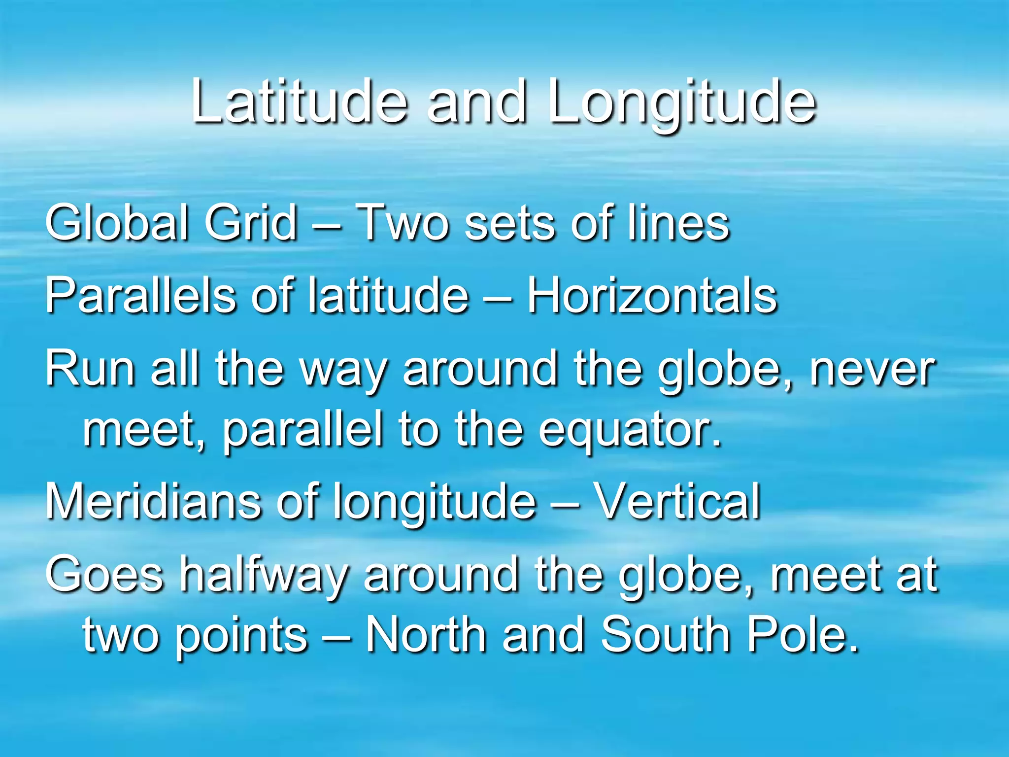
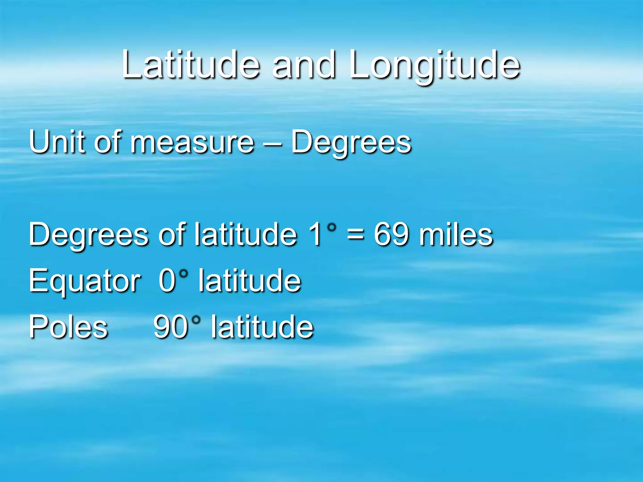
Map and Globe
    Skills
   Mr. Coltabaugh
  World Geography
Using Globes
 Globe is a scale model of the Earth
 Represents size, shape, distance,
  and direction accurately.

 Hemisphere -- 4
  –Northern/Southern
  –Eastern/Western
Using Globes

 Equator Circumference = 24,902 miles
 Equator Diameter = 7,926 miles

 Polar Circumference = 24,860 miles
 Polar Diameter = 7, 899 miles

 Is the earth round?
  – Oblated Spheroid
Understanding Map Projections

 Map – flat drawing of all or part of earth.
 Cannot accurately display round earth on a
  flat surface
 Distortions -- size, shape, or distance
  – Equal Area – shows size
  – Conformal map shows shape
Map Projections

Type          Advantage                     Disadvantage
Mercator      Shape and Distance            Size at Poles
              Sea Navigation L&L =90

Robinson      Shape/Good World Map          Edge

Mollweide     Size                          Shape at Edges

Interrupted   Size and Shape                Gaps in Distance

Polar         Distance/ Aerial/Navigation   Around Edges
Interpreting Maps

 Title – Type of Information
 Legend or Key – Shows
  meaning of symbols
 Symbols – Line, color, dot,
  picture, or star to represent
  something.
Interpreting Maps
 Types
  – Physical
  – Political
  – Weather
  – Road
  – Population
  – Economic
Reading a Physical Map
   Shows features of the land and location
   Elevation – Height above Sea Level
   Sea Level – Surface of Ocean
   Highland – Hills, Mountains, Plateaus
   Lowlands – Valleys and Plains
Reading a Physical Map
 Land surface relief
  –Difference between highest and
    lowest points
  –High relief – sizable drops and rises
    in surface
  –Low relief – land rise or falls only
    slightly over a long distance.
Telling Directions
 Determine which direction first?
  Why?
 Once you know which direction is
  NORTH you can figure out the
  other directions
 Cardinal N, E, S, W
 Intermediate NE, SE, NW, SW.
Telling Directions

 Direction Arrow – indicates
  North
 Compass Rose – Shows all four
  cardinal and intermediate
  directions.
Using Scale
 Scale – line that tells how many miles
  or kilometers on earth that are
  represented by certain units on the
  map.
 Map Area – map that show a large
  area in a small space are limited in the
  details that they can show.
 Maps that show a small area in a large
  space can often show many details.
Using A Grid
 Grid – pattern of regular sections
  identified by a system of numbering
  and lettering.
 Horizontal and vertical lines meet to
  form blocks.
 Index – list place and grid locations in
  alphabetical order.
Latitude and Longitude
Global Grid – Two sets of lines
Parallels of latitude – Horizontals
Run all the way around the globe, never
 meet, parallel to the equator.
Meridians of longitude – Vertical
Goes halfway around the globe, meet at
 two points – North and South Pole.
Latitude and Longitude
Unit of measure – Degrees

Degrees of latitude 1 = 69 miles
Equator 0 latitude
Poles 90 latitude

Map and globe skills

  • 1.
    Map and Globe Skills Mr. Coltabaugh World Geography
  • 2.
    Using Globes  Globeis a scale model of the Earth  Represents size, shape, distance, and direction accurately.  Hemisphere -- 4 –Northern/Southern –Eastern/Western
  • 3.
    Using Globes  EquatorCircumference = 24,902 miles  Equator Diameter = 7,926 miles  Polar Circumference = 24,860 miles  Polar Diameter = 7, 899 miles  Is the earth round? – Oblated Spheroid
  • 4.
    Understanding Map Projections Map – flat drawing of all or part of earth.  Cannot accurately display round earth on a flat surface  Distortions -- size, shape, or distance – Equal Area – shows size – Conformal map shows shape
  • 5.
    Map Projections Type Advantage Disadvantage Mercator Shape and Distance Size at Poles Sea Navigation L&L =90 Robinson Shape/Good World Map Edge Mollweide Size Shape at Edges Interrupted Size and Shape Gaps in Distance Polar Distance/ Aerial/Navigation Around Edges
  • 6.
    Interpreting Maps  Title– Type of Information  Legend or Key – Shows meaning of symbols  Symbols – Line, color, dot, picture, or star to represent something.
  • 7.
    Interpreting Maps  Types – Physical – Political – Weather – Road – Population – Economic
  • 8.
    Reading a PhysicalMap  Shows features of the land and location  Elevation – Height above Sea Level  Sea Level – Surface of Ocean  Highland – Hills, Mountains, Plateaus  Lowlands – Valleys and Plains
  • 9.
    Reading a PhysicalMap  Land surface relief –Difference between highest and lowest points –High relief – sizable drops and rises in surface –Low relief – land rise or falls only slightly over a long distance.
  • 10.
    Telling Directions  Determinewhich direction first? Why?  Once you know which direction is NORTH you can figure out the other directions  Cardinal N, E, S, W  Intermediate NE, SE, NW, SW.
  • 11.
    Telling Directions  DirectionArrow – indicates North  Compass Rose – Shows all four cardinal and intermediate directions.
  • 12.
    Using Scale  Scale– line that tells how many miles or kilometers on earth that are represented by certain units on the map.  Map Area – map that show a large area in a small space are limited in the details that they can show.  Maps that show a small area in a large space can often show many details.
  • 13.
    Using A Grid Grid – pattern of regular sections identified by a system of numbering and lettering.  Horizontal and vertical lines meet to form blocks.  Index – list place and grid locations in alphabetical order.
  • 14.
    Latitude and Longitude GlobalGrid – Two sets of lines Parallels of latitude – Horizontals Run all the way around the globe, never meet, parallel to the equator. Meridians of longitude – Vertical Goes halfway around the globe, meet at two points – North and South Pole.
  • 15.
    Latitude and Longitude Unitof measure – Degrees Degrees of latitude 1 = 69 miles Equator 0 latitude Poles 90 latitude