Download to read offline


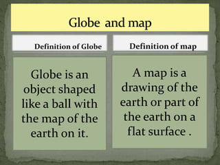
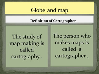
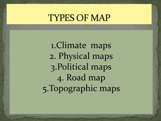
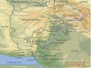
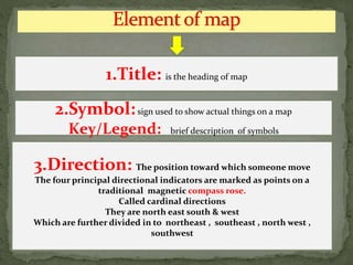

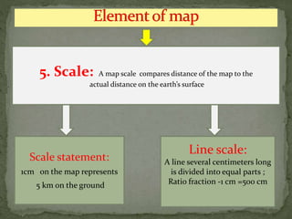
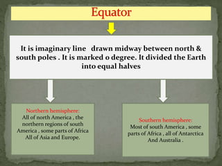


This document defines key terms related to maps, including globes, cartography, and different types of maps. It explains that a globe is a spherical object with an map of the earth, while a map is a flat representation. Cartography is the study of map making, and a cartographer is someone who makes maps. It then lists common types of maps like climate, physical, political, and topographic maps. The rest of the document provides details on the components of maps, such as titles, keys, directions, grid lines, scales, and the equator which divides the northern and southern hemispheres.