A coordinate system is a reference framework for representing geographic locations, using various measurement frameworks and units such as geographic (spherical) and planimetric (2D). Geographic coordinate systems use a 3D spherical model and include key elements like angular units and a datum, while projected coordinate systems transform these into a 2D plane. The document explains latitude and longitude concepts, their measurements, and different formats, along with types of coordinate systems like global and projected systems.
What is acoordinate system?
• A coordinate system is a reference system
used to represent the locations of geographic
features, imagery, and observations, within a
common geographic framework.
• Coordinate systems enable geographic
datasets to use common locations for
integration.
3.
What is acoordinate system?
Each coordinate system is defined by:
• Its measurement framework,
– geographic (in which spherical coordinates are measured from the
earth's center) or
– planimetric (in which the earth's coordinates are projected onto a
two-dimensional planar surface)
• Units of measurement (e.g. feet/meters for projected coordinate
systems or decimal degrees for lat/long)
• The definition of the map projection for projected coordinate
systems
• Other measurement system properties such as a spheroid of
reference, a datum, one or more standard parallels, a central
meridian, and possible shifts in the x- and y-directions
4.
Types of CoordinateSystems
• A global or spherical coordinate system such
as latitude-longitude.
– Also referred to as geographic coordinate systems.
• A projected coordinate system such as (UTM),
represented by Cartesian coordinate plane.
– Projected coordinate systems are referred to as
map projections.
5.
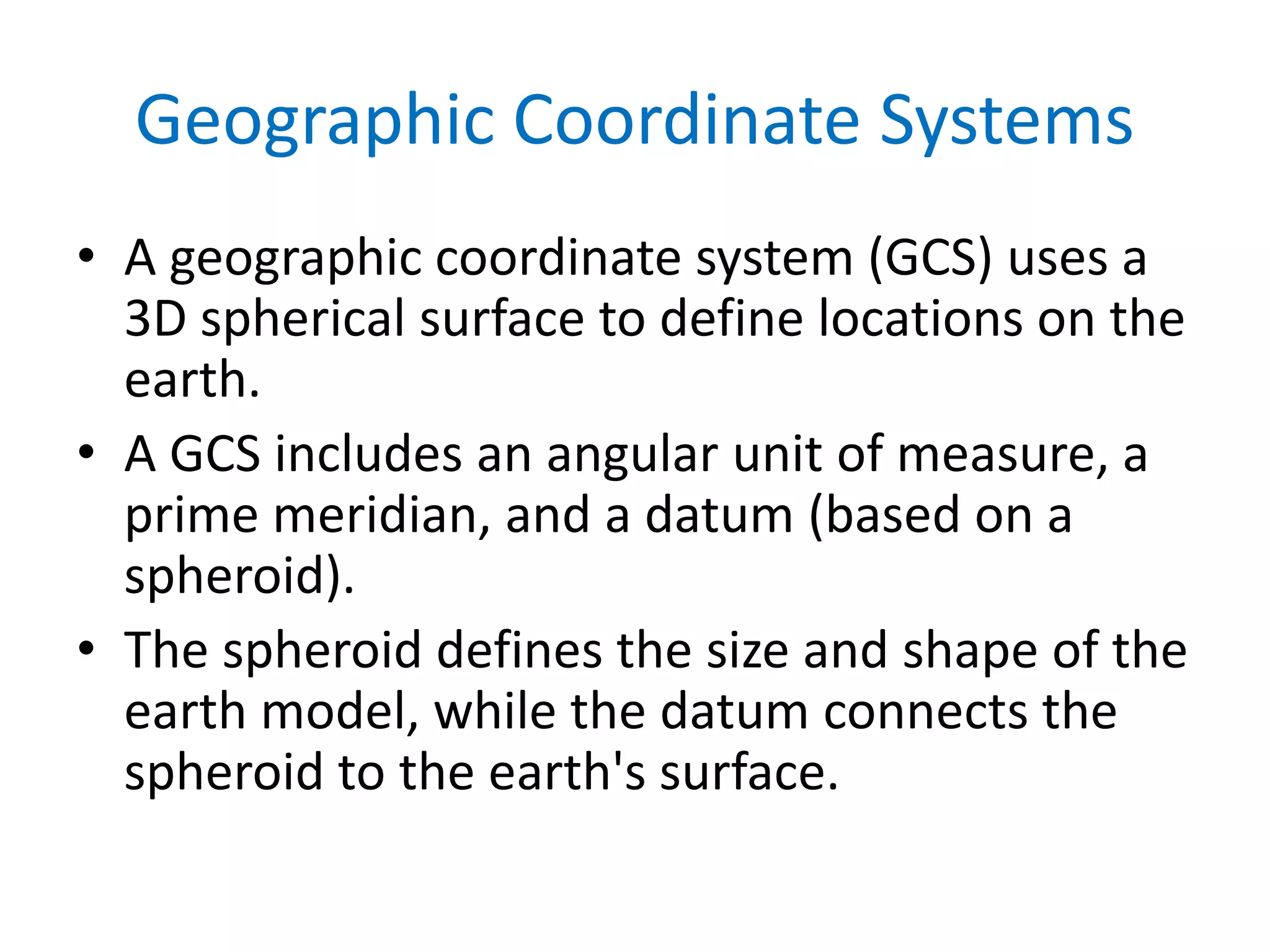
Geographic Coordinate Systems
•A geographic coordinate system (GCS) uses a
3D spherical surface to define locations on the
earth.
• A GCS includes an angular unit of measure, a
prime meridian, and a datum (based on a
spheroid).
• The spheroid defines the size and shape of the
earth model, while the datum connects the
spheroid to the earth's surface.
6.
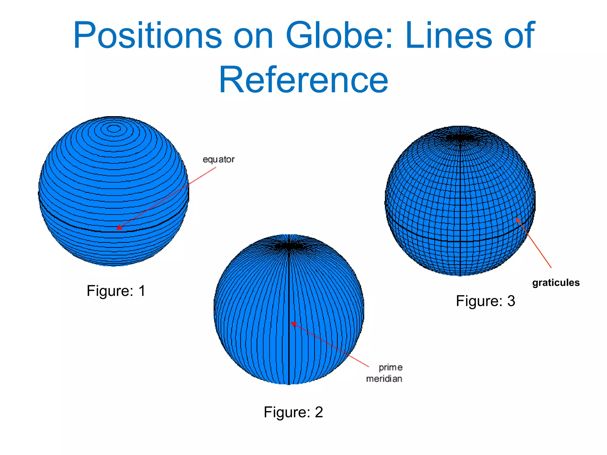
Positions on Globe:Lines of
Reference
Figure: 1
Figure: 2
Figure: 3
graticules
8.
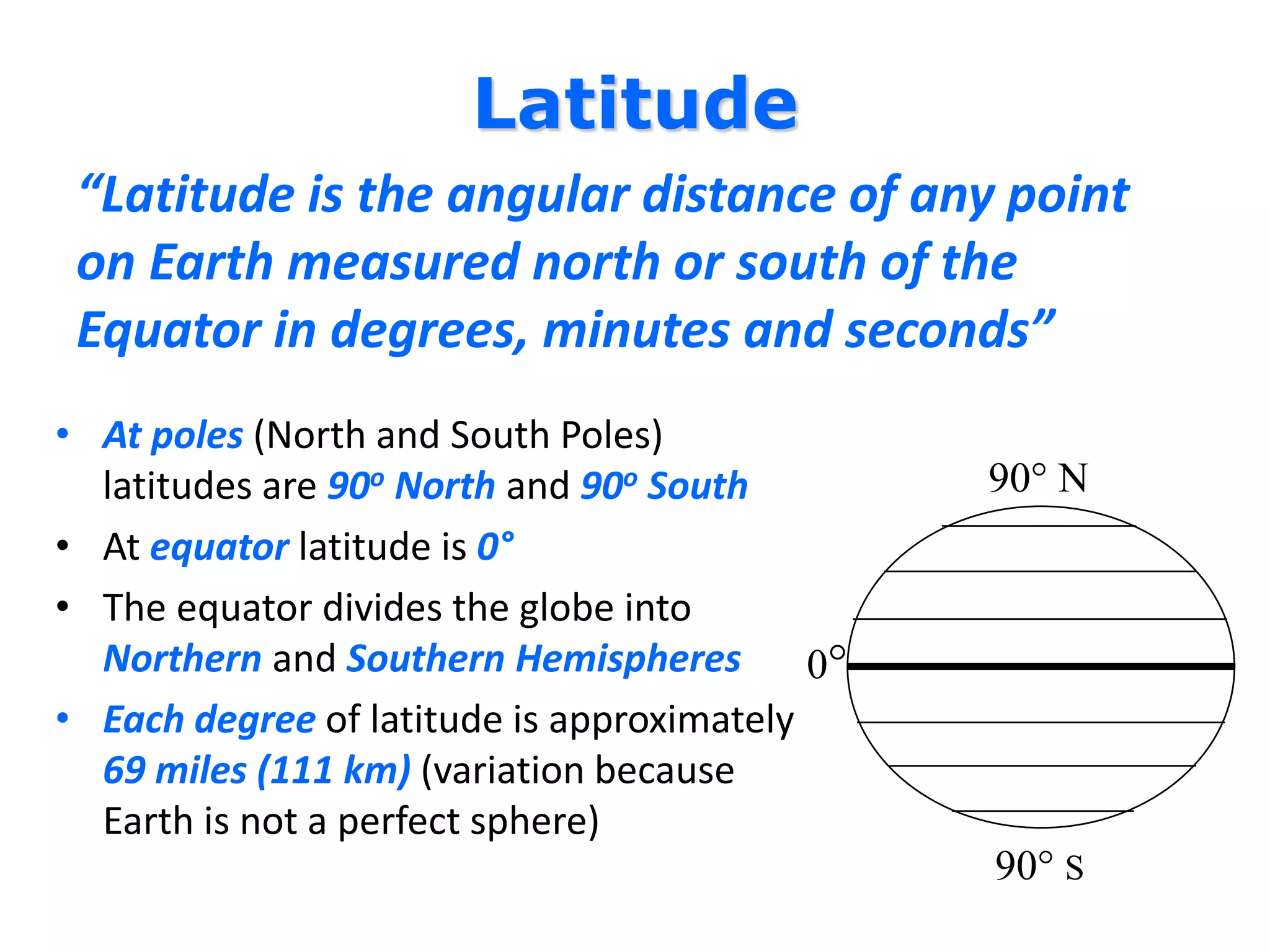
Latitude
“Latitude is theangular distance of any point
on Earth measured north or south of the
Equator in degrees, minutes and seconds”
• At poles (North and South Poles)
latitudes are 90o North and 90o South
• At equator latitude is 0°
• The equator divides the globe into
Northern and Southern Hemispheres
• Each degree of latitude is approximately
69 miles (111 km) (variation because
Earth is not a perfect sphere)
90° N
90° S
0°
9.
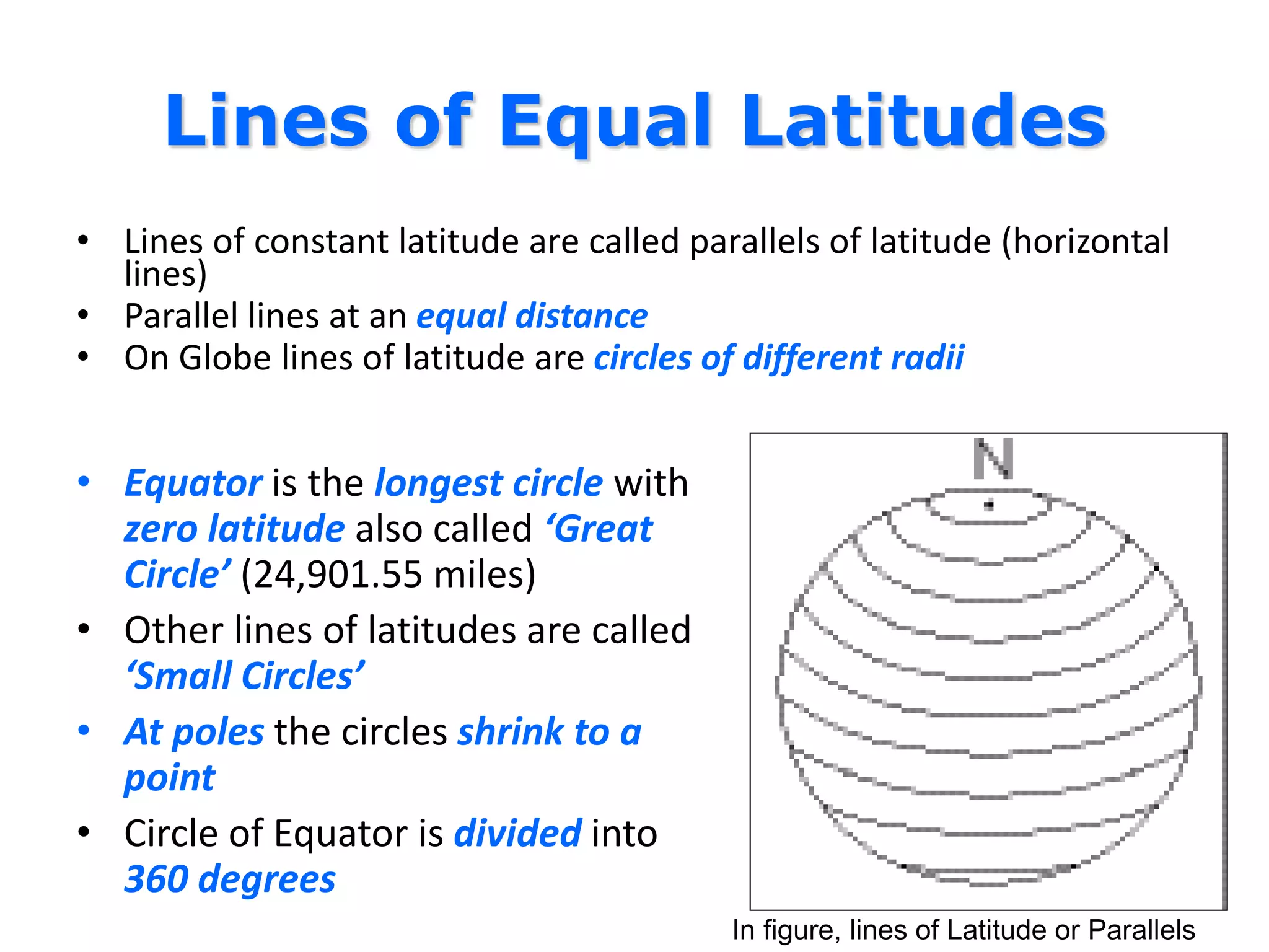
Lines of EqualLatitudes
• Lines of constant latitude are called parallels of latitude (horizontal
lines)
• Parallel lines at an equal distance
• On Globe lines of latitude are circles of different radii
• Equator is the longest circle with
zero latitude also called ‘Great
Circle’ (24,901.55 miles)
• Other lines of latitudes are called
‘Small Circles’
• At poles the circles shrink to a
point
• Circle of Equator is divided into
360 degrees
In figure, lines of Latitude or Parallels
10.
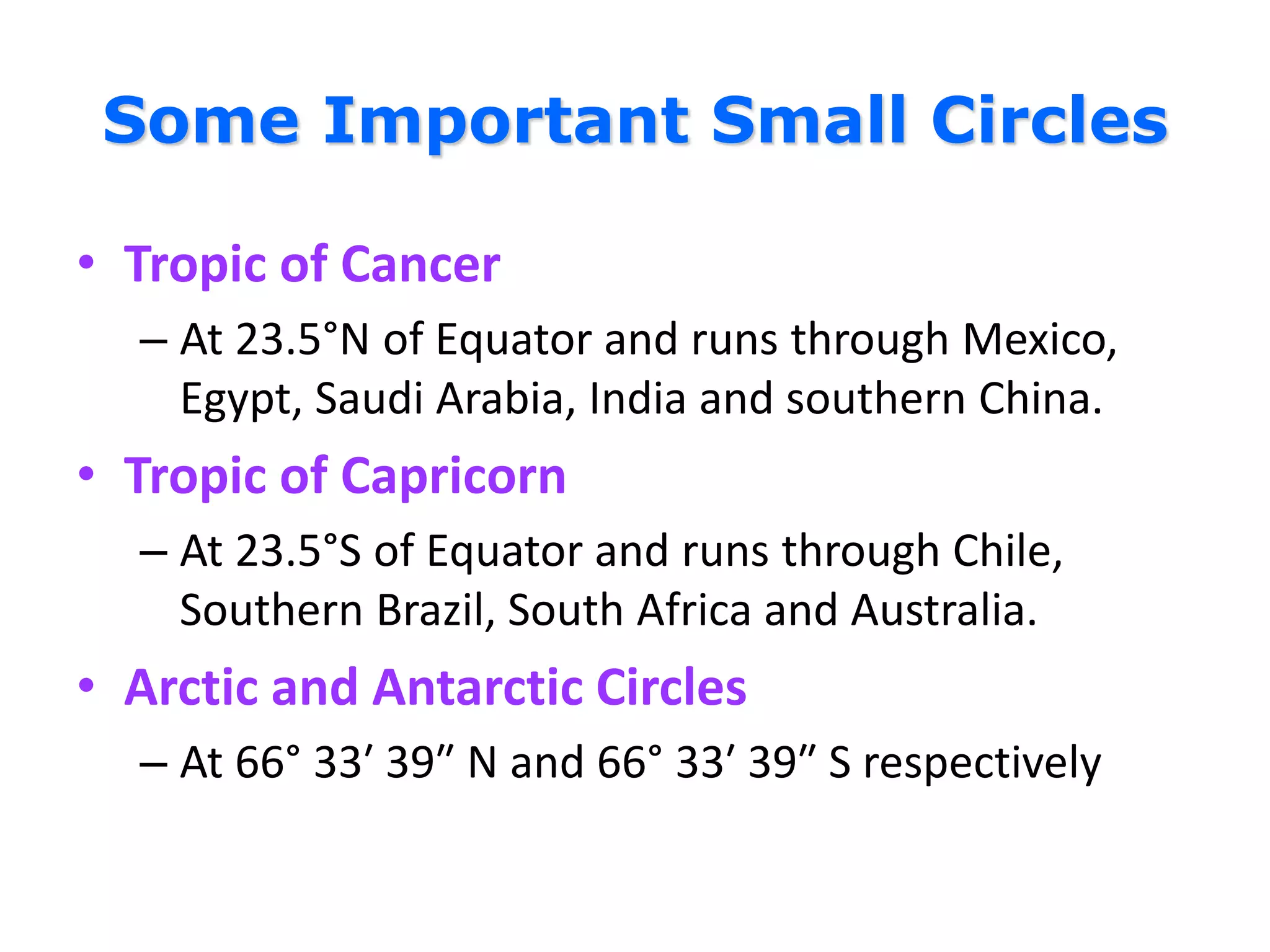
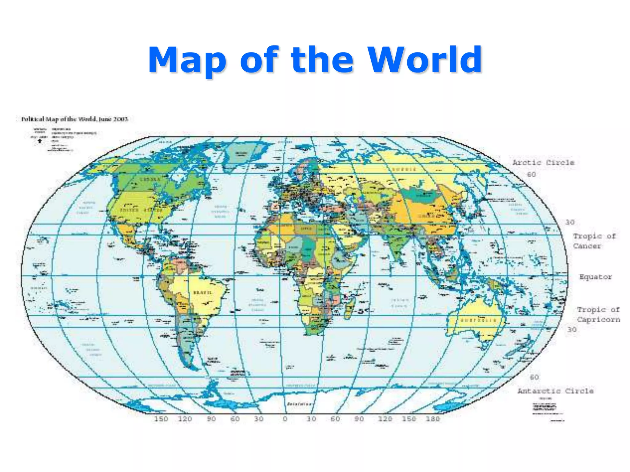
Some Important SmallCircles
• Tropic of Cancer
– At 23.5°N of Equator and runs through Mexico,
Egypt, Saudi Arabia, India and southern China.
• Tropic of Capricorn
– At 23.5°S of Equator and runs through Chile,
Southern Brazil, South Africa and Australia.
• Arctic and Antarctic Circles
– At 66° 33′ 39″ N and 66° 33′ 39″ S respectively
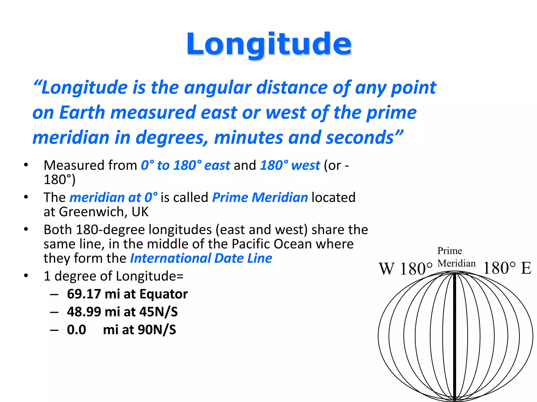
Longitude
“Longitude is theangular distance of any point
on Earth measured east or west of the prime
meridian in degrees, minutes and seconds”
• Measured from 0° to 180° east and 180° west (or -
180°)
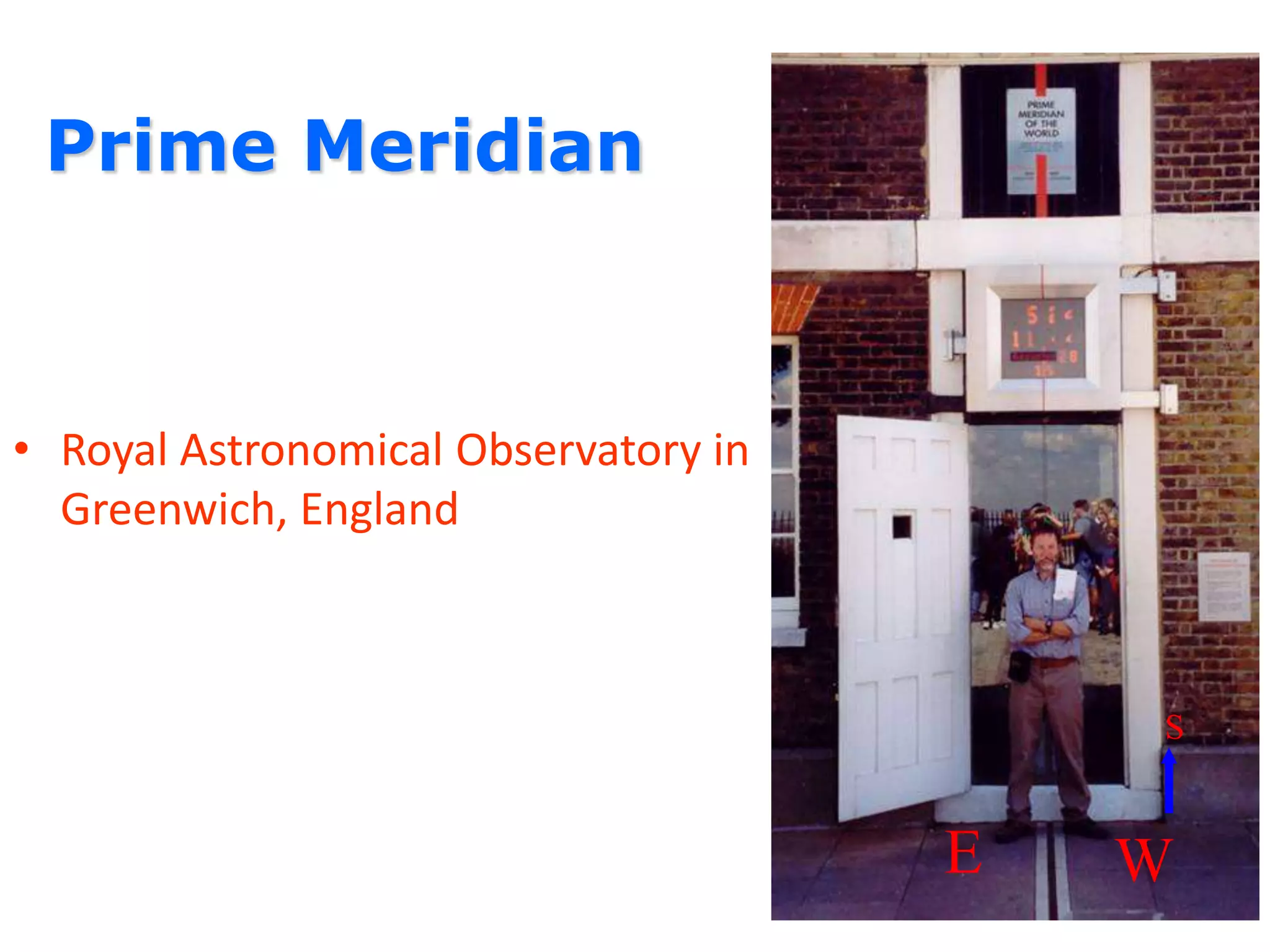
• The meridian at 0° is called Prime Meridian located
at Greenwich, UK
• Both 180-degree longitudes (east and west) share the
same line, in the middle of the Pacific Ocean where
they form the International Date Line
• 1 degree of Longitude=
– 69.17 mi at Equator
– 48.99 mi at 45N/S
– 0.0 mi at 90N/S
W 180° 180° E
Prime
Meridian
13.
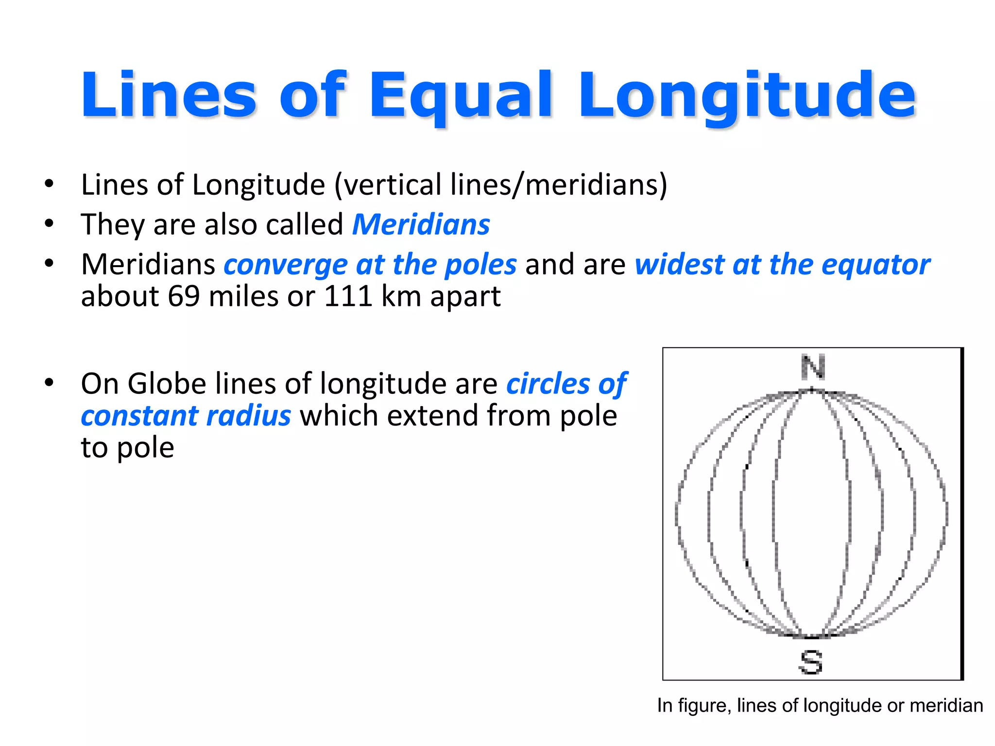
Lines of EqualLongitude
• Lines of Longitude (vertical lines/meridians)
• They are also called Meridians
• Meridians converge at the poles and are widest at the equator
about 69 miles or 111 km apart
• On Globe lines of longitude are circles of
constant radius which extend from pole
to pole
In figure, lines of longitude or meridian
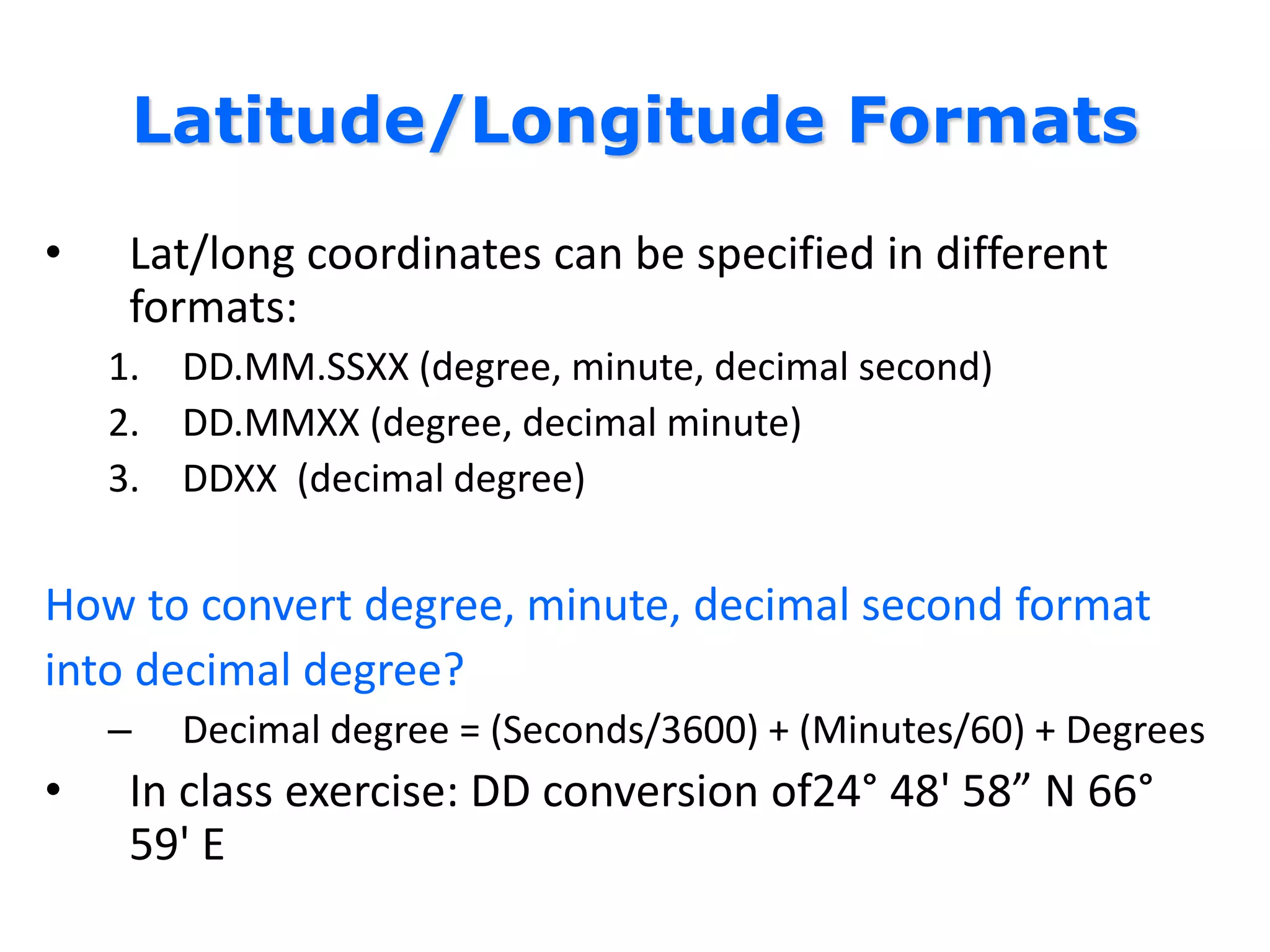
Latitude/Longitude Formats
• Lat/longcoordinates can be specified in different
formats:
1. DD.MM.SSXX (degree, minute, decimal second)
2. DD.MMXX (degree, decimal minute)
3. DDXX (decimal degree)
How to convert degree, minute, decimal second format
into decimal degree?
– Decimal degree = (Seconds/3600) + (Minutes/60) + Degrees
• In class exercise: DD conversion of24° 48' 58” N 66°
59' E
16.
Quiz 2 (a)
1.DD conversion of 38° 20' 20” N 70° 56' 04” E is
_______________ N and ______________ E
2. DD conversion of 35° 38' 20” S 134° 56' 59” E is
_______________ S and ______________ E
3. The DMS version of 5.23456° is _________________
17.
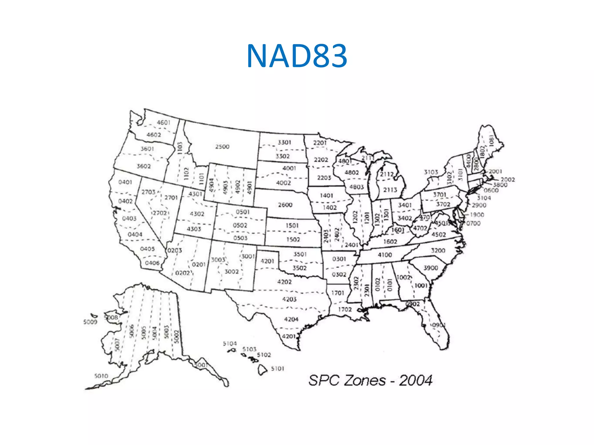
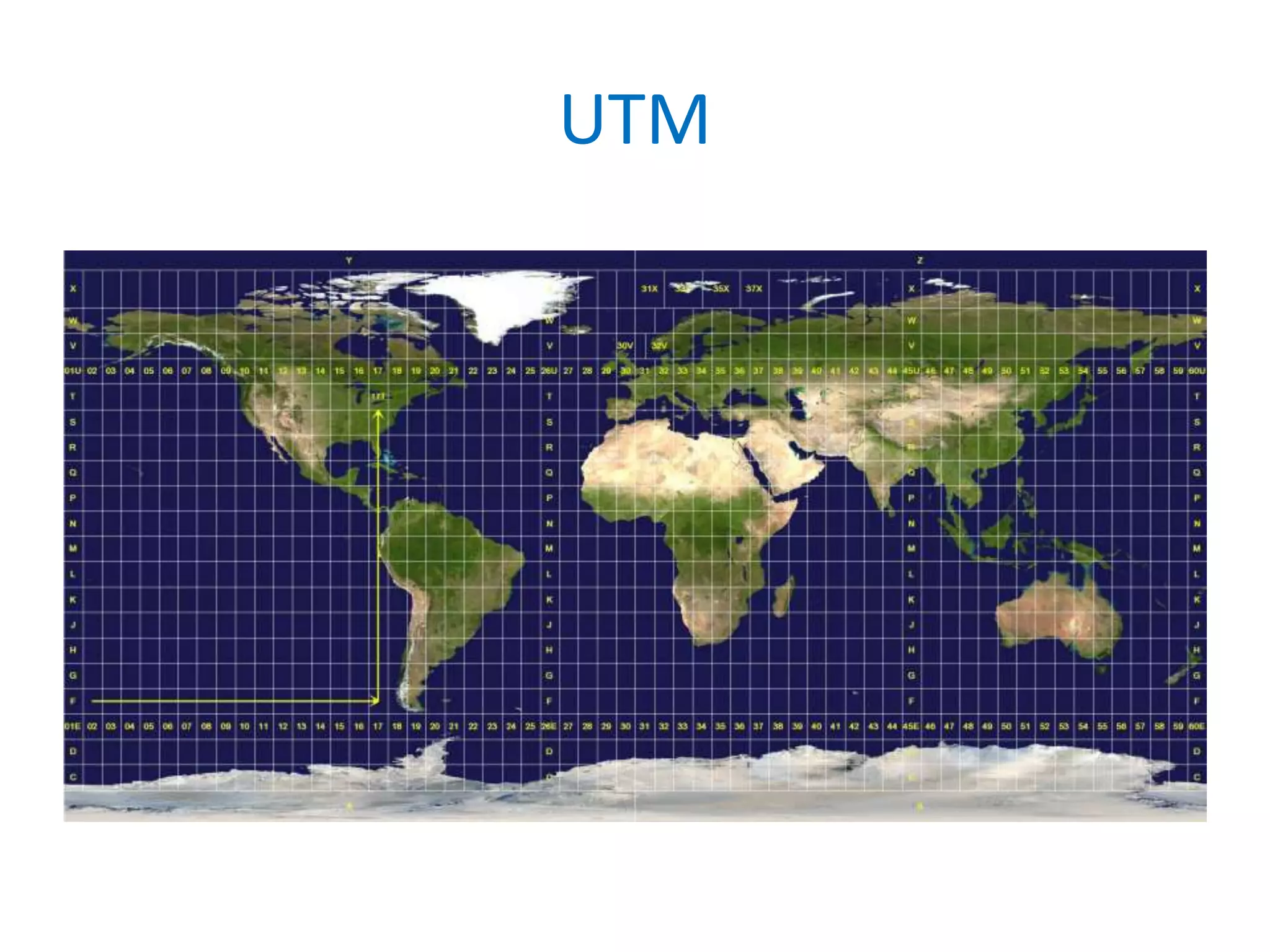
Projected Coordinate Systems
•A projected coordinate system (PCS) is defined
on a flat, 2D surface.
• A PCS is always based on a GCS that is based
on a sphere or spheroid.
• Projected coordinate system can be local (e.g.
NAD83) or global (UTM).