Dock and Harbor Engineering: Inland Water Transport in India, Tides, Winds and Waves Erosion, Transport of Sediments, Beach Drift, Littoral Drift, Sand Bars, Coast Protection, Classification of Ports and Harbors, Site Selection, Features of Break Waters, Jetties, Wharves, Piers, Facilities required, Dry Docks, Wet Docks, Lift Docks. Floating Docks, Spillways, Navigational Aids, Lighthouses, Terminal Buildings, and Dredging- Special Equipment.
This presentation will help you to interact with all the academic key points for the Subject B T C V C 7 0 2 I n f r a s t r u c t u r e E n g i n e e r i n g, Proposed Course Contents for B. Tech. in Civil Engineering w.e.f. June 2020.
Module 1 (5 Lectures)
Railway Engineering: Permanent Way, gauges, rails, sleepers, ballast, sub grade formation, fixtures and fastenings,
Geometric Design of tracks- Horizontal Alignment, Vertical Alignment Etc.
This presentation helps you to understand all concepts as per DBATU, Lonere for Last Year BTech Civil Subject- Infrastructural Engg.
Module-II
Points and Crossings:
Standard types, Design of simple turnout, various types of Junctions, Stations and Yards: Purpose, Location, Site selection, general layouts of Terminus and Junction, Signaling and Interlocking, Construction and Maintenance of Track, Modern trends in Railways
etc.
This presentation provides you the conceptual knowledge as per DBATU, Lonere Last Year BTech Civil subject, Infrastructure Engg. Module-V Tunnel Engineering
Shape and Size of Tunnel Shafts, Pilot Tunnels, Tunneling in Hard Rock, Tunneling in Soft Materials, Drilling-Patterns, Blasting, Timbering, Mucking, Tunnel Lining, Advances In Tunneling Methods, Safety Measures, Ventilation, Lighting and Drainage of Tunnels
etc.
Railway secondary part of the transportation . Railway use of maximum materials transport of one place to other place. Particular time of number of trains are move of particular junction so these part are used of points and crossing.
Best helpful of these ppt of railway track and design purposes.
This Presentation Contains Railway engineering concepts. The contents covered are Points & crossings: Turnout, switches, throw switches, diamond crossing, cross-overs, single slip and double slip, scissor cross-over, Triangle & turntable. Feel free to write in Comment Section or drop a line in my Inbox amanbathla710@gmail.com
This presentation helps you to get the conceptual idea about Bridge Superstructures as per the Syllabus of DBATU, Last Year BTech Lonere.
4.1 Bridge Engineering: Super-structures
4.2 Simple bridges or beam bridges: Deck bridges, Through bridges, Semi-through bridges
4.3 Introduction, advantages and disadvantages: Continuous bridges, Cantilever bridges, Arch bridges, Bow-string girder type bridges, Rigid frame bridges, Portal frame bridges, Suspension bridges, Cable-stayed bridges, Composite bridges
4.4 Materials for super-structures: Cement concrete, Masonry, Steel, Timber etc.
* DOWNLOAD AND PLAY IT IN MICROSOFT POWERPOINT CAUSE IT CONTAINS ANIMATION AND CAN'T WATCH WITHOUT IT *
Stations and Yards of Railway powerpoint presentation in Transport Engineering.
Significance of Road, Rail, Air and Water transports - Coordination of all modes to achieve sustainability - Elements of permanent way – Rails, Sleepers, Ballast, rail fixtures and fastenings, - Track Stress, coning of wheels, creep in rails, defects in rails – Route alignment surveys, conventional and modern methods- - Soil suitability analysis - Geometric design of railways, gradient, super elevation, widening of gauge on curves- Points and Crossings
This presentation helps you to get the detailed basics as per DBATU, Lonere for Last Year Civil BTech for subject Infrastructure Engg.
Module-3 Bridge Engineering: Sub-structures, Determination of design discharge, Linear Water Way, Economical Span, Afflux, Scour depth, Indian Road Congress Bridge Code
Abutments: Definition, Functions, Dimensions, Types, Forces acting on an abutment,Conditions of stabilityPiers: Definition, Function, Types, Forces acting on a pier, Conditions of stability, Dimensions, Location, Abutment pier
Wing walls: Definition, Functions, Types, Forces acting on a wing wall, Conditions of stability, Dimensions, Precautions
Materials for sub-structures: Cement concrete, Masonry, Steel etc.
Permanent Way of Railway & Components ?(part -1,2,3,4,5)RAMPRASAD KUMAWAT
Permanent Way Components: , Selection of Alignment, Ideal Permanent Ways and Cross-sections in different conditions, Salient Features and types of Components viz.
Rails, Sleepers, Ballast, Rail Fastenings.
Types and Selection of Gauges
A basic presentation of the coasts, suitable for Year 9 Geography. It includes: the definition of a coast, etymology, pelagic coasts and shores, the formation of the coasts, environmental importance, human uses of a coast, coasts and tourism, coast pollution, fishing declining, coastal landforms, cliff erosion, natural arch, sea caves, stacks, stumps, wave-cut notches and wave-cut platforms.
Harbours: History of water transportation, components of harbour, classification of harbours.
Introduction of Transportation Engineering
Harbours Engineering maximum data use for civil engineering students.
Course Outcomes-
CO1- Comprehend various types of transportation systems and their history of the development
CO2- Comprehend various types of pavements
CO3- Design the pavements by considering various aspects associated with traffic safety measures.
Topic Learning Outcomes:
C603.1.1 Understand the significance of various modes of transportation
C603.1.2 Discuss developments in road construction and Classify roads based on certain criteria.
C603.1.3 Describe factors for selecting road alignments and carrying out road surveys.
C603.2.1 Impart knowledge about various materials used for highway construction.
C603.2.2 Describe tests carried out on materials used for highway construction.
C603.2.3 Introduce the fundamental concepts of highway construction
C603.2.4 Classify pavements on the basis of structural behavior.
C603.3.1 Design different road geometrical elements.
C603.3.2 Identify traffic stream characteristics and Design a pre-timed signalized intersection.
C603.3.3 Identify causes of road accidents and measures for road safety.
C603.3.3 Analyze the important features of pavement designing.
Module 5: Pavement Design
(8 Lectures)
Basic Principles, Methods for Different Types of Pavements, Design of flexible pavement using IRC: 37- 2012, Design of rigid pavement using IRC: 58-2011
Other modes of Transport
Introduction to Railways, Airways, Waterways, Pipeline Transportation, Classification, Requirements, Comparative Studies.
Module 4: Traffic Engineering
(8 Lectures)
Traffic Characteristics, Speed, Journey Time and Delays, Vehicle Volume Counts, Origin and Destination Studies, Analysis and Interpretation of Survey Data, Traffic Operations, Design of Signals and Rotary intersections, Parking Space Design,Highway Lighting, Planning and Administration, Road Markings, Signs
Road Accidents and Safety:Classification, Causes, Mitigation and Control Measures, Aspects of Safety in Usage of Roads, Type and Design of anti-crash barriers, Introduction to Intelligent Transport Systems (ITS).
Module 1: Introduction
(6 Lectures)
•Importance of various modes of transportation,
•Highway Engineering,
•Road Classification,
•Developments in Road Construction,
•Highway Planning,
•Alignment and Surveys
Geology of Dams, Reservoirs, Tunnels and Bridges, Dam, types of dams, Influence of geological conditions on location, alignment, design and types of a dam, geological considerations in site selection for dams, Site improvement techniques, dams on carbonate rocks, sedimentary rocks, folded strata and Deccan traps, favorable and unfavorable geological conditions for a reservoir site. Tunneling:- Types of tunnels, the influence of geological conditions on tunneling, difficulties during tunneling, tunnel lining, tunneling in folded strata, sedimentary rocks and Deccan traps. Bridges:- Types of bridges, dependence of types of bridges on geological conditions.
Structural geology is the study of the three-dimensional distribution of rock units concerning their deformational histories.
The primary goal of structural geology is to use measurements of present-day rock geometries to uncover information about the history of deformation (strain) in the rocks, and ultimately, to understand the stress field that resulted in the observed strain and geometries.
Scope of Engg. Geology and Civil Engineering Applications. Geology in Construction Jobs, Geology & Civil Engineering, Geology in Water Resource Development, Brief History of Formation of Earth and Earth Crust, Formation of different rocks,
Mineralogy: Physical properties of mineral, Classification of minerals, Petrology: Definition, rock cycle, Igneous rocks: origin, textures and structures, classification, concordant and dis-concordant intrusions, civil engineering significance, Secondary rocks: formation, classification, residual deposits: soil, laterite and bauxite and their importance, Sedimentary deposits: formation, textures, classification and structures, civil engineering significance, chemical and organic deposits, Metamorphic rocks: agents and types of metamorphism, stress and anti-stress minerals, structures, products of metamorphism.
Absorption of sound, various materials, Sabine’ s formula, optimum reverberation time, conditions for good acoustics
Sound insulation: Acceptable noise levels, noise prevention at its source, transmission of noise, Noise control-general
considerations
Building planning byelaws & regulations as per SP-7, National Building Code of India group 1 to 5, planning of residential building: bungalows, row bungalows, apartments and twin bungalows, procedure of building permission, significance of commencement, plinth completion or occupancy certificate.
LABORATORY MANUAL FOR SURVEYING-II
AS PER DBATU's Syllabus.. all experiments and field work-related data will be helpful by this manual to all BTECH. Students belong to DBATU, Lonere
Principles of building planning, significance sun diagram, wind diagram, orientation, factors affecting, and criteria under Indian condition, concept of green building: aspect at planning level, construction stage and operational level.
Saudi Arabia stands as a titan in the global energy landscape, renowned for its abundant oil and gas resources. It's the largest exporter of petroleum and holds some of the world's most significant reserves. Let's delve into the top 10 oil and gas projects shaping Saudi Arabia's energy future in 2024.
Forklift Classes Overview by Intella PartsIntella Parts
Discover the different forklift classes and their specific applications. Learn how to choose the right forklift for your needs to ensure safety, efficiency, and compliance in your operations.
For more technical information, visit our website https://intellaparts.com
Democratizing Fuzzing at Scale by Abhishek Aryaabh.arya
Presented at NUS: Fuzzing and Software Security Summer School 2024
This keynote talks about the democratization of fuzzing at scale, highlighting the collaboration between open source communities, academia, and industry to advance the field of fuzzing. It delves into the history of fuzzing, the development of scalable fuzzing platforms, and the empowerment of community-driven research. The talk will further discuss recent advancements leveraging AI/ML and offer insights into the future evolution of the fuzzing landscape.
Welcome to WIPAC Monthly the magazine brought to you by the LinkedIn Group Water Industry Process Automation & Control.
In this month's edition, along with this month's industry news to celebrate the 13 years since the group was created we have articles including
A case study of the used of Advanced Process Control at the Wastewater Treatment works at Lleida in Spain
A look back on an article on smart wastewater networks in order to see how the industry has measured up in the interim around the adoption of Digital Transformation in the Water Industry.
TECHNICAL TRAINING MANUAL GENERAL FAMILIARIZATION COURSEDuvanRamosGarzon1
AIRCRAFT GENERAL
The Single Aisle is the most advanced family aircraft in service today, with fly-by-wire flight controls.
The A318, A319, A320 and A321 are twin-engine subsonic medium range aircraft.
The family offers a choice of engines
CFD Simulation of By-pass Flow in a HRSG module by R&R Consult.pptxR&R Consult
CFD analysis is incredibly effective at solving mysteries and improving the performance of complex systems!
Here's a great example: At a large natural gas-fired power plant, where they use waste heat to generate steam and energy, they were puzzled that their boiler wasn't producing as much steam as expected.
R&R and Tetra Engineering Group Inc. were asked to solve the issue with reduced steam production.
An inspection had shown that a significant amount of hot flue gas was bypassing the boiler tubes, where the heat was supposed to be transferred.
R&R Consult conducted a CFD analysis, which revealed that 6.3% of the flue gas was bypassing the boiler tubes without transferring heat. The analysis also showed that the flue gas was instead being directed along the sides of the boiler and between the modules that were supposed to capture the heat. This was the cause of the reduced performance.
Based on our results, Tetra Engineering installed covering plates to reduce the bypass flow. This improved the boiler's performance and increased electricity production.
It is always satisfying when we can help solve complex challenges like this. Do your systems also need a check-up or optimization? Give us a call!
Work done in cooperation with James Malloy and David Moelling from Tetra Engineering.
More examples of our work https://www.r-r-consult.dk/en/cases-en/
Hybrid optimization of pumped hydro system and solar- Engr. Abdul-Azeez.pdffxintegritypublishin
Advancements in technology unveil a myriad of electrical and electronic breakthroughs geared towards efficiently harnessing limited resources to meet human energy demands. The optimization of hybrid solar PV panels and pumped hydro energy supply systems plays a pivotal role in utilizing natural resources effectively. This initiative not only benefits humanity but also fosters environmental sustainability. The study investigated the design optimization of these hybrid systems, focusing on understanding solar radiation patterns, identifying geographical influences on solar radiation, formulating a mathematical model for system optimization, and determining the optimal configuration of PV panels and pumped hydro storage. Through a comparative analysis approach and eight weeks of data collection, the study addressed key research questions related to solar radiation patterns and optimal system design. The findings highlighted regions with heightened solar radiation levels, showcasing substantial potential for power generation and emphasizing the system's efficiency. Optimizing system design significantly boosted power generation, promoted renewable energy utilization, and enhanced energy storage capacity. The study underscored the benefits of optimizing hybrid solar PV panels and pumped hydro energy supply systems for sustainable energy usage. Optimizing the design of solar PV panels and pumped hydro energy supply systems as examined across diverse climatic conditions in a developing country, not only enhances power generation but also improves the integration of renewable energy sources and boosts energy storage capacities, particularly beneficial for less economically prosperous regions. Additionally, the study provides valuable insights for advancing energy research in economically viable areas. Recommendations included conducting site-specific assessments, utilizing advanced modeling tools, implementing regular maintenance protocols, and enhancing communication among system components.
Student information management system project report ii.pdfKamal Acharya
Our project explains about the student management. This project mainly explains the various actions related to student details. This project shows some ease in adding, editing and deleting the student details. It also provides a less time consuming process for viewing, adding, editing and deleting the marks of the students.
Automobile Management System Project Report.pdfKamal Acharya
The proposed project is developed to manage the automobile in the automobile dealer company. The main module in this project is login, automobile management, customer management, sales, complaints and reports. The first module is the login. The automobile showroom owner should login to the project for usage. The username and password are verified and if it is correct, next form opens. If the username and password are not correct, it shows the error message.
When a customer search for a automobile, if the automobile is available, they will be taken to a page that shows the details of the automobile including automobile name, automobile ID, quantity, price etc. “Automobile Management System” is useful for maintaining automobiles, customers effectively and hence helps for establishing good relation between customer and automobile organization. It contains various customized modules for effectively maintaining automobiles and stock information accurately and safely.
When the automobile is sold to the customer, stock will be reduced automatically. When a new purchase is made, stock will be increased automatically. While selecting automobiles for sale, the proposed software will automatically check for total number of available stock of that particular item, if the total stock of that particular item is less than 5, software will notify the user to purchase the particular item.
Also when the user tries to sale items which are not in stock, the system will prompt the user that the stock is not enough. Customers of this system can search for a automobile; can purchase a automobile easily by selecting fast. On the other hand the stock of automobiles can be maintained perfectly by the automobile shop manager overcoming the drawbacks of existing system.
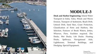
1. MODULE-3
Dock and Harbor Engineering: Inland Water
Transport in India, Tides, Winds and Waves
Erosion, Transport of Sediments, Beach Drift,
Littoral Drift, Sand Bars, Coast Protection,
Classification of Ports and Harbors, Site
Selection, Features of Break Waters, Jetties,
Wharves, Piers, Facilities required, Dry
Docks, Wet Docks, Lift Docks. Floating
Docks, Spillways, Navigational Aids,
Lighthouses, Terminal Buildings, and
Dredging- Special Equipment.
Prepared by-
Prof. Basweshwar S. J.
2. 6.1 Dock and Harbor Engineering:
• The definition of a dock is a place where a ship enters, a gate is closed behind it, and water is
pumped out.
• A vessel is “docked” when high and dry in the chamber.
• A floating dry DOCK is a vessel which can flood down to allow another vessel to enter between
its walls before the floating dry dock pumps the water out of is numerous flooded chambers to
raise itself back up until the vessel it contains is clear of the water.
Prepared by-
Prof. Basweshwar S. J.
3. 6.1.1 Inland Water Transport in India-
• India has an extensive network of inland waterways in the form of rivers, canals, backwaters and creeks.
• The total navigable length is 14,500 km (9,000 mi), out of which about 5,200 km (3,200 mi) of river and 4,000
km (2,500 mi) of canal can be used by mechanized crafts.
• About 44 million tonnes (49,000,000 short tons) of cargo are moved annually through these waterways using
mechanized vessels and country boats.
• Cargo transported in an organized manner is confined to a few waterways in Goa, West Bengal, Assam and
Kerala.
• Inland waterways consist of the Ganges-Bhagirathi-Hooghly rivers, the Brahmaputra, the Barak river, the
rivers in Goa, the backwaters in Kerala, inland waters in Mumbai and the deltaic regions of the Godavari-
Krishna rivers.
Prepared by-
Prof. Basweshwar S. J.
4. 6.1.2.1 Tides-
• Tides are one of the most reliable phenomena in the world.
• As the sun rises in the east and the stars come out at night, we are
confident that the ocean waters will regularly rise and fall along
our shores.
• Tides are very long-period waves that move through the oceans
in response to the forces exerted by the moon and sun. Tides
originate in the oceans and progress toward the coastlines where
they appear as the regular rise and fall of the sea surface.
• When the highest part, or crest, of the wave reaches a particular
location, high tide occurs; low tide corresponds to the lowest
part of the wave, or its trough. The difference in height between
the high tide and the low tide is called the tidal range.
Prepared by-
Prof. Basweshwar S. J.
5. 6.1.2.2 Winds and Waves Erosion
• Waves shape the coast through erosion by breaking
down rock and transporting sand and other sediment.
• Impact is when waves pound the shore and break
apart the rocks, and softer rock breaks apart first.
• Abrasion is when waves grind rocks together like
sandpaper. A headland is a harder part of the shore
that sticks out into the sea. Waves erode softer rock
and create landforms such as sea stacks, sea caves,
sea arches, and wave-cut cliffs.
• Wind is the weakest agent of erosion. Sand dunes are
large deposits of sand that have been deposited by
wind.
https://www.windy.com/?21.040,74.815,9
Prepared by-
Prof. Basweshwar S. J.
6. 6.1.3 Transport of Sediments-
• Sediment transport is the movement of solid particles
(sediment), typically due to a combination of gravity
acting on the sediment, and/or the movement of the fluid
in which the sediment is entrained.
• Sediment transport occurs in natural systems where the
particles are clastic rocks (sand, gravel, boulders, etc.),
mud, or clay; the fluid is air, water, or ice; and the force of
gravity acts to move the particles along the sloping surface
on which they are resting.
• Sediment transport due to fluid motion occurs in rivers,
oceans, lakes, seas, and other bodies of water due to
currents and tides.
Prepared by-
Prof. Basweshwar S. J.
7. 6.1.4.1 Beach Drift, Littoral Drift,
• Beach drift is defined as the progressive
movement of sand and sediment along the beach.
• The transport of sand and pebbles along the coast
is called long shore drift.
• The prevailing wind (the direction the wind
usually blows from) causes waves to approach the
coast at an angle.
• The swash carries the sand and pebbles up the
beach at the same angle (usually 45º).
• Littoral drift refers to the movement of
entrained sand grains in the direction of the
longshore current.
• Littoral drift can be thought of as a river of sand
moving parallel to the shore, moving sand from
one coastal location to the next and so on until
the sand is eventually lost to the littoral system
Prepared by-
Prof. Basweshwar S. J.
8. 6.1.4.2 Sand Bars-
• A sandbar is an area of sand, gravel or fine sediment that sits above the water.
• It may be connected to the shoreline, or it may be offshore.
• It is generally narrow and straight.
• A sandbar is also known as a shoal or sandbank.
• A large sandbar is called a barrier island.
Prepared by-
Prof. Basweshwar S. J.
9. 6.1.5 Coast Protection-
• Coast protection, methods used to protect coastal lands
from erosion.
• Beaches can exist only where a delicate dynamic
equilibrium exists between the amount of sand supplied
to the beach and the inevitable losses caused by wave
erosion.
• Various activities of man have upset this equilibrium,
decidedly increasing the rate of erosion of the
shorelines.
• Measures aimed at protecting the coast against coastline
retreat, thus protecting housing, infrastructure, the coast
and the hinterland from erosion often at the expense of
losing the beach and the dynamic coastal landscape.
Prepared by-
Prof. Basweshwar S. J.
10. 6.1.6 Classification of Ports and Harbors-
• A port is a location on a coast or shore containing one or more harbors where ships can dock and transfer
people or cargo to or from land.
• A port is a place on the coast that facilitates loading and unloading cargo.
• A port is usually located inside a harbor.
• A sheltered area of the sea in which vessels could be launched, built or taken for repair; or could seek
refuge in time of storm; or provide for loading and unloading of cargo and passengers.
• A harbour is a place that is situated on the coast where ships, boats, barges, etc. can be moored safely.
• The word harbour is derived from the Old English word “herebeorg” meaning shelter or refuge.
• In American English, this is spelt as ‘harbor.’
Prepared by-
Prof. Basweshwar S. J.
12. 6.1.7 Site Selection-
The guiding factors which play a great role in choice of site for a harbour are as follows
• Availability of cheap land and construction materials
• Transport and communication facilities
• Natural protection from winds and waves
• Industrial development of the locality
• Sea-bed subsoil and foundation conditions
• Traffic potentiality of harbour
• Availability of electrical energy and fresh water
• Favorable marine conditions
• Defence and strategic aspects
Prepared by-
Prof. Basweshwar S. J.
13. 6.1.8 Features of Break Waters-
Breakwaters are structures constructed near the coasts as
part of coastal management or to protect an anchorage from
the effects of both weather and longshore drift.
• Breakwaters reduce the intensity of wave action in
inshore waters and thereby provide safe harbourage.
• Breakwaters may also be small structures designed to
protect a gently sloping beach to reduce coastal erosion;
they are placed 100–300 feet (30–90 m) offshore in
relatively shallow water.
• An anchorage is only safe if ships anchored there are
protected from the force of powerful waves by some
large structure which they can shelter behind.
Prepared by-
Prof. Basweshwar S. J.
14. 6.1.9.1 Jetties-
• These are the structures in the form of piled projections
and they are built out from the shore to deep water and
they may be constructed either for a navigable river or
in the sea.
• In rivers, the jetties divert the current away from the
river bank and thus, the scouring action is prevented.
• As the current is diverted to deep waters, the navigation
is also controlled.
• In the sea, the jetties are at places where harbour
entrance is affected by littoral drift or the sea is shallow
for a long distance.
• Thus, they extend from the shore to the deep sea to
receive the ships.
Prepared by-
Prof. Basweshwar S. J.
15. 6.1.9.2 Wharves-
• Platforms or landing places are necessary for ships to
come, close enough to the shore, for purposes of
embarkation, disembarkation, etc. at the same time.
• These platform locations should give sufficient depth of
water for the ship to float such platforms are, called
wharves.
• They are built out into or on to the water.
• Thus, a wharf affords a working platform alongside the
ship in continuity of the shore.
• A wharf is quay but the term wharf is generally used for an
open structure of piles or posts with bracings, jutting
from the shore towards the sea.
Prepared by-
Prof. Basweshwar S. J.
16. 6.1.9.3 Piers
• The structure which are built perpendicular to the shore of a sea are known as piers.
• In the sea, the piers are constructed where the sea is not deep and the natural harbour is not
convenient for allowing the ships to berth adjacent to the shore.
Prepared by-
Prof. Basweshwar S. J.
17. 6.1.9.4 Facilities required-
• Ports are strategic geographical locations which are situated at the edge of ocean, seas, rivers, or lakes.
• These locations are then developed to inculcate facilities for loading and unloading of cargo ships.
• The facilities provided for a port depends on the purpose for which the port is being used.
• Whereas a terminal is referred to as the set of facilities at a port where loading and unloading of
cargo/container take place.
• Terminals are named on the basis of the type of cargo that can be handled by them.
• Some of the most common types of terminals are container terminal, bulk cargo terminal, LNG terminal etc.
Prepared by-
Prof. Basweshwar S. J.
18. 6.1.9.4 Facilities required-
a) Special Warehouse: This is available on all the ports, for storing the shipment and for maintaining regular stock.
b) Port Reception: Reception has details of all the shipment scheduled and moreover it is a guide for the port facilities.
c) Other facilities: Some other essential facilities are also available at seaports namely hotels, restaurants, restrooms and
eateries for the port visitors. Some of the ports are provided with medical facilities to the people present there, if there is no
hospital in the vicinity it becomes obligatory for the port to provide with primary medical services.
d) Fishing facilities: Fishing ports allow its customer with fishing aids and amenities at the port.
e) Warm water facility: A greater revenue-generating warm water port provides warm water even in frosting winters.
f) Loading and Unloading Facility: It is the mandatory part of every port to allow loading and unloading of freight as well as
people in a ship.
g) Infrastructure and Equipment’s: A port has piers, basins, stacking or storage areas, warehouses to store various ferry
equipment. Each port is equipped with essential equipment for e.g. hauling equipment’s, draggers, cranes, trucks, loaders, etc.
h) Workshop: All the bigger and significant ports provide the facility of vessel workshop. It is the place where one can get spare
parts and accessories of a vessel. Also, the vessels which have gone out of order are repaired and catered in the workshop.
Prepared by-
Prof. Basweshwar S. J.
19. 6.1.10 Dry Docks, Wet Docks, Lift Docks-
• A dry dock (sometimes dry-dock or
dry-dock) is a narrow basin or
vessel that can be flooded to allow
a load to be floated in, then
drained to allow that load to come
to rest on a dry platform.
• Dry docks are used for the
construction, maintenance, and
repair of ships, boats, and other
watercraft.
• A wet dock or
impounded dock is a variant in
which the water is impounded
either by dock gates or by a
lock, thus allowing ships to
remain afloat at low tide in
places with high tidal ranges.
• The level of water in the dock is
maintained despite the rising
and falling of the tide.
• Lift up docks provide one of
the easiest ways to remove
your dock for winter storage.
• The aluminum truss design
allows the dock's entire frame
to lift up.
Prepared by-
Prof. Basweshwar S. J.
20. 6.1.11 Floating Docks, Spillways-
• Floating dock (impounded), a development of the half tide
dock, where pumps or river flow are used to maintain the
dock at around the high tide level of a nearby tidal waterway.
• Floating dock (jetty), a lightweight quay or jetty, floating on
pontoons, that rises and falls with the tide and shipping.
• Floating dry dock, a portable dry dock that may be towed into
place.
• A spillway is a structure used to provide the controlled
release of flows from a port or levee into a downstream area,
typically the riverbed of the dammed river itself.
• Spillways ensure that the water does not overflow and
damage or destroy the port.
Prepared by-
Prof. Basweshwar S. J.
21. 6.1.12 Navigational Aids-
A navigational aid (navaid), also known
as aid to navigation (ATON), is any sort
of marker which aids the traveler in
navigation, usually nautical or aviation
travel.
Common types of such aids include
lighthouses, buoys, fog signals, and day
beacons.
Prepared by-
Prof. Basweshwar S. J.
22. 6.1.13 Lighthouses-
• A lighthouse is a tower, building, or another type of
structure designed to emit light from a system of lamps
and lenses and to serve as a navigational aid for maritime
pilots at sea or on inland waterways.
• Lighthouses mark dangerous coastlines, hazardous shoals,
reefs, rocks, and safe entries to harbors; they also assist in
aerial navigation.
• Once widely used, the number of operational lighthouses
has declined due to the expense of maintenance and has
become uneconomical since the advent of cheaper and
often much more effective electronic navigational
systems.
Prepared by-
Prof. Basweshwar S. J.
23. 6.1.14 Terminal Buildings-
• Ports are gateways for cargo and people and are made of up terminals that specialize in one or the other.
• A container terminal is a part of a port where containerized cargo is transported from land to sea and
from sea to land.
Prepared by-
Prof. Basweshwar S. J.
24. 6.1.15 Dredging- Special Equipment
Dredging is the form of excavation carried out underwater or partially underwater, in shallow waters or
ocean waters. It keeps waterways and ports navigable, and assists coastal protection, land reclamation and
coastal redevelopment, by gathering up bottom sediments and transporting it elsewhere.
Prepared by-
Prof. Basweshwar S. J.
25. Currently there are 13 "major ports" in India,
and all except Ennore Port are administered by
a Port Trust Board.
Ennore Port is a public company limited by
guarantee, and fully owned by the national
government. The ports with a Port Trust Board
are:
Mumbai
Kolkata
Chennai
Kandla
Jawaharlal Nehru Port (near Mumbai)
Mormugao
New Mangalore
Cochin
V.O. Chidambaranar Port
Port Blair (Andaman and Nicobar islands)
Visakhapatnam
Paradip
Prepared by-
Prof. Basweshwar S. J.