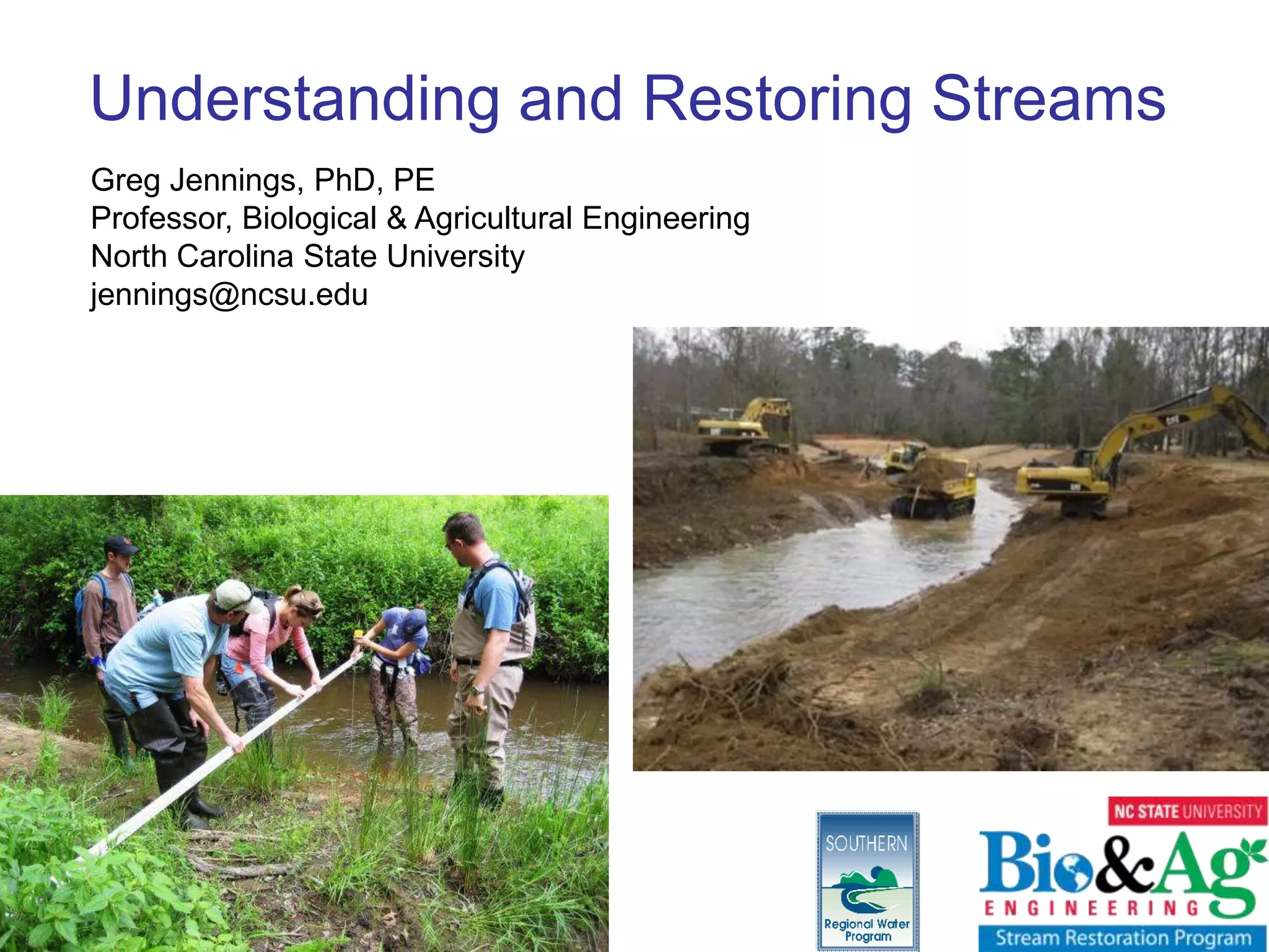
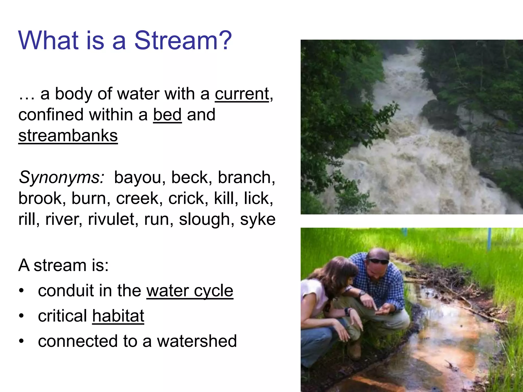
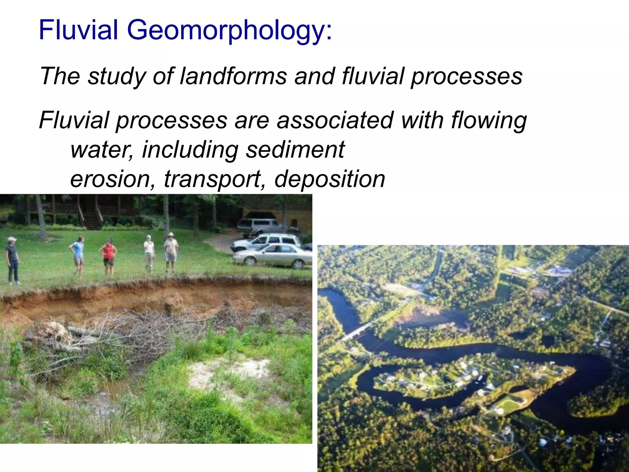
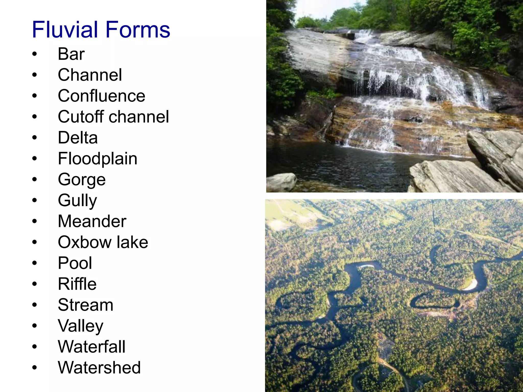
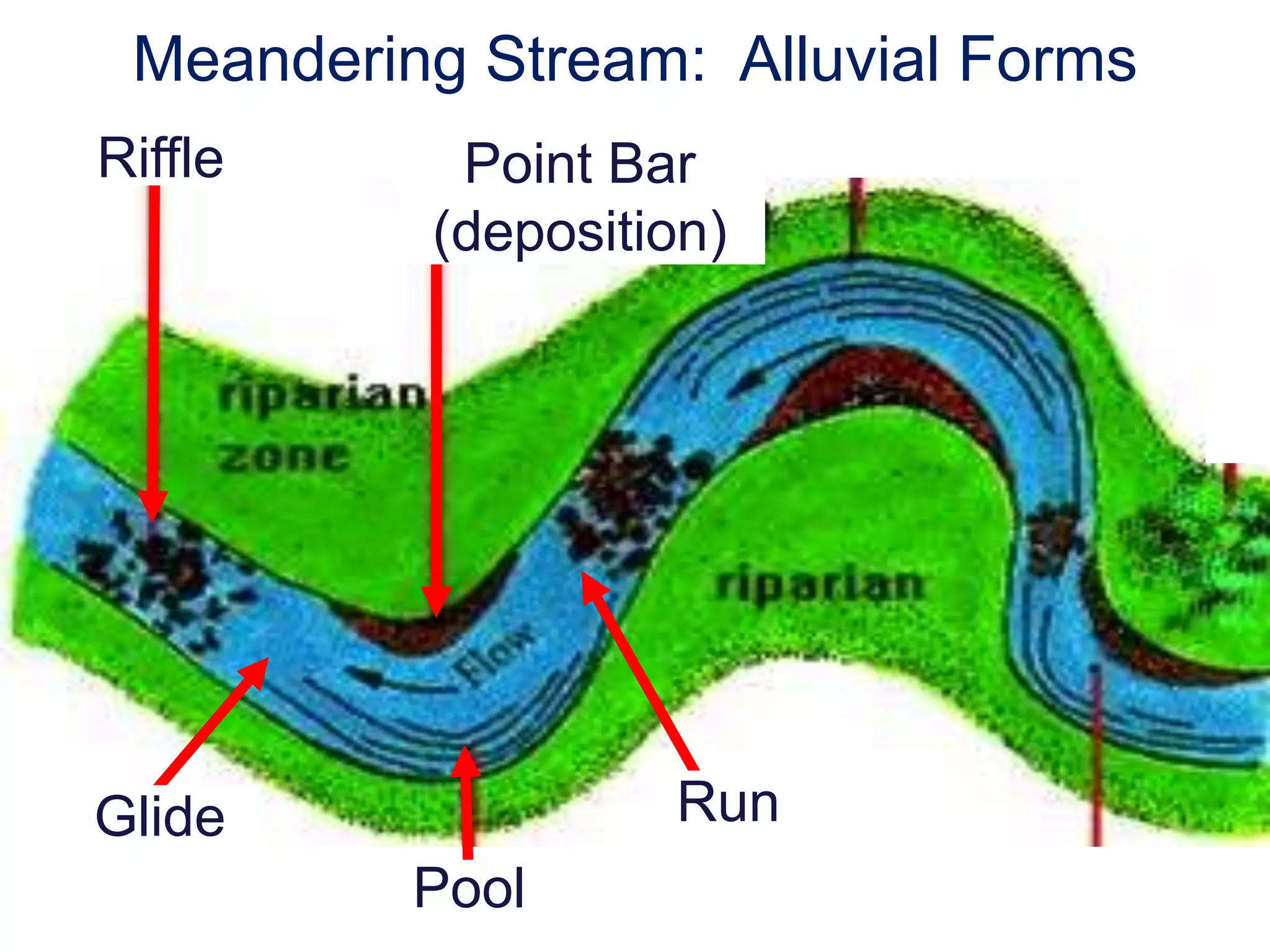
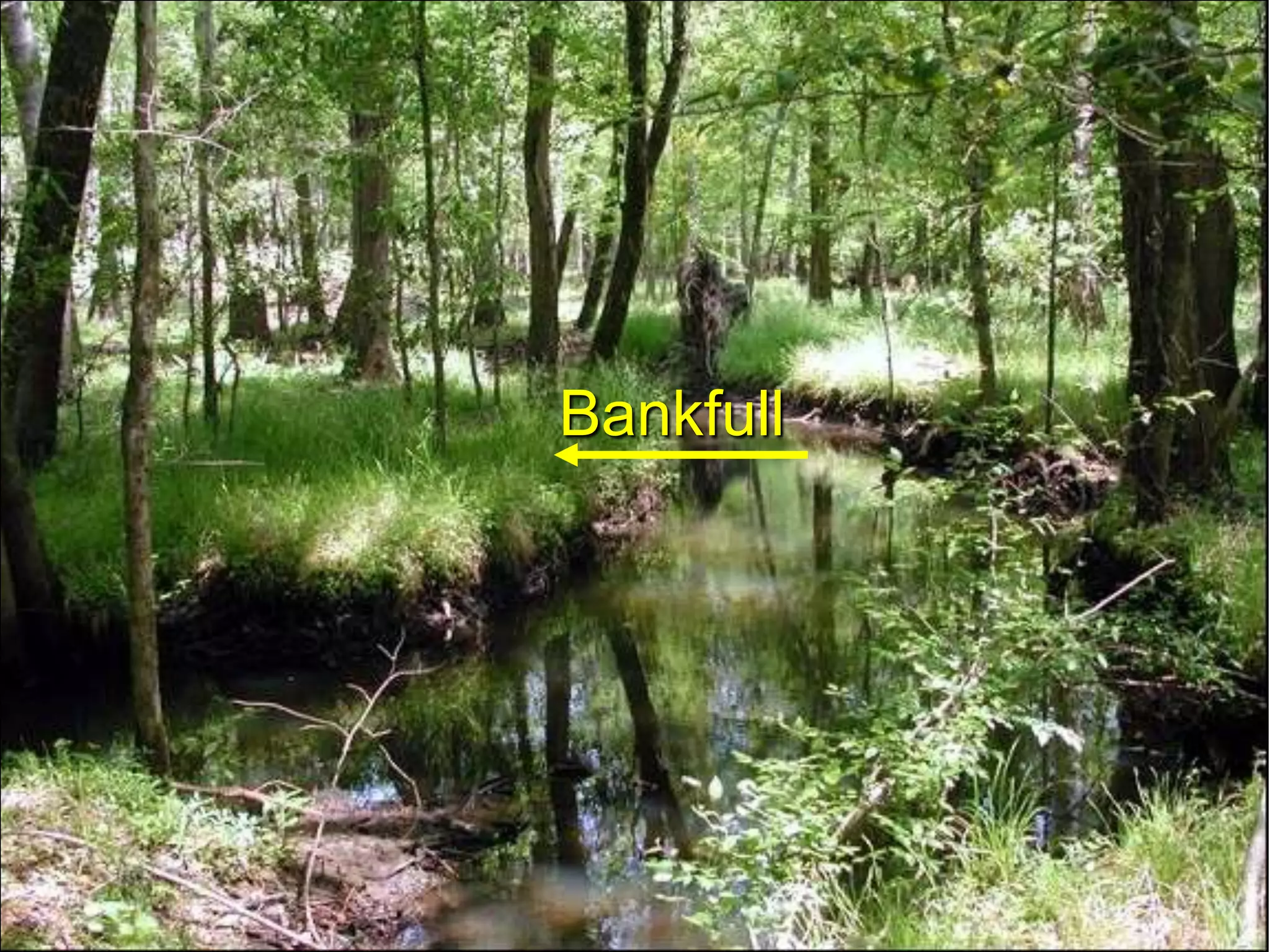
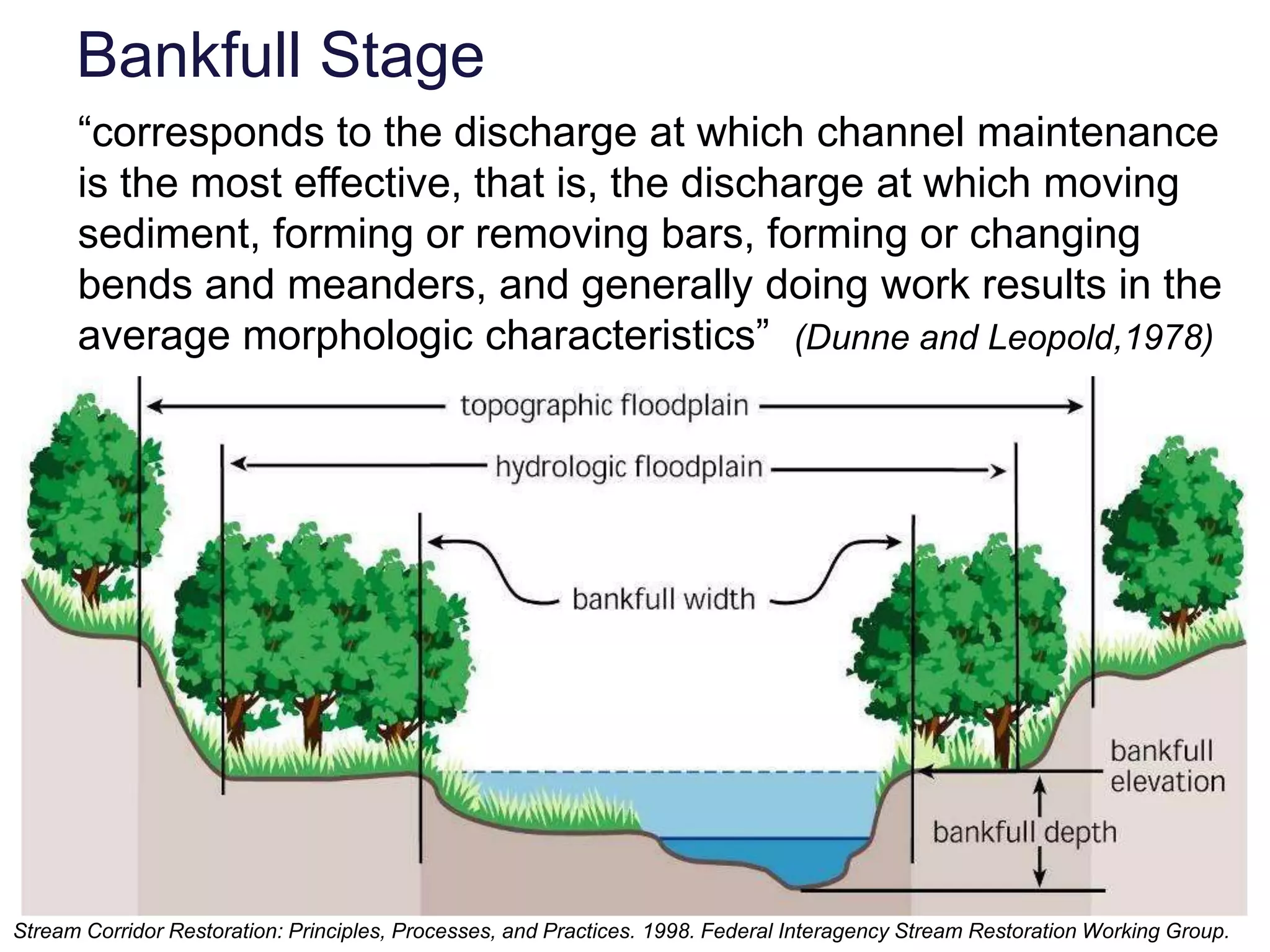
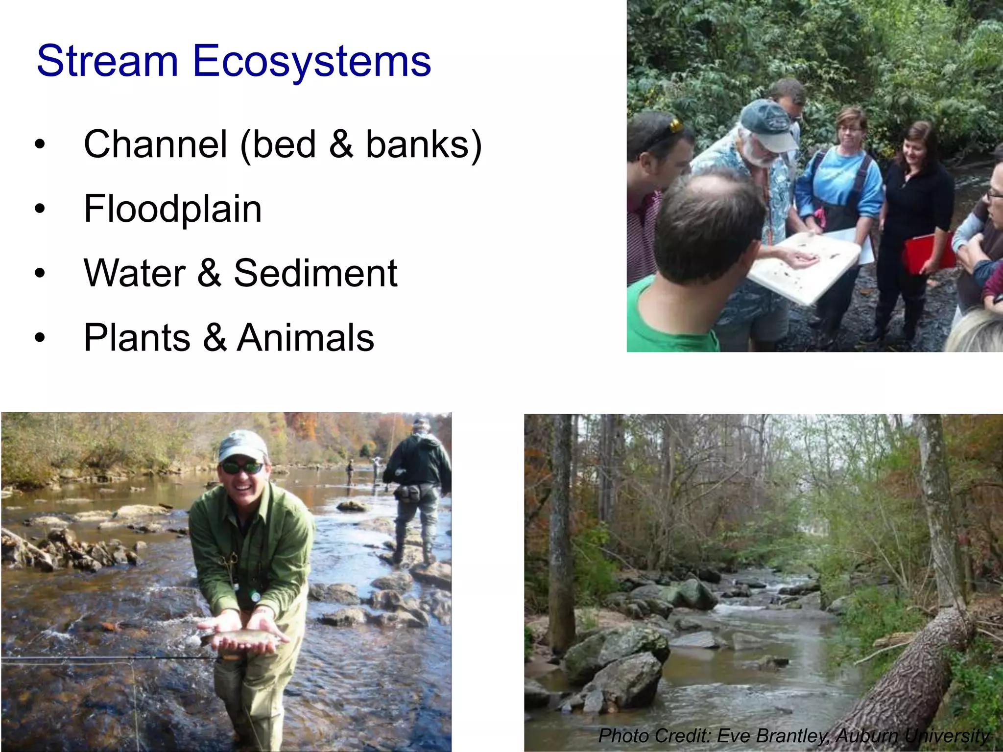
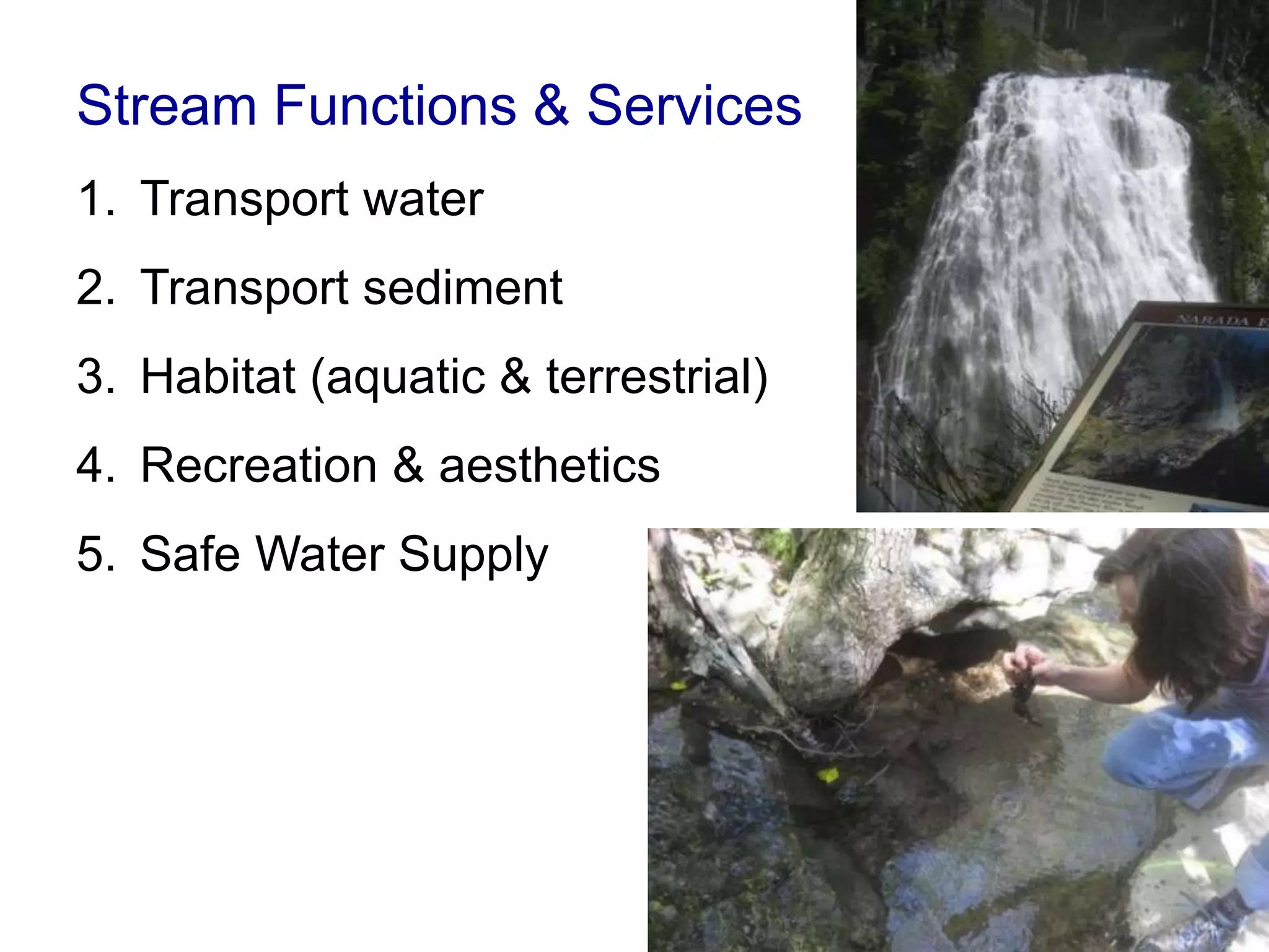
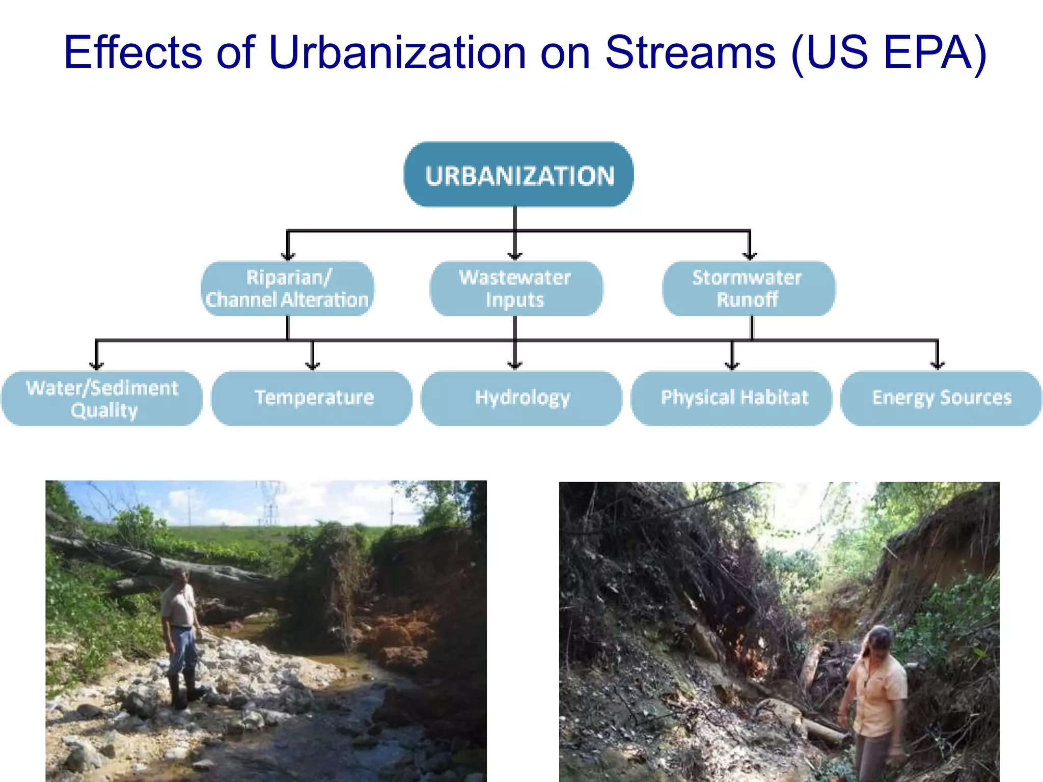
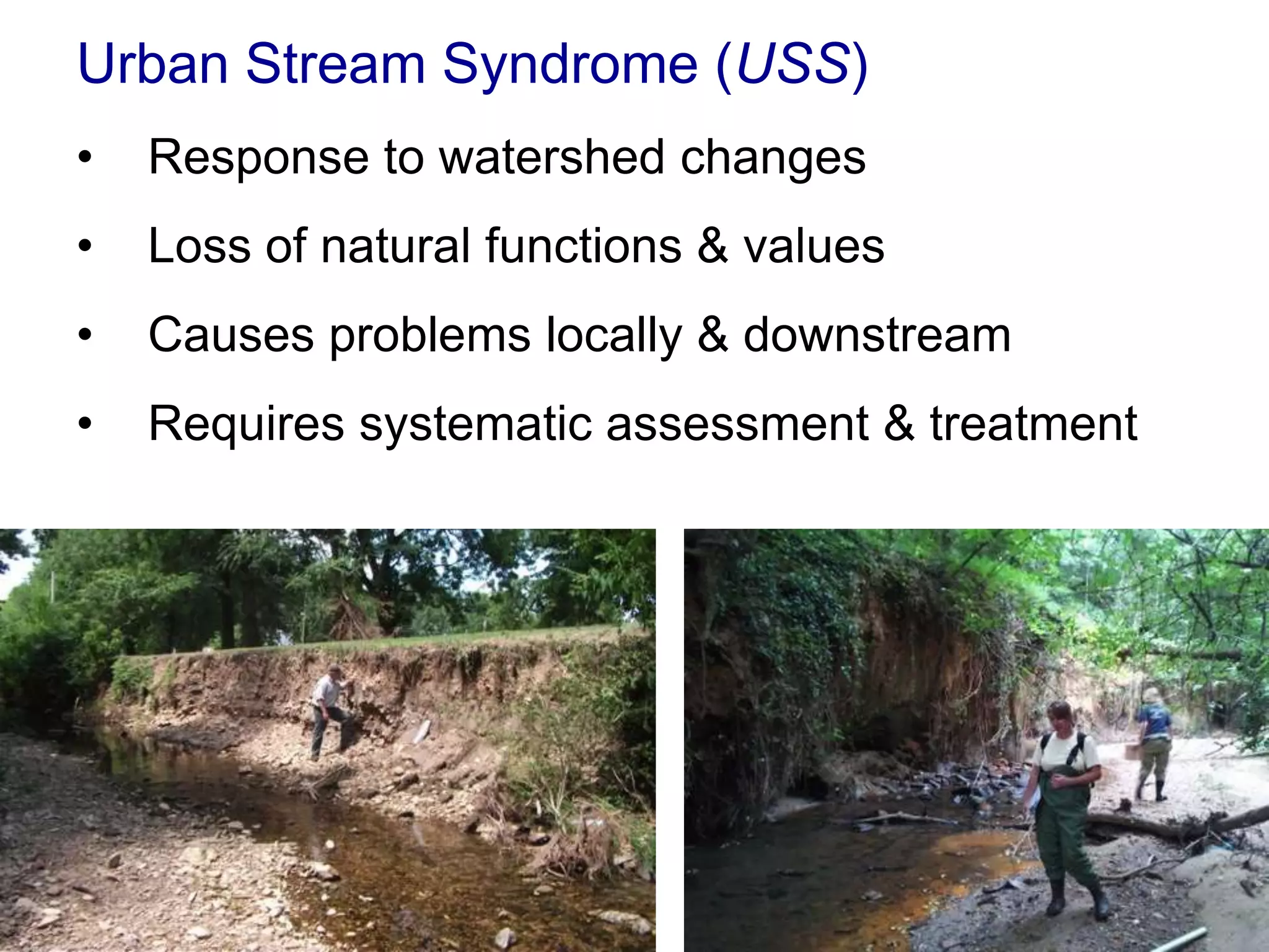
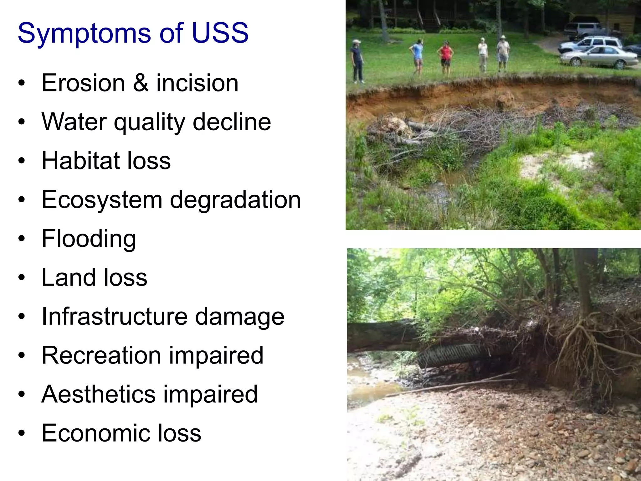
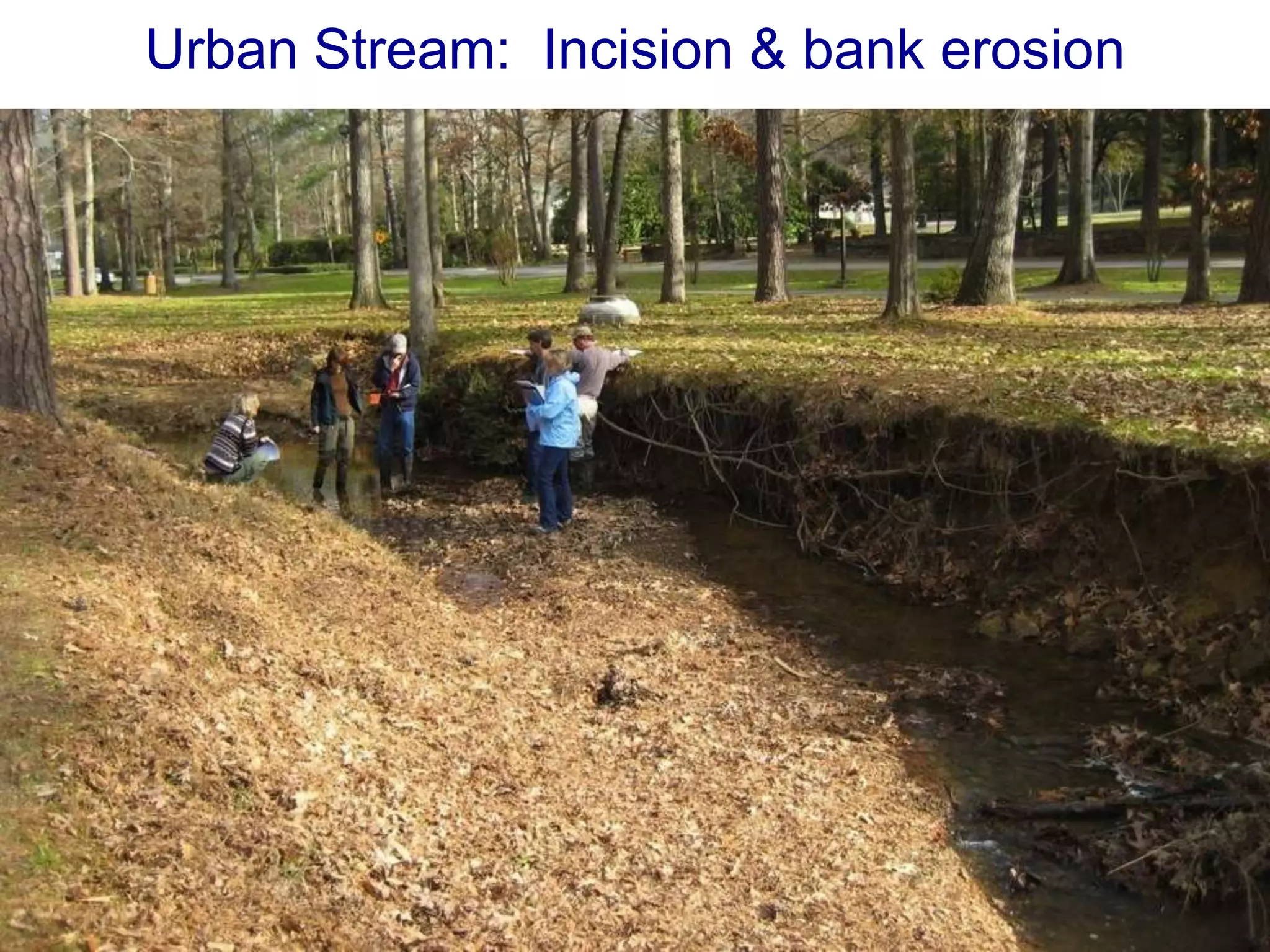
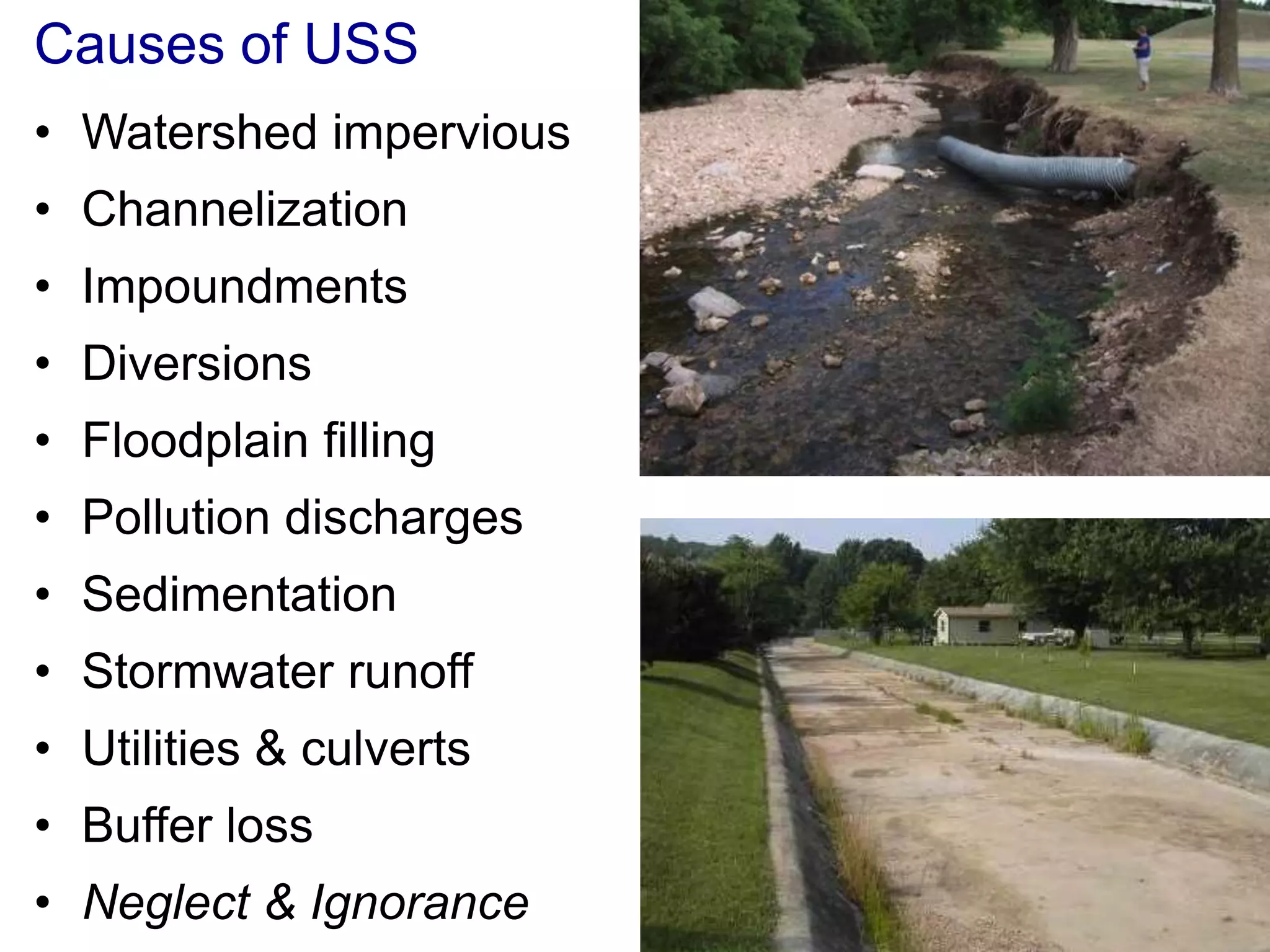
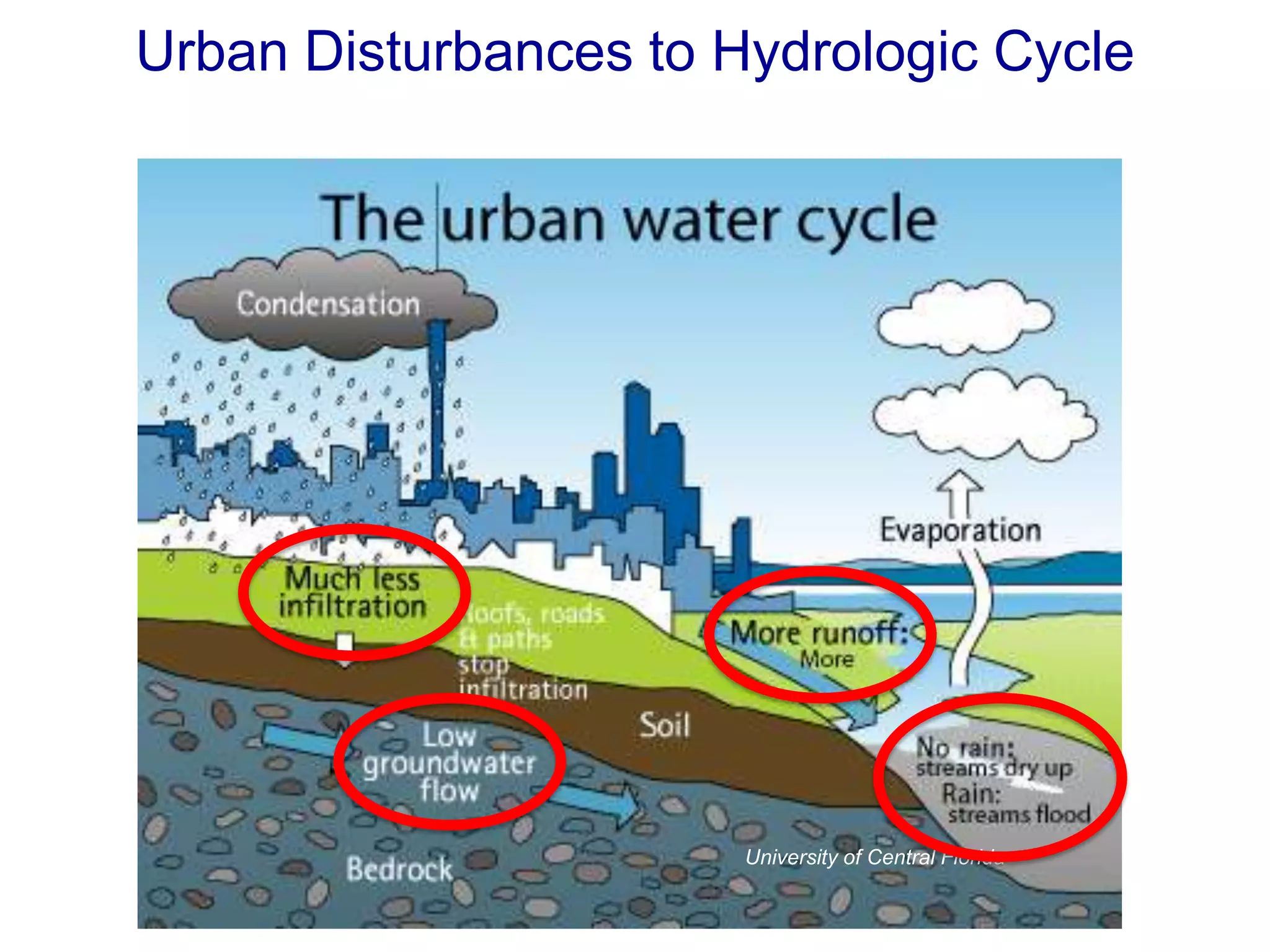
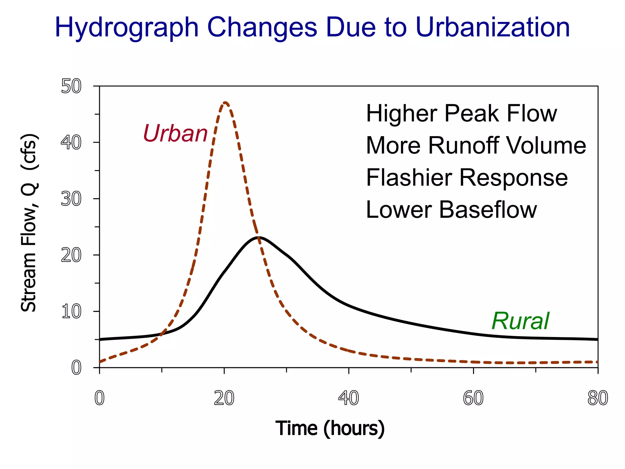
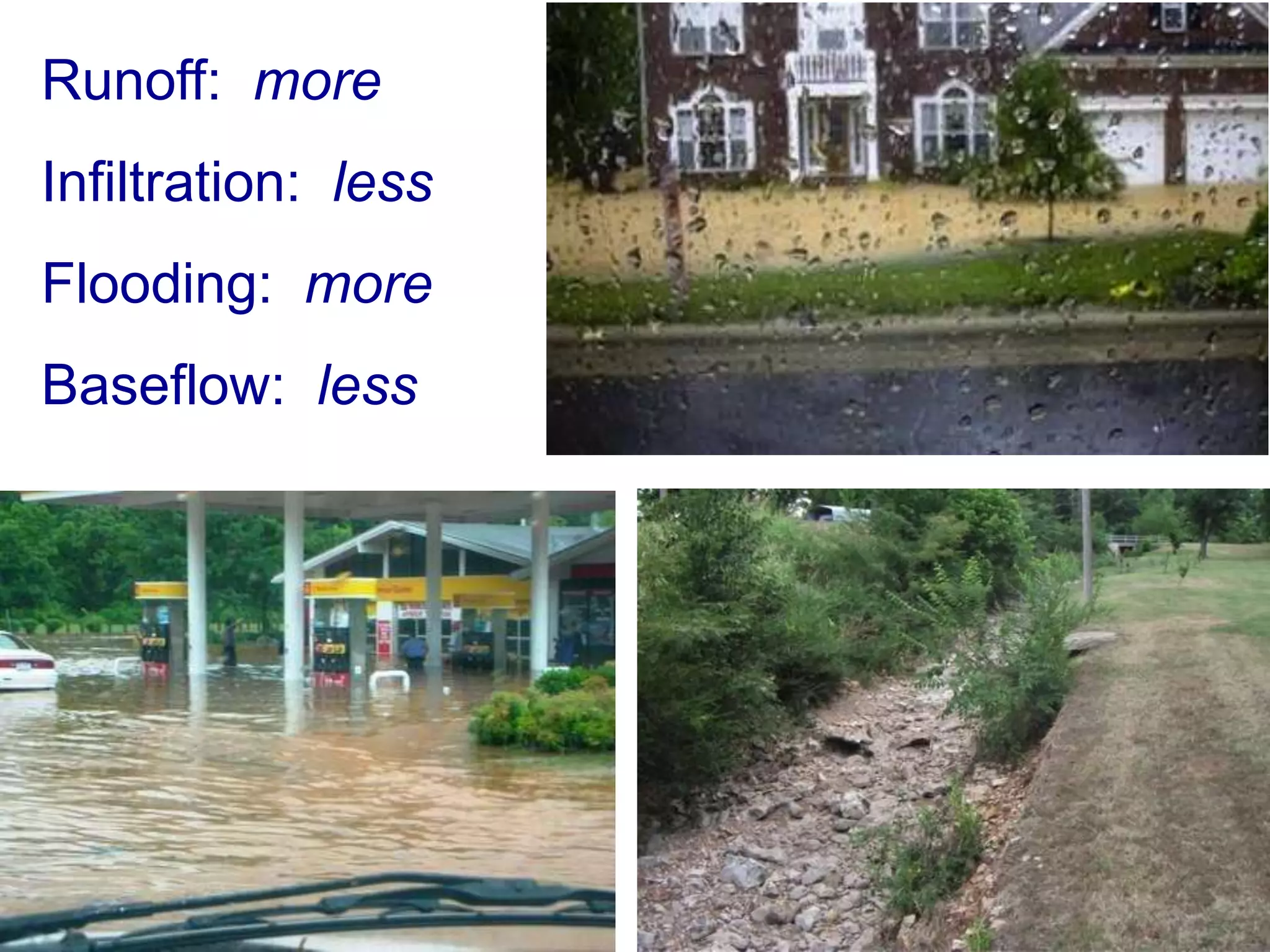
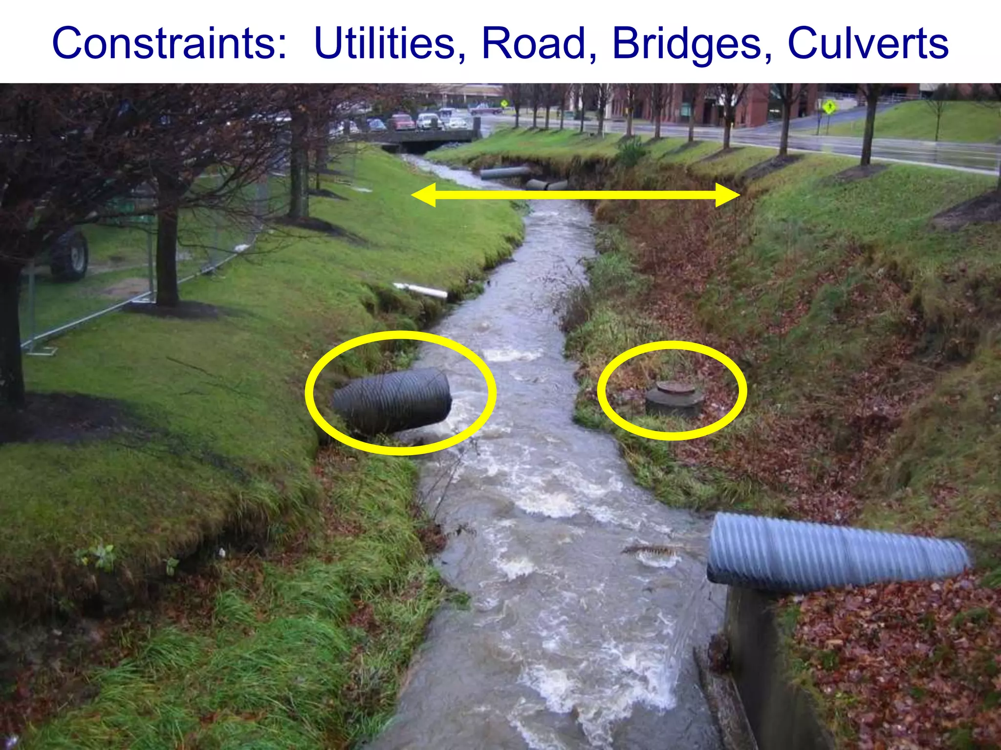
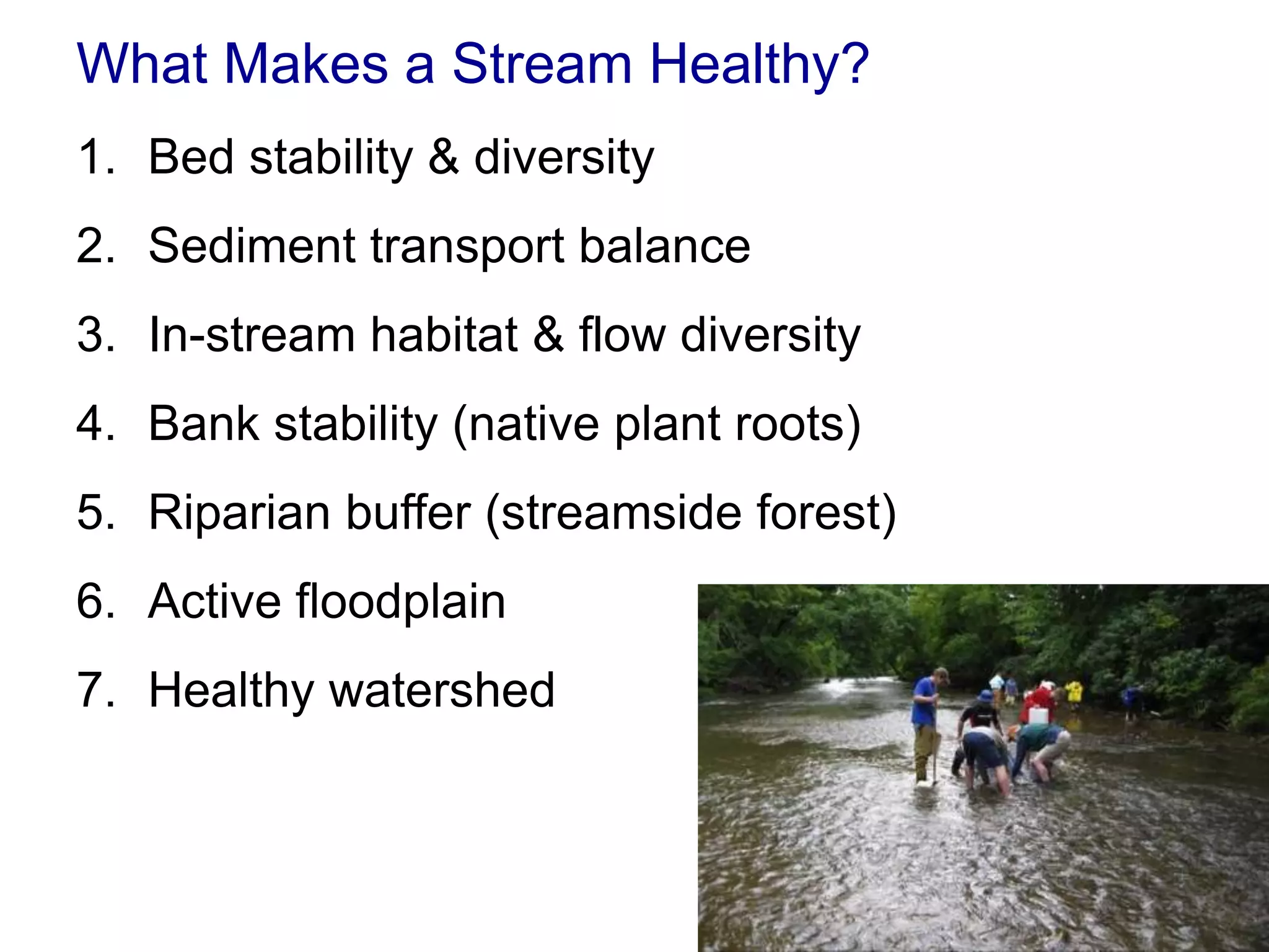
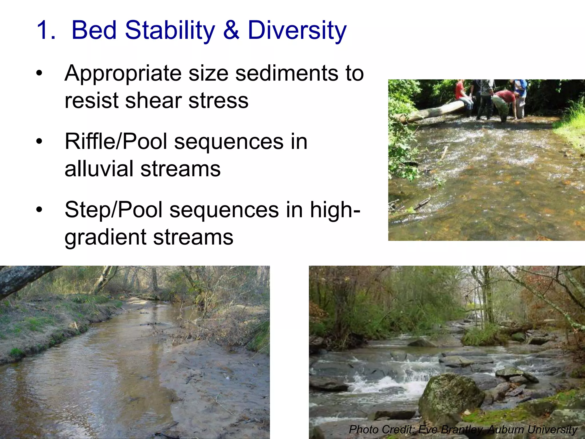
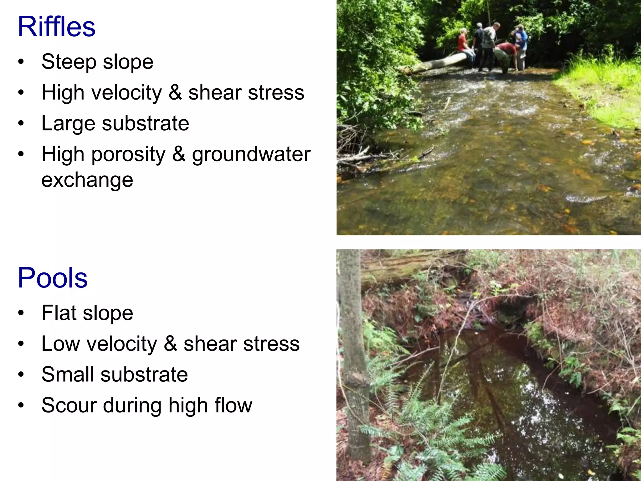
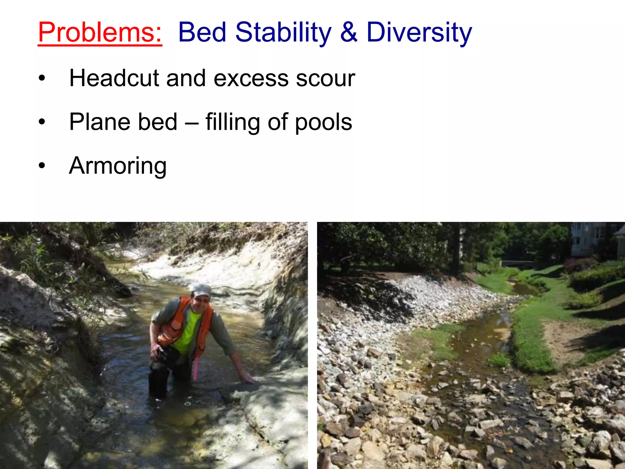
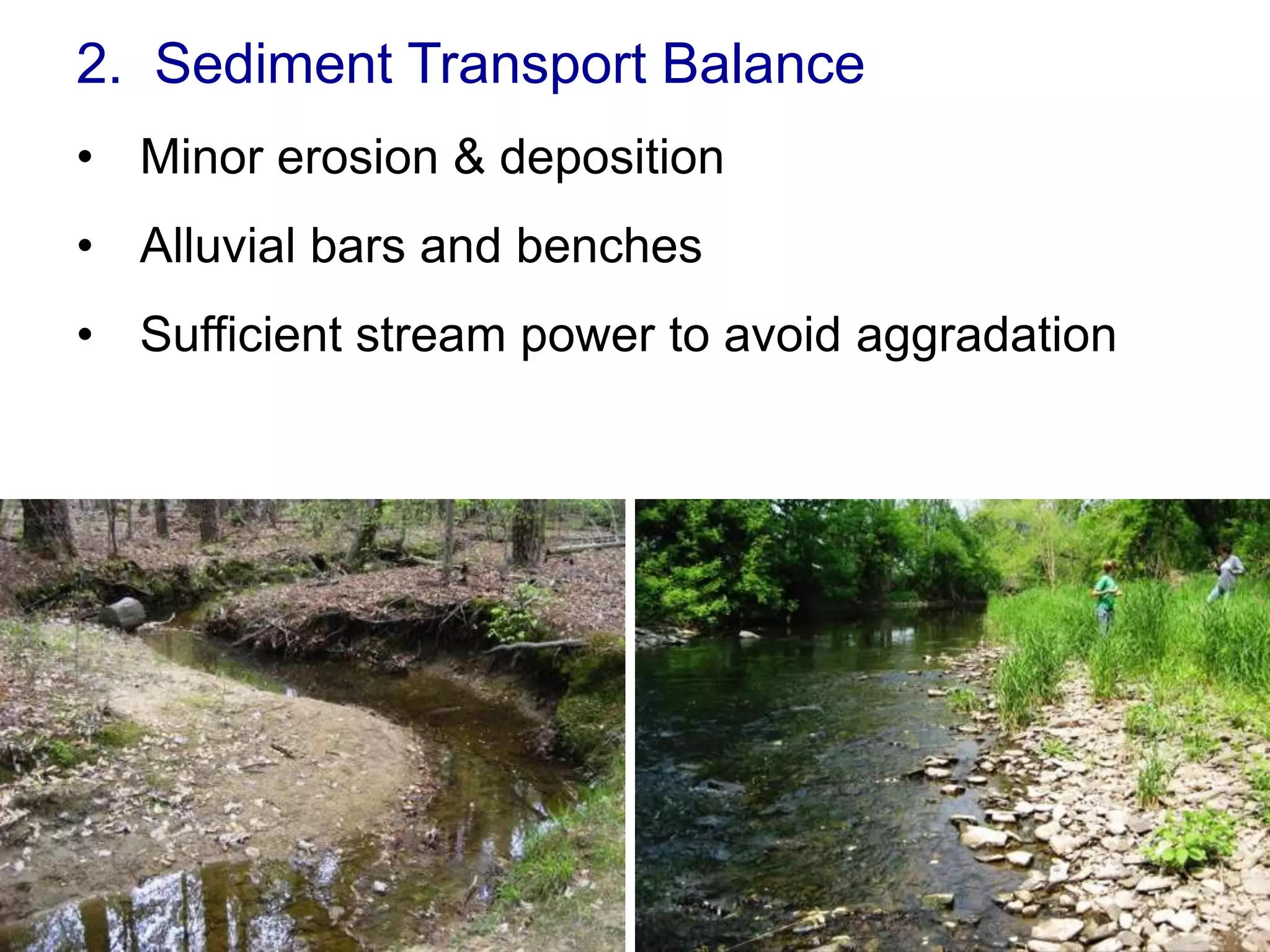
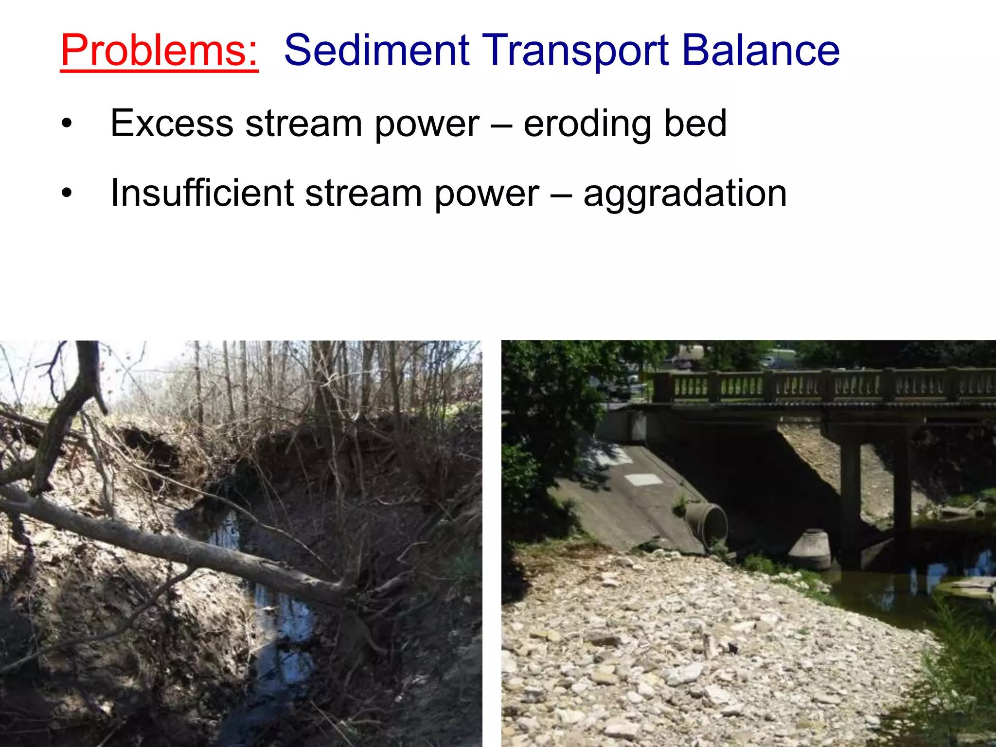
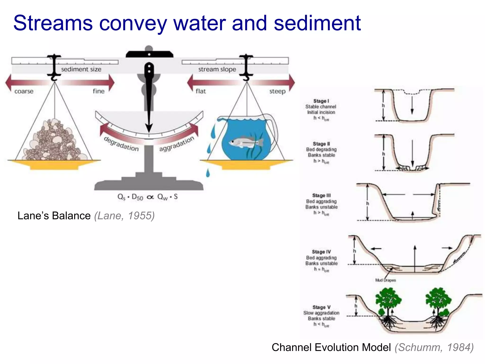
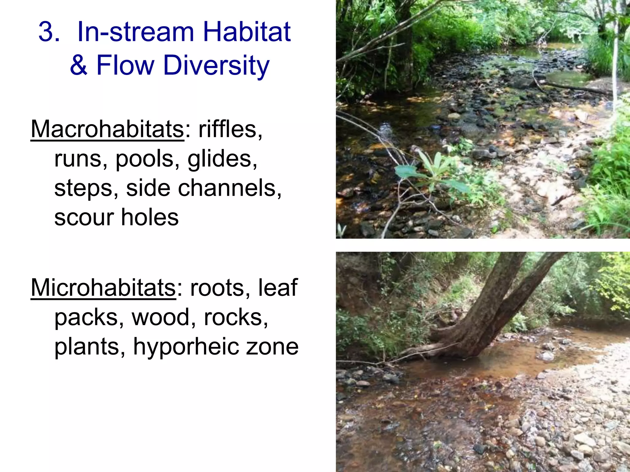
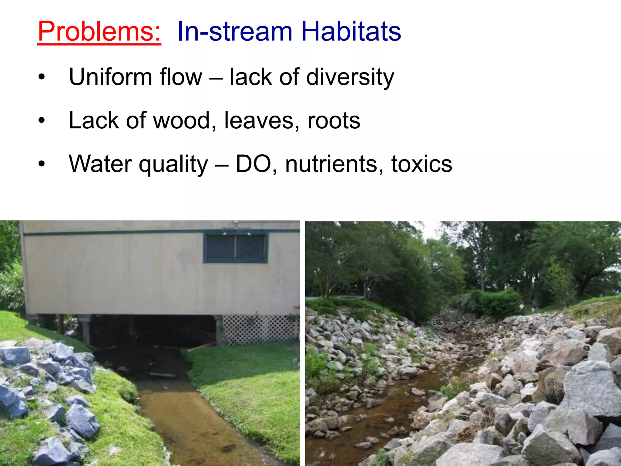
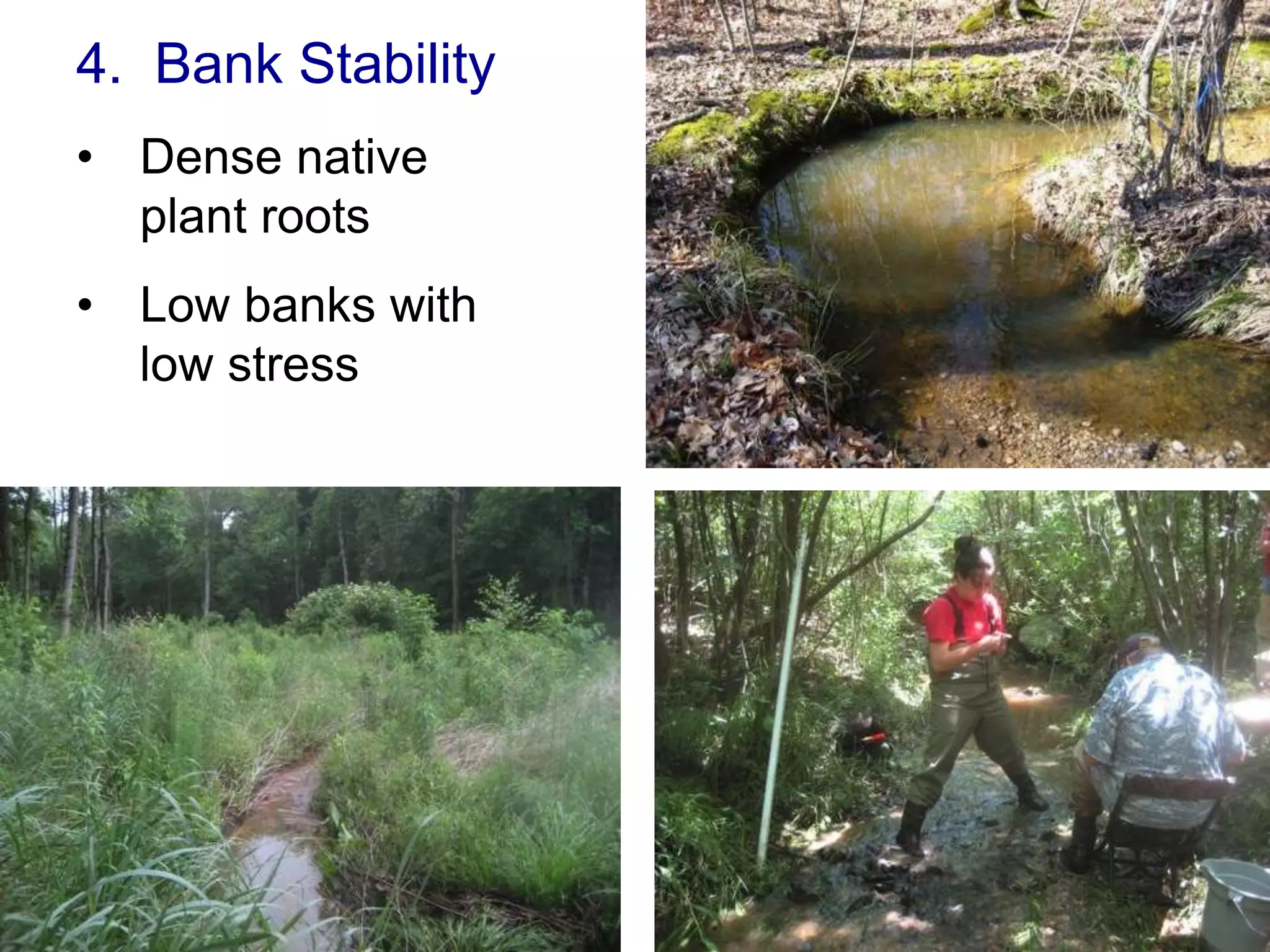
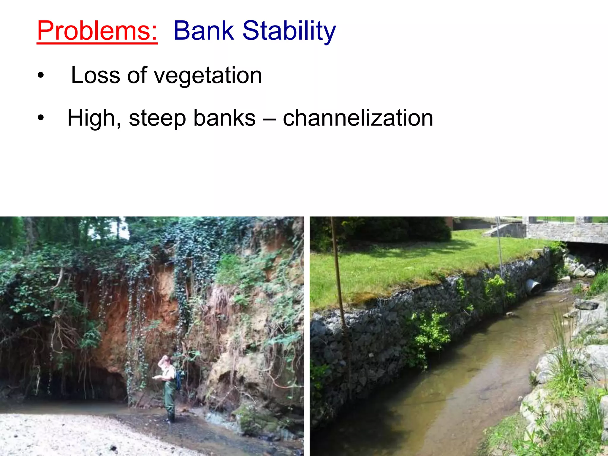
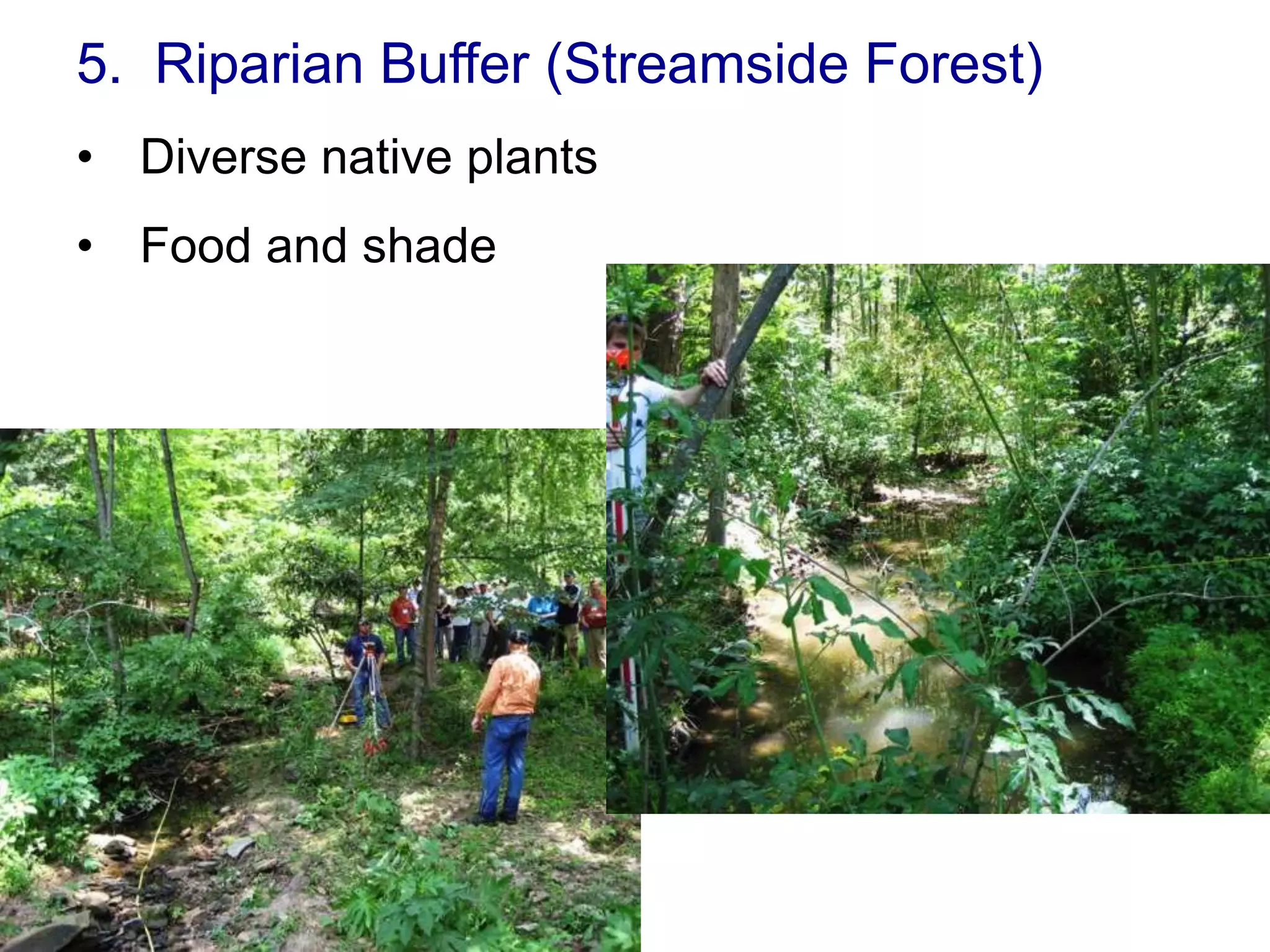
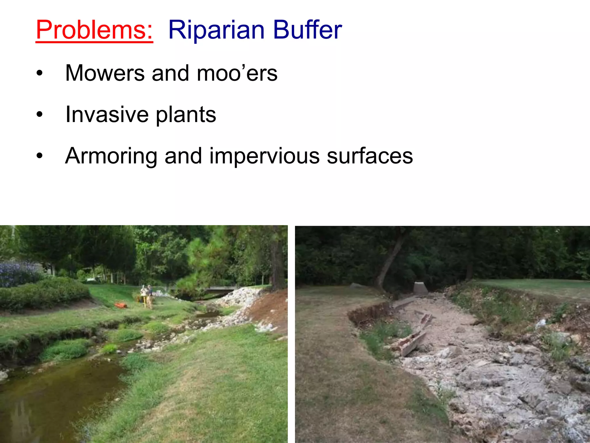
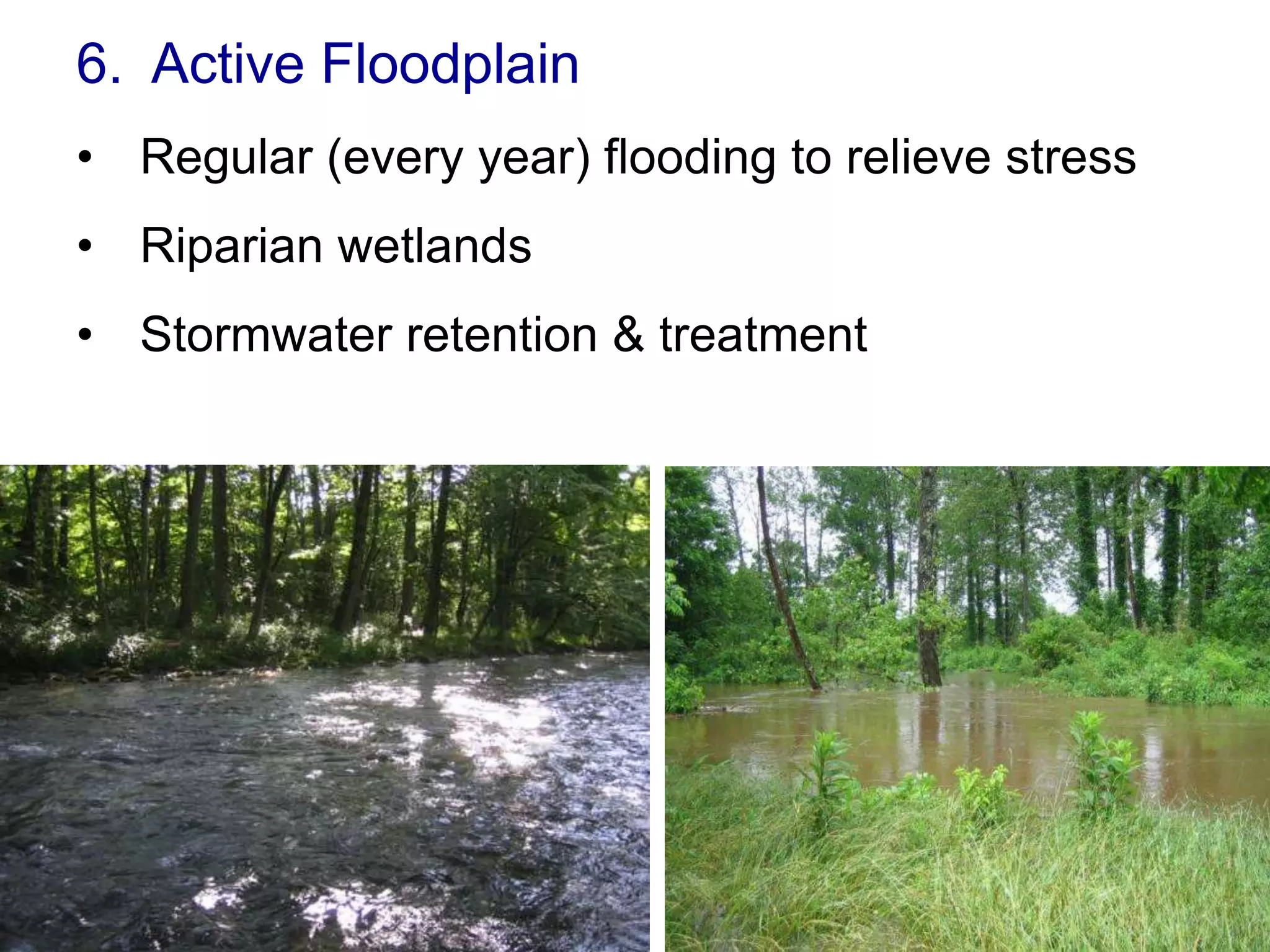
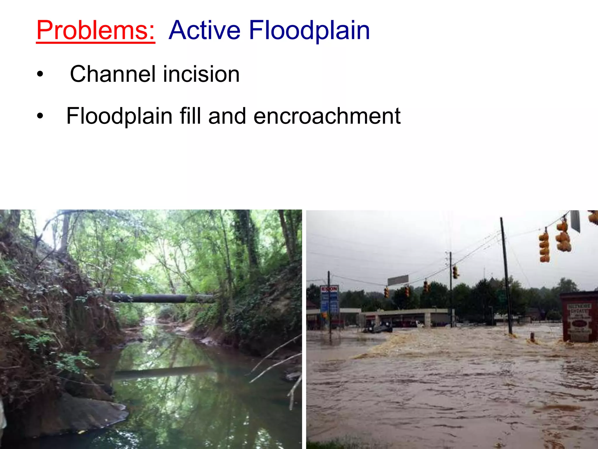
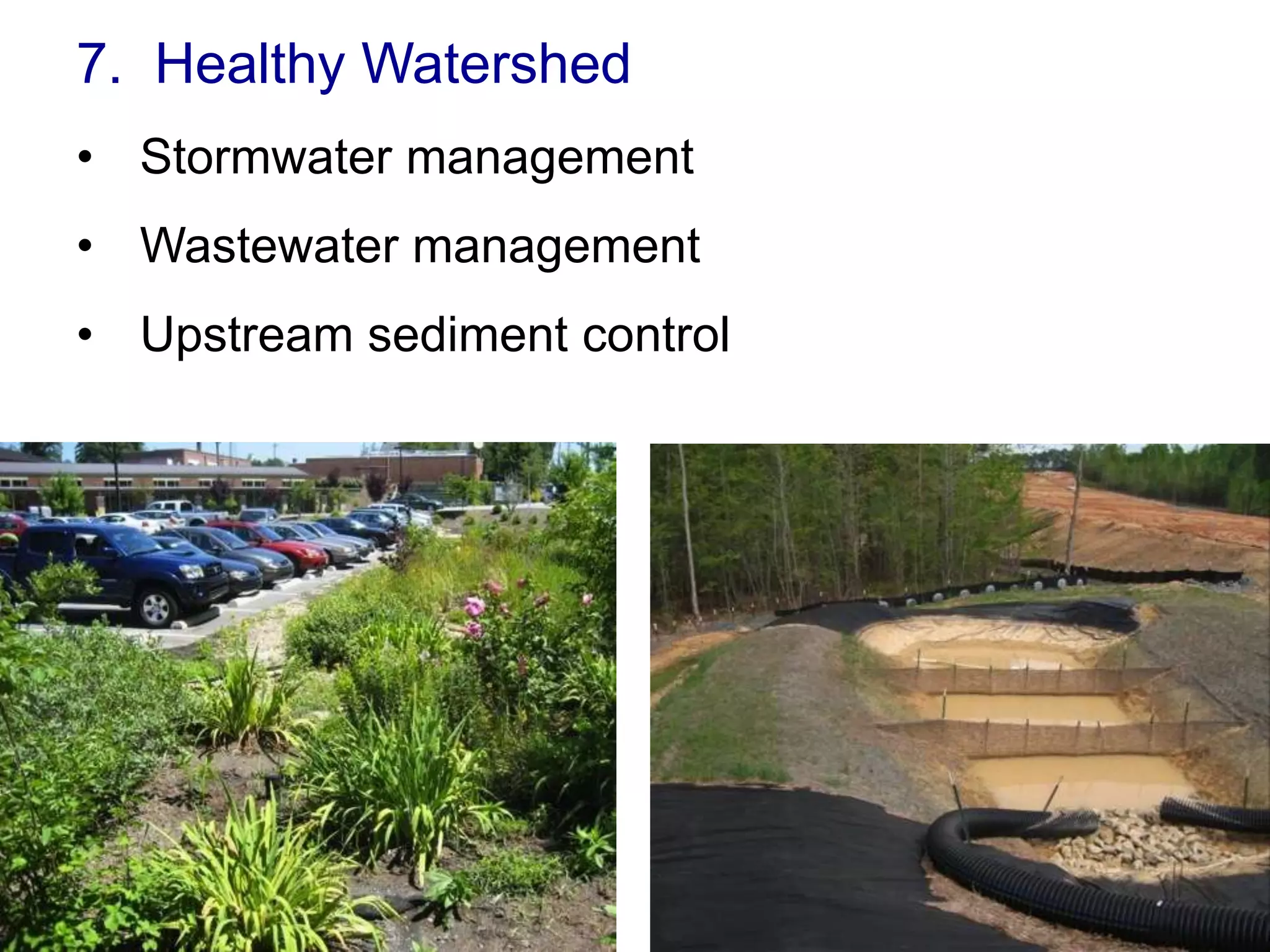
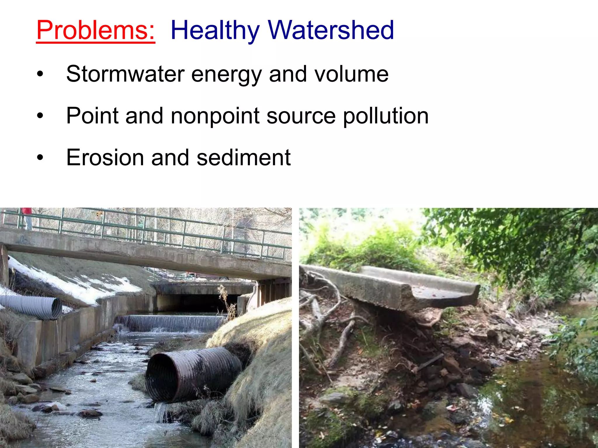
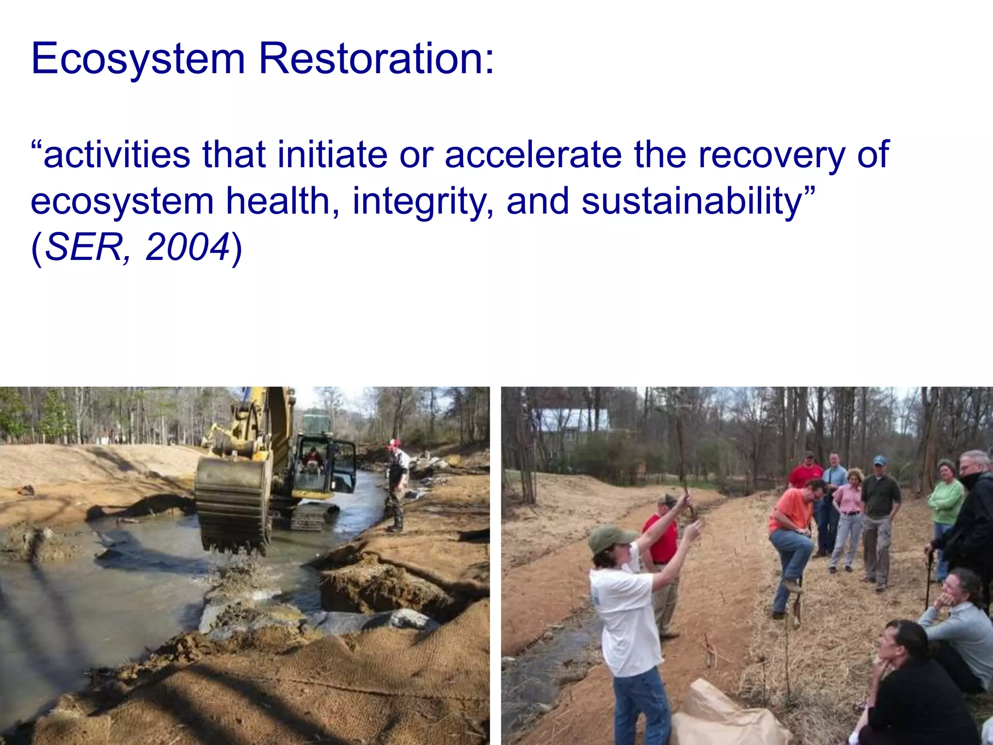
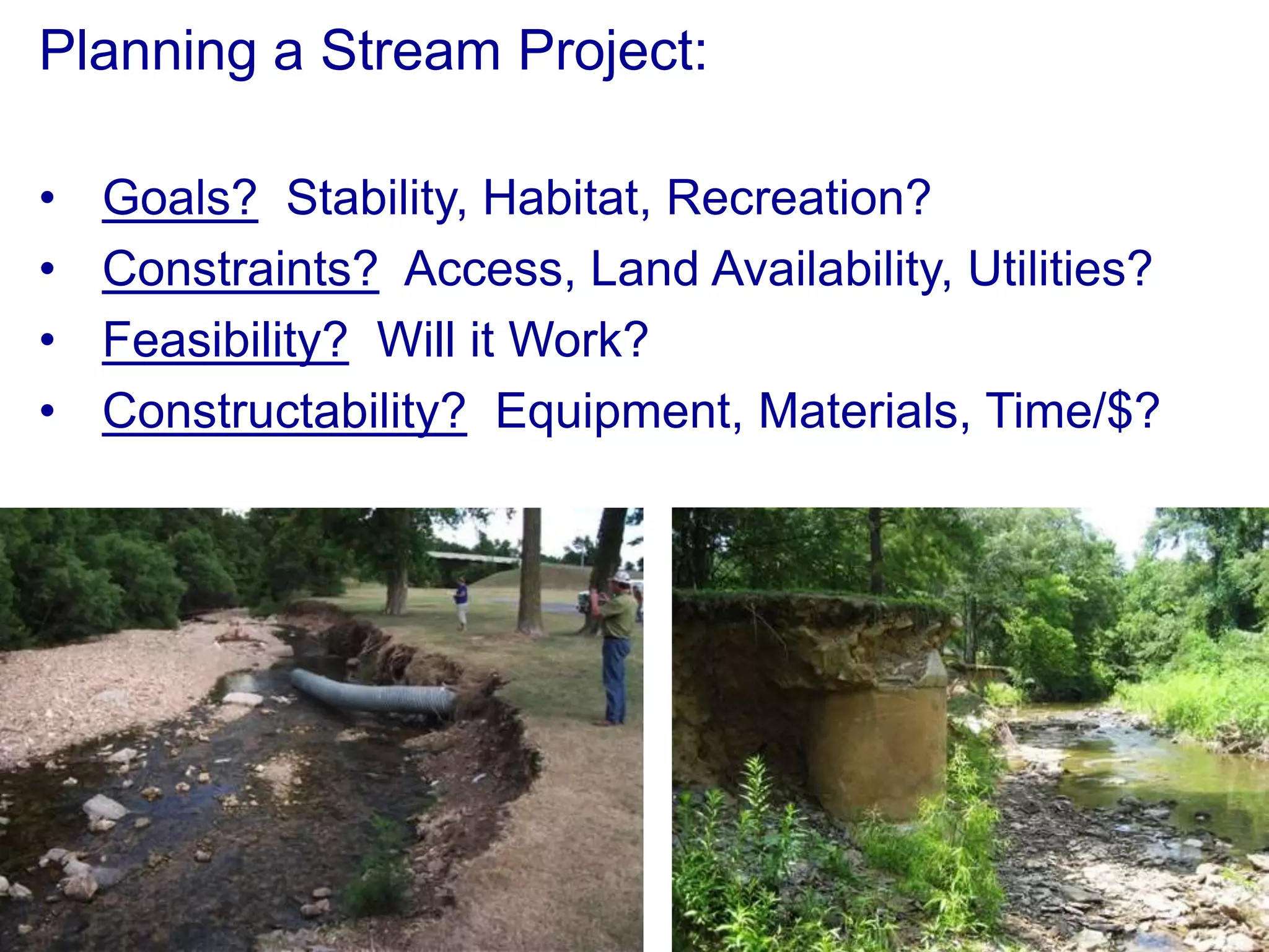
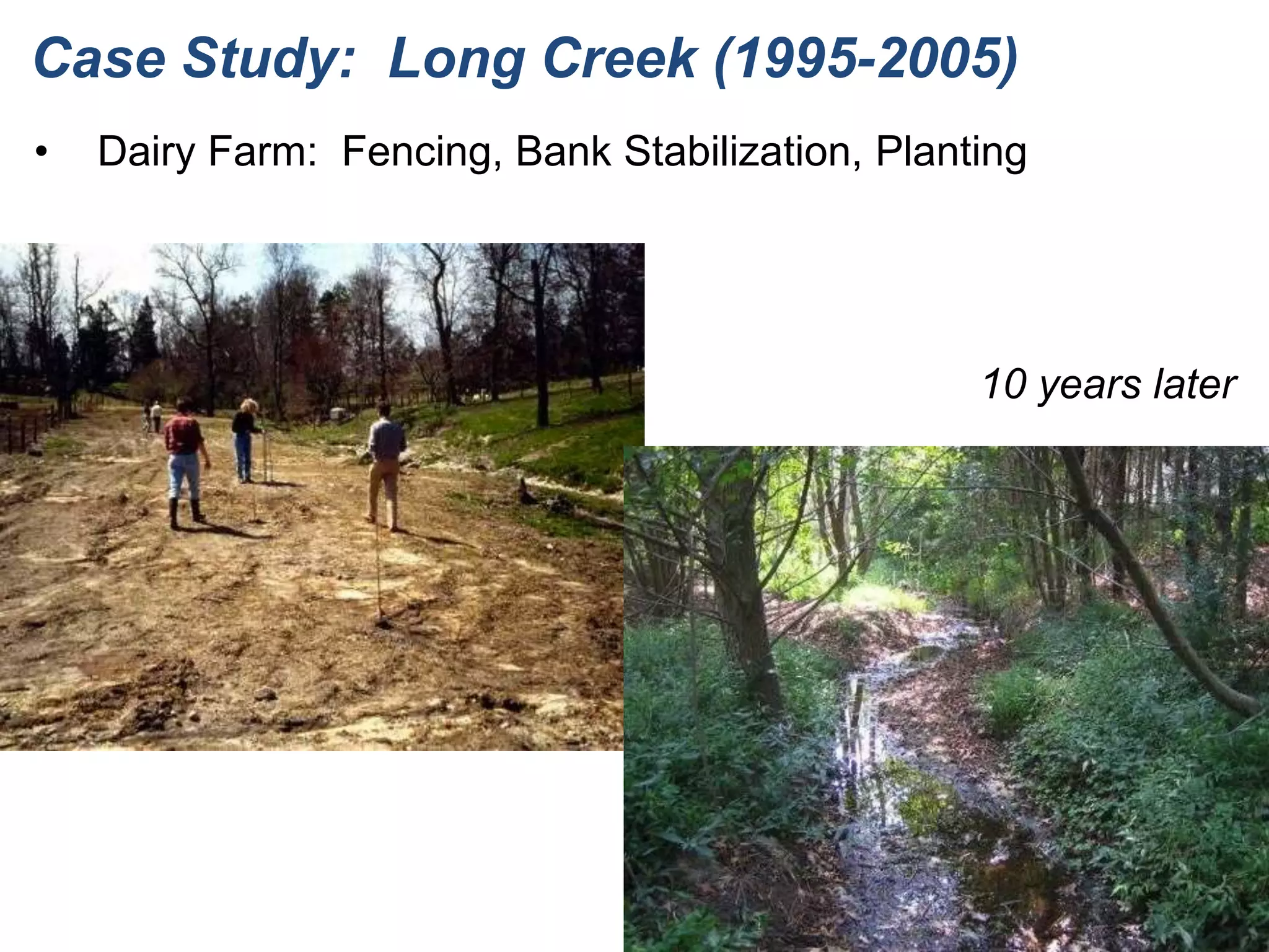
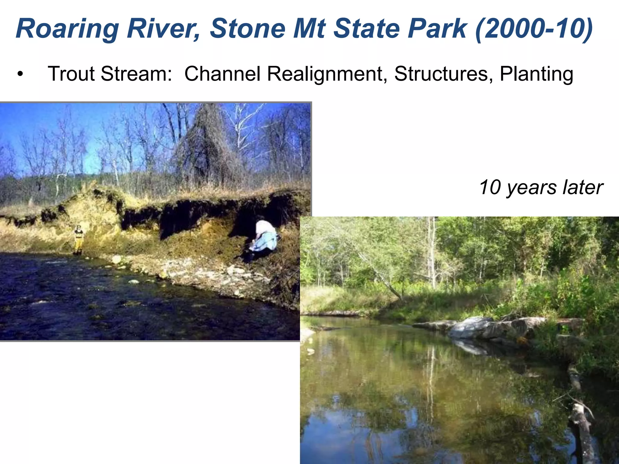
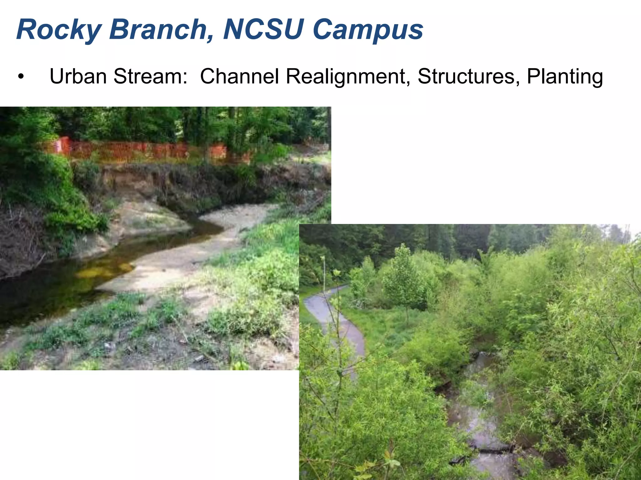
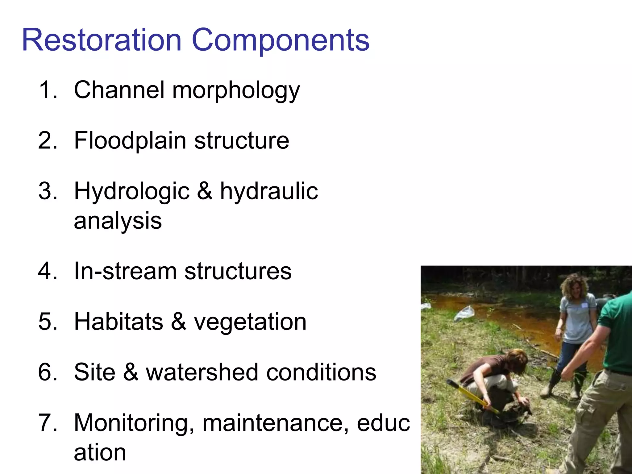
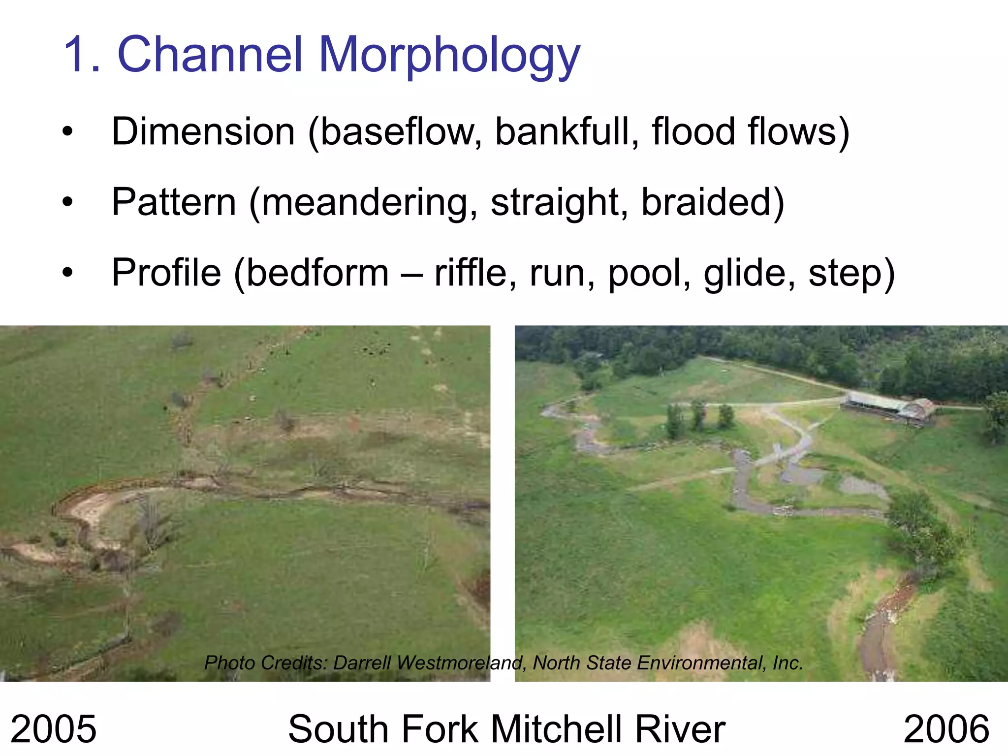
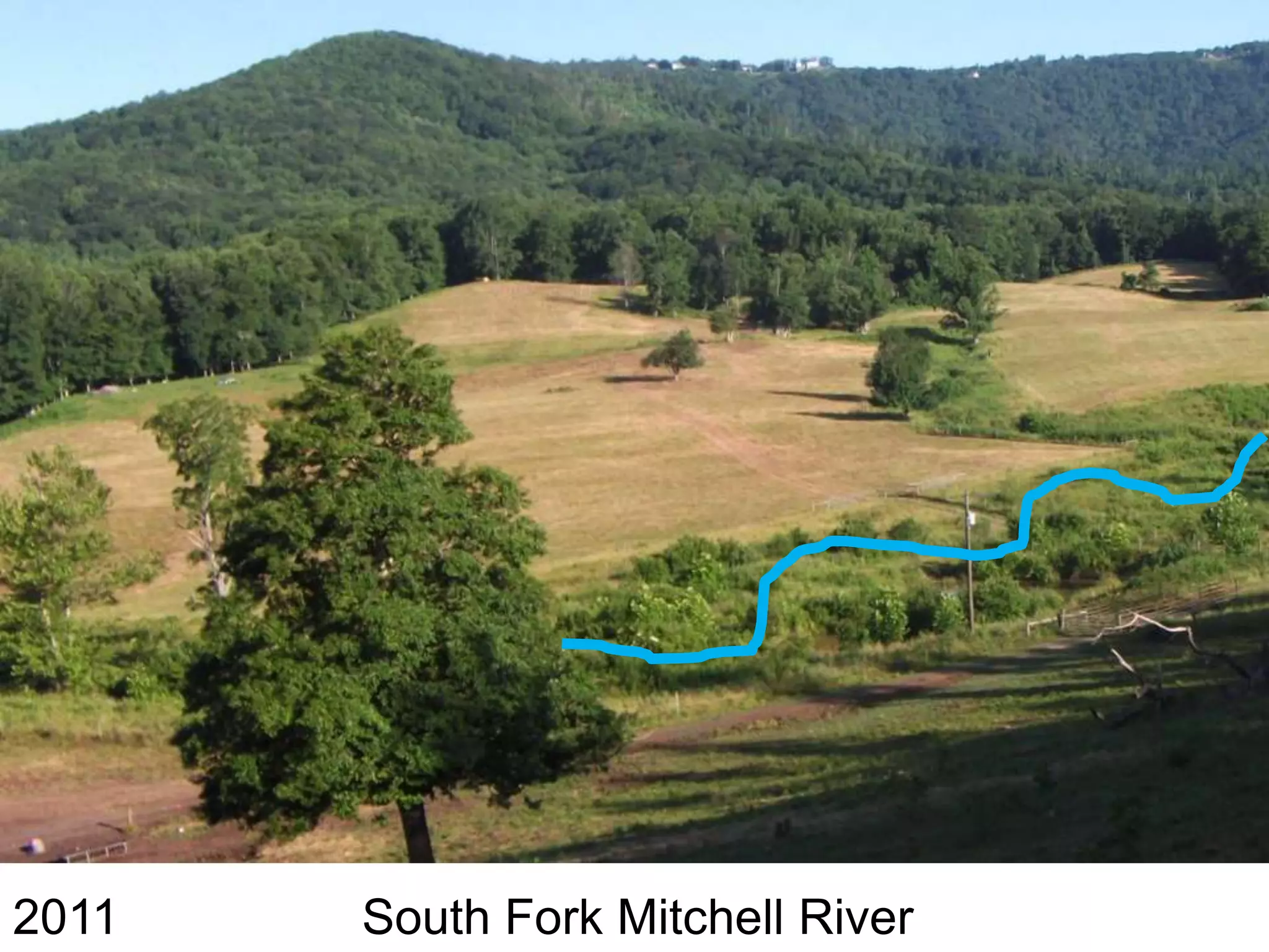
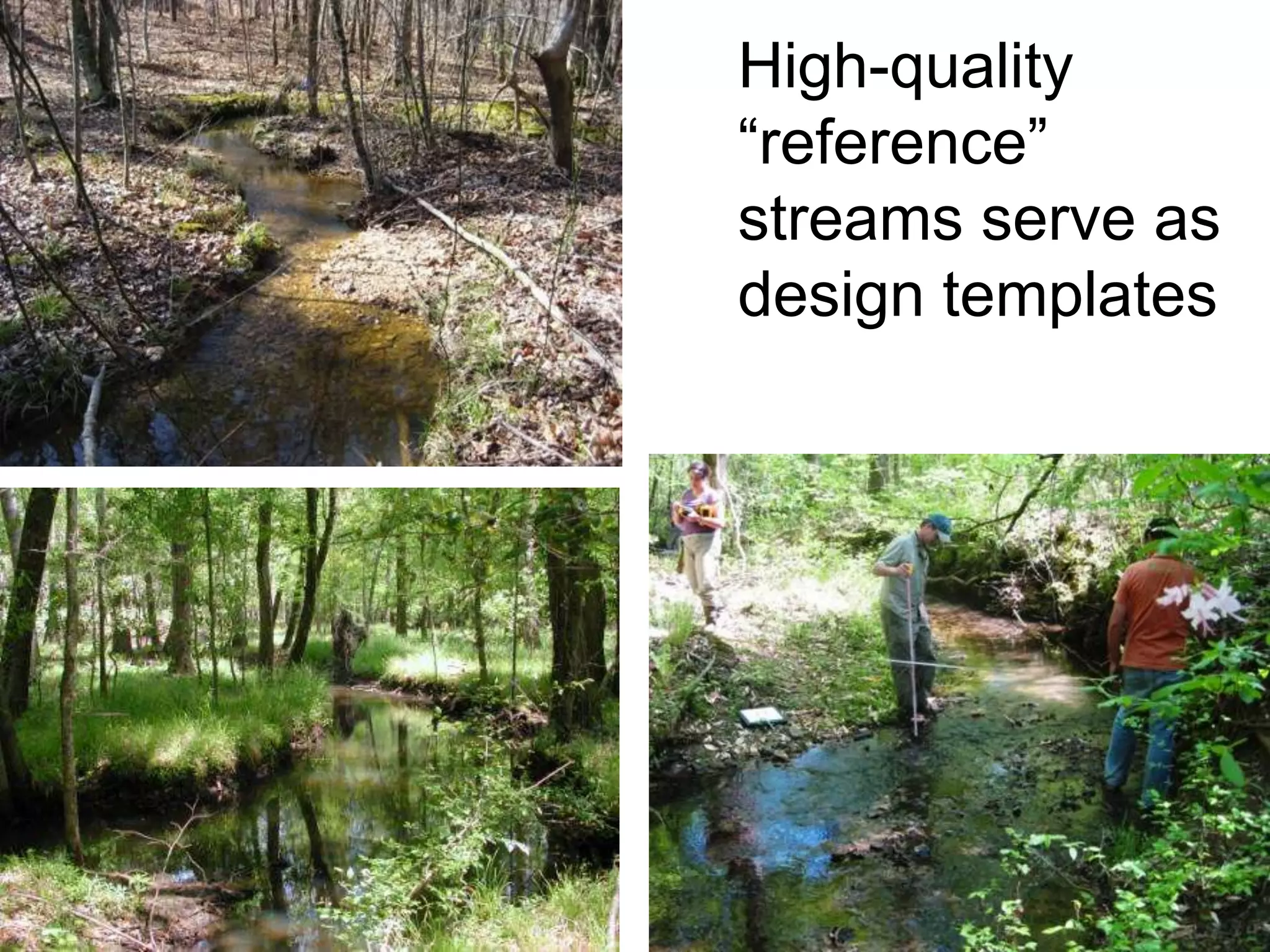
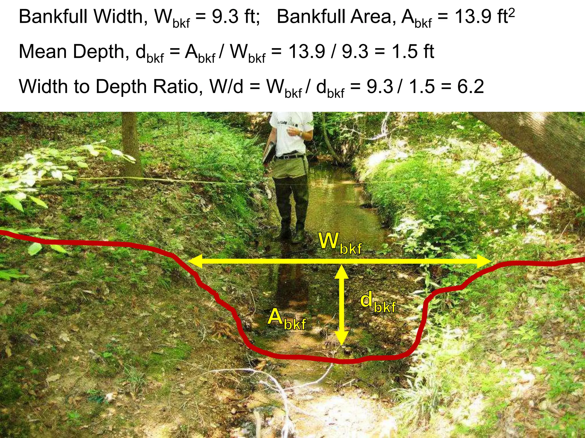
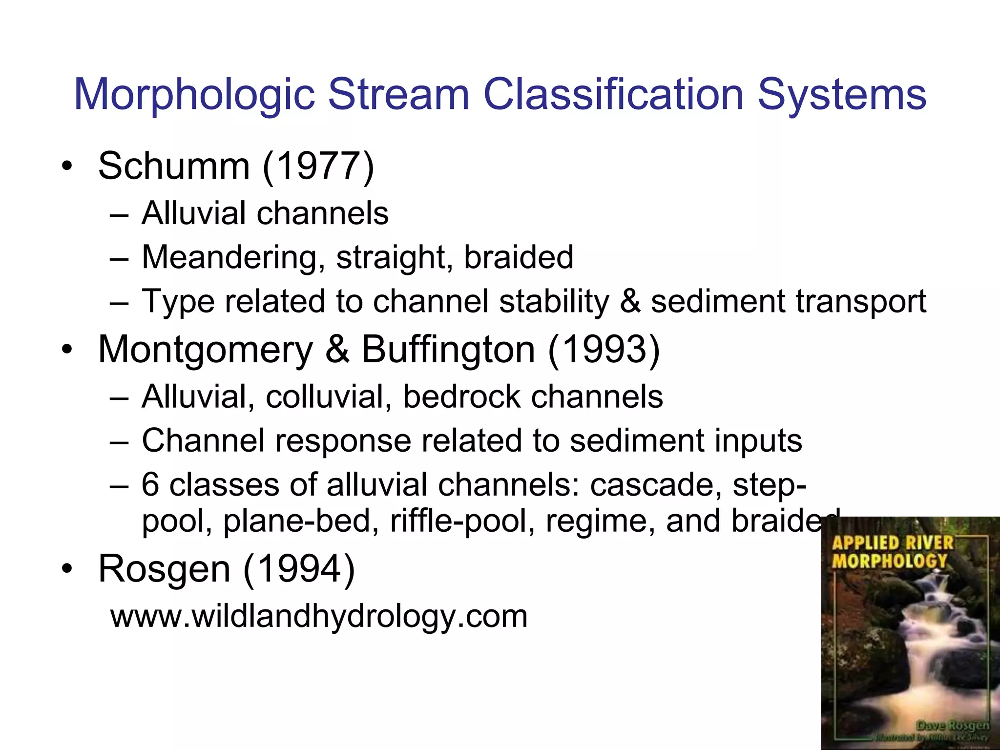
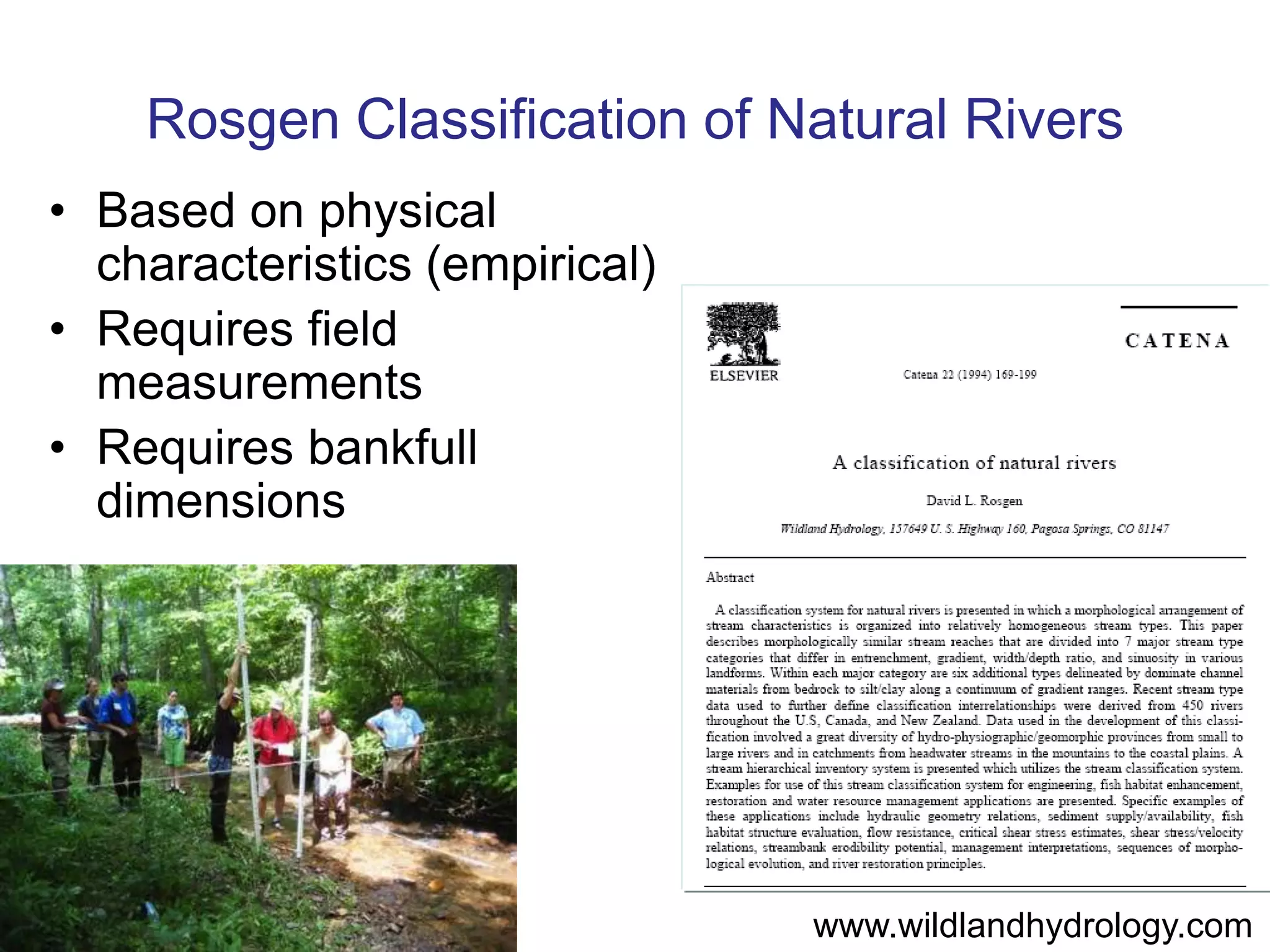
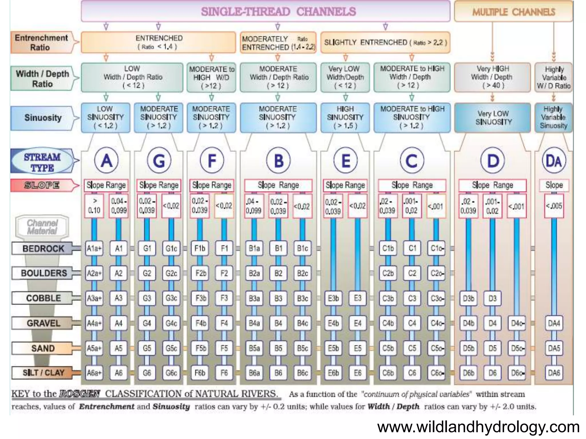
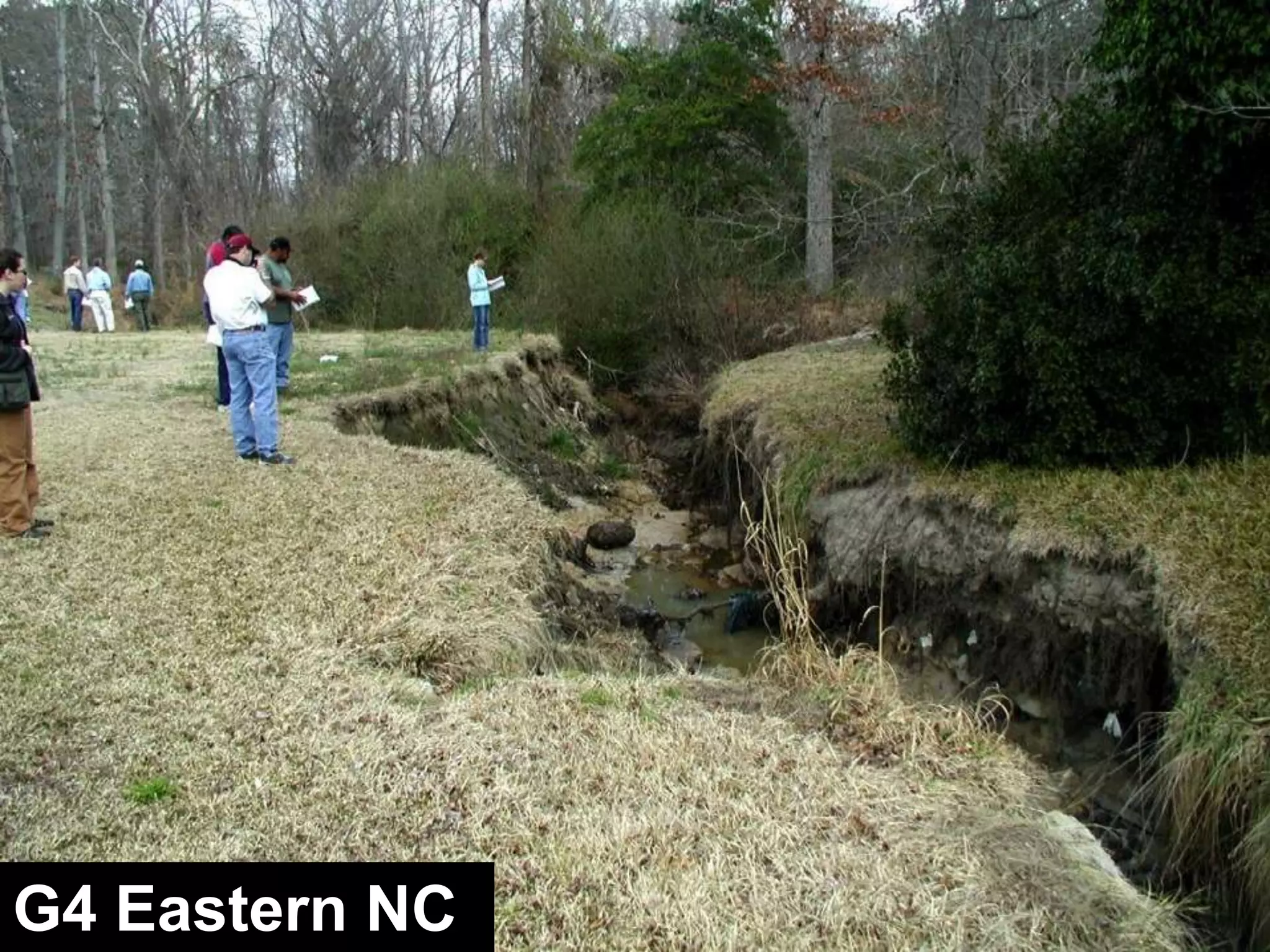
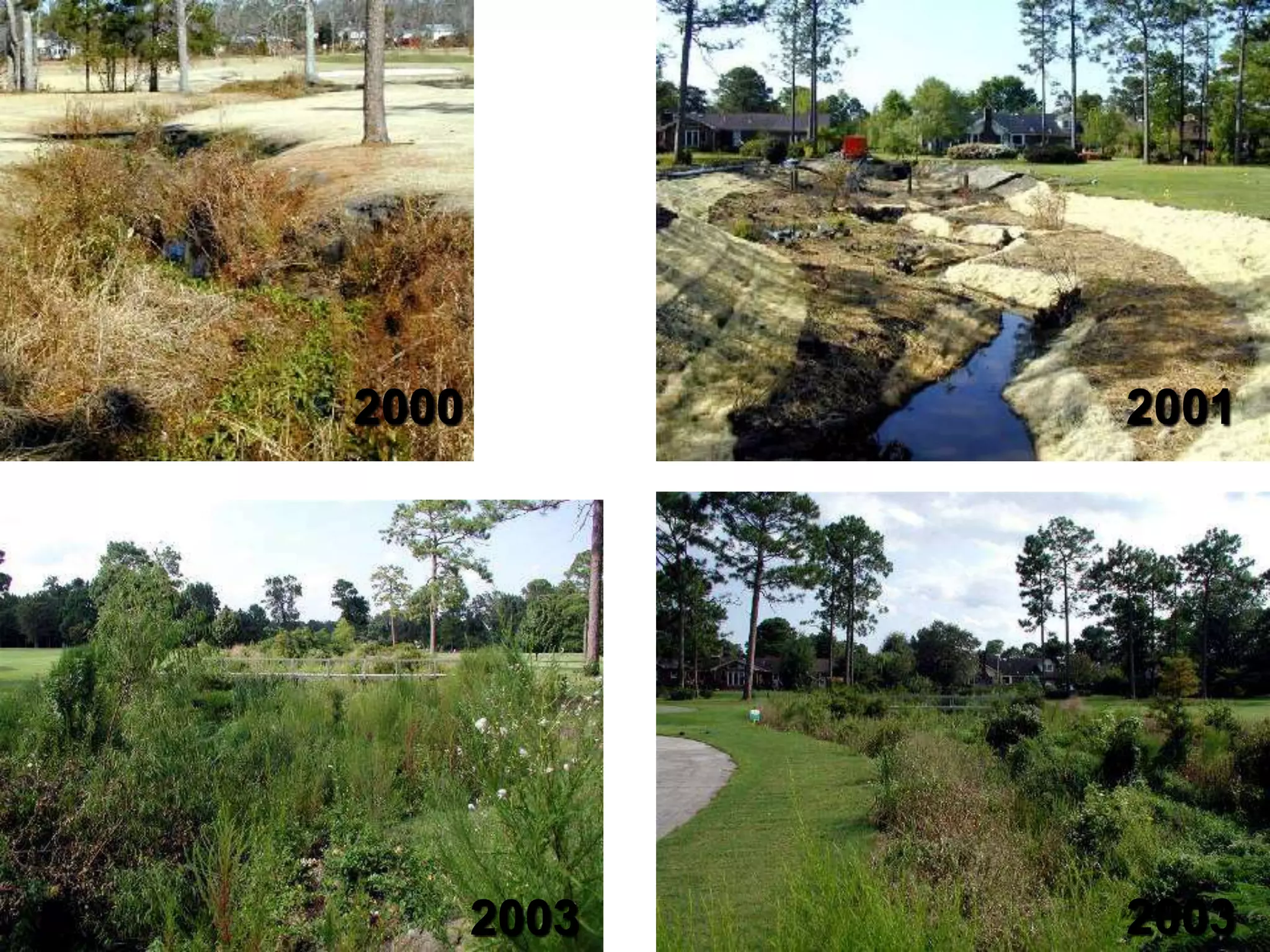
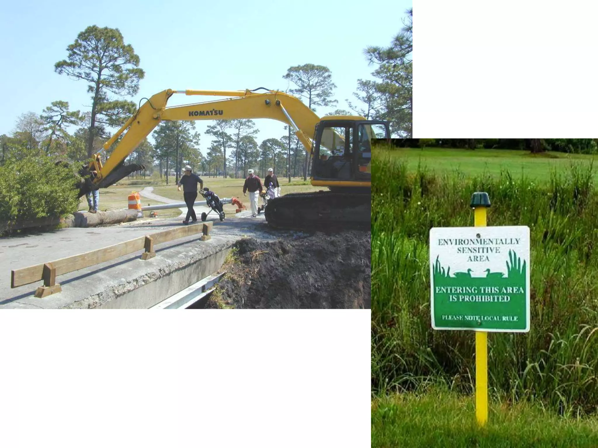
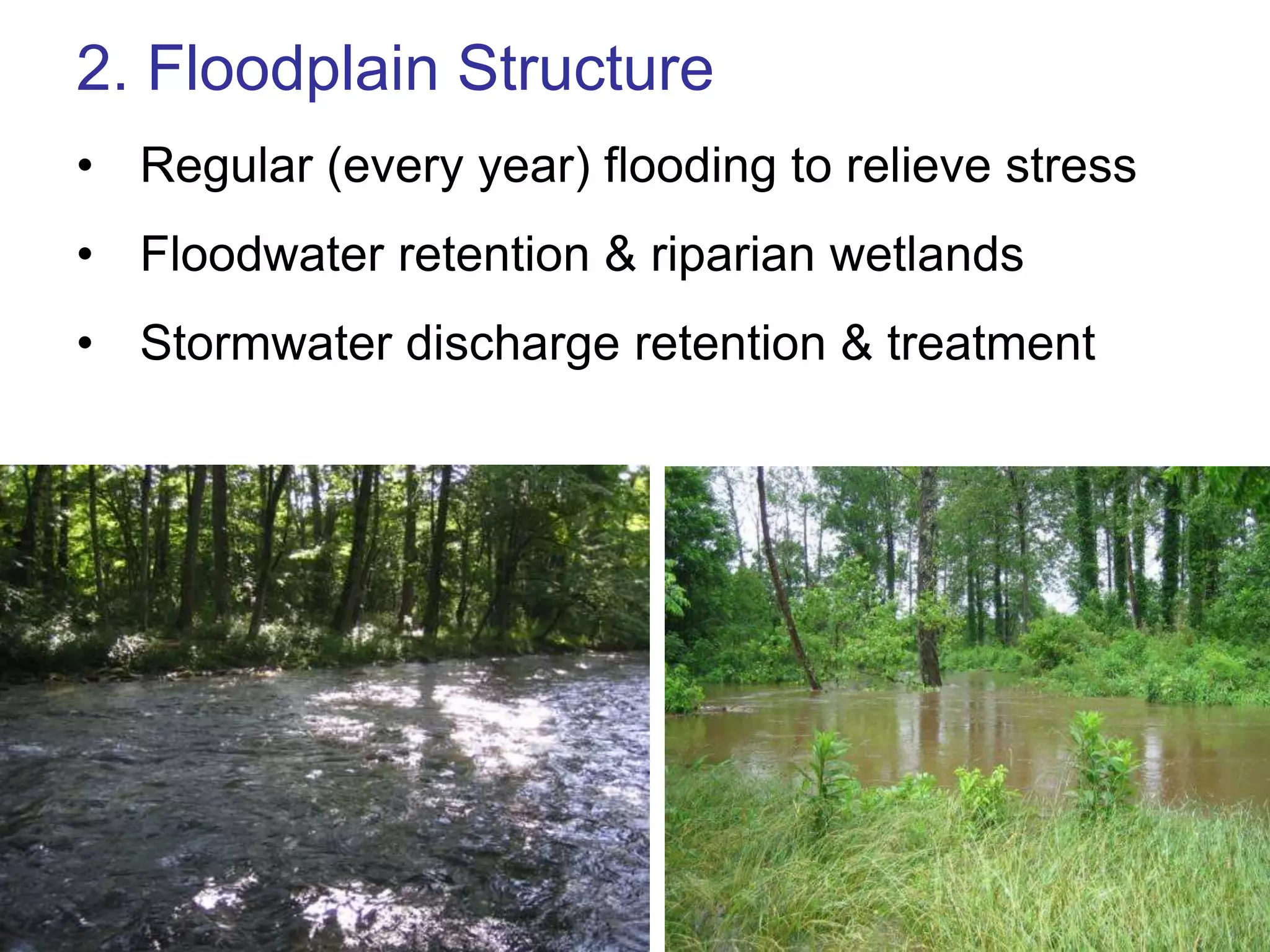
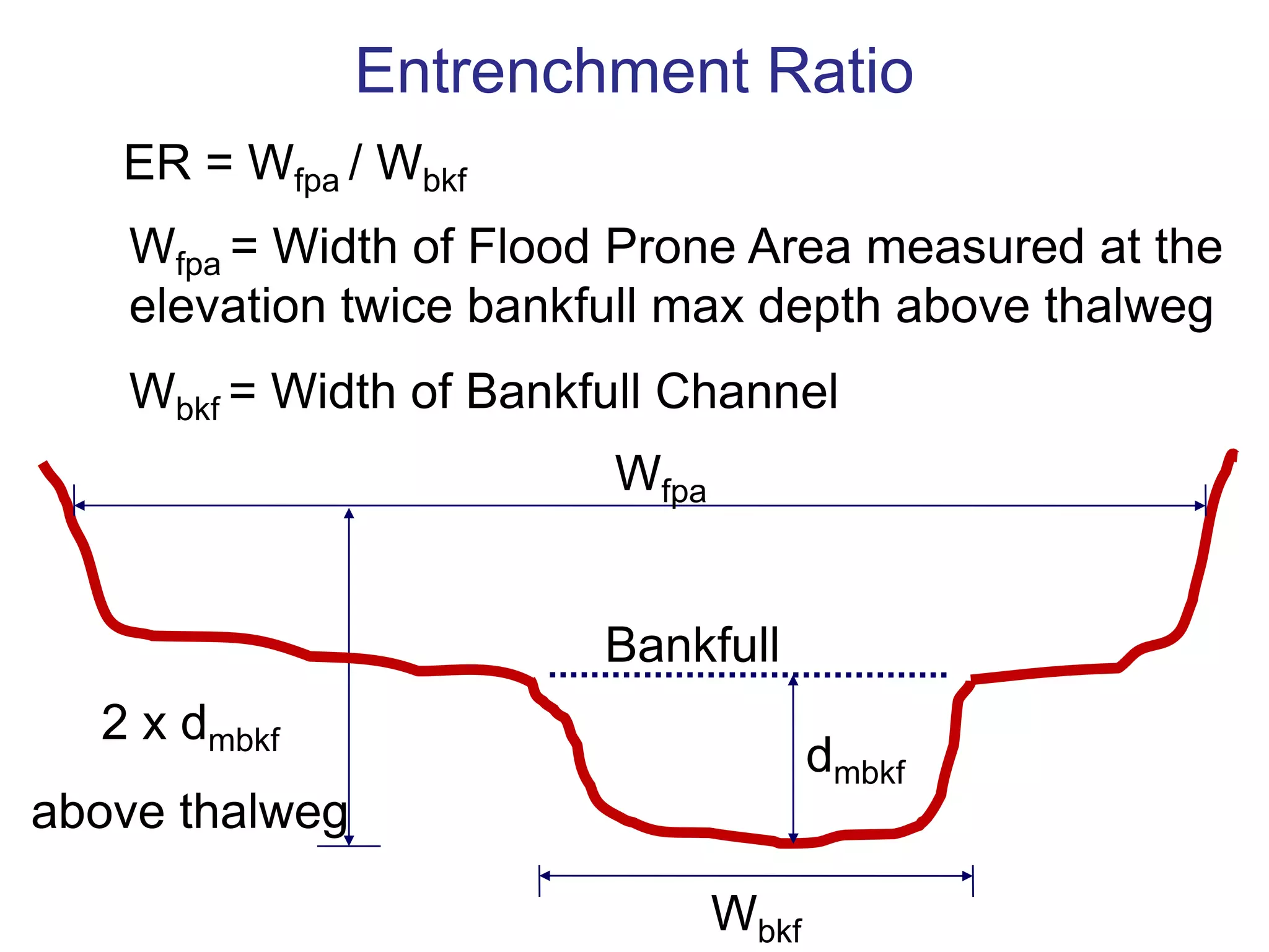
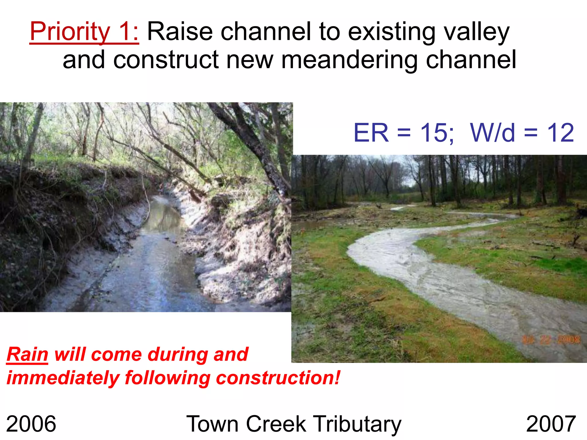
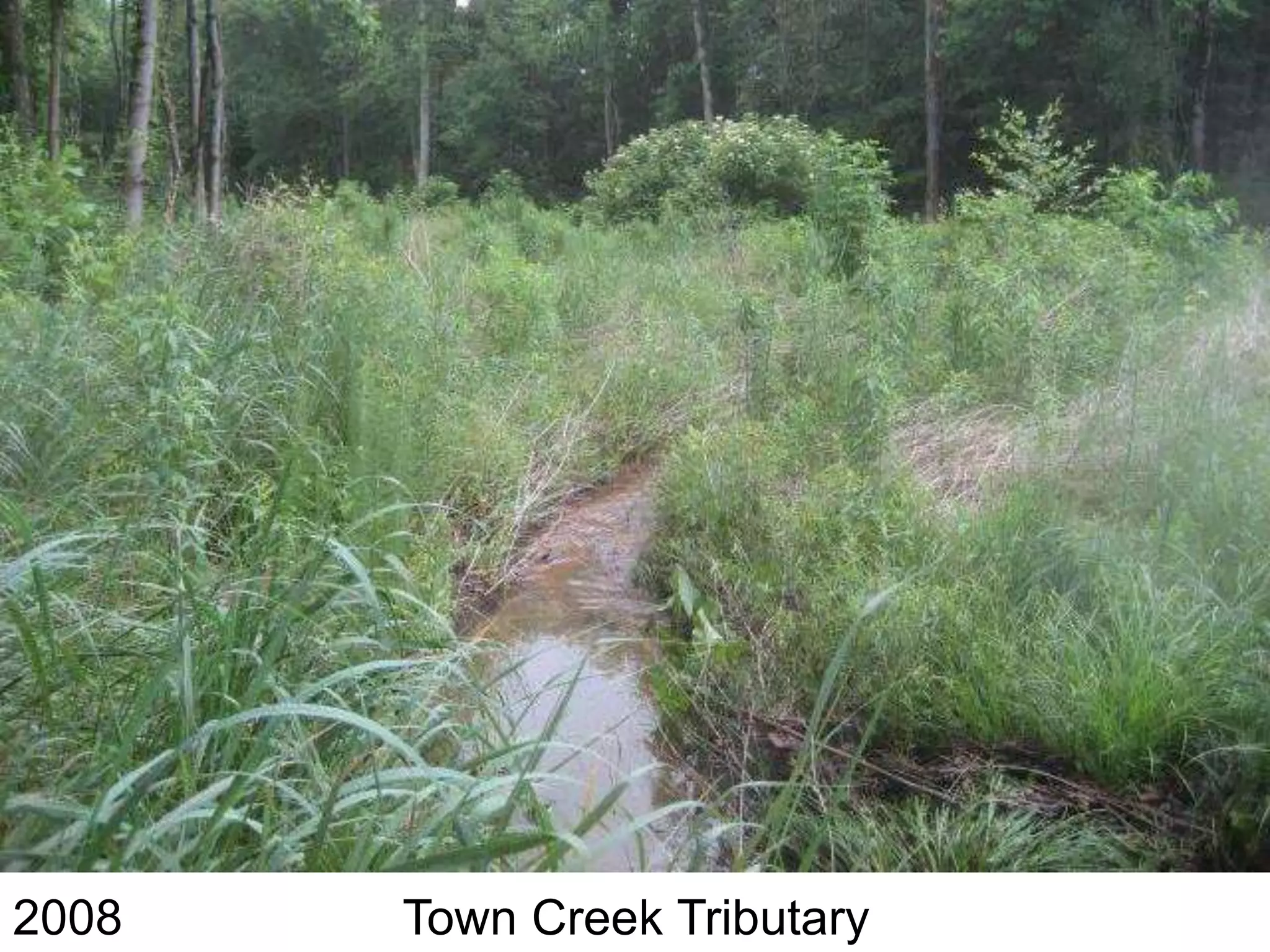
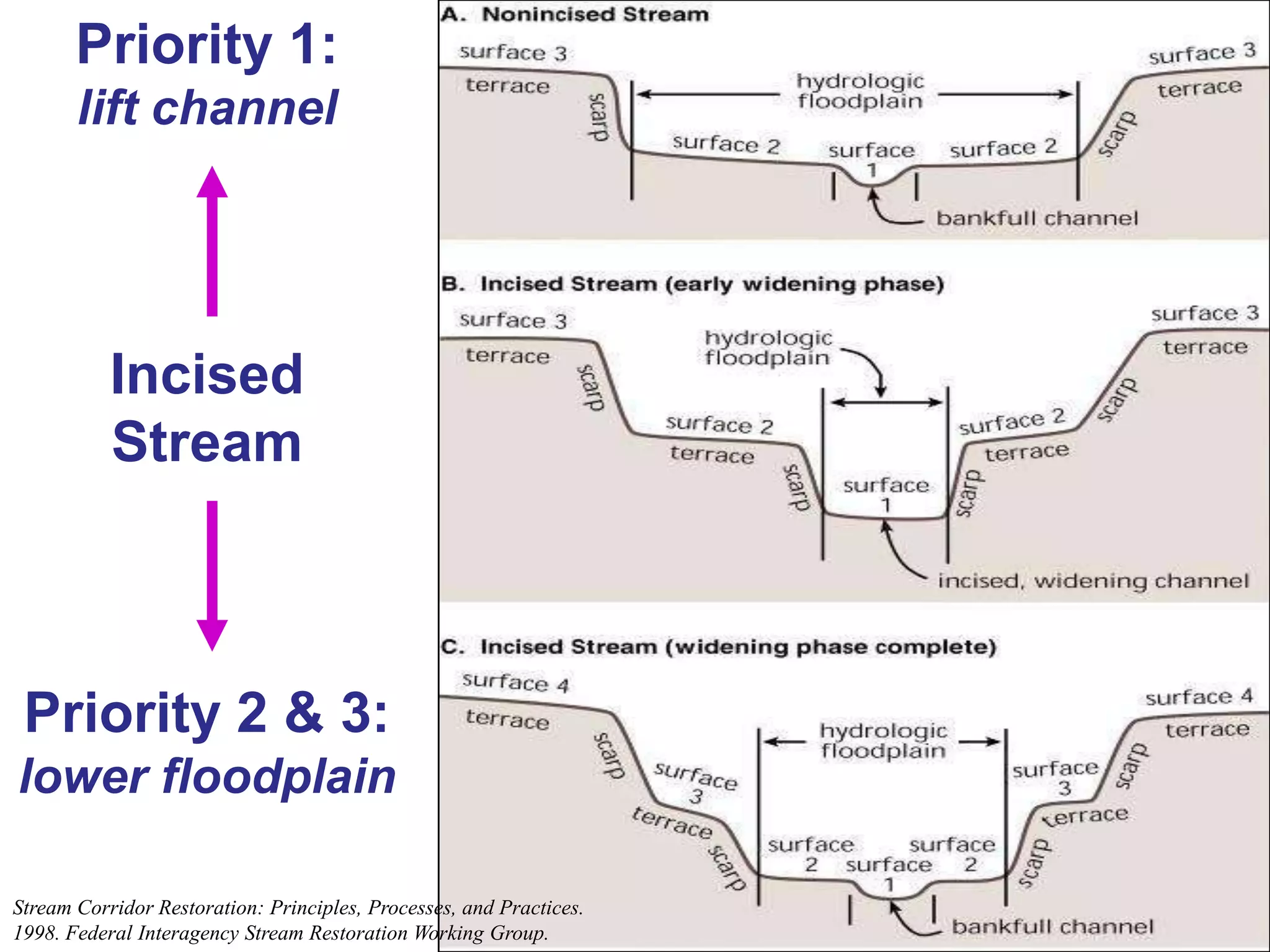
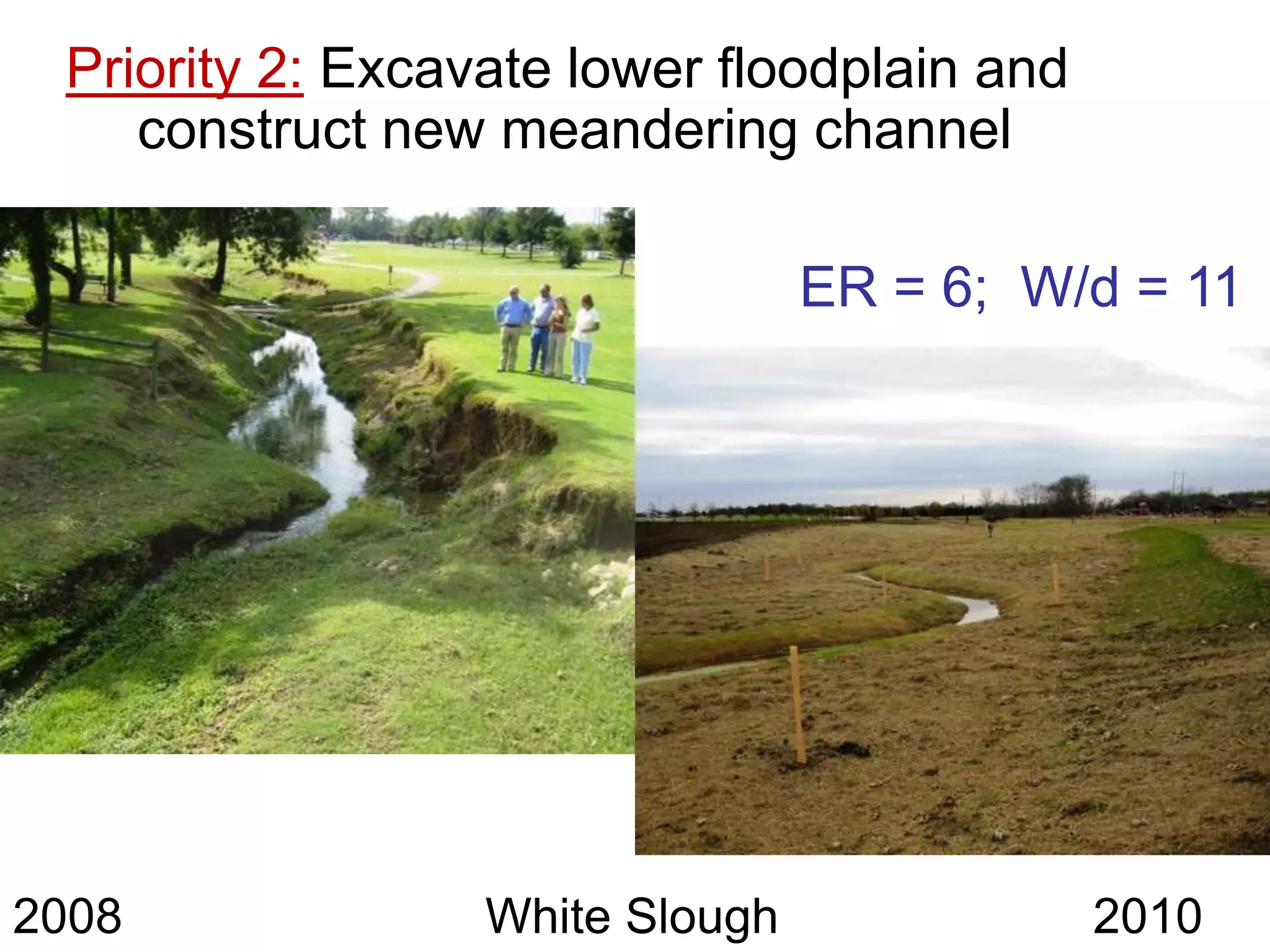
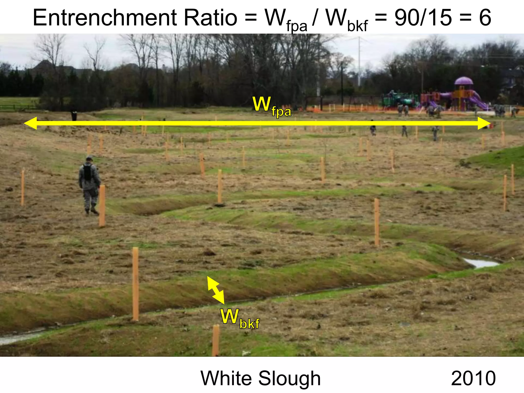
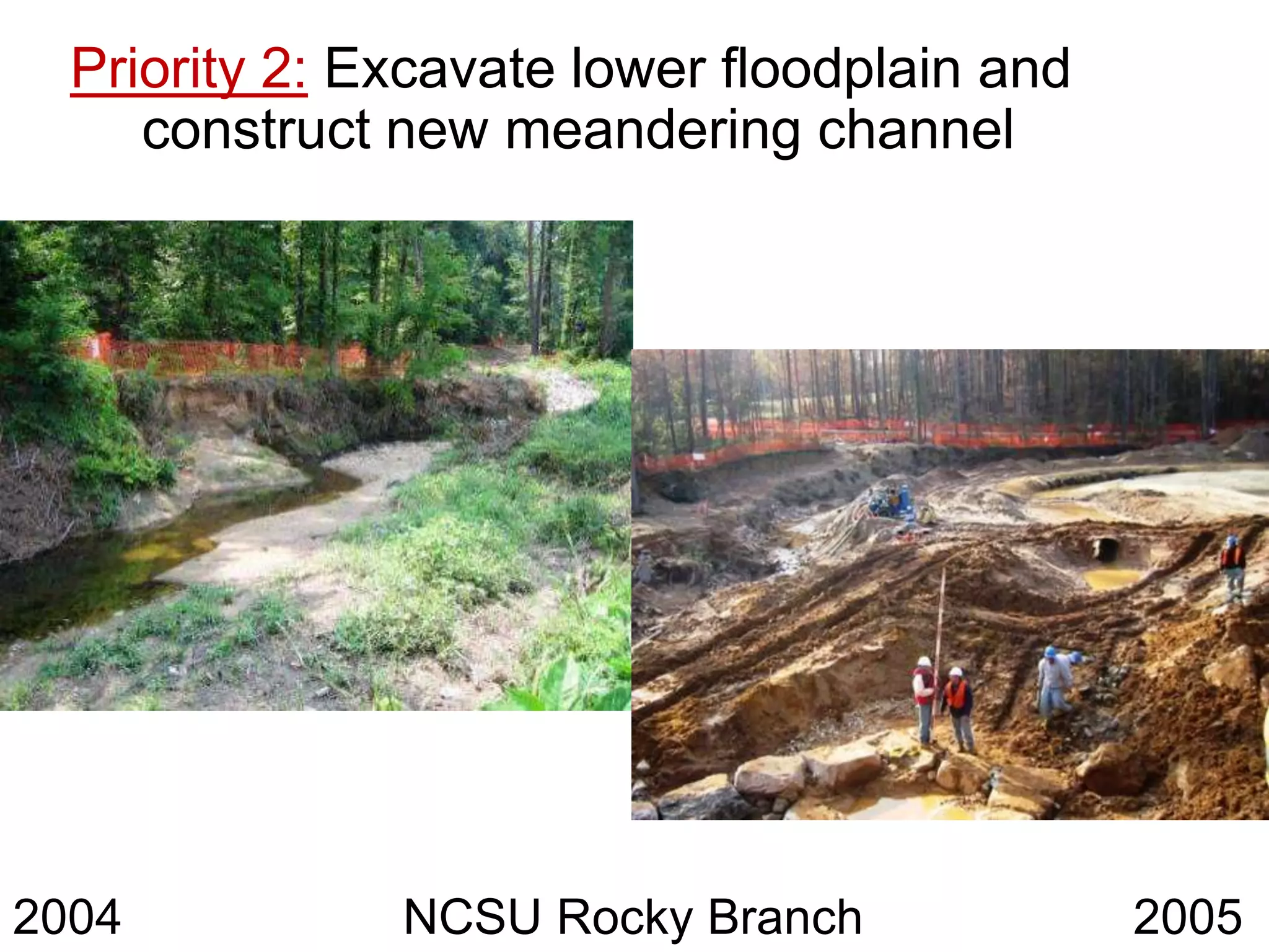
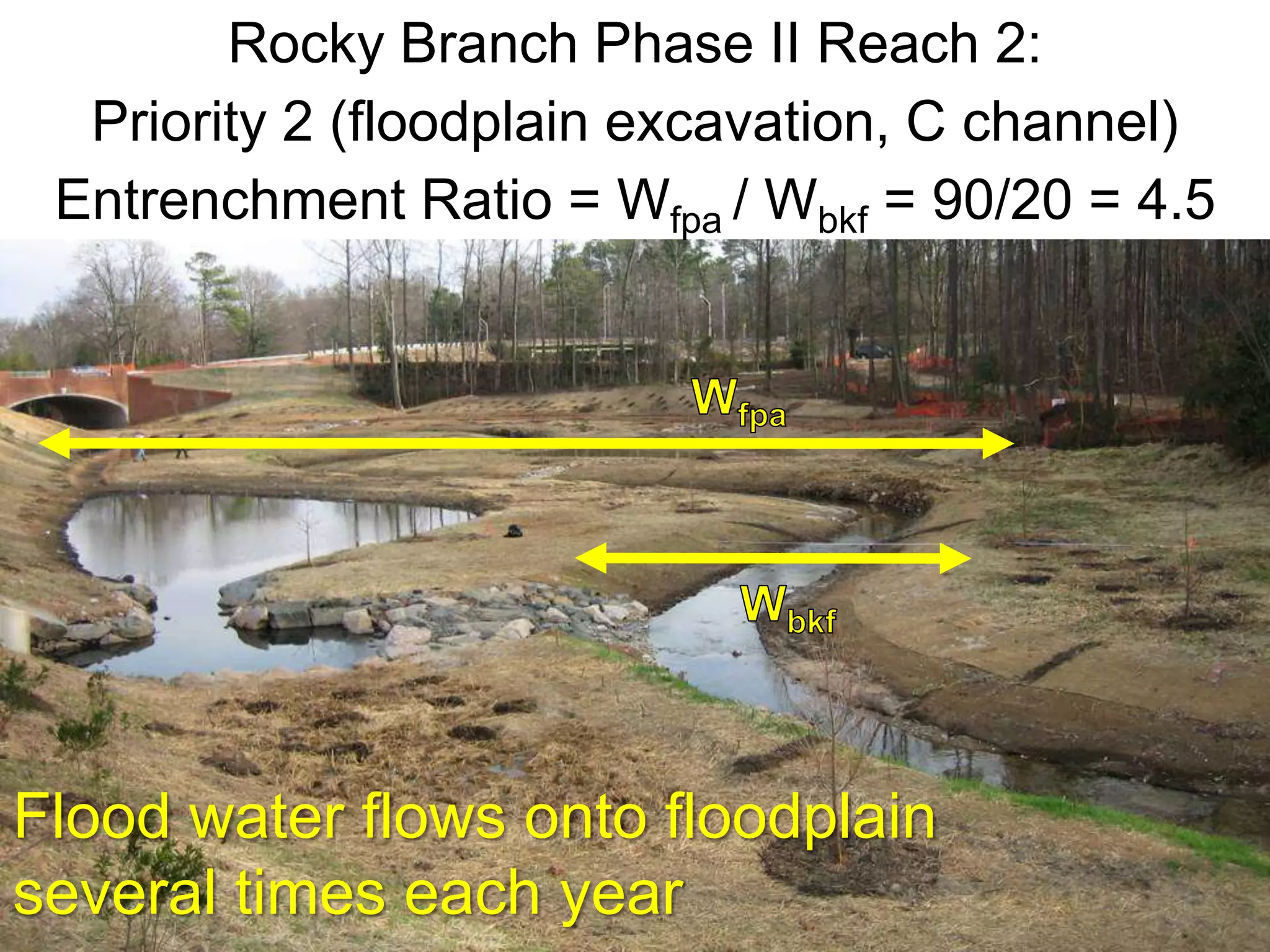
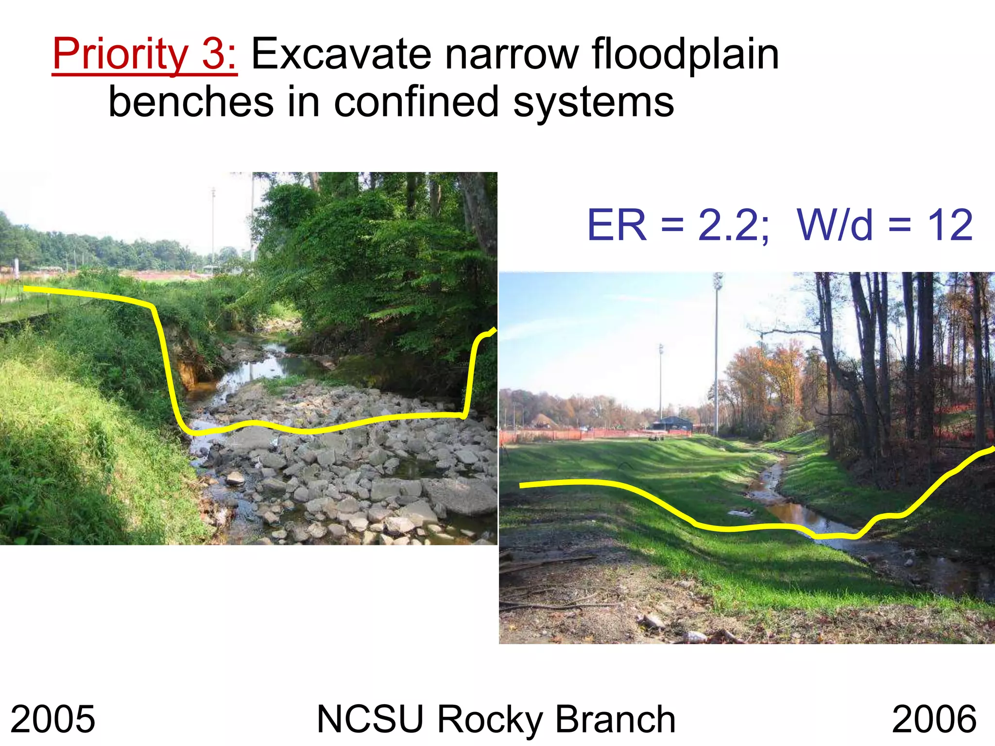
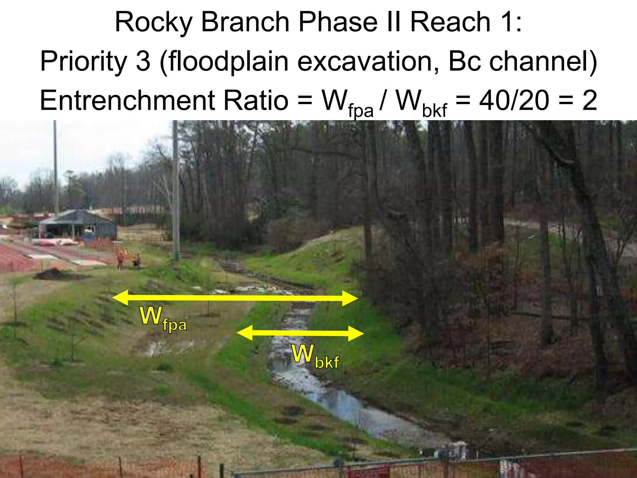
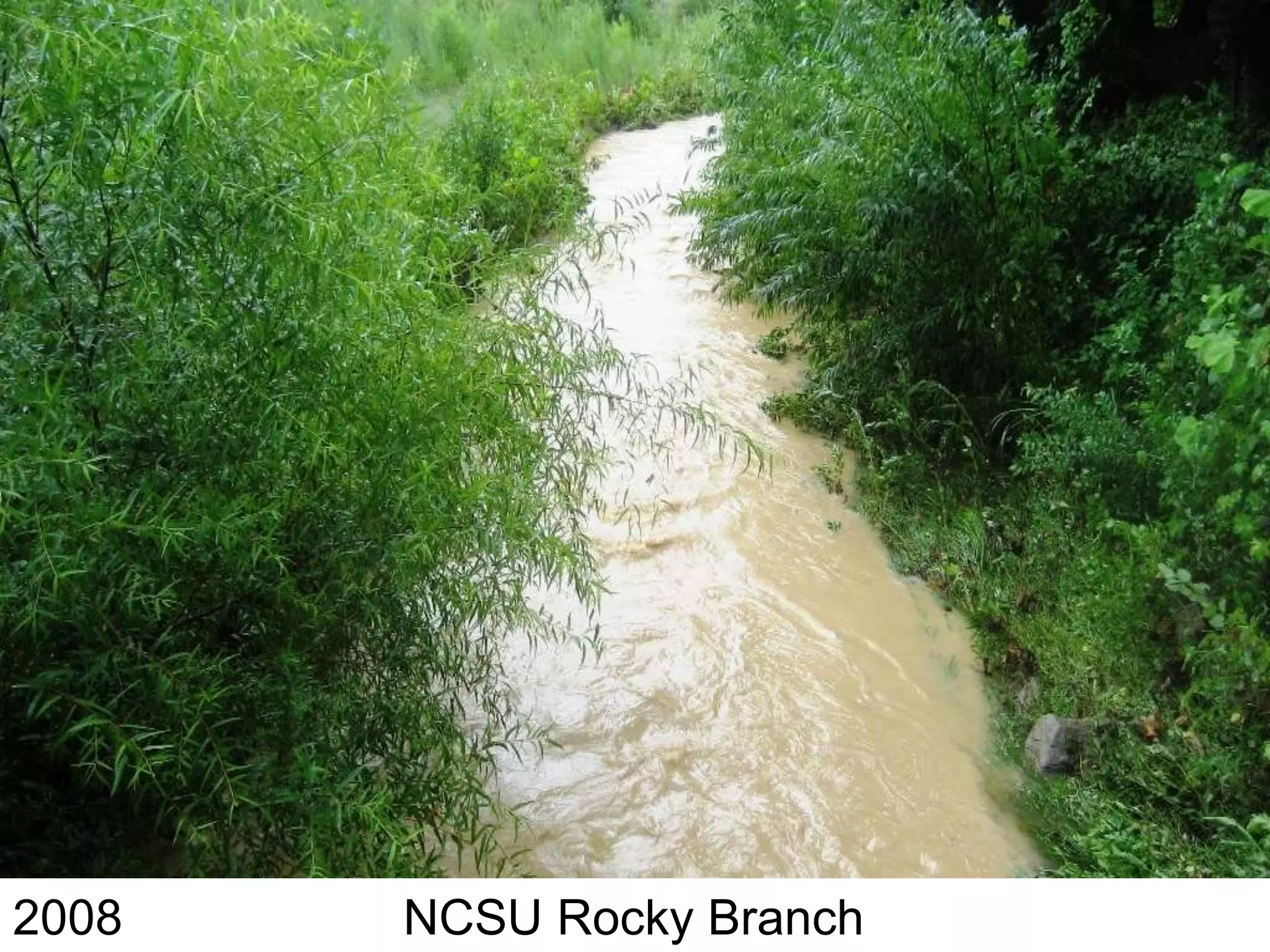
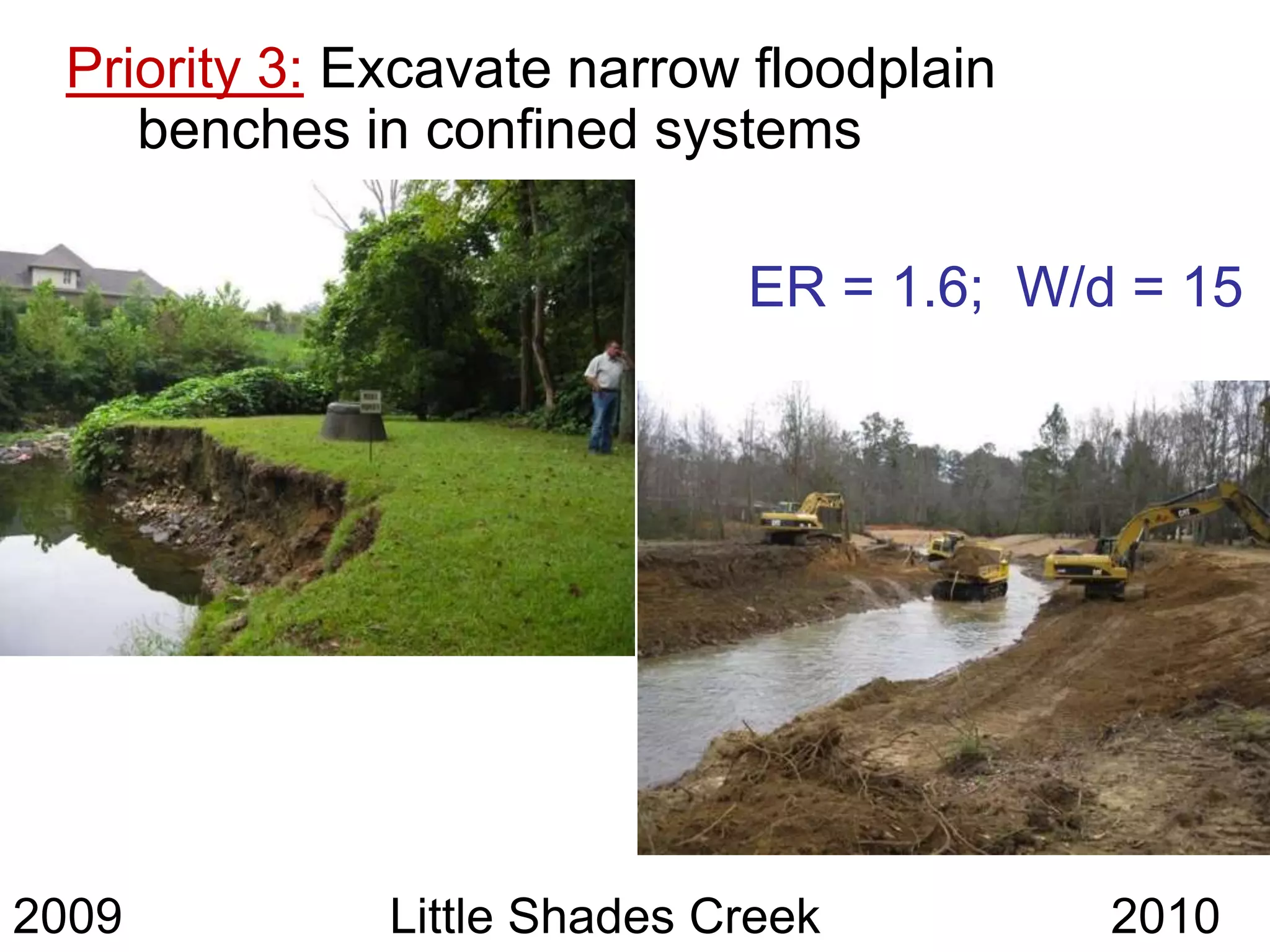
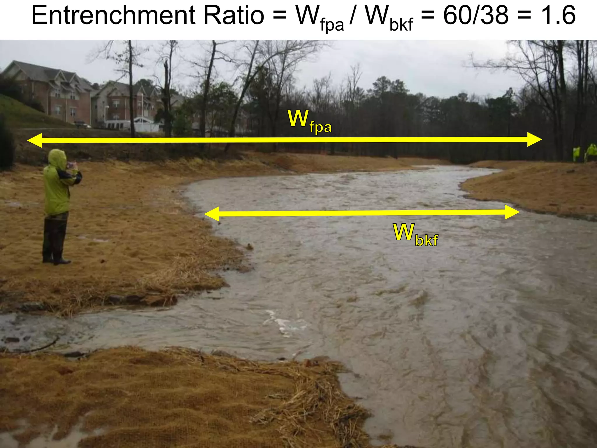
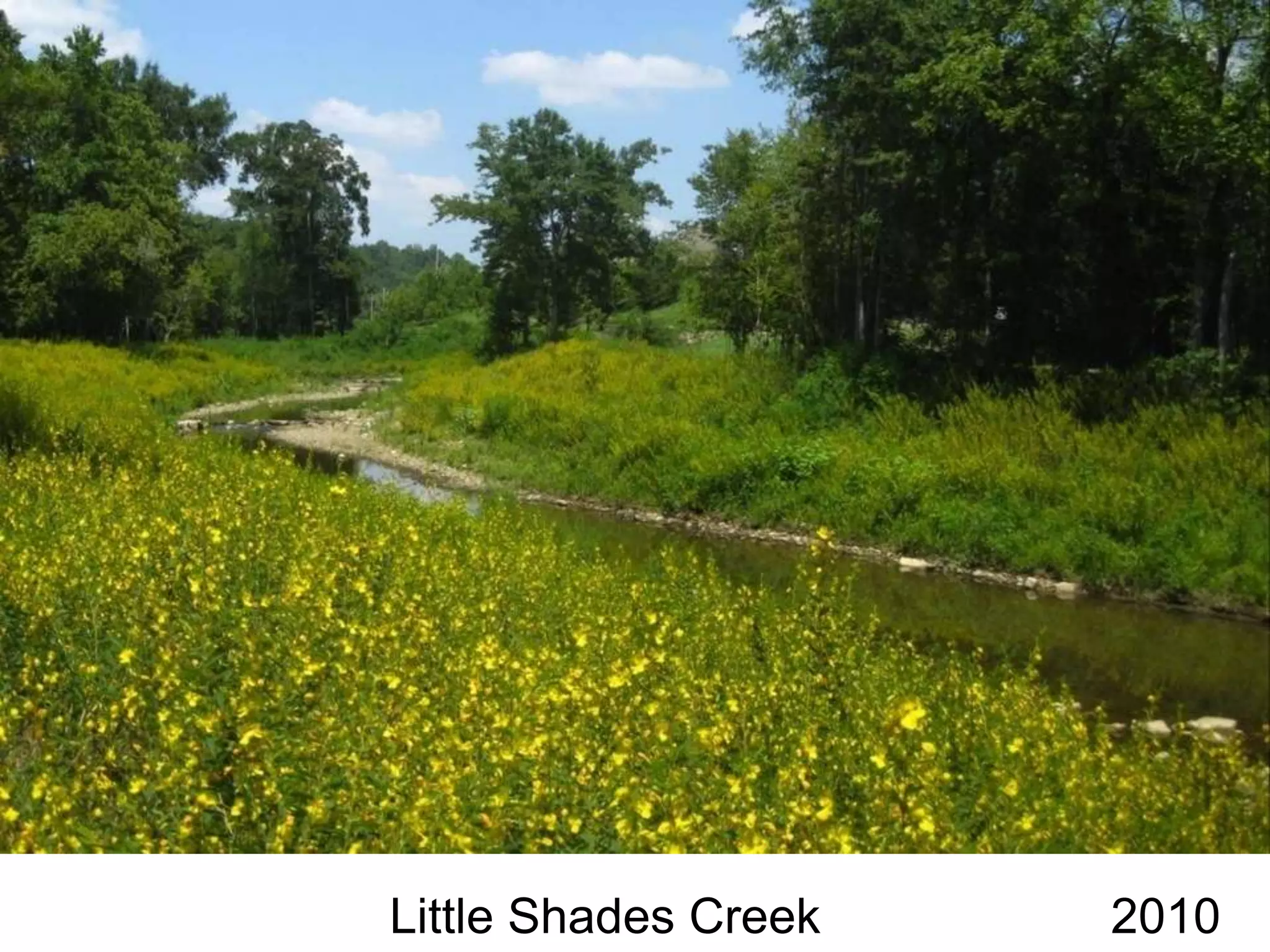
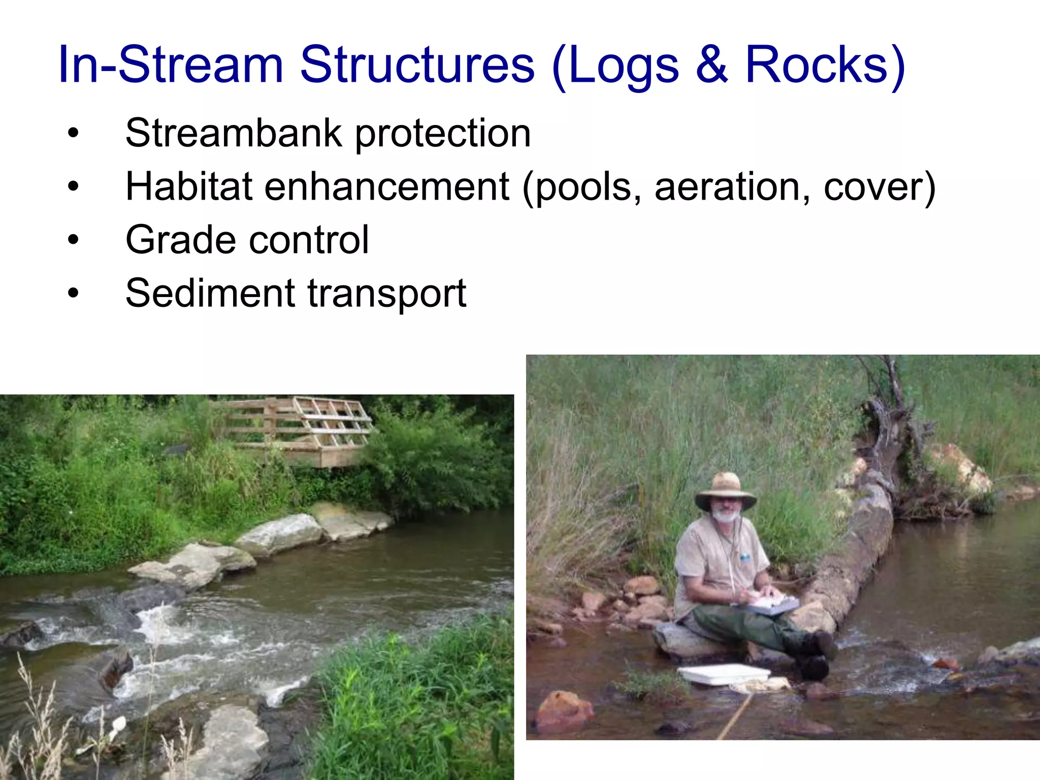
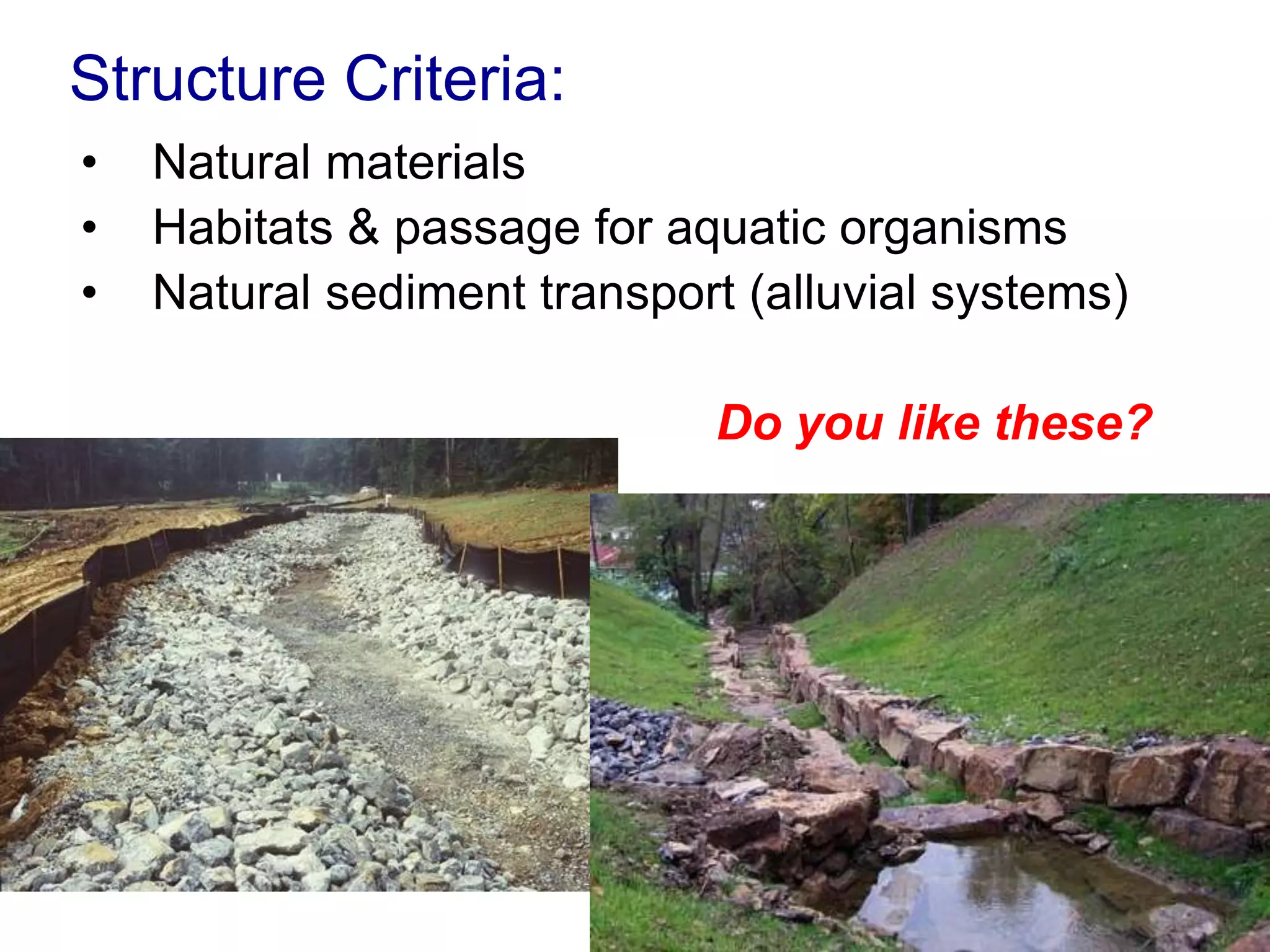
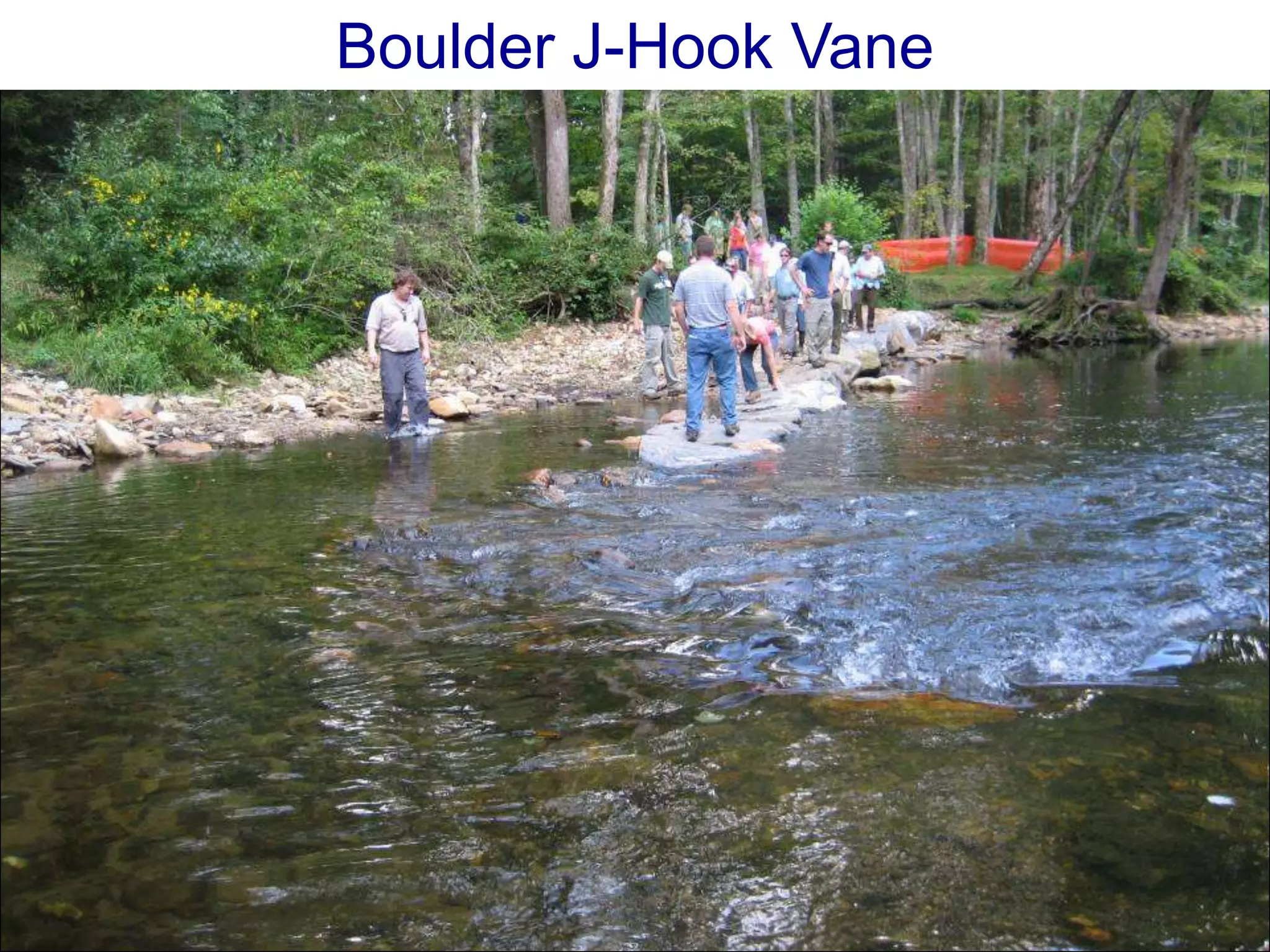
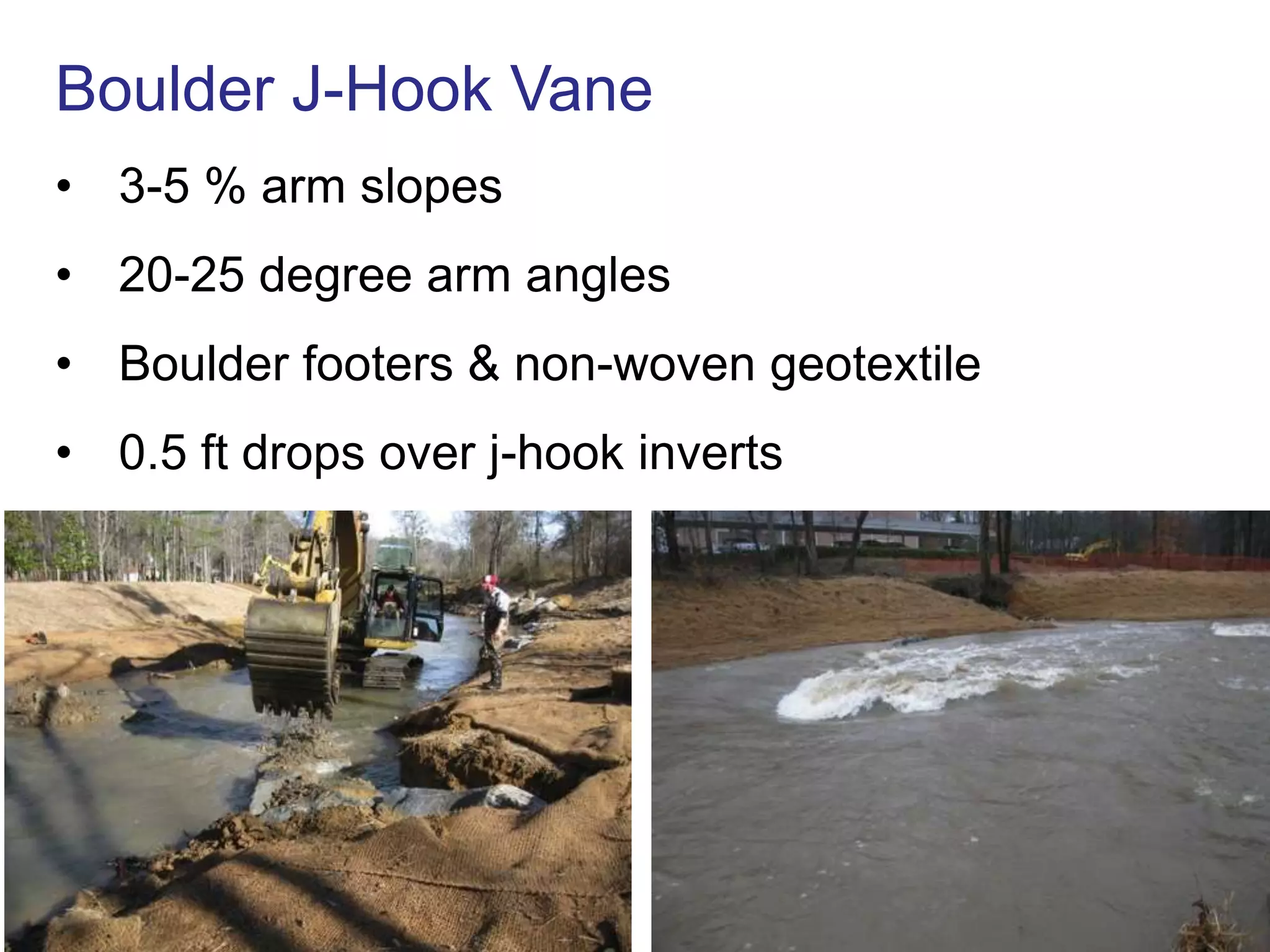
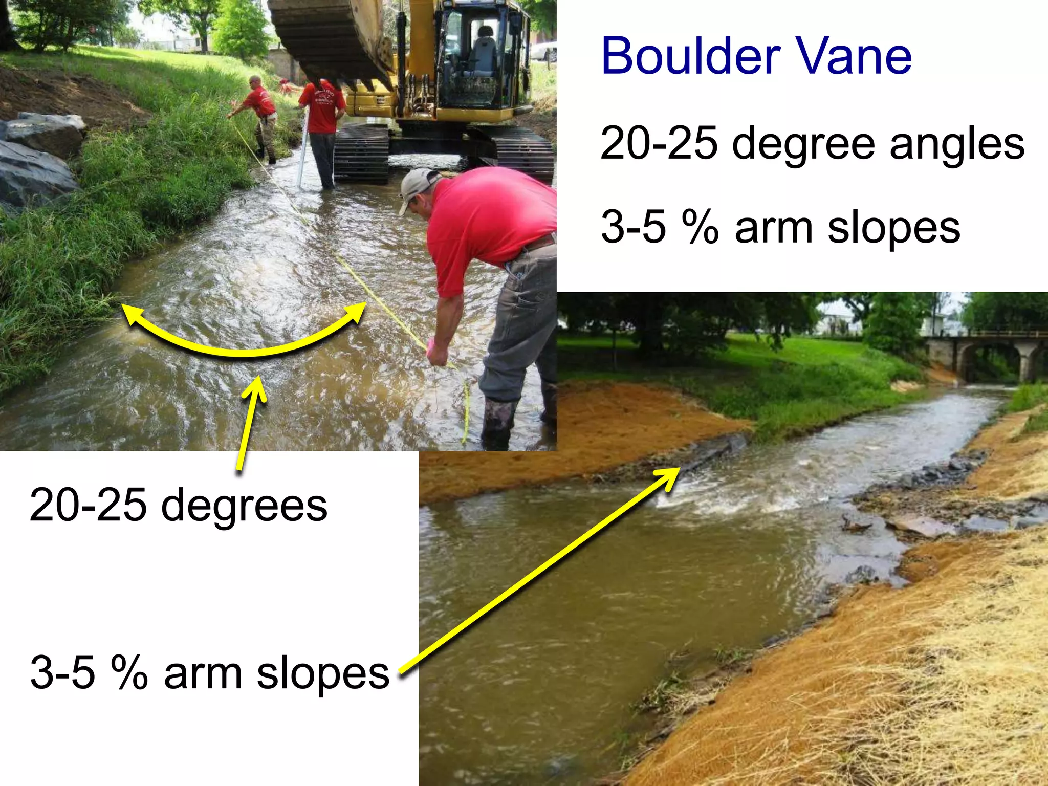
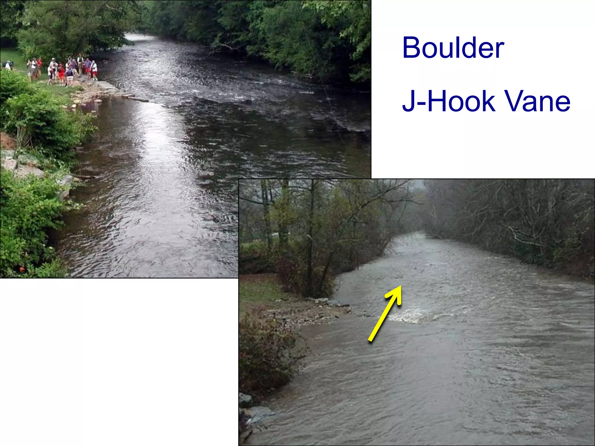
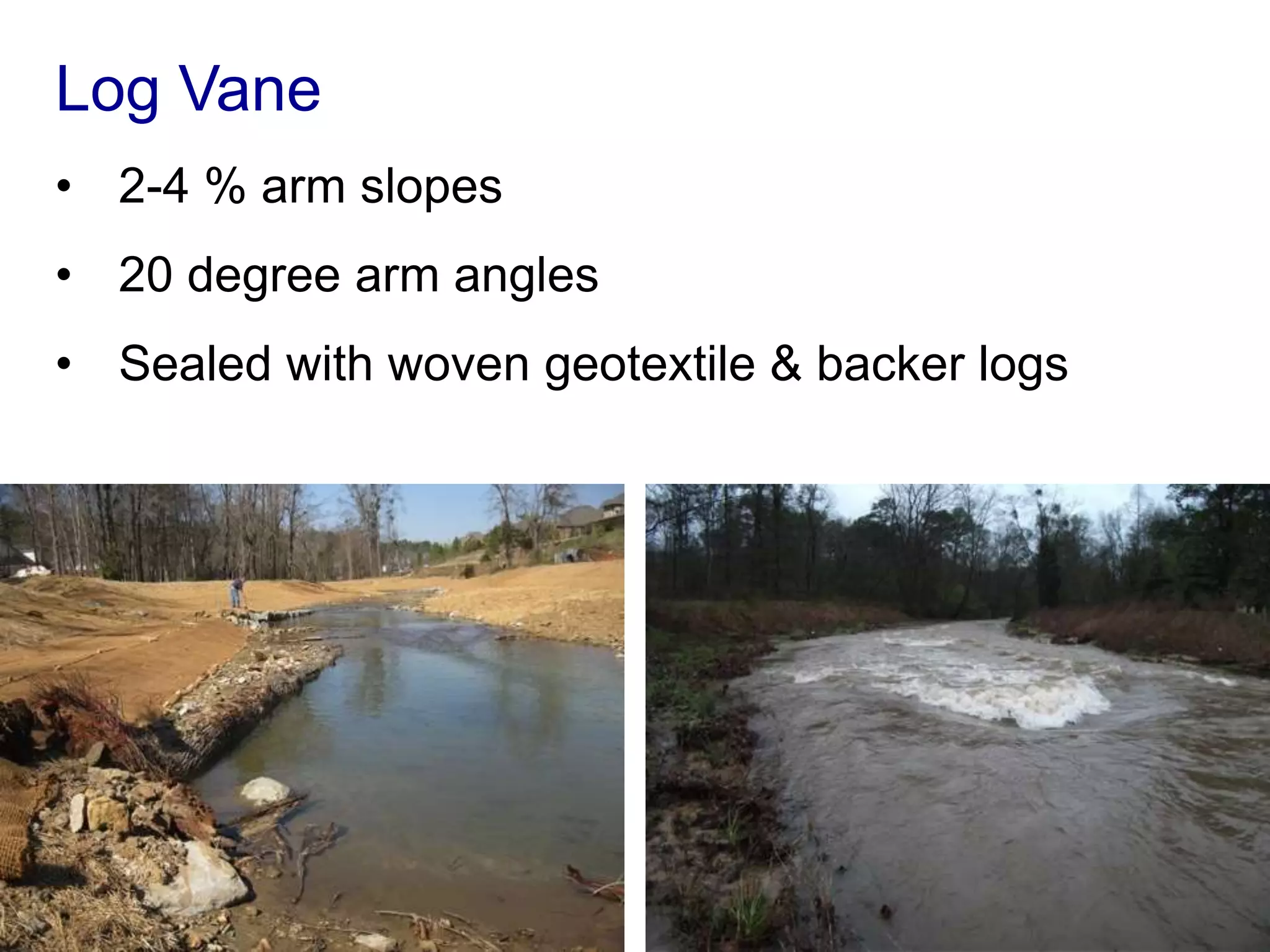
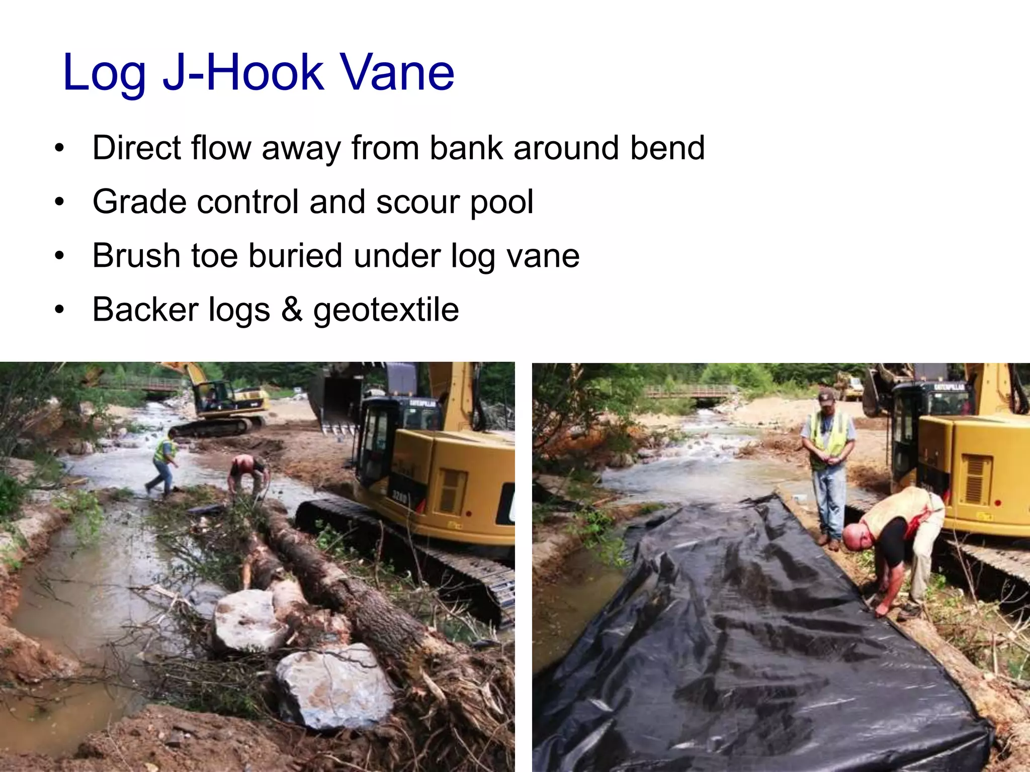
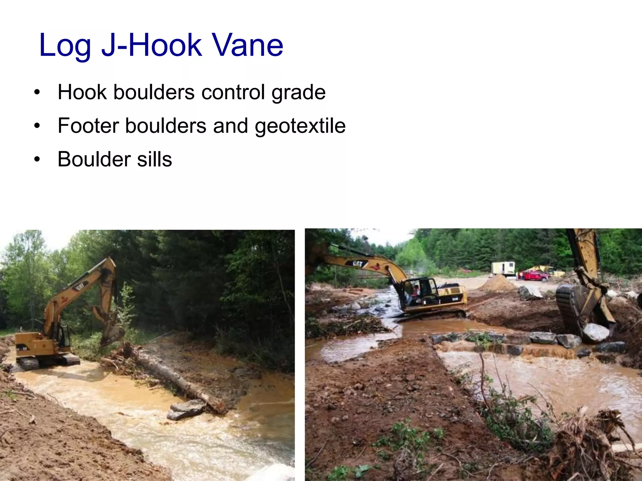
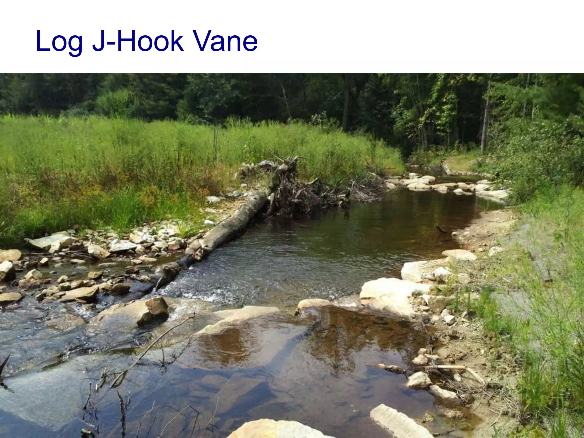
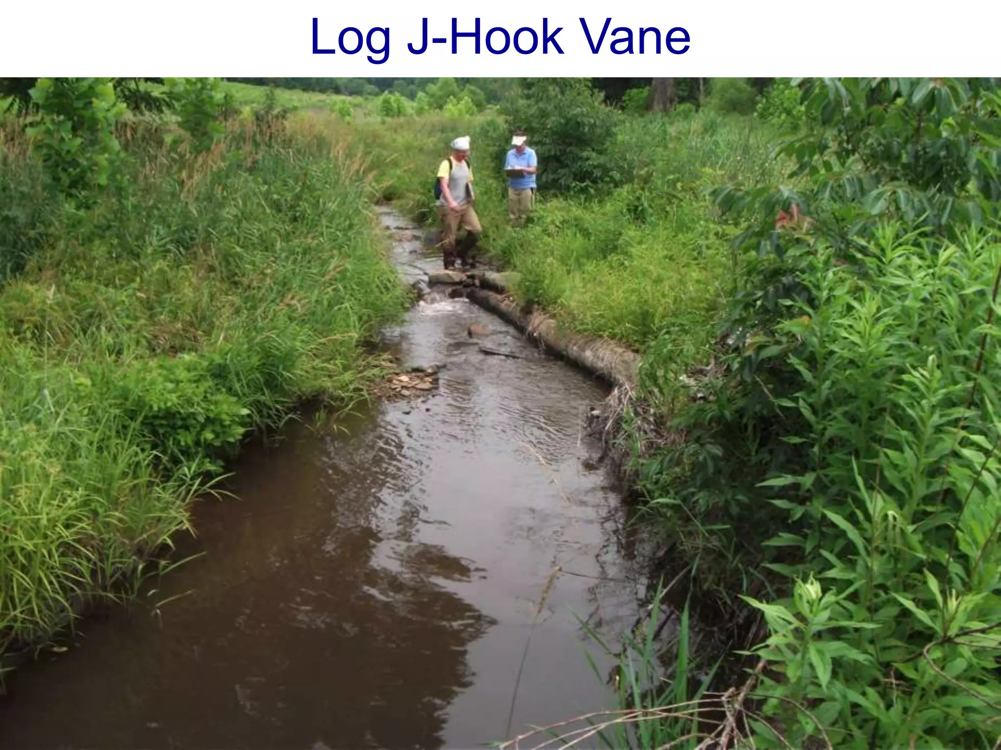
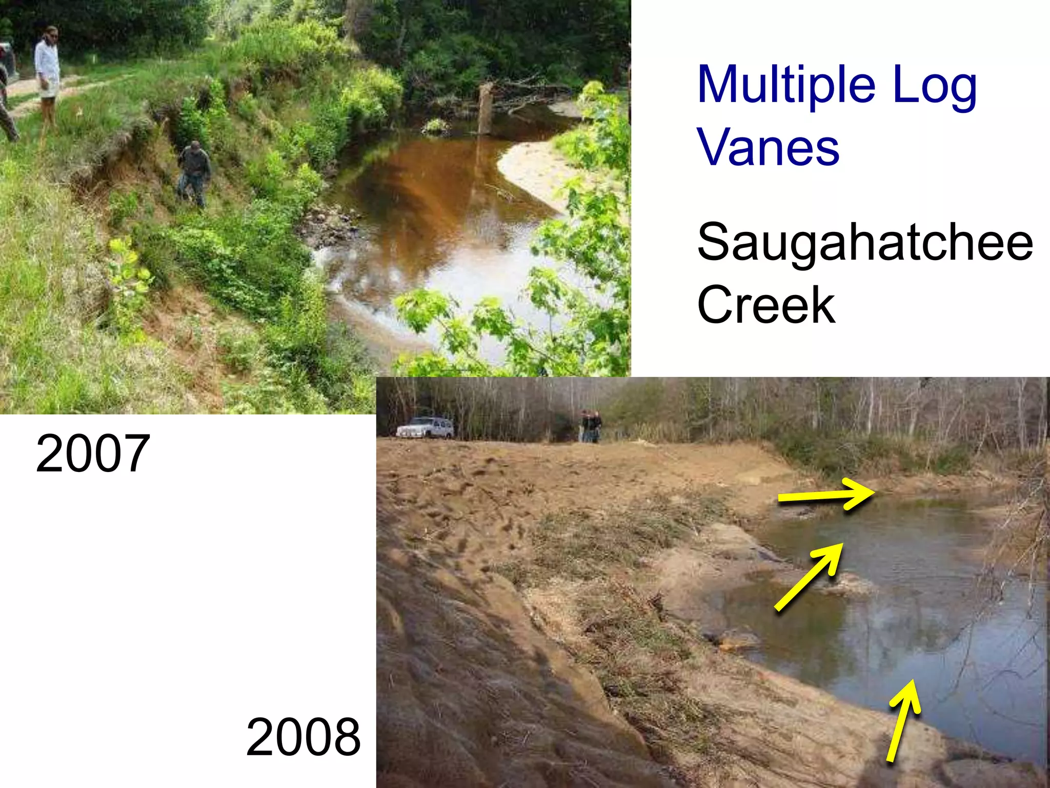
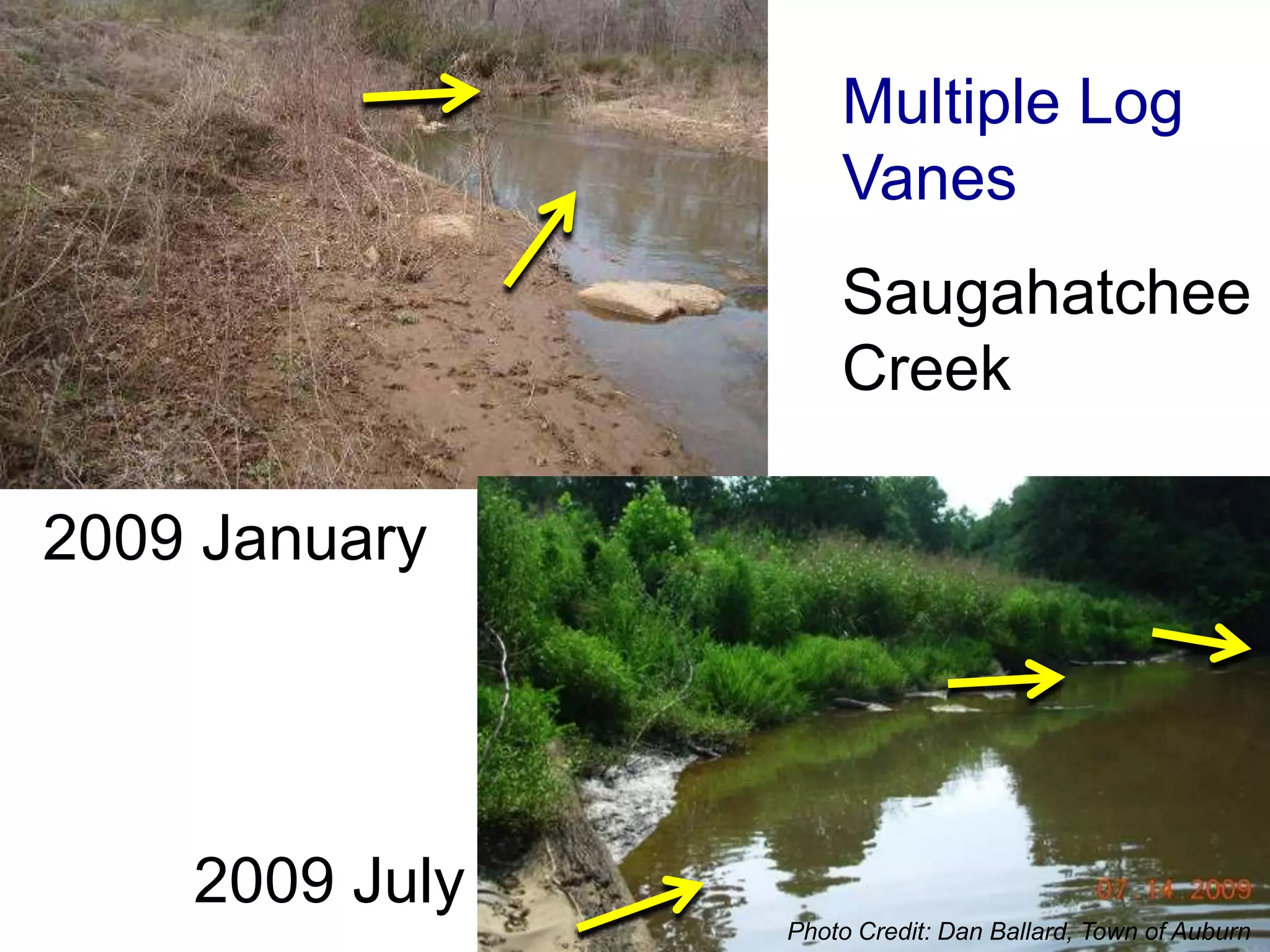
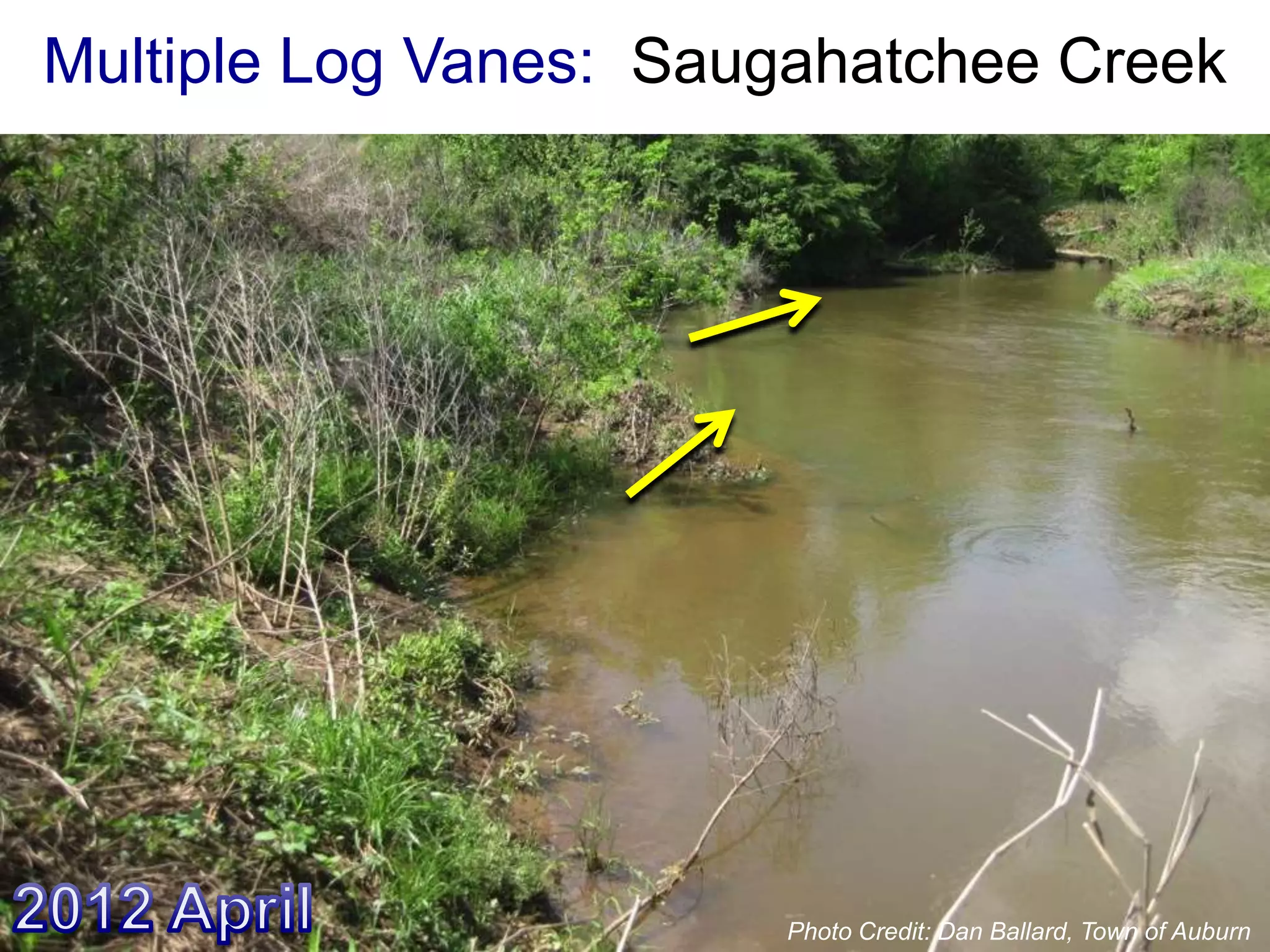
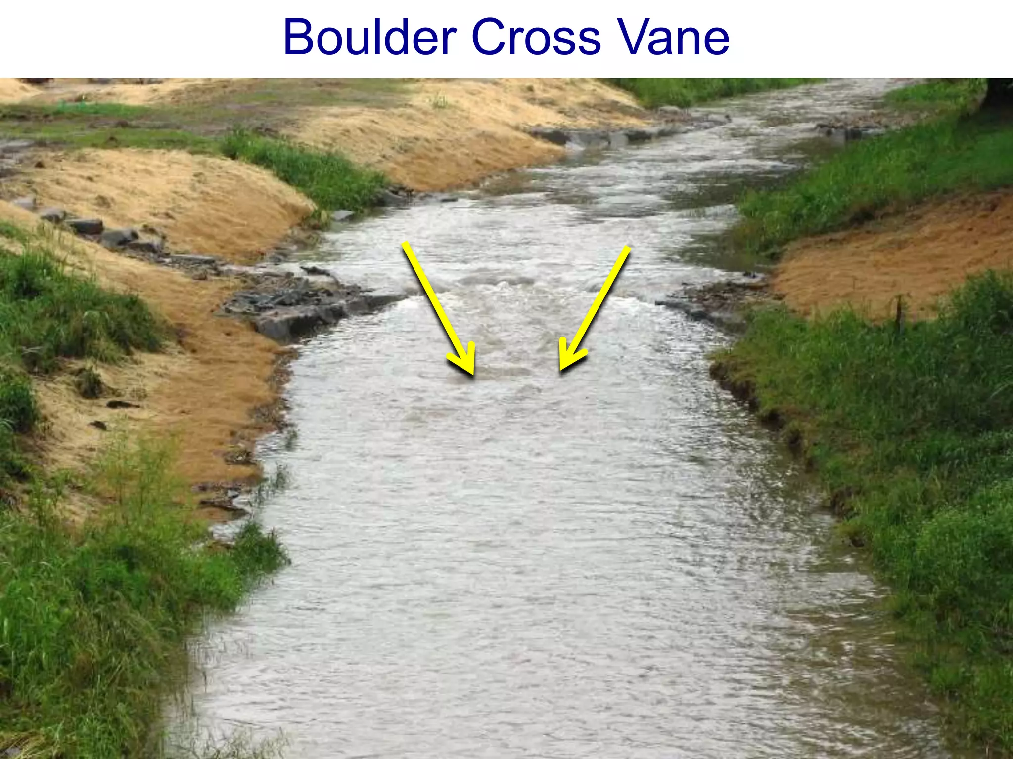
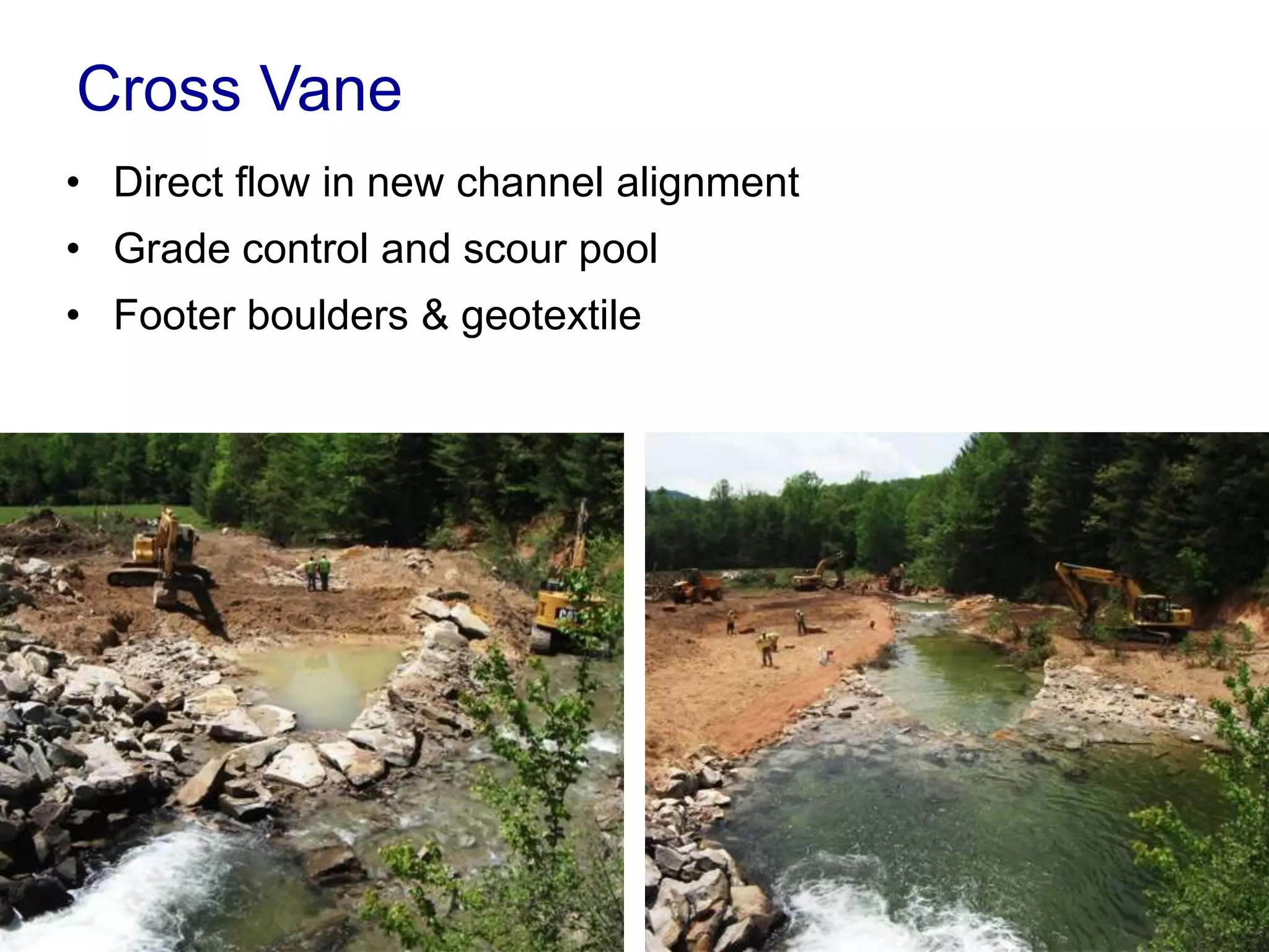
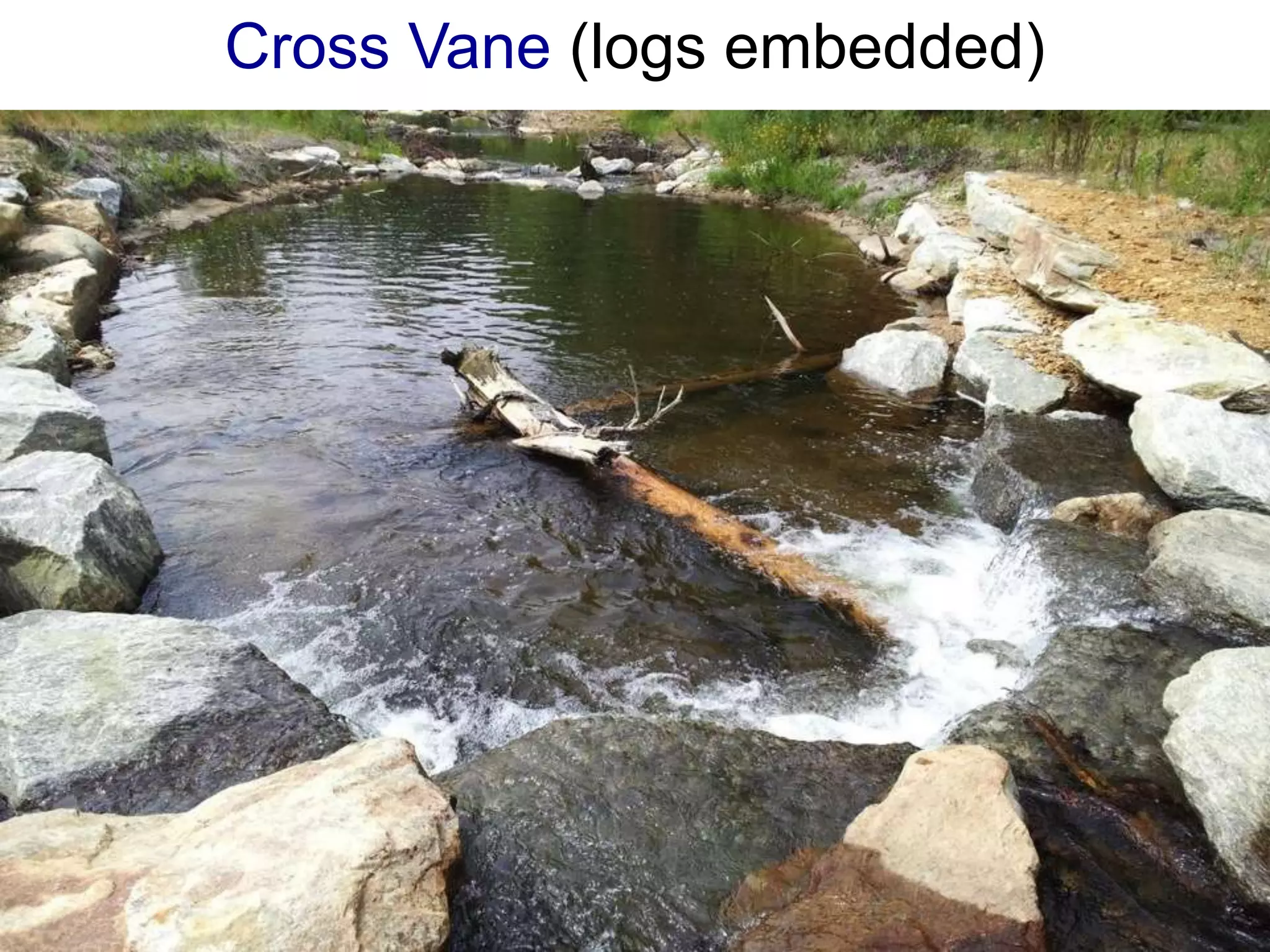
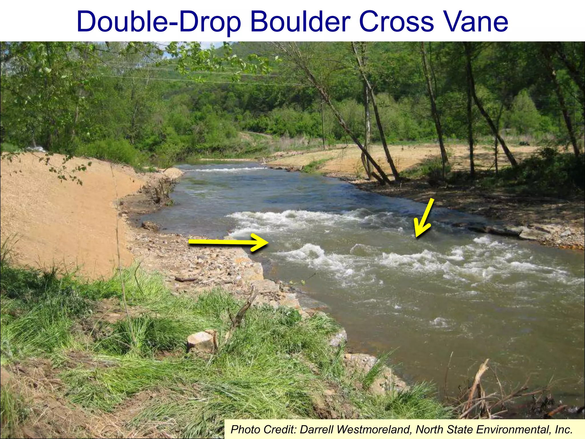
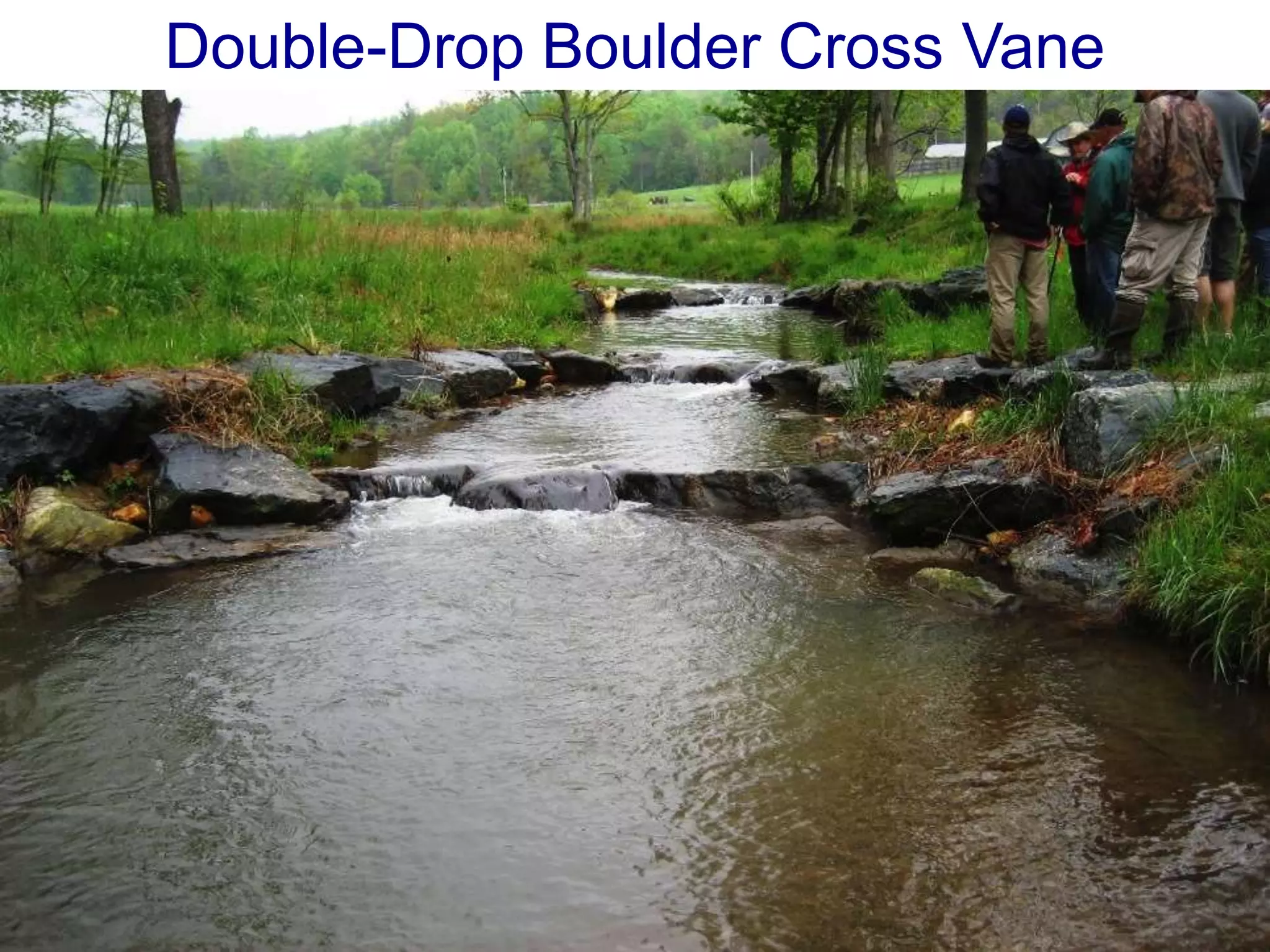
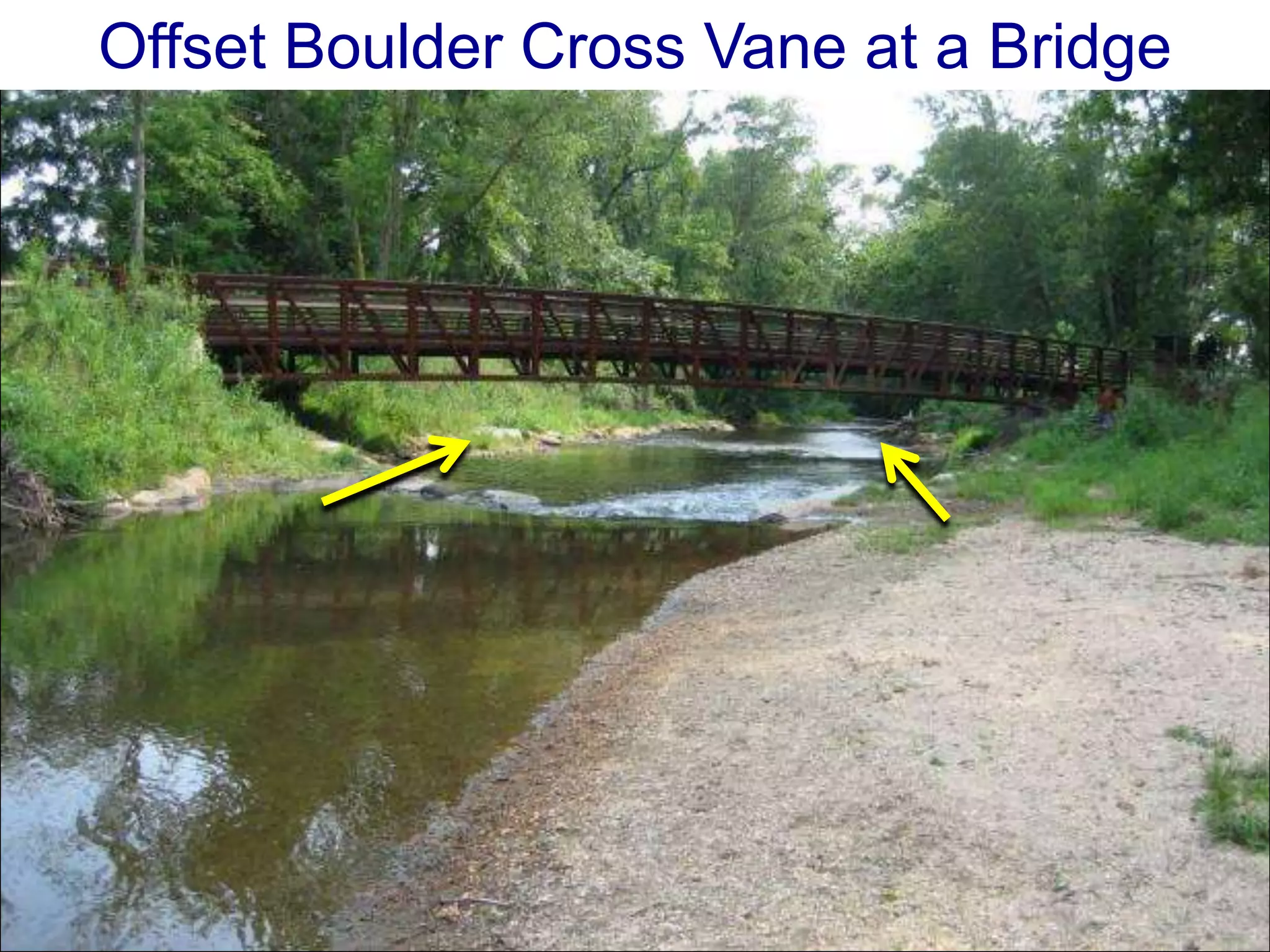
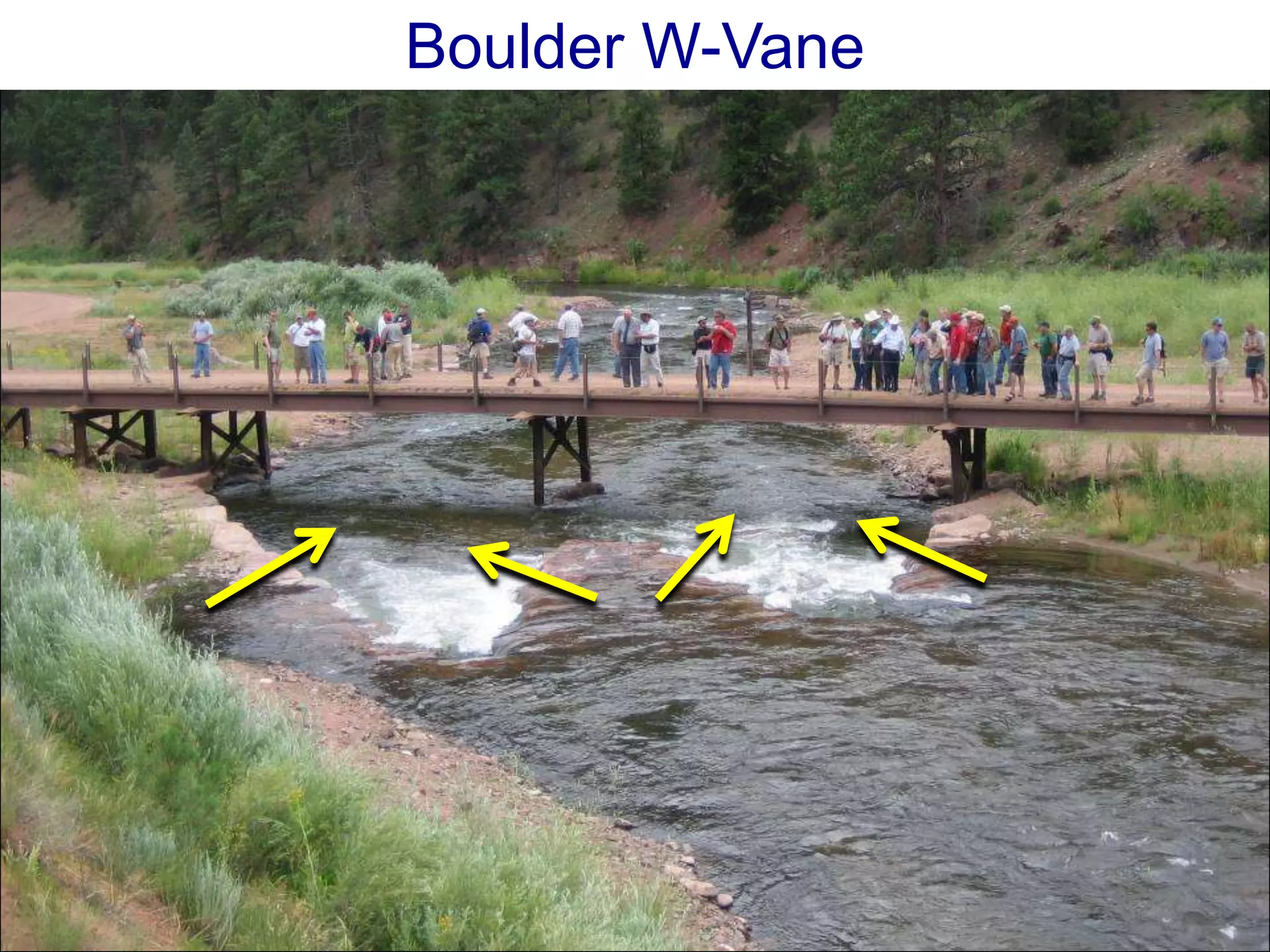
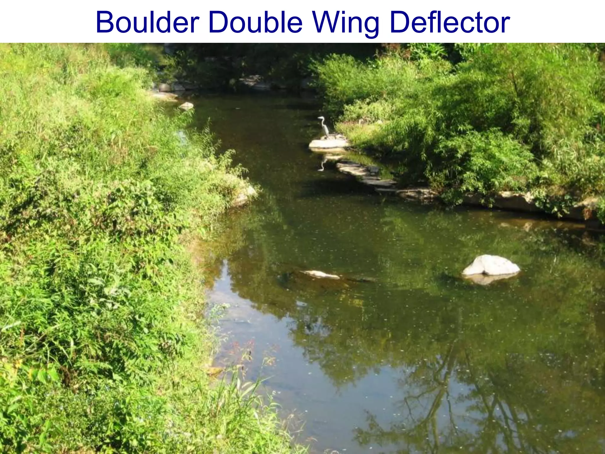
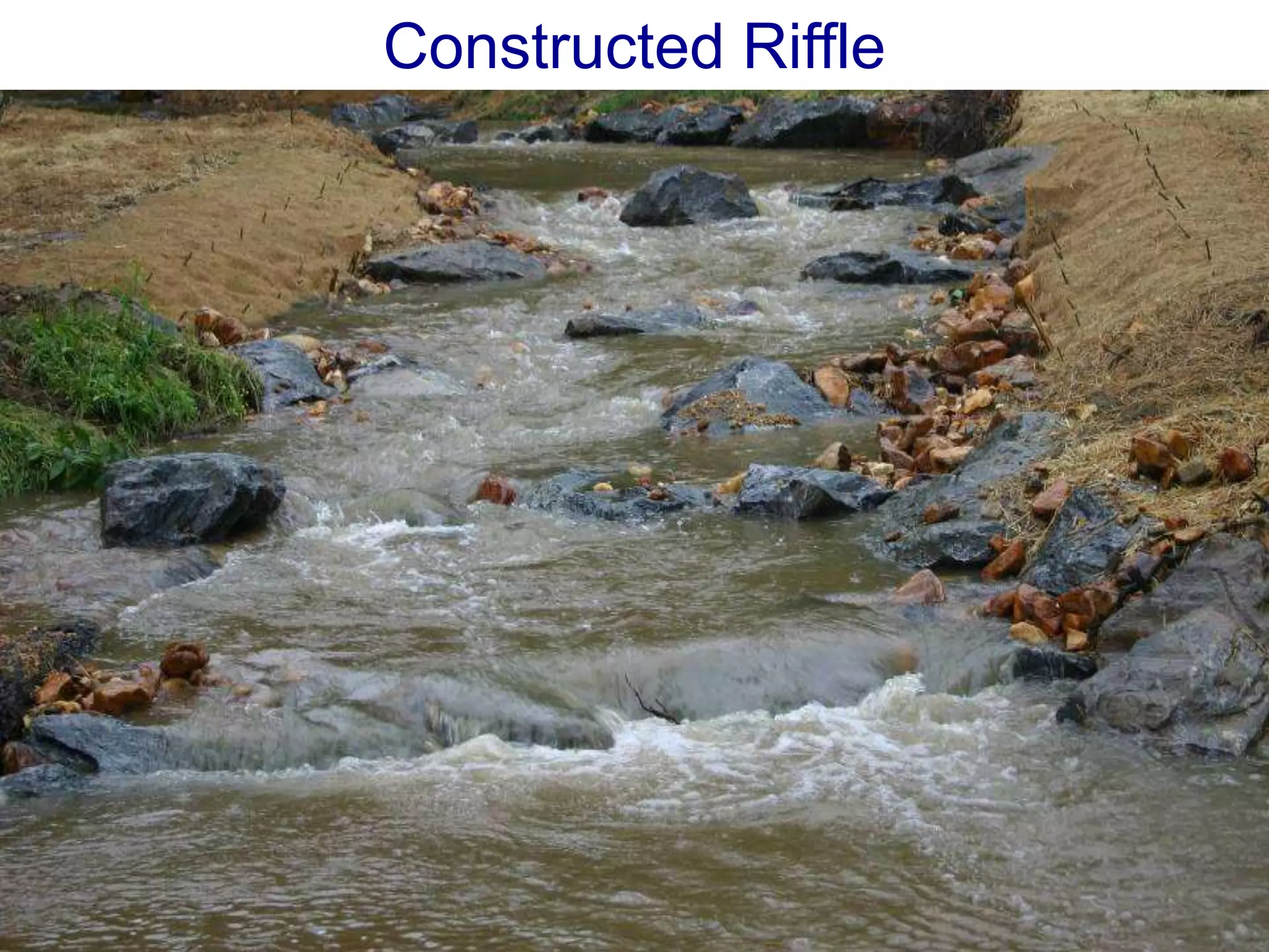
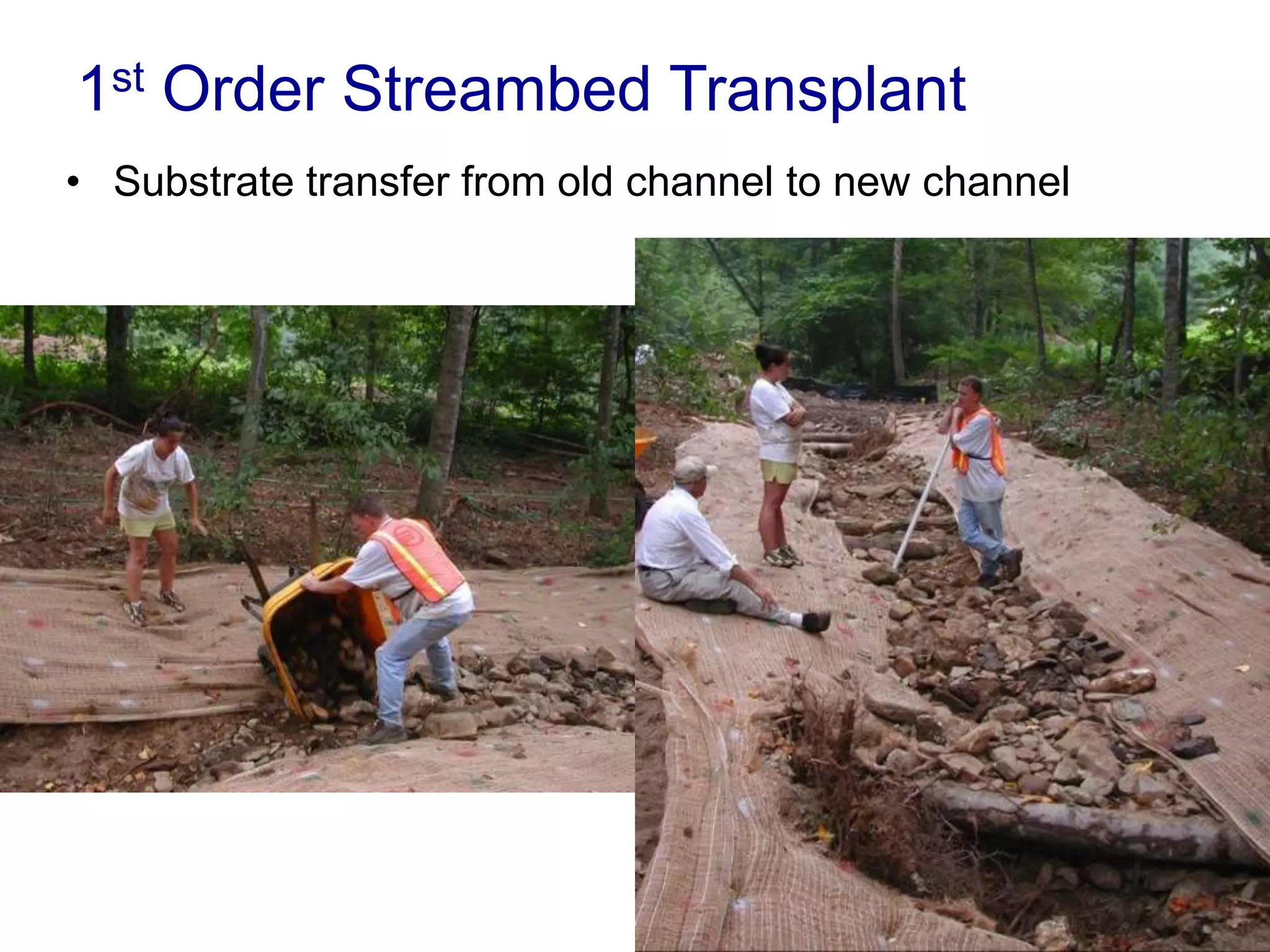
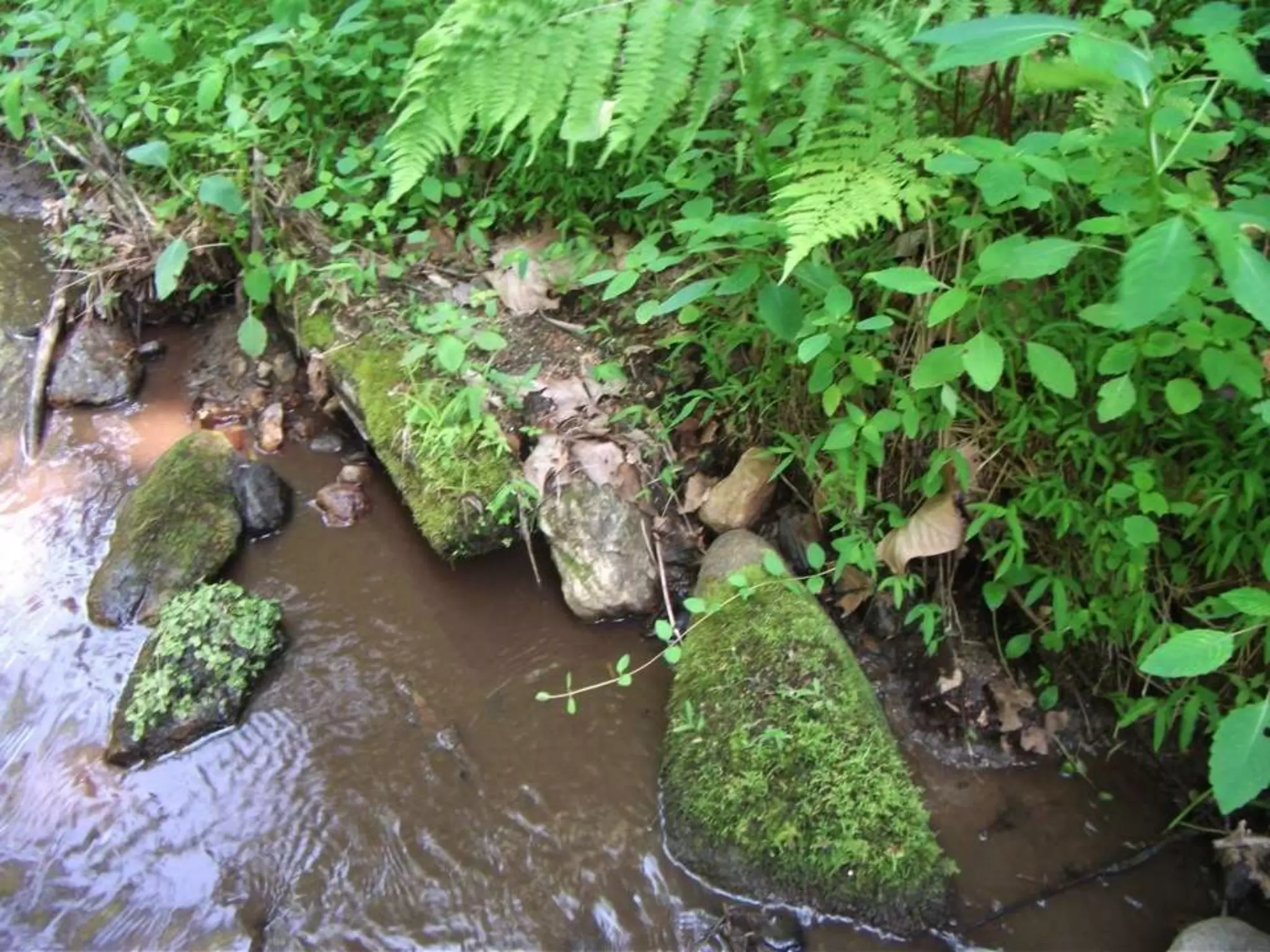
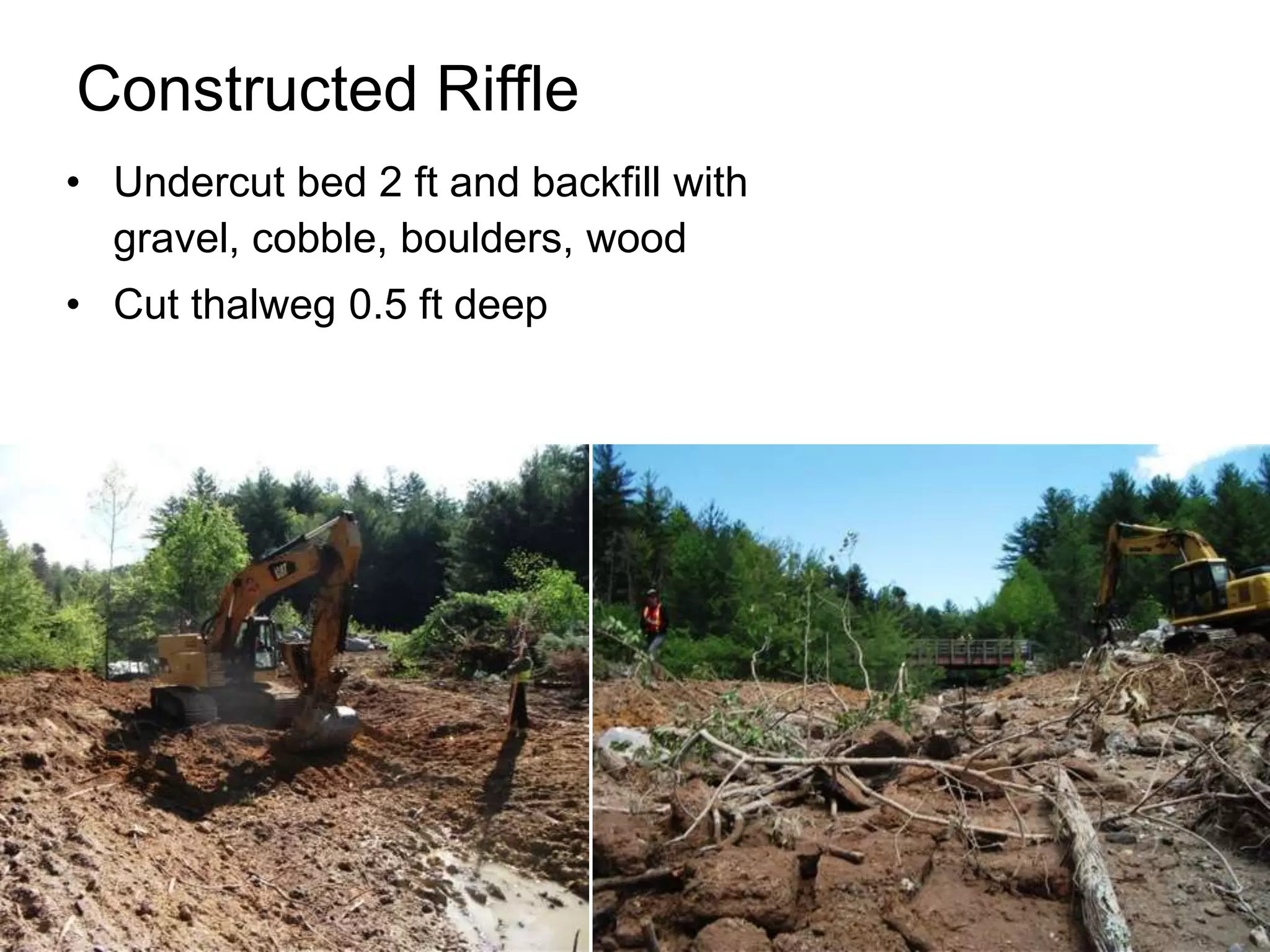
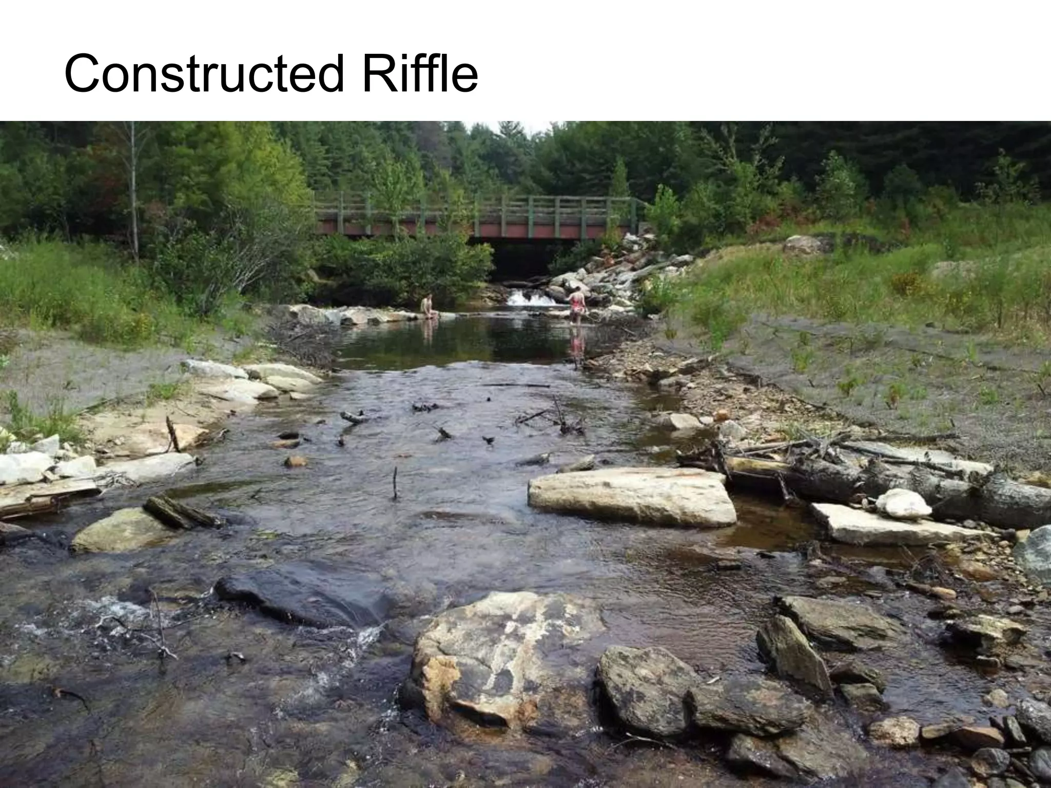
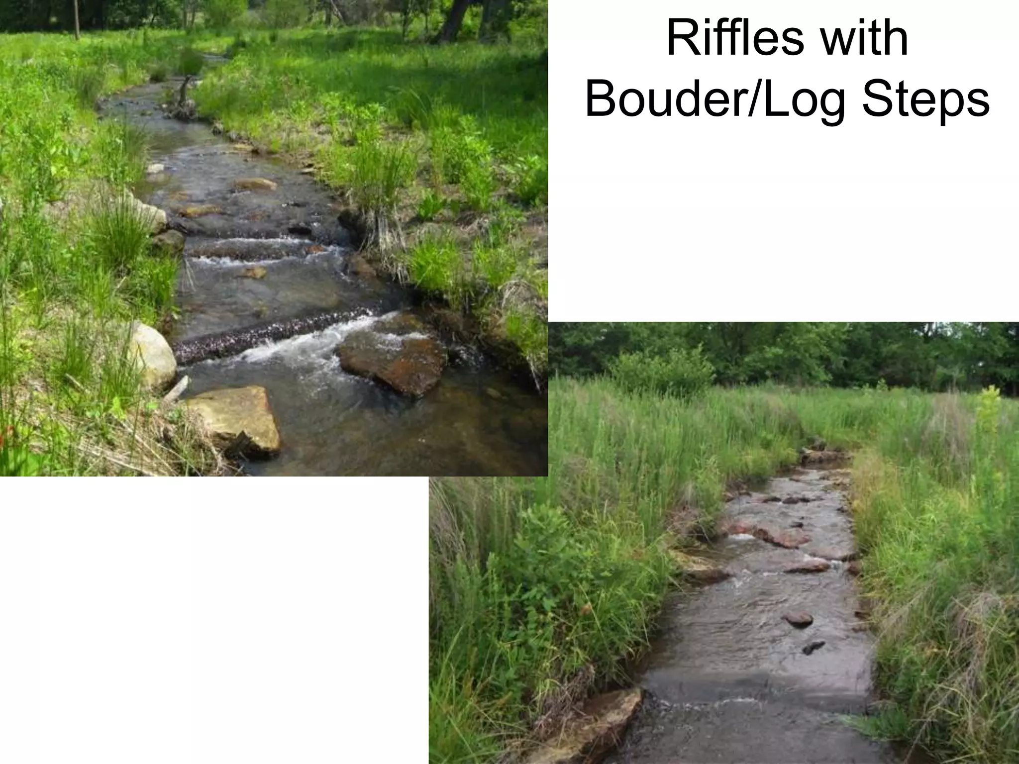
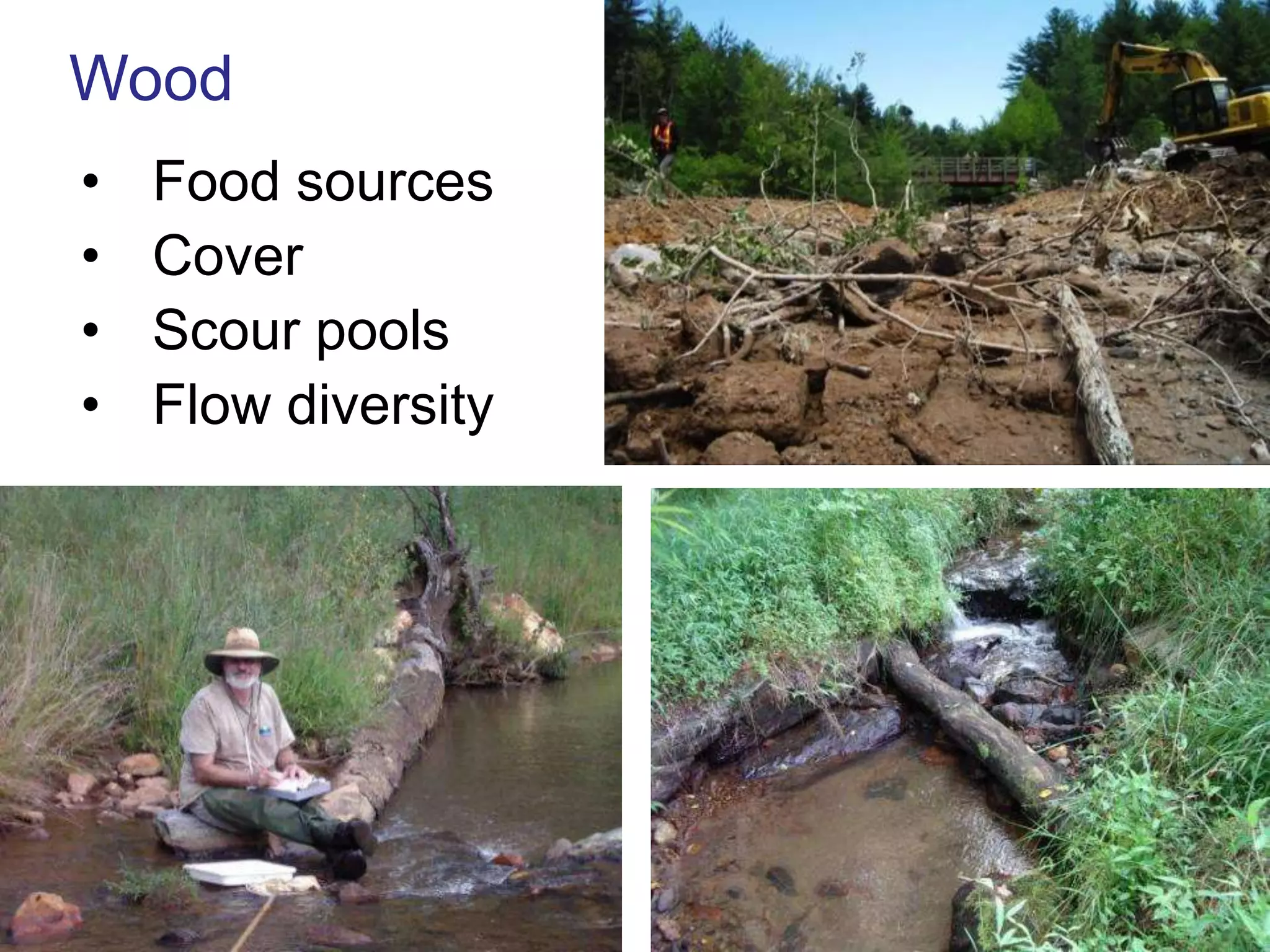
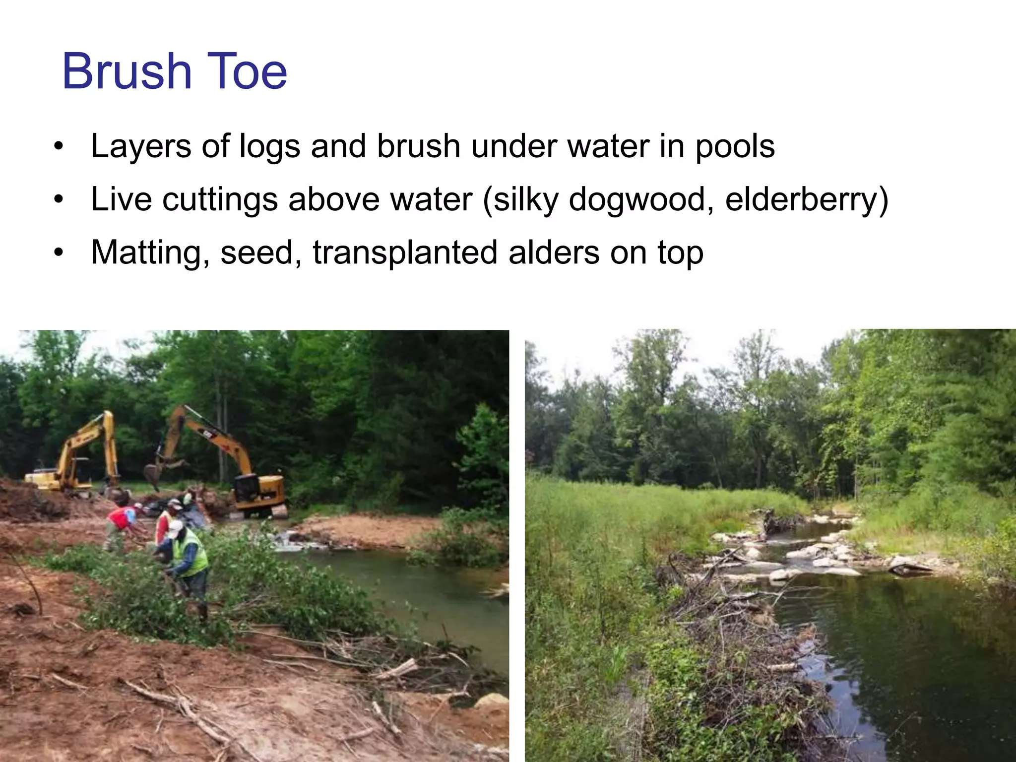
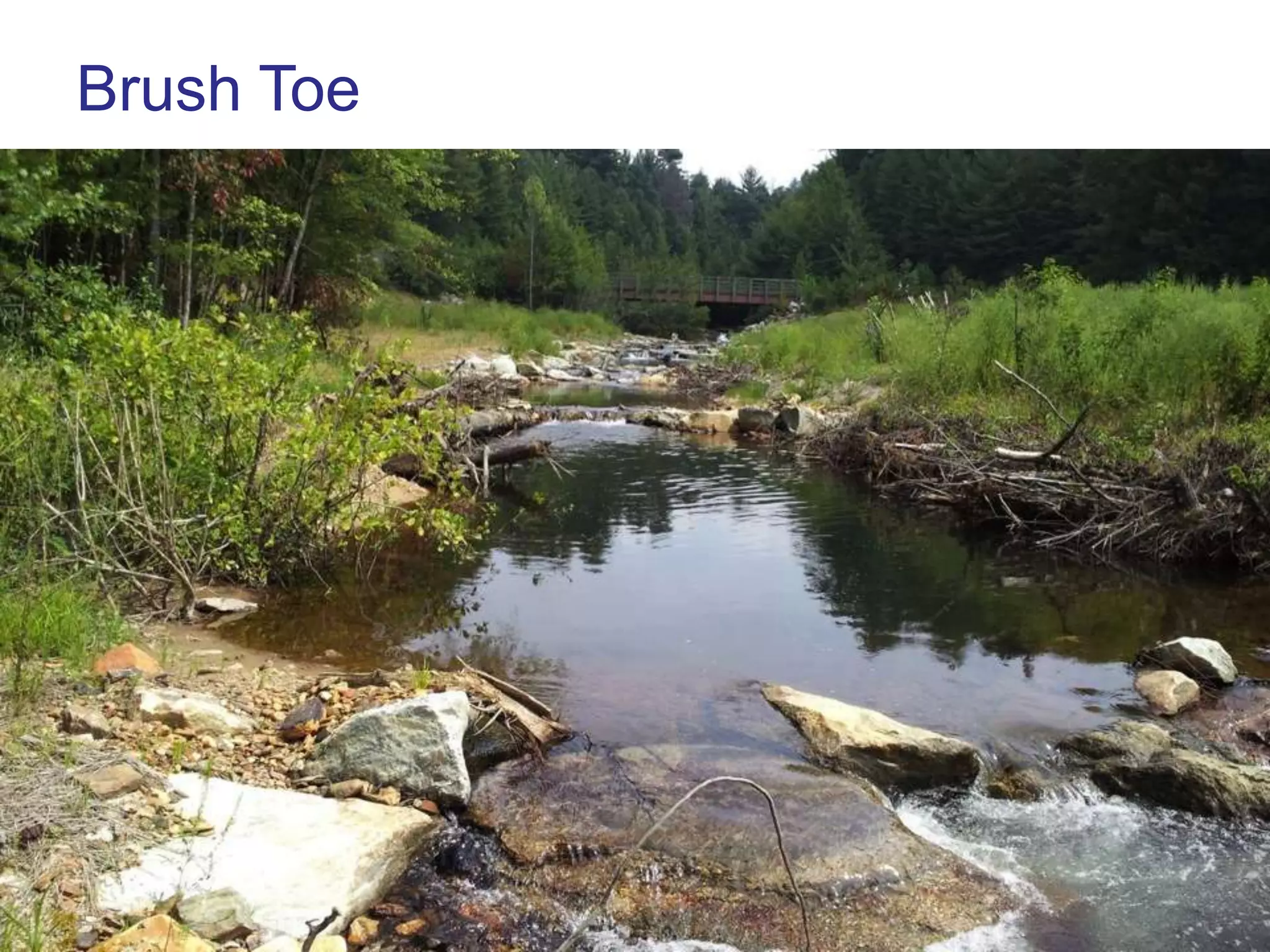
Understanding and Restoring Streams
Greg Jennings, PhD, PE
Professor, Biological & Agricultural Engineering
North Carolina State University
jennings@ncsu.edu
What is a Stream?
… a body of water with a current,
confined within a bed and
streambanks

Synonyms: bayou, beck, branch,
brook, burn, creek, crick, kill, lick,
rill, river, rivulet, run, slough, syke

A stream is:
• conduit in the water cycle
• critical habitat
• connected to a watershed
Fluvial Geomorphology:
The study of landforms and fluvial processes
Fluvial processes are associated with flowing
   water, including sediment
   erosion, transport, deposition
Fluvial Forms
•   Bar
•   Channel
•   Confluence
•   Cutoff channel
•   Delta
•   Floodplain
•   Gorge
•   Gully
•   Meander
•   Oxbow lake
•   Pool
•   Riffle
•   Stream
•   Valley
•   Waterfall
•   Watershed
Meandering Stream: Alluvial Forms
Riffle     Point Bar
          (deposition)


Glide              Run
          Pool
Bankfull
Bankfull Stage
      “corresponds to the discharge at which channel maintenance
      is the most effective, that is, the discharge at which moving
      sediment, forming or removing bars, forming or changing
      bends and meanders, and generally doing work results in the
      average morphologic characteristics” (Dunne and Leopold,1978)


Stream Corridor Restoration: Principles, Processes, and Practices. 1998. Federal Interagency Stream Restoration Working Group.
Stream Ecosystems
• Channel (bed & banks)
• Floodplain
• Water & Sediment
• Plants & Animals


                          Photo Credit: Eve Brantley, Auburn University
Stream Functions & Services
1. Transport water
2. Transport sediment
3. Habitat (aquatic & terrestrial)
4. Recreation & aesthetics
5. Safe Water Supply
Effects of Urbanization on Streams (US EPA)
Urban Stream Syndrome (USS)
•   Response to watershed changes
•   Loss of natural functions & values
•   Causes problems locally & downstream
•   Requires systematic assessment & treatment
Symptoms of USS
• Erosion & incision
• Water quality decline
• Habitat loss
• Ecosystem degradation
• Flooding
• Land loss
• Infrastructure damage
• Recreation impaired
• Aesthetics impaired
• Economic loss
Urban Stream: Incision & bank erosion
Causes of USS
• Watershed impervious
• Channelization
• Impoundments
• Diversions
• Floodplain filling
• Pollution discharges
• Sedimentation
• Stormwater runoff
• Utilities & culverts
• Buffer loss
• Neglect & Ignorance
Urban Disturbances to Hydrologic Cycle


                       University of Central Florida
Hydrograph Changes Due to Urbanization


                      Higher Peak Flow
      Urban           More Runoff Volume
                      Flashier Response
                      Lower Baseflow


                                Rural
Runoff: more
Infiltration: less
Flooding: more
Baseflow: less
Constraints: Utilities, Road, Bridges, Culverts
What Makes a Stream Healthy?
1. Bed stability & diversity
2. Sediment transport balance
3. In-stream habitat & flow diversity
4. Bank stability (native plant roots)
5. Riparian buffer (streamside forest)
6. Active floodplain
7. Healthy watershed
1. Bed Stability & Diversity
• Appropriate size sediments to
  resist shear stress
• Riffle/Pool sequences in
  alluvial streams
• Step/Pool sequences in high-
  gradient streams


                               Photo Credit: Eve Brantley, Auburn University
Riffles
•   Steep slope
•   High velocity & shear stress
•   Large substrate
•   High porosity & groundwater
    exchange


Pools
•   Flat slope
•   Low velocity & shear stress
•   Small substrate
•   Scour during high flow
Problems: Bed Stability & Diversity
• Headcut and excess scour
• Plane bed – filling of pools
• Armoring
2. Sediment Transport Balance
• Minor erosion & deposition
• Alluvial bars and benches
• Sufficient stream power to avoid aggradation
Problems: Sediment Transport Balance
• Excess stream power – eroding bed
• Insufficient stream power – aggradation
Streams convey water and sediment


Lane’s Balance (Lane, 1955)


                              Channel Evolution Model (Schumm, 1984)
3. In-stream Habitat
   & Flow Diversity

Macrohabitats: riffles,
 runs, pools, glides,
 steps, side channels,
 scour holes

Microhabitats: roots, leaf
  packs, wood, rocks,
  plants, hyporheic zone
Problems: In-stream Habitats
• Uniform flow – lack of diversity
• Lack of wood, leaves, roots
• Water quality – DO, nutrients, toxics
4. Bank Stability
• Dense native
  plant roots
• Low banks with
  low stress
Problems: Bank Stability
•   Loss of vegetation
• High, steep banks – channelization
5. Riparian Buffer (Streamside Forest)
• Diverse native plants
• Food and shade
Problems: Riparian Buffer
• Mowers and moo’ers
• Invasive plants
• Armoring and impervious surfaces
6. Active Floodplain
• Regular (every year) flooding to relieve stress
• Riparian wetlands
• Stormwater retention & treatment
Problems: Active Floodplain
•   Channel incision
• Floodplain fill and encroachment
7. Healthy Watershed
• Stormwater management
• Wastewater management
• Upstream sediment control
Problems: Healthy Watershed
• Stormwater energy and volume
• Point and nonpoint source pollution
• Erosion and sediment
Ecosystem Restoration:

“activities that initiate or accelerate the recovery of
ecosystem health, integrity, and sustainability”
(SER, 2004)
Planning a Stream Project:

•   Goals? Stability, Habitat, Recreation?
•   Constraints? Access, Land Availability, Utilities?
•   Feasibility? Will it Work?
•   Constructability? Equipment, Materials, Time/$?
Case Study: Long Creek (1995-2005)
•   Dairy Farm: Fencing, Bank Stabilization, Planting


                                                  10 years later
Roaring River, Stone Mt State Park (2000-10)
•   Trout Stream: Channel Realignment, Structures, Planting


                                                10 years later
Rocky Branch, NCSU Campus
•   Urban Stream: Channel Realignment, Structures, Planting
Restoration Components
 1. Channel morphology

 2. Floodplain structure

 3. Hydrologic & hydraulic
    analysis

 4. In-stream structures

 5. Habitats & vegetation

 6. Site & watershed conditions

 7. Monitoring, maintenance, educ
    ation
1. Channel Morphology
  • Dimension (baseflow, bankfull, flood flows)
  • Pattern (meandering, straight, braided)
  • Profile (bedform – riffle, run, pool, glide, step)


          Photo Credits: Darrell Westmoreland, North State Environmental, Inc.


2005               South Fork Mitchell River                                     2006
2011   South Fork Mitchell River
High-quality
“reference”
streams serve as
design templates
Bankfull Width, Wbkf = 9.3 ft; Bankfull Area, Abkf = 13.9 ft2
Mean Depth, dbkf = Abkf / Wbkf = 13.9 / 9.3 = 1.5 ft
Width to Depth Ratio, W/d = Wbkf / dbkf = 9.3 / 1.5 = 6.2
Morphologic Stream Classification Systems
• Schumm (1977)
  – Alluvial channels
  – Meandering, straight, braided
  – Type related to channel stability & sediment transport
• Montgomery & Buffington (1993)
  – Alluvial, colluvial, bedrock channels
  – Channel response related to sediment inputs
  – 6 classes of alluvial channels: cascade, step-
    pool, plane-bed, riffle-pool, regime, and braided
• Rosgen (1994)
  www.wildlandhydrology.com
Rosgen Classification of Natural Rivers
• Based on physical
  characteristics (empirical)
• Requires field
  measurements
• Requires bankfull
  dimensions


                                www.wildlandhydrology.com
www.wildlandhydrology.com
G4 Eastern NC
2000          2001


       2003   2003
2. Floodplain Structure
• Regular (every year) flooding to relieve stress
• Floodwater retention & riparian wetlands
• Stormwater discharge retention & treatment
Entrenchment Ratio
   ER = Wfpa / Wbkf
    Wfpa = Width of Flood Prone Area measured at the
    elevation twice bankfull max depth above thalweg
    Wbkf = Width of Bankfull Channel
                         Wfpa


                         Bankfull
  2 x dmbkf
                                       dmbkf
above thalweg

                                Wbkf
Priority 1: Raise channel to existing valley
     and construct new meandering channel

                                      ER = 15; W/d = 12


Rain will come during and
immediately following construction!

2006              Town Creek Tributary             2007
2008   Town Creek Tributary
Priority 1:
       lift channel


           Incised
           Stream


 Priority 2 & 3:
lower floodplain

Stream Corridor Restoration: Principles, Processes, and Practices.
1998. Federal Interagency Stream Restoration Working Group.
Priority 2: Excavate lower floodplain and
    construct new meandering channel

                                 ER = 6; W/d = 11


2008              White Slough               2010
Entrenchment Ratio = Wfpa / Wbkf = 90/15 = 6


                White Slough            2010
Priority 2: Excavate lower floodplain and
     construct new meandering channel


2004           NCSU Rocky Branch              2005
Rocky Branch Phase II Reach 2:
  Priority 2 (floodplain excavation, C channel)
 Entrenchment Ratio = Wfpa / Wbkf = 90/20 = 4.5


Flood water flows onto floodplain
several times each year
Priority 3: Excavate narrow floodplain
    benches in confined systems

                            ER = 2.2; W/d = 12


2005          NCSU Rocky Branch           2006
Rocky Branch Phase II Reach 1:
Priority 3 (floodplain excavation, Bc channel)
Entrenchment Ratio = Wfpa / Wbkf = 40/20 = 2
2008   NCSU Rocky Branch
Priority 3: Excavate narrow floodplain
    benches in confined systems

                             ER = 1.6; W/d = 15


2009          Little Shades Creek         2010
Entrenchment Ratio = Wfpa / Wbkf = 60/38 = 1.6
Little Shades Creek   2010
In-Stream Structures (Logs & Rocks)
•   Streambank protection
•   Habitat enhancement (pools, aeration, cover)
•   Grade control
•   Sediment transport
Structure Criteria:
•   Natural materials
•   Habitats & passage for aquatic organisms
•   Natural sediment transport (alluvial systems)

                             Do you like these?
Boulder J-Hook Vane
Runaway Truck Ramp
Boulder J-Hook Vane
• 3-5 % arm slopes
• 20-25 degree arm angles
• Boulder footers & non-woven geotextile
• 0.5 ft drops over j-hook inverts
Boulder Vane
                   20-25 degree angles
                   3-5 % arm slopes


20-25 degrees


3-5 % arm slopes
Boulder
J-Hook Vane
Log Vane
• 2-4 % arm slopes
• 20 degree arm angles
• Sealed with woven geotextile & backer logs
Log J-Hook Vane
• Direct flow away from bank around bend
• Grade control and scour pool
• Brush toe buried under log vane
• Backer logs & geotextile
Log J-Hook Vane
• Hook boulders control grade
• Footer boulders and geotextile
• Boulder sills
Log J-Hook Vane
• Hook boulders control grade
• Footer boulders and geotextile
• Boulder sills
Log J-Hook Vane
Multiple Log
              Vanes
              Saugahatchee
              Creek

2007


       2008
Multiple Log
                    Vanes
                    Saugahatchee
                    Creek

2009 January


    2009 July
                Photo Credit: Dan Ballard, Town of Auburn
Multiple Log Vanes: Saugahatchee Creek


                       Photo Credit: Dan Ballard, Town of Auburn
Boulder Cross Vane
Cross Vane
• Direct flow in new channel alignment
• Grade control and scour pool
• Footer boulders & geotextile
Cross Vane (logs embedded)

• Undercut bed 2 ft and backfill with
  gravel, cobble, boulders, wood
• Cut thalweg 0.5 ft deep
Double-Drop Boulder Cross Vane


          Photo Credit: Darrell Westmoreland, North State Environmental, Inc.
Double-Drop Boulder Cross Vane
Offset Boulder Cross Vane at a Bridge
Boulder W-Vane
Boulder Double Wing Deflector
Constructed Riffle
1st Order Streambed Transplant
• Substrate transfer from old channel to new channel
Constructed Riffle
• Undercut bed 2 ft and backfill with
  gravel, cobble, boulders, wood
• Cut thalweg 0.5 ft deep
Constructed Riffle
• Undercut bed 2 ft and backfill with
  gravel, cobble, boulders, wood
• Cut thalweg 0.5 ft deep
Riffles with
Bouder/Log Steps
Wood
•   Food sources
•   Cover
•   Scour pools
•   Flow diversity
Brush Toe
• Layers of logs and brush under water in pools
• Live cuttings above water (silky dogwood, elderberry)
• Matting, seed, transplanted alders on top
Brush Toe
• Layers of logs and brush under water in pools
• Live cuttings above water (silky dogwood, elderberry)
• Matting, seed, transplanted alders on top
Summary: Plan for Success
1. Plan for floods -- immediately & often
2. Plan for dry weather
3. Plan for vegetation maintenance
4. Understand constraints
5. Expect the Unexpected

Jennings tdec stream small

  • 1.
    Understanding and RestoringStreams Greg Jennings, PhD, PE Professor, Biological & Agricultural Engineering North Carolina State University jennings@ncsu.edu
  • 2.
    What is aStream? … a body of water with a current, confined within a bed and streambanks Synonyms: bayou, beck, branch, brook, burn, creek, crick, kill, lick, rill, river, rivulet, run, slough, syke A stream is: • conduit in the water cycle • critical habitat • connected to a watershed
  • 3.
    Fluvial Geomorphology: The studyof landforms and fluvial processes Fluvial processes are associated with flowing water, including sediment erosion, transport, deposition
  • 4.
    Fluvial Forms • Bar • Channel • Confluence • Cutoff channel • Delta • Floodplain • Gorge • Gully • Meander • Oxbow lake • Pool • Riffle • Stream • Valley • Waterfall • Watershed
  • 5.
    Meandering Stream: AlluvialForms Riffle Point Bar (deposition) Glide Run Pool
  • 6.
  • 7.
    Bankfull Stage “corresponds to the discharge at which channel maintenance is the most effective, that is, the discharge at which moving sediment, forming or removing bars, forming or changing bends and meanders, and generally doing work results in the average morphologic characteristics” (Dunne and Leopold,1978) Stream Corridor Restoration: Principles, Processes, and Practices. 1998. Federal Interagency Stream Restoration Working Group.
  • 9.
    Stream Ecosystems • Channel(bed & banks) • Floodplain • Water & Sediment • Plants & Animals Photo Credit: Eve Brantley, Auburn University
  • 10.
    Stream Functions &Services 1. Transport water 2. Transport sediment 3. Habitat (aquatic & terrestrial) 4. Recreation & aesthetics 5. Safe Water Supply
  • 11.
    Effects of Urbanizationon Streams (US EPA)
  • 12.
    Urban Stream Syndrome(USS) • Response to watershed changes • Loss of natural functions & values • Causes problems locally & downstream • Requires systematic assessment & treatment
  • 13.
    Symptoms of USS •Erosion & incision • Water quality decline • Habitat loss • Ecosystem degradation • Flooding • Land loss • Infrastructure damage • Recreation impaired • Aesthetics impaired • Economic loss
  • 14.
    Urban Stream: Incision& bank erosion
  • 15.
    Causes of USS •Watershed impervious • Channelization • Impoundments • Diversions • Floodplain filling • Pollution discharges • Sedimentation • Stormwater runoff • Utilities & culverts • Buffer loss • Neglect & Ignorance
  • 16.
    Urban Disturbances toHydrologic Cycle University of Central Florida
  • 17.
    Hydrograph Changes Dueto Urbanization Higher Peak Flow Urban More Runoff Volume Flashier Response Lower Baseflow Rural
  • 18.
  • 19.
  • 20.
    What Makes aStream Healthy? 1. Bed stability & diversity 2. Sediment transport balance 3. In-stream habitat & flow diversity 4. Bank stability (native plant roots) 5. Riparian buffer (streamside forest) 6. Active floodplain 7. Healthy watershed
  • 21.
    1. Bed Stability& Diversity • Appropriate size sediments to resist shear stress • Riffle/Pool sequences in alluvial streams • Step/Pool sequences in high- gradient streams Photo Credit: Eve Brantley, Auburn University
  • 22.
    Riffles • Steep slope • High velocity & shear stress • Large substrate • High porosity & groundwater exchange Pools • Flat slope • Low velocity & shear stress • Small substrate • Scour during high flow
  • 23.
    Problems: Bed Stability& Diversity • Headcut and excess scour • Plane bed – filling of pools • Armoring
  • 24.
    2. Sediment TransportBalance • Minor erosion & deposition • Alluvial bars and benches • Sufficient stream power to avoid aggradation
  • 25.
    Problems: Sediment TransportBalance • Excess stream power – eroding bed • Insufficient stream power – aggradation
  • 26.
    Streams convey waterand sediment Lane’s Balance (Lane, 1955) Channel Evolution Model (Schumm, 1984)
  • 27.
    3. In-stream Habitat & Flow Diversity Macrohabitats: riffles, runs, pools, glides, steps, side channels, scour holes Microhabitats: roots, leaf packs, wood, rocks, plants, hyporheic zone
  • 28.
    Problems: In-stream Habitats •Uniform flow – lack of diversity • Lack of wood, leaves, roots • Water quality – DO, nutrients, toxics
  • 29.
    4. Bank Stability •Dense native plant roots • Low banks with low stress
  • 30.
    Problems: Bank Stability • Loss of vegetation • High, steep banks – channelization
  • 31.
    5. Riparian Buffer(Streamside Forest) • Diverse native plants • Food and shade
  • 32.
    Problems: Riparian Buffer •Mowers and moo’ers • Invasive plants • Armoring and impervious surfaces
  • 33.
    6. Active Floodplain •Regular (every year) flooding to relieve stress • Riparian wetlands • Stormwater retention & treatment
  • 34.
    Problems: Active Floodplain • Channel incision • Floodplain fill and encroachment
  • 35.
    7. Healthy Watershed •Stormwater management • Wastewater management • Upstream sediment control
  • 36.
    Problems: Healthy Watershed •Stormwater energy and volume • Point and nonpoint source pollution • Erosion and sediment
  • 37.
    Ecosystem Restoration: “activities thatinitiate or accelerate the recovery of ecosystem health, integrity, and sustainability” (SER, 2004)
  • 38.
    Planning a StreamProject: • Goals? Stability, Habitat, Recreation? • Constraints? Access, Land Availability, Utilities? • Feasibility? Will it Work? • Constructability? Equipment, Materials, Time/$?
  • 39.
    Case Study: LongCreek (1995-2005) • Dairy Farm: Fencing, Bank Stabilization, Planting 10 years later
  • 40.
    Roaring River, StoneMt State Park (2000-10) • Trout Stream: Channel Realignment, Structures, Planting 10 years later
  • 41.
    Rocky Branch, NCSUCampus • Urban Stream: Channel Realignment, Structures, Planting
  • 42.
    Restoration Components 1.Channel morphology 2. Floodplain structure 3. Hydrologic & hydraulic analysis 4. In-stream structures 5. Habitats & vegetation 6. Site & watershed conditions 7. Monitoring, maintenance, educ ation
  • 43.
    1. Channel Morphology • Dimension (baseflow, bankfull, flood flows) • Pattern (meandering, straight, braided) • Profile (bedform – riffle, run, pool, glide, step) Photo Credits: Darrell Westmoreland, North State Environmental, Inc. 2005 South Fork Mitchell River 2006
  • 44.
    2011 South Fork Mitchell River
  • 45.
    2011 South Fork Mitchell River
  • 46.
  • 47.
    Bankfull Width, Wbkf= 9.3 ft; Bankfull Area, Abkf = 13.9 ft2 Mean Depth, dbkf = Abkf / Wbkf = 13.9 / 9.3 = 1.5 ft Width to Depth Ratio, W/d = Wbkf / dbkf = 9.3 / 1.5 = 6.2
  • 48.
    Morphologic Stream ClassificationSystems • Schumm (1977) – Alluvial channels – Meandering, straight, braided – Type related to channel stability & sediment transport • Montgomery & Buffington (1993) – Alluvial, colluvial, bedrock channels – Channel response related to sediment inputs – 6 classes of alluvial channels: cascade, step- pool, plane-bed, riffle-pool, regime, and braided • Rosgen (1994) www.wildlandhydrology.com
  • 49.
    Rosgen Classification ofNatural Rivers • Based on physical characteristics (empirical) • Requires field measurements • Requires bankfull dimensions www.wildlandhydrology.com
  • 50.
  • 51.
  • 52.
    2000 2001 2003 2003
  • 54.
    2. Floodplain Structure •Regular (every year) flooding to relieve stress • Floodwater retention & riparian wetlands • Stormwater discharge retention & treatment
  • 55.
    Entrenchment Ratio ER = Wfpa / Wbkf Wfpa = Width of Flood Prone Area measured at the elevation twice bankfull max depth above thalweg Wbkf = Width of Bankfull Channel Wfpa Bankfull 2 x dmbkf dmbkf above thalweg Wbkf
  • 56.
    Priority 1: Raisechannel to existing valley and construct new meandering channel ER = 15; W/d = 12 Rain will come during and immediately following construction! 2006 Town Creek Tributary 2007
  • 57.
    2008 Town Creek Tributary
  • 58.
    Priority 1: lift channel Incised Stream Priority 2 & 3: lower floodplain Stream Corridor Restoration: Principles, Processes, and Practices. 1998. Federal Interagency Stream Restoration Working Group.
  • 59.
    Priority 2: Excavatelower floodplain and construct new meandering channel ER = 6; W/d = 11 2008 White Slough 2010
  • 60.
    Entrenchment Ratio =Wfpa / Wbkf = 90/15 = 6 White Slough 2010
  • 61.
    Priority 2: Excavatelower floodplain and construct new meandering channel 2004 NCSU Rocky Branch 2005
  • 62.
    Rocky Branch PhaseII Reach 2: Priority 2 (floodplain excavation, C channel) Entrenchment Ratio = Wfpa / Wbkf = 90/20 = 4.5 Flood water flows onto floodplain several times each year
  • 63.
    Priority 3: Excavatenarrow floodplain benches in confined systems ER = 2.2; W/d = 12 2005 NCSU Rocky Branch 2006
  • 64.
    Rocky Branch PhaseII Reach 1: Priority 3 (floodplain excavation, Bc channel) Entrenchment Ratio = Wfpa / Wbkf = 40/20 = 2
  • 65.
    2008 NCSU Rocky Branch
  • 66.
    Priority 3: Excavatenarrow floodplain benches in confined systems ER = 1.6; W/d = 15 2009 Little Shades Creek 2010
  • 67.
    Entrenchment Ratio =Wfpa / Wbkf = 60/38 = 1.6
  • 68.
  • 69.
    In-Stream Structures (Logs& Rocks) • Streambank protection • Habitat enhancement (pools, aeration, cover) • Grade control • Sediment transport
  • 70.
    Structure Criteria: • Natural materials • Habitats & passage for aquatic organisms • Natural sediment transport (alluvial systems) Do you like these?
  • 71.
  • 72.
  • 73.
    Boulder J-Hook Vane •3-5 % arm slopes • 20-25 degree arm angles • Boulder footers & non-woven geotextile • 0.5 ft drops over j-hook inverts
  • 74.
    Boulder Vane 20-25 degree angles 3-5 % arm slopes 20-25 degrees 3-5 % arm slopes
  • 75.
  • 76.
    Log Vane • 2-4% arm slopes • 20 degree arm angles • Sealed with woven geotextile & backer logs
  • 77.
    Log J-Hook Vane •Direct flow away from bank around bend • Grade control and scour pool • Brush toe buried under log vane • Backer logs & geotextile
  • 78.
    Log J-Hook Vane •Hook boulders control grade • Footer boulders and geotextile • Boulder sills
  • 79.
    Log J-Hook Vane •Hook boulders control grade • Footer boulders and geotextile • Boulder sills
  • 80.
  • 81.
    Multiple Log Vanes Saugahatchee Creek 2007 2008
  • 82.
    Multiple Log Vanes Saugahatchee Creek 2009 January 2009 July Photo Credit: Dan Ballard, Town of Auburn
  • 83.
    Multiple Log Vanes:Saugahatchee Creek Photo Credit: Dan Ballard, Town of Auburn
  • 84.
  • 85.
    Cross Vane • Directflow in new channel alignment • Grade control and scour pool • Footer boulders & geotextile
  • 86.
    Cross Vane (logsembedded) • Undercut bed 2 ft and backfill with gravel, cobble, boulders, wood • Cut thalweg 0.5 ft deep
  • 87.
    Double-Drop Boulder CrossVane Photo Credit: Darrell Westmoreland, North State Environmental, Inc.
  • 88.
  • 89.
    Offset Boulder CrossVane at a Bridge
  • 90.
  • 91.
  • 92.
  • 93.
    1st Order StreambedTransplant • Substrate transfer from old channel to new channel
  • 95.
    Constructed Riffle • Undercutbed 2 ft and backfill with gravel, cobble, boulders, wood • Cut thalweg 0.5 ft deep
  • 96.
    Constructed Riffle • Undercutbed 2 ft and backfill with gravel, cobble, boulders, wood • Cut thalweg 0.5 ft deep
  • 97.
  • 98.
    Wood • Food sources • Cover • Scour pools • Flow diversity
  • 99.
    Brush Toe • Layersof logs and brush under water in pools • Live cuttings above water (silky dogwood, elderberry) • Matting, seed, transplanted alders on top
  • 100.
    Brush Toe • Layersof logs and brush under water in pools • Live cuttings above water (silky dogwood, elderberry) • Matting, seed, transplanted alders on top
  • 101.
    Summary: Plan forSuccess 1. Plan for floods -- immediately & often 2. Plan for dry weather 3. Plan for vegetation maintenance 4. Understand constraints 5. Expect the Unexpected