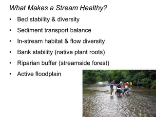
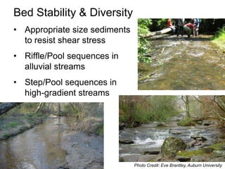
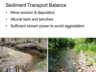
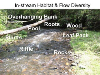
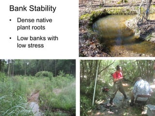
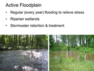
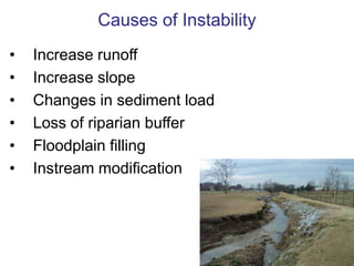
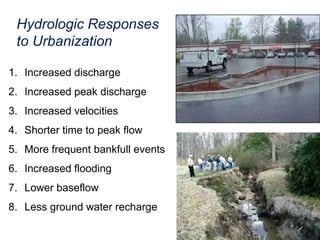
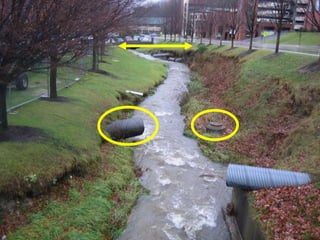
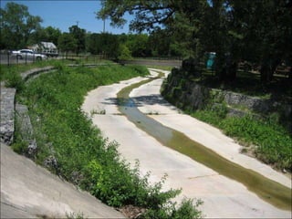
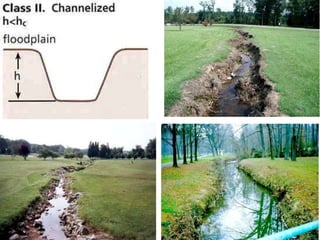
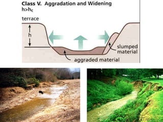
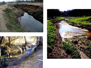
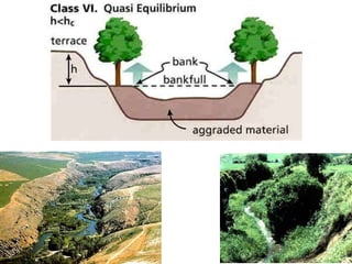
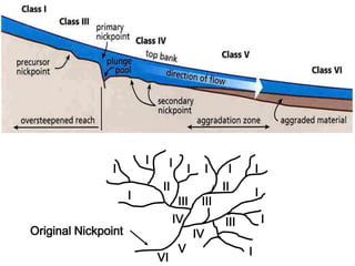
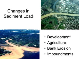
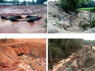
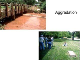
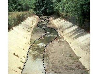
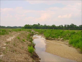
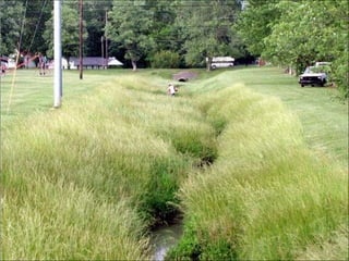
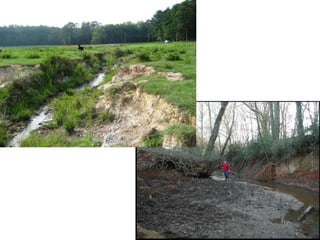
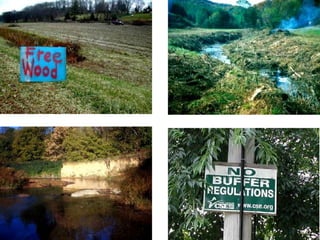
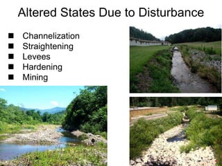
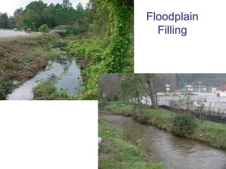
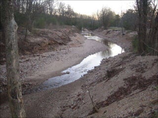
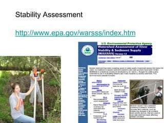
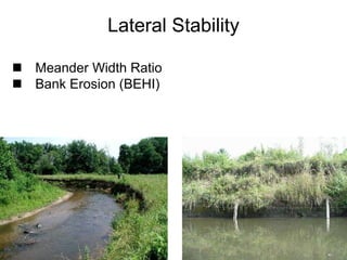
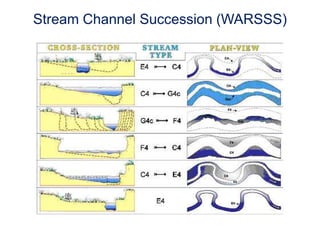
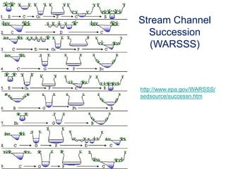
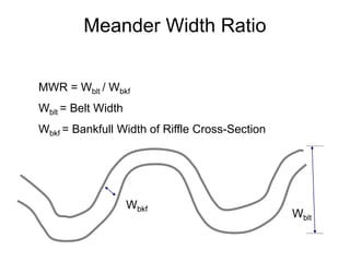
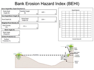
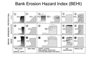
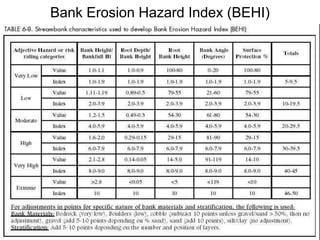
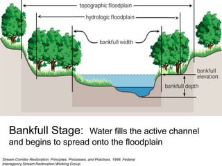
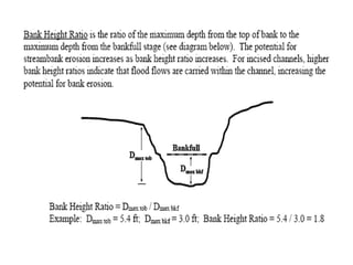
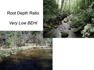
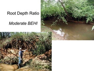
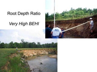
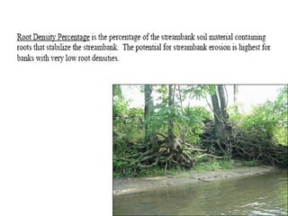
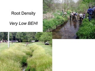
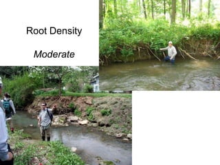
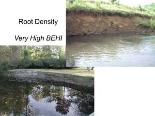
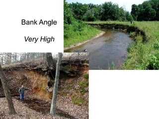
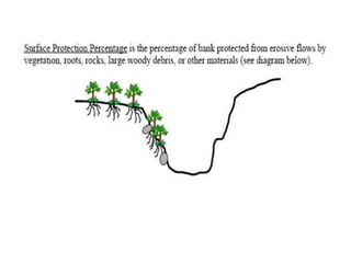
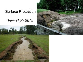
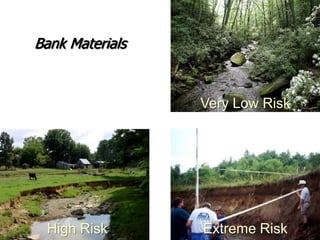
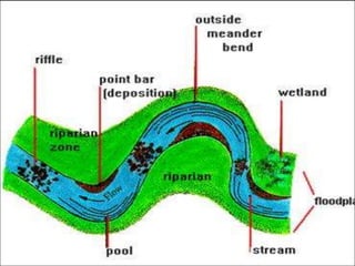
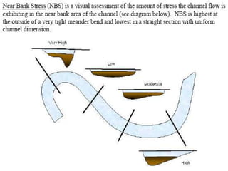
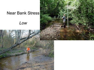
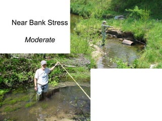
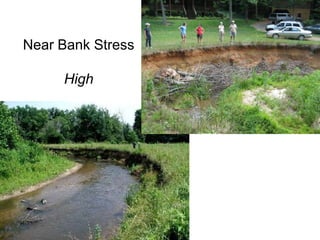
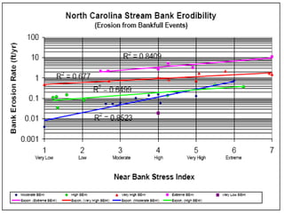
What Makes a Stream Healthy?Bed stability & diversity
Sediment transport balance
In-stream habitat & flow diversity
Bank stability (native plant roots)
Riparian buffer (streamside forest)
Active floodplainBed Stability & DiversityAppropriate size sediments to resist shear stress
Riffle/Pool sequences in alluvial streams
Step/Pool sequences in high-gradient streamsPhoto Credit: Eve Brantley, Auburn University
Sediment Transport BalanceMinor erosion & deposition
Alluvial bars and benches
Sufficient stream power to avoid aggradationIn-stream Habitat & Flow DiversityOverhanging BankRootsWoodPoolLeaf PackPlantsRiffleRocks
Bank StabilityDense native plant roots
Low banks with low stressRiparian Buffer (Streamside Forest)Diverse native plants
Food and shadeActive FloodplainRegular (every year) flooding to relieve stress
Riparian wetlands
Stormwater retention & treatmentWhat is a “Stable” Stream?“Graded” Stream:  Condition of “balance between erosion and deposition attained by mature rivers” (Davis, 1902)“Dynamic Equilibrium”:  Stream form & character unchanged while continuous inflow of water/sediment (Strahler, 1957)“Equilibrium Controlling Factors”:  Width, depth, velocity, slope, discharge, sediment size, sediment concentration, channel roughness (Leopold, 1964)“Regime Channels”:  Some erosion and deposition but no net change in dimension, pattern, and profile (Hey, 1997)“Stream Channel Stability”:  ability of a stream, over time, in the present climate, to transport the sediment and flows produced by its watershed in such a manner that the stream maintains its dimension, pattern, and profile without either aggrading or degrading (Rosgen, 1996)
Lane’s Stream Balance Relationship
Causes of InstabilityIncrease runoff
Increase slope
Changes in sediment load
Loss of riparian buffer
Floodplain filling
Instream modificationIncrease Runoff:  Land Use Changes
10%50%Development Impacts on the Water Cycle55%15%Courtesy NEMO, Univ. of CT
Impervious Surfaces Across the LandscapeCenter for Watershed ProtectionSidewalksRoadsParkingDrivewaysBuildings
More RunoffArriving FasterNEMOThe Science of Stormwater…
Hydrologic Responses to UrbanizationIncreased dischargeIncreased peak dischargeIncreased velocitiesShorter time to peak flowMore frequent bankfull eventsIncreased floodingLower baseflowLess ground water recharge
Increase SlopeChannelization
Lower Reservoir Water Surface
Dam Break
Geologic UpliftSimon Channel Evolution ModelSource:Simon, 1989, USACE 1990
Head Cut
IIIIIIIIIIIIIIIIIIIIVIIIIOriginal NickpointIVVIVI
G4c Alabama
Changes in Sediment LoadDevelopment
Agriculture
Bank Erosion
Impoundments
Aggradation
Mid-channel bar and transverse bar directing flow into a high bank causing erosion and slumping
Debris OccurrenceLarge Woody Debris
Depends on Riparian Stability
Beaver DamsWoody debris
ImpoundmentsUpstream:Decrease velocities
Deposition of fine material
Loss of habitatDownstream:“Hungry water”
Change in flowRiparian Condition (Buffer)Composition
Density
PotentialValues of VegetationHabitatsWater QualityBank StabilityShade & FoodStream Corridor Restoration: Principles, Processes, and Practices, 10/98, by the Federal Interagency Stream Restoration Working Group (FISRWG)."
Streamside Forests (also known as riparian buffers)Trees, shrubs, herbs, and grasses are critical to the health of streams
Buffers are the first line of defense against the impacts of polluted runoff
natural vegetation buffers are especially critical in urban areas
Altered States Due to DisturbanceChannelization
Straightening
Levees
Hardening
MiningFloodplain Filling
Stability Assessmenthttp://www.epa.gov/warsss/index.htm
Entrenchment Ratio
Lateral StabilityMeander Width Ratio
Bank Erosion (BEHI)G4c Alabama
Stream Channel Succession (WARSSS)
Stream Channel Succession (WARSSS)http://www.epa.gov/WARSSS/sedsource/successn.htm
Stability Assessmenthttp://www.epa.gov/warsss/index.htm
Entrenchment Ratio
Lateral StabilityMeander Width Ratio
Bank Erosion (BEHI)Meander Width RatioMWR = Wblt / WbkfWblt = Belt WidthWbkf = Bankfull Width of Riffle Cross-SectionWbkfWblt
Bank ErosionMonitoring
Bank Erosion Hazard Index (BEHI)
Bankfull Stage:  Water fills the active channel and begins to spread onto the floodplainStream Corridor Restoration: Principles, Processes, and Practices. 1998. Federal Interagency Stream Restoration Working Group.
Bank Height RatioVery Low
Bank Height RatioModerate
Bank Height RatioVery High
Root Depth RatioVery Low BEHI

Rc101 Day 3 Jennings 10