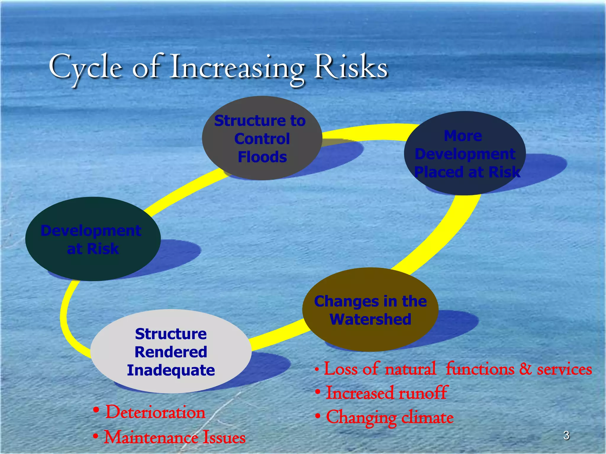
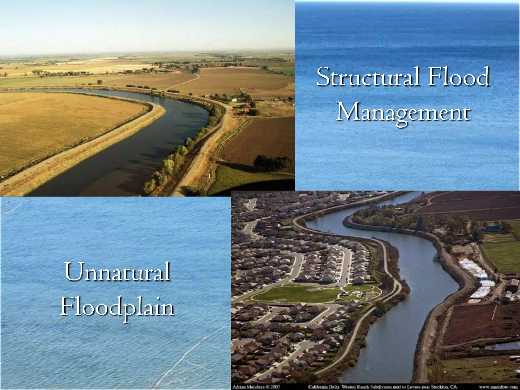
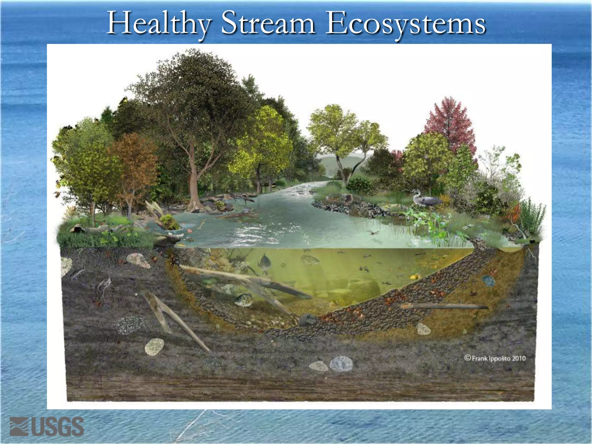
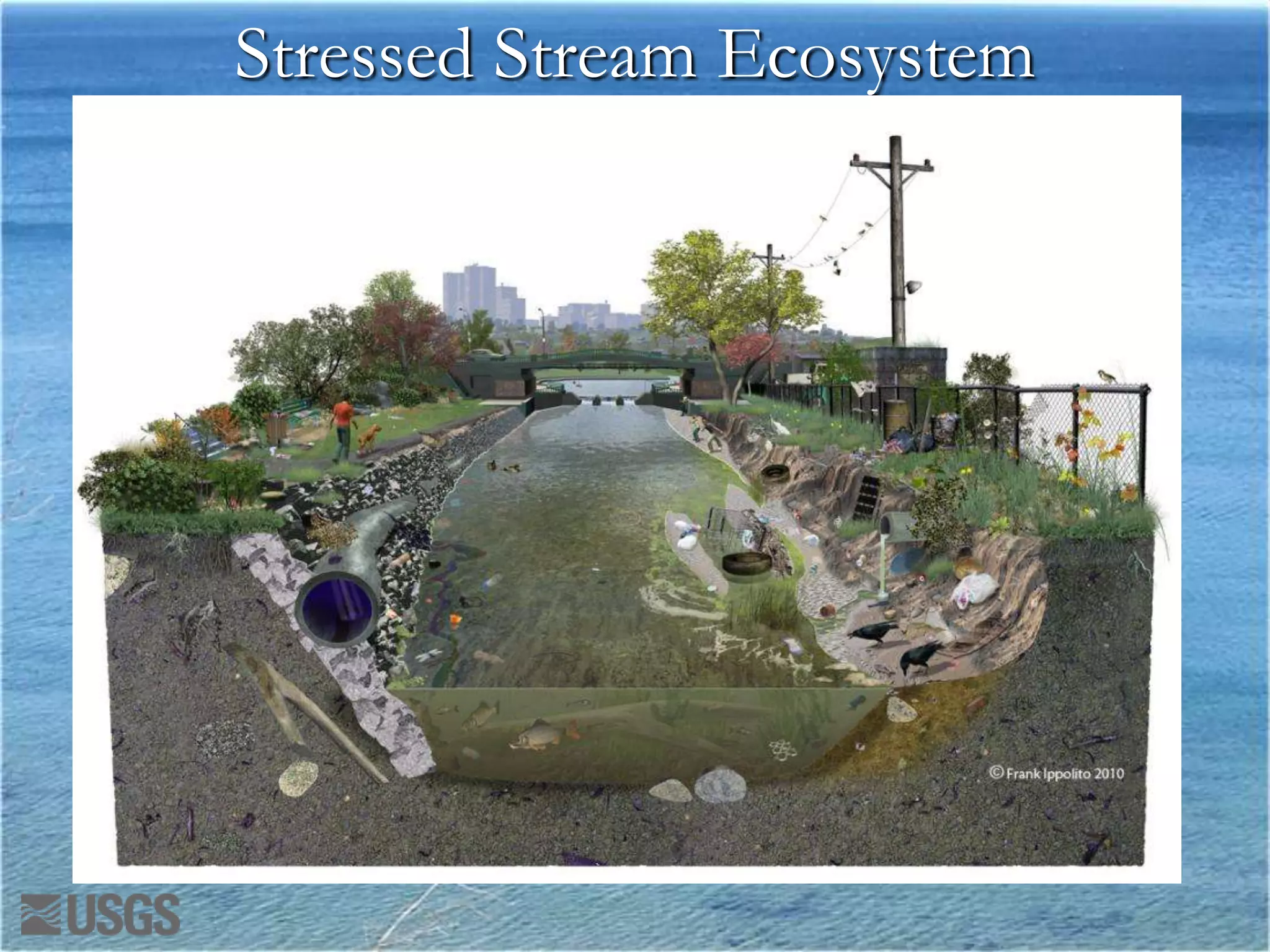
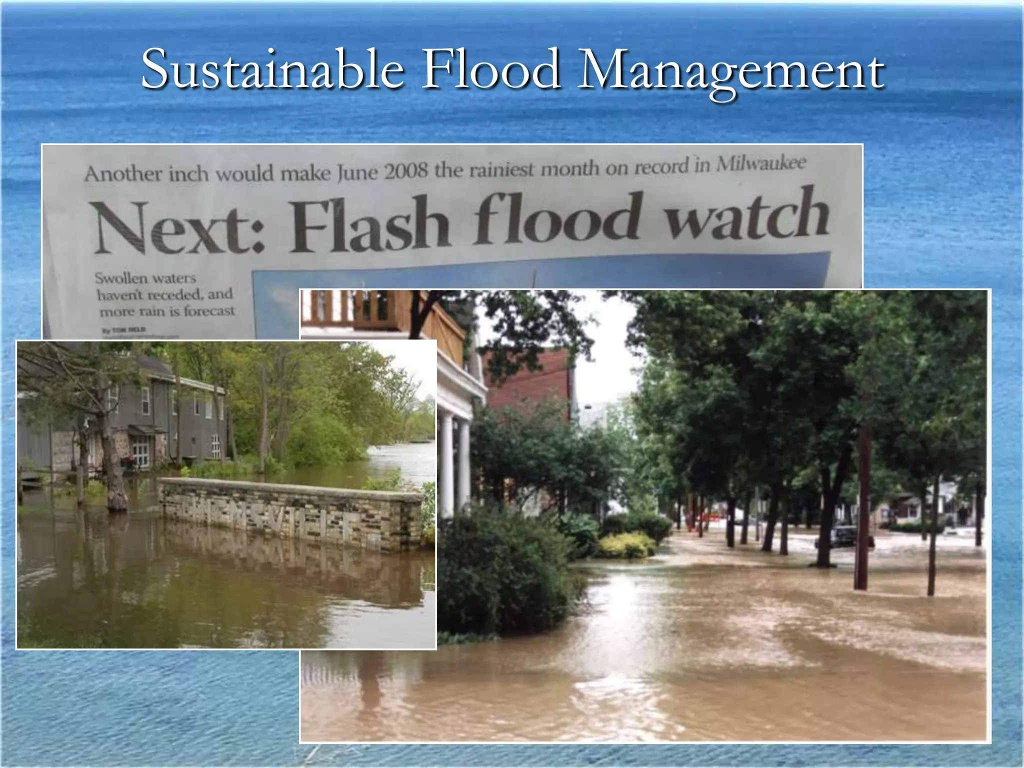
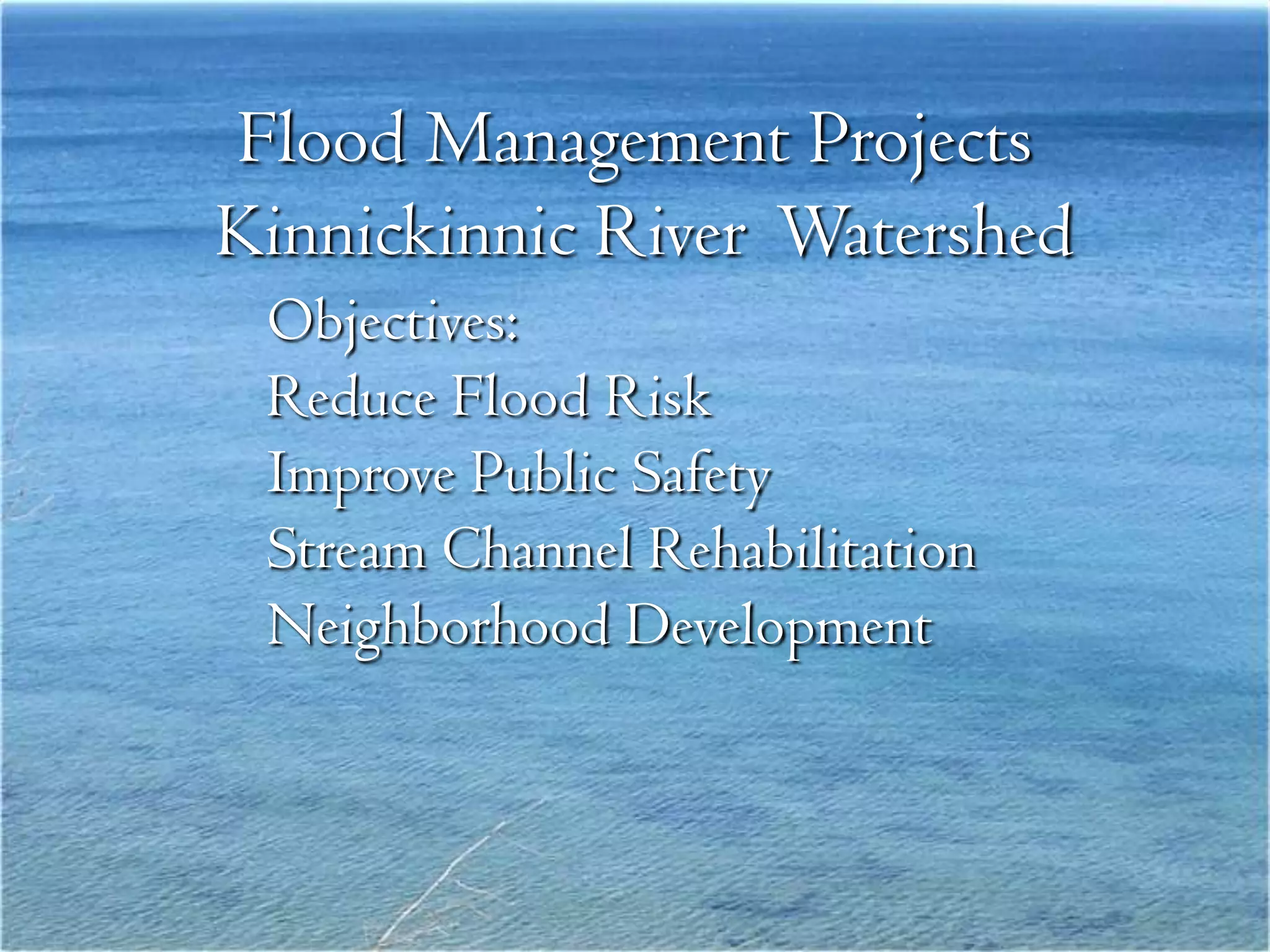
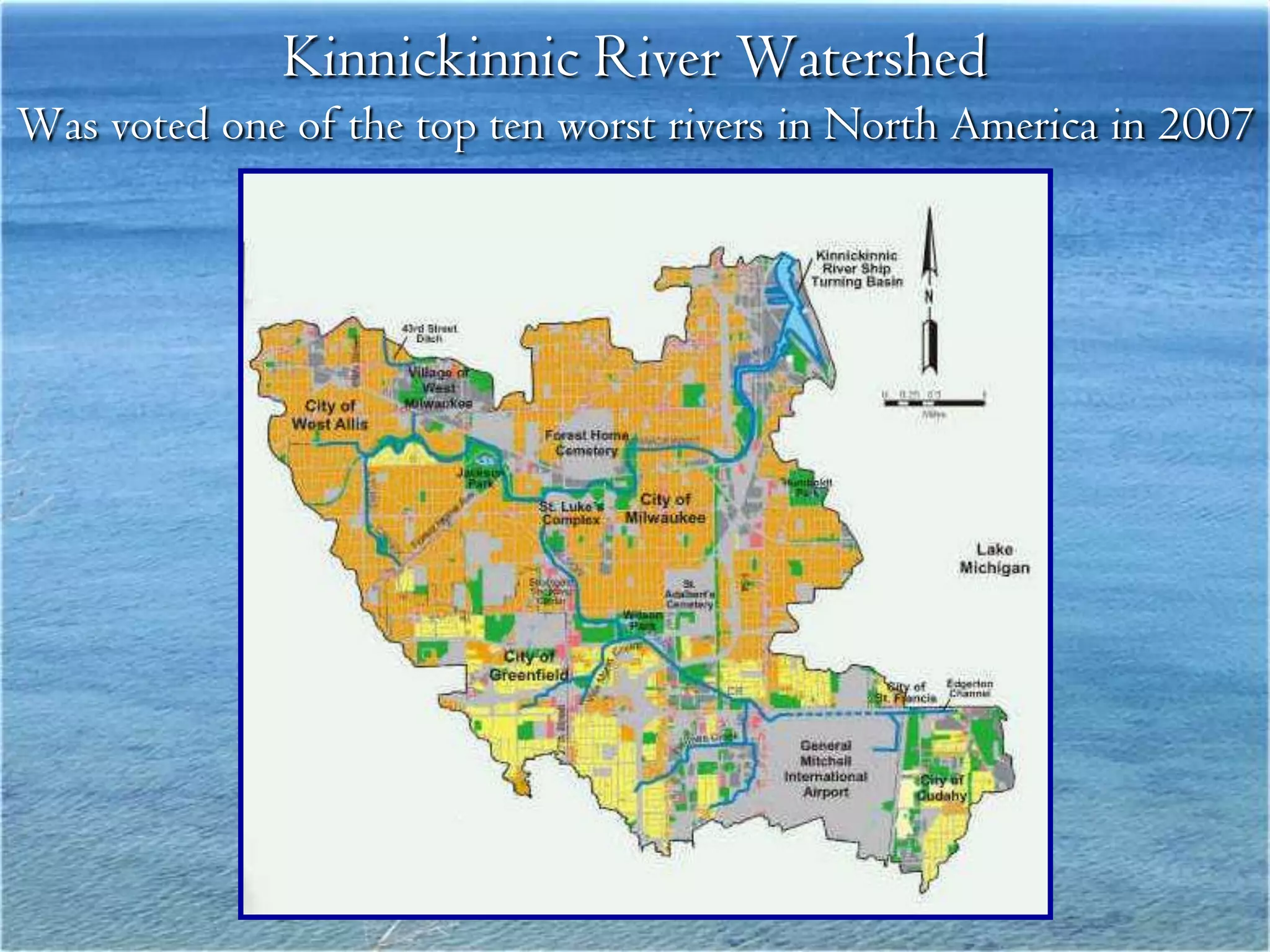
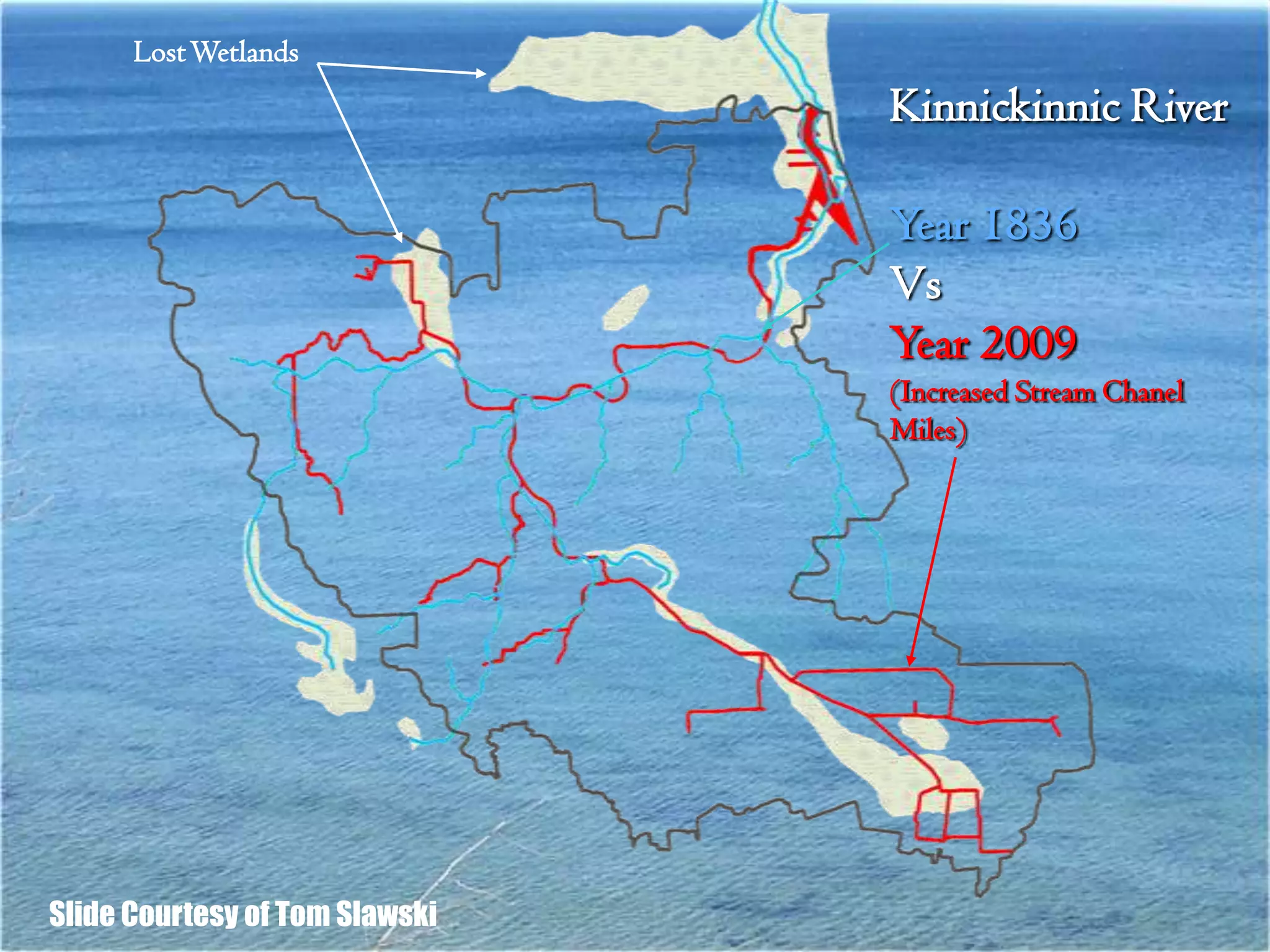
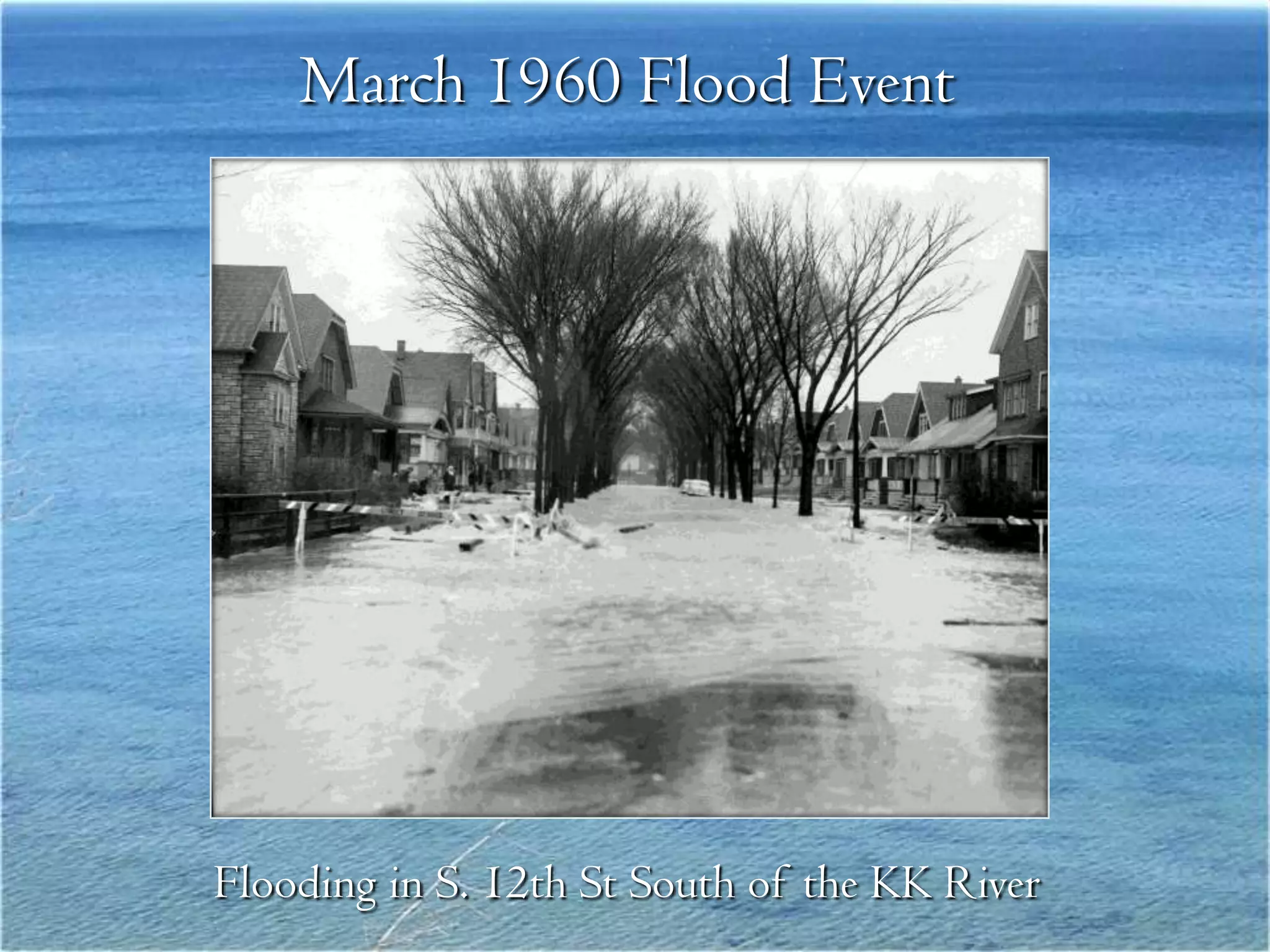
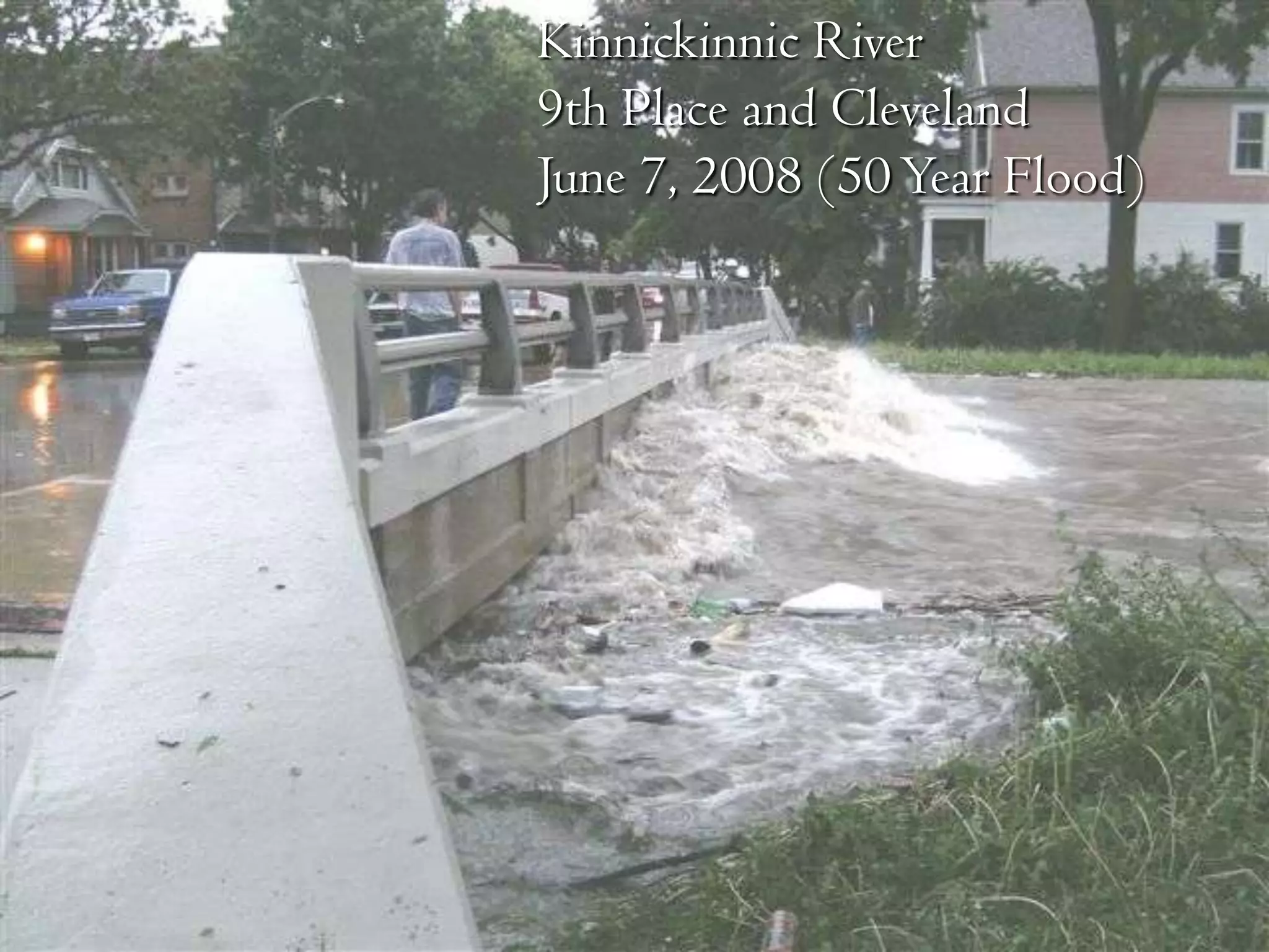
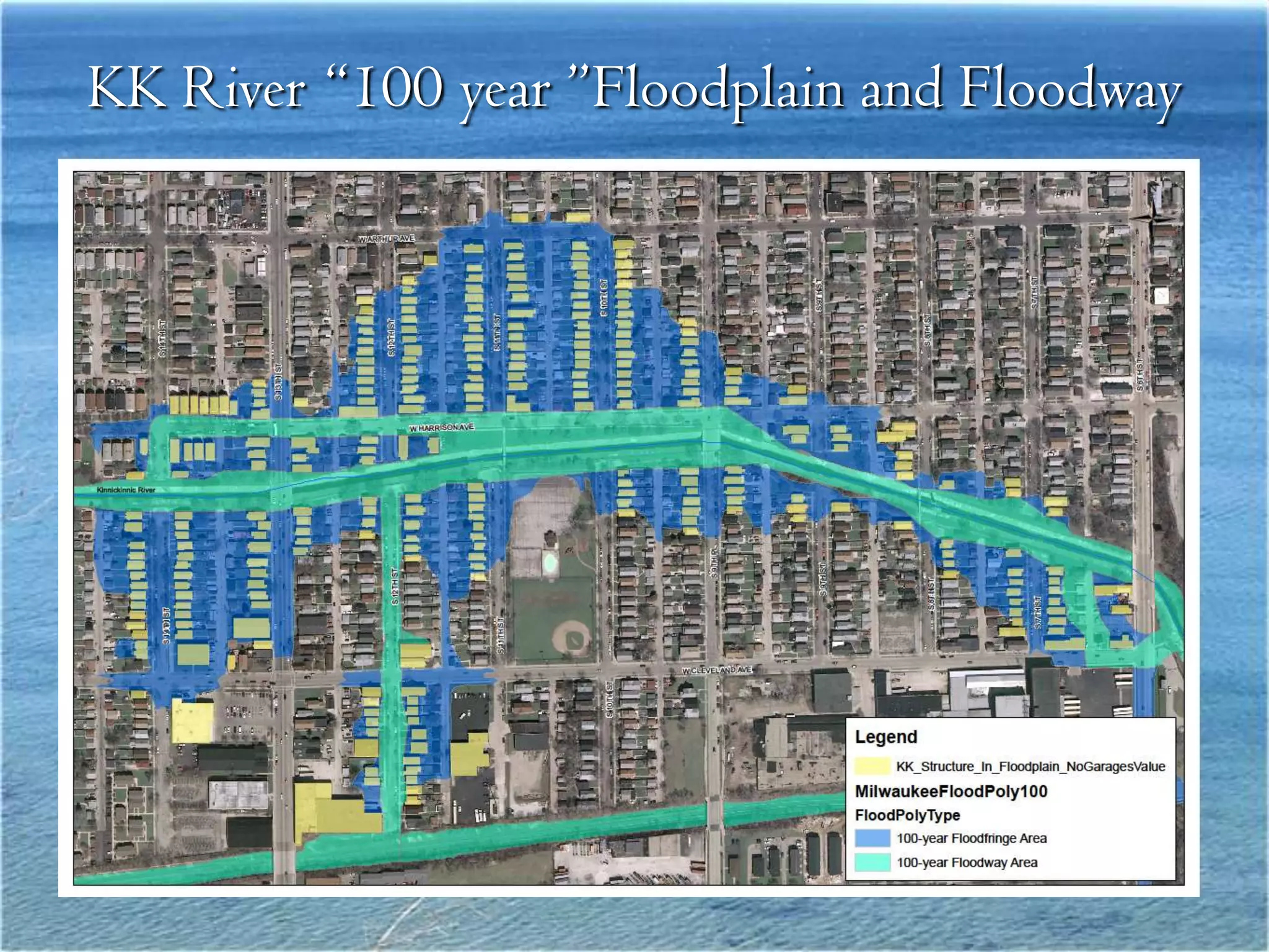
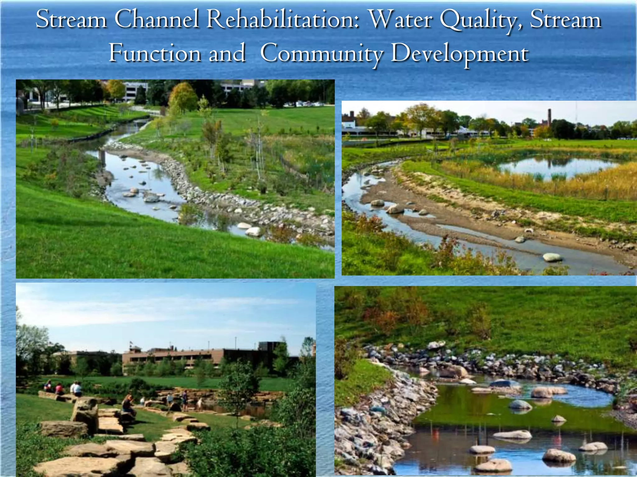
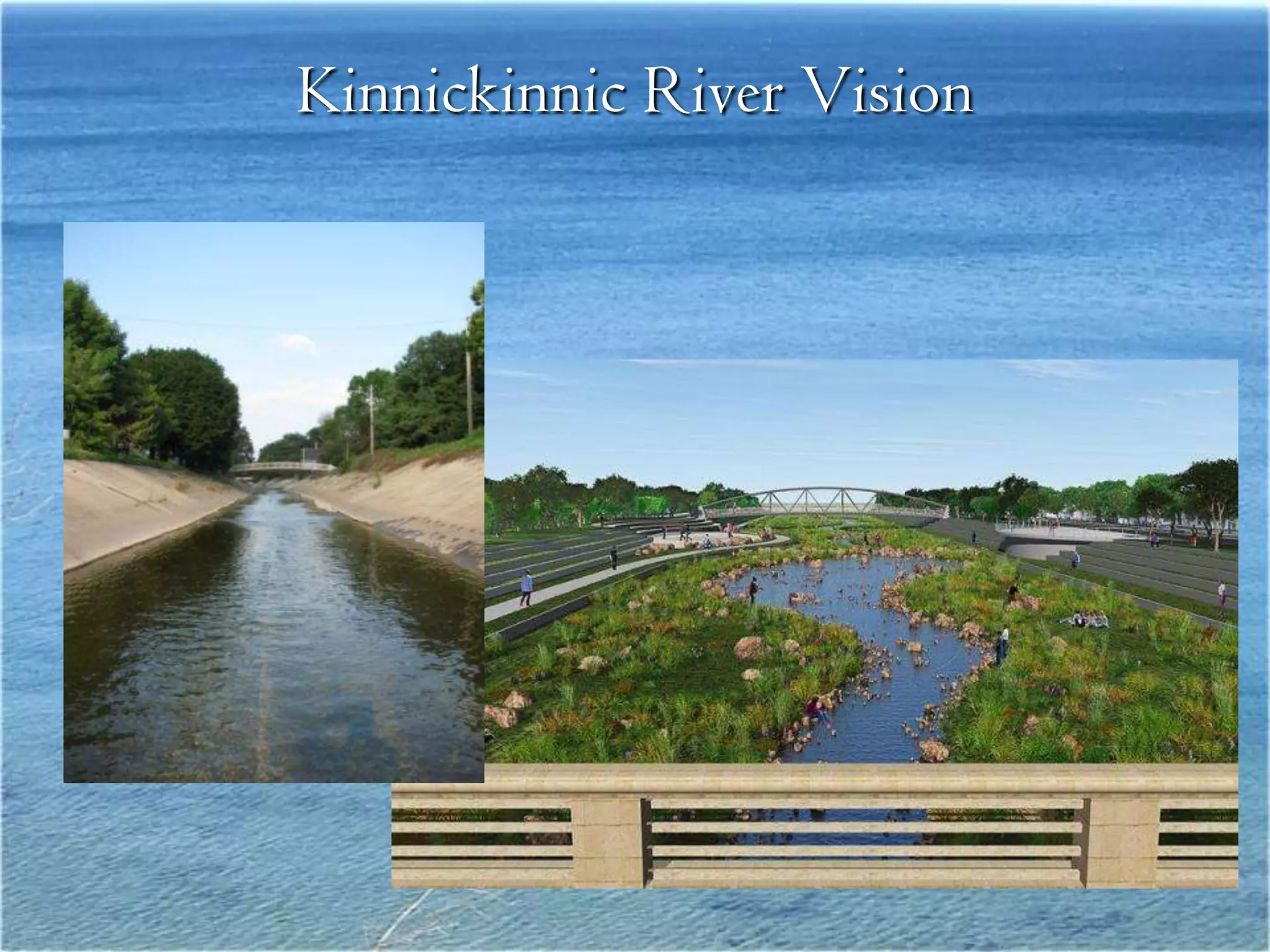
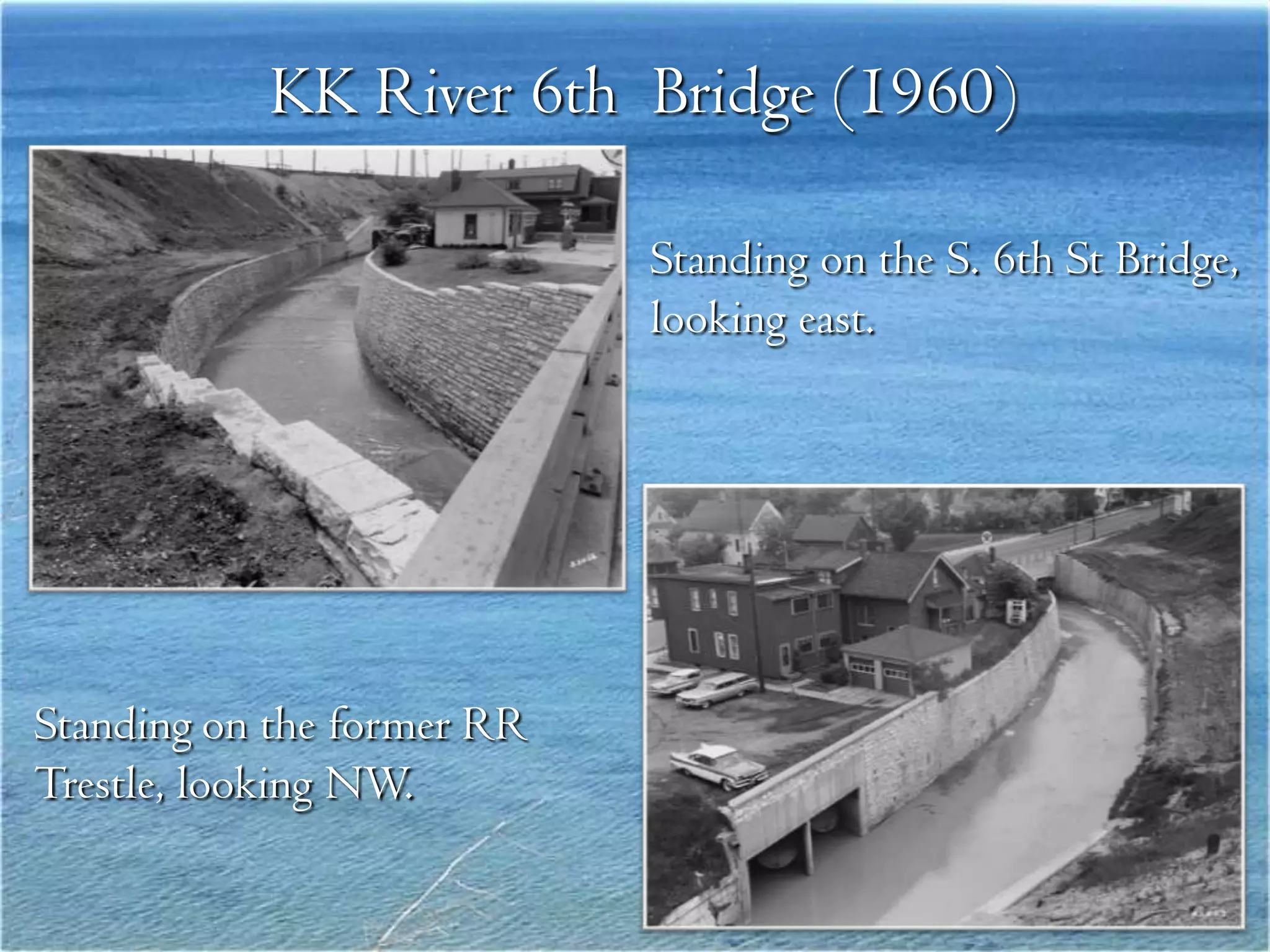
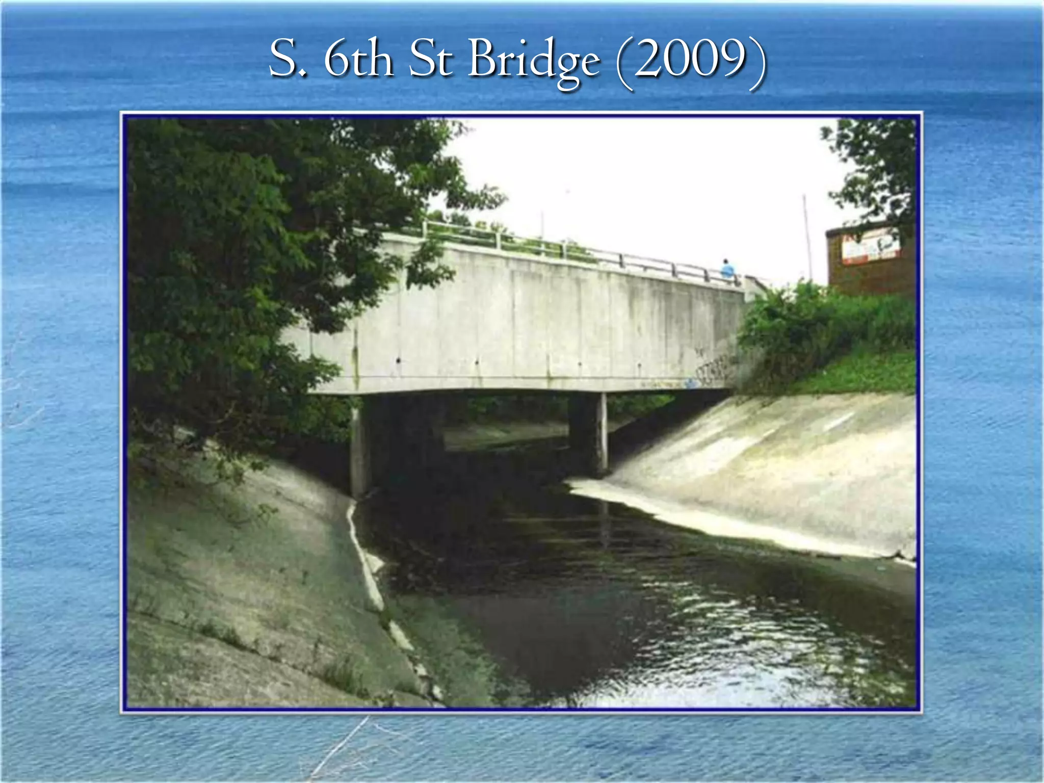
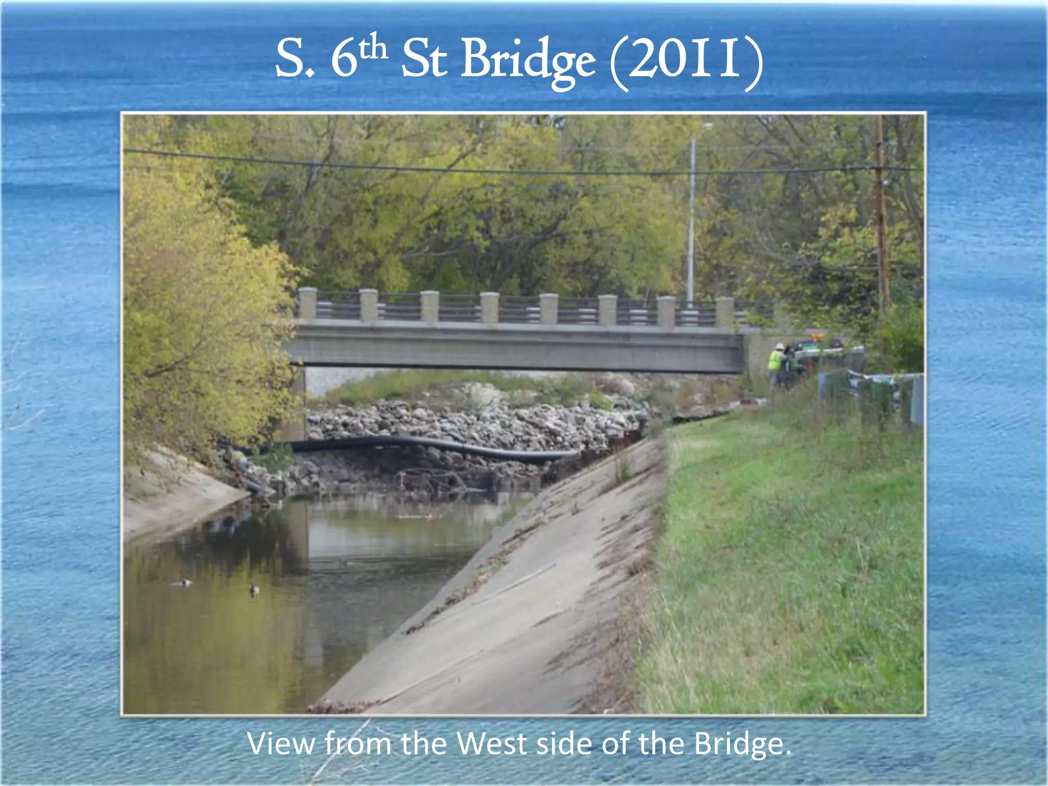
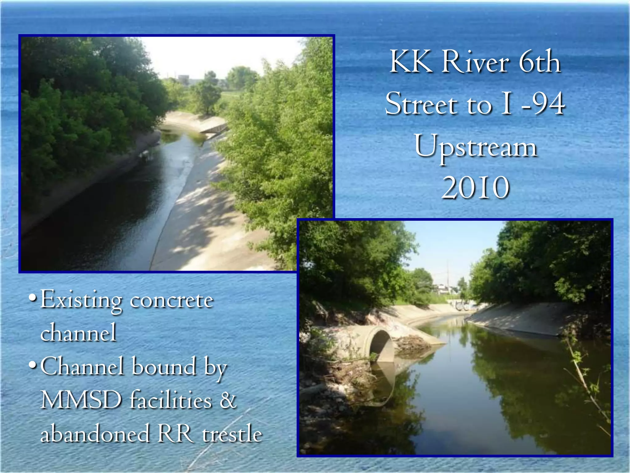
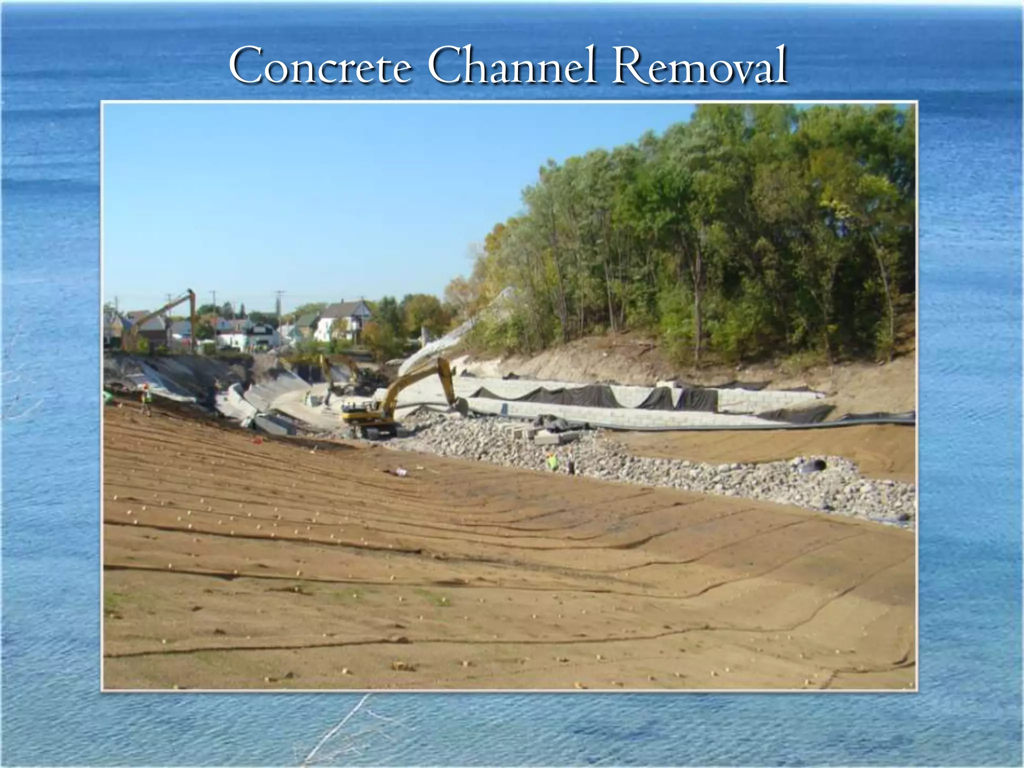
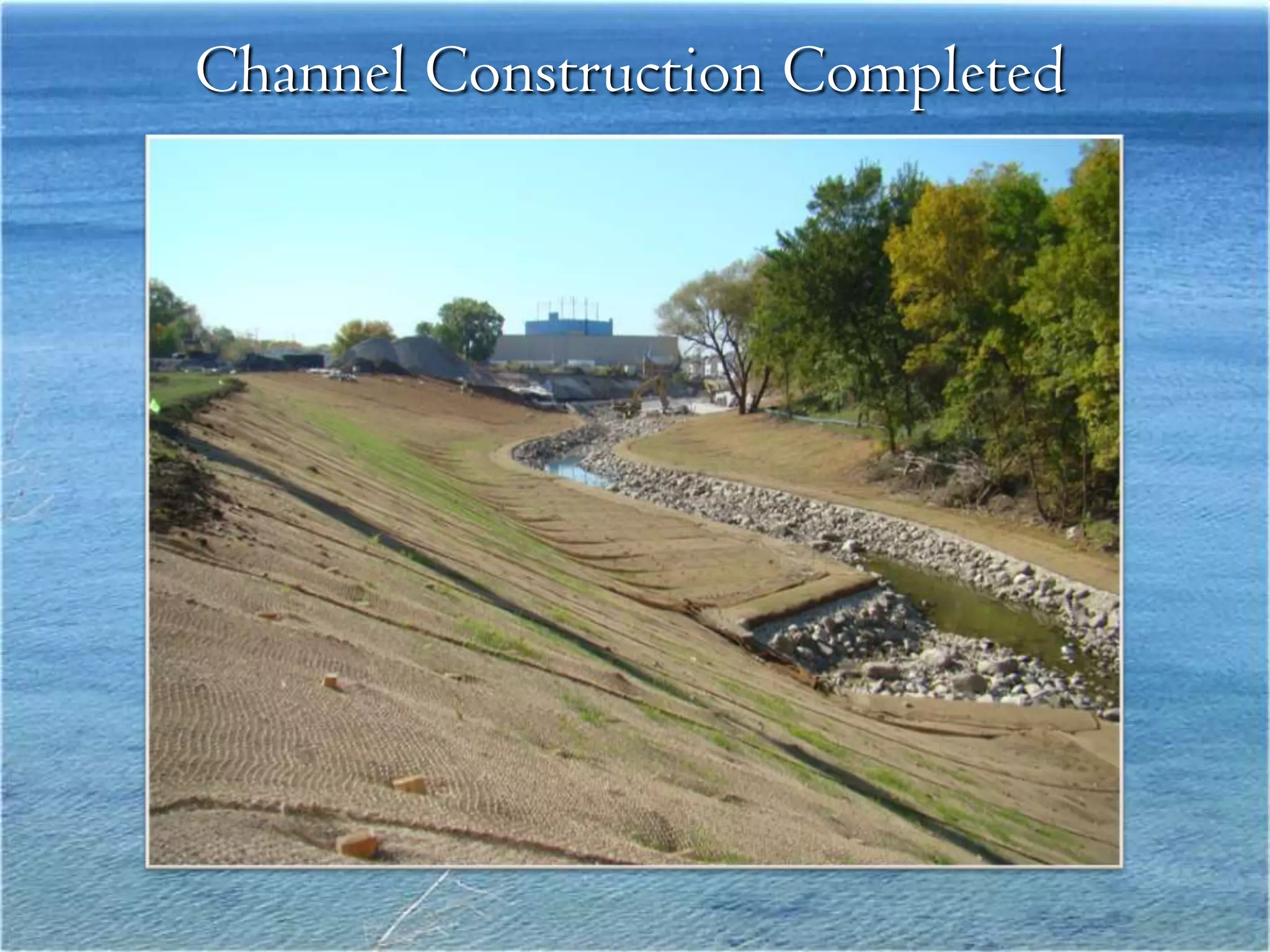
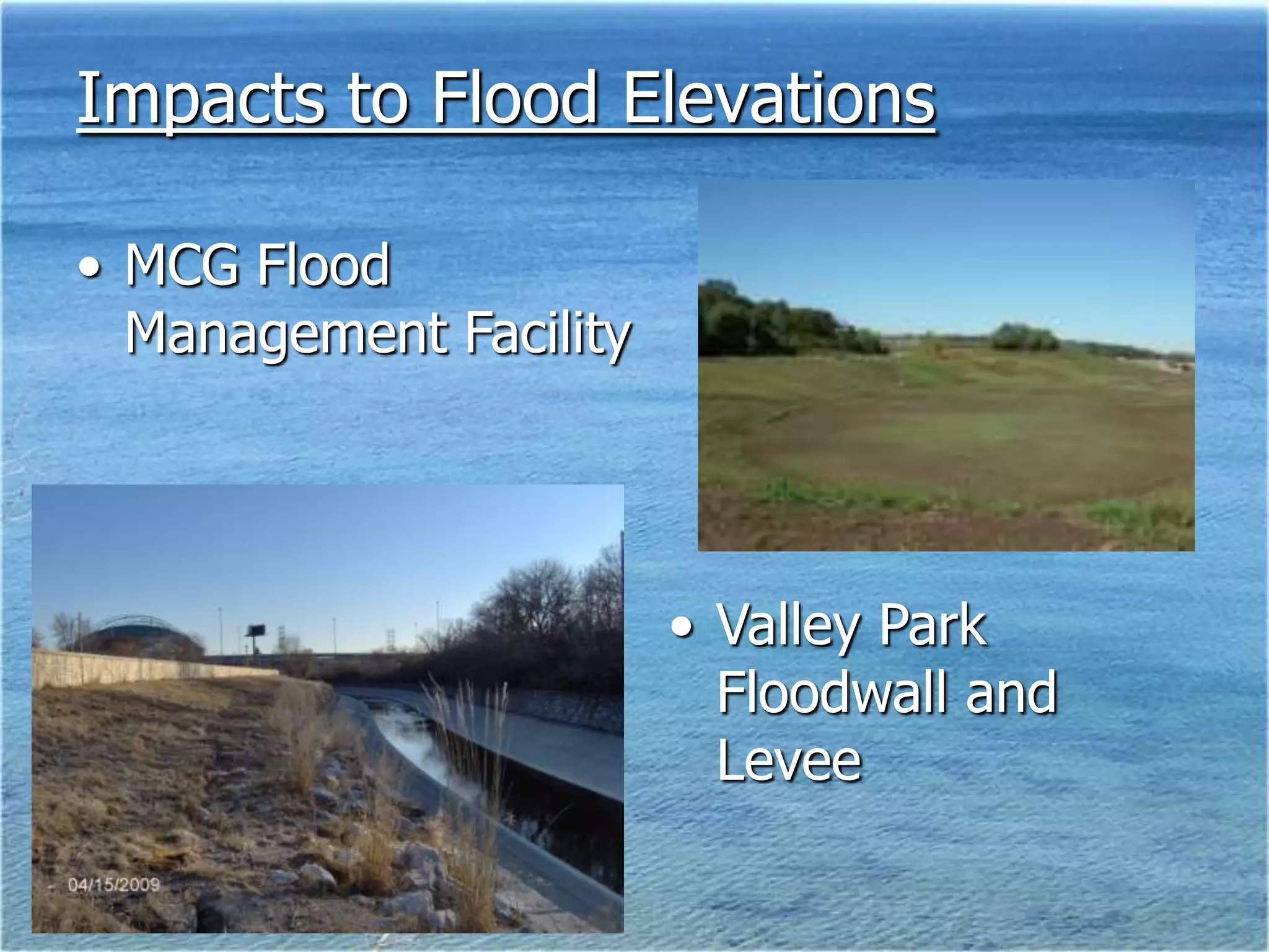
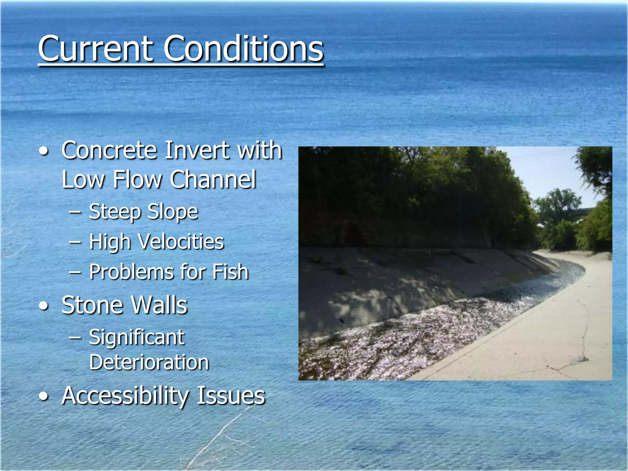
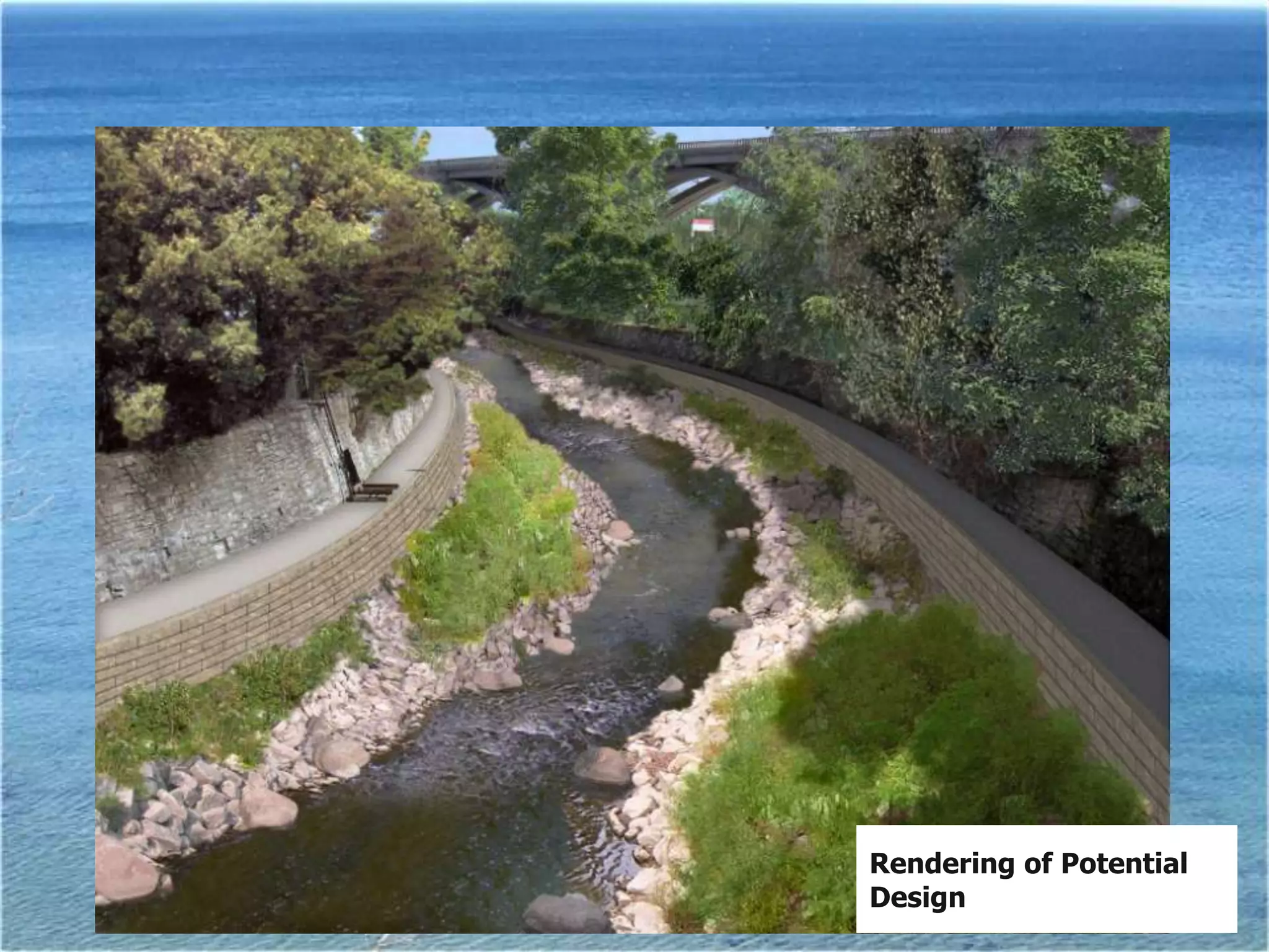
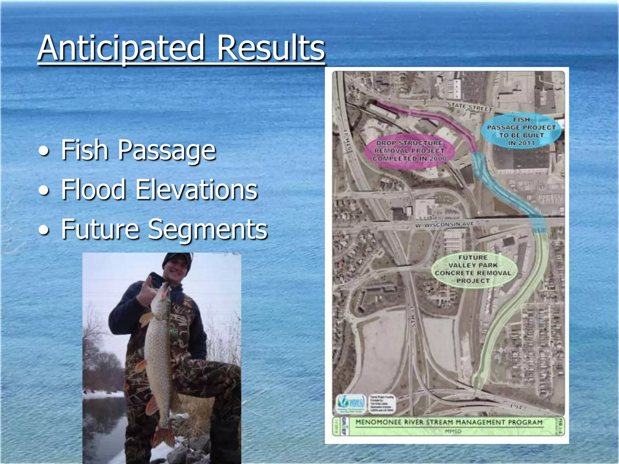
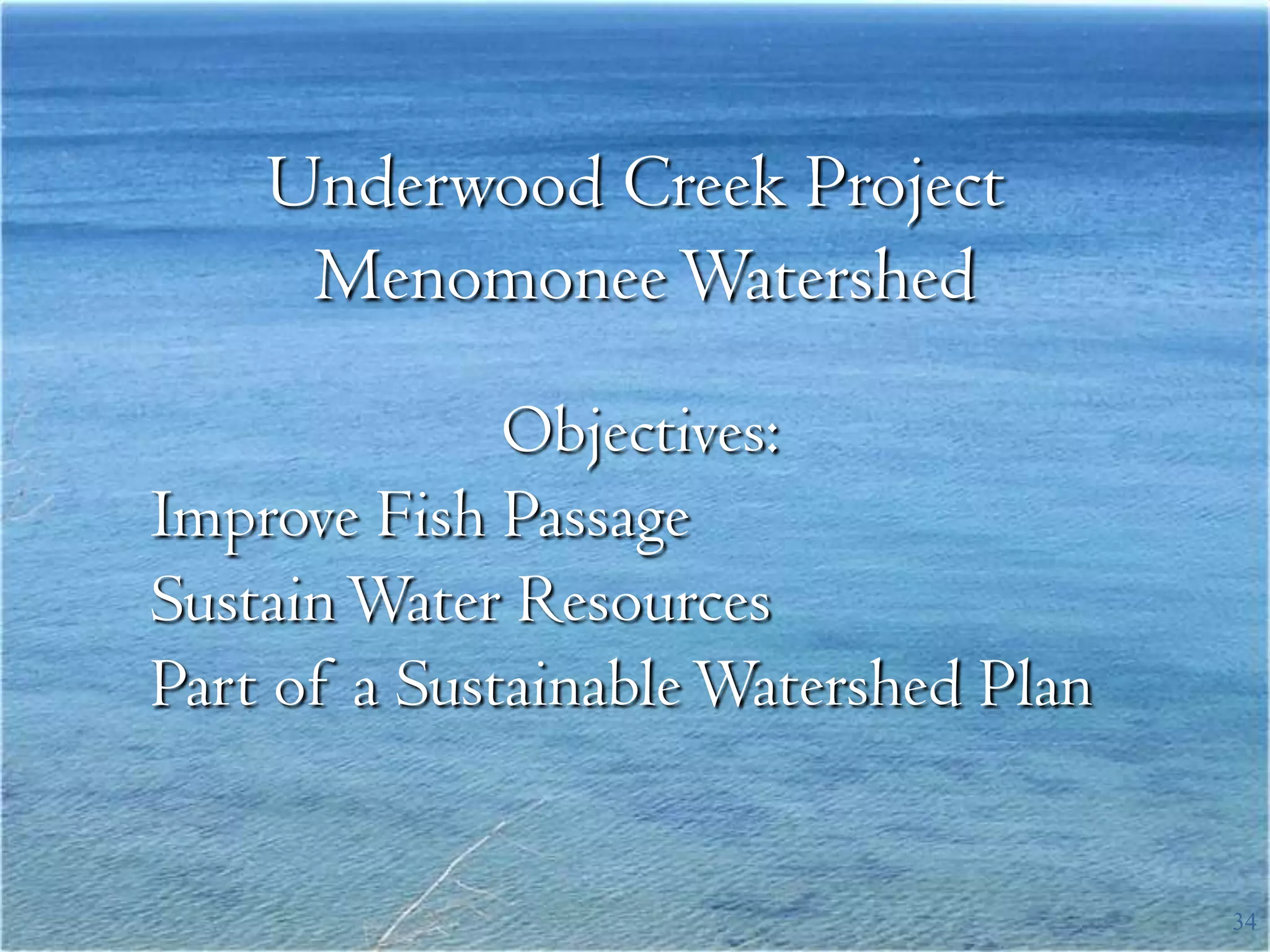
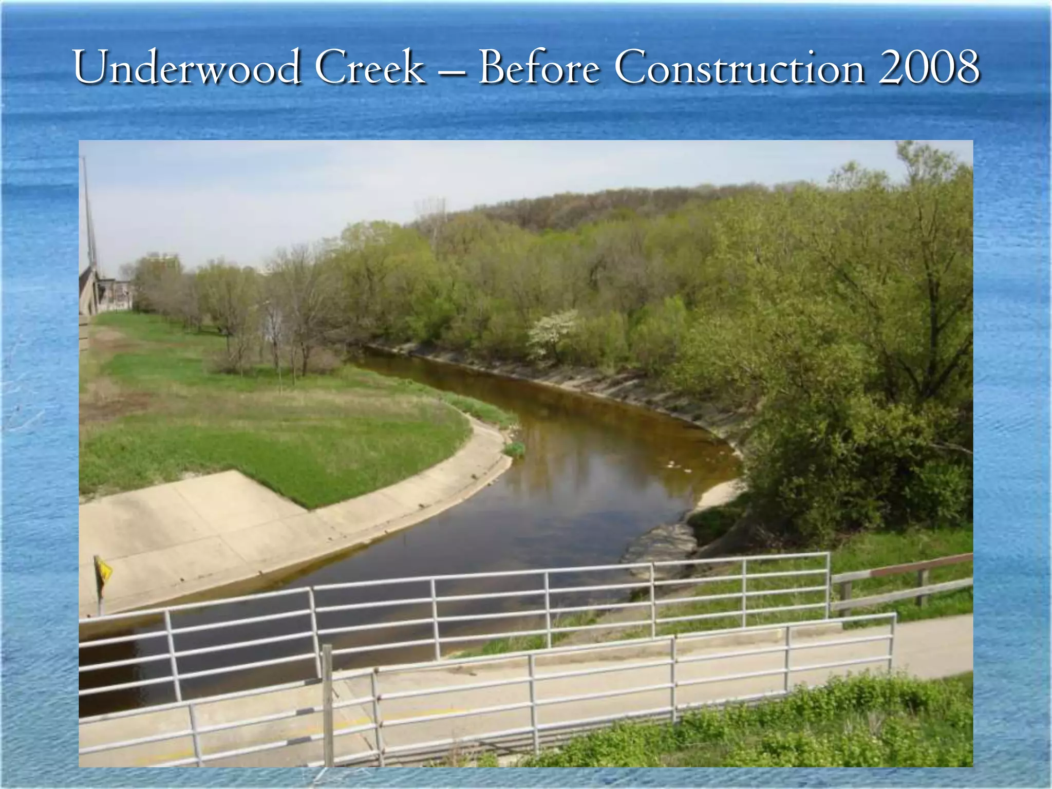
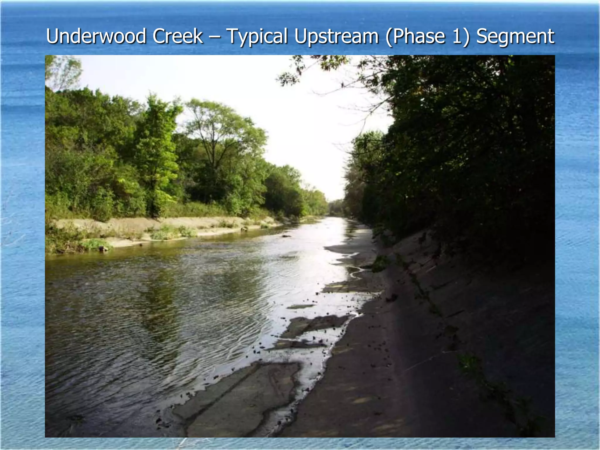
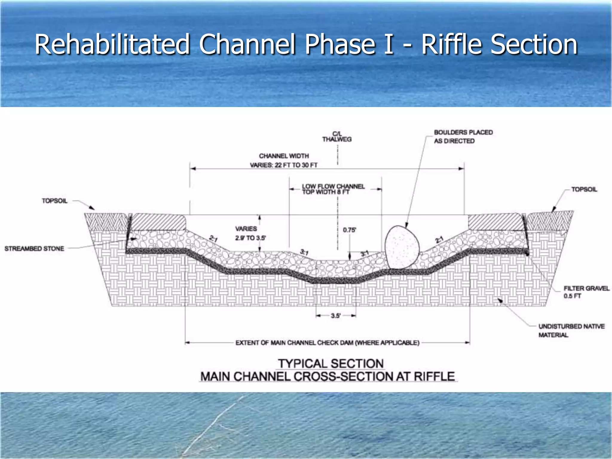
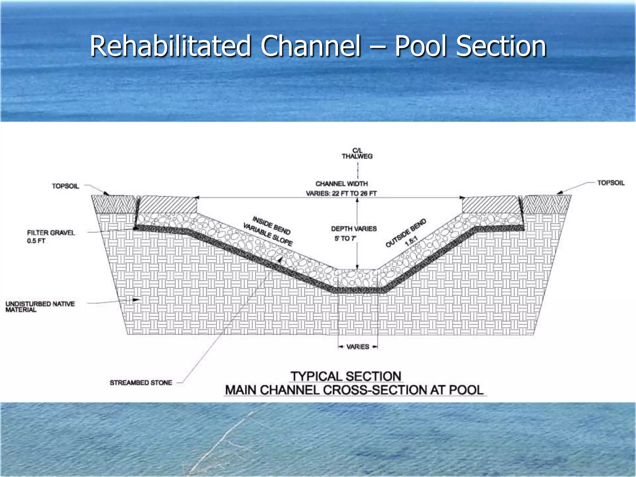
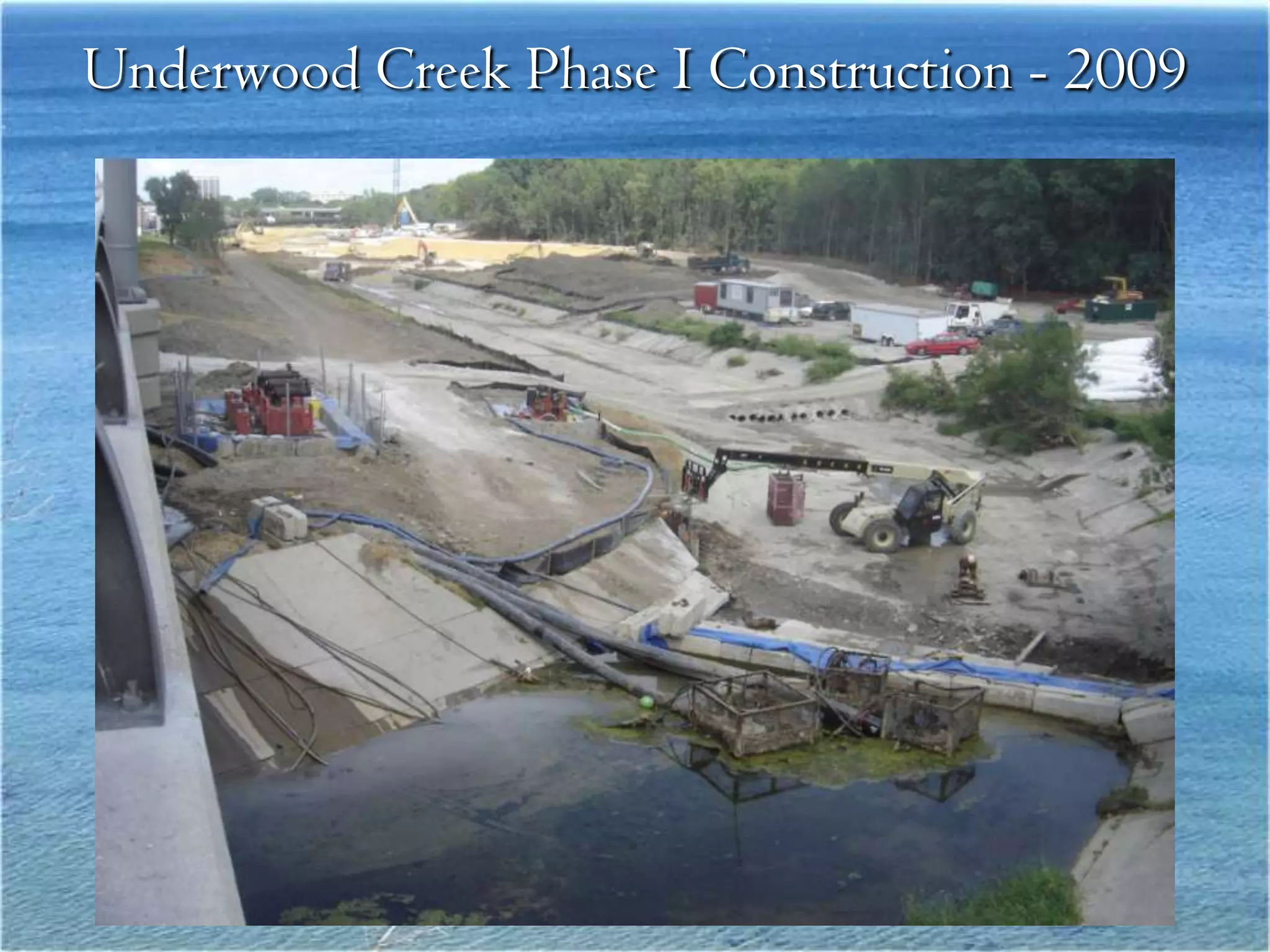
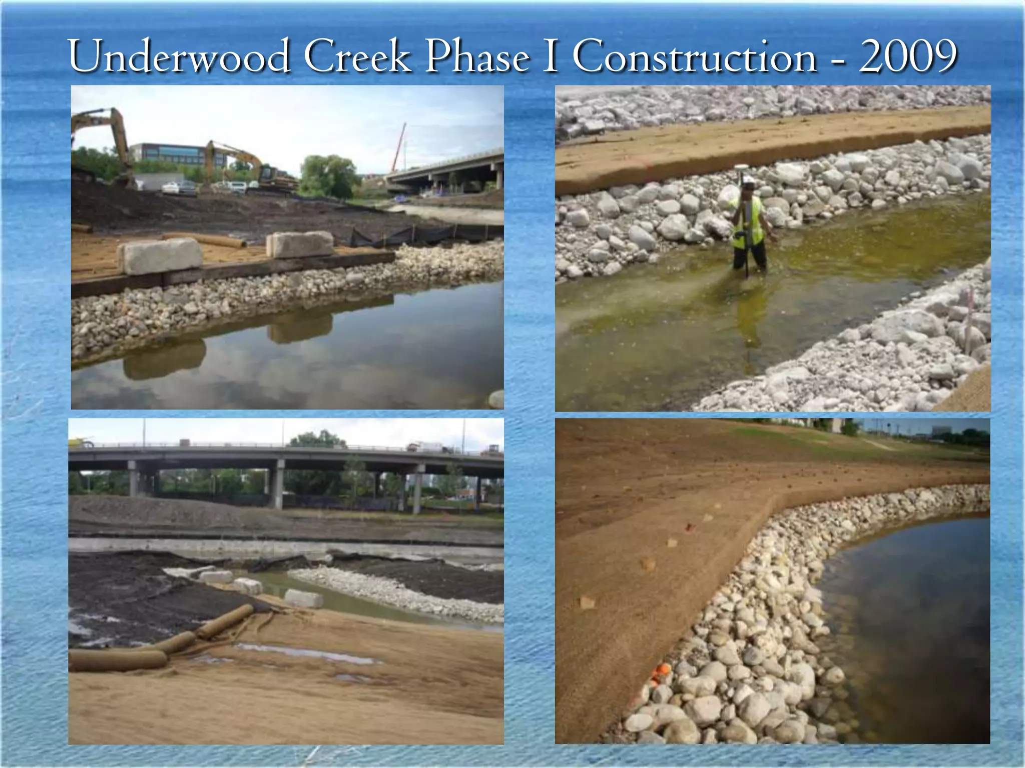
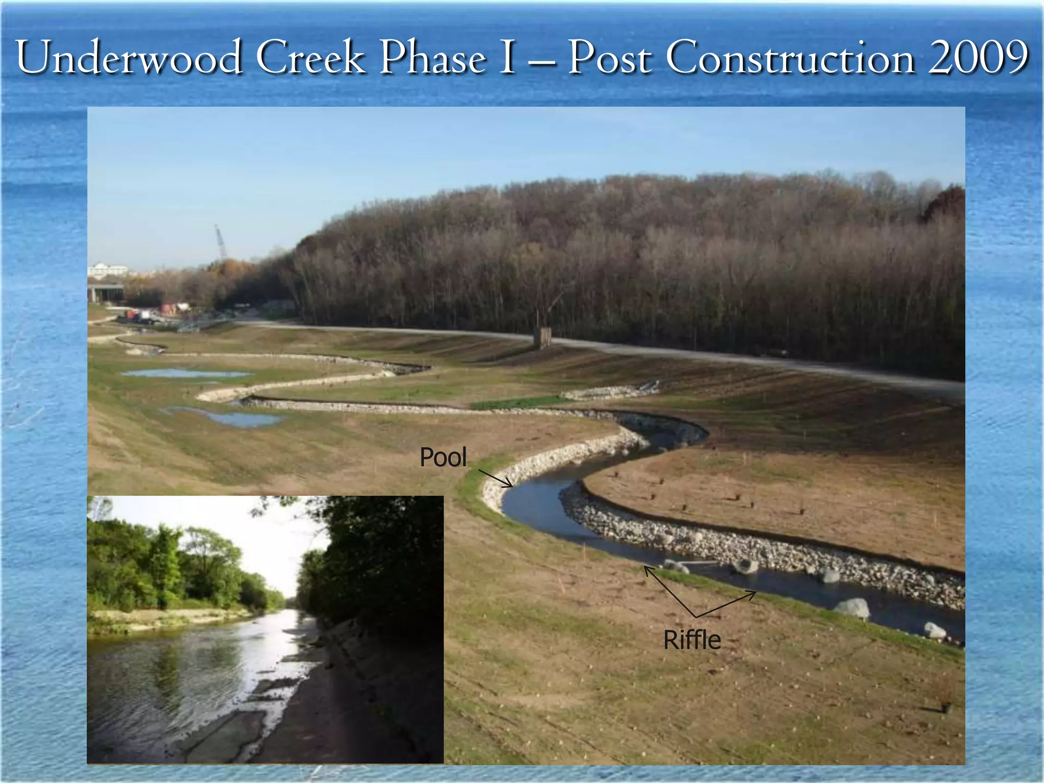
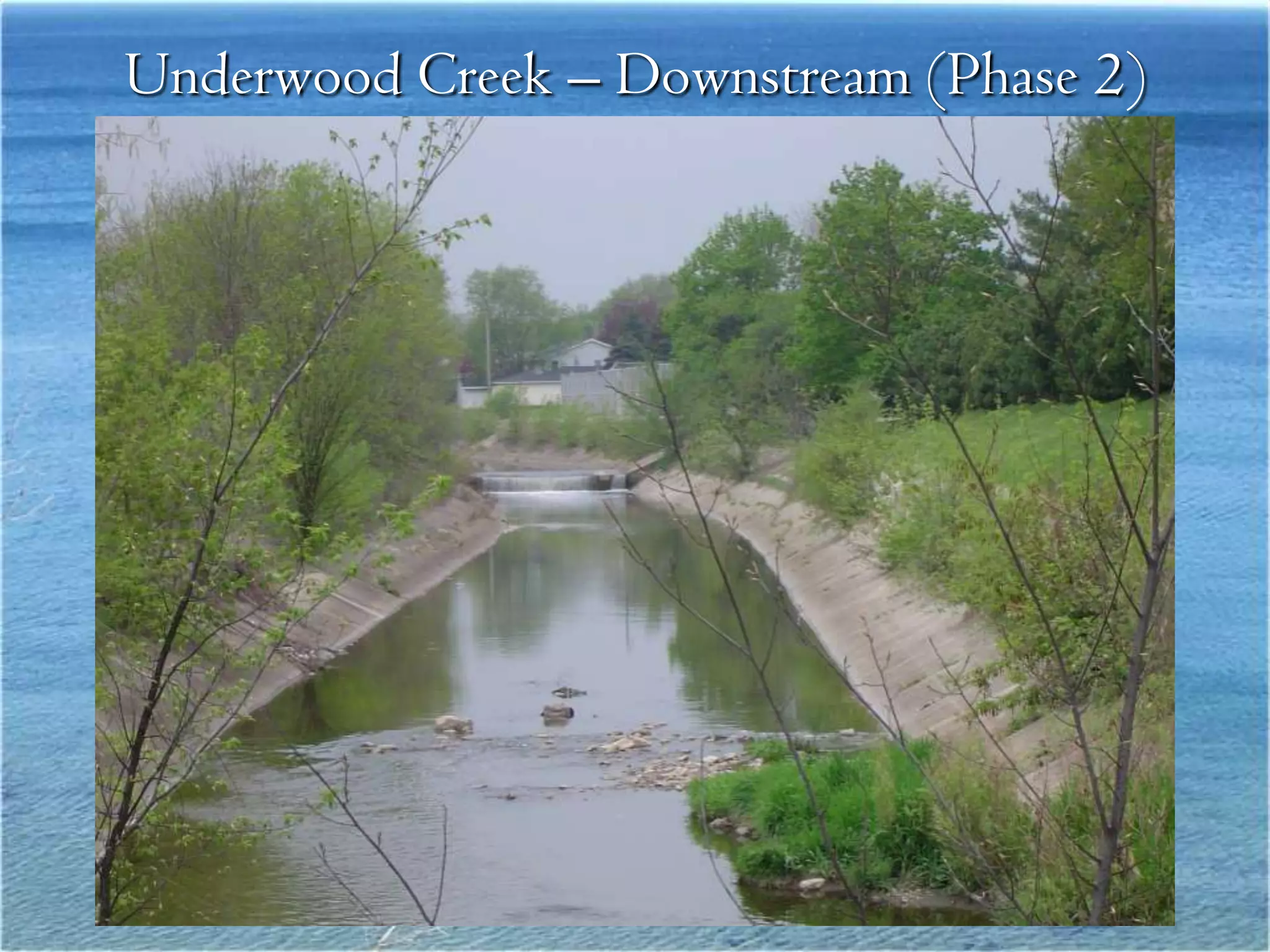
Clean Rivers
                         Clean Lakes
                    8th Annual Conference
 New Projects on the KK and Menomonee Rivers


David C. Fowler CFM
Association of State Floodplain Managers Region V
Director
Milwaukee Metropolitan Sewerage District Senior Project
Manager
Floodplain Managers Celebrating Job Security


                                               2
Cycle of Increasing Risks
                       Structure to
                          Control                      More
                          Floods                   Development
                                                   Placed at Risk


Development
   at Risk


                                      Changes in the
                                        Watershed
          Structure
          Rendered
         Inadequate                   • Loss of natural functions & services
                                      • Increased runoff
     • Deterioration                  • Changing climate
     • Maintenance Issues                                              3
Natural Floodplain Functioning


Slide Courtesy of
 John Mc Shane
Structural Flood
               Management


Unnatural
Floodplain
Healthy Stream Ecosystems
Stressed Stream Ecosystem
Sustainable Flood Management
Flood Management Projects
Kinnickinnic River Watershed
 Objectives:
 Reduce Flood Risk
 Improve Public Safety
 Stream Channel Rehabilitation
 Neighborhood Development
Kinnickinnic River Watershed
Was voted one of the top ten worst rivers in North America in 2007
Lost Wetlands
                                Kinnickinnic River

                                Year 1836
                                Vs
                                Year 2009
                                (Increased Stream Chanel
                                Miles)


Slide Courtesy of Tom Slawski
Kinnickinick River
                              1930-1960


• Channel photos taken
  April 1960 in vicinity
  of S. 6th St Bridge
• Channel constructed by
  WPA in 1930’s
March 1960 Flood Event


Flooding in S. 12th St South of the KK River
Old Flood Risk Management
   Improved Channel ???
Concrete Channel Encouraged Development in the
              “real” Floodplain
Kinnickinnic River
9th Place and Cleveland
June 7, 2008 (50 Year Flood)
KK River “100 year ”Floodplain and Floodway
Stream Channel Rehabilitation: Water Quality, Stream
      Function and Community Development
Kinnickinnic River Vision
KK River 6th Bridge (1960)

                            Standing on the S. 6th St Bridge,
                            looking east.


Standing on the former RR
Trestle, looking NW.
S. 6th St Bridge (2009)
S. 6th St Bridge (2011)


View from the West side of the Bridge.
KK River 6th
                        Street to I -94
                          Upstream
                             2010


•Existing concrete
 channel
•Channel bound by
 MMSD facilities &
 abandoned RR trestle
Concrete Channel Removal
Channel Construction Completed
Menomonee River
 Stream Channel Rehabilitation

              Objectives:
Improve Fish Passage
Sustain Water Resources
Part of a Sustainable Watershed Plan


                                       26
Impacts to Flood Elevations

• MCG Flood
  Management Facility


                        • Valley Park
                          Floodwall and
                          Levee
Project Design

• Construction Document Preparation
  – Topographic Survey
  – Structural Evaluations
  – Plans and Specifications
  – Plan for Contractor Operations
    • Construct from Upstream to Downstream
    • Maintenance of Normal and High Flows
    • Fish Passage Boulder Placement
    • Final Restoration
Current Conditions

• Concrete Invert with
  Low Flow Channel
   – Steep Slope
   – High Velocities
   – Problems for Fish
• Stone Walls
   – Significant
     Deterioration
• Accessibility Issues
Project Design
•   Riffle and Pool Layout
     – Fish Passage Support
•   WPA Wall Repairs
     – Areas of Failure and
          in Need of General
          Repair
•   Existing Outfalls to River
     – Maintained During
          Construction
•   Railroad Bridge Issues
     – Fragile Abutments
          and Structure
•   Access During and After
    Construction
•   Modeling
     – HEC-RAS
     – Sediment Transport
Project Design

• Construction Document Preparation
  – Topographic Survey
  – Structural Evaluations
  – Plans and Specifications
  – Plan for Contractor Operations
    • Construct from Upstream to Downstream
    • Maintenance of Normal and High Flows
    • Fish Passage Boulder Placement
    • Final Restoration
Rendering of Potential
Design
Anticipated Results

• Fish Passage
• Flood Elevations
• Future Segments
Underwood Creek Project
     Menomonee Watershed
              Objectives:
Improve Fish Passage
Sustain Water Resources
Part of a Sustainable Watershed Plan


                                       34
Underwood Creek – Before Construction 2008
Underwood Creek – Typical Upstream (Phase 1) Segment
Rehabilitated Channel Phase I - Riffle Section
Rehabilitated Channel – Pool Section
Underwood Creek Phase I Construction - 2009
Underwood Creek Phase I – Post Construction 2009


                   Pool


                              Riffle
Underwood Creek – Downstream (Phase 2)
43
Questions?

Clean Rivers, Clean Lake 8 -- New Projects on KK and Menomonee Rivers -- Dave Fowler

Editor's Notes

  • #5 Physical habitat encompasses all the physical features and attributes that describe the home of creatures that live in a stream. This is similar to the physical shelter a house provides for humans. Healthy stream ecosystems can be identified by some particular habitat features. [VIDEO CLIP OF HEALTHY STREAM WITH OVERHANGING VEGETATION, LOGS, RIFFLES AND POOLS]First, healthy streams have a complex diversity of habitats, provided by a variety of flow and depth combinations, such as shallow and fast in rapids and slow and deep in pools. These variations in flow and depths are accentuated in meandering streams that have many bends and curves.Second, healthy streams offer cover, or hiding places, for fish and insects and also places of refuge where organisms can go during floods. Grass and shrubs along a bank, or boulders and logs in the middle of the channel make good cover. Small tributary entrants, variations in the bank line, or riparian wetlands provide refuge from high velocities and scour during floods. Third, in a healthy stream the stream bottom, or streambed, has a variety of substrate types, from rocks to gravels, with spaces between the larger rocks for food to grow and small creatures to hide [UNDERWATER VIDEO OF GRAVELS (SEE USGS BEDLOAD CORECAST).The specific habitat features in a healthy stream may vary for particular regions, depending on such things as topography, geologic setting, natural vegetation, soils, and climate. Finally, the ability of organisms to move up and down the length of a stream, called longitudinal connection, is also very important. Organisms may use different habitat settings depending on their life cycle requirements for spawning, nursery, or food sources. [SHOW VIDEO OF SALMON SPAWNING]
  • #6 When waterhsheds become developed, several things can happen to change a stream’s physical habitat. Increases in impervious cover and addition of storm sewers cause the volume and rate of storm runoff to increase, and also change the timing of various types of streamflows. The end result of urban development tends to be streamflows that are more flashy. Flashy streamflows can degrade stream habitats by erosion and scour of streambeds and streambanks. Excessive sediment contributions from construction sites can transport large amounts of sediment into streams during storm events. Streambanks become unstable and start to fall in as the channel is enlarged. Contributions of sediment from construction sites or streambanks bury important habitat features downstream or may clog channels and cause more scour and erosion.When channels unravel from too much runoff they can also result in extensive damage to infrastructure….roads and bridges.[SHOW DIAGRAM OF CHANGES IN RUNOFF HYDROGRAPH?]
  • #9 MMSD also provides regional flood management protection to residents in the service area.Some people question why the District does flood management projects.These pictures show homes with flood waters around them; if this water enters the basement, it will drain out through the floor drain, which is a direct connection to the MMSD system. This can overload the system causing sewer overflows.
  • #15 Flood Risk reduced, Reduction of aquatic habitat, public safety issues from “flashy flows”
  • #16 Current channel, housing encroaching on channel, concrete deteriorating
  • #17 June 2008flood peak going down
  • #19 In upcoming years Milwaukee will improve habitat conditions and fish passage in the Kinnickinnick River, the smallest but most densely populated of the three rivers that drain Milwaukee. XX miles of the Kinnickinnick are cement lined, which poses a hazard and eyesore for neighboring residents as well as severely limits use of the stream by any aquatic species. The restoration is starting from the mouth and working its way up stream. The new design channel for the Kinnickinnick has steps and hiding places so that fish and other creatures can move up and down the river corridor. The design includes a low flow channel which keeps the water deep enough for fish to swim in. The rock lined banks are stepped upward to provide some additional flood storage and allowing use by humans. All the designed features are armored with very large rocks to be able to withstand the high flows during floods.[ONSITE VIDEO CLIP –Kinnickinnik cement channel removal in progress]Interview –Tom Chapman, Dave Fowler, Eric (MMSD?) Questions for MMSD – How has MMSD changed their practices over the last couple of years in regard to storm-water management? Why have the changes been done? (mandated or voluntary?). Are there special things that have to be done for cold climates/frozen ground situations in designs? Are there specific stream restoration techniques that both mitigate stormwater effects and improve water quality and physical habitat?What has been the impact of the Great Lakes Restoration Initiative on your activities?Has climate change predictions been considered in design?
  • #21 .
  • #27 MMSD Objectives, Diverse stakeholder groups, citizens community groups, city SEWRPC, WDNR, business groups, City of Milwaukee (planning and engineering
  • #35 MMSD Objectives, Diverse stakeholder groups, citizens community groups, city SEWRPC, WDNR, business groups, City of Milwaukee (planning and engineering