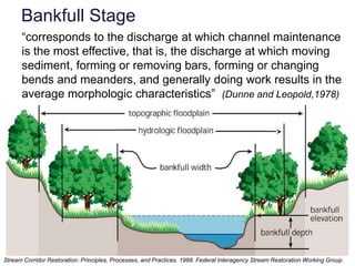
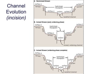
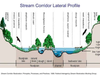
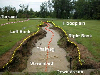
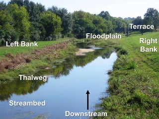
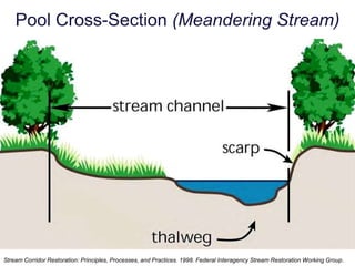
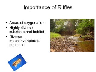
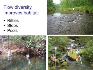
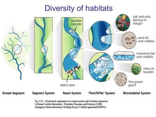
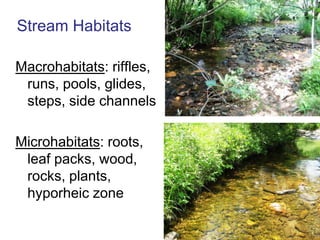
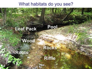
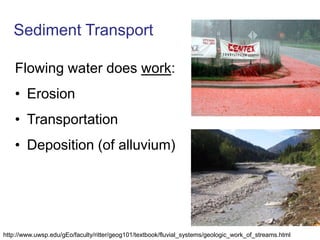
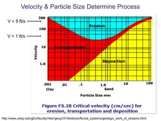
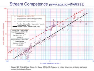
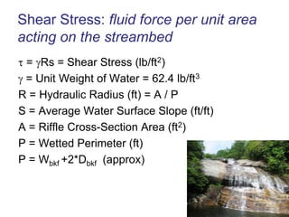
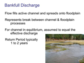
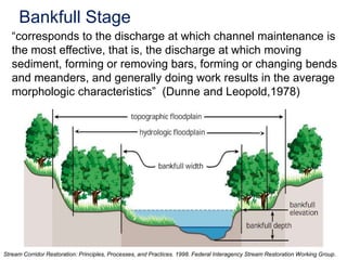
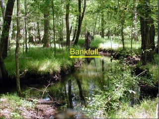
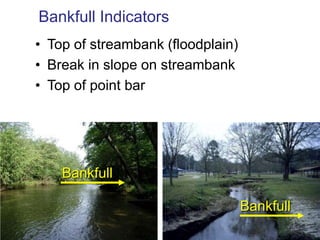
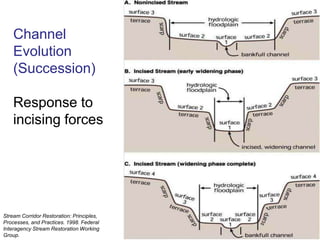
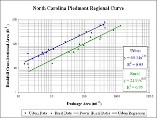
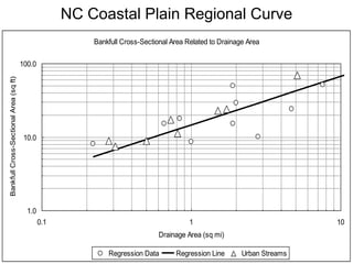
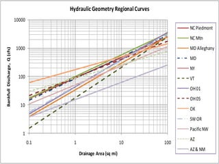
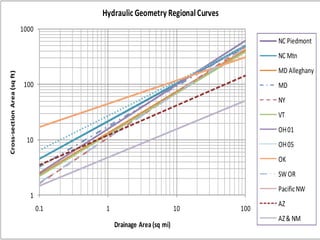
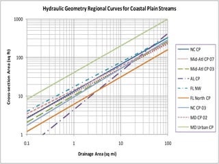
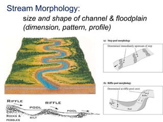
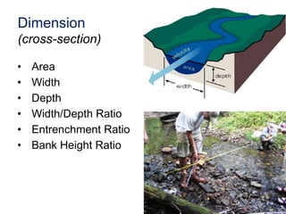
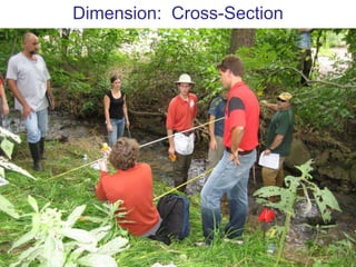
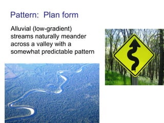
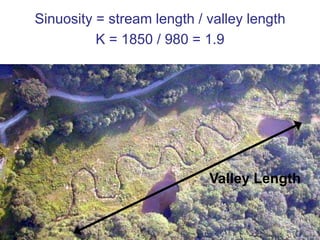
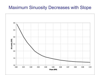
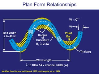
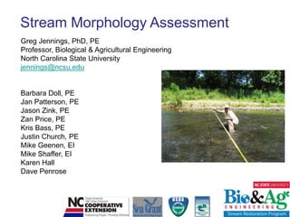
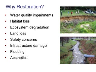
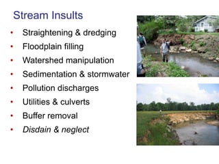
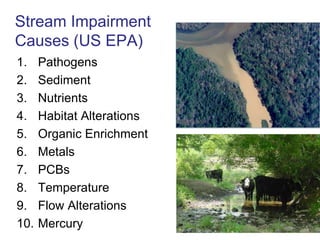
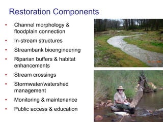
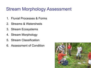
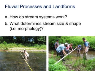
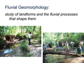
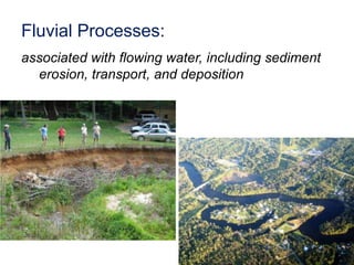
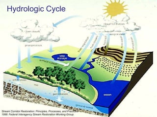
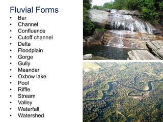
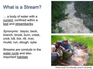
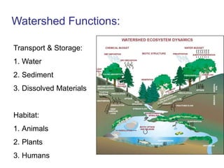
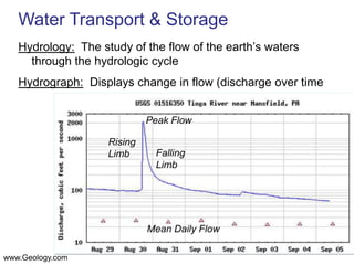
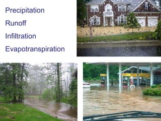
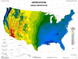
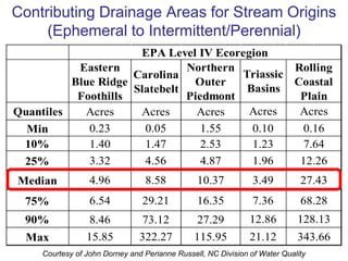
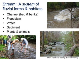
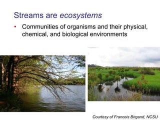
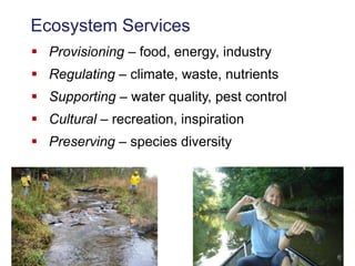
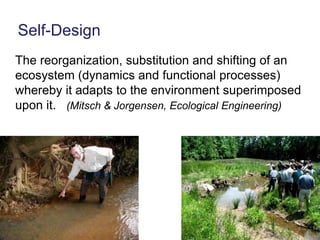
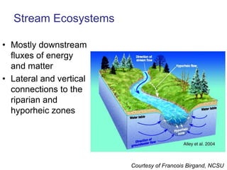
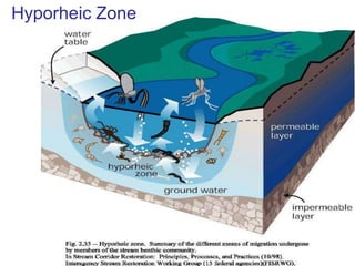
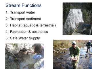
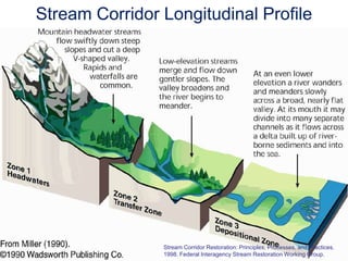
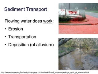
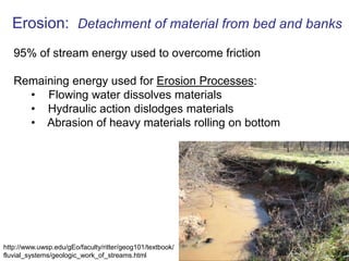
This document provides an overview of stream morphology assessment and restoration. It discusses why stream restoration is important, common causes of stream impairment, and key components of restoration projects. The document also describes stream ecosystems and processes, including watersheds, hydrology, fluvial geomorphology, sediment transport, channel patterns, dimensions, and classification. The goal is to understand stream form and function in order to properly assess conditions and plan successful restoration efforts.
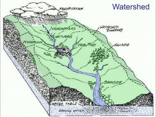
![From Webster's Revised Unabridged Dictionary (1913) :Watershed, n [Cf. G. wasserscheide; wasserwater + scheidea place where two things separate, fr. scheidento separate.]The whole region or extent of country which contributes to the supply of a river or lake.The line of division between two adjacent rivers or lakes with respect to the flow of water by natural channels into them; the natural boundary of a basin.Other Terms: Catchment, Drainage basin, River basin](https://image.slidesharecdn.com/rc101day1jennings10-100326094042-phpapp01/85/Rc101-Day-1-Jennings-10-47-320.jpg)