
Recommended
More Related Content
What's hot
What's hot (20)
Viewers also liked
Viewers also liked (20)
Similar to GEOMETRIC DESIGN OF HIGHWAY
Similar to GEOMETRIC DESIGN OF HIGHWAY (20)
Recently uploaded
Recently uploaded (20)
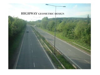
GEOMETRIC DESIGN OF HIGHWAY
- 2. Importance of geometric design •The geometric design of a highway deals with the dimensions and layout of visible features of the highway such as alignment, sight distance and intersection. •The main objective of highway design is to provide optimum efficiency in traffic operation with maximum safety at reasonable cost. •Geometric design of highways deals with following elements : Cross section elements Sight distance considerations Horizontal alignment details Vertical alignment details Intersection elements
- 3. Goals of Geometric design : • Maximize the comfort, safety and economy of facilities. • Provide efficiency in traffic operation. • Provide maximum safety at reasonable cost. • Minimize the environmental impacts.
- 4. Factors affecting geometric design : • Design speed. • Topography. • Traffic. • Environmental factors. • Economical factors. • Vehicles properties (dimensions, weight, operating characteristics, etc.). • Humans (the physical, mental and psychological characteristics of the driver and pedestrians like the reaction time).
- 5. Cross-Section of road & its elements :
- 6. Alignment decision is important because a bad alignment will enhance the construction, maintenance and vehicle operating cost. Once an alignment is fixed and constructed, it is not easy to change it due to increase in cost of adjoining land and construction of costly structures by the roadside.
- 7. CROSS SECTION OF ROAD
- 8. CROSS SECTION OF ROAD
- 9. The Width of pavement way on which vehicles travel is called carriage way .
- 10. Road Shoulders : • Shoulders are provided along the road edge to serve as an emergency lane for vehicles . • As per IRC, the min. width of shoulder should be 2.5m. • Uses : • Repair of broken down vehicles • Overtaking operations • To act as an emergency lane • For future widening of road • For temp. diversion of traffic during road repair etc
- 11. Formation width : • Formation width is the top width of the highway embankment or the bottom width of cutting excluding the side drain . • Formation width = Width of Carr. Way + Width of shoulder
- 12. Right of way : • Right of way is the area of land acquired for the land, along its alignment. • It is the distance between boundary stones of road on either side of road.
- 13. Side slope : • The slope of earthwork in Filling(embankment) or cutting is called sideslope.
- 14. Berm : • The distance between the road toe and inner edge of borrow pit is called berm. • It prevents the erosion of embankment soil.
- 15. Side drain : • For the drainage of rain water, drains are provided on either side of the road . • Normally, Side drain are required for road in cutting. For road in embankment side drain is not necessary.
- 16. Building line : • The distance from the centre line of road on either side, within which construction of building is not permitted is called building line. • Purposes : • For future widening of road • To reduce the chance of accidents • To relieve residents from noise pollution • To prevent disturbance to the traffic by nearby residents
- 17. Kerbs : • The boundaries between pavement and shoulders or footpath are known as kerbs.
- 18. Types of kerbs
- 20. Camber • Camber or cross slope is the slope provided to the road surface in the transverse direction to drain off rain water from the road surface. • The rate of camber is usually designated by 1 in n (1 vertical to n horizontal)
- 21. CAMBER • PERCENTAGE OF CAMBER- 2% • PURPOSE OF CAMBER A slight downward curve from the middle to the sides of a surface (such as a road)
- 22. Purposes of camber : • To remove the rain water from the pavement surface as quickly as possible. • To prevent entry of water into bituminous pavement layers. • To prevent entry of surface water into subgrade soil through pavement. • To make pavement surface attractive.
- 23. Super elevation : • It is the slope across pavement surface and is fully developed in the circular curve. (or) • Super-elevation (banking) is the transverse slope provided at horizontal curve to counteract the centrifugal force, by raising the outer edge of the pavement with respect to the inner edge, throughout the length of the horizontal curve. • So super elevation helps the vehicle to over come the centrifugal force on the curves on pavements • The need for super-elevation on road curves, to ensure safety against skidding and over turning with the advent of fast moving traffic.
- 24. • In the past, roads were constructed without any regard to super-elevation on curves and had generally a cambered section for drainage purposes. It was later realised then that a vehicle moving on a curve had to overcome a centrifugal force to enable it to follow the curved path instead of a straight line, but, in justice to the early designers of roads, it must be said that there was no fast traffic in those days.
- 25. SIGHT DISTANCE •Sight distance available from a point is the actual distance along the road surface, which a driver from a specified height above the carriageway has visibility of stationary or moving objects. OR •It is the length of road visible ahead to the driver at any instance.
- 27. Types of sight distance •Stopping or absolute minimum sight distance(SSD) •Safe Overtaking or passing sight distance (OSD) •Safe sight distance forentering into uncontrolled intersection. •Intermediate sight distance
- 28. Stopping sight distance: •The minimum sight distance available on a highway at any spot should be of sufficient length to stop a vehicle traveling at design speed, safely without collision with any other obstruction. Over taking sight distance: •The minimum distance open to the vision of the driver of a vehicle intending to overtake slow vehicle ahead with safety against the traffic of opposite direction is known as the minimum overtaking sight distance (OSD) or the safe passing sight distance. .
- 29. Intermediate sight distance: This is defined as twice the stopping sight distance. When overtaking sight distance can not be provided, intermediate sight distance is provided to give limited overtaking opportunities to fast vehicles.
- 30. • Stopping Sight Distance •SSD is the minimum sight distance available on a highway at any spot having sufficient length to enable the driver to stop a vehicle traveling at design speed, safely without collision with any other obstruction. • It depends on: •Feature of road ahead •Height of driver’s eye above the road surface(1.2m) •Height of the object above the road surface(0.15m
- 31. • Criteria for measurement • •(h) • h • HIRC • •H = 1.2m • •h = 0.15m • •Height of driver’s eye above road surface (H) • •Height of object above road surface(h)
- 32. • `` Factors affecting the SSD •Total reaction time of driver •Speed of vehicle •Efficiency of brakes •Frictional resistance between road and tyre •Gradient of road Total reaction time of driver: •It is the time taken from the instant the object is visible to the driver to the instant the brake is effectively applied, it divide into types 1.Perception time 2.Brake reaction time