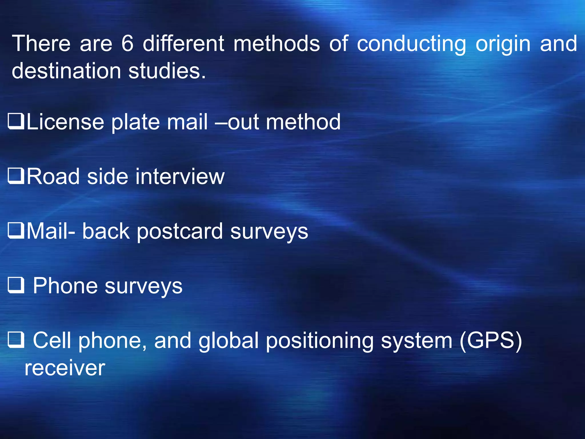
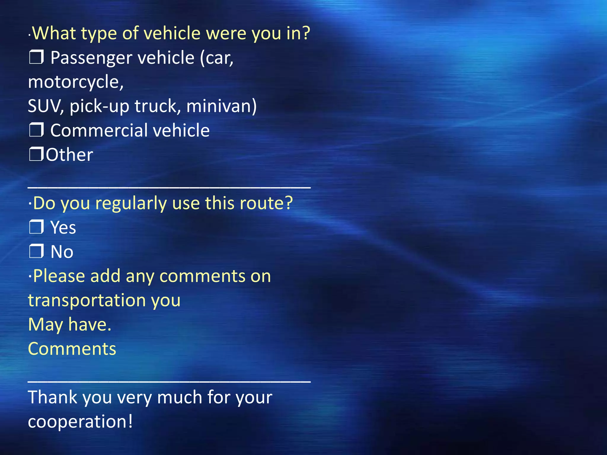
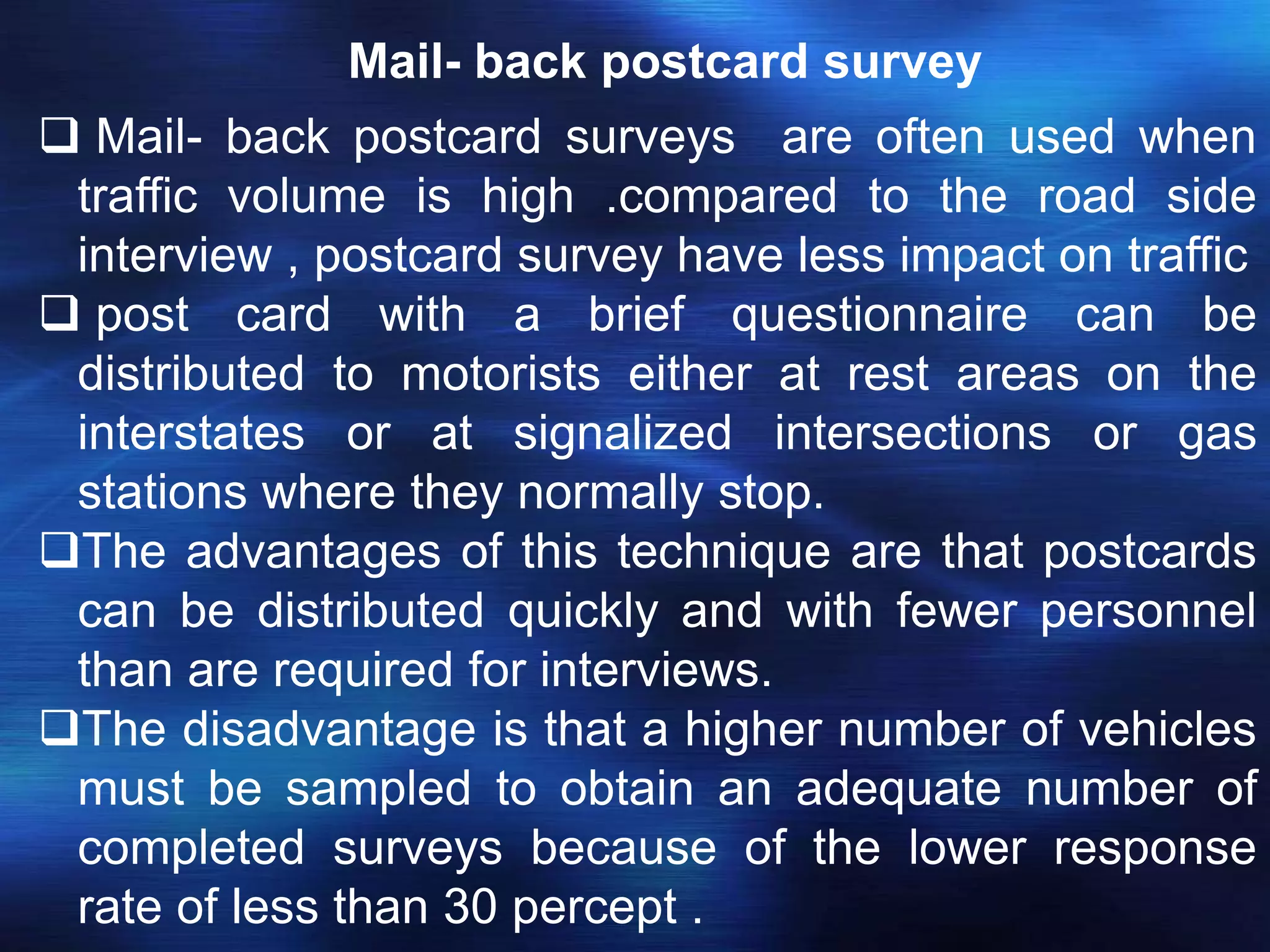
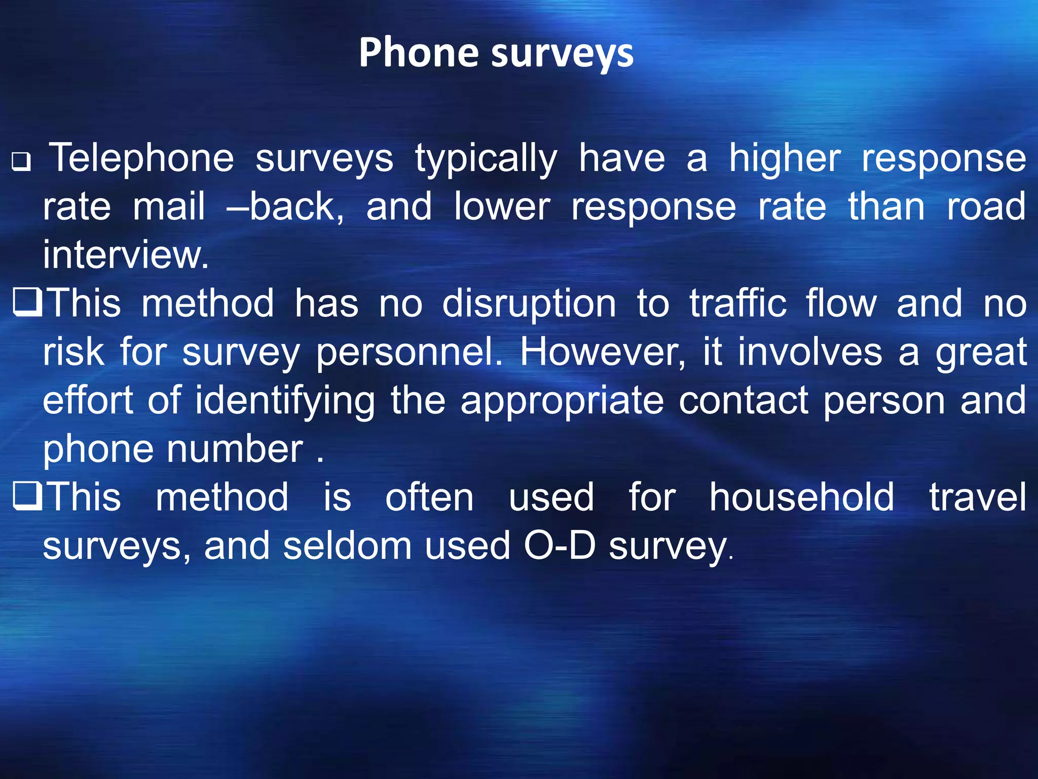
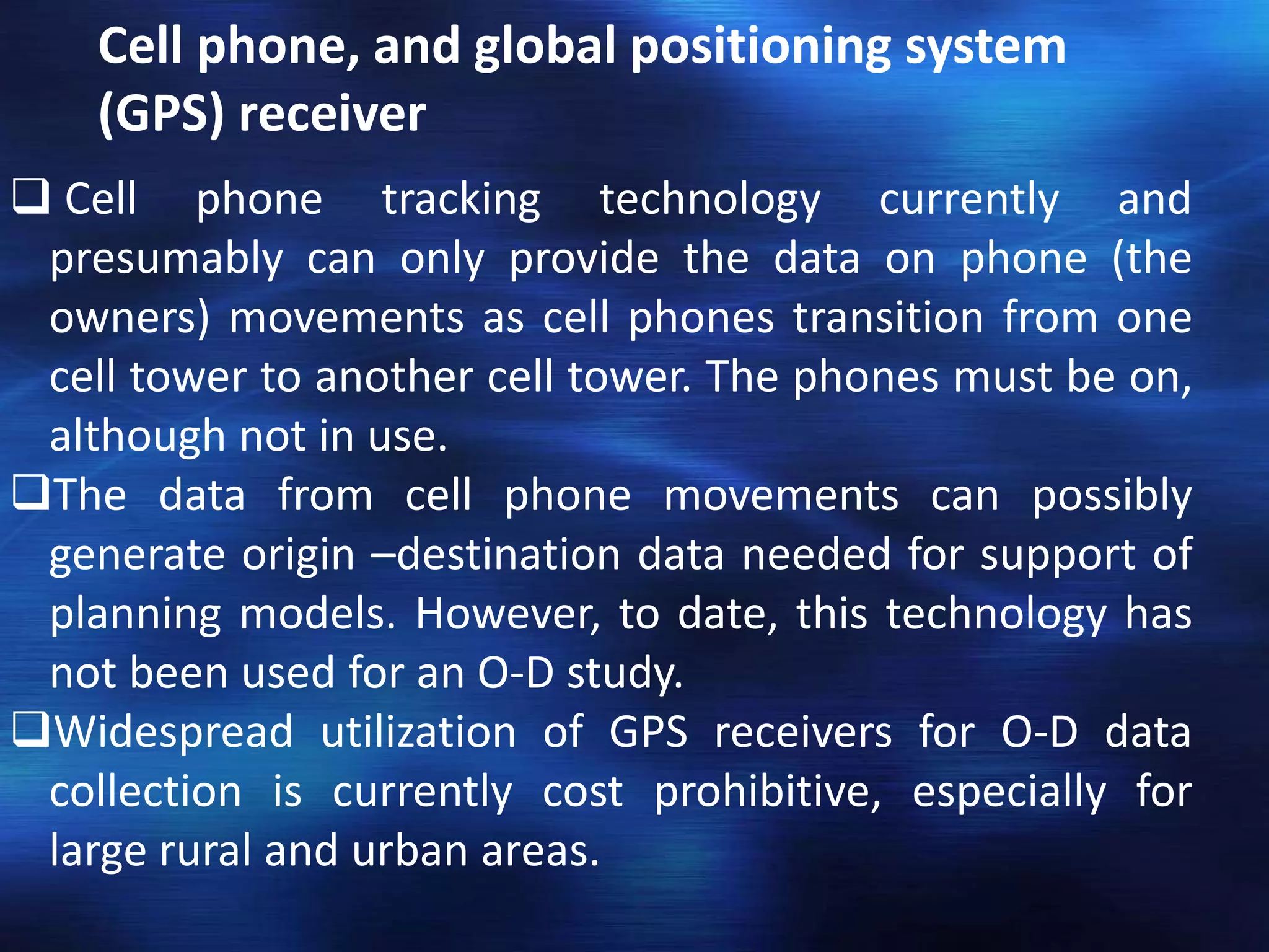
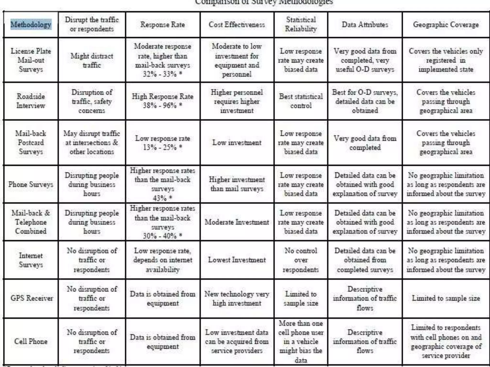
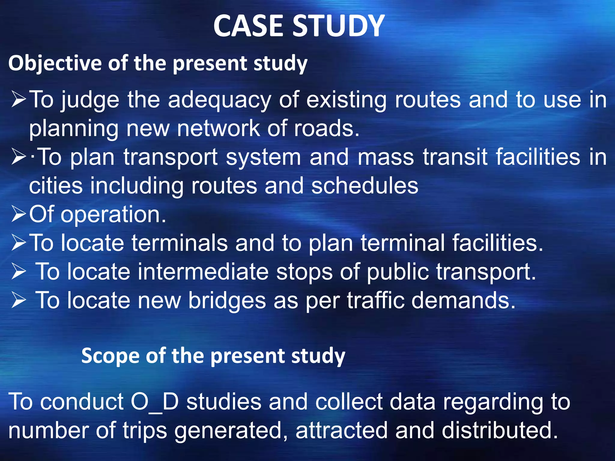
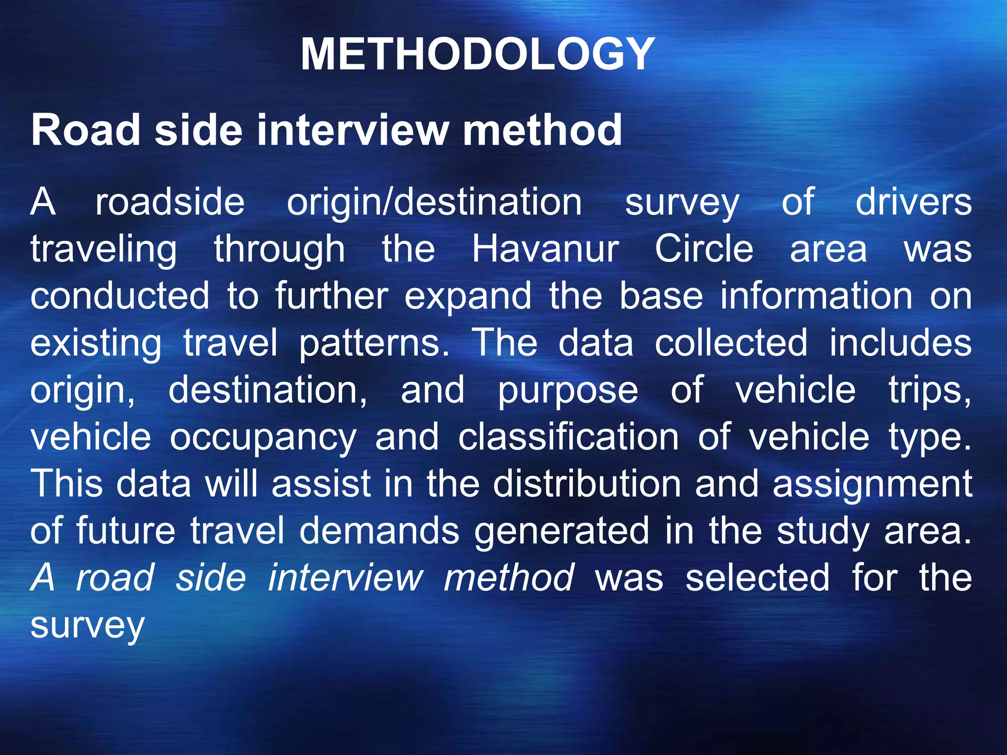
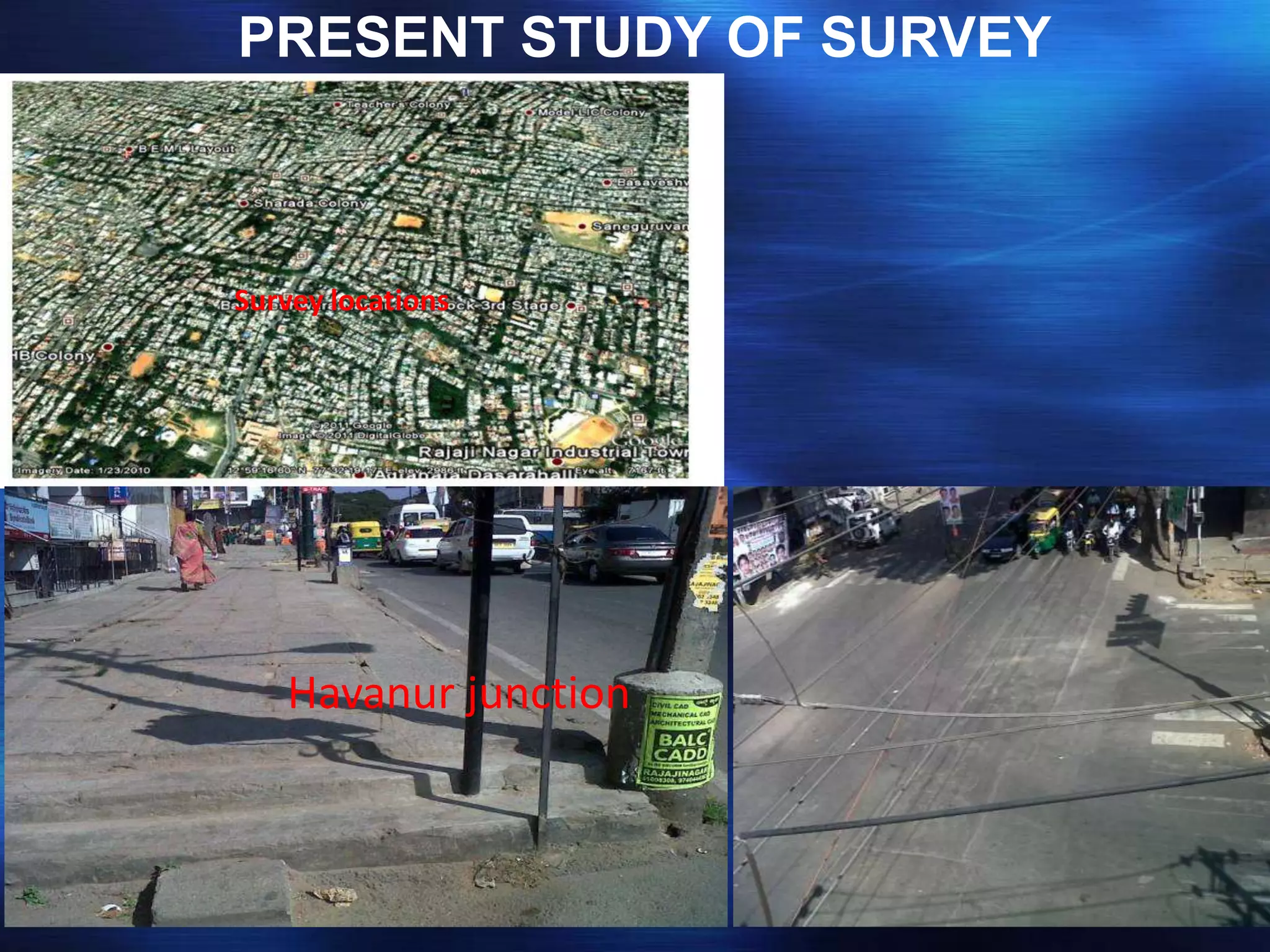
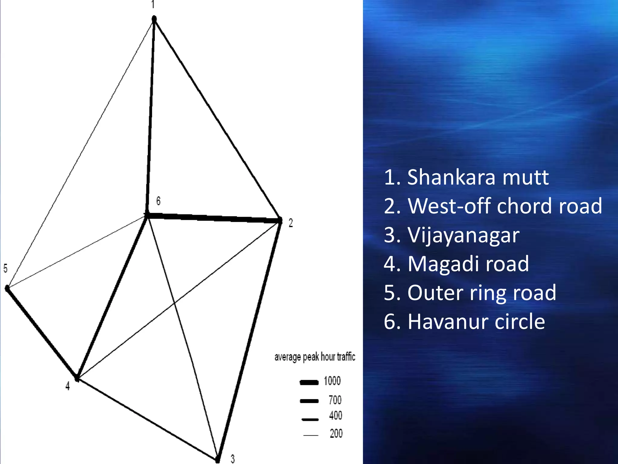
UNIVERSITY OF MYSORE
Manasagangothri, Mysore-6
BY
MANIKANTASWAMY V S
2nd semester ,M.tech(URP)
I.D.S
 In a transportation study, it is often necessary to know the
exact origin and destination of the trips. The information
yielded by O-D survey includes land-use of the zones of
origin and destination, household characteristics of the
trip making family, time of the day when journeys are
made, trip purpose and mode of travel.
INTRODUCTION
 Origin is defined as the place where the trip begins and
destination is defined as the place where the trip ends.
 Origin-Destination (OD) studies are an important tool
for transportation Professionals. OD studies are
conducted to understand the pattern of the movement
of Persons and goods in a particular area of interest
during a particular period of time (Wang, 1997).
The specific uses to which o-d survey data
To determine the amount of by passable traffic that
enters a town and thus establishes the need for
bypass.
To develop trip generation and trip distribution models
in transport planning process.
To determine the extent to which the present highway
system is adequate and plan for new facilities.
To assess the adequacy of parking facilities and plan
for future
METHODS OF ORIGIN AND DESTINATION
STUDY
In order that may flow as smoothly and safety as
possible, it may become necessary to collect data as to
where the traffic came from and where it is going. That is
the purpose of this type of study. The information
gathered may be used to modify the circulation pattern
or assist in other long range planning activities. These
studies are time consuming and rather complex. They
also require the cooperation and assistance of the
public.
There are 6 different methods of conducting origin and
destination studies.
License plate mail –out method
Road side interview
Mail- back postcard surveys
 Phone surveys
 Cell phone, and global positioning system (GPS)
receiver
License plate mail –out method
The licence plate mail-out survey involves recording
licence plate numbers of vehicle on a selected
roadway, tracing vehicle ownership, and mailing a
survey to owner’s .
There are two different methods to obtain the licence
plate number: taking a photo / video or manually
recording the tag on vehicle. photo or video are often
used for high volume highways and the manual
recording method can be used for low and medium
volume road way .
This method has no disruption to normal traffic flow
because it does not require vehicles to be stopped to
receive the survey
Road side interview
Road side interview involves directing vehicles into a
designated interview area and asking a series of short
questions.
This technique has been widely used for both truck
and auto trip collection because it has a very high
response rate , good sampling control, boar
geographic coverage , and normally result in complete
information.
The dis advantage of this method is that it generally
requires more personal and traffic control at survey
sites. Sometimes, it may be difficult to implement due
to traffic disruption especially in urban areas.
Survey Questionnaire:
Location:
Date:
STANDARD FORMAT
Origin-Destination Survey
Questions
Please take a moment to answer a few questions
about your trip. Your responses will help determine the
need for improvements in this area.
·Where did your trip begin?
City/Town _____________________________
State ______
Zip _______
·What type of place is your trip start point?
❒ Primary Residence ❒ Workplace ❒ Store
❒ School (I am a student) ❒ Recreation Area
❒Other _________________________________
·Where did your trip end?
City/Town _____________________________
State ______
Zip __________
·What type of place is your trip end point?
❒ Primary Residence ❒ Workplace ❒ Store
❒ School (I am a student) ❒ Recreation Area
❒ Other _________________________________
·What was the purpose of your trip?
❒ Work Commute ❒ Business Related
❒ Shopping ❒ School (attend class)
❒Recreation ❒Other ___________________
·How many people were in the vehicle, including
the driver?
❒ 1 ❒ 2 ❒ 3 ❒ 4 ❒ 5 or
More
·What type of vehicle were you in?
❒ Passenger vehicle (car,
motorcycle,
SUV, pick-up truck, minivan)
❒ Commercial vehicle
❒Other
____________________________
·Do you regularly use this route?
❒ Yes
❒ No
·Please add any comments on
transportation you
May have.
Comments
____________________________
Thank you very much for your
cooperation!
Mail- back postcard survey
 Mail- back postcard surveys are often used when
traffic volume is high .compared to the road side
interview , postcard survey have less impact on traffic
 post card with a brief questionnaire can be
distributed to motorists either at rest areas on the
interstates or at signalized intersections or gas
stations where they normally stop.
The advantages of this technique are that postcards
can be distributed quickly and with fewer personnel
than are required for interviews.
The disadvantage is that a higher number of vehicles
must be sampled to obtain an adequate number of
completed surveys because of the lower response
rate of less than 30 percept .
Phone surveys
 Telephone surveys typically have a higher response
rate mail –back, and lower response rate than road
interview.
This method has no disruption to traffic flow and no
risk for survey personnel. However, it involves a great
effort of identifying the appropriate contact person and
phone number .
This method is often used for household travel
surveys, and seldom used O-D survey.
Cell phone, and global positioning system
(GPS) receiver
 Cell phone tracking technology currently and
presumably can only provide the data on phone (the
owners) movements as cell phones transition from one
cell tower to another cell tower. The phones must be on,
although not in use.
The data from cell phone movements can possibly
generate origin –destination data needed for support of
planning models. However, to date, this technology has
not been used for an O-D study.
Widespread utilization of GPS receivers for O-D data
collection is currently cost prohibitive, especially for
large rural and urban areas.
CASE STUDY
Objective of the present study
To judge the adequacy of existing routes and to use in
planning new network of roads.
·To plan transport system and mass transit facilities in
cities including routes and schedules
Of operation.
To locate terminals and to plan terminal facilities.
 To locate intermediate stops of public transport.
 To locate new bridges as per traffic demands.
Scope of the present study
To conduct O_D studies and collect data regarding to
number of trips generated, attracted and distributed.
METHODOLOGY
Road side interview method
A roadside origin/destination survey of drivers
traveling through the Havanur Circle area was
conducted to further expand the base information on
existing travel patterns. The data collected includes
origin, destination, and purpose of vehicle trips,
vehicle occupancy and classification of vehicle type.
This data will assist in the distribution and assignment
of future travel demands generated in the study area.
A road side interview method was selected for the
survey
PRESENT STUDY OF SURVEY
Survey locations
Havanur junction
WEEKDAY (9:00 am – 11:00 am)
SL.NO NO. OF
INTERVIEW
WORK SHOPPI
NG
SCHOOL
/COLLEG
E
OTHERS
1 15 8 2 3 2
2 20 10 4 4 2
3 10 2 1 3 4
4 25 6 5 10 4
5 10 1 2 2 2
6 20 10 2 6 2
1. Shankara mutt
2. West-off chord road
3. Vijayanagar
4. Magadi road
5. Outer ring road
6. Havanur circle
Conclusion:
Havanur circle is one of the busiest junctions in
Bangalore; this intersection makes a way to outer ring
road, magadi road and Mysore road. The following
measures are taken to reduce traffic congestion
·Short term measures:
 ·Alter the timings of the HAVANUR junction traffic
signals and review the traffic
 And pedestrian phases to ease congestion at
certain times of the day.
 ·Alteration of signal timings during off peak hour
period.
 ·Movement of heavy commercial vehicles should be
avoid at day time and allow at night time.
·Long term measures:
·Channelization of junction like providing free left on
both sides of the junction.
·Extra widening of carriage width by reducing the
footpath width of KHB of Vijayanagar to Shankara
mutt.
·Underpass should be provided from Westoff chord
road to Basaveshvaranagar 4th block.
·Models like modal split, travel time demandcan be
generated.
CONCLUSION
Origin is defined as the place where the trip begins and
destination is defined as the place where the trip ends.
Origin-Destination (OD) studies are an important tool for
transportation Professionals. OD studies are conducted
to understand the pattern of the movement of Persons
and goods in a particular area of interest during a
particular period of time. And used for many purpose like
to determine the extent to which the present highway
system is adequate and plan for new facilities
References
1. Guidelines for Data Collection Techniques and
Methods for Roadside Station Origin-
DestinationStudies
Bryan P. Guy,Jon D. Fricker
fricker@purdue.edu
2. “Origin-Destination Studies”-A Case Study Of
Junction Improvements In Bangalore City,
Manjunath K. R
Asst. professor, Department of Civil Engineering,
Dayananad sagar college of Engineering, Bangalore
3. khanna.s.k,justo.c.e.g -“Highway engineering”
4. http//www.trb.in
5. Origin-Destination and Traffic Circulation Study
Trunk Highway 43 Bridge Area
Winona, Minnesota
Thanking you

O and d study

  • 1.
    UNIVERSITY OF MYSORE Manasagangothri,Mysore-6 BY MANIKANTASWAMY V S 2nd semester ,M.tech(URP) I.D.S
  • 2.
     In atransportation study, it is often necessary to know the exact origin and destination of the trips. The information yielded by O-D survey includes land-use of the zones of origin and destination, household characteristics of the trip making family, time of the day when journeys are made, trip purpose and mode of travel. INTRODUCTION  Origin is defined as the place where the trip begins and destination is defined as the place where the trip ends.  Origin-Destination (OD) studies are an important tool for transportation Professionals. OD studies are conducted to understand the pattern of the movement of Persons and goods in a particular area of interest during a particular period of time (Wang, 1997).
  • 3.
    The specific usesto which o-d survey data To determine the amount of by passable traffic that enters a town and thus establishes the need for bypass. To develop trip generation and trip distribution models in transport planning process. To determine the extent to which the present highway system is adequate and plan for new facilities. To assess the adequacy of parking facilities and plan for future
  • 4.
    METHODS OF ORIGINAND DESTINATION STUDY In order that may flow as smoothly and safety as possible, it may become necessary to collect data as to where the traffic came from and where it is going. That is the purpose of this type of study. The information gathered may be used to modify the circulation pattern or assist in other long range planning activities. These studies are time consuming and rather complex. They also require the cooperation and assistance of the public.
  • 5.
    There are 6different methods of conducting origin and destination studies. License plate mail –out method Road side interview Mail- back postcard surveys  Phone surveys  Cell phone, and global positioning system (GPS) receiver
  • 6.
    License plate mail–out method The licence plate mail-out survey involves recording licence plate numbers of vehicle on a selected roadway, tracing vehicle ownership, and mailing a survey to owner’s . There are two different methods to obtain the licence plate number: taking a photo / video or manually recording the tag on vehicle. photo or video are often used for high volume highways and the manual recording method can be used for low and medium volume road way . This method has no disruption to normal traffic flow because it does not require vehicles to be stopped to receive the survey
  • 7.
    Road side interview Roadside interview involves directing vehicles into a designated interview area and asking a series of short questions. This technique has been widely used for both truck and auto trip collection because it has a very high response rate , good sampling control, boar geographic coverage , and normally result in complete information. The dis advantage of this method is that it generally requires more personal and traffic control at survey sites. Sometimes, it may be difficult to implement due to traffic disruption especially in urban areas.
  • 8.
    Survey Questionnaire: Location: Date: STANDARD FORMAT Origin-DestinationSurvey Questions Please take a moment to answer a few questions about your trip. Your responses will help determine the need for improvements in this area. ·Where did your trip begin? City/Town _____________________________ State ______ Zip _______ ·What type of place is your trip start point? ❒ Primary Residence ❒ Workplace ❒ Store ❒ School (I am a student) ❒ Recreation Area ❒Other _________________________________
  • 9.
    ·Where did yourtrip end? City/Town _____________________________ State ______ Zip __________ ·What type of place is your trip end point? ❒ Primary Residence ❒ Workplace ❒ Store ❒ School (I am a student) ❒ Recreation Area ❒ Other _________________________________ ·What was the purpose of your trip? ❒ Work Commute ❒ Business Related ❒ Shopping ❒ School (attend class) ❒Recreation ❒Other ___________________ ·How many people were in the vehicle, including the driver? ❒ 1 ❒ 2 ❒ 3 ❒ 4 ❒ 5 or More
  • 10.
    ·What type ofvehicle were you in? ❒ Passenger vehicle (car, motorcycle, SUV, pick-up truck, minivan) ❒ Commercial vehicle ❒Other ____________________________ ·Do you regularly use this route? ❒ Yes ❒ No ·Please add any comments on transportation you May have. Comments ____________________________ Thank you very much for your cooperation!
  • 11.
    Mail- back postcardsurvey  Mail- back postcard surveys are often used when traffic volume is high .compared to the road side interview , postcard survey have less impact on traffic  post card with a brief questionnaire can be distributed to motorists either at rest areas on the interstates or at signalized intersections or gas stations where they normally stop. The advantages of this technique are that postcards can be distributed quickly and with fewer personnel than are required for interviews. The disadvantage is that a higher number of vehicles must be sampled to obtain an adequate number of completed surveys because of the lower response rate of less than 30 percept .
  • 12.
    Phone surveys  Telephonesurveys typically have a higher response rate mail –back, and lower response rate than road interview. This method has no disruption to traffic flow and no risk for survey personnel. However, it involves a great effort of identifying the appropriate contact person and phone number . This method is often used for household travel surveys, and seldom used O-D survey.
  • 13.
    Cell phone, andglobal positioning system (GPS) receiver  Cell phone tracking technology currently and presumably can only provide the data on phone (the owners) movements as cell phones transition from one cell tower to another cell tower. The phones must be on, although not in use. The data from cell phone movements can possibly generate origin –destination data needed for support of planning models. However, to date, this technology has not been used for an O-D study. Widespread utilization of GPS receivers for O-D data collection is currently cost prohibitive, especially for large rural and urban areas.
  • 15.
    CASE STUDY Objective ofthe present study To judge the adequacy of existing routes and to use in planning new network of roads. ·To plan transport system and mass transit facilities in cities including routes and schedules Of operation. To locate terminals and to plan terminal facilities.  To locate intermediate stops of public transport.  To locate new bridges as per traffic demands. Scope of the present study To conduct O_D studies and collect data regarding to number of trips generated, attracted and distributed.
  • 16.
    METHODOLOGY Road side interviewmethod A roadside origin/destination survey of drivers traveling through the Havanur Circle area was conducted to further expand the base information on existing travel patterns. The data collected includes origin, destination, and purpose of vehicle trips, vehicle occupancy and classification of vehicle type. This data will assist in the distribution and assignment of future travel demands generated in the study area. A road side interview method was selected for the survey
  • 17.
    PRESENT STUDY OFSURVEY Survey locations Havanur junction
  • 18.
    WEEKDAY (9:00 am– 11:00 am) SL.NO NO. OF INTERVIEW WORK SHOPPI NG SCHOOL /COLLEG E OTHERS 1 15 8 2 3 2 2 20 10 4 4 2 3 10 2 1 3 4 4 25 6 5 10 4 5 10 1 2 2 2 6 20 10 2 6 2
  • 20.
    1. Shankara mutt 2.West-off chord road 3. Vijayanagar 4. Magadi road 5. Outer ring road 6. Havanur circle
  • 21.
    Conclusion: Havanur circle isone of the busiest junctions in Bangalore; this intersection makes a way to outer ring road, magadi road and Mysore road. The following measures are taken to reduce traffic congestion ·Short term measures:  ·Alter the timings of the HAVANUR junction traffic signals and review the traffic  And pedestrian phases to ease congestion at certain times of the day.  ·Alteration of signal timings during off peak hour period.  ·Movement of heavy commercial vehicles should be avoid at day time and allow at night time.
  • 22.
    ·Long term measures: ·Channelizationof junction like providing free left on both sides of the junction. ·Extra widening of carriage width by reducing the footpath width of KHB of Vijayanagar to Shankara mutt. ·Underpass should be provided from Westoff chord road to Basaveshvaranagar 4th block. ·Models like modal split, travel time demandcan be generated.
  • 23.
    CONCLUSION Origin is definedas the place where the trip begins and destination is defined as the place where the trip ends. Origin-Destination (OD) studies are an important tool for transportation Professionals. OD studies are conducted to understand the pattern of the movement of Persons and goods in a particular area of interest during a particular period of time. And used for many purpose like to determine the extent to which the present highway system is adequate and plan for new facilities
  • 24.
    References 1. Guidelines forData Collection Techniques and Methods for Roadside Station Origin- DestinationStudies Bryan P. Guy,Jon D. Fricker fricker@purdue.edu 2. “Origin-Destination Studies”-A Case Study Of Junction Improvements In Bangalore City, Manjunath K. R Asst. professor, Department of Civil Engineering, Dayananad sagar college of Engineering, Bangalore 3. khanna.s.k,justo.c.e.g -“Highway engineering” 4. http//www.trb.in 5. Origin-Destination and Traffic Circulation Study Trunk Highway 43 Bridge Area Winona, Minnesota
  • 25.