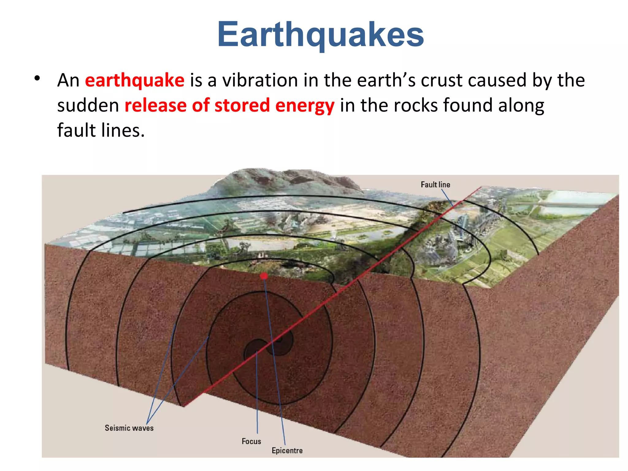
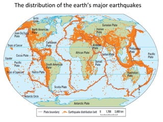
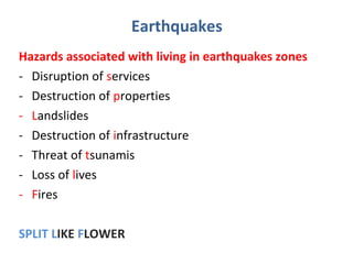
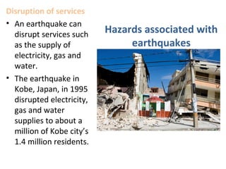
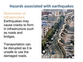
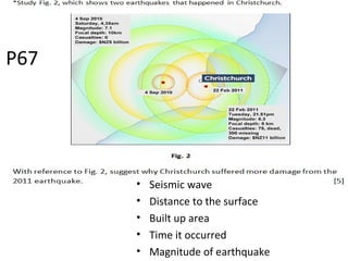
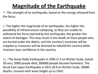
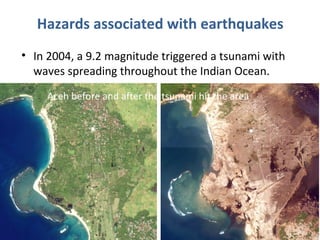
An earthquake is caused by the sudden release of energy along fault lines, generating seismic waves. Major earthquakes can trigger hazardous events like tsunamis, which are massive sea waves that cause extensive damage and loss of life when they reach coastal areas. Living in earthquake and tsunami prone zones presents many risks such as property destruction, disruption of basic services, fires, landslides, and loss of lives.


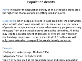

![• The tsunami is formed by the movement of the sea floor during a
large earthquake at the ________ zone. [1]
• The offshore earthquake forces out a ____________. [1]
• On reaching shallower water, greater friction slows the waves
and forces the waves to increase in __________. [1]
• At the point of impact on the coast, the tsunami waves could
reach heights of 15m. [1]
P64](https://image.slidesharecdn.com/eqandtsunamis-150331202702-conversion-gate01/85/Eq-and-tsunamis-33-320.jpg)
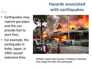
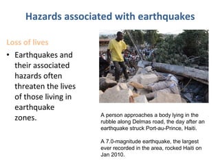
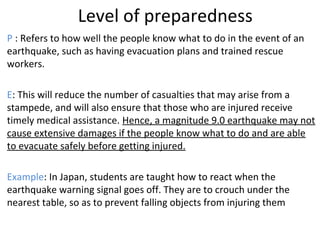
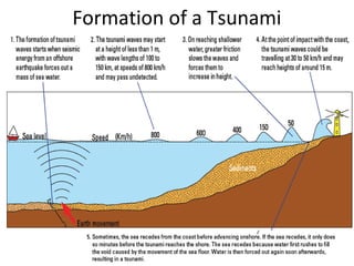
![• The tsunami is formed by the movement of the sea floor during a
large earthquake at the subduction zone. [1]
• The offshore earthquake forces out a mass of sea water. [1]
• On reaching shallower water, greater friction slows the waves
and forces the waves to increase in height. [1]
• At the point of impact on the coast, the tsunami waves could
reach heights of 15m. [1]
P64](https://image.slidesharecdn.com/eqandtsunamis-150331202702-conversion-gate01/85/Eq-and-tsunamis-34-320.jpg)
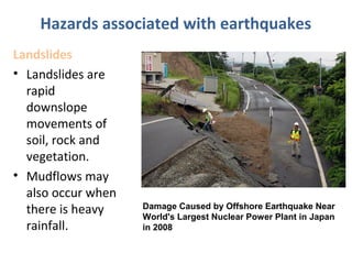
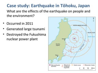
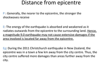
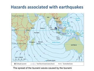
![Singapore is protected to a significant degree
[1]
by the southern end of Malaysia Peninsula [1]
and the island of Sumatra to the west [1].
The energy of waves travelling southwards
would have been absorbed by the coastlines of
those land masses. [1]
P64
Explain why the impact of the tsunami on Singapore was
minimal.
[4]](https://image.slidesharecdn.com/eqandtsunamis-150331202702-conversion-gate01/85/Eq-and-tsunamis-35-320.jpg)
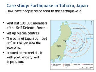
![P=Point Tsunamis can have an impact on the lives of the people.
D=Describe Tsunamis are unusually large waves caused by underwater earthquakes.
E=Explain Tsunamis can travel long distances and caused great destruction to coastal areas when they
sweep inland. At the point of contact on the coast, the tsunami waves could be travelling at
50km/h and may reach heights of around 15metres.
E=Example In 2004, a 9.2 magnitude earthquake occurred in the Indian Ocean and caused a tsunami with
waves that spread throughout the Indian Ocean. The most damage was experienced in the low-
lying coastal areas of western Sumatra, Indonesia.
There was loss of lives and destruction of properties along this stretch of the coast.
P=Point Earthquakes can have an impact on the lives of the people. Earthquakes can cause fire.
D=Describe Earthquakes may rupture gas pipes and the gas can provide fuel to start fires. Earthquakes may
expose electrical cables which may ignite flammable items like gas and oil.
E=Explain Once these items are ignited, fires can spread quickly to a large area, increasing the number of
deaths and injured.
E=Example For example, the 1995 earthquake in Kobe, Japan. The earthquake caused extensive fires that went
on for 2 days. Firemen were unable to control the fires as the ruptured water pipes meant that
there was no water supply to put out the fire.
Complete Worksheet
‘The impact of a tsunami on people’s lives can be more devastating than that of an
earthquake.’ How far do you agree with this statement? Give reasons for your answer.
[6]
Impact of a tsunami on people’s lives (1 example)
Impact of an earthquake on people’s lives (1 example)](https://image.slidesharecdn.com/eqandtsunamis-150331202702-conversion-gate01/85/Eq-and-tsunamis-37-320.jpg)


![Urban sprawl [compatibility mode]](https://cdn.slidesharecdn.com/ss_thumbnails/urbansprawlcompatibilitymode-141227110234-conversion-gate01-thumbnail.jpg?width=640&height=640&fit=bounds)