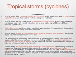
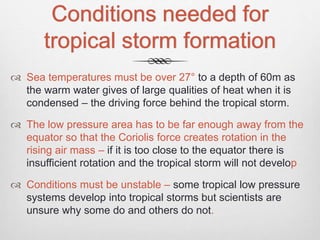
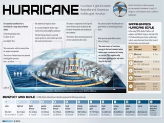
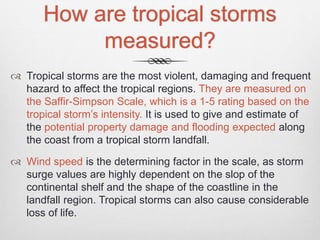
Downloaded 1,096 times

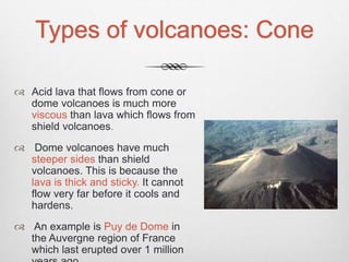
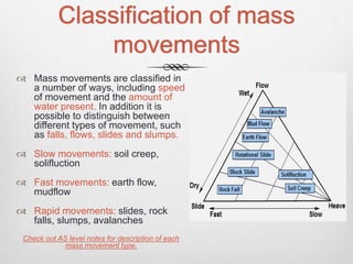
![Types of Volcanoes:
Shield
Shield volcanoes are low with gently
sloping sides and are formed from layers of
lava.
Eruptions are typically non-explosive but
frequent.
Shield volcanoes produce fast flowing fluid
[lava] that can flow for many miles.
Shield volcanoes are usually found at
constructive boundaries and sometimes at
volcanic hotspots. Examples of the largest
shield volcano is Mauna loa on Hawaii. It is
also one of the Earth’s most active
volcanoes and is carefully monitored. The
most recent eruption was in 1984.](https://image.slidesharecdn.com/hazardousenvironments-151112165828-lva1-app6891/85/Hazardous-environments-24-320.jpg)
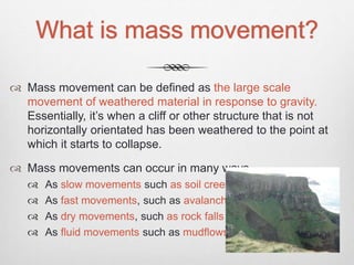


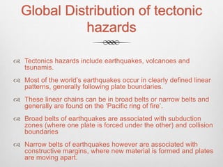
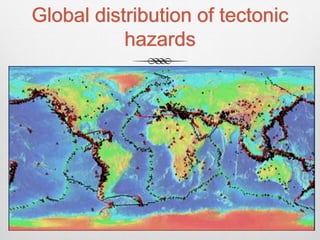
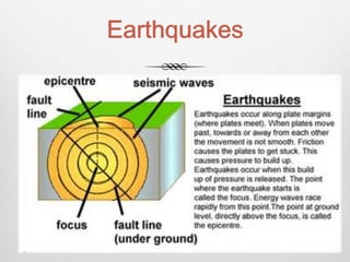
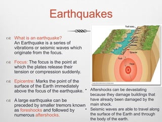
The document discusses the global distribution of tectonic hazards such as earthquakes, volcanoes, and tsunamis. It explains that most earthquakes occur along well-defined plate boundaries, including subduction zones where one plate slides under another, and collision boundaries. Narrow earthquake belts are associated with constructive margins where new crust is forming and plates are moving apart. Broadly, the document provides an overview of the types and causes of tectonic hazards around the world.


