SlideShare a Scribd company logo
CONTINENTAL MAPPING
Mapping from Earth, Sky and Space
www.continentalmapping.com
Madison, Wisconsin
Indianapolis, Indiana
Kansas City, Kansas
St. Louis, Missouri
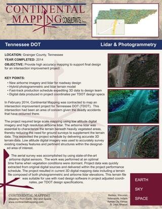
In February 2014, Continental Mapping was contracted to map an
intersection improvement project for Tennessee DOT (TDOT). This
intersection had been an area of concern given the deadly accidents
that have occurred there.
The project required large scale mapping using low altitude digital
imagery and high resolution airborne lidar. The airborne lidar was
essential to characterize the terrain beneath heavily vegetated areas,
thereby reducing the need for ground surveys to supplement the terrain
data. This expedited the project schedule by delivering accurate 3D
terrain data. Low altitude digital imagery was used to accurately survey
existing roadway features and pertinent structures within the designat-
ed area of interest.
The aerial survey was accomplished by using state-of-the-art
airborne digital sensors. The work was performed at an optimal
time frame when vegetation conditions were dormant. Project data was quickly
extracted from original digital sources and delivered within the project performance
schedule. The project resulted in current 3D digital mapping data including a terrain
file composed of both photogrammetric and airborne lidar elevations. This terrain file
was suitable for use with road design software in project adjusted coordi-
nates, per TDOT design specifications.
LOCATION: Grainger County, Tennessee
YEAR COMPLETED: 2014
OBJECTIVE: Provide high accuracy mapping to support final design
for an intersection improvement project
KEY POINTS:
• New airborne imagery and lidar for roadway design
• Hybrid photogrammetric and lidar terrain model
• Fast-track production schedule expediting 3D data to design team
• Digital data produced in project coordinates per TDOT design specs
Tennessee DOT Lidar & Photogrammetry

More Related Content

What's hot

Introduction To and Arcaeological Apps of GIS
Introduction To and Arcaeological Apps of GIS Introduction To and Arcaeological Apps of GIS
Introduction To and Arcaeological Apps of GIS
Jo Dyson
 
Applications of RS and GIS in Urban Planning by Rakshith m murthy
Applications of RS and GIS in Urban Planning by Rakshith m murthyApplications of RS and GIS in Urban Planning by Rakshith m murthy
Applications of RS and GIS in Urban Planning by Rakshith m murthy
s0l0m0n7
 
Application of gis & rs in urban planning
Application of gis & rs in urban planning Application of gis & rs in urban planning
Application of gis & rs in urban planning
sathish1446
 
Geographic Information Systems in the Oil & Gas Industry
Geographic Information Systems in the Oil & Gas IndustryGeographic Information Systems in the Oil & Gas Industry
Geographic Information Systems in the Oil & Gas Industry
Francois Viljoen
 
WHAT'S THERE IN GEOMATICS ENGINEERING???
WHAT'S THERE IN GEOMATICS ENGINEERING???WHAT'S THERE IN GEOMATICS ENGINEERING???
WHAT'S THERE IN GEOMATICS ENGINEERING???
Nepal Flying Labs
 

What's hot (20)

Gis in urban
Gis in urbanGis in urban
Gis in urban
 
Introduction To and Arcaeological Apps of GIS
Introduction To and Arcaeological Apps of GIS Introduction To and Arcaeological Apps of GIS
Introduction To and Arcaeological Apps of GIS
 
Gis applications in civil engineering
Gis applications in civil engineeringGis applications in civil engineering
Gis applications in civil engineering
 
Applications of RS and GIS in Urban Planning by Rakshith m murthy
Applications of RS and GIS in Urban Planning by Rakshith m murthyApplications of RS and GIS in Urban Planning by Rakshith m murthy
Applications of RS and GIS in Urban Planning by Rakshith m murthy
 
Archaeological Applications Of Gis
Archaeological Applications Of GisArchaeological Applications Of Gis
Archaeological Applications Of Gis
 
Application of gis in urban traffic air quality
Application of gis in urban traffic air qualityApplication of gis in urban traffic air quality
Application of gis in urban traffic air quality
 
application of gis
application of gisapplication of gis
application of gis
 
Presentation on gis and future trends
Presentation on gis and future trendsPresentation on gis and future trends
Presentation on gis and future trends
 
Application of gis and gps in civil engineering
Application of gis and gps in civil engineeringApplication of gis and gps in civil engineering
Application of gis and gps in civil engineering
 
Madhavi priyanka
Madhavi priyankaMadhavi priyanka
Madhavi priyanka
 
GIS for Urban Planning and Design
GIS for Urban Planning and DesignGIS for Urban Planning and Design
GIS for Urban Planning and Design
 
Application of gis in urban planning
Application of gis in urban planningApplication of gis in urban planning
Application of gis in urban planning
 
Application of gis & rs in urban planning
Application of gis & rs in urban planning Application of gis & rs in urban planning
Application of gis & rs in urban planning
 
Geographic Information Systems in the Oil & Gas Industry
Geographic Information Systems in the Oil & Gas IndustryGeographic Information Systems in the Oil & Gas Industry
Geographic Information Systems in the Oil & Gas Industry
 
WHAT'S THERE IN GEOMATICS ENGINEERING???
WHAT'S THERE IN GEOMATICS ENGINEERING???WHAT'S THERE IN GEOMATICS ENGINEERING???
WHAT'S THERE IN GEOMATICS ENGINEERING???
 
Role of gis in climate change
Role of gis in climate changeRole of gis in climate change
Role of gis in climate change
 
Bridge Inventory Using GIS
Bridge Inventory Using GISBridge Inventory Using GIS
Bridge Inventory Using GIS
 
Application of GIS
Application of GISApplication of GIS
Application of GIS
 
Status and Perspectives of GIS Application in BANGLADESH
Status and Perspectives of GIS Application in BANGLADESHStatus and Perspectives of GIS Application in BANGLADESH
Status and Perspectives of GIS Application in BANGLADESH
 
GIS & RS
GIS & RSGIS & RS
GIS & RS
 

Viewers also liked (7)

Continental Mapping Projects - Chattanooga
Continental Mapping Projects - ChattanoogaContinental Mapping Projects - Chattanooga
Continental Mapping Projects - Chattanooga
 
Continental Mapping Projects - FEMA Butler Co. MO
Continental Mapping Projects - FEMA Butler Co. MOContinental Mapping Projects - FEMA Butler Co. MO
Continental Mapping Projects - FEMA Butler Co. MO
 
Continental mapping projects las vegas water treatment plant
Continental mapping projects   las vegas water treatment plantContinental mapping projects   las vegas water treatment plant
Continental mapping projects las vegas water treatment plant
 
Continental Mapping Projects - Tualatin National Wildlife Refuge
Continental Mapping Projects - Tualatin National Wildlife RefugeContinental Mapping Projects - Tualatin National Wildlife Refuge
Continental Mapping Projects - Tualatin National Wildlife Refuge
 
Continental Mapping Projects - USACE Cleveland Levee
Continental Mapping Projects - USACE Cleveland LeveeContinental Mapping Projects - USACE Cleveland Levee
Continental Mapping Projects - USACE Cleveland Levee
 
Continental Mapping Projects - USACE Pine Creek
Continental Mapping Projects - USACE Pine CreekContinental Mapping Projects - USACE Pine Creek
Continental Mapping Projects - USACE Pine Creek
 
Continental Mapping Projects - ATC Dane County
Continental Mapping Projects - ATC Dane CountyContinental Mapping Projects - ATC Dane County
Continental Mapping Projects - ATC Dane County
 

Similar to Continental Mapping Projects - TDOT Grainger Co.

Max Bolen Resume 12202016
Max Bolen Resume 12202016Max Bolen Resume 12202016
Max Bolen Resume 12202016
Max Bolen
 
C Arias EA Current_WEM3 2015 Ouse Washes
C Arias EA Current_WEM3 2015 Ouse WashesC Arias EA Current_WEM3 2015 Ouse Washes
C Arias EA Current_WEM3 2015 Ouse Washes
Arias Christian
 
GIS and GPS - applications in civil engg
GIS and GPS - applications  in civil enggGIS and GPS - applications  in civil engg
GIS and GPS - applications in civil engg
Pundlik Rathod
 
Ar2419141919
Ar2419141919Ar2419141919
Ar2419141919
IJMER
 
geotourismFinalReportJun112106
geotourismFinalReportJun112106geotourismFinalReportJun112106
geotourismFinalReportJun112106
Paresh Parikh
 

Similar to Continental Mapping Projects - TDOT Grainger Co. (20)

Vivek Resume
Vivek Resume Vivek Resume
Vivek Resume
 
Headings - 2008 issue 2
Headings - 2008 issue 2Headings - 2008 issue 2
Headings - 2008 issue 2
 
Continental Mapping Projects - Trans Design
Continental Mapping Projects - Trans DesignContinental Mapping Projects - Trans Design
Continental Mapping Projects - Trans Design
 
Max Bolen Resume 12202016
Max Bolen Resume 12202016Max Bolen Resume 12202016
Max Bolen Resume 12202016
 
C Arias EA Current_WEM3 2015 Ouse Washes
C Arias EA Current_WEM3 2015 Ouse WashesC Arias EA Current_WEM3 2015 Ouse Washes
C Arias EA Current_WEM3 2015 Ouse Washes
 
Introduction of GIS & Remote Sensing (RS)
Introduction of GIS & Remote Sensing (RS)Introduction of GIS & Remote Sensing (RS)
Introduction of GIS & Remote Sensing (RS)
 
Lidar Unlocks Subterranean Philadelphia
Lidar Unlocks Subterranean PhiladelphiaLidar Unlocks Subterranean Philadelphia
Lidar Unlocks Subterranean Philadelphia
 
Advanced Technologies
Advanced TechnologiesAdvanced Technologies
Advanced Technologies
 
MODERN trends of GIS
MODERN trends of GISMODERN trends of GIS
MODERN trends of GIS
 
RNK - GIS Brochure
RNK - GIS BrochureRNK - GIS Brochure
RNK - GIS Brochure
 
GIS and GPS - applications in civil engg
GIS and GPS - applications  in civil enggGIS and GPS - applications  in civil engg
GIS and GPS - applications in civil engg
 
Ar2419141919
Ar2419141919Ar2419141919
Ar2419141919
 
5.0000099.pdf
5.0000099.pdf5.0000099.pdf
5.0000099.pdf
 
Geodatabase with GIS & RS
Geodatabase with GIS & RSGeodatabase with GIS & RS
Geodatabase with GIS & RS
 
Don Talend Geospatial Rural Utility Mobile Mapping Article
Don Talend Geospatial Rural Utility Mobile Mapping ArticleDon Talend Geospatial Rural Utility Mobile Mapping Article
Don Talend Geospatial Rural Utility Mobile Mapping Article
 
geotourismFinalReportJun112106
geotourismFinalReportJun112106geotourismFinalReportJun112106
geotourismFinalReportJun112106
 
Continental Mapping Projects - HWY F
Continental Mapping Projects - HWY FContinental Mapping Projects - HWY F
Continental Mapping Projects - HWY F
 
The Truth About Drones in Mapping and Surveying
The Truth About Drones in Mapping and SurveyingThe Truth About Drones in Mapping and Surveying
The Truth About Drones in Mapping and Surveying
 
Slope Modeling & Terrain Analysis (EPAN09)
Slope Modeling & Terrain Analysis (EPAN09)Slope Modeling & Terrain Analysis (EPAN09)
Slope Modeling & Terrain Analysis (EPAN09)
 
Sutapa_resume
Sutapa_resumeSutapa_resume
Sutapa_resume
 

More from Continental Mapping Consultants

More from Continental Mapping Consultants (16)

Continental Mapping Introduces TheGeoFoundry.com
Continental Mapping Introduces TheGeoFoundry.comContinental Mapping Introduces TheGeoFoundry.com
Continental Mapping Introduces TheGeoFoundry.com
 
Continental Mapping Projects - Wood Road Re-alignment
Continental Mapping Projects - Wood Road Re-alignmentContinental Mapping Projects - Wood Road Re-alignment
Continental Mapping Projects - Wood Road Re-alignment
 
Transportation Mapping
Transportation MappingTransportation Mapping
Transportation Mapping
 
Storygraphic - The Continental Mapping Story
Storygraphic - The Continental Mapping StoryStorygraphic - The Continental Mapping Story
Storygraphic - The Continental Mapping Story
 
Map America - 10 Tallest Dams Infographic
Map America - 10 Tallest Dams InfographicMap America - 10 Tallest Dams Infographic
Map America - 10 Tallest Dams Infographic
 
Continental Mapping - On All Continents
Continental Mapping - On All Continents Continental Mapping - On All Continents
Continental Mapping - On All Continents
 
FAA UAS Map
FAA UAS MapFAA UAS Map
FAA UAS Map
 
Red Wing Bridge Project
Red Wing Bridge ProjectRed Wing Bridge Project
Red Wing Bridge Project
 
Aztalan Project
Aztalan ProjectAztalan Project
Aztalan Project
 
Continental mapping projects indot south split
Continental mapping projects   indot south splitContinental mapping projects   indot south split
Continental mapping projects indot south split
 
Continental Mapping Projects - Dodger Stadium
Continental Mapping Projects - Dodger StadiumContinental Mapping Projects - Dodger Stadium
Continental Mapping Projects - Dodger Stadium
 
Mobile Lidar - Speed You Need
Mobile Lidar - Speed You NeedMobile Lidar - Speed You Need
Mobile Lidar - Speed You Need
 
Control for Mobile Lidar
Control for Mobile LidarControl for Mobile Lidar
Control for Mobile Lidar
 
Yukon Delta Refuge Infographic
Yukon Delta Refuge InfographicYukon Delta Refuge Infographic
Yukon Delta Refuge Infographic
 
Photogrammetry
PhotogrammetryPhotogrammetry
Photogrammetry
 
Data Fusion Menu
Data Fusion MenuData Fusion Menu
Data Fusion Menu
 

Recently uploaded

Heuristic Evaluation of System & Application
Heuristic Evaluation of System & ApplicationHeuristic Evaluation of System & Application
Heuristic Evaluation of System & Application
Jaime Brown
 
Research about Venice ppt for grade 6f anas
Research about Venice ppt for grade 6f anasResearch about Venice ppt for grade 6f anas
Research about Venice ppt for grade 6f anas
anasabutalha2013
 
National-Learning-Camp 2024 deped....pptx
National-Learning-Camp 2024 deped....pptxNational-Learning-Camp 2024 deped....pptx
National-Learning-Camp 2024 deped....pptx
AlecAnidul
 

Recently uploaded (14)

Heuristic Evaluation of System & Application
Heuristic Evaluation of System & ApplicationHeuristic Evaluation of System & Application
Heuristic Evaluation of System & Application
 
CA OFFICE office office office _VIEWS.pdf
CA OFFICE office office office _VIEWS.pdfCA OFFICE office office office _VIEWS.pdf
CA OFFICE office office office _VIEWS.pdf
 
Spring 2024 wkrm_Enhancing Campus Mobility.pdf
Spring 2024 wkrm_Enhancing Campus Mobility.pdfSpring 2024 wkrm_Enhancing Campus Mobility.pdf
Spring 2024 wkrm_Enhancing Campus Mobility.pdf
 
Pitch Presentation for Service Design in Technology
Pitch Presentation for Service Design in TechnologyPitch Presentation for Service Design in Technology
Pitch Presentation for Service Design in Technology
 
Research about Venice ppt for grade 6f anas
Research about Venice ppt for grade 6f anasResearch about Venice ppt for grade 6f anas
Research about Venice ppt for grade 6f anas
 
Art Nouveau Movement Presentation for Art History.
Art Nouveau Movement Presentation for Art History.Art Nouveau Movement Presentation for Art History.
Art Nouveau Movement Presentation for Art History.
 
National-Learning-Camp 2024 deped....pptx
National-Learning-Camp 2024 deped....pptxNational-Learning-Camp 2024 deped....pptx
National-Learning-Camp 2024 deped....pptx
 
The Evolution of Fashion Trends: History to Fashion
The Evolution of Fashion Trends: History to FashionThe Evolution of Fashion Trends: History to Fashion
The Evolution of Fashion Trends: History to Fashion
 
PORTFOLIO FABIANA VILLANI ARCHITECTURE.pdf
PORTFOLIO FABIANA VILLANI ARCHITECTURE.pdfPORTFOLIO FABIANA VILLANI ARCHITECTURE.pdf
PORTFOLIO FABIANA VILLANI ARCHITECTURE.pdf
 
Common Designing Mistakes and How to avoid them
Common Designing Mistakes and How to avoid themCommon Designing Mistakes and How to avoid them
Common Designing Mistakes and How to avoid them
 
BIT- Pinal .H. Prajapati Graphic Designer
BIT- Pinal .H. Prajapati  Graphic DesignerBIT- Pinal .H. Prajapati  Graphic Designer
BIT- Pinal .H. Prajapati Graphic Designer
 
The Design Code Google Developer Student Club.pptx
The Design Code Google Developer Student Club.pptxThe Design Code Google Developer Student Club.pptx
The Design Code Google Developer Student Club.pptx
 
Design lessons from Singapore | Volume 3
Design lessons from Singapore | Volume 3Design lessons from Singapore | Volume 3
Design lessons from Singapore | Volume 3
 
Claire's designing portfolio presentation
Claire's designing portfolio presentationClaire's designing portfolio presentation
Claire's designing portfolio presentation
 

Continental Mapping Projects - TDOT Grainger Co.

  • 1. CONTINENTAL MAPPING Mapping from Earth, Sky and Space www.continentalmapping.com Madison, Wisconsin Indianapolis, Indiana Kansas City, Kansas St. Louis, Missouri In February 2014, Continental Mapping was contracted to map an intersection improvement project for Tennessee DOT (TDOT). This intersection had been an area of concern given the deadly accidents that have occurred there. The project required large scale mapping using low altitude digital imagery and high resolution airborne lidar. The airborne lidar was essential to characterize the terrain beneath heavily vegetated areas, thereby reducing the need for ground surveys to supplement the terrain data. This expedited the project schedule by delivering accurate 3D terrain data. Low altitude digital imagery was used to accurately survey existing roadway features and pertinent structures within the designat- ed area of interest. The aerial survey was accomplished by using state-of-the-art airborne digital sensors. The work was performed at an optimal time frame when vegetation conditions were dormant. Project data was quickly extracted from original digital sources and delivered within the project performance schedule. The project resulted in current 3D digital mapping data including a terrain file composed of both photogrammetric and airborne lidar elevations. This terrain file was suitable for use with road design software in project adjusted coordi- nates, per TDOT design specifications. LOCATION: Grainger County, Tennessee YEAR COMPLETED: 2014 OBJECTIVE: Provide high accuracy mapping to support final design for an intersection improvement project KEY POINTS: • New airborne imagery and lidar for roadway design • Hybrid photogrammetric and lidar terrain model • Fast-track production schedule expediting 3D data to design team • Digital data produced in project coordinates per TDOT design specs Tennessee DOT Lidar & Photogrammetry