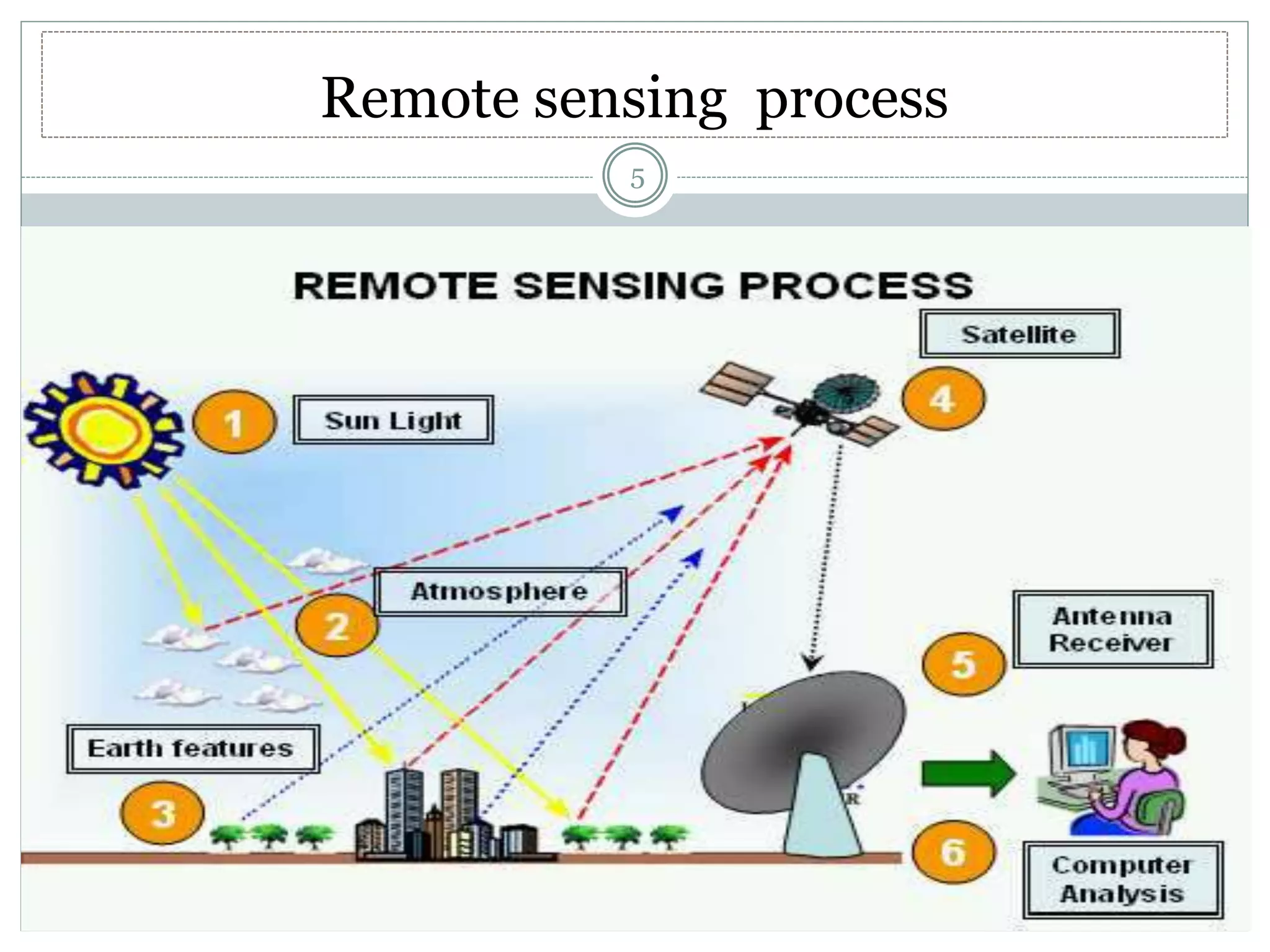
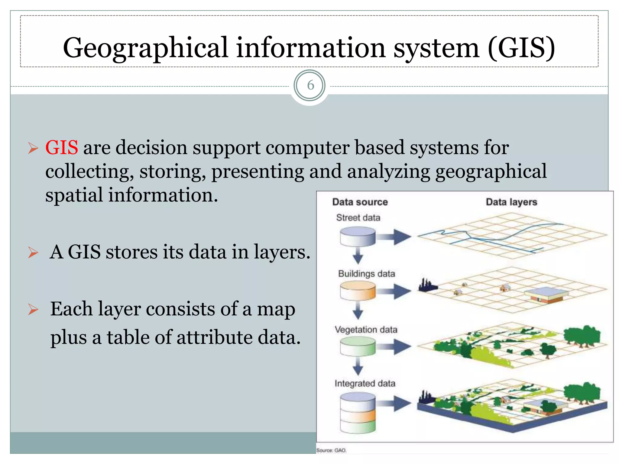
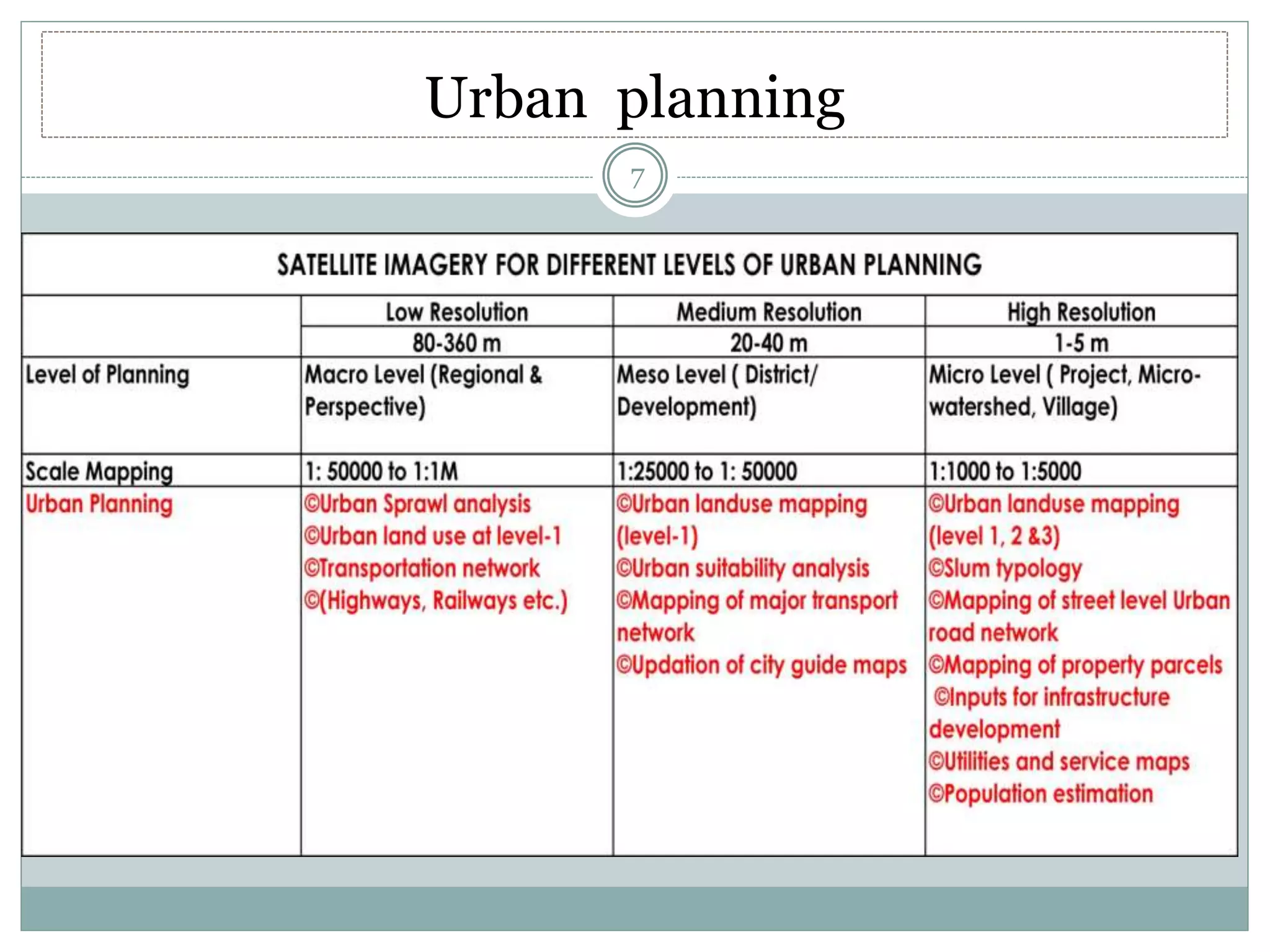
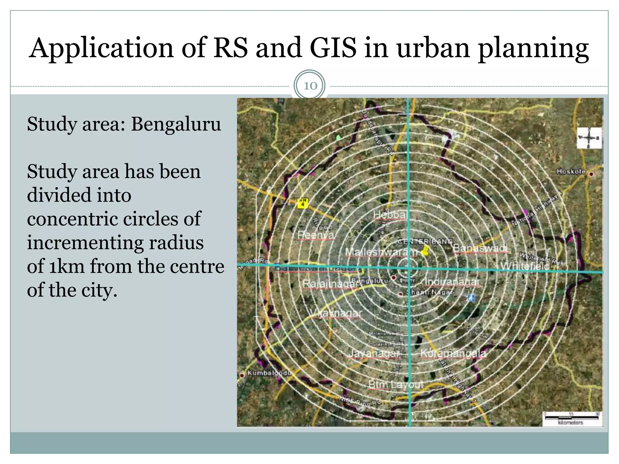
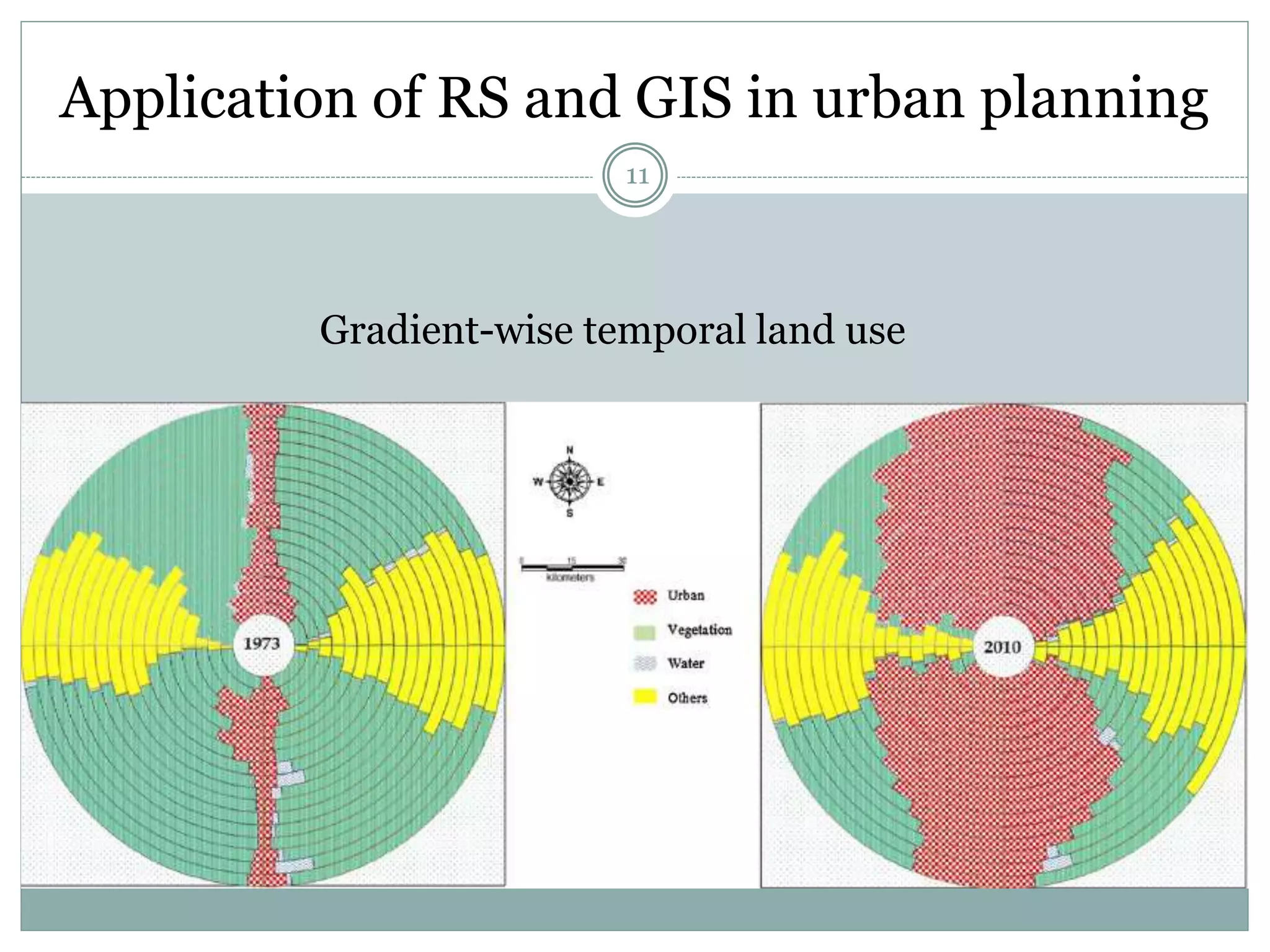
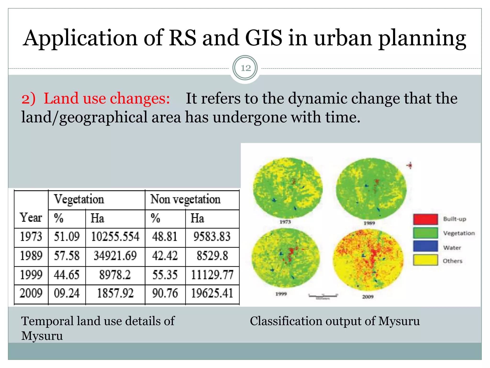
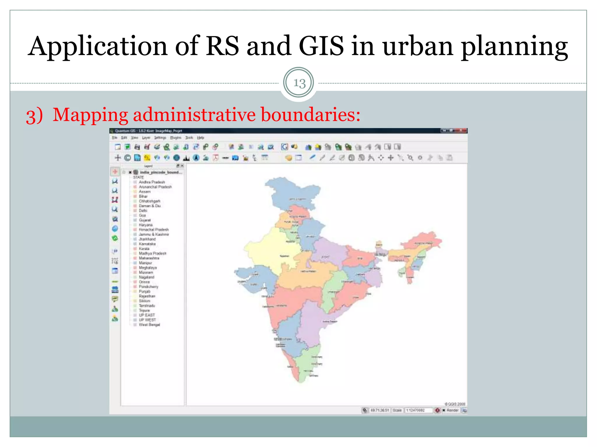
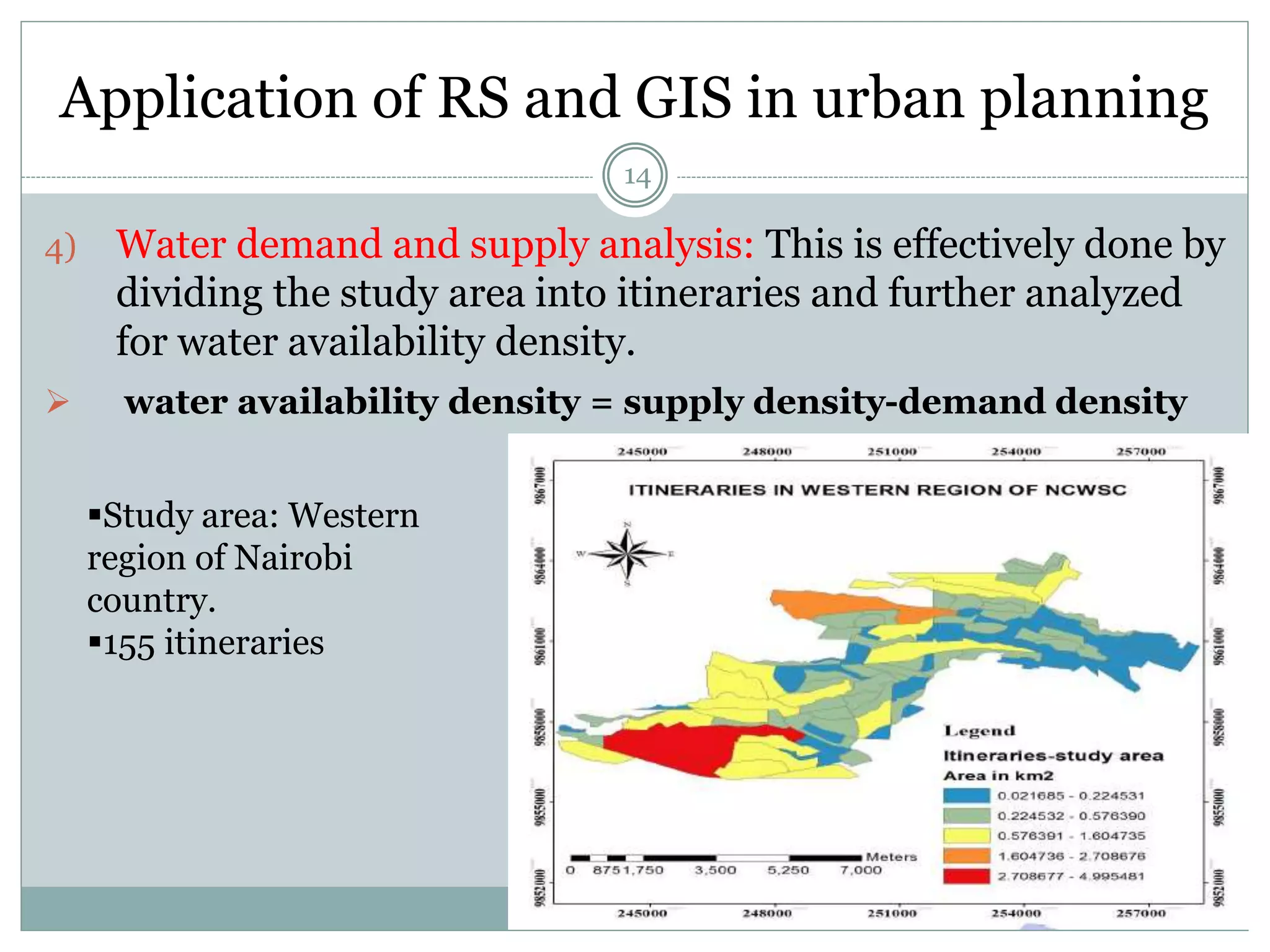
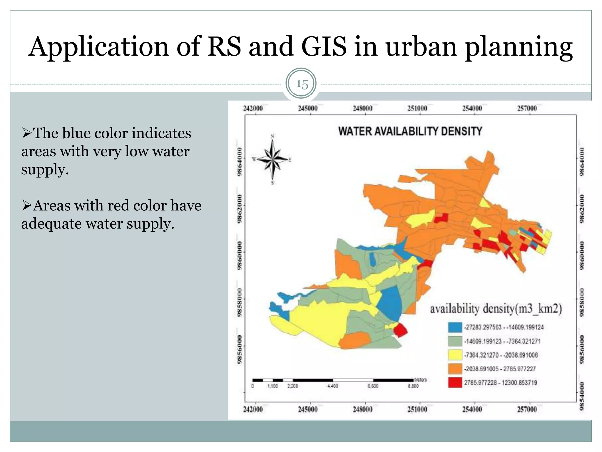
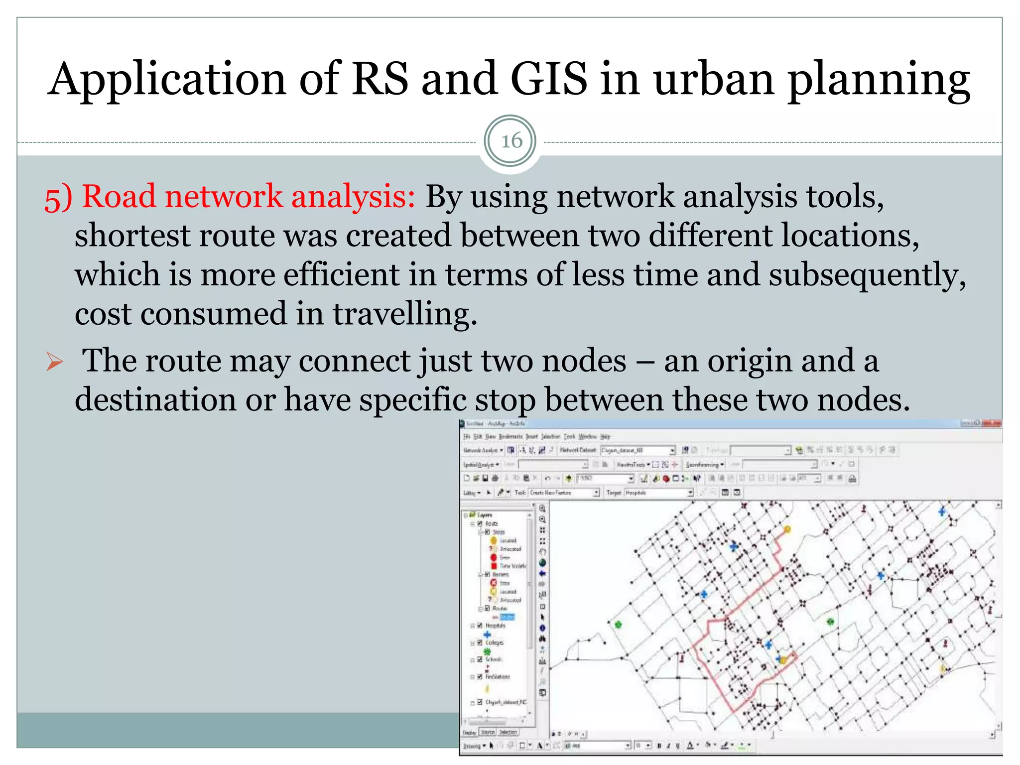
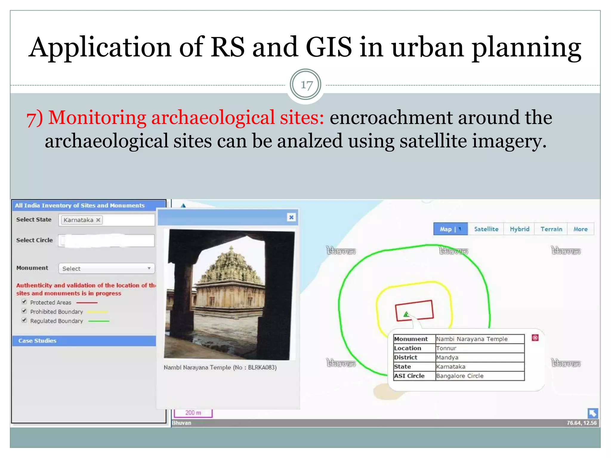
This document discusses the application of remote sensing (RS) and geographical information systems (GIS) in urban planning. It explains that RS allows for the collection of spatial, spectral and temporal data about areas in an accurate and cost-effective manner, while GIS stores and analyzes geographic data in layers. The document then provides several examples of how RS and GIS have been used in urban planning, including analyzing urban sprawl in Bengaluru, mapping land use changes in Mysuru over time, assessing water demand and supply in Nairobi, and monitoring archaeological sites for encroachment using satellite imagery. It concludes that RS and GIS are necessary technologies for urban planning authorities to efficiently respond to issues faced by rapidly urbanizing