
Recommended
Recommended
More Related Content
What's hot
What's hot (20)
Similar to Application of Remote Sensing and GIS in Urban Planning
Similar to Application of Remote Sensing and GIS in Urban Planning (20)
Recently uploaded
Recently uploaded (20)
Application of Remote Sensing and GIS in Urban Planning
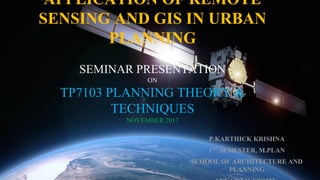
- 1. APPLICATION OF REMOTE SENSING AND GIS IN URBAN PLANNING SEMINAR PRESENTATION ON TP7103 PLANNING THEORY & TECHNIQUES NOVEMBER 2017 P.KARTHICK KRISHNA 1ST SEMESTER, M.PLAN SCHOOL OF ARCHITECTURE AND PLANNING
- 2. CONTENTS: 1. INTRODUCTION. 2. NEED OF REMOTE SENSING AND GIS IN PLANNING 3. APPLICATION OF REMOTE SENSING AND GIS 4. FUTURE IS WEB GIS,INTERNERT OF THINGS & BIG DATA …. 5. CONCLUSION 6. REFERENCES
- 3. OBJECTIVE: To understand the potentiality of Remote Sensing and GIS by studying the applications on urban planning.
- 4. INTRODUCTION: Remote Sensing is: ”the measurement and analysis of electromagnetic radiation reflected from, transmitted through, or absorbed and scattered by the atmosphere, the hydrosphere and by material at or near the land surface, for the purpose of understanding and managing the Earth’s resource and environment” (Larry Morley, Teledetection International).
- 5. GIS :”is an integrated system of computer hardware, software, and trained personnel linking topographic, utility, facility, image and other resource data that is geographically referenced” (NASA, 2000)
- 6. 2.NEED OF RS AND GIS IN PLANNING: ▶ Important source of data for urban landuse/land cover mapping. ▶ Environmental and Resource monitoring. ▶ More Accurate. ▶ Flexible. ▶ Efficient Decision making tool in Planning process. ▶ Cost and time effective and reliable. ▶ Integrate Spatial and Attribute data. GIS Capabilities • Topological map overlay • Buffer generation • Proximity analysis • Spatial data management • LocationAllocation modeling • Network analysis • Sophisticated tabular analysis • Cartography and mapping • Report generation
- 7. 3.APPLICATION OF REMOTE SENSING AND GIS: 3.1. BASE MAP PREPARATION PROCESS: 3.2. URBAN LAND SUITABILITY ANALYSIS 3.3. MONITORING TEMPORAL CHANGES: URBAN GROWTH, LAND USE CHANGES 3.4. DELINEATING ENVIRONMENTAL SENSITIVE AND FRAGILE AREAS. 3.5. LOCATIONAL ANALYSIS. 3.6. OPTIMAL ROUTE ANALYSIS. 3.7. STUDY OF URBAN BUILT UP AND OPEN SPACES. 3.8. TERRAIN MODELLING. 3.9. GREEN COVER MAPPING IN URBAN AREA: TREE CANOPY 3.10. MAPPING URBAN HEAT ISLAND. 3.11. URBAN WATERSHED MODELLING: FLOOD ASSESSMENT. 3.12. URBAN POLLUTION MAPPING 3.13. HAZARDOUS ZONE MAPPING And so on..
- 8. 3.1. Base Map Preparation: Wealth of information pertaining to land features, land use, built up areas, town structure, physical aspects of environment etc. are available from the aerial photography. # Digitization of planning base maps facilitated updating of base maps wherever changes have taken place. # Superimposition of revenue maps on base maps with reasonable accuracy is great advantage compared to manually done jobs. Source: Author.
- 9. 3.2. Terrain Modelling: Using RS data and GIS, the terrain is created. It helpful tool to identify the flood plains, by inferring the slope and contour details. Source: Author.
- 10. 3.3. Urban Watershed Modelling: - ASTER Digital Elevation Model is obtained from USGS. - Using GIS to identify the micro watershed. - Deriving the natural streams in a micro watershed - Overlaying existing SWD with natural surface streams. Source: Author.
- 11. 3.3. Delineation of Environmental Sensitive and fragile areas: SoilMap SoilErosion Map SlopeMap LULC Map (2010-11) - Using overlaying technique in GIS. Final Outcome as a composite map layer delineates the delicate fragile areas. Source: IDDP, Kollam.
- 12. 3.4. Monitoring Temporal Changes: Urban Growth Source: Bhopal Development Authority - Temporal Data is obtained and Digitized. - Overlapping the layers to identify the direction of the growth of the town.
- 13. 3.5. Urban land Suitability Analysis: Source: Bhopal Development Authority
- 14. Selection of Parameter is critical:
- 15. 4. Future is Web GIS, IOT & Big DATA…….. ✓ New Methodology to data collection ✓ Self explorative and explaining Maps ✓ Closed System to Open System
- 16. 5.Conclusion: ✓ Remote Sensing and GIS is an intelligent combination that could deliver the efficiency, accuracy and inducing innovative methodology in data collection and analysis. ✓ The are numerous application emerging through the technological advancement in the Teledetection filed makes future to rely on RS and GIS.
- 17. 5.References: ❖ Remote Sensing and Urban Analysis, Taylor and Francis Publications, London. ❖ Patkar, V.N. (2003), “Directions for GIS in Urban Planning” ❖ Tiwari, D.P. (2006), Remote Sensing and GIS for efficient ❖ Urban Planning, GIS Development. ❖ GIS for Urban and Regional Planning, ESRI