SlideShare a Scribd company logo
1 of 1
Download to read offline
CONTINENTAL MAPPING
Mapping from Earth, Sky and Space
www.continentalmapping.com
Madison, Wisconsin
Indianapolis, Indiana
Kansas City, Kansas
St. Louis, Missouri
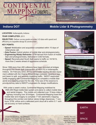
Since 1999 more than 400 collisions have been recorded at bridges
throughout the South Split (intersection of I-65/I-70) in Indianapolis,
Indiana. On February 22nd, 2013 a semi-trailer hauling elevator equip-
ment collided with the Virginia Street Bridge overpass, causing a sup-
port beam to split, and severely impacting traffic. INDOT responded
swiftly engaging with Continental Mapping to complete a mobile lidar
aerial and mapping project for the site. Time was of the essence to
provide survey data to INDOT’s engineers for design modifications.
With under a week’s notice, Continental Mapping mobilized its
VMX-250 Riegl mobile lidar system and plane to collect mobile lidar
and aerial imagery. The mobile unit collected over 15 lane miles of
highway including over 30 bridges. Continental Mapping fused the
mobile lidar and imagery to complete 1”=25’ planimetric mapping
throughout the corridor and deliver stereo bridge clearances, 1’ con-
tours, DTM, orthos and a calibrated point cloud all to within 0.1’ verti-
cal accuracy on hard surfaces.
Indiana DOT Mobile Lidar & Photogrammetry
LOCATION: Indianapolis, Indiana
YEAR COMPLETED: 2013
OBJECTIVE: Deliver survey grade accurate 3-D data with speed and
efficiency to expedite design & construction
KEY POINTS:
• Speed: Mobilization and acquisition completed within 10 days of
initial phone call.
• Data Fusion: Hybrid solution of mobile lidar and photogrammetry.
• Engineering Ready Deliveries: DTM derived from fusion of mobile
lidar and photogrammetry. Delivered in CAD formats.
• Speed: Reconstructed South Split opens to traffic on 10/16/13,
more than 2 weeks ahead of aggressive schedule.
image source: INDOT
image source: INDOT

More Related Content

What's hot

Land use classification using taxi gps traces
Land use classification using taxi gps tracesLand use classification using taxi gps traces
Land use classification using taxi gps traces
ecwayerode
 
Miranda Saarentaus, ESA Business Applications program
Miranda Saarentaus, ESA Business Applications programMiranda Saarentaus, ESA Business Applications program
Miranda Saarentaus, ESA Business Applications program
Business Turku
 
Presentation latest
Presentation latestPresentation latest
Presentation latest
Mislam01
 

What's hot (20)

Transport modelling utrecht
Transport modelling utrechtTransport modelling utrecht
Transport modelling utrecht
 
先進網際服務系統
先進網際服務系統先進網際服務系統
先進網際服務系統
 
Land use classification using taxi gps traces
Land use classification using taxi gps tracesLand use classification using taxi gps traces
Land use classification using taxi gps traces
 
Continental Mapping Projects - ATC Dane County
Continental Mapping Projects - ATC Dane CountyContinental Mapping Projects - ATC Dane County
Continental Mapping Projects - ATC Dane County
 
Presentation on App-Based, On-Demand Ride-Sharing Program - July 2017
Presentation on App-Based, On-Demand Ride-Sharing Program - July 2017Presentation on App-Based, On-Demand Ride-Sharing Program - July 2017
Presentation on App-Based, On-Demand Ride-Sharing Program - July 2017
 
Community Growth & Land Use Planning in Athens-Clarke County
Community Growth & Land Use Planning in Athens-Clarke CountyCommunity Growth & Land Use Planning in Athens-Clarke County
Community Growth & Land Use Planning in Athens-Clarke County
 
The 2028 Olympics: A Catalyst for Los Angeles’s Transportation Improvements a...
The 2028 Olympics: A Catalyst for Los Angeles’s Transportation Improvements a...The 2028 Olympics: A Catalyst for Los Angeles’s Transportation Improvements a...
The 2028 Olympics: A Catalyst for Los Angeles’s Transportation Improvements a...
 
Ero_dep_blue_red
Ero_dep_blue_redEro_dep_blue_red
Ero_dep_blue_red
 
Prospecting for Profits with GIS
Prospecting for Profits with GIS Prospecting for Profits with GIS
Prospecting for Profits with GIS
 
Light Rail at the End of the Tunnel
Light Rail at the End of the TunnelLight Rail at the End of the Tunnel
Light Rail at the End of the Tunnel
 
Scenarios S and X
Scenarios S and XScenarios S and X
Scenarios S and X
 
2015 on Spatial Development (Personal Projects)
2015 on Spatial Development (Personal Projects)2015 on Spatial Development (Personal Projects)
2015 on Spatial Development (Personal Projects)
 
Urban transportation system project in cikarang
Urban transportation system project in cikarangUrban transportation system project in cikarang
Urban transportation system project in cikarang
 
Downstream Business Applications (by Norbert Hübner)
Downstream Business Applications (by Norbert Hübner)Downstream Business Applications (by Norbert Hübner)
Downstream Business Applications (by Norbert Hübner)
 
Understanding Gis
Understanding GisUnderstanding Gis
Understanding Gis
 
site map of Karnafuli Hydro Power Station
site map of Karnafuli Hydro Power Stationsite map of Karnafuli Hydro Power Station
site map of Karnafuli Hydro Power Station
 
Miranda Saarentaus, ESA Business Applications program
Miranda Saarentaus, ESA Business Applications programMiranda Saarentaus, ESA Business Applications program
Miranda Saarentaus, ESA Business Applications program
 
Arc 1950
Arc 1950Arc 1950
Arc 1950
 
Presentation latest
Presentation latestPresentation latest
Presentation latest
 
Geoscape - Capturing the built environment
Geoscape - Capturing the built environmentGeoscape - Capturing the built environment
Geoscape - Capturing the built environment
 

Similar to Continental mapping projects indot south split

Continental mapping projects las vegas water treatment plant
Continental mapping projects   las vegas water treatment plantContinental mapping projects   las vegas water treatment plant
Continental mapping projects las vegas water treatment plant
Continental Mapping Consultants
 
Global Projects Center - East End Crossing
Global Projects Center - East End CrossingGlobal Projects Center - East End Crossing
Global Projects Center - East End Crossing
João Vitor Dutra
 
Flood Disaster Risk Mapping to Assess Impacts on Transportation Infrastructur...
Flood Disaster Risk Mapping to Assess Impacts on Transportation Infrastructur...Flood Disaster Risk Mapping to Assess Impacts on Transportation Infrastructur...
Flood Disaster Risk Mapping to Assess Impacts on Transportation Infrastructur...
Waheed Uddin
 

Similar to Continental mapping projects indot south split (15)

City Growth: Case Study of Denver, Colorado
City Growth: Case Study of Denver, ColoradoCity Growth: Case Study of Denver, Colorado
City Growth: Case Study of Denver, Colorado
 
Continental mapping projects las vegas water treatment plant
Continental mapping projects   las vegas water treatment plantContinental mapping projects   las vegas water treatment plant
Continental mapping projects las vegas water treatment plant
 
Continental Mapping Projects - Trans Design
Continental Mapping Projects - Trans DesignContinental Mapping Projects - Trans Design
Continental Mapping Projects - Trans Design
 
Continental Mapping Projects - HWY F
Continental Mapping Projects - HWY FContinental Mapping Projects - HWY F
Continental Mapping Projects - HWY F
 
Continental Mapping Projects - TDOT Grainger Co.
Continental Mapping Projects - TDOT Grainger Co.Continental Mapping Projects - TDOT Grainger Co.
Continental Mapping Projects - TDOT Grainger Co.
 
Continental Mapping Projects - USACE Pine Creek
Continental Mapping Projects - USACE Pine CreekContinental Mapping Projects - USACE Pine Creek
Continental Mapping Projects - USACE Pine Creek
 
Continental Mapping Projects - Wood Road Re-alignment
Continental Mapping Projects - Wood Road Re-alignmentContinental Mapping Projects - Wood Road Re-alignment
Continental Mapping Projects - Wood Road Re-alignment
 
Transportation Mapping
Transportation MappingTransportation Mapping
Transportation Mapping
 
Global Projects Center - East End Crossing
Global Projects Center - East End CrossingGlobal Projects Center - East End Crossing
Global Projects Center - East End Crossing
 
5 reasons why inspection drones are the future of civil infrastructure
5 reasons why inspection drones are the future of civil infrastructure5 reasons why inspection drones are the future of civil infrastructure
5 reasons why inspection drones are the future of civil infrastructure
 
10 maps that have made a difference
10 maps that have made a difference10 maps that have made a difference
10 maps that have made a difference
 
2017 Vendor Showcase Track: Mapillary and Transportation: How Computer Vision...
2017 Vendor Showcase Track: Mapillary and Transportation: How Computer Vision...2017 Vendor Showcase Track: Mapillary and Transportation: How Computer Vision...
2017 Vendor Showcase Track: Mapillary and Transportation: How Computer Vision...
 
project final year civil
project final year civilproject final year civil
project final year civil
 
Flood Disaster Risk Mapping to Assess Impacts on Transportation Infrastructur...
Flood Disaster Risk Mapping to Assess Impacts on Transportation Infrastructur...Flood Disaster Risk Mapping to Assess Impacts on Transportation Infrastructur...
Flood Disaster Risk Mapping to Assess Impacts on Transportation Infrastructur...
 
NY Empire State Trail
NY Empire State TrailNY Empire State Trail
NY Empire State Trail
 

More from Continental Mapping Consultants

More from Continental Mapping Consultants (17)

Continental Mapping Introduces TheGeoFoundry.com
Continental Mapping Introduces TheGeoFoundry.comContinental Mapping Introduces TheGeoFoundry.com
Continental Mapping Introduces TheGeoFoundry.com
 
Storygraphic - The Continental Mapping Story
Storygraphic - The Continental Mapping StoryStorygraphic - The Continental Mapping Story
Storygraphic - The Continental Mapping Story
 
Continental Mapping Projects - USACE Cleveland Levee
Continental Mapping Projects - USACE Cleveland LeveeContinental Mapping Projects - USACE Cleveland Levee
Continental Mapping Projects - USACE Cleveland Levee
 
Map America - 10 Tallest Dams Infographic
Map America - 10 Tallest Dams InfographicMap America - 10 Tallest Dams Infographic
Map America - 10 Tallest Dams Infographic
 
Continental Mapping Projects - Chattanooga
Continental Mapping Projects - ChattanoogaContinental Mapping Projects - Chattanooga
Continental Mapping Projects - Chattanooga
 
Continental Mapping Projects - Tualatin National Wildlife Refuge
Continental Mapping Projects - Tualatin National Wildlife RefugeContinental Mapping Projects - Tualatin National Wildlife Refuge
Continental Mapping Projects - Tualatin National Wildlife Refuge
 
Continental Mapping - On All Continents
Continental Mapping - On All Continents Continental Mapping - On All Continents
Continental Mapping - On All Continents
 
FAA UAS Map
FAA UAS MapFAA UAS Map
FAA UAS Map
 
Red Wing Bridge Project
Red Wing Bridge ProjectRed Wing Bridge Project
Red Wing Bridge Project
 
Aztalan Project
Aztalan ProjectAztalan Project
Aztalan Project
 
Continental Mapping Projects - FEMA Butler Co. MO
Continental Mapping Projects - FEMA Butler Co. MOContinental Mapping Projects - FEMA Butler Co. MO
Continental Mapping Projects - FEMA Butler Co. MO
 
Continental Mapping Projects - Dodger Stadium
Continental Mapping Projects - Dodger StadiumContinental Mapping Projects - Dodger Stadium
Continental Mapping Projects - Dodger Stadium
 
Mobile Lidar - Speed You Need
Mobile Lidar - Speed You NeedMobile Lidar - Speed You Need
Mobile Lidar - Speed You Need
 
Control for Mobile Lidar
Control for Mobile LidarControl for Mobile Lidar
Control for Mobile Lidar
 
Yukon Delta Refuge Infographic
Yukon Delta Refuge InfographicYukon Delta Refuge Infographic
Yukon Delta Refuge Infographic
 
Photogrammetry
PhotogrammetryPhotogrammetry
Photogrammetry
 
Data Fusion Menu
Data Fusion MenuData Fusion Menu
Data Fusion Menu
 

Recently uploaded

Digital Communication Essentials: DPCM, DM, and ADM .pptx
Digital Communication Essentials: DPCM, DM, and ADM .pptxDigital Communication Essentials: DPCM, DM, and ADM .pptx
Digital Communication Essentials: DPCM, DM, and ADM .pptx
pritamlangde
 
Integrated Test Rig For HTFE-25 - Neometrix
Integrated Test Rig For HTFE-25 - NeometrixIntegrated Test Rig For HTFE-25 - Neometrix
Integrated Test Rig For HTFE-25 - Neometrix
Neometrix_Engineering_Pvt_Ltd
 
DeepFakes presentation : brief idea of DeepFakes
DeepFakes presentation : brief idea of DeepFakesDeepFakes presentation : brief idea of DeepFakes
DeepFakes presentation : brief idea of DeepFakes
MayuraD1
 

Recently uploaded (20)

Employee leave management system project.
Employee leave management system project.Employee leave management system project.
Employee leave management system project.
 
NO1 Top No1 Amil Baba In Azad Kashmir, Kashmir Black Magic Specialist Expert ...
NO1 Top No1 Amil Baba In Azad Kashmir, Kashmir Black Magic Specialist Expert ...NO1 Top No1 Amil Baba In Azad Kashmir, Kashmir Black Magic Specialist Expert ...
NO1 Top No1 Amil Baba In Azad Kashmir, Kashmir Black Magic Specialist Expert ...
 
Unleashing the Power of the SORA AI lastest leap
Unleashing the Power of the SORA AI lastest leapUnleashing the Power of the SORA AI lastest leap
Unleashing the Power of the SORA AI lastest leap
 
COST-EFFETIVE and Energy Efficient BUILDINGS ptx
COST-EFFETIVE  and Energy Efficient BUILDINGS ptxCOST-EFFETIVE  and Energy Efficient BUILDINGS ptx
COST-EFFETIVE and Energy Efficient BUILDINGS ptx
 
Digital Communication Essentials: DPCM, DM, and ADM .pptx
Digital Communication Essentials: DPCM, DM, and ADM .pptxDigital Communication Essentials: DPCM, DM, and ADM .pptx
Digital Communication Essentials: DPCM, DM, and ADM .pptx
 
Thermal Engineering Unit - I & II . ppt
Thermal Engineering  Unit - I & II . pptThermal Engineering  Unit - I & II . ppt
Thermal Engineering Unit - I & II . ppt
 
HAND TOOLS USED AT ELECTRONICS WORK PRESENTED BY KOUSTAV SARKAR
HAND TOOLS USED AT ELECTRONICS WORK PRESENTED BY KOUSTAV SARKARHAND TOOLS USED AT ELECTRONICS WORK PRESENTED BY KOUSTAV SARKAR
HAND TOOLS USED AT ELECTRONICS WORK PRESENTED BY KOUSTAV SARKAR
 
AIRCANVAS[1].pdf mini project for btech students
AIRCANVAS[1].pdf mini project for btech studentsAIRCANVAS[1].pdf mini project for btech students
AIRCANVAS[1].pdf mini project for btech students
 
Jaipur ❤CALL GIRL 0000000000❤CALL GIRLS IN Jaipur ESCORT SERVICE❤CALL GIRL IN...
Jaipur ❤CALL GIRL 0000000000❤CALL GIRLS IN Jaipur ESCORT SERVICE❤CALL GIRL IN...Jaipur ❤CALL GIRL 0000000000❤CALL GIRLS IN Jaipur ESCORT SERVICE❤CALL GIRL IN...
Jaipur ❤CALL GIRL 0000000000❤CALL GIRLS IN Jaipur ESCORT SERVICE❤CALL GIRL IN...
 
Integrated Test Rig For HTFE-25 - Neometrix
Integrated Test Rig For HTFE-25 - NeometrixIntegrated Test Rig For HTFE-25 - Neometrix
Integrated Test Rig For HTFE-25 - Neometrix
 
DeepFakes presentation : brief idea of DeepFakes
DeepFakes presentation : brief idea of DeepFakesDeepFakes presentation : brief idea of DeepFakes
DeepFakes presentation : brief idea of DeepFakes
 
A CASE STUDY ON CERAMIC INDUSTRY OF BANGLADESH.pptx
A CASE STUDY ON CERAMIC INDUSTRY OF BANGLADESH.pptxA CASE STUDY ON CERAMIC INDUSTRY OF BANGLADESH.pptx
A CASE STUDY ON CERAMIC INDUSTRY OF BANGLADESH.pptx
 
Thermal Engineering -unit - III & IV.ppt
Thermal Engineering -unit - III & IV.pptThermal Engineering -unit - III & IV.ppt
Thermal Engineering -unit - III & IV.ppt
 
Generative AI or GenAI technology based PPT
Generative AI or GenAI technology based PPTGenerative AI or GenAI technology based PPT
Generative AI or GenAI technology based PPT
 
Tamil Call Girls Bhayandar WhatsApp +91-9930687706, Best Service
Tamil Call Girls Bhayandar WhatsApp +91-9930687706, Best ServiceTamil Call Girls Bhayandar WhatsApp +91-9930687706, Best Service
Tamil Call Girls Bhayandar WhatsApp +91-9930687706, Best Service
 
Bhubaneswar🌹Call Girls Bhubaneswar ❤Komal 9777949614 💟 Full Trusted CALL GIRL...
Bhubaneswar🌹Call Girls Bhubaneswar ❤Komal 9777949614 💟 Full Trusted CALL GIRL...Bhubaneswar🌹Call Girls Bhubaneswar ❤Komal 9777949614 💟 Full Trusted CALL GIRL...
Bhubaneswar🌹Call Girls Bhubaneswar ❤Komal 9777949614 💟 Full Trusted CALL GIRL...
 
Unit 4_Part 1 CSE2001 Exception Handling and Function Template and Class Temp...
Unit 4_Part 1 CSE2001 Exception Handling and Function Template and Class Temp...Unit 4_Part 1 CSE2001 Exception Handling and Function Template and Class Temp...
Unit 4_Part 1 CSE2001 Exception Handling and Function Template and Class Temp...
 
Theory of Time 2024 (Universal Theory for Everything)
Theory of Time 2024 (Universal Theory for Everything)Theory of Time 2024 (Universal Theory for Everything)
Theory of Time 2024 (Universal Theory for Everything)
 
457503602-5-Gas-Well-Testing-and-Analysis-pptx.pptx
457503602-5-Gas-Well-Testing-and-Analysis-pptx.pptx457503602-5-Gas-Well-Testing-and-Analysis-pptx.pptx
457503602-5-Gas-Well-Testing-and-Analysis-pptx.pptx
 
A Study of Urban Area Plan for Pabna Municipality
A Study of Urban Area Plan for Pabna MunicipalityA Study of Urban Area Plan for Pabna Municipality
A Study of Urban Area Plan for Pabna Municipality
 

Continental mapping projects indot south split

  • 1. CONTINENTAL MAPPING Mapping from Earth, Sky and Space www.continentalmapping.com Madison, Wisconsin Indianapolis, Indiana Kansas City, Kansas St. Louis, Missouri Since 1999 more than 400 collisions have been recorded at bridges throughout the South Split (intersection of I-65/I-70) in Indianapolis, Indiana. On February 22nd, 2013 a semi-trailer hauling elevator equip- ment collided with the Virginia Street Bridge overpass, causing a sup- port beam to split, and severely impacting traffic. INDOT responded swiftly engaging with Continental Mapping to complete a mobile lidar aerial and mapping project for the site. Time was of the essence to provide survey data to INDOT’s engineers for design modifications. With under a week’s notice, Continental Mapping mobilized its VMX-250 Riegl mobile lidar system and plane to collect mobile lidar and aerial imagery. The mobile unit collected over 15 lane miles of highway including over 30 bridges. Continental Mapping fused the mobile lidar and imagery to complete 1”=25’ planimetric mapping throughout the corridor and deliver stereo bridge clearances, 1’ con- tours, DTM, orthos and a calibrated point cloud all to within 0.1’ verti- cal accuracy on hard surfaces. Indiana DOT Mobile Lidar & Photogrammetry LOCATION: Indianapolis, Indiana YEAR COMPLETED: 2013 OBJECTIVE: Deliver survey grade accurate 3-D data with speed and efficiency to expedite design & construction KEY POINTS: • Speed: Mobilization and acquisition completed within 10 days of initial phone call. • Data Fusion: Hybrid solution of mobile lidar and photogrammetry. • Engineering Ready Deliveries: DTM derived from fusion of mobile lidar and photogrammetry. Delivered in CAD formats. • Speed: Reconstructed South Split opens to traffic on 10/16/13, more than 2 weeks ahead of aggressive schedule. image source: INDOT image source: INDOT