Downloaded 272 times
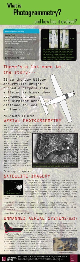

Photogrammetry is the science of making reliable measurements using photographs, especially aerial photographs, and has evolved from early uses in surveying to include aerial photography from airplanes, satellite imagery, and most recently drone-derived imagery. It allows the creation of accurate maps and three-dimensional models through the process of extracting measurements from overlapping photographs. Since the Wright brothers' first flight, photogrammetry has advanced from using airplanes to capture early aerial photos for mapping to using satellites and drones to capture imagery on an ever wider scale.


