Comparing erosion rates and processes after land use conversion from rainfed to irrigated crops in fragile areas with water scarcity
•Download as PPTX, PDF•
1 like•62 views

Mr. Nicolaas Verschaeren, Wageningen University & Research, Netherlands. Global Symposium on Soil Erosion (GSER19), 15 - 17 May 2019 at FAO HQ.
Report
Share
Report
Share

Recommended
Enabling the Flow of Ecosystem Services from Agriculture to Improve Puerto Ri...
Enabling the Flow of Ecosystem Services from Agriculture to Improve Puerto Ri...National Institute of Food and Agriculture
This project aims to (1) reduce nutrient losses and nitrous oxide emissions from agriculture in Puerto Rico, (2) increase farmer flexibility and motivation to provide ecosystem services, and (3) develop additional farm revenue streams. The researchers will assess impacts of alternative management practices, quantify ecosystem service credits, identify areas for cost-effective emissions reductions, and estimate a regional supply curve for credits. Field trials will compare nitrous oxide and nitrate impacts of control and reduced nitrogen application rates on plantain crops.Pls tile pres gen
Tile drainage systems are designed to remove excess water from soil to improve crop growth. They work by allowing water to drain through perforated pipes underground and flow to an outlet. Studies show tile drainage can increase crop yields by up to 38% and reduce surface runoff, soil erosion, and movement of nutrients and pesticides. It also benefits the environment by improving soil health, structure, and biological activity. Regulations around tile drainage vary between provinces but generally require notification or permits from local water authorities.
Opportunities to Practically Scale-up Perennial Feedstocks
Presented by Vance Owens, Director of North Central Sun Grant Center, South Dakota State University on December 8, 2014 at Minnesota Bioenergy Feedstock Development meeting and forum.
Balancing Wetland Preservation and Stormwater Management: a case study
Balancing Wetland Preservation and Stormwater Management: a case studyAndrew T. Der & Associates, LLC
Presented at 2013 joint scientific meeting of the Society of Wetland Scientists South Atlantic Chapter, Florida Association of Environmental Soil Scientists, and Southwest Chapter of the Florida Association of Environmental Professionals - Wetland Resources and Regulations in a Changing World: What Have We Learned?Evidence that land use interventions including Agroforestry can deliver quant...
Evidence that land use interventions including Agroforestry can deliver quant...Pro-poor Rewards for Environmental Services in Africa ICRAF
Forests and agroforestry systems improve the amount of water in the soil, retards surface runoff and reduces soil erosion. They also help increase and regulate base water flow.
Wetlands and Stormwater Management
This document summarizes a case study presentation on balancing wetland and stream preservation with stormwater management. It discusses how initial plans avoided disturbing surface water resources but still did not meet state criteria. The proposed solution included limiting habitat impacts, establishing stream buffers, wetland mitigation, and implementing a hierarchy of stormwater BMPs including infiltration, filtration, and retention ponds. Water quality monitoring of macroinvertebrates and chemistry was also proposed before, during, and after construction to evaluate project impacts.
Irwin Prairie gw flow regime and drainage pp
This document summarizes a study of groundwater flow and drainage at Irwin Prairie State Nature Preserve. The preserve contains a seasonal wetland with different sub-ecotones like wet prairie and swamp forest. The objective was to measure water levels in piezometers and the wetland to determine surface-water and groundwater interactions and the groundwater flow direction. Weekly measurements were taken and a potentiometric map was plotted showing groundwater flows towards and discharges into the wetland, while the wetland recharges groundwater in September.
Jabari Lee Poster
This project investigated using native Rio Grande cottonwood trees and zeolite to improve water quality in nearby urban streams and drains. Six test plots were established, with cottonwood trees planted in soil with or without added zeolite. Data on soil properties, plant health, weather, and water quality was collected. Initial results found the cottonwoods survived well and established baseline data on soil and plant conditions prior to irrigation testing.
Introduction to Low Impact Development
The document discusses low impact development (LID) engineering and landscape design considerations. It outlines various integrated management practices (IMPs) that can be used like bioretention, bioswales, infiltration ponds/trenches, and permeable pavement. These practices aim to mimic natural hydrology and treat stormwater through filtration, microbial breakdown, and infiltration/evapotranspiration. The document provides guidance on sizing, locating, and maintaining different IMPs based on treatment needs and technical limitations.
Krider - Prioritizing Watersheds for PMP Placement
The document summarizes a case study on prioritizing watersheds for best management practices (BMPs) placement in southern Minnesota. It discusses:
- Water quality issues related to agriculture and drainage systems increasing nitrates and sediment in the Minnesota River watershed
- A watershed approach being taken by state agencies to monitor watersheds and implement restoration strategies
- A case study of a two-stage ditch construction project in Mower County that showed stability over time, increased habitat, and 10-30% nitrate removal.
Water Sensitive Urban Design
The document discusses key principles of water sensitive urban design including protecting natural waterways, integrating storm water treatment into landscapes, reducing runoff and peak flows, and protecting water quality. It provides statistics on household water consumption and savings from water efficient appliances. Recommendations are given for water efficient toilets, showerheads, faucets, and other fixtures that can save significant amounts of water and energy. Case studies and initiatives from the EPA and state environmental agencies on water conservation planning and pollution prevention are also summarized.
Evaluating Options for Water Sensitive Urban Design: A National Guide
The document provides case studies of various Water Sensitive Urban Design (WSUD) projects across Australia. The Pimpama Coomera Water Futures Project case study describes a master plan for a growing region that provides water and wastewater services more sustainably, including supplying houses from three water sources and improving stormwater management. The Springfield Development case study outlines a new residential development featuring dual reticulation for non-potable water reuse and surface irrigation with stormwater and recycled water. The Ascot Waters case study describes a redevelopment that converted degraded land into an estate divided into zones applying a 'treatment train' approach to water management, including vegetated swales and detention basins.
Watershed management
Watershed management aims to enable sustainable production and minimize hazards to natural resources like soil and water. A watershed is a geographical area that drains to a common water body. Key components of watershed management programs include soil and water conservation measures, water harvesting, and crop management and alternate land use systems suited to land capability. The overall objectives are improved livelihoods through increased incomes while protecting watershed resources.
Rain Water Harvesting- case study in DAV institution, Solapur
Dr. Vadagbalkar S.K.- Geologist and consultant has designed and successfully recharged the low yielding bore well in hard rock - basaltic terrain of Deccan traps.
Low yielding bore well in the basaltic rock is recharged by roof water collection in DAV institute, Solapur city, Maharashtra State, INDIA - to enhance its yield.
Conceptual Evolution of Water Sensitive Urban Design (WSUD) Concepts - Sarah ...
This document discusses the conceptual evolution of water sensitive urban design (WSUD) concepts. It outlines how urbanization and climate change are disrupting the water cycle and increasing risks like flooding. WSUD aims to harvest and treat stormwater through techniques like constructed wetlands and sand filters. The benefits of WSUD include collecting stormwater runoff for reuse, encouraging multi-disciplinary collaboration, and improving urban livability. The future of WSUD involves overcoming challenges from climate change and implementing more advanced concepts and technologies to treat stormwater to potable standards.
vetiver update 2011
This document discusses using vetiver grass as a solution for erosion and shallow slope failures of road slopes. It provides background on erosion issues in Indonesia and introduces vetiver grass as a green construction technology. It summarizes research conducted by the Institute of Road Engineering on vetiver grass, including laboratory and field experiments on various road slopes across Indonesia. The research demonstrated that vetiver grass can effectively control surface erosion and shallow failures on road slopes of 30-60 degrees. It recommends that road authorities implement vetiver systems to address erosion issues.
Water buffer management, 3R – Retention, Recharge and Reuse
Water buffer management, 3R – Retention, Recharge and Reuse
Francesco Sambalino
Introduction
The water buffer
The 3R formula
Examples
Planning
Water Sensitive Urban Design
The document discusses water sensitive urban design (WSUD) which aims to minimize the hydrological and water quality impacts of urban development through an integrated approach. It describes some key principles of WSUD including protecting natural water systems, integrating stormwater treatment into the landscape, protecting water quality, and reducing runoff and peak flows. It provides examples of WSUD practices such as bioretention systems, wetlands, and detention ponds that can achieve these goals.
3R Environmental considerations
3R Environmental considerations
SUSWA K-Ex, Kajiado, 31 October 2012
Luuk Fleskens
Water source site management
Wider environmental management
Resource use patterns
Diversification of sources and uses
Water%20 Efficient%20 Landscaping%20 Design
The document provides a model ordinance for water-efficient landscape design to help Colorado communities promote water conservation. It was developed by the Colorado Department of Local Affairs to encourage the use of drought-tolerant landscaping. The model ordinance includes standards for landscape design, plant selection, irrigation systems, and other best practices to ensure water-efficient landscapes while preserving communities' character. It is meant to serve as an alternative or supplement to other landscape codes and support local master plans and conservation goals.
Rain water harvesting
This document discusses rainwater harvesting and provides reasons to practice it. It explains that rainwater harvesting involves collecting, conveying, and storing rainfall for beneficial use. Some benefits of rainwater harvesting include conserving water resources, providing water at low cost, replenishing groundwater, and acting as good environmental stewards. The document also describes methods of rainwater harvesting like surface runoff collection, percolation pits, and recharge wells to divert rainwater runoff into aquifers and replenish groundwater supplies.
Knowledge Exchange mission SUSWA project 30 November – 5 December 2014, Kajia...
Knowledge Exchange mission SUSWA project 30 November – 5 December 2014, Kajia...SamSamWater Foundation
This document describes a project to improve water yields for villages in Tanzania through rainwater harvesting and artificial groundwater recharge. A 1989 water scheme was experiencing declining yields, so from 2006-2014 monitoring and pilots were conducted. A strategy of increasing groundwater recharge through rainwater infiltration was tested. A hillside dam and infiltration pits successfully recharged an estimated 2.5 million liters, increasing dry season yields from 0.3 to 0.8 liters/second. Proper maintenance and community involvement were important to the project's sustainability. While challenges remain, the results demonstrate that rainwater harvesting can significantly improve rural water supplies.Oregon Rain Garden Guide
The document provides a step-by-step guide to building a rain garden. It begins with observing and mapping the site to determine how water flows and where to locate the garden. Next, it discusses assessing the soil by testing infiltration and texture. It then covers determining the size of the garden based on the area draining to it. The guide also includes instructions for constructing the garden, including excavating, grading, and installing drainage. It concludes with recommendations for planting suitable species, mulching, and maintaining the garden. The overall goal is to help homeowners landscape to reduce stormwater runoff and pollution entering local waterways.
Using the Vetiver Grass Technology to Protect Shorelines - Golabi
Using the Vetiver Grass Technology to Protect Shorelines - GolabiSoil and Water Conservation Society
This document discusses the use of Vetiver grass systems to protect water resources from sedimentation and pollution. It describes how establishing narrow hedges of Vetiver grass across slopes can slow rainfall runoff, spread it evenly, and trap sediments. The deep, dense root systems of Vetiver grass also increase soil shear strength and stability. The document provides examples of using Vetiver hedges for various applications like soil and water conservation, slope stabilization, wastewater treatment, shoreline protection, and watershed management. Case studies from Guam and Vietnam demonstrate how Vetiver grass successfully reduced soil erosion and sedimentation in construction areas near water resources.Building Raingardens
The document discusses the benefits and design considerations for building raingardens. Raingardens are shallow depressions planted with vegetation that improve stormwater quality through biological and soil processes. They reduce runoff, recharge groundwater, and remove various pollutants. Key factors in designing raingardens include the watershed size, soil type, utility locations, plant selection, and ensuring proper overflow drainage. Several examples of existing raingardens are also presented.
Tuesday Plenary Panel - Tomer
The document provides an overview of the Agricultural Conservation Planning Framework (ACPF), a database, concept, and GIS toolbox for watershed planning in the Midwest. The ACPF uses data on soils, land use, terrain and other factors to identify opportunities for placing different conservation practices in fields, at field edges, and in riparian zones. It emphasizes a tiered approach starting with improving soil health within fields, then placing water control practices below fields and riparian buffers along streams. The ACPF can help develop planning alternatives to reduce nutrient loads and prioritize practices, but does not make final recommendations, as watershed planning requires local stakeholder involvement.
July 29-430-Timothy Randhir
This study evaluated the relationship between forest cover and water quality in tropical agricultural watersheds in Brazil. The results showed that watersheds with higher percentages of forest cover (>55%) had better water quality, with lower levels of turbidity, nutrients, and bacteria. In contrast, watersheds with larger areas of agriculture and urbanization (<35% forest cover) had worse water quality. The results also indicated that restoration of riparian forest buffers could improve water quality by reducing sediment levels by up to 9% and nutrient levels by up to 22%. The study highlights the importance of maintaining forest cover and implementing best management practices in agricultural and urban areas to protect water quality in tropical watersheds.
3R techniques
There are many options and technologies available to apply the 3R concept in a watershed. During the Knowledge Exchange mission several 3R technologies that might be applied in the Kajiado area were introduced to the participants. Sander de Haas (PWN / SamSamWater) gave a presentation on several 3R technologies.
Basche swcs 7.31.17_final
This document summarizes research on how ecological practices can mitigate floods and droughts. A meta-analysis found that no-till practices improved infiltration rates by 21% on average, while cover crops improved infiltration by 19% and perennials by 59%. Continuous living covers like cover crops and perennials increased soil water storage by 8-9%. Modeling shows that shifting less profitable cropland to perennials and cover crops reduced runoff 10-14% and increased water usage 7-10%, with larger benefits during droughts. Targeting these practices to high erosion or low profit areas provides flood mitigation and drought resilience benefits.
Poster_Brussel_Jarne.pdf
This study aims to restore two depressional wetlands in the Breeven site by manipulating the local drainage network. Temporary weirs made of sandbags will be installed in two ditches to block drainage and increase water retention. Groundwater levels and discharge will be closely monitored using piezometers and a Venturi channel. The targets are to protect wet nature and restore the local hydrological system by increasing water retention and storage. Based on the results, permanent measures may be installed ranging from adjustable weirs to completely filling the ditches. Field data will also be compared to modeling scenarios to improve existing hydrological models.
More Related Content
What's hot
Introduction to Low Impact Development
The document discusses low impact development (LID) engineering and landscape design considerations. It outlines various integrated management practices (IMPs) that can be used like bioretention, bioswales, infiltration ponds/trenches, and permeable pavement. These practices aim to mimic natural hydrology and treat stormwater through filtration, microbial breakdown, and infiltration/evapotranspiration. The document provides guidance on sizing, locating, and maintaining different IMPs based on treatment needs and technical limitations.
Krider - Prioritizing Watersheds for PMP Placement
The document summarizes a case study on prioritizing watersheds for best management practices (BMPs) placement in southern Minnesota. It discusses:
- Water quality issues related to agriculture and drainage systems increasing nitrates and sediment in the Minnesota River watershed
- A watershed approach being taken by state agencies to monitor watersheds and implement restoration strategies
- A case study of a two-stage ditch construction project in Mower County that showed stability over time, increased habitat, and 10-30% nitrate removal.
Water Sensitive Urban Design
The document discusses key principles of water sensitive urban design including protecting natural waterways, integrating storm water treatment into landscapes, reducing runoff and peak flows, and protecting water quality. It provides statistics on household water consumption and savings from water efficient appliances. Recommendations are given for water efficient toilets, showerheads, faucets, and other fixtures that can save significant amounts of water and energy. Case studies and initiatives from the EPA and state environmental agencies on water conservation planning and pollution prevention are also summarized.
Evaluating Options for Water Sensitive Urban Design: A National Guide
The document provides case studies of various Water Sensitive Urban Design (WSUD) projects across Australia. The Pimpama Coomera Water Futures Project case study describes a master plan for a growing region that provides water and wastewater services more sustainably, including supplying houses from three water sources and improving stormwater management. The Springfield Development case study outlines a new residential development featuring dual reticulation for non-potable water reuse and surface irrigation with stormwater and recycled water. The Ascot Waters case study describes a redevelopment that converted degraded land into an estate divided into zones applying a 'treatment train' approach to water management, including vegetated swales and detention basins.
Watershed management
Watershed management aims to enable sustainable production and minimize hazards to natural resources like soil and water. A watershed is a geographical area that drains to a common water body. Key components of watershed management programs include soil and water conservation measures, water harvesting, and crop management and alternate land use systems suited to land capability. The overall objectives are improved livelihoods through increased incomes while protecting watershed resources.
Rain Water Harvesting- case study in DAV institution, Solapur
Dr. Vadagbalkar S.K.- Geologist and consultant has designed and successfully recharged the low yielding bore well in hard rock - basaltic terrain of Deccan traps.
Low yielding bore well in the basaltic rock is recharged by roof water collection in DAV institute, Solapur city, Maharashtra State, INDIA - to enhance its yield.
Conceptual Evolution of Water Sensitive Urban Design (WSUD) Concepts - Sarah ...
This document discusses the conceptual evolution of water sensitive urban design (WSUD) concepts. It outlines how urbanization and climate change are disrupting the water cycle and increasing risks like flooding. WSUD aims to harvest and treat stormwater through techniques like constructed wetlands and sand filters. The benefits of WSUD include collecting stormwater runoff for reuse, encouraging multi-disciplinary collaboration, and improving urban livability. The future of WSUD involves overcoming challenges from climate change and implementing more advanced concepts and technologies to treat stormwater to potable standards.
vetiver update 2011
This document discusses using vetiver grass as a solution for erosion and shallow slope failures of road slopes. It provides background on erosion issues in Indonesia and introduces vetiver grass as a green construction technology. It summarizes research conducted by the Institute of Road Engineering on vetiver grass, including laboratory and field experiments on various road slopes across Indonesia. The research demonstrated that vetiver grass can effectively control surface erosion and shallow failures on road slopes of 30-60 degrees. It recommends that road authorities implement vetiver systems to address erosion issues.
Water buffer management, 3R – Retention, Recharge and Reuse
Water buffer management, 3R – Retention, Recharge and Reuse
Francesco Sambalino
Introduction
The water buffer
The 3R formula
Examples
Planning
Water Sensitive Urban Design
The document discusses water sensitive urban design (WSUD) which aims to minimize the hydrological and water quality impacts of urban development through an integrated approach. It describes some key principles of WSUD including protecting natural water systems, integrating stormwater treatment into the landscape, protecting water quality, and reducing runoff and peak flows. It provides examples of WSUD practices such as bioretention systems, wetlands, and detention ponds that can achieve these goals.
3R Environmental considerations
3R Environmental considerations
SUSWA K-Ex, Kajiado, 31 October 2012
Luuk Fleskens
Water source site management
Wider environmental management
Resource use patterns
Diversification of sources and uses
Water%20 Efficient%20 Landscaping%20 Design
The document provides a model ordinance for water-efficient landscape design to help Colorado communities promote water conservation. It was developed by the Colorado Department of Local Affairs to encourage the use of drought-tolerant landscaping. The model ordinance includes standards for landscape design, plant selection, irrigation systems, and other best practices to ensure water-efficient landscapes while preserving communities' character. It is meant to serve as an alternative or supplement to other landscape codes and support local master plans and conservation goals.
Rain water harvesting
This document discusses rainwater harvesting and provides reasons to practice it. It explains that rainwater harvesting involves collecting, conveying, and storing rainfall for beneficial use. Some benefits of rainwater harvesting include conserving water resources, providing water at low cost, replenishing groundwater, and acting as good environmental stewards. The document also describes methods of rainwater harvesting like surface runoff collection, percolation pits, and recharge wells to divert rainwater runoff into aquifers and replenish groundwater supplies.
Knowledge Exchange mission SUSWA project 30 November – 5 December 2014, Kajia...
Knowledge Exchange mission SUSWA project 30 November – 5 December 2014, Kajia...SamSamWater Foundation
This document describes a project to improve water yields for villages in Tanzania through rainwater harvesting and artificial groundwater recharge. A 1989 water scheme was experiencing declining yields, so from 2006-2014 monitoring and pilots were conducted. A strategy of increasing groundwater recharge through rainwater infiltration was tested. A hillside dam and infiltration pits successfully recharged an estimated 2.5 million liters, increasing dry season yields from 0.3 to 0.8 liters/second. Proper maintenance and community involvement were important to the project's sustainability. While challenges remain, the results demonstrate that rainwater harvesting can significantly improve rural water supplies.Oregon Rain Garden Guide
The document provides a step-by-step guide to building a rain garden. It begins with observing and mapping the site to determine how water flows and where to locate the garden. Next, it discusses assessing the soil by testing infiltration and texture. It then covers determining the size of the garden based on the area draining to it. The guide also includes instructions for constructing the garden, including excavating, grading, and installing drainage. It concludes with recommendations for planting suitable species, mulching, and maintaining the garden. The overall goal is to help homeowners landscape to reduce stormwater runoff and pollution entering local waterways.
Using the Vetiver Grass Technology to Protect Shorelines - Golabi
Using the Vetiver Grass Technology to Protect Shorelines - GolabiSoil and Water Conservation Society
This document discusses the use of Vetiver grass systems to protect water resources from sedimentation and pollution. It describes how establishing narrow hedges of Vetiver grass across slopes can slow rainfall runoff, spread it evenly, and trap sediments. The deep, dense root systems of Vetiver grass also increase soil shear strength and stability. The document provides examples of using Vetiver hedges for various applications like soil and water conservation, slope stabilization, wastewater treatment, shoreline protection, and watershed management. Case studies from Guam and Vietnam demonstrate how Vetiver grass successfully reduced soil erosion and sedimentation in construction areas near water resources.Building Raingardens
The document discusses the benefits and design considerations for building raingardens. Raingardens are shallow depressions planted with vegetation that improve stormwater quality through biological and soil processes. They reduce runoff, recharge groundwater, and remove various pollutants. Key factors in designing raingardens include the watershed size, soil type, utility locations, plant selection, and ensuring proper overflow drainage. Several examples of existing raingardens are also presented.
Tuesday Plenary Panel - Tomer
The document provides an overview of the Agricultural Conservation Planning Framework (ACPF), a database, concept, and GIS toolbox for watershed planning in the Midwest. The ACPF uses data on soils, land use, terrain and other factors to identify opportunities for placing different conservation practices in fields, at field edges, and in riparian zones. It emphasizes a tiered approach starting with improving soil health within fields, then placing water control practices below fields and riparian buffers along streams. The ACPF can help develop planning alternatives to reduce nutrient loads and prioritize practices, but does not make final recommendations, as watershed planning requires local stakeholder involvement.
July 29-430-Timothy Randhir
This study evaluated the relationship between forest cover and water quality in tropical agricultural watersheds in Brazil. The results showed that watersheds with higher percentages of forest cover (>55%) had better water quality, with lower levels of turbidity, nutrients, and bacteria. In contrast, watersheds with larger areas of agriculture and urbanization (<35% forest cover) had worse water quality. The results also indicated that restoration of riparian forest buffers could improve water quality by reducing sediment levels by up to 9% and nutrient levels by up to 22%. The study highlights the importance of maintaining forest cover and implementing best management practices in agricultural and urban areas to protect water quality in tropical watersheds.
3R techniques
There are many options and technologies available to apply the 3R concept in a watershed. During the Knowledge Exchange mission several 3R technologies that might be applied in the Kajiado area were introduced to the participants. Sander de Haas (PWN / SamSamWater) gave a presentation on several 3R technologies.
What's hot (20)
Krider - Prioritizing Watersheds for PMP Placement
Krider - Prioritizing Watersheds for PMP Placement
Evaluating Options for Water Sensitive Urban Design: A National Guide
Evaluating Options for Water Sensitive Urban Design: A National Guide
Rain Water Harvesting- case study in DAV institution, Solapur
Rain Water Harvesting- case study in DAV institution, Solapur
Conceptual Evolution of Water Sensitive Urban Design (WSUD) Concepts - Sarah ...
Conceptual Evolution of Water Sensitive Urban Design (WSUD) Concepts - Sarah ...
Water buffer management, 3R – Retention, Recharge and Reuse
Water buffer management, 3R – Retention, Recharge and Reuse
Knowledge Exchange mission SUSWA project 30 November – 5 December 2014, Kajia...
Knowledge Exchange mission SUSWA project 30 November – 5 December 2014, Kajia...
Using the Vetiver Grass Technology to Protect Shorelines - Golabi
Using the Vetiver Grass Technology to Protect Shorelines - Golabi
Similar to Comparing erosion rates and processes after land use conversion from rainfed to irrigated crops in fragile areas with water scarcity
Basche swcs 7.31.17_final
This document summarizes research on how ecological practices can mitigate floods and droughts. A meta-analysis found that no-till practices improved infiltration rates by 21% on average, while cover crops improved infiltration by 19% and perennials by 59%. Continuous living covers like cover crops and perennials increased soil water storage by 8-9%. Modeling shows that shifting less profitable cropland to perennials and cover crops reduced runoff 10-14% and increased water usage 7-10%, with larger benefits during droughts. Targeting these practices to high erosion or low profit areas provides flood mitigation and drought resilience benefits.
Poster_Brussel_Jarne.pdf
This study aims to restore two depressional wetlands in the Breeven site by manipulating the local drainage network. Temporary weirs made of sandbags will be installed in two ditches to block drainage and increase water retention. Groundwater levels and discharge will be closely monitored using piezometers and a Venturi channel. The targets are to protect wet nature and restore the local hydrological system by increasing water retention and storage. Based on the results, permanent measures may be installed ranging from adjustable weirs to completely filling the ditches. Field data will also be compared to modeling scenarios to improve existing hydrological models.
Baffaut - Multi-Scale Monitoring
This document summarizes research from the Goodwater Creek Experimental Watershed on the effects of no-till and cover crops on water quality. The summary is:
1) No-till and cover crops reduced sediment loss but did not change nitrate transport and increased dissolved phosphorus transport.
2) Multiple factors like land use change, urbanization, and stream processes influence watershed water quality and make it difficult to detect trends or impacts from individual changes.
3) To better detect water quality impacts from management changes, the changes need to be implemented quickly, targeted spatially, of large magnitude, and address the key processes causing water quality issues.
Accesible hydrological monitoring for better decision making and modelling: a...
Presentación, en inglés, de Bert De Bievre, Coordinador del Área de Cuencas Andinas de CONDESAN, en el American Geophysical Union Meeting of the Americas (http://moa.agu.org/2013/) dado el 14 de mayo, 2013.
Adapting conservation systems
The document discusses the Watershed Demonstration Project, a joint initiative between USDA-NRCS and Environmental Defense Fund to address water quality issues associated with Midwestern agriculture using a watershed approach. It notes that nutrient reductions of 45% are needed to reduce dead zones and algal blooms. The watershed approach aims to strategically implement practices that reduce and recycle nutrient inputs, manage water flow, and restore buffers and filters across fields and landscapes. It is a voluntary, participatory, iterative process supported by various partners and tools to monitor progress and outcomes.
The watershed approach
This document outlines an innovative watershed approach to reducing nutrient losses from agricultural landscapes. The key points are:
1) Past conservation efforts have successfully reduced soil erosion but more is needed to reduce nutrients like nitrogen and phosphorus. The scale of the problem requires solutions at the watershed scale rather than just the farm scale.
2) By understanding how landscapes have changed and nutrient flowpaths, critical source areas and sink areas can be identified. Restoring sinks on just 1-2% of the landscape can decrease downstream loads by 45%.
3) The watershed approach follows nutrient flowpaths and prioritizes practices to reduce sources, transport, and restore sinks. These may include improved fertilizer management, cover crops
Best management practices verification
This document summarizes a study evaluating the effectiveness of best management practices (BMPs) at improving water quality in the Gully Creek watershed in Ontario. Monitoring and modeling approaches were used to analyze the impacts of BMPs including cover crops, conservation tillage, nutrient management, and water and sediment control basins. Key findings included: 1) Land management BMPs were difficult to monitor but modeling suggested they could reduce sediments, phosphorus, and nitrogen at the watershed scale; 2) A water and sediment control basin was effective at reducing sediments; and 3) Monitoring during high flow events and at more locations is needed to better understand BMP impacts on water quality.
Soil erosion assessment using RUSLE and Projection Augmented Landscape Model ...
Mr. José María León Villalobos, Centro de Investigación
en Ciencias de Información Geoespacia (CentroGeo),
Mexico. Global Symposium on Soil Erosion (GSER19), 15 - 17 May 2019 at FAO HQ.
Duriancik - Applying Monitoring Projects
This document summarizes findings from the Conservation Effects Assessment Project (CEAP) Watersheds studies and how they are being used by the Natural Resources Conservation Service (NRCS). Key findings include how certain conservation practices are effective at reducing nutrients in surface runoff but less so in tile drainage, and that over 50% of sediment in watersheds comes from stream sources like banks and gullies. NRCS is using these data to improve conservation planning, targeting, program guidelines, and practice standards to increase effectiveness, especially in addressing phosphorus and sediment losses at the watershed scale.
Lessons learned from the nifa ceap synthesis
This document summarizes lessons learned from the NIFA-CEAP Synthesis and other watershed studies. Key lessons include: (1) Conservation planning must be done at the watershed scale with sufficient water quality and modeling information; (2) Pollutants of concern and their sources must be identified before implementing practices; and (3) Technical assistance to farmers works best when delivered locally by a trusted contact. Effective conservation requires addressing economic, social, and technical factors influencing farmer decision-making. While models and monitoring provide useful information, they also have limitations and must be carefully designed and implemented.
Sensor-Based Site-Specific Management of Irrigation and Fertilizer
Sensor-Based Site-Specific Management of Irrigation and FertilizerDaugherty Water for Food Global Institute
This document summarizes a research project that aims to improve groundwater quantity and quality through sensor-based variable rate irrigation and concurrent management of irrigation and nitrogen. The research activities involve field experiments with different irrigation and nitrogen application methods using various sensors. Preliminary outcomes include engaging industry collaborations and contributing to publications and presentations. Next steps involve additional field experiments comparing sensors and evaluating variable rate fertigation and crop water use with nitrogen stress. The overall goal is to advance integrated irrigation and nutrient management and share knowledge through extension.A2 Poster_Sotirios Moustakas and Patrick Willems.pdf
The document investigates using a distributed hydrological model at a catchment scale to analyze the effectiveness of blue-green measures for mitigating droughts. The model couples unsaturated and saturated zone processes, including an AquaCrop soil water balance model. An example preliminary investigation showed that disabling modelled forest drains and ditches increased average groundwater levels by 5 cm. Ongoing work includes extending the model to consider the effects of large depressions on hydrology.
Measuring Success of Targeted BMP Implementation, and Getting Smarter about E...
Measuring Success of Targeted BMP Implementation, and Getting Smarter about E...National Institute of Food and Agriculture
This document summarizes a project that aimed to reduce sediment and nutrient export from watersheds in Kansas through targeted BMP implementation. The project measured the success of prior BMPs, targeted new ephemeral gully BMPs through mapping and modeling, educated producers and stakeholders, and expanded higher education opportunities. Key findings included identifying the most vulnerable crop fields, accurately locating and measuring ephemeral gullies, understanding phosphorus losses from different erosion processes, and increasing awareness of conservation practices. The project produced peer-reviewed publications, educated students, and established connections with local stakeholders.Scotland river temperature network - Iain Malcolm, Marine Scotland Science
Scotland river temperature network - Iain Malcolm, Marine Scotland ScienceScottish Fisheries Co Ordination Centre
Talk provided during the Scottish Fisheries Co-ordination Centre Annual Biologist's Meeting, February 3rd and 4th 2016, Milton Birnam HotelAn Integrated Approach to Foster Science-Based Management of Agricultural Dra...
An Integrated Approach to Foster Science-Based Management of Agricultural Dra...National Institute of Food and Agriculture
1) The document discusses an integrated approach to improve the management of agricultural drainage channels in the Western Lake Erie Basin. It aims to design channels that provide drainage while reducing downstream water quality impacts.
2) The project will quantify sediment and nutrient retention within alternative channel designs over time and space. It will also evaluate the ecosystem services provided by analyzing soil microbiota.
3) Educational activities will be conducted to enhance knowledge of innovative channel practices among students and stakeholders.Conservation Innovation - Tying it all Together
From the 2020 NACD Annual Meeting.
Lear about the innovative culture and connection opportunities of the Agriculture Research Service.
Pitts_MRDAC2014
This document summarizes a study to identify tidal creeks in Beaufort County, SC that are most sensitive to changes in salinity from stormwater runoff. It outlines a partnership between Beaufort County, SCDNR, and other organizations to monitor salinity changes in 5 watersheds under different rainfall conditions. The goals are to determine which watersheds are most impacted, how far downstream effects occur, and how volume control strategies and development affect conditions. Monitoring involves rainfall and salinity data loggers over 9-10 months. Results will inform the county's stormwater management plan and protection of important fisheries habitats.
Kelp Ecosystem Ecology Network Organizational Session at ITRS 2014
Slides from the organizational meeting of the Kelp Forest Ecosystem Ecology Network's first meeting at ITRS in 2014
Davis+Hilvers_9-21-15_IECA Presentation (Pub) (1)
This document evaluates roadside vegetation for erosion control in West Virginia. It summarizes:
1) Typical issues with roadsides in WV include rock falls, bare slopes, erosion, and poor vegetative growth due to variable soil types, elevation changes, and steep slopes.
2) The study aimed to determine the effectiveness of current reclamation methods and improve practices to provide better vegetative cover to prevent erosion. Sites across multiple locations, soil types, seed mixtures, slopes, aspects, and climates were sampled.
3) Results showed 30% of sites had excellent cover over 90% while 24% had poor cover under 50%. Only 55% met the 70% cover requirement. Soil nutrient levels and
UCOWR2016_ShresthaP
This study investigated concentrated flow paths (CFPs) in agricultural fields in southern Illinois:
- CFPs drained a large percentage (average 81%) of field areas and were the main conduit for transporting sediment and nutrients off-site.
- Field characteristics like organic matter, clay content, slope, and saturated hydraulic conductivity were associated with CFP occurrence and properties, but explained little (1-2%) of the variation observed.
- Further research is needed to better understand the physical processes forming CFPs and how their morphology changes over time to help target conservation practices like riparian buffers.
Similar to Comparing erosion rates and processes after land use conversion from rainfed to irrigated crops in fragile areas with water scarcity (20)
Accesible hydrological monitoring for better decision making and modelling: a...
Accesible hydrological monitoring for better decision making and modelling: a...
Soil erosion assessment using RUSLE and Projection Augmented Landscape Model ...
Soil erosion assessment using RUSLE and Projection Augmented Landscape Model ...
Sensor-Based Site-Specific Management of Irrigation and Fertilizer
Sensor-Based Site-Specific Management of Irrigation and Fertilizer
A2 Poster_Sotirios Moustakas and Patrick Willems.pdf
A2 Poster_Sotirios Moustakas and Patrick Willems.pdf
Measuring Success of Targeted BMP Implementation, and Getting Smarter about E...
Measuring Success of Targeted BMP Implementation, and Getting Smarter about E...
Scotland river temperature network - Iain Malcolm, Marine Scotland Science
Scotland river temperature network - Iain Malcolm, Marine Scotland Science
An Integrated Approach to Foster Science-Based Management of Agricultural Dra...
An Integrated Approach to Foster Science-Based Management of Agricultural Dra...
Kelp Ecosystem Ecology Network Organizational Session at ITRS 2014
Kelp Ecosystem Ecology Network Organizational Session at ITRS 2014
More from ExternalEvents
Mauritania
AfriLAB: Regional Soil Laboratory Network for Africa | First meeting. 21 - 24 May 2019 | Nairobi, Kenya
Malawi - M. Munthali
AfriLAB: Regional Soil Laboratory Network for Africa | First meeting. 21 - 24 May 2019 | Nairobi, Kenya
Malawi (Mbewe)
AfriLAB: Regional Soil Laboratory Network for Africa | First meeting. 21 - 24 May 2019 | Nairobi, Kenya
Malawi (Desideri)
AfriLAB: Regional Soil Laboratory Network for Africa | First meeting. 21 - 24 May 2019 | Nairobi, Kenya
Lesotho
AfriLAB: Regional Soil Laboratory Network for Africa | First meeting. 21 - 24 May 2019 | Nairobi, Kenya
Kenya
AfriLAB: Regional Soil Laboratory Network for Africa | First meeting. 21 - 24 May 2019 | Nairobi, Kenya
ICRAF: Soil-plant spectral diagnostics laboratory
The ICRAF Soil-Plant Spectral Diagnostics Laboratory in Kenya operates 1 spectral reference laboratory and provides technical support to 30 labs in 17 countries. It has helped build capacities for private mobile testing services and is working on developing handheld near-infrared spectrometers. The lab specializes in customized solutions, standard operating procedures, project planning, soil and plant health monitoring, and spectral technology support and training. It aims to improve end-to-end spectral advisory software and develop low-cost handheld devices. Through GLOSOLAN, the lab hopes to standardize dry spectroscopy methods, protocols, and data analysis globally.
Ghana
AfriLAB: Regional Soil Laboratory Network for Africa | First meeting. 21 - 24 May 2019 | Nairobi, Kenya
Ethiopia
The National Soil Testing Center (NSTC) in Ethiopia has 18 soil analysis laboratories in various government ministries. The presenter, Fikre Mekuria, notes that the NSTC's strengths are its analytical service delivery, training, and research on soil microbiology and fertility. Areas for improvement include capacity building, sample exchange/quality control, and accreditation to international standards. The presenter's expectations for the meeting and GLOSOLAN network are to develop competency in soil/plant/water/fertilizer analysis, have periodic country member meetings, and share experiences.
Item 15
AfriLAB: Regional Soil Laboratory Network for Africa | First meeting. 21 - 24 May 2019 | Nairobi, Kenya
Item 14
AfriLAB: Regional Soil Laboratory Network for Africa | First meeting. 21 - 24 May 2019 | Nairobi, Kenya
Item 13
AfriLAB: Regional Soil Laboratory Network for Africa | First meeting. 21 - 24 May 2019 | Nairobi, Kenya
Item 7
Standard operating procedures (SOPs) are important to have in writing to ensure quality and consistency. Quality assurance (QA) policies aim to prevent errors and ensure standards, while quality control (QC) checks that standards are being met. This poster exercise divides participants into groups to discuss why SOPs are important, what quality assurance entails, whether an organization has a QA policy and how it is implemented, and how quality control is performed.
Item 6
AfriLAB: Regional Soil Laboratory Network for Africa | First meeting. 21 - 24 May 2019 | Nairobi, Kenya
Item 3
This document provides an overview of the status of soil laboratories in AFRILAB based on information received from various sources, including ZimLabs, AgLabs, the University of Zimbabwe lab, University of Nottingham, British Geological Survey, Chemistry and Soil Research Institute RS-DFID, WEPAL-ISE, WEPAL-IPE, University of Texas A&M, AgriLASA, BIPEA, CORESTA, University of Texas A&M (who provided testimony of satisfaction), and TUNAC (who provided accreditation). The document thanks the reader for their attention.
Item 16
AfriLAB: Regional Soil Laboratory Network for Africa | First meeting. 21 - 24 May 2019 | Nairobi, Kenya
Item 9: Soil mapping to support sustainable agriculture
SOIL ATLAS OF ASIA
2ND EDITORIAL BOARD MEETING
RURAL DEVELOPMENT ADMINISTRATION, NATIONAL INSTITUTE OF AGRICULTURAL SCIENCES,
JEONJU, REPUBLIC OF KOREA | 29 APRIL – 3 MAY 2019
Markus Anda (Indonesia)
Item 8: WRB, World Reference Base for Soil Resouces
SOIL ATLAS OF ASIA
2ND EDITORIAL BOARD MEETING
RURAL DEVELOPMENT ADMINISTRATION, NATIONAL INSTITUTE OF AGRICULTURAL SCIENCES,
JEONJU, REPUBLIC OF KOREA | 29 APRIL – 3 MAY 2019
Satira Udomsri (Thailand)
Item 7: Progress made in Nepal
- Nepal has been working to systematically classify its soils since 1957, completing surveys of 55 districts by 1983, though some high hill districts remained unsurveyed for a long time.
- In 1998 and 2014, soil maps of Nepal were prepared using the USDA and WRB soil classification systems, respectively. Around 6000 soil profiles were studied from five physiographic regions.
- The data from 158 representative soil profiles were analyzed and converted to fit the HWSD format using formulas from Batjes et al. 2017 to standardize the data into layers from 0-30 cm and 30-100 cm.
- Major soils identified include Calcaric Fluvisols, Eutric Gleysols, Calcaric Ph
Item 6: International Center for Biosaline Agriculture
SOIL ATLAS OF ASIA
2ND EDITORIAL BOARD MEETING
RURAL DEVELOPMENT ADMINISTRATION, NATIONAL INSTITUTE OF AGRICULTURAL SCIENCES,
JEONJU, REPUBLIC OF KOREA | 29 APRIL – 3 MAY 2019
More from ExternalEvents (20)
Item 9: Soil mapping to support sustainable agriculture
Item 9: Soil mapping to support sustainable agriculture
Item 8: WRB, World Reference Base for Soil Resouces
Item 8: WRB, World Reference Base for Soil Resouces
Item 6: International Center for Biosaline Agriculture
Item 6: International Center for Biosaline Agriculture
Recently uploaded
clinical examination of hip joint (1).pdf
described clinical examination all orthopeadic conditions .
Introduction to AI for Nonprofits with Tapp Network
Dive into the world of AI! Experts Jon Hill and Tareq Monaur will guide you through AI's role in enhancing nonprofit websites and basic marketing strategies, making it easy to understand and apply.
South African Journal of Science: Writing with integrity workshop (2024)
South African Journal of Science: Writing with integrity workshop (2024)Academy of Science of South Africa
A workshop hosted by the South African Journal of Science aimed at postgraduate students and early career researchers with little or no experience in writing and publishing journal articles.Assessment and Planning in Educational technology.pptx
In an education system, it is understood that assessment is only for the students, but on the other hand, the Assessment of teachers is also an important aspect of the education system that ensures teachers are providing high-quality instruction to students. The assessment process can be used to provide feedback and support for professional development, to inform decisions about teacher retention or promotion, or to evaluate teacher effectiveness for accountability purposes.
Azure Interview Questions and Answers PDF By ScholarHat
Azure Interview Questions and Answers PDF By ScholarHat
Pollock and Snow "DEIA in the Scholarly Landscape, Session One: Setting Expec...
Pollock and Snow "DEIA in the Scholarly Landscape, Session One: Setting Expec...National Information Standards Organization (NISO)
This presentation was provided by Steph Pollock of The American Psychological Association’s Journals Program, and Damita Snow, of The American Society of Civil Engineers (ASCE), for the initial session of NISO's 2024 Training Series "DEIA in the Scholarly Landscape." Session One: 'Setting Expectations: a DEIA Primer,' was held June 6, 2024.DRUGS AND ITS classification slide share
Any substance (other than food) that is used to prevent, diagnose, treat, or relieve symptoms of a
disease or abnormal condition
Natural birth techniques - Mrs.Akanksha Trivedi Rama University
Natural birth techniques - Mrs.Akanksha Trivedi Rama UniversityAkanksha trivedi rama nursing college kanpur.
Natural birth techniques are various type such as/ water birth , alexender method, hypnosis, bradley method, lamaze method etcCACJapan - GROUP Presentation 1- Wk 4.pdf
Macroeconomics- Movie Location
This will be used as part of your Personal Professional Portfolio once graded.
Objective:
Prepare a presentation or a paper using research, basic comparative analysis, data organization and application of economic information. You will make an informed assessment of an economic climate outside of the United States to accomplish an entertainment industry objective.
How to Fix the Import Error in the Odoo 17
An import error occurs when a program fails to import a module or library, disrupting its execution. In languages like Python, this issue arises when the specified module cannot be found or accessed, hindering the program's functionality. Resolving import errors is crucial for maintaining smooth software operation and uninterrupted development processes.
How to Build a Module in Odoo 17 Using the Scaffold Method
Odoo provides an option for creating a module by using a single line command. By using this command the user can make a whole structure of a module. It is very easy for a beginner to make a module. There is no need to make each file manually. This slide will show how to create a module using the scaffold method.
How to Add Chatter in the odoo 17 ERP Module
In Odoo, the chatter is like a chat tool that helps you work together on records. You can leave notes and track things, making it easier to talk with your team and partners. Inside chatter, all communication history, activity, and changes will be displayed.
PCOS corelations and management through Ayurveda.
This presentation includes basic of PCOS their pathology and treatment and also Ayurveda correlation of PCOS and Ayurvedic line of treatment mentioned in classics.
A Strategic Approach: GenAI in Education
Artificial Intelligence (AI) technologies such as Generative AI, Image Generators and Large Language Models have had a dramatic impact on teaching, learning and assessment over the past 18 months. The most immediate threat AI posed was to Academic Integrity with Higher Education Institutes (HEIs) focusing their efforts on combating the use of GenAI in assessment. Guidelines were developed for staff and students, policies put in place too. Innovative educators have forged paths in the use of Generative AI for teaching, learning and assessments leading to pockets of transformation springing up across HEIs, often with little or no top-down guidance, support or direction.
This Gasta posits a strategic approach to integrating AI into HEIs to prepare staff, students and the curriculum for an evolving world and workplace. We will highlight the advantages of working with these technologies beyond the realm of teaching, learning and assessment by considering prompt engineering skills, industry impact, curriculum changes, and the need for staff upskilling. In contrast, not engaging strategically with Generative AI poses risks, including falling behind peers, missed opportunities and failing to ensure our graduates remain employable. The rapid evolution of AI technologies necessitates a proactive and strategic approach if we are to remain relevant.
Recently uploaded (20)
Introduction to AI for Nonprofits with Tapp Network
Introduction to AI for Nonprofits with Tapp Network
South African Journal of Science: Writing with integrity workshop (2024)
South African Journal of Science: Writing with integrity workshop (2024)
Assessment and Planning in Educational technology.pptx
Assessment and Planning in Educational technology.pptx
Azure Interview Questions and Answers PDF By ScholarHat
Azure Interview Questions and Answers PDF By ScholarHat
Pollock and Snow "DEIA in the Scholarly Landscape, Session One: Setting Expec...
Pollock and Snow "DEIA in the Scholarly Landscape, Session One: Setting Expec...
Natural birth techniques - Mrs.Akanksha Trivedi Rama University
Natural birth techniques - Mrs.Akanksha Trivedi Rama University
How to Build a Module in Odoo 17 Using the Scaffold Method
How to Build a Module in Odoo 17 Using the Scaffold Method
Comparing erosion rates and processes after land use conversion from rainfed to irrigated crops in fragile areas with water scarcity
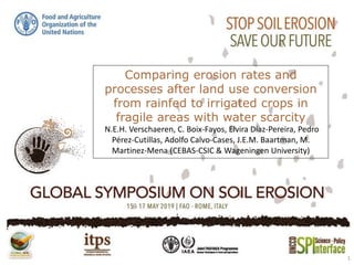
- 1. Comparing erosion rates and processes after land use conversion from rainfed to irrigated crops in fragile areas with water scarcity N.E.H. Verschaeren, C. Boix-Fayos, Elvira Díaz-Pereira, Pedro Pérez-Cutillas, Adolfo Calvo-Cases, J.E.M. Baartman, M. Martinez-Mena (CEBAS-CSIC & Wageningen University) 1
- 2. 2 Introduction • SE Spain: Susceptible area for erosion • Land use conversion • Traditional rain-fed almonds on terraces • Irrigated citrus on levelled terrain using ridges • Main research question: What is the influence of changing traditional cultivation methods into modern cultivation methods on erosion?
- 5. Methodology • Field inventory • Erosion Pins • Remote sensing 5
- 7. Results 7
- 8. Results 8
- 9. Results 9
- 10. Results 10
- 11. Discussion • Large variation • Age estimation • Root exposure, gullies and pedestals • Upslope area 11
- 12. Conclusion • Erosion rates show a large variation • Changing rainfed to irrigated systems does not significantly influence erosion in this study 12
- 13. Thank you! Acknowledgements: • This research was done with the support of the H2020-RUR-2016-2017 project, Diverfarming 728003 • Next to CEBAS-CSIC and Wageningen University also the University of Murcia and the University of Valencia contributed to this research 13
- 15. 15
- 17. 17