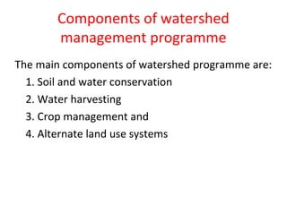
Watershed management aims to enable sustainable production and minimize hazards to natural resources like soil and water. A watershed is a geographical area that drains to a common water body. Key components of watershed management programs include soil and water conservation measures, water harvesting, and crop management and alternate land use systems suited to land capability. The overall objectives are improved livelihoods through increased incomes while protecting watershed resources.
Soil water conservation methods in agricultureVaishali Sharma
This presentation includes introduction as well as all the methods in agriculture either engineering or agronomic measures used in conservation of soil and water against erosion or other deteriorative factors.
Soil water conservation methods in agricultureVaishali Sharma
This presentation includes introduction as well as all the methods in agriculture either engineering or agronomic measures used in conservation of soil and water against erosion or other deteriorative factors.
QUALITY OF IRRIGATION WATER AND MANAGEMENT OF SALINE WATER FOR IRRIGATION
GOVARDHAN LODHA
Enroll. No. (160111017)
Department of Agronomy
M.Sc. (Ag) Agronomy 2nd semester
describes the irrigation and irrigation requirements of different crops. this ppt also describes about different methods to measure the soil moisture availability.
Introduction
enlist of problematic soil
Salt affected soil
Characteristic of salt affected soil
Comparison between salt affected soil
Reclamation of Saline soils
Reclamation of sodic soils
Reclamation of saline-sodic soils
Acidic soils
Reclamation of acidic soil
Acid Sulphate soils and its management
Calcareous soil
Soil moisture characteristic curve is the relationship between the water content and the soil water potential, ψ.
It describes the functional relationship between soil water content and its energy status in terms of its matric potential under equilibrium conditions.
This curve is characteristic for different types of soil.
It is also called the Water retention curve
Watershed Management for Sustainable Development of Rainfed areasAntaraPramanik
Development of watershed is one of the most trusted and eco-friendly approach to manage rainwater and other natural resources, which has paid rich dividends in the rainfed areas and is capable of addressing many natural, social and environmental issues. (Wani et al., 2003).
Over 120 million ha land area has been declared degraded (Maji et al., 2007) in India.
The annual soil loss rate in India is nearly 16.4 t/ha (Mandal and Sharda, 2013).
The loss of sediments caused by soil erosion not only deteriorates the quality of surface water, nearby water bodies, and wetlands but also reduces the productivity of agricultural land (Issaka and Ashraf, 2017).
Watershed technology is suitable to protect and enhance soil fertility, which is deteriorating at an alarming rate with agricultural intensification. A vast range of activities of every day life depends upon adequate supplies of water. For e.g. Agriculture and Industry, power production, inland transportation, sanitation and public health services and so on.
Therefore to provide all these activities construction of watershed and manage is essential.
Fast deterioration of natural resources is one of the key issues, threatening sustainable development of rainfed agriculture as most rainfed regions are facing multifaceted problems of land degradation, water shortage, acute poverty, and escalating population pressure.
Poor watershed management is a major cause of land and water degradation, rural poverty in India.
The management of watershed provides a means to achieve sustainable land and water management.
Improved and appropriate soil and water management practices are most important for sustainable and improved livelihoods in the rainfed areas because other technological interventions such as improved varieties, fertilizers, etc. are generally not so effective where soil is degraded and water is severely limited.
water shed management, its objectives ,factors effecting water shed management, perspective of watershed management ,organizational setup, steps in water shed management, classification of watershed, component and practices of water shed management
Soil conservation is the preventing of soil loss from erosion or reduced fertility caused by over usage, acidification, salinization or other chemical soil contamination.
Ethnobotany and Ethnopharmacology:
Ethnobotany in herbal drug evaluation,
Impact of Ethnobotany in traditional medicine,
New development in herbals,
Bio-prospecting tools for drug discovery,
Role of Ethnopharmacology in drug evaluation,
Reverse Pharmacology.
The Indian economy is classified into different sectors to simplify the analysis and understanding of economic activities. For Class 10, it's essential to grasp the sectors of the Indian economy, understand their characteristics, and recognize their importance. This guide will provide detailed notes on the Sectors of the Indian Economy Class 10, using specific long-tail keywords to enhance comprehension.
For more information, visit-www.vavaclasses.com
The Roman Empire A Historical Colossus.pdfkaushalkr1407
The Roman Empire, a vast and enduring power, stands as one of history's most remarkable civilizations, leaving an indelible imprint on the world. It emerged from the Roman Republic, transitioning into an imperial powerhouse under the leadership of Augustus Caesar in 27 BCE. This transformation marked the beginning of an era defined by unprecedented territorial expansion, architectural marvels, and profound cultural influence.
The empire's roots lie in the city of Rome, founded, according to legend, by Romulus in 753 BCE. Over centuries, Rome evolved from a small settlement to a formidable republic, characterized by a complex political system with elected officials and checks on power. However, internal strife, class conflicts, and military ambitions paved the way for the end of the Republic. Julius Caesar’s dictatorship and subsequent assassination in 44 BCE created a power vacuum, leading to a civil war. Octavian, later Augustus, emerged victorious, heralding the Roman Empire’s birth.
Under Augustus, the empire experienced the Pax Romana, a 200-year period of relative peace and stability. Augustus reformed the military, established efficient administrative systems, and initiated grand construction projects. The empire's borders expanded, encompassing territories from Britain to Egypt and from Spain to the Euphrates. Roman legions, renowned for their discipline and engineering prowess, secured and maintained these vast territories, building roads, fortifications, and cities that facilitated control and integration.
The Roman Empire’s society was hierarchical, with a rigid class system. At the top were the patricians, wealthy elites who held significant political power. Below them were the plebeians, free citizens with limited political influence, and the vast numbers of slaves who formed the backbone of the economy. The family unit was central, governed by the paterfamilias, the male head who held absolute authority.
Culturally, the Romans were eclectic, absorbing and adapting elements from the civilizations they encountered, particularly the Greeks. Roman art, literature, and philosophy reflected this synthesis, creating a rich cultural tapestry. Latin, the Roman language, became the lingua franca of the Western world, influencing numerous modern languages.
Roman architecture and engineering achievements were monumental. They perfected the arch, vault, and dome, constructing enduring structures like the Colosseum, Pantheon, and aqueducts. These engineering marvels not only showcased Roman ingenuity but also served practical purposes, from public entertainment to water supply.
Welcome to TechSoup New Member Orientation and Q&A (May 2024).pdfTechSoup
In this webinar you will learn how your organization can access TechSoup's wide variety of product discount and donation programs. From hardware to software, we'll give you a tour of the tools available to help your nonprofit with productivity, collaboration, financial management, donor tracking, security, and more.
How to Split Bills in the Odoo 17 POS ModuleCeline George
Bills have a main role in point of sale procedure. It will help to track sales, handling payments and giving receipts to customers. Bill splitting also has an important role in POS. For example, If some friends come together for dinner and if they want to divide the bill then it is possible by POS bill splitting. This slide will show how to split bills in odoo 17 POS.
2. Introduction
Soil, water and vegetation are the three
important natural resources. As these
resources are interdependent there is a need
to have a unit of management for most
effective and useful management of these
resources. In this context, watershed is an
important unit for the management of the
natural resources
3. Concept of watershed management
A watershed is defined as any spatial area from
which runoff from precipitation is collected and
drained through a common point or outlet.
In other words, it is a geo-hydrological unit the
water of which flow through a common outlet. It is
defined as unit of area, which covers all the land,
which contributes runoff to a common point.
It is synonymous with a drainage basin or
catchment area. The basic unit of development is a
watershed, which is a manageable hydrological unit.
The watershed is also known as ridgeline in U.K.
5. Watershed management
Watershed management implies the wise use of
soil and water resources within a given
geographical area so as to enable sustainable
production and to minimize floods.
Watershed management is the rational
utilization of land and water resources for
optimum production with minimum hazard to
natural resources.
6. Watershed management programmes
The Drought Prone Area Development Programme(DPAP) and
the Desert Development Programme (DDP) adopted
watershed development approach in 1987.
The Integrated Watershed Development Project (IWDP)
taken up by the National Wasteland Development Board
(NWDB) in 1989 also aimed at development of wastelands
on watershed basis.
The fourth major programme based on watershed concept is
the National Watershed Development Programme for
Rainfed Areas (NWDPRA) under the ministry of Agriculture.
The ministry of Rural development funds watershed
development schemes under DDP, DPAP and IWDP.
7. Classification of Watersheds
Based on the size the watersheds may be classified
as:
• Micro watersheds: The size of the watershed
range from few hectares to hundreds of hectares.
These can be designed within the crop fields.
• Small watersheds: The watershed has few
thousands of hectares as drainage area.
• Large watersheds: The river basins are
considered as large watersheds.
8. Principles of watershed management
• Utilizing the land based on its capability
• Protecting the fertile top soil
• Minimizing the silting up of the reservoirs and lower fertile lands
• Protecting vegetative cover throughout the year
• In situ conservation of rain water
• Safe diversion of surface runoff to storage structures through grassed water ways
• Stabilization of gullies and construction of check dams for increasing ground water
recharge.
• Increasing cropping intensity through inter and sequence cropping.
• Alternate land use systems for efficient use of marginal lands
• Water harvesting for supplemental irrigation
• Ensuring sustainability of the ecosystem
• Maximizing farm income through agricultural related activities such as dairy poultry,
sheep, and goat farming
• Improving infrastructural facilities for storage transport and agricultural marketing
• Setting up of small scale agro industries and
• Improving socio-economic status of farmers.
9. Objectives of watershed management
• The term watershed management is synonymous
with soil and water conservation with the
difference that emphasis is on flood protection
and sediment control besides maximizing crop
production. The watershed aims ultimately at
• improving standards of living of common people
in the basin by increasing their earning capacity,
by offering facilities such as electricity, drinking
water, irrigation water, freedom from fear of
floods, drought etc.,
10. The objectives of watershed management programme can also be described in
symbolic form by the expression: POWER. Here the letters symbolize the following:
• P = Production of food-fodder-fuel-fruit-fibre-fish-milk combined on sustained
basis
Pollution control
Prevention of floods
• O= Over exploitation of resources to be minimized by controlling excessive biotic
interferences like over grazing
Operational practicability of all on farm operations and follow up
programmes including easy approachability to different locations in watershed
• W = Water storage at convenient locations for different purposes
Wild animal and indigenous plant life conservation at selected places
• E = Erosion control
Ecosystem safety
Economic stability
Employment generation
• R = Recharge of ground water
Reduction of drought hazards
Reduction of siltation in multipurpose reservoirs
Recreation
11. Action plan for watershed development
(steps in watershed management):
1. Identification and selection of watershed
2. Description of watershed.
3. Analysis of problems and identification of available
solutions
4. Designing the technology components
5. Preparation of base maps of watershed
6. Cost-benefit analysis
7. Fixing the time frame
8. Monitoring and evaluation
9. On-farm research
10. Organizational requirement:
13. Components of watershed
management programme
The main components of watershed programme are:
1. Soil and water conservation
2. Water harvesting
3. Crop management and
4. Alternate land use systems
14. Soil and water conservation measures
These measures coupled with water
harvesting help to improve the moisture
availability in the soil profile and surface water
availability for supplemental irrigation. Based on
the nature and type of hydraulic barriers and
their cost the conservation measures in arable
lands can be divided into three categories:
a. Permanent treatments (Hardware treatments)
b. Semi permanent treatments (medium
software
treatments) and
c. Temporary treatments (software treatments).
15. a. Permanent measures:
These measures are provided for improvement of relief,
physiography and drainage features of watershed, aimed at
controlling soil erosion, regulating surface runoff and reducing
peak flow rates. Bunds, terraces and waterways are the
permanent measures in watershed management project.
• Waterways: both with and without vegetation- grassed
waterways for safe disposal of runoff water.
• Bunds: contour bunds –Suitable for low rainfall areas (< 600
mm) and in permeable soils having slope up to 6%.
• Graded bunds – Suitable for high rainfall areas (> 600 mm) and
for poor permeable soils having 2-6% slope and for soils having
crust.
• Terraces: Bench terracing: suitable for soils having slopes 16 to
33%. Bench terraces reduce both slope length and degree of
slope. At Ootacamund erosion rate decreased from 39 t/ha to
less than 1.0 t/ha on 25% sloping land by bench terracing.
16. b. Semi permanent measures:
These are usually interbund treatments where field sizes
are large in conventionally bunded area. They are adopted to
minimize the velocity of overland flow. These measures may
lost for 2 to 5 years.
i. Small section / key line bunds: A small section bund may be
created across the slope at half of the vertical bund spacing,
which needs to be renovated at an interval of 2-3 years.
ii. Strip Levelling: Levelling of about 4 to 5 m strips of land above
the bund across the major land slope help in reducing the
velocity of surface flow. Strip levelling can be done by running
blade harrow at an interval of 2 to 4 years.
iii. Live beds: One or two live beds of 2-3 m width on contour or
on grade also serve the purpose. The vegetation on the beds
may be annual or perennial or both.
iv. Vegetative or live barriers: One or two barriers of close
growing grasses or legumes along the bund and at mid length
of slope can filter the runoff water or slow down over land
flow. Khus grass is widely recommended as vegetative barrier.
17. c. Temporary measures
(Software treatments):
These are simple treatments for in situ
moisture conservation and needs to be remade
or renovated every year. Simple practices like
contour farming, compartmental bunding,
broad bed and furrows, dead furrows, tillage
and mulching have gained wide acceptance in
the recent past.
18. Crop management
Location specific package of practices for dryland
crops have been developed by dryland research
centres and state agricultural Universities for all the
crops and cropping systems which include.
a) Selection of crops and cropping systems to suit length
of growing season
b) Optimum sowing time
c) Fertilizer schedules and balanced use of plant nutrients
for crops and cropping systems
d) Weed management and package of practices for
aberrant weather
e) Contingent cropping
19. Land use classification
(land capability classification)
Land capability classification is grouping of soils into
different classes according to their capability for intensive
use and treatments required for sustained use. It
emphasizes the need for using the land only for what it is
suited best to realize optimum returns, without land
degradation. Land capability classification system
developed by USDA is useful for Agriculture. Eight land
capability classes are recognized and designated by Roman
numericals from I to VIII. The Roman numericals indicate
increasing limitations and fewer choices for practical field
crop use.
• Land capability classes from I to IV are suitable for arable
crop production
• Land capability classes from V to VIII are suitable for
alternate land use systems
20. • CLASS I: This group of soils has few limitations on their
use. They are deep (> 90 cm), well drained and nearly
levelled. They are fertile or responsive to fertilizer
application. There is no limitation on the type of crops
grown. A variety of crops can be grown intensively
with recommended management practices. They are
suitable for intensive cultivation. This group of soils is
represented by light green colour in land use maps
• CLASS II: Soils have moderate limitations such as
gentle slope, moderate erosion problem, inadequate
depth (22.5–45 cm), slight salinity and alkalinity and
relatively restricted drainage. Less intensive cropping
systems must be followed. Simple management
practices such as contour cultivation will maintain the
soil for crop production. They are represented by
yellow colour in land use maps.
21. • CLASS III: Soils have moderate to severe limitations.
The soil erosion, shallow water permeability, low
moisture retentively, moderate salinity and low
fertility are the limitations for their use. Soils can be
used for crop production with special conservation
practices like terracing. Smothering crops such as
legumes are more
ideal than row crops. They are represented by red
colour in land capability maps.
• CLASS IV: These soils will have very severe limitations
that reduce the choice of crops. Steep slope, severe
erosion, shallow soil depth, salinity or alkalinity
restricts their use for profitable crop production. These
lands should be used for close growing crops or
grasses with special soil conservation practices.
22. • CLASS V: These soils generally not suitable for grain crops
due to limitations such as rocky soil, faded areas with no
drainage facilities. Pastures can be improved on this class
of land.
• CLASS VI: These soils are suitable for growing grasses and
forest trees. Limitations are same as those for class V but
they are more rigid. Their use may be restricted to
woodland or wild life.
• CLASS VII: These have severe limitations even for growing
grass and forest trees. They are steep soils of extremely
shallow depth, used for woodlands and wild life.
• CLASS VIII: Not suitable for forest trees and grasslands as
they are steep, rough stony mountains. Land use is
restricted to recreation, wild life etc.,
23.
24. Capability classes can be sub divided into sub classes
within each class based on special limitations. They are
designated by adding small letter c, e, s or w to roman
numerical.
c : shows that chief limitation is climate, low rainfall, too
cold or too dry (very high or very low temperature)
e : chief limitation is soil erosion
s : main limitation is soil character like depth (shallow
depth, stony, salinity, rocky)
w : soil wetness, excess water in or on soil interferes the
plant growth