Download to read offline
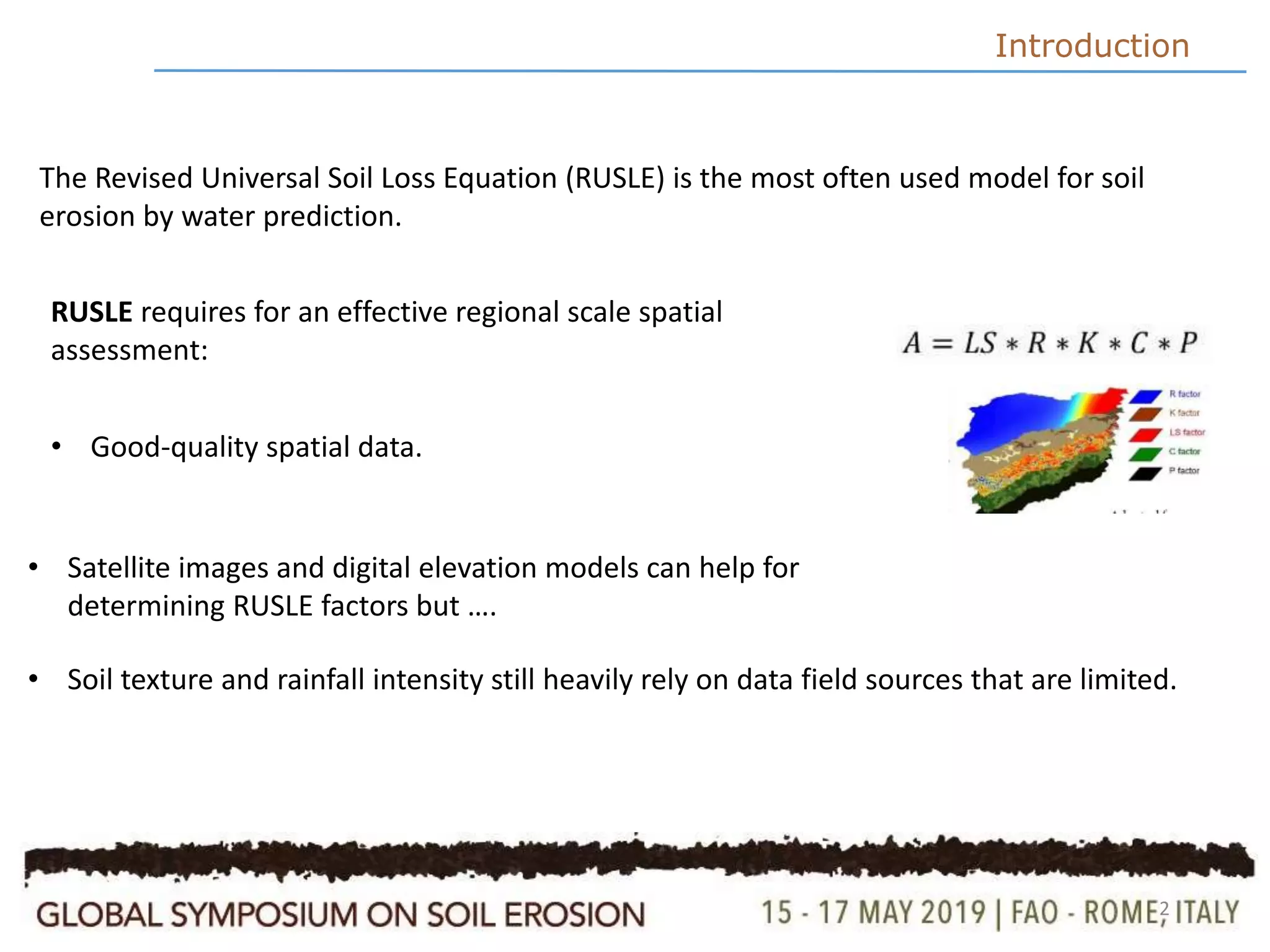
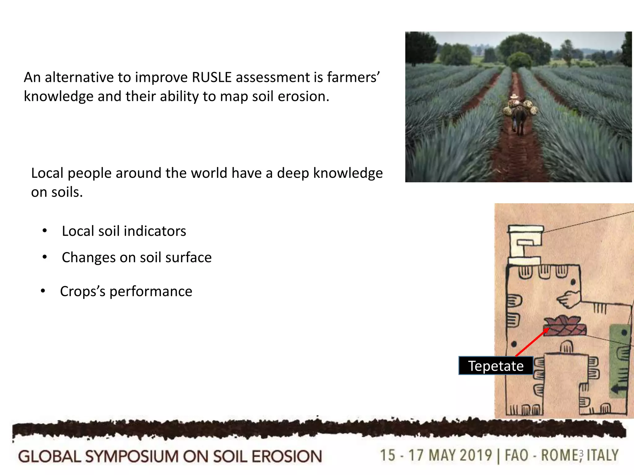
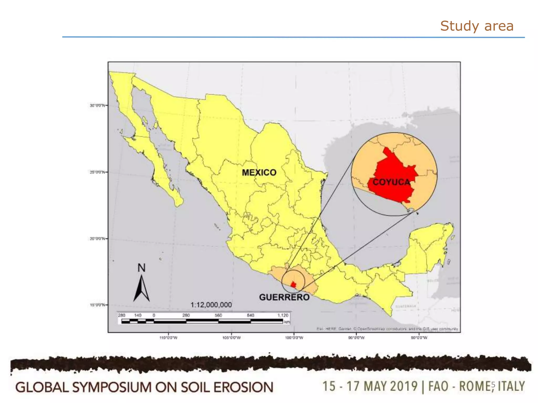
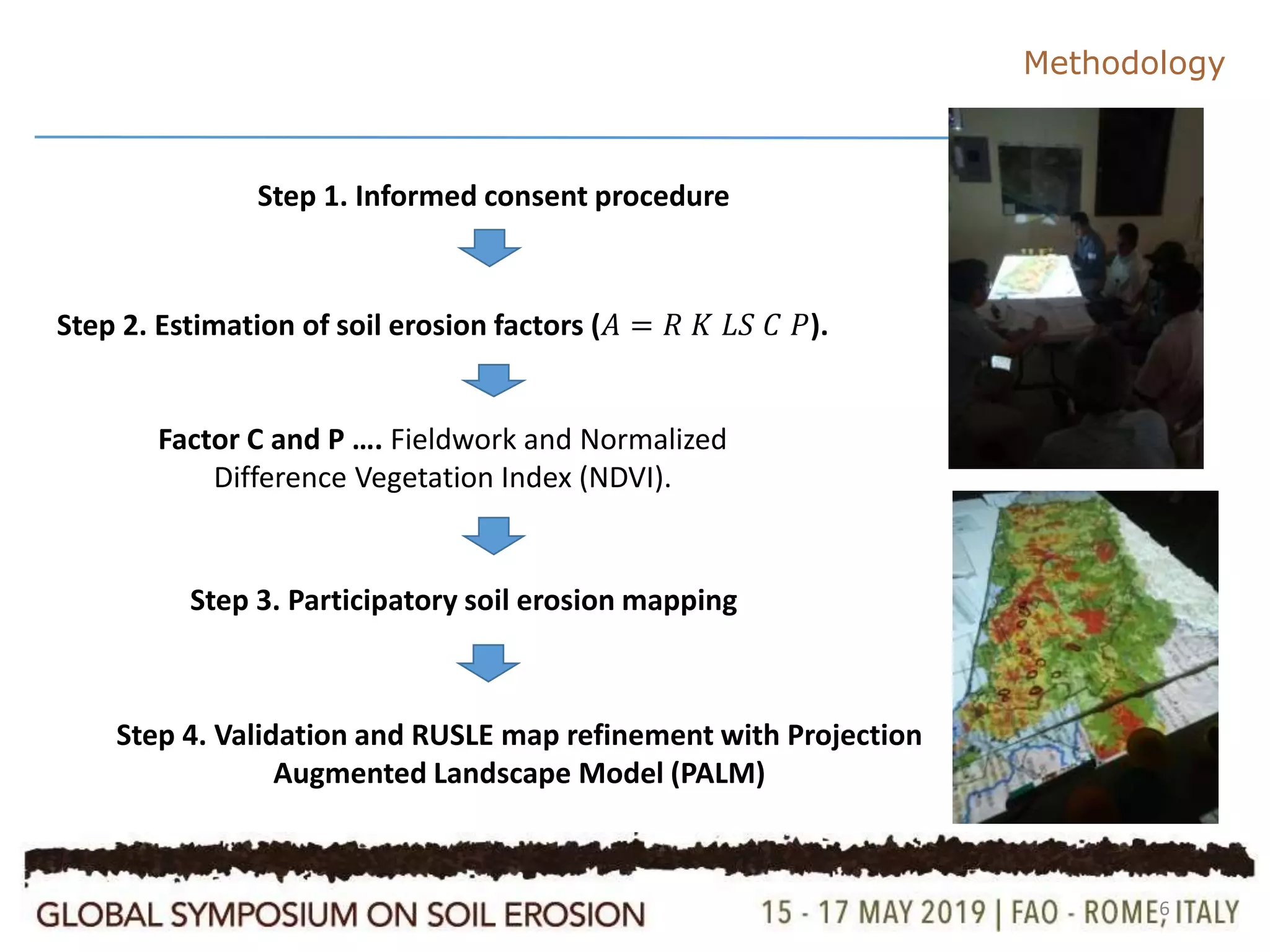
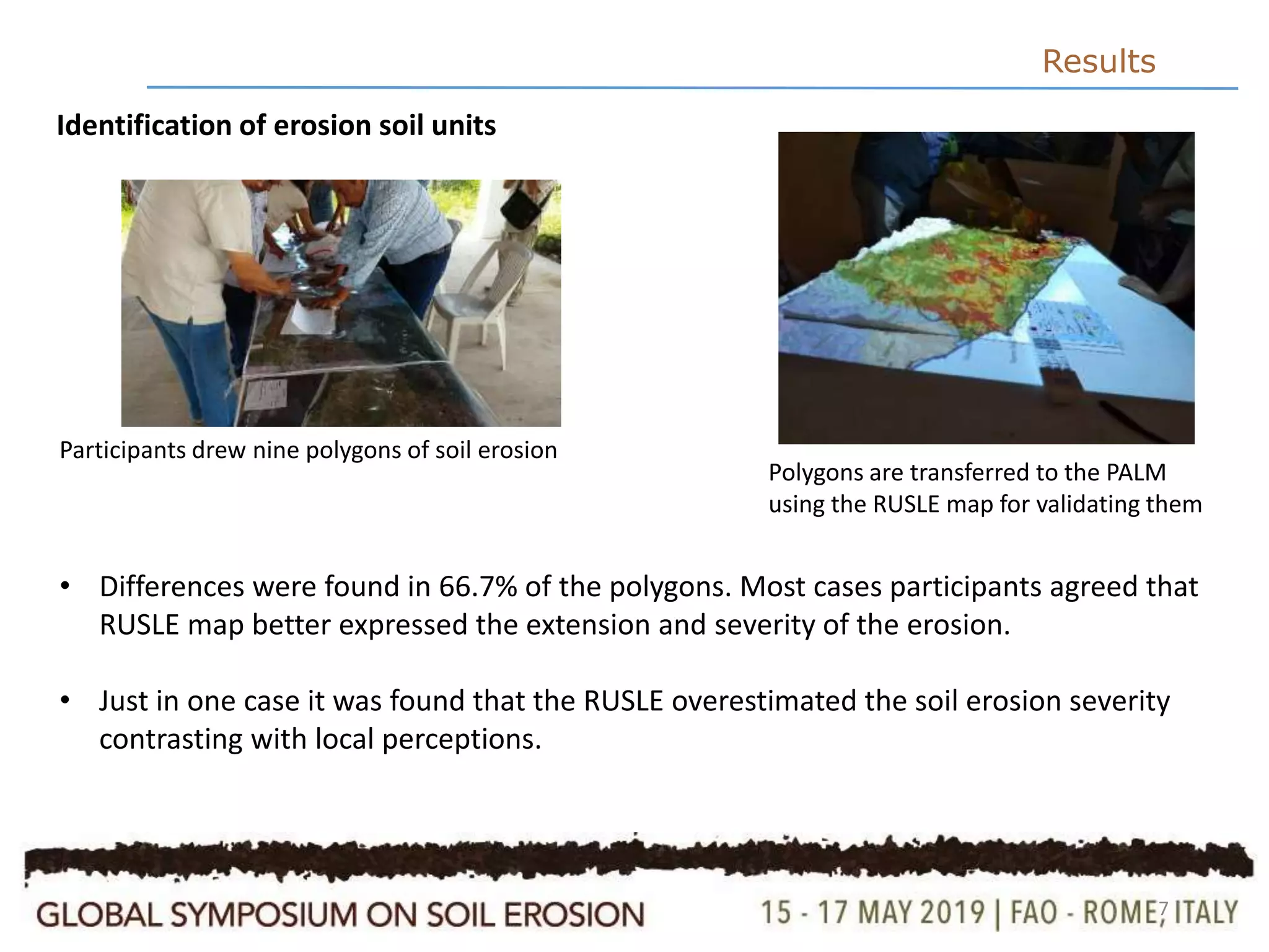
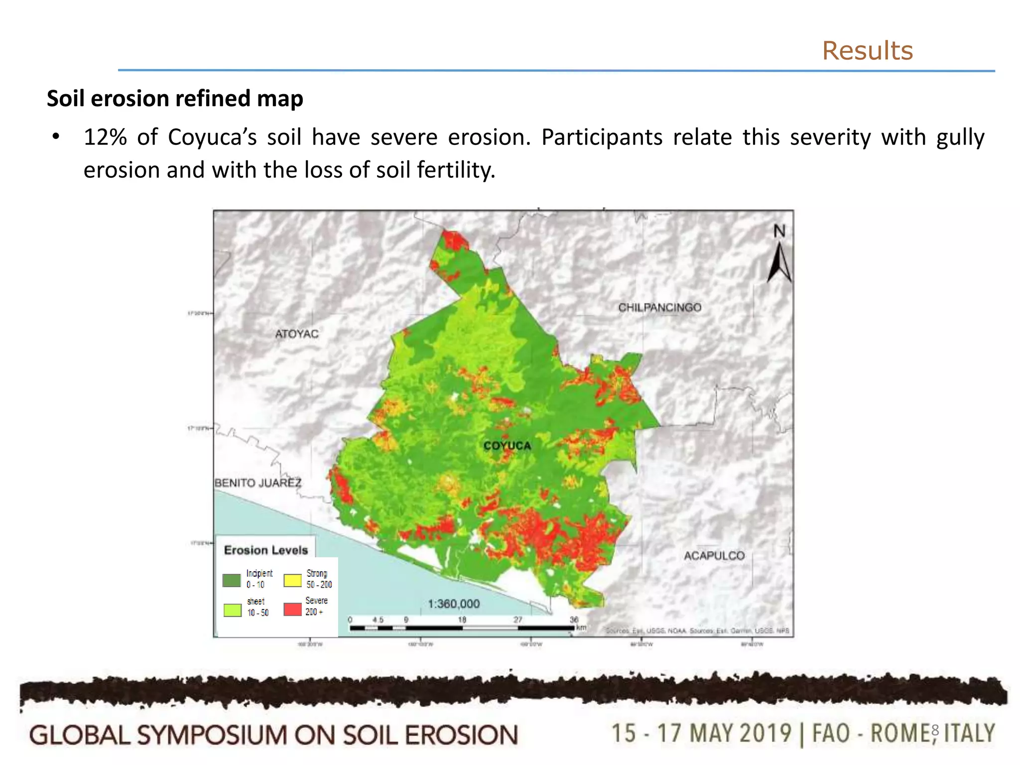
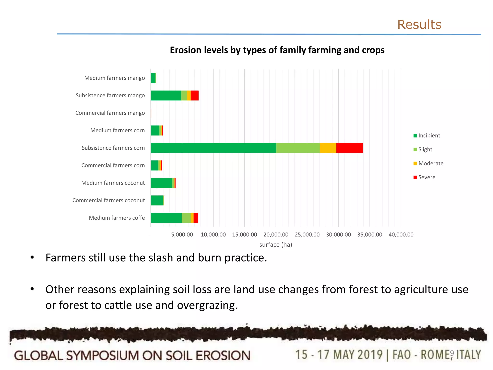

This study explores the use of the Revised Universal Soil Loss Equation (RUSLE) and the Projection Augmented Landscape Model (PALM) to assess soil erosion in a Mexican peasant community using local farmers' knowledge through participatory mapping. Results indicate that 12% of Coyuca's soil experiences severe erosion, linked to factors like gully erosion and changes in land use. The combination of spatial models and local perceptions proved effective for assessing soil erosion and fostering awareness among participants about its impact on agricultural practices.