Downloaded 110 times

![THREE DISCIPLINES
Corbusier noticed three qualities in India
1. The discipline of money- as it was the period of post independence the project
couldn't be made to a grand level and had to be made in a ideal budget.
2. The discipline of technology-even with vast amounts of clay stone , sand
Corbusier went for usage of rough concrete in capitol and central business
district.
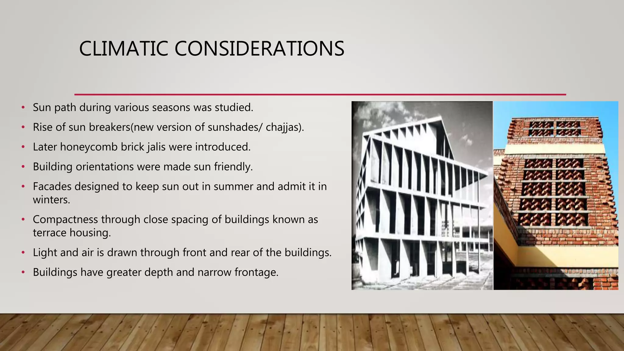
3. The discipline of climate- besides the administrative and financial regulations
there was a law of the sun in India. The architectural problem consists; first to
make shade, second to make a current of air[to ventilate], third to control
hydraulics.](https://image.slidesharecdn.com/gridironpattern151109031-181127052017/75/Chandigarh-grid-iron-pattern-8-2048.jpg)


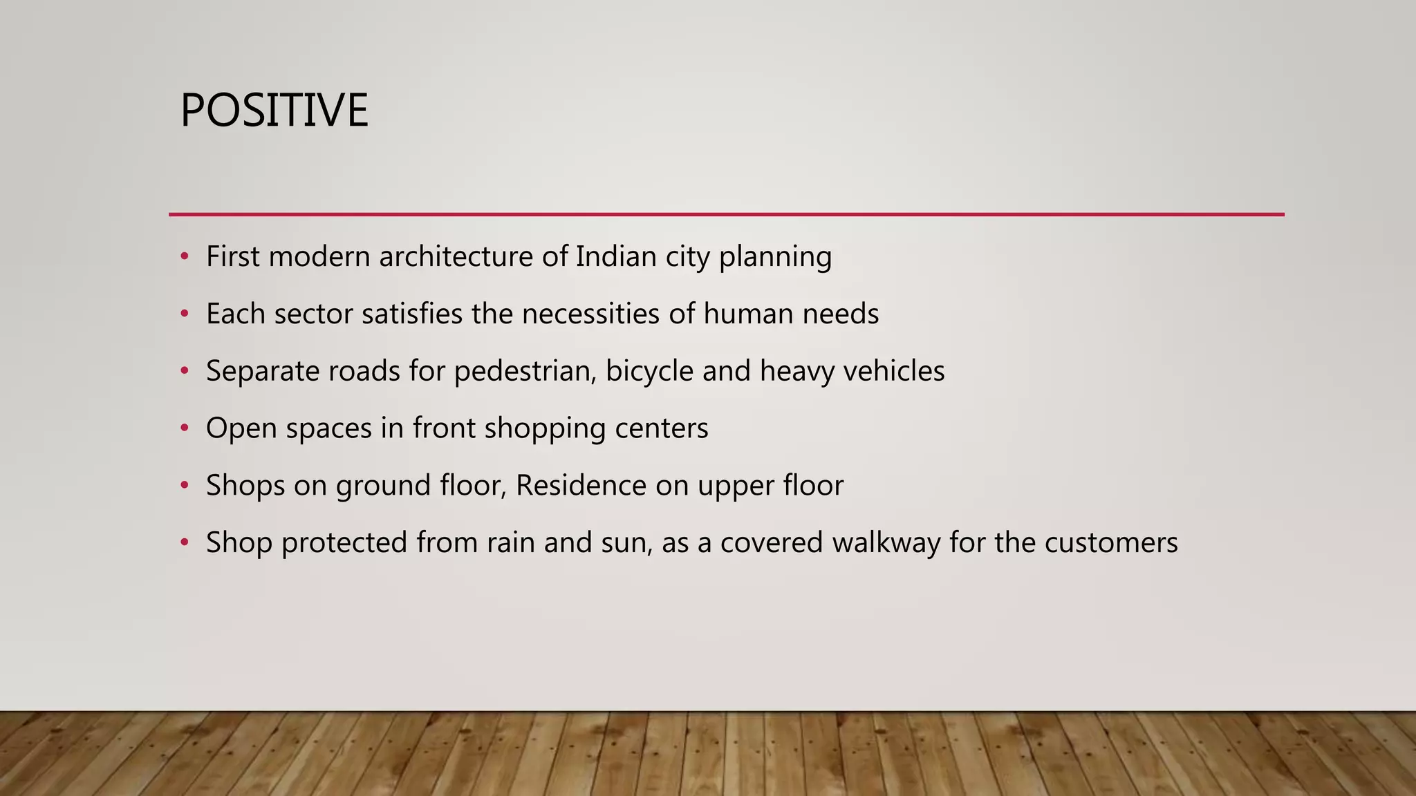
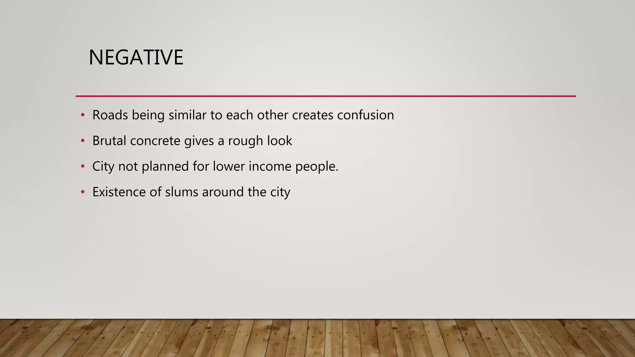

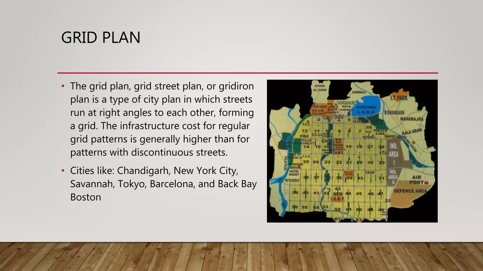
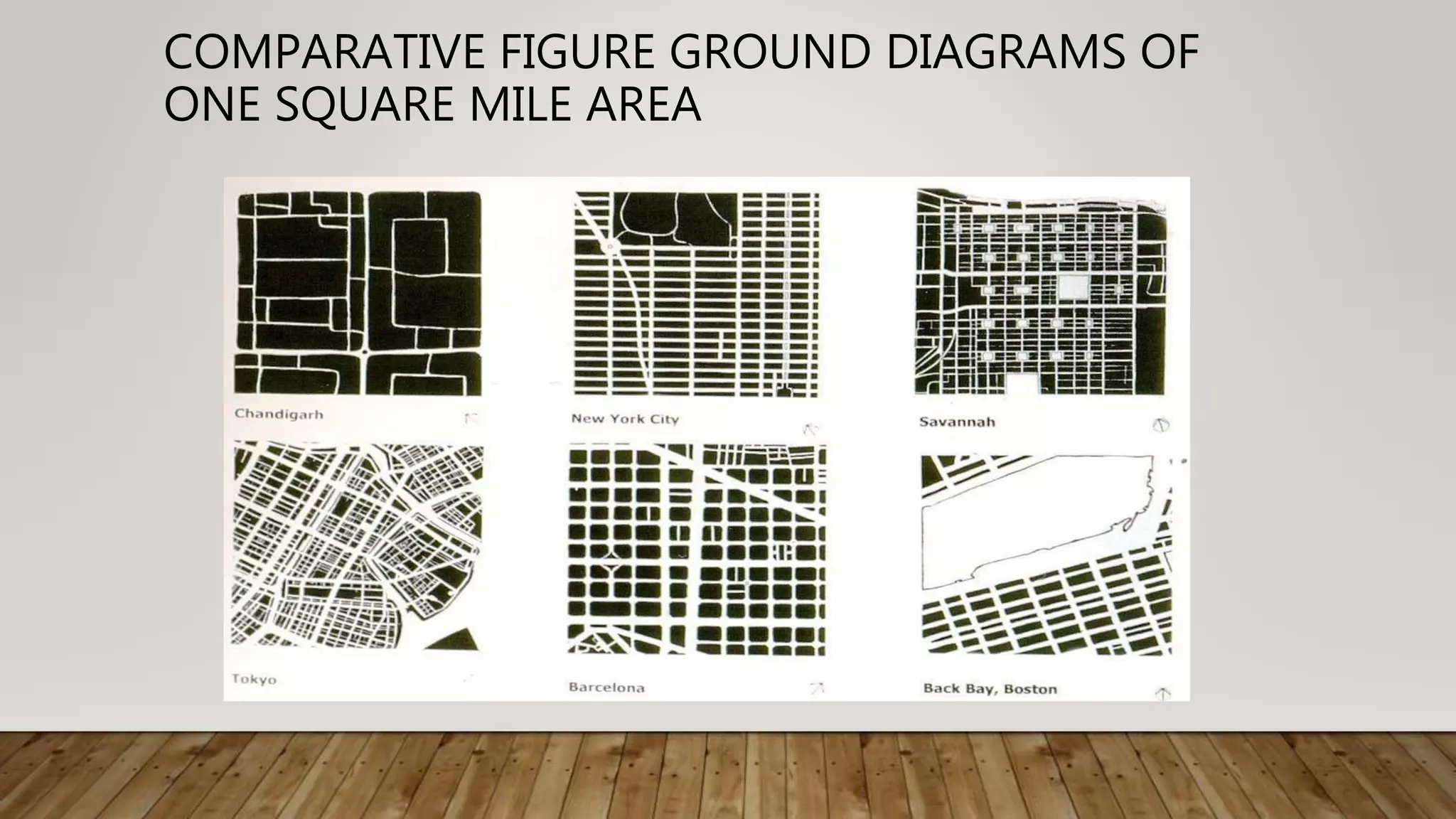
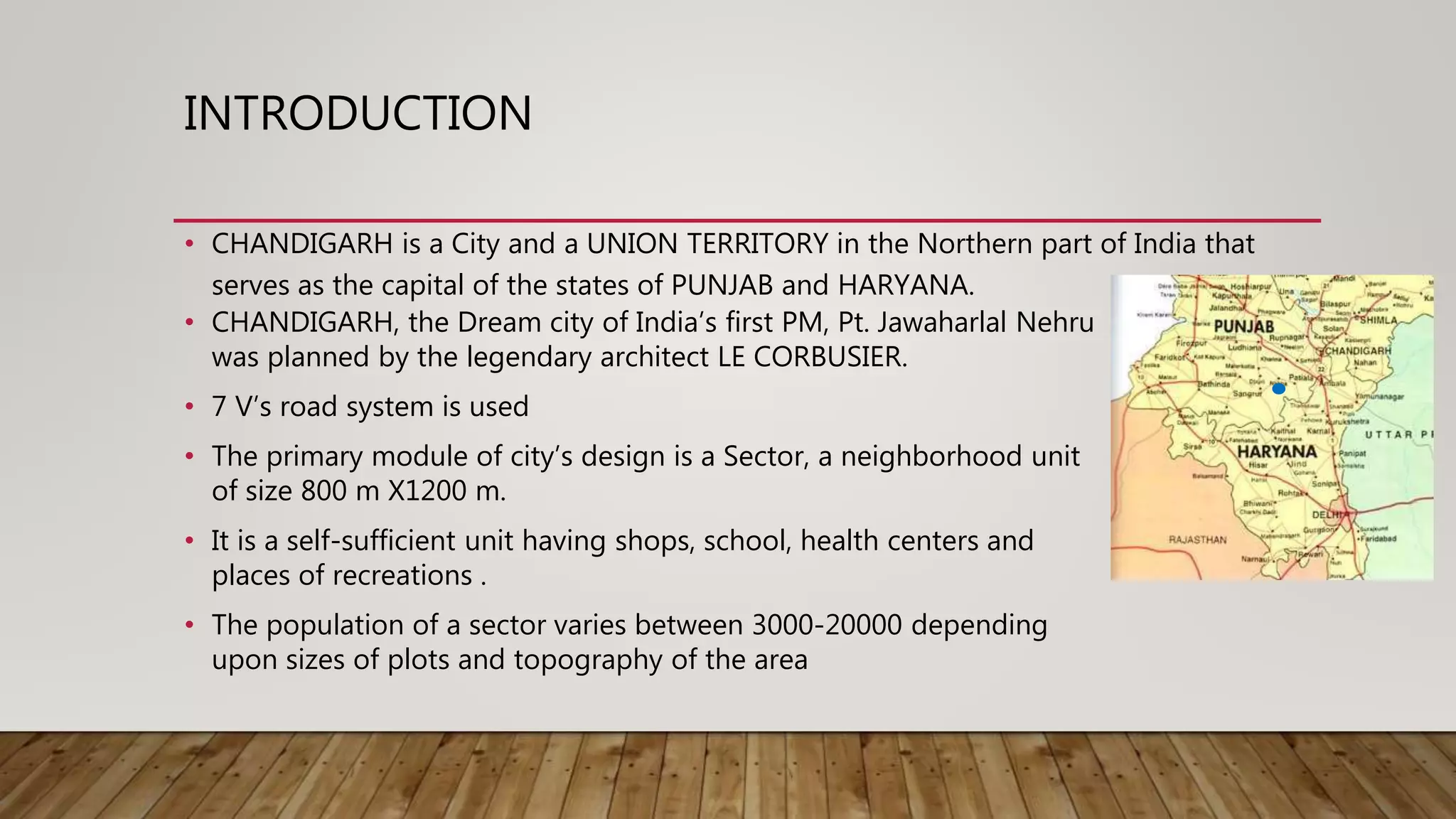
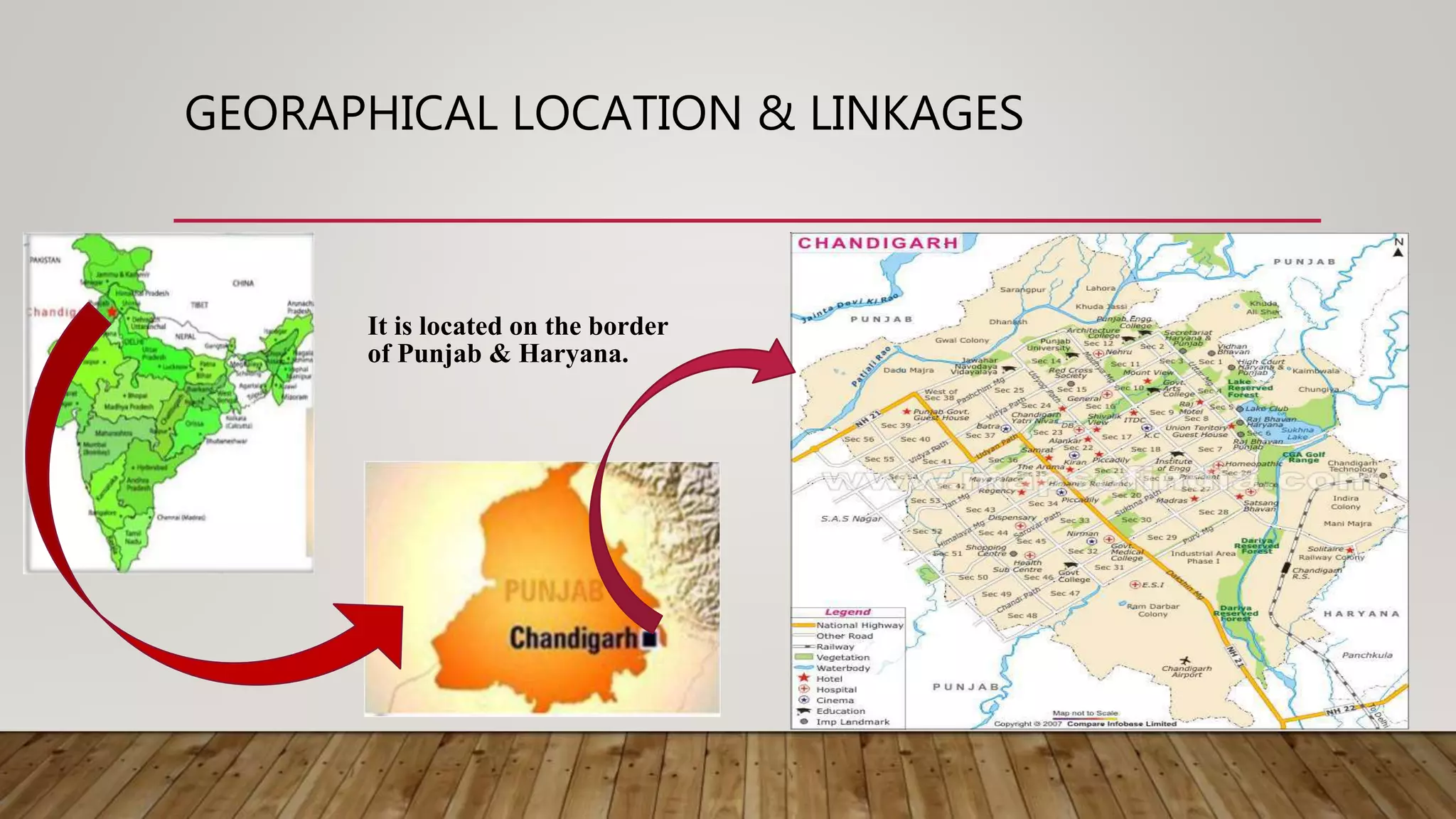
The document is a case study of Chandigarh's gridiron city plan, designed by Le Corbusier, emphasizing its structured layout where streets intersect at right angles to form sectors that promote self-sufficiency. It discusses the historical context of Chandigarh's planning, aimed at creating a modern capital for Punjab and Haryana, while addressing urban design challenges such as infrastructure costs, climate adaptability, and community needs. The summary highlights both positive aspects, like pedestrian-friendly designs, and critiques, such as the exclusion of lower-income residents.


