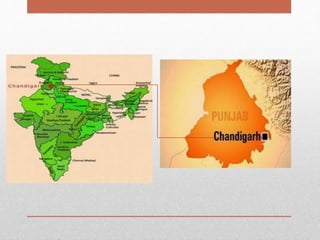
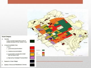
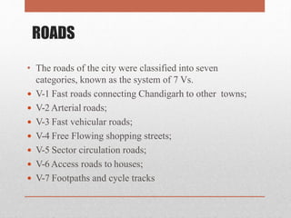
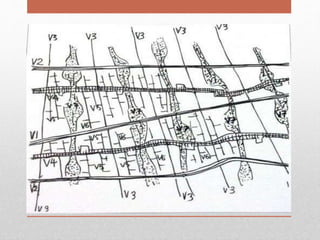
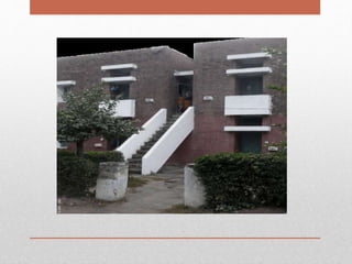
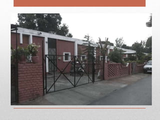
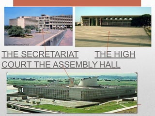
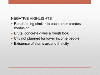
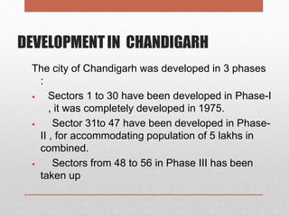
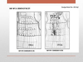
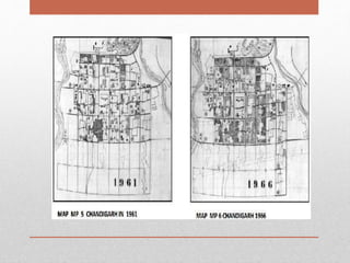
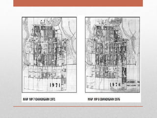
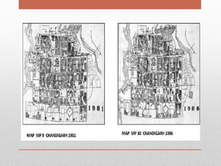
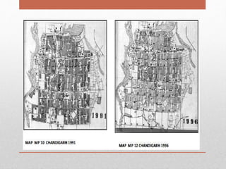
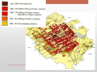
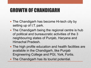
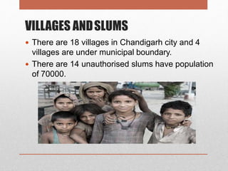
CHANDIGARH—CITY PLANING
-THE PLANNED CITY OF INDIA
SHARMILA.B
140101601075
URBAN DESIGN-CITY PLANING BASE STUDY
CRESCENT SCHOOL OF ARCHITECTURE
INTRODUCTION
Chandigarh is one of the most significant urban planning
experiments of the 20th century.
It is the only one of the numerous urban planning schemes of
Le Corbusier to have actually been executed.
It is also the site of some of his greatest architectural creations.
The city has had a far-reaching impact, in a modern idiom of
architecture and city planning all over India.
It has become a symbol of planned urbanism. It is as famous for
its landscaping as for its architectural ambience. Most of the
buildings are in pure, cubical form, geometrically subdivided
with emphasis on proportion, scale and detail.
HISTORY
 SINCE PUNJAB WAS DIVIDED INTO TWO PARTS, THE CAPITAL WAS LEFT
IN PAKISTAN THERE FORE PUNJAB IN INDIA REQUIRED NEW CAPITAL
 LE CORBUSIER WAS APPROACHED BY PUNJAB GOVERNMENT AND
THE PRIME MINISTER OF INDIA
 CHANDIGARH IS A BOLD EXPERIMENT INMODERN CIVIC DESIGN
 MAXWELL FRY, JANE DREW AND PIERRE JEANNERET
WERE ALSO INVOLVED IN THE TEAM OFARCHITECTS
 WHEN LE CORBUSIER ASSUMED CONTROL OF THE CHANDIGARH
PROJECT IN 1951, HOWEVER THE DESIGN OF THE CITY HAD ALREADY
BEENDEVISED BY THE NEW YORK FIRM OF MAYER, WHITTLESEY, AND
GLASS WHO RECEIVED A CONTRACT FORTHE MASTER PLANOF
CHANDIGARH IN 1950
GEOGRAPHICAL AND DEMOGRAPHICALPROFILE
 Area
 Longitude
 Latitude
114 sq kms
76 47' 14E
30 44' 14N
 Total Population (2011 census)
10.55 Lacs(97.25% people live in urban
regions)
 Density of population/sq. km.7,900
IDEA OF LECORBUSIER
The city of Chandigarh is planned to human scale.
 Head–capitol (place of power)
 Heart –the city centre
 Stomach–the commercial area
 Arms–university and Industrial zone
 Lungs–leisure valley ,open spaces
 Arteries–network of roads
SECTORS
The key of modern urbanism is 'the
Sector',
which was defined as a container Of family life (24 solar hours:
night and day).
Each sector was 800 meters by 1,200 meters, enclosed by
roads allocated to fast- mechanized transport and sealed to
direct access from the houses.
The population would be approximately from 5,000 to 20,000
inhabitants. Chandigarh had 30 sectors.
ROADS
• The roads of the city were classified into seven
categories, known as the system of 7 Vs.
 V-1 Fast roads connecting Chandigarh to other towns;
 V-2Arterial roads;
 V-3 Fast vehicular roads;
 V-4 Free Flowing shopping streets;
 V-5 Sector circulation roads;
 V-6Access roads to houses;
 V-7 Footpaths and cycle tracks
HOUSING
The residential buildings were governed by a
mechanism known as 'frame control' created by
the municipal administration to control their
facades.
This fixed the building line and height and the use of building
materials. Certain standard sizes of doors and windows are
specified and all the gates and boundary walls must conform
to standard design. The idea was to ensure that the view from
the street, which belonged to the community, was of same
visual order and discipline to maintain uniformity.
COMMERCIALBUILDINGS
All buildings located in the City Centre and
commercial or institutional buildings located along
V-2 roads were subjected to controls. The system
of the City Centre was based on a grid of
columns. fixed 5.26 meters shuttering pattern on
concrete and a system of glazing or screen walls
behind the line of columns. The interior planning
was left to the owners. and in the exterior, certain
variations are permitted to give variety to the
architectural composition.
THE SECRETARIAT THE HIGH
COURT THE ASSEMBLY HALL
INFERENCE
POSITIVE HIGHLIGHTS
 Each sector satisfies the necessities of human
needs
 Separate roads for pedestrian, bicycle and heavy
vehicles
 Shops on ground floor, Residence on upper floor
 Shop protected from rain and sun, as a covered
walkway for the customers
NEGATIVE HIGHLIGHTS
 Roads being similar to each other creates
confusion
 Brutal concrete gives a rough look
 City not planned for lower income people.
 Existence of slums around the city
DEVELOPMENTIN CHANDIGARH
The city of Chandigarh was developed in 3 phases
:
 Sectors 1 to 30 have been developed in Phase-I
, it was completely developed in 1975.
 Sector 31to 47 have been developed in Phase-
II , for accommodating population of 5 lakhs in
combined.
 Sectors from 48 to 56 in Phase III has been
taken up
GROWTH OF CHANDIGARH
 The Chandigarh has become Hi-tech city by
setting up of I.T. park.
 The Chandigarh being the regional centre is hub
of political and bureaucratic activities of the 3
neighbouring states of Punjab, Haryana and
Himachal Pradesh.
 The high profile education and health facilities are
available in the Chandigarh, like Punjab
Engineering College and PGI, York, Fortis.
 The Chandigarh has its tourist potential.
PROBLEMS
With the development of the city, it is also
confronting some problems because population
increased in city due to high rate of migration to
cities and due to that :
 Water supply demand is increased
 Sanitation problem occurs
 And slum development started
VILLAGES ANDSLUMS
 There are 18 villages in Chandigarh city and 4
villages are under municipal boundary.
 There are 14 unauthorised slums have population
of 70000.
SLUM REHABILATION ON
PERIPHERY
INFRASTRUCTURE HIGHLIGHTS
 Safeguarding the health, integrated management of
water source, liquid & solid waste and protection of
environment.
 Protection of environment and safeguarding the
health of the general public by providing a
complete underground sewerage system.
 100% Coverage of the whole green area in gardens,
parks and open spaces with tertiary treated water in
order to save the potable water of drinking purposes.
 To have good connectivity of city with other cities
through roads and better solid waste collection
centres.
THANK YOU 

Chandigarh

  • 1.
    CHANDIGARH—CITY PLANING -THE PLANNEDCITY OF INDIA SHARMILA.B 140101601075 URBAN DESIGN-CITY PLANING BASE STUDY CRESCENT SCHOOL OF ARCHITECTURE
  • 2.
    INTRODUCTION Chandigarh is oneof the most significant urban planning experiments of the 20th century. It is the only one of the numerous urban planning schemes of Le Corbusier to have actually been executed. It is also the site of some of his greatest architectural creations. The city has had a far-reaching impact, in a modern idiom of architecture and city planning all over India. It has become a symbol of planned urbanism. It is as famous for its landscaping as for its architectural ambience. Most of the buildings are in pure, cubical form, geometrically subdivided with emphasis on proportion, scale and detail.
  • 3.
    HISTORY  SINCE PUNJABWAS DIVIDED INTO TWO PARTS, THE CAPITAL WAS LEFT IN PAKISTAN THERE FORE PUNJAB IN INDIA REQUIRED NEW CAPITAL  LE CORBUSIER WAS APPROACHED BY PUNJAB GOVERNMENT AND THE PRIME MINISTER OF INDIA  CHANDIGARH IS A BOLD EXPERIMENT INMODERN CIVIC DESIGN  MAXWELL FRY, JANE DREW AND PIERRE JEANNERET WERE ALSO INVOLVED IN THE TEAM OFARCHITECTS  WHEN LE CORBUSIER ASSUMED CONTROL OF THE CHANDIGARH PROJECT IN 1951, HOWEVER THE DESIGN OF THE CITY HAD ALREADY BEENDEVISED BY THE NEW YORK FIRM OF MAYER, WHITTLESEY, AND GLASS WHO RECEIVED A CONTRACT FORTHE MASTER PLANOF CHANDIGARH IN 1950
  • 5.
    GEOGRAPHICAL AND DEMOGRAPHICALPROFILE Area  Longitude  Latitude 114 sq kms 76 47' 14E 30 44' 14N  Total Population (2011 census) 10.55 Lacs(97.25% people live in urban regions)  Density of population/sq. km.7,900
  • 6.
    IDEA OF LECORBUSIER Thecity of Chandigarh is planned to human scale.  Head–capitol (place of power)  Heart –the city centre  Stomach–the commercial area  Arms–university and Industrial zone  Lungs–leisure valley ,open spaces  Arteries–network of roads
  • 8.
    SECTORS The key ofmodern urbanism is 'the Sector', which was defined as a container Of family life (24 solar hours: night and day). Each sector was 800 meters by 1,200 meters, enclosed by roads allocated to fast- mechanized transport and sealed to direct access from the houses. The population would be approximately from 5,000 to 20,000 inhabitants. Chandigarh had 30 sectors.
  • 10.
    ROADS • The roadsof the city were classified into seven categories, known as the system of 7 Vs.  V-1 Fast roads connecting Chandigarh to other towns;  V-2Arterial roads;  V-3 Fast vehicular roads;  V-4 Free Flowing shopping streets;  V-5 Sector circulation roads;  V-6Access roads to houses;  V-7 Footpaths and cycle tracks
  • 12.
    HOUSING The residential buildingswere governed by a mechanism known as 'frame control' created by the municipal administration to control their facades. This fixed the building line and height and the use of building materials. Certain standard sizes of doors and windows are specified and all the gates and boundary walls must conform to standard design. The idea was to ensure that the view from the street, which belonged to the community, was of same visual order and discipline to maintain uniformity.
  • 15.
    COMMERCIALBUILDINGS All buildings locatedin the City Centre and commercial or institutional buildings located along V-2 roads were subjected to controls. The system of the City Centre was based on a grid of columns. fixed 5.26 meters shuttering pattern on concrete and a system of glazing or screen walls behind the line of columns. The interior planning was left to the owners. and in the exterior, certain variations are permitted to give variety to the architectural composition.
  • 17.
    THE SECRETARIAT THEHIGH COURT THE ASSEMBLY HALL
  • 18.
    INFERENCE POSITIVE HIGHLIGHTS  Eachsector satisfies the necessities of human needs  Separate roads for pedestrian, bicycle and heavy vehicles  Shops on ground floor, Residence on upper floor  Shop protected from rain and sun, as a covered walkway for the customers
  • 19.
    NEGATIVE HIGHLIGHTS  Roadsbeing similar to each other creates confusion  Brutal concrete gives a rough look  City not planned for lower income people.  Existence of slums around the city
  • 20.
    DEVELOPMENTIN CHANDIGARH The cityof Chandigarh was developed in 3 phases :  Sectors 1 to 30 have been developed in Phase-I , it was completely developed in 1975.  Sector 31to 47 have been developed in Phase- II , for accommodating population of 5 lakhs in combined.  Sectors from 48 to 56 in Phase III has been taken up
  • 27.
    GROWTH OF CHANDIGARH The Chandigarh has become Hi-tech city by setting up of I.T. park.  The Chandigarh being the regional centre is hub of political and bureaucratic activities of the 3 neighbouring states of Punjab, Haryana and Himachal Pradesh.  The high profile education and health facilities are available in the Chandigarh, like Punjab Engineering College and PGI, York, Fortis.  The Chandigarh has its tourist potential.
  • 28.
    PROBLEMS With the developmentof the city, it is also confronting some problems because population increased in city due to high rate of migration to cities and due to that :  Water supply demand is increased  Sanitation problem occurs  And slum development started
  • 29.
    VILLAGES ANDSLUMS  Thereare 18 villages in Chandigarh city and 4 villages are under municipal boundary.  There are 14 unauthorised slums have population of 70000.
  • 30.
  • 31.
    INFRASTRUCTURE HIGHLIGHTS  Safeguardingthe health, integrated management of water source, liquid & solid waste and protection of environment.  Protection of environment and safeguarding the health of the general public by providing a complete underground sewerage system.  100% Coverage of the whole green area in gardens, parks and open spaces with tertiary treated water in order to save the potable water of drinking purposes.  To have good connectivity of city with other cities through roads and better solid waste collection centres.
  • 32.