The document provides details about the planning and development of Chandigarh, the capital city of Punjab, India. It discusses:
- The initial master plan for Chandigarh was created by American planner Albert Mayer in the early 1950s. His plan included a Capitol complex, city center, and residential neighborhoods.
- Le Corbusier was later brought in to redesign the master plan. He retained the basic framework of Mayer's plan but replaced the neighborhoods with "sectors", standardized neighborhood units.
- Le Corbusier's plan divided the city into 30 sectors, with 24 residential. Each sector was planned to be self-sufficient with schools, shops, and community facilities to limit the need
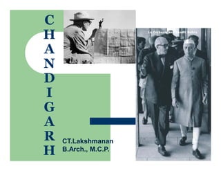
PLANNING PRINCIPLES OF LE CORBUSIER – A CASE STUDY OF CHANDIGARH CITYYash Shah
The city has a pre-historic past. The gently sloping plains on which modern Chandigarh exists, was in the ancient past, a wide lake ringed by a marsh. The fossil remains found at the site indicate a large variety of aquatic and amphibian life, which was supported by that environment. About 8000 years ago the area was also known to be a home to the Harappans. Since the medieval through modern era, the area was part of the large and prosperous Punjab Province which was divided into East & West Punjab during partition of the country in 1947. The city was conceived not only to serve as the capital of East Punjab, but also to resettle thousands of refugees who had been uprooted from West Punjab. In March, 1948, the Government of Punjab, in consultation with the Government of India, approved the area of the foothills of the Shivaliks as the site for the new capital. The location of the city site was a part of the erstwhile Ambala district as per the 1892-93 gazetteer of District Ambala. The foundation stone of the city was laid in 1952. Subsequently, at the time of reorganization of the state on 01.11.1966 into Punjab, Haryana and Himachal Pardesh, the city assumed the unique distinction of being the capital city of both, Punjab and Haryana while it itself was declared as a Union Territory and under the direct control of the Central Government.
The Union Territory of Chandigarh is located in the foothills of the Shivalik hill ranges in the north, which form a part of the fragile Himalayan ecosystem. It is occupied by Kandi (Bhabhar) in the north east and Sirowal (Tarai) and alluvial plains in the remaining part. The subsurface formation comprises of beds of boulders, pebbles, gravel, sand, silt, clays and some kankar. The area is drained by two seasonal rivulets viz. Sukhna Choe in the east and Patiala-Ki-Rao Choe in the west. The central part forms a surface water divide and has two minor streams.
Chandigarh remains grossly misunderstood and appreciated with entire credit of city planning and development given to Le- Corbusier and his team. In the process, enormous work done by the first team of Architects ( led by Albert Mayer and Ar. Methew Nowiscki ) engaged for the planning and development of Chandigarh, remains unknown, unrecognised, diluted and marginalised. Basic concept of city planning, besides defining the framework for locating the four major components of the city- Capitol, City Centre, University and Industrial areas was all done by the first team including preparing the master plan super-block, city centre, capitol etc. Second plan prepared by Corbusier is primarily and essentially was based on the first master plans because second plan was prepared merely in 96 hours by Le- Corbusier. First plans had its positivity and uniqueness, which would have made Chandigarh a different city from what it is today. It makes a interesting study to compare two master plans to visualise the shape and function of the city had the first master plan was implemented. Looking at the present context, Could you ever think of city beautiful Chandigarh, being a leaf shaped city, with all curved and radial roads, planned as a traditional Indian city with bustling bazaars, without wonderful Sukhna lake, having no sector, without ceremonial Jan Marg, without bustling Madhya Marg and without vibrant shopping streets V4 with Sukhna choe lost in the haze and glory of Capitol complex. This would have been a distinct reality, had the first master plan prepared by Albert Mayer would have been implemented to make the capital city a reality. Historically looking, Chandigarh remains the product and synthesis of two distinct but diametrically different master plans (in thought, approach, intent, content, planning and architecture), prepared for the city by the American and French architects. First plan shows clearly the influence of principles and pattern of American planning with basic residential unit defined by Superblock, whereas Corbu plan has genesis in French approach to city planning based on the ideology of CIAM.
This is the presentation on Chandigarh planning.In this presentation,students have shown the planning and some views of the city CHANDIGARH-The City Beautiful.
Explore this presentation and share and like it.
For more presentation just call or message me at:-
+919872297936 (RHYTHM MURGAI)
THANK YOU.
Paper looks at the history and geography of Chandigarh in terms of its conceptualization, planning, designing,growth and development besides looking at the issues and options which the city has to overcome emerging problems. Paper is based on earlier papers loaded on Chandigarh
PLANNING PRINCIPLES OF LE CORBUSIER – A CASE STUDY OF CHANDIGARH CITY”Yash Shah
The city has a pre-historic past. The gently sloping plains on which modern Chandigarh exists, was in the ancient past, a wide lake ringed by a marsh. The fossil remains found at the site indicate a large variety of aquatic and amphibian life, which was supported by that environment. About 8000 years ago the area was also known to be a home to the Harappans. Since the medieval through modern era, the area was part of the large and prosperous Punjab Province which was divided into East & West Punjab during partition of the country in 1947. The city was conceived not only to serve as the capital of East Punjab, but also to resettle thousands of refugees who had been uprooted from West Punjab. In March, 1948, the Government of Punjab, in consultation with the Government of India, approved the area of the foothills of the Shivaliks as the site for the new capital. The location of the city site was a part of the erstwhile Ambala district as per the 1892-93 gazetteer of District Ambala. The foundation stone of the city was laid in 1952. Subsequently, at the time of reorganization of the state on 01.11.1966 into Punjab, Haryana and Himachal Pardesh, the city assumed the unique distinction of being the capital city of both, Punjab and Haryana while it itself was declared as a Union Territory and under the direct control of the Central Government.
The Union Territory of Chandigarh is located in the foothills of the Shivalik hill ranges in the north, which form a part of the fragile Himalayan ecosystem. It is occupied by Kandi (Bhabhar) in the north east and Sirowal (Tarai) and alluvial plains in the remaining part. The subsurface formation comprises of beds of boulders, pebbles, gravel, sand, silt, clays and some kankar. The area is drained by two seasonal rivulets viz. Sukhna Choe in the east and Patiala-Ki-Rao Choe in the west. The central part forms a surface water divide and has two minor streams.
Making and Unmaking of Chandigarh - - making public spaces [Autosaved] - Copy...JIT KUMAR GUPTA
Chandigrah is known as a city of crisis. It was conceptulised, planned, designed, constructed in crisis.Even after 72 years of its launch, It continues to be in crisis. It faces crisis of population, development, prosperity, poverty, haphazard and unplanned development. It presents a crisis of travel and traffic. Despite all challenges, cities remains a role model of development, planning of town and cities. It has many messages for professionals. City remains a working lab for the professional architects, planners, engineers and urban managers. City needs to studies, evaluated and analysed as to how one can plan and design a neat , clean and sustainable city. Despite the fact Chandigarh remains a designed city, it holds all the values and principles of planned development. Chandigarh needs to be valued in terms of its role and importance in urban planning, architecture and development. Credit for all this goes to the first team of professionals led by American Architet Albert Mayer; Second team led by Le-Corbusier,P Jenneret; Maxwell Fry; Jane B Drew; Chief Engineer P L Verma; Project Chief Sh P N Thapar ICS; Planner Sh N S Lmba, Young Indian team of young architects including; Architects Prabhawalkar; Aditya Prakash; Jeet Malhotra; Bhanu Mathur.
Cahndigarh City & Housing
Chandigarh is one of the most significant urban planning experiments of the 20th century. It is the only one of the numerous urban planning schemes of Le Corbusier to have actually been executed. It is also the site of some of his greatest architectural creations. The city has had a far-reaching impact, ushering in a modern idiom of architecture and city planning all over India. It has become a symbol of planned urbanism. It is as famous for its landscaping as for its architectural ambience. Most of the buildings are in pure, cubical form, geometrically subdivided with emphasis on proportion, scale and detail. It was one of the early planned cities in post-independent India and is internationally known for its architecture and urban design. The master plan of the city was prepared by Swiss-French architect Le Corbusier, which transformed from earlier plans created by the Polish architect Maciej Nowicki and the American planner Albert Mayer. Most of the government buildings and housing in the city, were designed by the Chandigarh Capital Project Team headed by Le Corbusier, Jane Drew and Maxwell Fry
Presentation made by students of Thejus College of Architecture about the contributions of Le corbusier. Created by Group 5 students [Mohammad Ashiq, Nirmal Jose, Rahul Ram, Nitha Sherin, Rithik and Sanjay.
Making and Unmaking of Chandigarh - A City of Two Plans2-4-24.pptJIT KUMAR GUPTA
Presentation is a narrative of a
capital city- known for its innovative planning, designing, construction and management of a new capital . It briefs about the principles used in the planning and designing of city -by the first team of planners led by Albert Mayer and Mathew Nowicki-- followed by the second team led by Le- Corbusier, P Jenerette, Jane B Drew , Maxwell Fry. It also details about the various aspects of the city planning, planning of the sector as a neighbourhood, typologies of
various developmental controls used for regulating the construction of buildings. Innovations used for regulating the growth and development of periphery; redensification of city in case city exceeds its planned population of half a million, creating a narrative of city and periphery, innovative landscaping, defining an edict for the city to educate the future citizens of the capital city to safeguard the future growth and development besides lessons learnt from planning and designing the new cities.
Paper tries to compare the intent, content, scope of two plans prepared by the two master for the capital city of Chandigarh and tries to showcase how the city destiny has been changed with the change in the new team to implement the master plan. Paper tries to map the impact of both plans on the growth and development of the capital city of Chandigarh
LE COBUSIER, BACKGROUNG OF CITY DEVELOPMENT IN EARLY 20th CENTURY, THE GRID CONCEPT, Contemporary City, Radiant City, THE RADIANT CITY CONCEPT, CONCEPT OF RADIANT CITY, HOUSING TOWERS
Making and unmaking of Chandigarh - making public spaces -JIT KUMAR GUPTA
Presentation tries to showcase in brief , what went into making and unmaking of Chandigarh in its historical perspective in terms of planning, architecture, principles adopted to make city a great experiment in urban planning and architecture. It also briefly goes over the challenge faced by the city and the options which can be exercised. It also briefly defines the wonderful public spaces, city has developed over a period of time.
The perfect Sundabet Slot mudah menang Promo new member Animated PDF for your conversation. Discover and Share the best GIFs on Tenor
Admin Ramah Cantik Aktif 24 Jam Nonstop siap melayani pemain member Sundabet login via apk sundabet rtp daftar slot gacor daftar
2137ad Merindol Colony Interiors where refugee try to build a seemengly norm...luforfor
This are the interiors of the Merindol Colony in 2137ad after the Climate Change Collapse and the Apocalipse Wars. Merindol is a small Colony in the Italian Alps where there are around 4000 humans. The Colony values mainly around meritocracy and selection by effort.
The Legacy of Breton In A New Age by Master Terrance LindallBBaez1
Brave Destiny 2003 for the Future for Technocratic Surrealmageddon Destiny for Andre Breton Legacy in Agenda 21 Technocratic Great Reset for Prison Planet Earth Galactica! The Prophecy of the Surreal Blasphemous Desires from the Paradise Lost Governments!
Explore the multifaceted world of Muntadher Saleh, an Iraqi polymath renowned for his expertise in visual art, writing, design, and pharmacy. This SlideShare delves into his innovative contributions across various disciplines, showcasing his unique ability to blend traditional themes with modern aesthetics. Learn about his impactful artworks, thought-provoking literary pieces, and his vision as a Neo-Pop artist dedicated to raising awareness about Iraq's cultural heritage. Discover why Muntadher Saleh is celebrated as "The Last Polymath" and how his multidisciplinary talents continue to inspire and influence.
2137ad - Characters that live in Merindol and are at the center of main storiesluforfor
Kurgan is a russian expatriate that is secretly in love with Sonia Contado. Henry is a british soldier that took refuge in Merindol Colony in 2137ad. He is the lover of Sonia Contado.
thGAP - BAbyss in Moderno!! Transgenic Human Germline Alternatives ProjectMarc Dusseiller Dusjagr
thGAP - Transgenic Human Germline Alternatives Project, presents an evening of input lectures, discussions and a performative workshop on artistic interventions for future scenarios of human genetic and inheritable modifications.
To begin our lecturers, Marc Dusseiller aka "dusjagr" and Rodrigo Martin Iglesias, will give an overview of their transdisciplinary practices, including the history of hackteria, a global network for sharing knowledge to involve artists in hands-on and Do-It-With-Others (DIWO) working with the lifesciences, and reflections on future scenarios from the 8-bit computer games of the 80ies to current real-world endeavous of genetically modifiying the human species.
We will then follow up with discussions and hands-on experiments on working with embryos, ovums, gametes, genetic materials from code to slime, in a creative and playful workshop setup, where all paticipant can collaborate on artistic interventions into the germline of a post-human future.
2. INTRODUCTION
Since punjab was
divided into two parts,
the capital was left in
pakistan there fore
punjab in india
required new capital
The first masterplan
for the new capital
was assigned to
American engineer
and planner Albert
Mayer, who was a
friend of Clarence
Stein of Radburn
fame in New Jersey.
He worked on the
masterplan with his
closest assistant,
Matthew Nowicki,
until the latter died in
a plane crash in
1950. His duties were
to take the form of
architectural control.
Le corbusier was
approached by
punjab government
and the prime
minister of india in
1951
Maxwell fry, jane
drew and pierre
jeanneret were also
involved in the team
of architects
3. ALBERT MAYER
Mayer wasn’t new to India. In December, 1949, when the Punjab government approached him
for the Chandigarh project, he was already associated with a rural development project at
Etawah (Uttar Pradesh), and preparation of master plans for Greater Bombay and Kanpur.
Mayer was thrilled with the prospect of planning a brand-new city, and he accepted the
assignment although it offered him a modest fee of $30,000 for the entire project. His brief
was to prepare a master plan for a city of half a million people, showing the location of major
roads and areas for residence, business, industry, recreation and allied uses. He was also to
prepare detailed building plans for the Capitol Complex, City Centre, and important
government facilities and architectural controls for other areas.
4. ALBERT MAYER’S MASTER PLAN
The master plan which albert mayer produced for chandigarh assumes a fan-shaped
outline,spreading gently to fill the site between the two river beds.
At the head of the plan was the Capitol , the seat of the state government, and the City
Centre was located in the heart of the city.
Two linear parklands could also be noticed running continuously from the northeast head
of the plain to its southwestern tip. A curving network of main roads surrounded the
neighborhood units called Super blocks.
first phase of the city was to be developed on the north-eastern side to accommodate
1,50,000 residents and the second phase on the South-western side for another 350,000
people.
5.
6. Le corbusier
Le Corbusier requested the assistance of his cousin Pierre Jeanneret.
Jeanneret eventually agreed to live on the site as his representative and
chief architect.
Le Corbusier could then visit India twice a year for a month at a time (he
came to the site 22 times). Thus, Jeanneret, together with Fry and Drew,
as senior architects working in India for a period of three years and
assisted by a team of 20 idealistic young Indian architects, would detail
the plan and Le Corbusier could concentrate on major buildings.
All four of the protagonists were members of the Congres Internationaux
d'Architecture Moderne (CIAM).
7. THREE DISCIPLINES
The discipline of money Le corbuiser once remarked that ”india has the
treasures of a proud culture,but her coffers are empty.” And throughout the project
the desire for grandness was hampered by the need for strict economy. In working
up his designs,le corbuiser consulted the program for each building as given in the
budget and then prepared the initial project.
The discipline of technology Available in quantity, however, was good clay stone
and sand,and,above all’ human labour. The materials of which chandigarh has
been constructed are rough concrete in the capitol complex and the central
business district and for most of the city, especially in housing,locally produced
brick.
The discipline of climate Besides the administrative and financial regulatons
there was a law of the sun in india. The architectural problem consists;first to make
shade,second to make a current of air[to ventilate], third to control hydraulics.
8. AS THE MOST ECONOMICAL AND READILY AVAILABLE MATERIAL
FOR BUILDING AT CHANDIGARH WAS LOCALLY MADE BRICK.
THE FLAT ROOF WAS EMPLOYED THROUGH OUT IN CHANDIGARH
HOUSING BECAUSE OF ITS USEFULNESS AS A SLEEPING AREA
70% OF THE BUILDING WOULD BE PRIVATE IN ALL THE SECTORS.
RESIDENTIAL PLOTS RANGING IN DIMENSIONS FROM 75 SQ.
YARDS TO 5000 SQ YARDS.
9. LE-CORBUISER WAS RESPONSIBLE FOR THE GENERAL OUTLINES OF THE MASTER
PLAN AND THE CREATION OF THE MONUMENTAL BUILDLINGS,WHILE PIERRE
JEANNERET,MAXWELL FRY AND JANE DREW WERE CHARGED WITH THE TASK OF
DEVELOPING THE NEIGHBOURHOOD SECTORS WITH THEIR SCHOOLS,SHOPPING
BAZAARS,AND THE TRACTS OF GOVERNMENT HOUSING.
IN THE PROGRAM PRESENTED TO THE ARCHITECTS,13 CATEGORIES OF HOUSES
WERE SPECIFIED,EACH CORRESPONDING TO A LEVEL OF GOVERNMENT
EMPLOYMENT.
SMALL WINDOWS OPENINGS HAVE BEEN CONSISTENTLY EMPLOYED
10. The city of Chandigarh was the culmination of Le
corbusier’s life.
This city is like the man. It is not gentle. It is hard and
assertive. It is not practical; it is riddled with mistakes made
not in error but in arrogance.
It is disliked by small minds, but not by big ones. It is
unforgettable. The man who adored the Mediterranean has
here found fulfillment, in the scorching heat of India.
11. GEOGRAPHICAL LOCATION
It was bound by two seasonal choes, or rivulets, the patiali Rao
and the Sukhna in the northwest and the south east respectively.
It extends in the northeast right up to the foothills of the shivaliks.
The region experiences extremes in the climate. The temperature
could rise to 45 degrees in summer and drop to freezing point in
winter.
The direction of the prevalent winds is southeast to the northwest
in summer and northwest to the southeast in winter.
12. the basic framework of the master plan and its components - the Capitol , City Centre, university,
industrial area, and a linear parkland - as conceived by Mayer and Nowicki were retained by Le
Corbusier.
The restructured master plan almost covered the same site and the neighbourhood unit was retained
as the main module of the plan.
The Super block was replaced by now what is called the Sector covering an area of 91 hectares,
approximately that of the three-block neighbourhood unit planned by Mayer.
The City Centre, the railway station and the industrial areas by and large retained their original
locations.
However, the Capitol , though still sited at the prime location of the northeastern tip of the plan, was
shifted slightly to the northwest.
13. THE BIOLOGICAL
ANALOGY
Le Corbusier liked to compare the city he planned to a
biological entity: the head was the Capitol, the City
Centre was the heart and work area of the
institutional area and the university was limbs.
Aside from the Leisure Valley traversing almost the
entire city, parks extended lengthwise through each
sector to enable every resident to lift their eyes to the
changing panorama of hills and sky.
14. Le Corbusier identified four basic functions of a city: living, working,
circulation and care of the body and spirit.
Each sector was provided with its own shopping and community facilities,
schools and places of worship. “Circulation” was of great importance to Le
Corbusier and determined the other three basic functions.
By creating a hierarchy of roads, Le Corbusier sought to make every place in
the city swiftly and easily accessible and at the same time ensure tranquility
and safety of living spaces.
15. THE PERIPHERY CONTROL
ACT
The Periphery Control Act of 1952 created a
wide green belt around the entire union
territory. It regulated all development within
16 kilometers of the city limit, prohibited the
establishment of any other town or village
and forbade commercial or industrial
development. The idea was to guarantee that
Chandigarh would always be surrounded by
countryside.
16. INDUSTRY
Despite his bias against industry, Le Corbusier was persuaded to
set aside 235 hectares for non-Polluting, light industry on the
extreme southeastern side near the railway line as far away from
the Educational Sector and Capitol as possible. Of this, 136
hectares were to be developed during the first phase.
In the event of the city expanding southward, Le Corbusier
suggested the creation of an additional industrial area in the
southern part of the city where a second railway station could be
established.
17. SECTOR
Le Corbusier and his team replaced superblocks with a geometric matrix of
generic neighbourhood units, ”sectors”.
The new city plan represented a general city that could, like a roman military
settlement, be placed on any flat piece of land. Le Corbusier claimed that”the
first phase of existence is to occupy space” and the new plan allowed for such
an expansion.
However, the city was planned to house a number of 150 000 inhabitants in
its first phase, realized between 1951-66, and 500 000 in its” final stage”.
18. The neighbourhood itself is surrounded by the fast-traffic road called
V3 intersecting at the junctions of the neighbourhood unit called
sector with a dimension of 800 meters by 1200 meters.
The entrance of cars into the sectors of 800 meters by 1200m, which
are exclusively reserved to family life, can take place on four points
only; in the middle of the 1200 m. in the middle of the 800 meters.
All stoppage of circulation shall be prohibited at the four circuses, at
the angles of the Sectors.
19. The bus stops are provided each time at 200 meters from the circus so as to
serve the four pedestrian entrances into a sector.
Thus, the transit traffic takes place out of the sectors: the sectors being
surrounded by four wall-bound car roads without openings (the V3s).
And this (a novelty in town-planning and decisive) was applied at Chandigarh:
no house (or building) door opens on the thoroughfare of rapid traffic.
20. THE SECTOR
TAKING CHANDIGARH AS AN EXAMPLE,WE MAY SEE AT ONCE THE
DEMOCRATIC IDEA WHICH ALLOWS US TO DEVOTE AN EQUAL CARE TO
HOUSING ALL CLASSES OF SOCIETY TO SEEK NEW SOCIAL GROUPINGS
EACH SECTOR IS DESIGNATED BY NUMBER,THE CAPITAL COMPLEX BEING
NUMBER 1,WITH THE REMAINING SECTORS NUMBERED CONSECUTIVELY
BEGINNING AT THE NORTH CORNER OF THE CITY.
THERE ARE 30 SECTORS IN CHANDIGARH,OF WHICH 24 ARE RESIDENTIAL.
THE SECTORS AT THE UPPER EDGE OF THE CITY ARE OF ABBREVIATED
SIZE.
21. OPEN SPACES
Some 800 hectares of green open space are
spread over the approximately 114 square
kilometers of the Capital Project area. Major
open areas include the Leisure Valley,
Sukhna Lake, Rock Garden and many other
special gardens. In addition, the sectors are
vertically integrated by green space oriented
in the direction of the mountains.
22. HOUSING
Lower category residential buildings are governed by a
mechanism known as “frame control” to control their facades.
This fixes the building line and height and the use of building
materials.
Certain standard sizes of doors and windows are specified and all
the gates and boundary walls must conform to standard design.
This particularly applies to houses built on small plots of 250
square metres or less.
23. 7 V’s
V1 CONNECTS CHANDIGARH TO OTHER CITIES
V2 ARE THE MAJOR AVENUES OF THE CITY E.G MADHYA MARG ETC
V3 ARE THE CORRIDORS STREETS FOR VEHICULAR TRAFFIC ONLY
V4…..V7 ARE THE ROADS WITHIN THE SECTORS
The 7Vs establishes a hierarchy of traffic circulation ranging from: arterial roads (V1), major boulevards
(V2) sector definers (V3), shopping streets (V4), neighbourhood streets (V5), access lanes (V6) and
pedestrian paths and cycle tracks (V7s and V8s).
26. THE CAPITOL COMPLEX
THE AREA OF THE GREATEST SYMBOLIC SIGNIFICANCE IN CHANDIGARH WAS THE CAPITOL
COMPLEX , WHICH IN ITS FINAL FORM WAS BASED ON THE DESIGN OF A GRAET CROSS AXIS
THE MOST IMPORTANT GROUP OF THE BUILDINGS CONSTITUTING THE CAPITOL- RIGHT, THE
PARLIAMENT, LEFT,IN THE BACKGROUND, THE SECRETARIAT
IN THE FOREGROUND, THE POOL OF THE PALACE OF JUSTICE
THE ARTIFICIAL HILLS IN THE FRONT OF THE SECRETARIAT HAVE NOT BEEN CREATED AND
LAID OUT IN ACCORDANCE WITH COEBUSIERS CONCEPTIONS
ALTHOUGH THE SCENE IS HARMONIUS IN EFFECT, THERE ARE STILL MISSING THE
BUILDINGS THAT BELONG HERE, SUCH AS , FOR INSTANCE, THE TOWERS OF SHADOWS